
- How to visit Hornstrandir: Full Hiking Guide 2024
Hornstrandir is one of the last places on earth where you can still safely hike in untouched nature and enjoy full remoteness without the internet, cell phone, and any other fellow tourists.
We decided to write this guide on how to visit the Hornstrandir Nature Reserve because hiking in Hornstrandir is neither easy nor well accessible. To explore this northernmost corner of Iceland, you need to plan everything well in advance and pray for good weather.
For those willing to put up all the effort to conquer Hornstrandir, the reward is huge, though! This secluded peninsula offers endless hiking opportunities, many picturesque fjords, arctic foxes playing with your tent, and lots of moments to clear your mind and contemplate your life.
In this guide, we compile all the information we have about Hornstrandir from locals , our friends, and visitors who have hiked here recently, as well as numerous hard-to-find Icelandic online sources.

Hornstrandir Map
Guided tours, 1. skálarkambur pass views, 2. hafnarskarð pass views, 3. hornbjarg cliffs, 4. hornbjargsvíti lighthouse, 5. kirfi cliffs, 6. fljótsvatn lake, 7. aðalvík fjord, hornstrandir accommodation, campsites in hornstrandir, meals in hornstrandir, multi-day hiking expedition, hiking tips from a local, veiðileysufjörður – hornvík, hornvík – horn – hornvík loop, hornvík – hlöðuvík, hlöðuvík – fljótsvatn, fljótsvatn – látrar, fljótavík – látrar, látrar – hesteyri, hesteyri – sæból, hesteyri – hlöðuvík, horn – hornbjargsvíti, hornvík – hornbjargsvíti, hornsá – hornbjargsvíti – bjarnanes – smiðjuvík, smidjuvík – furufjörður, furufjörður – hrafnfjörður south, látrar – sæból, veiðileysufjörður – tafla – veiðileysufjörður, rekavík – kirfi – rekavík, látrar – straumnesfjall – látrar, sæból – darri – sæból, hornvík – sópandi, fljótsvatn – fljótavík east, fljótavík – kögur, veiðileysufjörður – kvíar, veiðileysufjörður – hlöðuvík, furufjörður – hrafnfjörður north, is hornstrandir worth it, can i see arctic foxes in hornstrandir, how many days do you need for hornstrandir, is hornstrandir safe to visit, how to prepare for hornstrandir, hornstrandir hiking rules.
Our interactive Hornstrandir map displays all the campsites in Hornstrandir, ferry stops, 26 hiking trails, accommodations, all emergency shelters, and many interesting places to see:
Beware!!! Use only main hiking trails if you don’t have enough previous experience with Hornstrandir! The secondary trails may be very dangerous . Several visitors have almost died there. They should be taken only with a local guide or if you are highly experienced in the area!
How to visit Hornstrandir
The only way to reach Hornstrandir is by using a ferry from Ísafjörður or Bolungarvik or by hiking for multiple days from the mainland in Westfjords. There are no roads in Hornstrandir. Once there, your only way of transportation is hiking.
It’s important to say that visiting Hornstrandir is not easy . If you are looking for a laid-back trip without much effort, stay away from this part of Iceland. Just getting to Hornstrandir requires careful planning, and if you want to hike it, you have to prepare even more thoroughly.
Hornstrandir is also no place for those with a fear of heights or mobility issues. This is a hiking-only region and the hiking is not the easiest, although not the most hardcore one as well.
There are currently three ferry companies running boat transfers to Hornstrandir from Westfjords :
- Sjóferðir – departs from Ísafjörður
- Borea Adventures – departs from Ísafjörður
- Hornstrandir Tours – departs from Bolungarvík
They typically operate the boats from early June until early September. See all the current Hornstrandir ferry schedules here:
- Sjoferdir 2024 Hornstrandir ferry schedule
- Borea Adventures 2024 Hornstrandir ferry schedule , 5% discount code: EPICICELAND
- Hornstrandir Tours 2024 Hornstrandir ferry schedule

Hornstrandir ferry schedule for 2024 from Ísafjörður – a boat run by Borea Adventures
Borea Adventures ferry stops at six different stops – Aðalvík, Grunnavík, Hesteyri, Hornvik , and Veidileysufjörður .
The ferry by Sjóferðir also stops at Fljótavík and Hrafnfjörður upon request.
The Hornstrandir Tours ferry leaving from Bolungarvík stops at all stops above and also at Slétta, Hlöðuvík, Lónafjörður, and Flæðareyri .
You have to book the ferry in advance. The boat may be either full or may not depart at all if there are not enough passengers.

Multi-day Hornstrandir guided tour by Borea Adventures
The easiest and safest way to visit Hornstrandir is to attend a guided tour . All the planning is handled by a guide. The main downside of a guided tour is that you will not see as much as you possibly can when hiking alone. Additionally, you won’t be alone, which means a part of Hornstrandir’s magic will be gone .
There are two main tour companies operating guided trips to Hornstradir – Borea Adventures and West Tours . Both companies are running their tours from Ísafjörður in Westfjords. Apart from tours, Borea also runs a ferry, as mentioned above.
5% discount code on all Hornstrandir Tours and Ferries by Borea Adventures : EPICICELAND
Both tour providers offer day hikes as well as multi-day treks across Hornstrandir, all with experienced local guides.
All tours have to be booked in advance and can be canceled due to unfavorable weather with a refund or a new proposed date.
When to visit Hornstrandir

When to visit Hornstrandir? Only in summer. Even then, snowfields can be present. Photo by Rob Oo , CC BY 2.0
In short, you can visit Hornstrandir only in summer and only when the weather is favorable . This means no strong wind, no heavy rain, and definitely no weather alerts .
Planning is crucial when it comes to visiting Hornstrandir. The same applies to weather. I know it’s hard, but it’s essential to plan your trip to happen over a nice weather period . Otherwise, it may just turn into suffering rather than joy.
Discount codes on Icelandic Guided tours and Car rentals.
You can visit Hornstrandir from early June until early September when the ferries are running. The main season also coincides with the time when Hornstrandir is partially or mostly snow-free. This is also when the weather is the mildest, with the lowest number of storms and weather alerts.
Hiking trails in Hornstrandir are typically best accessible between mid-July and the end of August when there’s only a little snow and temperatures reach their peaks.

Hornstrandir has by far the highest chances of spotting arctic foxes in Iceland!
Weather in Hornstrandir can be your biggest friend and also the biggest enemy. Simply said, it’s extreme . On a bad day, wind can reach hurricane-force strength and on a nice day, you can even sunbathe easily. That’s Hornstrandir, be ready for it!
In an ideal case, you should wait for a week or two of a stable and mild weather forecast . This is a good time to visit Hornstrandir. In reality, however, this is easier said than done. How are you supposed to know what the weather will be like at the time of your visit? Well, you can’t know. This basically leaves you with two options:
- Plan for fixed dates. In this case, be ready to cancel everything when the weather gets really bad. Or be ready to experience fog, rain, and wind throughout your entire trip. This can easily happen.
- Be flexible. Very flexible. Be ready to reschedule, postpone, shorten your trip, or whatever is needed to avoid harsh weather and maximize the time spent under favorable weather.
Always check the weather only on the official Icelandic meteorological office website . This is the most precise forecast. The longer it forecasts, the less precise it is, but it’s still the best one available.
25 hidden gems in Iceland nobody writes about.
Most Beautiful Spots in Hornstrandir
Below is the list of seven spots many consider to be the most beautiful places in Hornstrandir.

Skálarkambur pass offers one-of-its-kind views over Hloðuvík fjord. Picture by Reinhold Seiz.
Skálarkambur Pass is one of the most beautiful places in Hornstrandir, offering breathtaking views of Hloðuvík fjord. You will reach it on the hiking trail between Hornvík and Hlöðuvík .

Views from the top of Hafnarskarð mountain pass are one of Hornstrandir’s highlights. Picture by Reinhold Seiz .
Hafnarskarð pass is another spot where you will be rewarded with picturesque views of the gorgeous fjords of Hornstrandir. Hafnarskarð overlooks both the Hornvík fjord and Veiðileysufjörður fjord. You will find this viewpoint on the Veiðileysufjörður-Hornvík hiking trail .

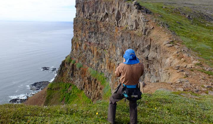
Hornbjarg Horn cliffs are by many considered the most beautiful spot in Hornstrandir. Photo by Evgeniy Metyolkin, CC BY-SA 3.0
The cliffs of Horn and Hornbjarg are undoubtedly the most iconic place in Hornstrandir. The sharp and steep cliffs full of birds entice thousands of photographers a year.

The scenery around Hornbjargsvíti Lighthouse is one of the most beautiful places in Hornstrandir
The views from above the Hornbjargsvíti lighthouse are simply incredible on a nice day. The vibrant colors of the lighthouse create a unique photography contrast against the backdrop of a green, rocky coast.

Hælavíkurbjarg bird cliffs at Kirfi in Hvannadalur are one of the most scenic spots of Hornstrandir, still unconquered by crowds. Picture by Náttúrustofa Norðausturlands .
Hælavíkurbjarg cliffs in Hvannadalur, sometimes also called Kirfi cliffs, are one of Hornstrandir’s hidden gems . You can reach them the easiest on a hike to Kirfi from Rekavík. It’s not a hike for the faint of heart, though.

One of the top views you can experience in Hornstrandir is a view over Lake’s Fljótsvatn floodplain. Picture by Reinhold Seiz.
Fljótsvatn Lake is the biggest and most beautiful lake in Hornstrandir. You will find the best views over Fljótsvatn on a hike between Hlöðuvík and Fljótavík or on the Fljótavík-Látrar hiking trail .

Bird’s eye view over Aðalvík fjord on one of the nearby hikes is one of Hornstrandir’s highlights. Picture by Reinhold Seiz.
You can experience wonderful views over Aðalvík fjord on either the Fljótavík-Látrar hiking trail or on the hike between Látrar and Hesteyri .
The only available accommodation in Hornstrandir is 14 campsites and three very simple guest houses with sleeping bag accommodation. Expect all three guesthouses to be fully booked in advance for the majority of summer:
- Læknishúsið (“Doctor’s House”) – book Læknishúsið accommodation here
- Hornbjargsvíti lighthouse – book Hornbjargsvíti lighthouse accommodation here
- Kvíar Lodge – book tours and accommodation in Kvíar Lodge here
Best Places in the Highlands of Iceland.
Remember, Hornstrandir is NOT a typical touristy destination . There is no comfortable lodging, and there are no normal services you are used to in a developed world. There’s wilderness and that’s it.
“No problem, I’m used to camping!” Well, are you? Have you camped in Hornstrandir? A friend of mine lost her top-class, well-pitched tent in Hornstrandir in August due to massive hurricane-force winds. She was lucky to be accommodated by one of the three guesthouses at the time. Is it always like this? No, it is not. But it can be. And you need to be ready for that!

Hornvík campsite, the biggest camping in Hornstrandir. Picture by Reinhold Seiz.
A note of caution! You may encounter a house from time to time. All houses in Hornstrandir are private properties! Don’t invade the privacy of the owners. These may be their holiday houses or a family heritage.
There are 14 different campsites in Hornstrandir. Six of them also offer an emergency shelter. Here is the list of all Hornstrandir campsites :
- Hornvík Höfn campsite (+emergency shelter)
- Hesteyri campsite
- Hornbjargsvíti campsite
- Látrar campsite (+emergency shelter)
- Sæból campsite
- Atlastaðir Fljotavik campsite (+emergency shelter)
- Smiðjuvík campsite
- Bjarnanes campsite
- Hrafnfjörður campsite (+emergency shelter)
- Glúmsstaðir Fljótavatn campsite
- Veiðileysufjörður campsite
- Við Hlöðuvíkurós campsite (+emergency shelter)
- Horn or Hornsá campsite
- Lónhorn campsite
- Furufjörður campsite (+emergency shelter)

Emergency shelter in Hornvík campsite. Picture by Reinhold Seiz.
Most campsites are equipped with running water and dry toilets . Travelers must camp at campsites if there is one on the ground or in its immediate vicinity.
The biggest campsite is in Hornvík in Höfn. It’s large and well set up. There is a ranger’s cabin, flush toilets, running water, and sinks in the Hornvík campsite.
There are no supermarkets or restaurants in Hornstrandir . You have to bring all the food by yourself or arrange for a food delivery. The basic food delivery can be ordered with any of the ferry companies, just discuss it with them in advance.
In summer, the three guesthouses typically offer snacks, hot beverages, canned drinks, and even soups or hot meals. This heavily depends on availability and their inventory at the time, though, so don’t rely on it!
It’s best you bring a calorie-heavy, lightweight food to Hornstrandir. The longer you stay, the calorie-heavier and more lightweight it should be. Nuts, biscuits, chocolate, and dried meat are some examples of such meals.

Steep drops on unstable terrain are one of the main Hornstrandir hiking challenges, especially with a heavy backpack. Picture by Reinhold Seiz.
What to Pack for Hornstrandir
The equipment you need to hike in Hornstrandir highly depends on how many days you plan to spend here . Is it just a day trip? Or do you intend to do a 2-week-long expedition? This makes a night and a day difference.
Remember you have to buy everything in mainland Iceland or/and in Isafjordur . There are no shops in Hornstrandir! You may be able to buy some essentials in Læknishúsið in Hesteyri or in Hornvík or Hornbjargsvíti, but don’t rely on that. It’s subject to availability.
Recommended Hornstrandir hiking gear:
- Backpack , fully waterproof, with a rain cover
- Hiking poles
- Map, GPS, compass , and a satellite device or Garmin InReach in case of emergency
- Sleeping bag , high-quality, light, warm
- Tent , high-quality, light, water and windproof
- Mattress , light, small, inflatable
- Cooking equipment, stove, gas, pot, matches, dish, cup
- Thermos, water bottle, pocket knife
- Sun protection
- Painkillers and emergency medication
- Band-aid and elastic bandages
- Food, light, dry, long-lasting, and high calories, e.g. biscuits, chocolate, dried meat, fruits
- Hot drinks, tea, coffee, cocoa
- Reserve batteries and/or power banks
- Towel , shampoo, toilet paper
- Headlight, lighter

What to pack for Hornstrandir multi-day trek (click to enlarge). Picture by Reinhold Seiz.
Recommended clothes:
- Hiking shoes , waterproof and sturdy
- Wading shoes , to ford rivers, or neoprene socks
- Jacket , waterproof
- Sweater , wool, or thermal
- Trousers, thermal
- Trousers, waterproof
- Hat , windproof
- Wool is the material you want to wear as much as possible to stay dry and warm
Pay special attention to your hiking shoes and the water and wind durability of your clothes . Gore Tex is highly recommended if you are looking for clothes that are really waterproof.
Hornstrandir is wet in many places , rocky, and hiking through wet grass makes most of the shoes leak. Bring shoes that have high ankle support, that are new, and wax leather shoes with fat before your trip. Don’t wear trail shoes.
Here’s an example 2-week trek Hornstrandir packing list , including item weights. Thanks to Reinhold Seiz for providing this:

If you are visiting Hornstrandir as a day trip only , you can skip the following items from the list above:
- Sleeping bag, Tent, Mattress, Cooking equipment, Knife, Medication, Hot drinks, Batteries, Towel, Headlight
If you are visiting Hornstrandir as a part of the guided tour , apart from the items above, you can also skip:
- Map, GPS, compass, satellite device (a guide has these)
- A guide will also inform you about your planned route and clothes requirements as well as any other requirements. Chances are, you won’t be fording rivers, and if yes, you will be informed about it

Official Hornstrandir hiking map (click to enlarge). Only the main hiking trails are displayed here. Source: www.ust.is
- Always check the Icelandic Safe Travel website and the local weather forecast before going.
- Submit your travel plan here before visiting and also provide it to all ferry companies you will be using.
- Consult your plan with an information center in Hornvik or Hesteyri, with a ranger if he/she is present at your point of arrival, and possibly also with a ferry company.
- Practice at home! Practice a multi-day hike in rain, wind, with a heavy backpack (20kg / 44lbs), wet shoes, etc. Practice pitching a tent in these conditions.
- Trails can often get swampy and boggy. Get ready for that with your gear.
- Sometimes, especially over the mountain passes, you can get a limited cell and internet signal. Use it to get the most recent weather info.
- Print the most recent weather forecast at Isafjordur and update it with a pen/pencil every time you receive any internet signal when hiking, and take screenshots of the forecast.
- If there’s a visible path, your best chances are to follow it. If there’s no visible path, use cairns, GPS, compass, and maps.
- Check tidal times here . Or tide times here. You may need to cross tricky parts through beaches.
- Let the boat company you booked a ferry with know of any changes to your plans! The best is to send them an SMS because it may get through even if you think you don’t have any cell coverage.
- The ferry will not be waiting for you. Better wait for a ferry yourself with enough time in advance.
- Take only the main hiking trails displayed above if you don’t have enough previous experience with Hornstrandir! Some of the secondary hiking trails displayed below may be deadly dangerous!
Hornstrandir Hiking Trails

Map of all Hornstrandir hiking trails (click to enlarge). Beware, some may not be passable or only very hard! Source: https://vefsja.iskort.is/
We describe below the fourteen main Hornstrandir hiking trails and twelve secondary trails. The secondary trails are usually less visited, often unmarked and can be very difficult , not always, though.
Bear in mind that the map of each trail may not be exactly precise, and the correct and easiest hiking trail may vary year by year and day by day. Especially the river and water crossing spots change based on the tide and conditions at the time.
The hiking trails in Hornstrandir range from almost invisible and unmarked to partially visible with sticks in the ground or boot prints to very clear when marked with stone cairns.
There can often be snowfields on trails , especially early in the season. If you are unsure of where to go, your best guess is to follow the shoe steps made by others.

View over Veiðileysufjörður on a hiking trail to Hornvík in Hornstrandir. Picture by Reinhold Seiz.
The hiking trail from Veiðileysufjörður to Hornvík via Hafnarskarð pass is the trail multi-day hikers often choose as their starting route. It’s a good warm-up trek, not too long, not too short, giving you a glimpse of what you can expect in Hornstrandir.
The highlight of the trails is definitely the spectacular view from the top of Hafnarskarð pass into both Veiðileysufjörður in the back and Hornvik in the front.
The trail near Veiðileysufjörður is often very swampy and wet, but it becomes drier the higher you go up. The route is clear and easy to follow, thanks to the big cairns that mark the way.
The most difficult spot of the trail is the Hafnarskarð pass. It’s steep and may be covered with snow all year round. Be prepared for steep snow slopes in this area, the bigger the earlier in the season you come.
There are typically no big rivers to cross, just small streams, and you shouldn’t even take your shoes off under standard, not-too-wet conditions.

Hornvík – Horn hiking trail in Hornstrandir, photo by Rob Oo , CC BY 2.0
The hiking trail from Hornvík in Höfn, leading to the famous Horn and Hornbjarg cliffs, is by far the single most popular trail in Hornstrandir. What makes it so much sought-after is that the cliffs are strikingly beautiful, and the path is relatively safe to visit. Secondly, the biggest campsite in Hornstrandir, Hornvík in Höfn, is close by.
Roughly one mile east of Hornvik, you have to cross the Hafnarós river. The river is, on average, knee-deep, and the official river crossing spot is higher up the river, marked by two yellow markers. However, sometimes it makes sense to search for even shallower spots.
You can often find the shallowest spot near the shore, where the river meets the sea, especially during low tide. If you want to minimize the part of your body underwater, take note of tidal times beforehand. Beware, though, here the riverbed may be more sandy.

A river crossing at sea level during low tide near Hornvík on the way to Horn and Hornbjarg. Picture by Reinhold Seiz.
The main highlight of this trek is the otherworldly view that you will get in the Horn and Hornbjarg area, where cliffs as high as 500 meters meet the sea. This is also where puffins and various birds often nest!
From Horn, you can walk in a loop along the cliffs and reach the mountain Miðfell. Please beware that the trail to Miðfell is steep and can be difficult to walk, especially in wet conditions.
The most difficult section of the trail besides the river crossing is the sheer drops right next to the trails. Take special care in the strong wind!

A sketchy spot over Tröllakambur cliffs on a Hornvík – Hlöðuvík hiking trail in Hornstrandir. Picture by Reinhold Seiz.
This trail connects two fjords – Hornvík and Hlöðuvík. Starting at Hornvík, the first part of the trail is a bit sketchy and leads along the edge of Tröllakambur cliffs. You have to watch your steps on the smooth stones, and there’s also a rope to help you pass.
After that, you will get to the bay of Rekavík Bak Höfn. At this junction, you can either continue to Hlöðuvík via Atlaskarð pass or do a detour to Kirfi cliffs in Hvannadalur. We describe the fascinating Kirfi/Hvannadalur trail below, under secondary trails.
The most gorgeous spot of the Hornvík – Hlöðuvík trail is the view from Skálarkambur pass all the way to Hlöðuvík. To reach Skálarkambur, though, you first have to hike up the Atlaskarð pass.
The hiking path to the Atlaskarð pass is well-marked with cairns. From Skálarkambur, you will take a very steep descent down to Hlöðuvík. This section of the trek can be quite dangerous earlier in the season when there’s still a lot of snow.

Steep rockslides and boulders on the Þorleifsskarð pass on a hiking trail from Hlöðuvík to Fljótsvatn. Picture by Reinhold Seiz.
The hiking trail from Hlöðuvík to Fljótsvatn is versatile but also demanding. The highlight of this trail is the view from the Þorleifsskarð pass down into the floodplain at Fljótavatn lake.
Some sections of the trail are marked with wooden sticks, however, you can easily lose your way in a fog. In that case, this will be a difficult and slow hike.
Fog is not the only threat of this trek. There are several sections with steep rockslides and boulders around Almenningar and Þorleifsskarð. Hiking poles will be priceless. And pray for no strong winds!
Apart from the steep parts and some unforgettable views, you will also encounter a seemingly endless stone desert.

Beginning of the Fljótsvatn – Látrar trail. Picture by Reinhold Seiz.
The considerable part of the hiking trail from Fljótsvatn campsite to Látrar in Aðalvík leads through the swampy floodplains of Fljótsvatn lake. How wet you get varies strongly based on the current conditions around the lake.
Except for the swamps and pesky flies, this part of the trails is rather easy to walk. Later in the season, you may also be lucky to find a lot of blueberries in this area.
The prettiest part of the Fljótsvatn – Látrar hiking trail is most likely the magnificent view of Látravík after overcoming the Tunguheiði mountain pass southwest of Fljótavatn. This section is marked with cairns, and the initial hike up from Tungudalur is pretty steep.

Steep Tunguheiði mountain pass on a Fljótavík – Látrar hiking trail in Hornstrandir. Picture by Reinhold Seiz.
The first real challenge of this trail is the Fljótsvatn Lake crossing next to Fljótavík. The water can be as high as your upper hips. The fording spot by the lake is marked opposite to Langanes.
Then there’s a steep ascent from Tungudalur all the way to Tunguheiði pass. After the pass, you can either continue southwest to Látrar in Aðalvík or choose one of the two detours – Rekavík and/or the Straumnes US Navy base.
By further following the main trail, you will then reach Látrar campsite by hiking alongside the mountain Látrafjall.

View over Látravík from the Stakkadalur pass on a hiking trail to Hesteyri. Picture by Reinhold Seiz.
The trek from Látrar to Hesteyri (or the other way round) is one of the easiest main hiking trails you can take in Hornstrandir. With Hesteyri being one of the main hubs of civilization in Hornstrandir, it’s also a well-trodden path.
While this trail is probably not as breathtaking as the others, the most beautiful section is a wonderful view down to Látravik once you climb up Stakkadalur. You will also meet a nice waterfall along the way.
When climbing up from Stakkadalur, you have to cross the river Stakkadalsós with a sandy bottom. This may be the most difficult spot of this hike. The section between Stakkadalur and Hesteyrarskarð mountain pass is marked with distant cairns. The final part of the trail between Hesteyrarskarð and Hesteyri is an old but well-visible road.

On a start to hiking trail from Hesteyri to Sæból in Hornstrandir. Picture by Reinhold Seiz.
The hike from Hesteyri to Sæból again belongs to the easier ones when it comes to hiking trails in Hornstrandir. From Sæból, you can take two side hikes – one to a British Military Base in Darri and one to Rytur mountain.
On your way from Hesteyrarfjörður, you will first overcome the mountain Nóngilsfjall and head towards Sléttuheiði. This part of the trail is well visible and marked with cairns. Then you have to cross the river Sléttuá.
The following part of the hike to Staður church is barely marked with a hard-to-see trail. However, the navigation is not too bad because you just have to keep right of the lake. This is also where the trail often gets wet.
During this trek, you may also make a detour to Slétta, which will extend your hiking time by about 1 to 2 hours. The most difficult part of the hike is the descent to Staður church, or the climb from the church, if you hike the other way round. It’s not any critical, though.

Doctor’s House, or Læknishúsið, in Hesteyri. Picture by Reinhold Seiz .
The hiking trail from Hesteyri to Hlöðuvík is more difficult, yet pretty popular because it’s one of the two shortest trails connecting southern and northern Hornstrandir.
The most difficult sections of the trail include hiking up and down the steep snowfields with an invisible path underneath. The sooner in season you go, the bigger and more dangerous the snowdrifts.
Nevertheless, the trail is marked well with plenty of stone cairns. Just sometimes, the path simply disappears, because of stony terrain or snow where footprints often can’t be seen.
Coming from Hesteyri, the first main challenge is the Kjaransvíkurskarð mountain pass. This is the place where snowdrifts occur often. However, it’s also most likely the prettiest spot of the trail, with a picturesque view back over Hesteyri fjord.
The rest of the trail is rather boring, though, with lots of rocks, cairns, and bogs. Despite cairns, it may be hard to find a trail due to difficult navigation on stones and occasional snowfields. On snowdrifts, your best guess should be the footprints of others, if there are any.
The final challenge of the hike is a crossing of river Kjaransvíkurá, which is most of the time best crossed at the shore.

Horn – Hornbjargsvíti trail map
Getting to Hornbjargsvíti is not easy nor comfortable, regardless of the trail you choose. But it’s well worth the effort! Your first alternative is the Horn – Hornbjargsvíti trek along the eastern shore.
The trail from Horn to Hornbjargsvíti is versatile but quite sketchy, especially around the Múli area, if you plan to continue along the eastern shore all the way to Hornbjargsvíti.
The hardest spot is said to be the climb up to Múli and back down to the shore. It’s particularly challenging with a huge backpack. The trails in this area are also not well visible and can be quite a daunting task to follow if it’s too foggy.
On a positive note, though, once at Hornbjargsvíti, you will be rewarded with one of its kind views and a surreal, remote atmosphere. Hornbjargsvíti lighthouse, with its surroundings, is one of the most scenic places in Hornstrandir.
A scenic view from over the Hornbjargsvíti Lighthouse in Hornstrandir, the destination of this trek.
The second way to reach Hornbjargsvíti leads south through the Kýrskarð pass. Although seemingly short, the trail is no easier than the second hiking trail. If you get lost, it may take you an entire day to pass.
There are rocky sections where you may even need to climb a bit. Then, there may be steep snow patches where both navigating and not falling would pose a challenge.
Moreover, the track is not that well-trodden and, at times, barely visible. You won’t welcome this in a fog. The only thing helping you not get lost are the wooden sticks along the trail. GPS should help you a lot on this trek.
And if it all wasn’t enough, the trek is not super eventful either and the path can become pretty muddy. Finally, you have to cross the river at the beginning, right next to Hornvík. And this needs to be examined for the best crossing spot, see the Hornvík – Horn – Hornvík loop trail above.

Views from the Hornbjargsvíti – Bjarnanes – Smiðjuvík hiking trail. Source: www.ust.is
This is a longer hike that can be divided into more days if necessary and ends up in Smiðjuvík. The first part of the hiking trail leads through the Innstidalur valley. Then, the section towards Hornbjargsvíti follows. Next, you have to overcome the Axarfjall mountain pass.
The highlight of this trail is the most beautiful and probably also the biggest waterfall in Hornstrandir, called Drifandisfoss. The waterfall is located halfway between Bjarnanes and Smiðjuvík and protrudes from majestic cliffs.

Smidjuvík – Furufjörður Hornstrandir hiking trail. Source: www.ust.is
The hiking trail from Smidjuvík to Furufjörður is long and remote. Privacy and no crowds guaranteed. Unfortunately, also almost no marks as well.
From time to time, you will find wooden sticks of various colors but don’t rely on this hike to be marked. Often, you just have to follow your GPS, and there’s no other option.
Your first checkpoint will be the fjord of Barðsvík on your east, and from there, you have to climb over the Göngumannaskörð mountain pass. To reach your next stop, Bolungarvík, you first have to cross the river Bolungarvíkurófæra. Watch out for a low tide time, though! Otherwise, you most likely won’t pass this river.
Finally, an almost never-ending, 7km long stretch of unmarked coastal hiking past tons of stones and driftwood will bring you to Furufjörður.

Furufjörður – Hrafnfjörður hiking trail. Source: www.ust.is
The hiking trail between Furufjörður and Hrafnfjörður is not long, but it’s very isolated. Hikers often extend this trek with other stops or detours, like Svartaskarð to Þarlátursfjörður or the direction of Reykjafjörður, Ófeigsfjörður and Ingólfsfjörður.
One of the main challenges of this hike is the almost non-existent track east of Skorarvatn Lake. Your only chance there is to follow the cairns. GPS often doesn’t help either.
Coming from the east, after passing the lake, the trail improves and eventually turns into a mountain road between Skorarheiði and Hrafnfjörður.
Secondary Hiking Trails

A beach hike with a steep cliff climb on a direct hiking trail between Látrar and Sæból. Source: https://is.nat.is/
You will not find the trail from Látrar to Sæból on the main hiking maps of Hornstrandir. However, this trail exists and hikers do take it every now and then.
This is mostly a coastal trail leading along the beaches of Aðalvík fjord. On a nice day it resembles a summer vacation, just a lot colder one.
The main obstacle and by far the hardest spot of this trail is a 100m high climb up the cliffs with the help of chains. This section is definitely not for the faint-hearted and it’s difficult to carry the bag on your back. After that, it’s easy to get to the campsite of Sæból.
From Veiðileysufjörður, you can take a short hike up to Tafla mountain. On a nice day, you will be rewarded with a spectacular view over Veiðileysufjörður fjord.
Hælavíkurbjarg bird cliffs at Kirfi in Hvannadalur, Hornstrandir, Iceland. Picture by Náttúrustofa Norðausturlands.
The hike to Kirfi Hill, also called the Hvannadalur hike, is a popular detour locals often take on their way from Hornvík towards Hlöðuvík.
Since this is an out-and-back hike, it’s best to leave your big backpack on a wooden platform around Rekavík bak Höfn, where the hike starts.
The most difficult spot of the hiking trail is a very narrow section leading on the side of the cliff with pretty scary drops all the way to the ocean below. The beginning of the trail can also be swampy at times, so be prepared for that.
The highlight of the trail is a scenic view of Hælavíkurbjarg cliffs, considered by many to be one of the best views in Hornstrandir. These are huge, vertical cliffs you won’t see anywhere else.

Straumnes or Straumnesfjall US military base in Hornstrandir. Picture by www.ust.is .
Straumnesfjall US military base is a popular day trip hikers take from Látrar in Aðalvík. There are two trails leading to Straumnes – the western one and the eastern one. The western trail is actually a road Americans built in the 50s, and it’s therefore considerably easier.
The highlights of this trail include a view over Aðalvík and, of course, an exploration of the abandoned radar station.
Thanks to the eastern path, you can turn this into a loop hike. This path down from Straumnesfjall leads through the Öldudalur valley in Rekavík. The trail here is almost invisible, but you can sometimes see cairns or pieces of cairns.
For those who still haven’t had enough, you can also hike around the Rekavíkurvatn lake.

A hike to the former UK radar station in Darri from Sæból in Hornstrandir.Source: Borea Adventures tour.
Straumnes is not the only military station in Hornstrandir. There’s also a British radar station in Darri. You can reach Darri on a day hike from Sæból.
Coming from the campsite in Sæból, you first have to cross the river Traðará. A well-visible path then follows up to the valley of Garðadalur. The ascent up the mountain is steep and challenging.
On top of the hill, there is a road that will take you to the ruins of the British military base on mountain Darri.

A typical driftwood on almost every coastal hiking path in Hornstrandir. Picture by Reinhold Seiz.
You can hike all the way from Hornvík to Sópandi in Lónafjörður fjord via one of the most challenging trails in Hornstrandir. The trek leads through the highest mountain pass in Hornstrandir called Rangalaskarð.
You should only take this hike with a local or if you are already highly experienced in the area. There are several dangerous sections, and the trail as such is hard to navigate through.
Some of the threats you may expect are no marks, boggy terrain, river crossings, and high tides. You need to plan for a low tide between Miðkjós and Sópandi, otherwise, you most likely won’t pass.
This is the trail leading along the eastern bank of the Fljótsvatn Lake to Fljótavík. By taking this path you should be able to avoid the crossing of the lake Fljótavatn.
It’s almost impossible to find any info about this trail, so if you know anything about it, please contact us, and we will give you credit for all the info you provide.

The map of a day hike to Kögur from Fljótavík.
Kögur is a mountain near Fljótavík that can be explored on a challenging day trip. You may also add the areas of Krossadalur and Sandvíkurvatn to extend this hike.
The only way to get to the Kvíar lodge, one of the very few non-camping lodgings in Hornstrandir, is to take a private boat on a guided tour or to hike to it via challenging and unmarked trails.
One such trail leads to Kvíar from Veiðileysufjörður, and you should take it only if you are already well experienced in navigating throughout Hornstrandir.

Veiðileysufjörður. Picture by Reinhold Seiz.
It’s possible to get to Hlöðuvík also directly from Veiðileysufjörður and vice versa. However, the hiking trail is unmarked and quite challenging.
There are sections west of Veiðileysufjörður campsite where you basically have to hike in the sea around cliffs for hundreds of meters. Better pick a sunny day and low tide for this activity!
If you are a nature lover and hiking enthusiast, Hornstrandir is totally worth the time and money spent on planning. It’s one of the last pieces of remote hiking heaven on the planet, with no dangerous animals or insects. Just with a very harsh weather.
Yes, you can, and the chances are high! Hornstrandir is by far the best place in Iceland to see an Arctic fox. It’s highly likely they may even start playing with your tent!
This highly depends on your hiking ambitions. As short as one day is enough to explore some of the most beautiful areas in Hornstrandir as a day trip. On the other hand, as long as two weeks may not be enough to fully explore all the beauty Hornstrandir has to offer.
Hornstrandir is 100% safe when it comes to:
- Animals – there are no dangerous species,
- Insects – none of them are dangerous,
- Water – it’s fully safe to drink.
However, Hornstrandir can also be dangerous because:
- Weather can get very harsh with strong wind, rain, and fog
- There’s no network or cell coverage
- Hiking trails may be steep and not well visible at times
- If anything happens to you, help is far away

Hornstrandir fjords offer some of the most amazing views in Europe. Picture by Reinhold Seiz.
Plan and study the area in advance. Dress well. Practice long hikes at home. Expect extreme weather conditions. Don’t overestimate your hiking skills.
After reading this article, you should already have a good idea of what to expect in Hornstrandir.
- Don’t leave any rubbish behind you, take it all with yourself
- Don’t move stones or driftwood in any way
- Follow the trodden path as much as possible
- You can camp only in designated campgrounds
- Most campsites have toilets, use them whenever possible
- Campfires are forbidden
- Do not disturb animals, keep a safe distance of at least 40 meters whenever possible
- It’s strictly forbidden to feed animals
- Drones are forbidden unless you have a special permit
- Don’t pick any flowers, you can pick up berries, though
- You can find detailed Hornstrandir visitors’ rules here
- All the houses are private, don’t disturb anyone’s property!
In the end, I would like to say a huge thank you to Mr. Reinhold Seiz , who contributed sizeably to this article with his stunning photos of Hornstrandir!
Please, if you have any additional info you believe would be useful to place in this article, or if you believe something should be corrected, contact us , and we will give you all the credit for this info and a bottle of wine when we meet in Iceland 🙂

Posted by Igor
We have hiked Hornstrandir before, but only 2-3 days. We are going back for a longer trip. The official camp map you provide has a campsite for Fljótavík at the very nothernmost tip, but on the trail you provide, you seem to mark a campsite at the south-east corner. Is there a designated site there, or were you wild camping there?
Hi Katie, not sure which trail you mean? On this map , then also on this map and also on this trail – the Fljotavik campsite is marked at the very same spot.
Hi! So it was this map that confused me ( https://www.wikiloc.com/hiking-trails/latrar-fljotvik-reida-1120718 ). The campsite is shown as on the right bottom of the lake, but in the other maps, it is on the left side bottom of the lake. Does that help?
OK i see now that you are asking about the Glúmsstaðir Fljótavatn campsite (not Atlastaðir Fljotavik campsite). Yes, that one should be located southwest of Fljótavatn, this is the location all maps show. But rather double check this with the ferry company and/or rangers at the place of your basecamp. We haven’t camped at this campsite yet.
Leave a Reply Cancel reply
Save my name, email, and website in this browser for the next time I comment.
Please follow & like us :)
Recent Posts
- How to Visit Langisjór lake: Full Guide
- Campervan or Car in Iceland? A Big Comparison
- 21 Best Day Trips from Reykjavik to Take in 2024
- How to Visit Maelifell Volcano
- How to visit Eldgjá
- Guided Tours or Rent a Car in Iceland?
- 25 Hidden Gems in Iceland Nobody Writes About
- Snækollur – Hiking the highest peak of Kerlingarfjöll
- Hveravellir Hot Springs: 2024 Guide + Hiking Trails

- Explore other regions:
Or try searching by Category and/or Location
Hornstrandir Nature Reserve
This territory of the Arctic fox has been uninhabited since the 1950s. As isolated as it was then, it attracts the casual half-day visitors and serious gore-tex hikers alike. Its main attractions are three. First, the bird cliffs surrounding the bay of Hornvík, are a magnet of gigantic proportions. On the eastern side of the bay the cliff reaches a height of more than 500 metres, and the birds are teeming. Second, as there is no infrastructure and the tourists few in relation to the sheer size of the area, the sense of remoteness is strong. You can hike days on end without seeing a single person. The nature is pure and the tranquillity unmatched. Third, dwas the area is a haven for the Arctic fox (think hunting-ban and bird-packed cliffs), the chances of spotting one are high.
Most tours, especially day tours, depart from Ísafjörður. Hikers wanting to go on their own can also take boats from Norðurfjörður.


How to hike Hornstrandir on your own?

Hiking in the beautiful nature reserve at Hornstrandir is incredible. However, it can be a logistical challenge if hiking alone without a guide. This hidden gem of Iceland is an exceptional choice for adventurers and those who want to escape the hustle and bustle of a city. Nonetheless, travelers need to prepare themselves and their backpack with essentials before walking down the spectacular landscape. Here are how solo trekkers can hike in this rugged landscape and home of Arctic foxes.
- Guide to Hornstandir
- Hiking Guides in Iceland
Hiking Tours in Iceland
- Hiking in Iceland
- Camping in Iceland
- Hiking in Þórsmörk

About Hornstrandir
Iceland’s protected Hornstrandir Natural Reserve is a remote territory covering 220 square miles in the snow-capped mountains and rough coastline northwest of the West Fjords . The beautiful fjords of Hrafnfjörður and Furufjörður are part of the Hornstrandir Nature Reserve, which also contains the icecap of Drangajökull glacier. In terms of the status of other glaciers, Drangajökull is the only one that has not reduced in size during the past several years.
The unpredictable weather and difficult access have helped preserve this remote wilderness. The winter here is harsh, and you will usually not find anyone here from October to March . It is accessible only in summers via a ferry that takes you to this stunning nature reserve. Even the summer window is limited. Therefore, the best time to visit Hornstrandir is between June to July .
In earlier centuries until the 1950s, Hornstrandir featured some scattered settlements consisting of hardy souls. However, the consistent famine and inaccessibility took a toll over the years, becoming an abandoned wilderness. Today, the ruins of churchyards and graveyards testify to what it takes to travel in this remote place. Nonetheless, few families do travel and set up temporary houses in the summers. If lucky, you might see another soul in this deserted place.
What makes it demanding is the reason why this place is so attractive to solo travelers. You will see nothing but miles of greenery, wildlife, and fjords. On lucky days, you may observe a den of Arctic foxes roaming around the wilderness.
If truth be told, hiking at Hornstrandir Natural Reserve is not suited for beginners or faint-hearted . The weather can range from a sunny sky with a warm temperature to a snowstorm lasting for hours. In addition, the fog near the mountains and coastline can be dense, with visibility of fewer than 10 meters. In short, weather predictions can go wrong, so be prepared to face anything on the land of fire and ice.

Wildlife in Hornstrandir
Hornstrandir’s natural reserve is home to Arctic foxes . Since the conservation efforts in 1975 and the ban on hunting, have helped the Hornstrandir to become a thriving place for this animal. Apart from foxes, it is also home to more than 200 species and 30 varieties of nesting birds, including Puffins , Arctic Terns, Black Guillemots.
On this tour, you’ll see two of the most incredible bird cliffs in Iceland, called Hornbjarg and Hælavíkurbjarg, and they are home to the world’s largest populations of Guillemots. Other species worth mentioning are Kittiwake, Razorbill, and Fulmar.
Sometimes polar bears floating on the drifted iceberg from Greenland end up in Hornstrandir. But sighting is difficult.

Access and Best Time to Visit
Reach ísafjörður.
This nature reserve is located close to Ísafjörður in the Westfjords . If you’re traveling from Reykjavik, rent a car or catch a flight to Ísafjörður. The road in the West Fjords is, although beautiful, often narrow and sometimes unpaved. That means you should perhaps take a 4×4 truck or a vehicle that can sustain the challenges of uncharted territories. In 4×4, you will feel more comfortable and confident driving on unpaved roads. Another option is to take a domestic flight from Reykjavik to Ísafjörður, ideal for those with less time.
Reach Hornstrandir
The only transport available from Ísafjörður for Hornstrandir is by boat . Several companies are offering boat trips to and from Ísafjörður. Borea and Sjóferðir are good options. Do check the availability and timing before reaching Ísafjörður. The round trip costs somewhere around 150 to 300 Euros, varies companies to company.

Help in an emergency - 112
As you’re in an isolated landscape with no human settlement, you should know what to do in an emergency. Phone networks may be down here. So in case of emergency, sending an text message to 112 is more feasible than calling. You can also download the 112 app to contact the nearest emergency service provider. Use the app to activate the emergency button to communicate your GPS coordinates to the police through text message. To increase your chances of survival, we also recommend you carry an emergency flashlight. It will help rescuers to locate you quickly.
Now when you’re prepared for your adventure, consider how many days you can spend hiking because Hornstrandir offers many hiking trails from a single day to multiple days. The choice is yours. We will first discuss main hiking trails and then we will provide a detailed step-by-step guide for multiple-day hiking.
Note: Because there are no vehicles or highways in Hornstrandir, you’ll need to take the ferry to get to the trails. Hikers typically take a private boat with Borea from Bolungarvik (a fishing helmet). Alternatively, you can ride a boat from Ísafjörður. Ensure to reserve your spot for a roundtrip in advance.
- Iceland Packing Lists
- Solo Travels in Iceland
- Rent a car in Iceland
- Discover hidden gems in Iceland.
- Self Driving in Iceland.

Choose between single-day and multi-day hiking
Single day hiking: adalvik to hesteyri.
Duration: 5-6 hours
This short day excursion is one of Hornstrandir’s most popular treks . The boat starts from Hesteyri in the morning and arrives in Adalvik in the afternoon, allowing you to complete the round trip in one day. Past the withering church, across grassy hills, and towards the abandoned town of Adalvik, you’ll arrive at this spot. You will go past a big lake on this trail, and as you climb the steamy hills, you will get great views of the snow-capped fjord fingers and the fjord’s bays. Here you may see the remnants of an old stone pavement and cairns. Next, navigate down muddy hills to the black sand pebble beach, then on to the abandoned town of Hesteyri. In the summer, a family resides in the “Old Doctor’s House,” where they can prepare coffee and pancakes for you. Relax here for a warm respite from the wind and rain as you wait for the boat back to Isafjordur.

Multiple Day Hiking: Hesteyri to Kögur
Duration: 3-5 days
After arriving in Hesteyri via boat, trek ten miles (16 kilometers) to the Sæból campground. You may either camp here overnight or go 7 miles (11 kilometers) farther down the shore to Látrar. The next day, climb 9 miles (15 kilometers) to Fljótavík and on to the stunning Kögur Mountain, which bends in on itself like a breaking wave. The route then makes a 16-mile (26-kilometer) circle back to Hesteyri through the campground at Álfsfell.

4 Days Hiking: Ísafjörður – Hesteyri – Hlöðuvík – Hornbjarg – Hornvík – Ísafjörður
Please mind that this challenging hike is suitable for experienced hikers. Traveling in a group is ideal but not necessary if you have a compass and essential gear in your backpack.
Day 1: Hesteyri to Hlöðuvík
After arriving in Hesteyri by ferry, begin the first day’s trek to a stunning bay area, Hlöðuvík. It’s around 15 kilometers, so it should take between 4 and 6 hours, depending on your speed. Next, continue down the beach on the northern side until you reach Budir (a few cottages and a campsite), where camping is permitted. Additionally, sleeping bag accommodations are available in some cabins.
Day 2: Hlöðuvík to Hornvík
On day 2, you’re going on a moderately strenuous trek to Skálarkambur, where, if the weather allows, you’ll enjoy stunning views. Approaching the climb from afar appears daunting; nevertheless, the path is well-marked and much simpler to follow. On your way, you will walk on a steep gradient, which should be easy for experienced hikers.
Bonus: Hælavíkurbjarg
Caution: Only for expert climbers and not afraid of height If you don’t stop by Hælavíkurbjarg, you might miss a hidden gem. After you return to the other side, the route turns right at a junction in Rekavik’s harbor. Taking the left-hand detour adds around two hours to your day if you have the energy and stamina. Keep your backpack at trail junctions or at the route’s starting point to Hælavíkurbjarg to walk light.
The route narrows and the steep fall down can be somewhat frightening and could result in injury. Grab on to the rope to keep your balance at the narrowest part. We would recommend waiting till dry. Hiking here requires skill, so better be late than caught in a dangerous situation. However, those brave souls who endeavor to walk on this meandering path are awarded a mind-blowing view of the ocean below.
You may also march down a basalt dyke with steep vertical hills on both sides. The grassy walkway is around 3 meters wide, so it should be comfortable for younger and healthy people.
Continue to Hornvik, which has a beautiful campsite. A lovely spot to camp for the night, but if you’re feeling active and the weather is good, you may go farther (across a large, unbridged river) and camp near the ancient Horn farm. So you go closer to the Hornbjarg cliff and Kálfatindar and have more time to enjoy the next day if you divert and trek to Horn (up to 12-15 hours).
Day 3: Hornbjarg to Kálfatindar
Day three is another challenging climb to Hornbjarg mountain. Ensure to walk light. Leave your backpack at the campsite. Some path along the edges of Hornbjarg requires crawling, but the stunning view from the cliff all the way to the ocean is perfect for your travel scrapbook.
The highest peak along this hiking trail is Kálfatindar, a 535m tall mountain looking over the ocean. The climb is a steep walk, but the trek is well marked and easy to follow. Once you reach the top, you almost become part of this natural landscape with greenery on your back and a vast ocean in front of you. That is day three, and it’s time to return to the campsite for another day of hiking to fjord Veiðileysufjörður.
Day 4: Hornvík to Veiðileysufjörður
You finish your trek on the last day by starting at the base of the Hornvík bay and then making your way over a mountain pass into the fjord of Veiðileysufjörður. It’s a fantastic trek with breathtaking views of the fjord from above. Ensure you have enough time and booking for a boat trip back to Ísafjörður.
If time is not a concern, you can add two more days to your hiking trip. There is an old lighthouse at Hornbjargsviti with modest accommodation facilities. Hornbjargsviti is close to Hornvík and has a few hours’ hike. You can contact the lighthouse accommodation provider for an advanced booking, https://www.fi.is/ .

Ultimate 5 Days Hiking Itinerary: Hornvik to Adalvik
It is the ultimate trekking expedition to experience the Hornstrandir Natural Reserve.
Day 1: Veiðileysufjörður to Hornvik
Length: Around 11 KM
Take a one-hour boat journey from Isafjordur to Veiðileysufjörður, from where your hiking expedition begins. After 1KM along the sea, you will climb following the path consisting of streams. Finally, you will get a stunning view of the Hornvik bay surrounded by Hornbjarg mountains after another 500 meters.
You will pass a mountain chain with waterfalls on its sides at its base on our way down. Finally, after another 2.5 KM hike, you will reach the Hornvik campsite.
Hornvik campsite seems to be the most popular and congested for hikers in Hornstrandir due to its closeness to Hornbjarg. This camp included a restroom, benches, and a ranger’s cabin. So put your base here and rest for the next day’s adventure.
Day 2: Hornvik to Hornbjarg
Length: 18 KM
Leave your travel backpack to Hornvik and carry only the most essentials. Prepare a day pack with a protein bar and water bottle—Trek over the delta to get to Hornbjarg. Surprise yourself with a small river with freezing cold water. There are wood sticks on both sides of the river as markers indicating the best spots to cross the river. You will see a waterfall and a sizeable basaltic column on the other side of the river. Continue the journey; you will encounter vast piles of rocks on the black sand beach.
Climb up towards the Hornbjarg Cliffs. Be cautious and stroll as the cliff ridges face strong winds. Once you climb the 200m tall cliff 500m above sea level will give you a gorgeous view of the coastline. You may observe birds flying over the mountain and adorable puffins. There are many nesting grounds, so be careful and respectful not to disturb them. Now following the same route, return to Hornvik.
Day 3: Hornvik to Hlöðuvík
Length: 11.2 KM
Pack your tent and gear and head towards the west. Trek begins with a well-marked trail along the seaside of a mountain. The slope leading to the sea can feel daunting so walk safely. You will come across another small river; crossing the river shouldn’t be challenging for a fit person. After that, follow a C-shaped path along the peak that is well marked with wooden sticks. Watch your steps on the rocks. This path ends at a short ascent that will take you to another pass before finally descending towards some small lakes. From here, you can see the Hlöðuvík bay area.
Take a break and set up your camp at the Hlöðuvík bay. The camping area features relatively stable ground, aged lumber, and a survival shelter. You may find other trekkers also resting and waiting for their next-day adventures.
Day 4: Hlöðuvík to Glúmsstaðir
Length: 13 KM
The trek starts on a beach trail. You may have to cross a river after 2 KM. You can see a rusted tank in the middle of the river. After that, take the grass path near the sea. But again, be careful, the course can be slippery, and even the marking spots are poor. You may end up taking the wrong route, so use your GPS and map. Expect fog and lower visibility during the climb. The best part is you can see an Arctic fox (if lucky!).
After some climbing and walking, you will reach a second pass. This is the time for witnessing the stunning display of fog and clouds ascending and descending on the mountain slopes. On the other side, you will see some small lakes.
The following descending path could be challenging if your backpack is heavy. Once you come over this obstacle, get ready for another steep zigzagging way along the waterfall. You may see another set of small rivers. Hike another 200-300 meters upstream to avoid getting into the river and stay dry. After another kilometer or so, you will arrive at Glúmsstaðir campground. The campground features a toilet facility and spots for camping. As it is close to the river, you can fetch water to cook your night meal. You also get a good view of the Flötsvatn lake from here.
Day 5: Glúmsstaðir to Aðalvik
Length: 12.7 KM
Day 5 of adventurous hike in the Hornstrandir. The marked path along the lake can be wet. However, even the trek is a little slippery with damp grass and snow patches. Use walking sticks to remain stable. Finally, climb a steep ascend to reach Tunguheiði mountain. The mountain top is surprisingly flat with no grass, almost like a moon landing!
From here, the path descends to Aðalvik bay. This section is lovely to ride downhill, but be cautious. The lone gravel road will be seen after trekking down and across a short plateau. The road provided access to an antenna erected by the United States on the summit of Straumnes Mountain in 1951.
Arrival at the Aðalvik bay
The gravel road will take you to Latrar on the Adalvik bay. The coastline is filled with stones and features a small café for tourists waiting for the boat. The boat to Ísafjörður usually comes in the afternoon.

Solheimajokull Glacier Hike
From 14,900 isk.

South Coast & Glacier Hike
From 24,900 isk.

Skaftafell Glacier Hike | 3-Hour Walk
From 14,500 isk.

Popular Articles

10 Unique Activities Around Iceland

Iceland Packing List

Top Alternatives When Your Iceland Tours Get Canceled

Best Selling Self Drive Activities in Iceland | Summer 2023

Volcano in Iceland: July 2023 Eruption at Litli-Hrútur | All you need to know

Sky Lagoon vs Blue Lagoon

Top 10 Iceland Locations

Black Friday Deals for your trip to Iceland 2021

7 Reasons why you should Rent a Camper Van in Iceland

Popular Things To Do
Sightseeing tours, glacier tours, hot spring tours, ice cave tours, glacier hiking tours, hiking tours, super jeep tours, northern lights tours, whale watching tours, popular tours.

Northern Lights Small Groups
Travel style, starts from, from 13,500 isk.

Whale Watching from Reykjavik
Pick up, Self Drive
From 10,990 ISK

Volcano Helicopter Tour
From 69,900 isk.

Glacier Zip Line & Ice Cave Adventure
Jokulsarlon Glacier Lagoon
From 49,261 ISK

Golden Circle, Blue Lagoon & Northern Lights | Small Groups
From 37,990 isk.

South Coast, Waterfalls & Glacier Hike
From 22,990 isk.

6 Day Iceland Ring Road Tour – Summer
From 324,000 isk.

Golden Circle & Snorkeling Silfra
From 34,900 isk.

Golden Circle Tour of Iceland
From 11,500 isk.

Silfra Snorkeling Tour | Snorkeling between tectonic plate
Thingvellir
From 18,990 ISK
More interesting articles.

Hiking in Kerlingarfjöll – Hiking Routes & Guides

Hiking in Landmannalaugar | Hiking Routes

Seal Watching in Iceland – An Ultimate Guide
Most popular things to do in iceland.

Snowmobile Tours

Horse Riding Tours

Top Attractions in Iceland

Seljalandsfoss

Reynisfjara

Jökulsárlón

Blue Lagoon
Explore iceland by region.

Golden Circle
South iceland.

Snaefellsnes

West Iceland

East Iceland

North Iceland

Hidden Gems
Create an account
Start your adventure today.
Already a member? Login

A Guide to Backpacking in Hornstrandir Nature Reserve
Quick navigation.
- Accommodation
- Interesting Facts
Iceland Travel Articles
Join our newsletter.
Get a weekly dose of discounts and inspiration for adventure lovers
If you want to escape the crowds of Iceland, there is no better place than the wild, northwest corner of the island – the Hornstrandir Nature Reserve. The Hornstrandir Nature Reserve operates under strict preservation rules and was established in 1975 to protect the Arctic Fox and the large colonies of seabirds that nest in the dramatic cliffs.
While it is possible to do day-hikes from various points on the peninsula (there are several tours that offer this), undertaking a multi-day hike will allow you to experience the amazing scenery that exists in every corner of the Hornstrandir Nature Reserve. It will also give you the chance to spot one of the elusive foxes and enjoy the eternal midsummer twilight – far away from the tourist crowds.

How to get to Hornstrandir : The closest major city to the Hornstrandir Nature Reserve is Ísafjörður, Iceland. You can fly to Ísafjörður directly from Reykjavik (it is a very interesting landing approach!) or drive. It takes approximately five hours and forty minutes to drive the 453km from Reykjavik to Ísafjörður, following Route 61.
Accommodation : The main type of accommodation at Hornstrandir is self-supported camping. If you are looking for a bit more luxury, there is the option of a hostel at “ The Doctor’s House ” in Hesteryi and a hut at Hornbjargsviti Lighthouse (if the caretaker is there).
Costs : Currently, the campsites in Hornstrandir are free so the only costs are the boat transfers from and to Ísafjörður. The prices depend on exactly where you want to be dropped off and picked up, but for this specific route they run to about USD$200 return.
Length Of The Trek : 5 Days for the route outlined here. It is possible to plan a longer route, but keep in mind you must only stay in designated campsites.
When To Go To Hornstrandir Nature Reserve : The boats from Ísafjörður to Hornstrandir operate only between June and August. This is the recommended hiking window for this part of Iceland.
Trekking in Hornstrandir Nature Reserve takes you to a very remote part of Iceland that should not be undertaken by inexperienced hikers. The trails are marked using a range of methods, from clear tracks through the vegetation, to large stone cairns or natural wooden stakes (that, unfortunately, are the same colour as the landscape) stuck into the ground. Weather can change very quickly and can be extreme. You should know how to navigate with a GPS and/or compass/map in case of fog.

Snow on Iceland’s Hornstrandir Nature Reserve trek

Hornvik side of the pass on Iceland’s Hornstrandir Nature Reserve trek
You must be fit and accustomed to carrying a full backpack for several days in order to undertake this trek. You need to be self-sufficient and bring everything with you from Ísafjörður, but water is plentiful and safe to drink directly from the streams (you only need to carry 1L at a time).
You must be prepared for extreme weather. Make sure your tent is able to withstand strong winds (several were destroyed in one night when I was there) and ensure your sleeping bag/sleeping pad will keep you warm enough. Even though it is summer, the changeable weather means you should carry several layers of clothing, including a base layer, mid-layer and a quality waterproof/windproof complete outer layer. Waterproof shoes will also come in handy!
If you suffer from vertigo, this may not be a good trek for you. The Hornbjarg has some of the highest cliffs in Iceland (think more than 200m) and a sheer drop into the ocean, while other parts of the route involve extremely steep ascents/descents on gravel.

Craggy edges on the way to Hornbjargsviti Lighthouse on Iceland’s Hornstrandir Nature Reserve trek

Lighthouse on Iceland’s Hornstrandir Nature Reserve trek
Route for hiking in Hornstrandir
Iceland’s hornstrandir hiking map.
The route outlined below starts at Veiðileysufjörður and comes around in a U-shape to end at Hesteryi. There is a pass (no more than 400m elevation gain) on each of the days, both of which offer stunning views if the weather is kind.
Hiking in Hornstrandir, you can expect some stunning views, encompassing everything from bright green vegetation and bare rocky terrain to the deep blue of the ocean. There are also several rivers to ford (river shoes and neoprene socks are a good idea), and you may even need to strip down to your underwear if you don’t want to get wet.
With 5 days to complete the route, there is enough time to enjoy the area without racing through it. That being said and if time permits, it is a good idea to schedule extra days to accommodate bad weather or some day hikes. Chat with the ranger at the Hornvík campsite for the latest trail conditions and further ideas for short explorations.
Finally, don’t forget to bring some money so that you can enjoy a well-earned, freshly brewed coffee and pancakes at “The Doctor’s House” in Hesteryi before heading back to Ísafjörður.
Iceland’s Hornstrandir Nature Reserve Trek Itinerary
Day 1: Boat transfer from Ísafjörður to Veiðileysufjörður – hike to Hornvík campsite. 10km.
Day 2: Hornvík campsite – Hornbjargsviti Lighthouse via Hornbjarg. 17km.
Day 3: Hornbjargsviti Lighthouse - Hornvík campsite. 10km.
Day 4: Hornvík campsite - Hlöðuvík. 15km (including detour below).
Day 5: Hlöðuvík to Hesteryi – boat transfer to Ísafjörður. 15km.
Route options:
- Take an extra day at the Hornvík campsite so that you have more time to explore Hornbjarg. It is a truly spectacular landscape and deserves more than a day to appreciate it fully.
- O n the way from the Hornvík campsite to Hlöðuvík, take the detour out to Kirfi to see the spectacular cliffs and nesting sites of Haelavikurbjarg.
- Spend an extra day at Hesteryi so that you can enjoy the amazing dinner at “The Doctor’s House” and explore the area further.

Accommodation in Hornstrandir
This is a remote trek with only two possibilities for accommodation besides camping - “ The Doctor’s House ” in Hesteryi and a hut at Hornbjargsviti Lighthouse . You should book well in advance if you plan to use either of these options as space is limited and the caretaker is not always at Hornbjargsviti Lighthouse.
Camping is only permitted in designated campsites (where there are toilet facilities) and strictly forbidden elsewhere. Your tent should be sturdy and able to withstand high winds and rain.

Waterfall and a large river on Iceland’s Hornstrandir Nature Reserve trek

Heart shaped inlet on Iceland’s Hornstrandir Nature Reserve trek
Food is only available at The Doctor’s House ” in Hesteryi. If you stay an extra night in Hesteryi, and even if you camp, it is definitely worth the money to have dinner there! You must bring everything else with you or arrange for a resupply at one of the drop-off points for the boat transfers.
Interesting Facts About Hornstrandir Nature Reserve
- The Hornstrandir Nature Reserve covers 220 square miles of wilderness in the Westfjords, in the northwest of Iceland.
- This region has a long and fascinating history, and has been inhabited by a sparse population since the Middle Ages. This lonely, wild peninsula was often used as a refuge for outlaws, who would flee to the region in the hope of catching a passing boat and starting a new life abroad. The reserve has been uninhabited since the 1950s.
- Hornstrandir Nature Reserve can only be accessed by boat, and there are no roads across the reserve.
- Hornstrandir Nature Reserve is home to over 250 different species of flowering plants and ferns, many of which are unique to the reserve or the Westfjords.
- Hornstrandir is home to Iceland’s only native mammal – the Arctic Fox. A hunting ban is in place across the reserve in order to protect the fox population.
- This region is also home to an important population of birds, including puffins and guillemots. Hornstrandir includes two of the largest bird cliffs in Europe, and is an important habitat for the fragile bird population.
- Hornstrandir Nature Reserve includes some of Iceland’s prettiest fjords, Hrafnfjörður and Furufjörður, and the Drangajökull glacier. Drangajökull is Iceland’s lowest-lying and northernmost glacier and is the only one not to have decreased in size in recent years.
- Occasionally, polar bears enter Hornstrandir Nature Reserve, having reached the peninsula on drift ice from Greenland.
Thinking about a trip to Iceland? These articles will help you plan your next adventure in Iceland.
- Backpacking Laugavegur and Fimmvorduhals
- Backpacking Iceland’s Volcanic Trails Route
- Backpacking Iceland’s Shadow of Vatnajokull Trek
Top Destinations
Tour activities, top regions, get travel inspiration and discounts.
Join our weekly travel newsletter
Breathtaking 11-Hour Hiking Tour of Hornstrandir Nature Reserve From Isafjordur
Description
Get ready for the hiking tour of a lifetime with a full-day exploration of the Hornstrandir Nature Reserve in the Westfjords. Active adventurers who want to see arctic foxes and experience birdwatching in Iceland should book this small-group tour from Isafjordur today.
The Hornstrandir Nature Reserve is a stone's throw from the Arctic Circle and an excellent area for viewing wildlife in Iceland. This remote Westfjords tour is a fantastic all-day experience full of natural beauty. It's one of the best places to go hiking in Iceland, so avid trekkers will not want to miss it.
You'll meet at the tour operator's office in downtown Isafjordur half an hour before departure, where the group can ask questions and prepare to set off. At 09:00, the tour leaves from the Isafjordur harbor on a comfortable passenger boat, ready to discover the incredible nature of Iceland.
Before starting the hike, you'll experience a one-hour boat tour across deep blue fjords. You might see seals, whales, or dolphins and can marvel at the beautiful views of towering cliffs along your journey.
The first section of this full-day hike follows a jeep track from the harbor at Adalvik bay into the mountains. You'll then begin your trek surrounded by amazing vistas.
Next, you'll see the remains of a British radar station from WWII, including generator, warehouse, and barracks ruins. Aside from this fascinating historical site, keep an eye out for the ever-elusive arctic foxes that call this area home.
Arctic foxes are wild creatures, so there is no guarantee that you'll spot one, but it's highly likely. The foxes are friendly and known to approach people they encounter.
The boat leaves from at Sletta, a sandy beach with a lighthouse. The nature here is unspoiled, and it's the perfect spot to end your Hornstrandir tour. Your hike finishes with a gradual walk from Teistuvatn lake, a magnificent area to enjoy birdwatching in Iceland.
The walk from the lake gradually descends along the Grandahl cliffs, which for many years provided fishing trawlers with cover while storms raged in the Atlantic. Incredible vistas of the Isafjardardjup bay and the Jokulfirdir glacial fjords await on a clear day.
Before returning to the boat, check out the swans and seabirds on the pristine lake water. Meander across the cliff tops over grassy, rocky terrain, to then peer over the edge and watch the waves crashing against the rocks. You'll likely see several bird species in this area, such as puffins, fulmars, gulls, and guillemots.
You'll feel exhilarated from your incredible achievement of traversing 9.3 miles (15 kilometers) with a 1640-foot (500-meter) elevation change.
Experienced hikers keen to see arctic foxes in Iceland and abundant birdlife amid spectacular natural beauty will love this 11-hour wilderness trek in the Hornstrandir Nature Reserve, departing from Isafjordur. Check availability now by choosing a date.
Attractions
What to bring
Good to know.
The minimum group size is two people, and the maximum is 10. Most tours have four to six people.
There are no trails on this hike, and the ground is mostly soft and easygoing, with some more challenging terrain, such as loose rock. Experienced hikers will have no trouble on this trek.
Similar tours

Download Iceland’s biggest travel marketplace to your phone to manage your entire trip in one place
Scan this QR code with your phone camera and press the link that appears to add Iceland’s biggest travel marketplace into your pocket. Enter your phone number or email address to receive an SMS or email with the download link.
Top things to do in Iceland
Book your complete trip with the best companies only

Visit a Live Volcano

Visit the Blue Lagoon

Go on a Road Trip

Do the Golden Circle

See the Glacier Lagoon

South Coast Tours

Find the Northern Lights

Explore an Ice Cave
- Insider Tips & Exclusive Offers Sign Up
- Customer Support & FAQ ISK USD EUR GBP Currency: € EUR
SUMMER DEAL: Up to 20% Off Selected Tours
OFF THE BEATEN PATH IN FJALLABAK NATURE RESERVE

Fjallabak Nature Reserve Trek: Iceland’s Hidden Highland Trails
This 4-day hiking journey through the Fjallabak Nature Reserve is an off-the-beaten-path adventure in the same enchanting area as the renowned Laugavegur trail. This trek offers a secluded exploration of varied landscapes, including geothermal hot springs, vast lava fields, and impressive waterfalls in one of Iceland's most captivating reserves.
Fjallabak Nature Reserve, the starting point of the celebrated Laugavegur trail, invites travelers to experience its hidden gems beyond the popular route. Nestled in the central Highlands of Iceland, the reserve boasts a diverse and rugged landscape, marked by colourful rhyolite mountains, volcanic formations, and untouched wilderness. The vibrant hues of the mountains blend with snow patches and moss-covered lava fields, creating a stunning testament to Iceland's volcanic history.
During this 4-day trek, each day unveils a new array of wonders, from soothing hot springs to awe-inspiring geological formations. Our expertly planned routes and seamless transport at the end of each trail ensure a comfortable and immersive experience. This adventure is perfect for those who love the outdoors and are eager to delve into the heart of Iceland's pristine landscapes, exploring areas that remain largely untouched by the usual tourist footfall.
Join us on this unique journey through Fjallabak's lesser-known paths, where the beauty of Iceland's wilderness is revealed in its most authentic form. It's an ideal opportunity for nature enthusiasts to connect with the raw, unspoiled beauty of one of Iceland's most treasured reserves.
TourID: IMG33
Activity provider: Icelandic Mountain Guides by Icelandia
BSÍ Bus Terminal - City center
Requirements.
For your own well-being and safety, we strongly suggest following the advice of our equipment list. This includes having good quality rain gear, tops and bottoms! Please note that cotton clothing is not appropriate for any strenuous outdoor activity. Modern outdoor clothing is far more comfortable and will greatly improve your experience.
- Flexible Cancellation
- No Booking Fees
Tour itinerary
Landmannahellir.
Departing Reykjavík at 08:00, we start our enthralling journey, heading east through scenic mountains on Highway 1. Our path leads us through the quaint towns of Hveragerði and Selfoss, before we venture through Dómadalsleið into the captivating highlands. Approaching Landmannahellir, our cozy cabin, we'll enjoy a picturesque hike to Rauðufossar, delving into the beauty and history of these falls. Our day ends as we settle into Landmannahellir for a three-night stay.
Active walking: 10 km, 3-4 hrs.
Landmannalaugar
LANDMANNALAUGAR
Our day starts with a 30-minute drive to Landmannalaugar, a surreal geological paradise. Here, we explore Iceland's largest rhyolite area with a hike that takes us through Blágil, up Brennisteinsalda, down Vondugil, and across Laugahraun. The day's hike highlights the striking landscapes of the Highlands. We'll cap our adventure with a soothing soak in the hot river baths before returning to our cabin at Landmannahellir.
Active walking: 10-15 km, 6-7 hrs
Mt. Löðmundur
Dedicated to mountain climbing, today's hike leads to Mt. Löðmundur's summit, the highest peak in the Fjallabak region at 1,077m. From the top, we're treated to sweeping panoramic views of southern Iceland.
Active walking: 5 hrs.
Landmannahellir- Reykjavik
On our final day, we pack up and hike from the cabin towards Sigalda. We embark on an exploration of the stunning Sigöldugljúfur canyon, followed by a hike lasting about an hour. Our return journey includes stops at the majestic Háifoss and Granni waterfalls and, time permitting, Gjáin, before we head back to Reykjavik in the late afternoon.
Active walking: 2-3 hrs.
What’s included and what to bring on this tour
It’s important to always be prepared for your next adventure in Iceland. See our list of what’s included, and what you should bring or add to your trip
- Experienced and qualified guide
- Mountain hut sleeping bag accommodation in dormitories
- Transport in a minibus at the beginning and end of the hikes each day
- Transfer of luggage between the huts
- Full board from lunch on day 1 to lunch on day 4
Not included
- Airport transfers
- Accommodation and food in Reykjavik
- Sleeping bag (Optional extra)
- See all ( 6 )
Tour highlights
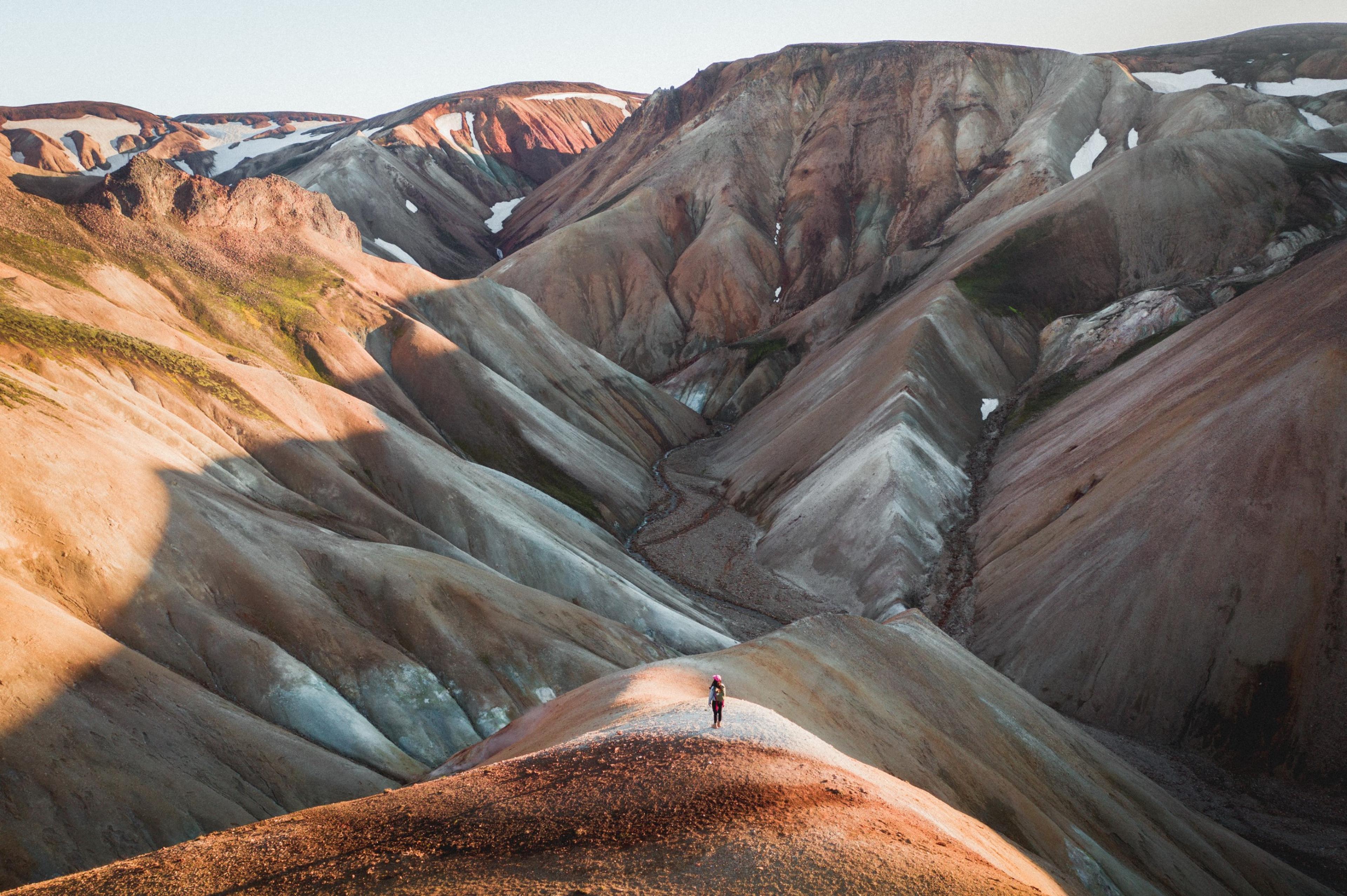
Are you wondering about something?
If you're planning a trip to Iceland, it's important to be prepared with the right information. Here are some frequently asked questions (FAQs) to help you plan your trip
I am a vegetarian/vegan/gluten intolerant, will there be a food option for me, what is it?
Special dietary options, such as vegetarian, pescatarian, vegan, and gluten-free, are available for an additional cost. These options will provide meals that meet the requirements of your diet.
What clothing should I bring on the trek?
We provide a full packing list which includes information about layers, waterproofs, footwear and other recommended or optional items. As we do cross rivers, we recommend aqua shoes over plastic or open-toe sandals for your safety.
How is it best to train for my tour?
To train for this tour, we highly recommend taking regular hikes in your local area, especially in places where the route includes both uphill and downhill segments, as well as uneven terrain. It's beneficial to carry some weight on your back during these hikes to simulate the conditions you'll experience on the tour. Begin with shorter walks and progressively increase their length to build the endurance needed for the longer hiking days you'll encounter during the tour.
Incorporating both low aerobic and aerobic training will help you build the strength and endurance required for longer hikes.
Lastly, it's crucial to train in the boots you plan to wear on the tour. Ensure they are well broken-in and comfortable to prevent blisters and discomfort during your trip.
How long in advance do I need to book?
We always recommend to book as soon as you are ready, especially if you have a tight travel schedule or are travelling as a large group. It is easy to change or cancel bookings up to 24 hours before departure by emailing us ([email protected]).
Is this suitable for hiking beginners?
This is not suited to beginner trekkers as this is mountainous terrain with 6-7 hour of hiking per day. We recommend this for hikers who are physically active with previous basic trekking experience.
Similar tours

5-Day Laugavegur Trek in Huts
The popular Laugavegur hiking route from the Landmannalaugar region to the Þórsmörk area is a 56-kilometre (35-mile) multi-day hike that attracts backpackers and hikers worldwide. If you’re coming to Iceland to hike just one trail, this is the one. Its popularity stems from various landscapes: bubbling hot springs, vast glaciers, beautiful mountains, stunning waterfalls, and roaring rivers.

4-Day Thórsmörk guided hikes in Huts
Enjoy the journey of a lifetime on this fantastic hiking experience in the glacier valley of Þórsmörk, up to the Fimmvörðuháls pass. This is one of the world’s best treks; through volcanic landscapes and green moss Þórsmörk is the last part of the famous Laugavegur trail, considered by many the most beautiful part. Expect to walk 4-7 hours per day on this guided 4-day tour with accommodation in rustic mountain huts. It’s a moderate to challenging hike that spans 40 kilometres with a maximum ascent of 1000 metres.

6-Day Laugavegur & Fimmvörðuháls in Huts
Experience the breathtaking beauty of the Icelandic highlands on the Laugavegur & Fimmvörðuháls Hiking Tour. This six-day trek is an extraordinary journey through some of Iceland's most stunning landscapes, perfectly blending two of the country's most famous trails.

The Volcanic Trails
Unveil Iceland's wild beauty on a 7-day trek through Vatnajökull National Park. Traverse moss, waterfalls, canyons, and deserts. An untamed Icelandic odyssey.

Glacier Panorama Trail
Enjoy a versatile, scenic hike by the volcano Katla that rewards you with a stunning panoramic glacier view of Eyjafjallajökull, Sólheimajökull and other unique landscapes of the scenic south coast. This guided day tour, which is moderately difficult, gives you a glimpse into the world of Iceland’s geological wonders and how glaciers have shaped the land for thousands of years. A specially modified glacier truck transports you approximately 750 metres to start the hike, which will generally continue downhill. Participants should be in good physical shape with some mountain climbing experience.

Day Hike over Fimmvörðuháls
Want to experience a slice of the highlands but don’t have the time for a multi-day hike? Book this guided day tour over the spectacular Fimmvörðuháls pass! A professionally trained guide will lead you on this trail, named one of the Best Hikes in the World by National Geographic. Expect a demanding 10-hour hike where you will see fantastic glacier views, volcanic craters, vast canyons and impressive waterfalls. The 22-kilometre hike is available July-August; participants must be at least 12 years old and up for a challenging hike.

Vatnajökull Glacier Expedition
Cross the largest glacier in Europe during this perfect combination of adventure, stunning nature and physical challenge. This is a dream tour for outdoor enthusiasts! Crossing the mighty Vatnajökull ice cap should be on the list for every ambitious adventurer. You can expect a strenuous 9-day tour with 7-9 hours of walking per day for a total distance of 110-130 km (68-81 mi). A professionally qualified guide will lead the group (4-12 participants). On the vast ice, you will battle conditions ranging from extreme colds and strong wind to extreme heat when the sun comes out and bounces off the snow. This trek combines camping and mountain huts and is not intended for beginner climbers.
Sign up for our newsletter
Subscribe to our newsletter for exclusive tips, personalized travel advice, and early-bird offers on unique experiences!
- Exclusive Insights
- Tailored Travel Tips
- Early Access to Offers
Sign up today!
By subscribing you are accepting our privacy policy
Iceland is open for travel: check volcano updates here
- Language/Currency EN Language EN English DE German CN Chinese $ USD ISK ISK $ USD € EUR CA$ CAD £ GBP

Multi-day Tours
Trekking Tours
6 Day Hornstrandir Hike
6 day Hornstrandir Hike
Backpacking journey to the spectacular hornstrandir nature reserve.

A backpacking journey beyond the roads to the stunningly spectacular Hornstrandir Nature Reserve - experience the magic of edge-of-the-world places only accessible on foot or by boat!
- Ísafjörður (Isafjordur)
- Hesteyrarskarð (mountain pass)
- Aðalvík (Adalvik)
- Mount Straumnesfjall
- Fljótavík (Fljotavik)
- Hlöðuvík (Hloduvik)
- Hornbjarg bird cliff
- Professional guiding service
- Tents and cooking equipment
- Lunch and dinner on day 1
- Breakfast, lunch and dinner on days 2 to 5
- Breakfast and lunch on day 6
- Boat ride to and from Hornstrandir Nature Reserve
- Pick up at Ísafjörður Airport
What to bring
- Thermal underwear (top and bottom), at least two sets of shirts
- Wool or fleece thermal mid layer
- Hiking pants
- Waterproof, breathable pants and jacket
- Wool/fleece hat & gloves
- 2-3 pairs of thick hiking socks
- Sun glasses
- Waterproof hiking boots
- Sleeping bag (rated to at least 0°C) and travel pillow
- Thin self inflatable sleeping mattress
- Day backpack (50-70L) to carry all belongings
- River crossing shoes (old sneakers or similar for fording rivers)
- Short gaiters recommended
- Health supplies and prescription medicine
- Sunscreen / after sun cream
- Personal medical kit and personal medication
- 1-2 liter water bottle
Tour Snapshot
- Expert Guides
- Small Group Experience
- No Booking Fees
- Fast & Secure Payment
- Best Price Guarantee
- Operated by our trusted partner
The Lost Fjords are really dramatic, incredibly mystical and remote places in the West Fjords. These are the kind of places you meet on your travels and will never ever forget. Like the Vikings of old you need to be tough enough to carry everything you need for the next 6 days with you.
This tour begins in Ísafjörður (Isafjordur). It is easy for us to help you to arrange accommodation for the nights before and after your tour in both Isafjörður and Reykjavík.
Hornstrandir Nature Reserve is a magical place of untouched beauty with amazing wildlife which thrives unhindered in these no longer inhabited places. The only way to get to these isolated gems is by boat or on foot. This precious preserved area is situated in Vestfirðir (the West Fjords), on the most northernmost peninsula of Iceland which has the remotest coastline in the country.
This area was very sparsely populated until the middle of the 20th century. See the very remote work sheds used by the toughest of Icelandic fisherman, farmers and craftsman in the olden days. Farmer or fisherman it was a hard life within a tight-knit community, farmers were fisherman and the fisherman worked the fields at certain times of year. When times were really hard people found a way to survive, many say the spirit or atmosphere left by these hardy and intrepid folk can still be felt here. One thing is for certain, you cannot help but feel in awe of the generations of people who survived here surrounded by the greatest beauty but also the harshest elements.
You will see dramatic steep cliffs and mountainsides which fall dramatically away into very deep fjords and enormous untouched bays. There are overwhelming cliffs and tons of driftwood carried on the tide all the way from the forests of Siberia. Some of the biggest bird cliffs in Europe can be found here, this is one of the largest seabird colonies in the world. Fifty different species of bird have their breeding grounds here, there are plentiful seals, whales, porpoises and last but not least, the only authentic wild mammal in Iceland, the Arctic Fox. The beautiful wildlife sounds and the movement of the ocean are the only sounds you will really hear, you leave the usual 21st century sounds far behind you! The Hornstrandir Nature Reserve is often compared with Fjordland in New Zealand, however, there is one crucial difference, Hornstrandir has not yet been discovered by mass tourism. This explains the nickname “The Lost Fjords” which is, of course, the name we have adopted for this tour!
This trekking tour in Hornstrandir, West Iceland will exceed your greatest dreams and build memories to last a lifetime.
Day 1: ISAFJORDUR - ADALVIK

Your guide organizes the meals but assistance from willing participants is warmly appreciated. Forge friendships and be part of the team!
We will meet at Ísafjörður harbor. We introduce ourselves and then get organized for the scheduled boat trip to the charming village of Hesteyri, the last of the local inhabitants left in the 1950s. We depart from the harbor in Ísafjörður on our passenger ferry Bjarmi at 9 am .
The two-hour ferry trip will have delivered us to an experience which is about as far from the modern world as it is possible to get. We will have stepped into a natural wonderland where the only sounds are the bliss-inducing gurgle of mountain streams, the soft swishing back and forth of the ocean waves onto the beach and the myriad songs and sounds of the birds. The only signs of habitation are a few well-maintained buildings used a little in the summer.
Your backpacking really tour begins in Hesteyri when we head up over Hesteyrarskarð mountain pass, on a clear day there will be the most stupendous views all around you. We then make our way down the other side of the mountain to sea level again, we will camp for the night close to an abandoned farm/village at Látrar, Adalvík (Main Bay). Here you will be lulled to sleep by the sounds of nature and breathe some of the purest air in the world. Distance: 11km (6.75mi).
Day 2: ADALVIK - FLJOTAVIK
We break camp and get ready to go. From Aðalvík , we aim to take a little detour, walking the track to the top of the Straumnesfjall mountain to explore an abandoned radar station built in 1953 by the American army. It does not seem to have taken them many years to figure out this is a pretty harsh place to exist in, the station was abandoned in 1960. Perhaps they got bored with the total absence of enemies showing up!
We then set off on our main hike to Fljótavík , a sensational and wild bay a little to the north. Getting to this destination will take us over some interesting terrain, with truly stunning views all the way. We will need to cross a tidal river, Atlastaðaós , naturally this can be a bit of a challenge, not least because the ocean tides will influence things, we need to time our crossing when the tide is not too high. We will camp overnight at Atlastaðir on Fljótavík , close to a ruined farmstead but way out in remote nature. Wandering in rhythm with nature, smelling the salt-tang and listening to the sea birds to replenish mind, body and soul.
Distance 18km (11.25mi).
DAY 3: FLJOTAVIK - HLODUVIK

Today is a day of mountain passes! Our efforts will be well rewarded by the stunningly dramatic scenery along the way. We begin our trek along the green banks of Fljótsvatn , an exceptionally beautiful lake. The very impressive mountains will be on our left-hand side. We will continue across the mountain range which lays between us and our next destination, the bay of Hlöðuvík . Our overnight camp will be at Búðir , a cove with the ocean in front of us and the grand mountains at our back. Those who would like to can participate in an optional evening walk to Hælavík , an incredibly beautiful bay close to the Sigmindarfell , Álfsfell and Hafnafjall mountains.
The local folklore concerning Álfsfell is particularly rich. It is said that this mountain is partially occupied by elves or hidden people. It is also said that a ghost or spirit woman called Ásdís would appear to assist the local fisherman to find the best fishing grounds. There are reports of another ghost, a spirit man named Indriði, who has sometimes been seen in this area. It is impossible to avoid feeling close to the forces of nature and creation in this place, whatever you believe them to be!
DAY 4: HLODUVIK - HORNVIK

Today we trek up a very steep section which will take us up onto the Skalakambur mountain ridge, we then follow an old track marked with cairns all the way up to 327 m above sea level at the Atlasskarð (Atlaskard) mountain pass. The most stunning scenery and magical natural beauty will be all around us. We will skirt around Mount Kollur as we hike towards Höfn in Hornvík , right in the heart of the Hornstrandir Nature Reserve. The natural beauty here is of an unmatched kind, no one who travels to this area should miss out on this. To experience the best of this area we need to spend a little more time, so we will set up camp in this spectacularly peaceful and awe inspiring place for two nights. Distance 12km (7.5mi).
DAY 5: HORNVIK - HORNBJARG - HORNVIK
The beauty of Hornvík is unique and spellbinding and the area is particularly well-blessed with an abundance of birds. Two of Iceland’s largest bird cliffs frame this little bay, Hælavíkurbjarg which rises up from the ocean almost vertically to 4,500 m and the Hornbjarg cliff which rises to over 500 m. This area is a nesting ground for three American bird species: The Great Northern Diver; Harlequin Duck; and Barrows Goldeneye, and also for an Arctic seabird, the Brünnichs Guillemot. a sturdy auk with a thick bill.
Of course, like the entire Hornstrandir area, Hornvík is very remote and it can only be reached by boat or on foot. We will hike to the Hornbjarg bird cliff where thousands of birds can be seen, and the enormous cliff sculptures fashioned by mother nature will make every human being feel very small, vulnerable and in no doubt that nature is king. Many of our customers say that the hike to the Hornbjarg bird cliff was the absolute highlight of their Hornstrandir trip. At the end of the day we trek back to Hornvík where we camp for the night, enjoying our final evening together in this pristine ocean and mountain paradise. Distance 16km (10mi).
DAY 6: HORNVIK - VEIÐILEYSUFJORDUR - ISAFJORDUR
Today we will pack our tents and gear, hit the trail and cross yet another mountain pass to get to the Veiðileysufjörður fjord. After crossing the mountain range, we descend down to the coast again, following alongside the beach for a while until we get to Meleyri . From there we will be picked up by the boat which will take us to Isafjörður . Back to civilization after almost a week in the wilderness! For those eager to wash away the hiking dust, we thoroughly recommend a visit to the Ísafjörður swimming pool, refreshing showers, soothing hot tubs and a swimming pool to stretch any tired muscles. There are a variety of places to go out to eat, where you can relax and go over precious memories of your just completed trek.
*Boat ride from Veiðileysa to Ísafjordur . Distance 11km (6.75mi).
Those who wish to fly back to Reykjavik may arrange to stay overnight in Ísafjörður and fly back the following morning or later (accommodation and flight costs are not included).

Pre-departure meeting
We meet at our office in Aðalstræti 17 (downtown main street) the day before departure at 17:00 , where we will answer any questions and make final preparations.
Please note
The minimum number of participants is 4 persons. Maximum number of participants is 14 persons per guide. If there are less than 4 people in your group, contact us to see if there is a group that you can join.

What type of power outlets are used in Iceland? Do I need to bring an adapter?
The standard in Iceland is 230V and 50Hz and we use F-type power sockets and plugs, so you might have to bring an adaptor if you are visiting from UK, USA, Canada or other countries using a different voltage, Hz or plugs.
How are the tours rated in terms of difficulty?
Our tours are split into four different categories that help participants to understand what to expect from the tour. The categories are Easy, Moderate, Challenging and Demanding. Each tour is rated making it easier to find tours that suit you.
For further information about the difficulty ratings and descriptions.
How hard is the hike?
The distances are between 12-16 km a day. We carry all our stuff on most of the days and have to go through mountain passes up to 600 meters elevation. We keep a slow pace and enjoy the scenery, we're not in a hurry! This hike is a wilderness hike, the terrain where we hike is in some parts wet, mossy, rocky, muddy and everything in between, steep and flat. In some parts, there aren't any trails.
What type of weather can I expect? What should I wear?
First of all, check the weather forecast but keep in mind that the weather in Iceland can be extremely unpredictable, as you may have heard. We have a saying “If you don’t like the weather in Iceland, just wait 5 minutes” which is sometimes disturbingly accurate!
The weather can be anything from sunny to snowy in almost any season although snow is rare during summer time. We do suggest that you dress accordingly. This means in layers, thermal closest to you and waterproof on top. We’ve prepared a guide to help you get ready for your adventures, check out – How to prepare for hiking and trekking in Iceland .
Can I wear jeans and sneakers?
No, please do not wear jeans and sneakers on this tour, it’s not appropriate clothing for this type of tour. Check the list of what to bring to see what kind of clothing is appropriate.
What if I don’t own all of these clothing necessaries?
Don’t worry, you can always rent sturdy hiking shoes, a waterproof jacket and pants in the booking process or add them to your booking. You can book these items and more under the selection “Extras” in the booking widget when booking your tour on our website.
If you have already booked the tour and wish to add some rental gear to your booking, you can do so at least 24 hours prior to your tour starting by using our customer portal - My Adventures , or contacting our customer care .
Please keep in mind that we do not rent gear on location.
Do we need to carry our personal gear?
Yes, you do. This is a self-supported backpacking trip but we try to get as many food drops with the passenger boats as possible. We will spend two of the last nights in Hornvík Bay and do a beautiful day trip on day 5 along the magnificent bird cliffs with only lunch for the day. On the last day, you only need to carry your personal belongings. You can even lighten your load for the last day by sending gear back to town with the scheduled boat.
Is it early enough to arrive on the morning plane to Ísafjörður on the day of departure?
It's not recommended. You're cutting it really tight and if there is a delay in the flight, you will miss your trip. We also plan a meeting at 5 pm the day before and we recommend that you try to make that meeting.
Similar tours that people viewed also
")
5 Day Laugavegur Trek, South Coast & Glacier Hiking Tour (HUTS)

Laugavegur & Fimmvörðuháls Trek - 6 Day Tour
Contact us for more information about this tour.
Arctic Adventures offers pick up service from selected Reykjavík pick up points. Note that you can always update your pick-up / drop-off location through our customer portal: https://my.adventures.is You can press the login button in your confirmation email for an easy login to the customer portal. If you experience an error with logging into the customer portal or can't find your booking, please contact us on Facebook Messenger, or send us a message here below. Chat with us on Facebook Messenger
- Conservation
- Nature & Wildlife
- Trails & Walks
- How to reach
- Where To Stay
- Who can visit
- When to visit
Visit Options
- Individuals
- Institutions
- Photo Gallery
- Get Involved
Visiting JNR
JNR is open to all visitors with an interest in nature, walking...
How to Reach
JNR is conveniently located on the Mussoorie-Dhanolti road...
Booking a day visit for individuals or small groups...
Become a Member
Support JNR and get unlimited access by becoming a member...
JNR Gallery
- View All Gallery
Support JNR and get unlimited access by becoming a member..
As one of the few remaining natural forest patches near Mussoorie with connections to the Sivalik Hills and the middle Himalayas, they form an important wildlife corridor
Watch the video
Seasons @ jnr.
When to visit at JNR
JNR offers something to the visitor at all times of the year. Each month brings with it new discoveries and vistas so that you will never get tired of the place even if you are a frequent visitor. See the gallery on Seasons @ JNR to view the wonders of each season.
In spring, the trails are scarlet with fallen rhododendron flowers and the trees are flowering and new leaves appearing. Birds are at their best at this time of the year and early mornings will give you vistas of the Himalayas.
+91 8859566222 - JNR +91 8171264710 - Virendra +91 6396-816670 - Vipul
[email protected], facebook twitter instagram, jnr, dhanolti road, mussoorie | uttarakhand..
Jabarkhet Nature Reserve © 2015 | All Rights Reserve
Top Website Design & Development Company of Dehradun
Dana to Petra Trek + Wadi Rum & the Dead Sea
- Min group size: 2
- Max group size: 15
- Price (USD) from : $1,595
Difficulty: Easy Moderate Challenging Tough
Price (USD) from $1,595
Have a question?

Join a small group of Experience Jordan Adventures on the Dana to Petra Trek - rated as one of the world’s 15 best hikes by National Geographic!
Tour Highlights
- 5-day trek from Dana Nature Reserve to the ancient city of Petra. - Hike through breathtaking, ever-changing Landscapes. - Explore the picturesque red-sand desert Wadi Rum. - Float in the Dead Sea.
Welcome to Jordan! Take some time to arrive, check into your hotel room, and have a first experience of the delightful Jordanian cuisine. Depending on when your flight arrived, you will even have some time to explore Amman by yourself.
Amman is Jordan’s capital, and one of the oldest cities in the world. Inhabited since the Bronze Age, the city has grown into a modern city with all that you might expect. Despite this amazing growth, Amman has retained its character and traditions, and the culture of hospitality and generosity is still very present across the city.
Overnight: Hotel in Amman
At 7:30 am right after breakfast, the group will be picked up from the hotel in Amman. The drive from Amman to the starting point of the trek takes about 2.5 hours – time to get to know your fellow hikers or to take a nap. Our trekking journey starts with hiking through the diverse landscapes of the Dana Biosphere Reserve. The reserve includes four distinct ecozones thus accommodating an astonishing diversity of plants, birds, and other animals. First, we’ll follow a trail along the mountains overlooking Dana Valley, and then descend into al Khashasha Valley A wilderness campsite awaits us on the outskirts of the valley
Overnight: Wilderness Camping in Mansoura
Time: 5-7 hrs Hiking Distance: 15 Km Ascent: 260m Descent: 690 m
Well rested, we will leave the campsite in the early morning, and head towards Furon. Today‘s hike is challenging but extremely rewarding We will start ascending through the mountains for approximately an hour before getting a glimpse of the beautiful Sharah Mountains and the wide Wadi Araba Desert. That outstanding view will accompany you all the way to your campsite in Al Furon Enjoy a cup of tea and the great view from the campsite while passing the time until your well-earned dinner.
Overnight: Wilderness Camping in Furon
Time: 5-7 hrs Hiking Distance: 16 Km Ascent: 563 m Descent: 170 m
Today’s hike leads past Ras Al-Feid and towards Ghbour Whedat, through some of the country’s wildest corners.
Contouring the Sharah Mountains, we follow a trail comprised of smaller, connecting Bedouin shepherd paths. The bare peeks of black, rugged mountains overlooking the trail, and the precipitous drops of the canyons below make this part of the trek spectacular.
Gradually climbing up the hills, you will uncover more spectacular views over the barren desert below. Then, as you proceed towards the wilderness campsite, the landscape slowly becomes softer, with mushroom-like rock formations lining the way.
Overnight: Wilderness Camping in Ghbour Whedat
Hiking Distance: 17.1Km Ascent: 750m Descent: 920m
After yesterday’s very remote hike, we will see signs of increasing human habitation while approaching Little Petra today. Passing Bedouin camps, sheep pens, and small agricultural plots you can gain an impression of the living environment of part of Jordan’s population. We will also pass the first Nabataean ruins, including wine and olive presses, aqueducts, and other ancient water infrastructures.
Finally, we will climb up through a canyon walled with soft sandstone rocks, and then down a narrow, steep flight of stairs into Little Petra. The site, also known as Siq al-Barid (Engl. the Cold Canyon), is believed by archaeologists to be a ‘suburb’ of Petra and was probably meant to house traders traveling along the Silk Road. After some time to explore, we’ll head on to our home for the night – hot showers are waiting!
Overnight: Bedouin Camp near Little Petra
Hiking Distance: 14Km Ascent: 610m Descent: 560m
On our last trekking day, we will enter Petra ‘via the Back Door’, avoiding most other tourists.
Amidst high sandstone mountains, a good track leads down Wadi Ghurab. The way then follows a Nabataean route out of the valley, and skirts around the final mountain on a natural rock terrace which has been ‘improved’ for the safety of walkers. It narrows slightly before reaching a hidden plateau high above the impressive chasm of Wadi Siyyagh. Just beyond, ‘the Monastery’ suddenly comes into view.
After walking the last meters to the impressive structure, we can rest for a bit, taking in the view There also is a Bedouin café for refreshments. Then, more Nabataean steps will lead us down into the main site. We’ll make our way through a colonnaded street, past rock-cut tombs, temples, and a Roman-style theater, to finally arrive at Petra’s probably most famous building – the Treasury. Take your time to marvel at the façade’s detailed artworks. After a final look, we’ll leave the site through the Siq a narrow, high-walled canyon, and then head to our accommodation for the night.
Overnight: Hotel in Petra
Hiking Distance: 13.8Km Ascent: 496m Descent: 519m
After a relaxed breakfast, we leave the mountains of Petra behind and move on to Wadi Rum. Are you ready for a desert adventure?! We will meet our Bedouin hosts and set out on a 4×4 jeep safari to explore valleys and narrow gorges, discover ancient rock inscriptions, climb sand dunes and rock bridges, and generally enjoy the majestic desert landscape. At each step, you have the opportunity to hike, scramble and explore at your own pace. After viewing one of the most magical sunsets in the world, we’ll return to our camp for, dinner, an experience of the famous Bedouin hospitality, a night under the starlit sky, and – of course – countless cups of tea.
Overnight: Bedouin camp in Wadi Rum
Today, we will leave the desert and proceed to the Dead Sea, the lowest point on earth. You can spend some time floating in the salty waters, try out the ‘magical’ Dead Sea mud, relax by the pool, or pamper yourself with some spa treatments – the perfect cure if your legs are still tired and sore from all the hiking. In the late afternoon, we will hop on the bus for the last time, and follow the long, winding road up to Amman – to return to where the adventure began.
Sadly, all great things must come to an end. For those flying out already, it is generally recommended to leave Amman at least 4 hours prior to your departure. We wish you a safe flight, and hope you will return back home with many wonderful memories of your time in Jordan!
End of services.
Enhance your tour with these add-ons

Single Supplement - Dana to Petra Trek (9 Days)
Price: $200.00
If you would like to have your own room in the hotels on this tour, please select the single supplement option. Otherwise, you will be paired with another traveler of the same gender.
During this tour, everyone who wishes will have their own tent on wilderness camping nights.

Airport Pick Up
Price: $50.00
Private transfer from the Airport (QAIA) to your hotel in Amman.
You can book this for any day. After booking, we will just ask for your flight details, so that we can pick you up at the right time!

Airport Drop off
Private transfer from Amman (or the Dead Sea) to the Airport for your departure flight.
You can book this for any day. After booking, we will just ask for your flight details, so that we can drop you off at the right time!

1 Extra Night before the tour
Price: $100.00
1 extra night's hotel reservation before the tour in Amman, in the same hotel if possible. If you are interested in booking more than one extra night, are not sure yet, or have questions, no worries! You can still book your tour to reserve your space and we can arrange those details afterward.
Just respond to your booking confirmation email, or at any time, you can click "Enquire" below to ask us questions and we will be happy to help.

1 Extra Night after the tour
1 extra night's hotel reservation after the tour in Amman, in the same hotel if possible.
If you are interested in booking more than one extra night, are not sure yet, have questions, etc., no worries! You can still book your tour to reserve your space and we can arrange those details afterward.

(D2P) Tour Extension: Red Sea & Dead Sea
Price: $600.00
Tour Extension: Red Sea & Dead Sea Extension
Day 1: Wadi Rum to Aqaba
Take a morning transfer (approx. 1 hour) from Wadi Rum to Aqaba. Check-in at the beautiful and new Hyatt Regency Aqaba Ayla Resort. Enjoy a free day in Aqaba. You can relax on the beach of the Red Sea, swim in the pool, or explore the city. Overnight: 5-star hotel in Aqaba (Al Manara, a Luxury Collection Hotel Aqaba Or similar)
Day 2: Aqaba – Dead Sea
Today, you will leave the Red Sea coast and proceed to the Dead Sea, the lowest point on earth. You will check in to the Hilton Dead Sea Resort & Spa. Spend some time floating in the salty waters and try out the ‘magical’ Dead Sea mud and relax by the pool!
Overnight: 5-star hotel in the Dead Sea (Hilton Dead Sea Resort & Spa Or similar)
Day 3: Free Day at the Dead Sea
Enjoy some extra time at the Dead Sea and the resort!
Overnight: 5-star hotel in the Dead Sea (Hilton Dead Sea Resort & Spa Or similar)
Day 4: Airport transfer (Departure)
A car and driver will pick you up from your hotel and drive you to Queen Alia International Airport (QAIA) in time for your flight. --
Booking Note: Minimum price of 2 people.

Deluxe Tent in Little Petra (Shared)
Upgrade your basic tent to deluxe tent.
- Private toilet and shower
- Rooming on a share basis (unless a single supplement is purchased)
** Kindly note the upgrade is based on availability in the camp**

Price (USD): $200.00

Price (USD): $50.00

Price (USD): $100.00

Price (USD): $600.00

Private Tour Option
*The prices below represent the tour base price for a private group. Prices may change due to other factors, such as holidays.
Group Size: Price per Person
2-5 people: $2,245 / person
6+ people: $1,495 / person
Tour Extension: Red Sea & Dead Sea
Itinerary Note: For this extension, you will separate from the group on Day 8 in Wadi Rum. Instead of heading back to Amman with the group, your will start day 1 of this extension and go to Aqaba.
Day 1: Wadi Rum to Aqaba Overnight: 5-star hotel in Aqaba (Al Manara, a Luxury Collection Hotel Aqaba Or similar)

Day 2: Aqaba to Dead Sea Overnight: 5-star hotel in the Dead Sea (Hilton Dead Sea Resort & Spa Or similar)
Day 3: Free Day at the Dead Sea Overnight: 5-star hotel in the Dead Sea (Hilton Dead Sea Resort & Spa Or similar) Day 4: Airport Transfer (Departure)
Full Itinerary with Extension
Day 1: Arrival Day 2-6: Dana to Petra Trek Day 7: Petra – Wadi Rum
(Start of Extension) Day 8: Wadi Rum to Aqaba Overnight: 5-star hotel in Aqaba (Al Manara, a Luxury Collection Hotel Aqaba Or similar) Day 9: Aqaba to Dead Sea Overnight: 5-star hotel in the Dead Sea (Hilton Dead Sea Resort & Spa Or similar) Day 10: Free Day at the Dead Sea Overnight: 5-star hotel in the Dead Sea (Hilton Dead Sea Resort & Spa Or similar) Day 11: Airport Transfer (Departure)
Booking note: You can book both extensions mentioned above directly as add-ons. Minimum price of 2 people.
More details on both extensions can be found in the add-ons section.
- Meals: 8 Breakfasts, 7 Lunches, 7 Dinners. (See food tab for more)
- Accommodation: 8-nights. (See accommodation tab for more)
- English-speaking licensed guide on days 2-8.
- Local hiking guide with a donkey for safety measures on days 2-4
- Transportation as per itinerary.
- Luggage transfers. (By pickup truck)
- Jordan Pass – “Jordan Wanderer” (Visa & Entrance Fees)
- Airport pick-up and drop off
- Tips for service providers (drivers, guides, camping/ hotel staff, etc.).
- Travel insurance.
- Personal expenses.
- Hiking gear.
- Anything not mentioned in the inclusions.
Starting Location: 1st night’s hotel. (If the airport pick-up option is selected, then the starting location is at the airport.)
Ending Location: Last night’s hotel. (If the airport drop-off option is selected, then the ending location is at the airport.)
Day 1: N/A Day 2: Breakfast, Lunch, Dinner Day 3: Breakfast, Lunch, Dinner Day 4: Breakfast, Lunch, Dinner Day 5: Breakfast, Lunch, Dinner Day 6: Breakfast, Lunch, Dinner Day 7: Breakfast, Lunch, Dinner Day 8: Breakfast, Lunch, Dinner Day 9: Breakfast
- Day 1: Arrive, check in to your hotel and food is on your own.
- Day 2-8: While on this tour all meals are provided.
- Day 9: Have breakfast, check out from your hotel, and depart to the airport.
- Vegetarian and vegan options are available.
Day 1: 3-star hotel in Amman (twin-share) Day 2: Wilderness Camp Day 3: Wilderness Camp Day 4: Wilderness Camp Day 5: Bedouin Camp (twin-share) Day 6: 3-star hotel in Petra (twin-share) Day 7: Bedouin Camp (twin-share) Day 8: 3-star hotel in Amman (twin-share) Day 9: N/A
Notes: Wilderness Camps: All single travelers will be provided with their own tent for free.
Our amazing local Bedouin support team sets up the campsite during the day, so everything is prepared when you arrive. Upon arrival, enjoy some time to sit down, relax and have some tea. Then when dinner is ready, our Bedouin support will reveal the locally made feast.
In the tents, we provide foam mattresses, sheets, and blankets. So no sleeping bags are needed unless you want to bring your own.
A shower tent and a bathroom tent are provided.
Our wilderness camps provide a nice escape from everyday life, great views, good service, and some wonderful dinners. Some people may refer to it as “glamping.”
Bedouin Camps: Rooming on a twin-share basis. So travelers booking together will share a room.
These are fixed site, touristic Bedouin Camps, staffed by locals, in Little Petra and Wadi Rum. Bathrooms are normally off-suite, with a women’s and men’s public bathroom. The tents do not have A/C or heater, but the desert normally has cooler temperatures at night.
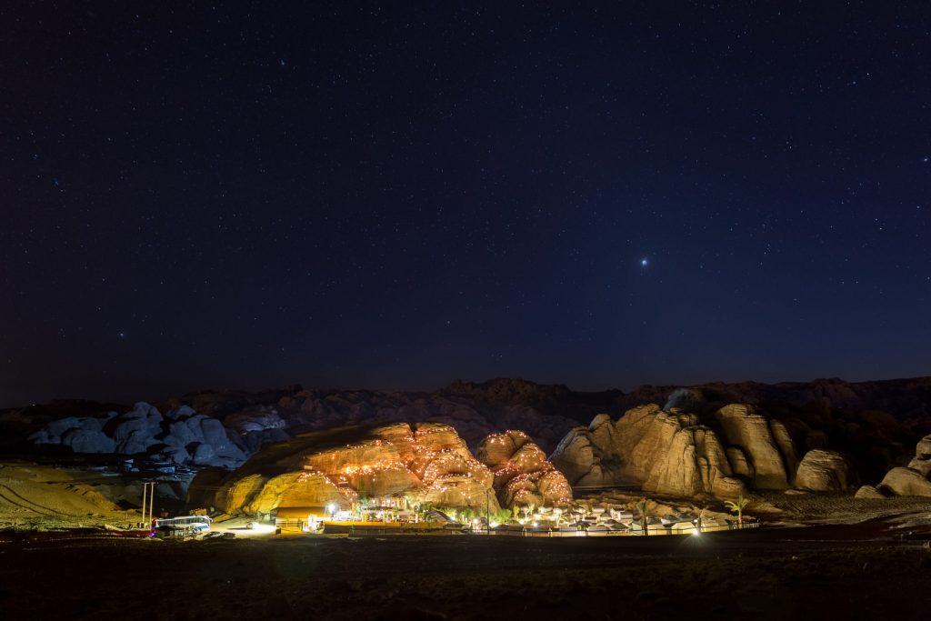
The main airport (QAIA – Queen Alia International Airport) is approximately 1-hour outside of Amman.
Arrival: Day 1 is scheduled just for your arrival and check-in.
Therefore any flight arriving on Day 1, with enough time to arrive, make it to the hotel, and get some sleep, is a good choice.
If you would like to arrive a day or so early, that’s great! You can easily book an add-on for one extra night on either end of your tour. Let us know and we can book extra nights and/or additional activities. Or feel free to arrange things on your own and join the group when it’s time.
Departure: Day 9 is scheduled just for your check-out and departure to the airport.
Therefore a morning / mid-day departure flight on Day 9 is ideal.
It is possible to have a departure flight on day 8. If you chose to do so, we recommend a flight that departs at least after 7 pm.
Departing on Day 8 makes things a bit more rushed and more tiring. But this option may work well for people with relatively short flights, less time off, or if the airfare available just happens to be a better deal that day.
We are operating these trips during the best times of year to trek in Jordan.
Throughout the year, at the camps during the night you will want to have long pants, and a light jacket or sweatshirt.
During November, December, and February, you may also want warmer clothes like a bigger jacket, hats, gloves, and a light rain jacket.
We know we are located in the Middle East, but don’t worry – Jordan is not that hot. We don’t offer many departures in the Summer for that reason, but May has the potential to be on the warmer side. During the warmest times this trip operates, the temperature is usually not much over 35 celsius (95 Fahrenheit).
This is a 5-day trek with each day covering 14-17+ kilometers (8.5-10.5+ miles). That is five days in a row with 5-7 hour hikes.
So you should be reasonably fit to be able to enjoy this hike.
Shoes The ideal shoe for this hike is light-weight hiking shoes.
If you only have big-clunky hiking boots and running/athletic shoes, you could take both and see what you prefer on the hike.
Hiking Sticks/Poles Most of this hike is on good, firm ground, so hiking sticks are not required. The vast majority of people do not use hiking sticks for this hike.
However, if you like hiking with Hiking sticks/poles, or want them just in case, feel free to bring them.
During Wilderness Camping, you should not expect to have access to electric charging.
After leaving Amman on Day 2, your first good charging opportunity will be at the Bedouin Camp in Little Petra on night 5. You can charge your devices there until around 10pm when the camp turns the generator off for the night.
If you want extended access to electronic devices, we recommend bringing battery packs or you can also bring solar recharging devices.
Here are some things you are not allowed to bring to Jordan: 1- Drones 2- Binoculars
Book Your Tour
Secure your spot with just a 25% deposit if you book more than 60 days before the tour. The remaining balance is due 45 days before the tour. Don't miss out! ⏰ Save $100 on your next adventure in 2024 or 2025. Limited-time discount!
There are no booking dates available for this tour right now. Please check back again soon!
Similar Tours

Cycle Jordan: Jordan Bike Trail through Petra and Wadi Rum
Full Adventures
Price (USD): $1,850
Join us for an unforgettable 8-day cycling adventure along the breathtaking Jordan Bike Trail! This ...

Petra & Wadi Rum Hikes & Scrambles
Price (USD): $1,495
Combine the Petra Full Immersion with Wadi Rum - Hike & Mountain Summit, and a ...

Jordan Active Adventure (Hike & Bike)
Experience Jordan’s most beautiful sights and places – all with a sense of adventure! Combine two ...

Experience Jordan Tour
Price (USD): $1,295
Visit Jordan's unique sites, experience the country's beauty, and engage with its people and their ...

Summer Adventure in Jordan
Price (USD): $995
Join a small group to experience adventurous hikes, stunning landscapes, and outstanding hospitality in Jordan! Tour ...
Your booking will expire in 5 minutes. Continue to secure your booking.

Hiking The Pilgrimage Trek: Yading Nature Reserve
Yading Nature Reserve is a beautiful place in the Tibetan plateau with towering mountain peaks, alpine lakes and vast pastures. You can hike to the many beautiful lakes, and witness locals complete pilgrimage treks on unmaintained paths around the sacred Xiannairi mountain regularly. As someone who loves a challenge, the small kora pilgrimage trek was very hard to resist. This Yading hike was one of my most memorable experiences in China.

Preparations and Acclimatisation
Before arriving in Yading, we had been traveling for 1.5 weeks in Yunnan. We felt altitude sickness starting in Lijiang at 2900m. I initially did not think much of the lethargy I felt throughout the day, until I realised that my friend had felt the same symptoms. We had no appetite and had headaches throughout the night.
Based on what I had researched, altitude sickness happens to fit people too. Taking altitude sickness pills, sleeping at high altitude in Litang (4000m), and taking time to acclimatise were probably beneficial. We had been hiking at increasing altitudes since the start of our trip, so it gave us plenty of time to acclimatise. Here are the hikes we did before this:
- Dali’s Cangshan (2600m)
- Jade Dragon Snow Mountain (4506-4680m)
- Tiger Leaping Gorge (2500m)
- Yubeng Village (3000-3900m)
When we got to Yading National Park on the first day, we did a short 3-4 hour hike to get used to the 3700m altitude. We still got breathless throughout the trail, but we noticed that we were doing better than others around us who rested more frequently and relied on oxygen tanks.
Getting to Yading Nature Reserve
Bus routes end in Daocheng (稻城) city, which is located 110km north of Yading. From there, you will need to carpool to the park entrance. If you are choosing the bus options, I recommend taking motion sickness pills before your ride.
- Chengdu to Daocheng : There is a 2-day bus journey that passes through Kangding to Daocheng (270 RMB). You can buy these tickets from the bus station in Chengdu. Alternatively, there are domestic flights flying to Daocheng Yading Airport.
- Shangrila to Daocheng: It takes 10-12 hours and costs 133 RMB for this bus ride, and passes through high mountain roads with scenic views.
- Daocheng to Yading : When you get out of the bus station, there will be drivers approaching you to ask where you are going. Most of the time, they are looking for people to fill up their carpool ride. It costs only 50 RMB for the 1.5-2 hour journey to either Riwa or the Yading Tourist Center (亚丁游客中心). We payed 150 RMB for the entrance and 120 RMB for the sightseeing bus that takes you a further 30-45 minutes into the park.
Planning A Yading Hike

Based on recommendations from various blogs to spend at least 2 days in Yading. Ideally, one day should be like a warm up day. You can hike the shorter Pearl Lake (珍珠海) or ZhuoMaLaCuo (卓玛拉措) route, and the other should be a full day where you can explore the longer route to Milk Lake (牛奶海) and Five Colour Lake (五色海). If you plan to go on the small kora pilgrimage trek, include an additional day for a night of camping in the mountains. I do not recommend doing the Yading hike in 1 day if you are not acclimatised because it is super difficult and you risk developing altitude related problems in the mountains.
You can choose to stay in Daocheng or Riwa Town (also known as Shangri-La Town) the night before. We stayed in Daocheng because the best chance to get a carpool ride was in the morning. The next day, we checked in at Yading Village in order to maximise the time spent within the park. Our private twin room only cost 150 RMB per night during the off-peak season in 彭措民宿. It was quite nice because they use their living room as the guests’ dining area.

The Small Kora Hike
When I started the day, I did not plan to do the small kora trek around the sacred Xiannairi (Chenresig) mountain. Although I read the inspiring story where 2 women managed to complete the hike in 11.5 hours, I brushed it aside and told myself not to get too ambitious. Besides, my travel buddy needed some rest, so I was going to have to hike solo . Hence, I decided to follow the tourists’ trail and hiked up towards Milk Lake and Five Colour Lake.
Let me be first to reach the lake!
It was my second day in the park and I wanted to avoid the crowd as far as possible. I took the first bus from Yading Village at 7:30am, bought the one-way electric car ticket (50 RMB) from Chonggu Monastery to Luorong Pasture. By 8:30am, I had started my ascend to Milk Lake. It was very calming to hike by myself, and I felt very safe because of the well maintained trail. I eventually caught up to 2 local women who were gathering some plants which they said were for religious purposes. Since it was safer to walk with the locals, I stayed with them and started a conversation. To be honest, I sometimes cannot understand the Chinese spoken by the Tibetans, so I smiled and tried to guess from the context.

We were ascending from 3700m to about 4300m at the Milk Lake, so the Yading hike got more and more challenging towards the top. I matched the pace of the local women all the way till we reached the beautiful and empty lake at 10am. The locals told me they were going to do the small kora trek after passing Milk Lake, and that it would only require 5-6 more hours from here. I couldn’t believe it! I wondered if I had acclimatised enough to join them on this seemingly crazy journey.
I’m not alone anymore – I have 2 new friends

They let me decide for myself if I wanted to follow them. I figured that since I could keep up with them earlier, the rest of the hike should be fine. It was risky, because I had time constraints and needed to meet my friend before 5pm. Although I knew that there was going to be one part where it gets super difficult, I did not want to have any regrets. This is the hike I had been dreaming of, and now that I have guides I am not alone anymore! I felt a rush when I decided to join them.

After snapping some pictures of the Milk Lake, we proceeded onto the unmaintained trail beside it, forgoing the Five Colour Lake. As we walked uphill for 40 minutes, I was panting a lot and we stopped several times to rest. I couldn’t help but wonder if I would regret my decision, since the start was already so tiring. However, my pride prevented me from backing out and I wanted to prove myself wrong.
Reaching the 1st Col

As we passed by more prayer flags and probably the 1st Col, I knew it was going to be a 2 hour long descend and was relieved. The women took out their new prayer flags and started attaching them to the existing ones. I quietly observed at the side as they prayed facing the mountain. It was a cloudy day so it was hard to recognise places based on blogs I had read. However, when we passed by ReSongCuo Lake, the fog cleared just in time for me to snap some pictures. Thank God for my 2 new friends, because they helped me through steep and narrow paths which felt really dangerous. I would not recommend doing this Yading hike alone.

We shared a Tibetan lunch
At about 12:30pm we reached an area with many piles of rocks and 1 remaining stone hut which was quite dirty. It was also lined with branches and leaves, which I suppose was used for insulation against the cold stones at night. We shared homemade “baba” bread, some yak cheese and spicy pickled seaweed. I brought my own sausage and snacks, but I was quite full from the food they brought. Despite the language barrier, they tried to chat with me more and asked if I had a boyfriend. It felt nice, because they were quite motherly towards me throughout.

Onwards to the gruelling 2nd Col
Eventually we could see the prayer flags on top of the mountain ridge in the distance. That was going to be where we had to cross over, the 2nd Col that everyone complained to be the hardest part of the trail. The thin air really got me here because we were ascending 600m up to 4775m. It felt like the worst cardio workout ever, but I did not want to fail. I was panting really loudly, and eventually one of the women picked up my bag and carried it for me, while the other supported me by my arm. It sounds embarrassing now, but I was so thankful for their help.

The ascent to the 2nd Col took 1.5 hours, and they stopped often to let me catch my breath. One time, we were overtaken by a young Tibetan couple who looked about my age. How do they make it look so easy? The prayer flags were getting closer and closer, and I knew that the moment when I cross over the 2nd Col would be a celebration for me. The women kept encouraging me and told me that it’s all downhill after this. I cannot give up now, the end is near!
2nd Col down to Pearl Lake

At last, the sense of achievement! I checked the time at the 2nd Col – it was 2:40pm. The prayer flags were flying behind me, and I felt so triumphant. I took some selfies and kept looking back at what we overcame. As we descended and came to a clearing with prayer flags, the women attached theirs and prayed towards the mountain again. I reflected on the amazing hike we just did throughout the descend, and continually expressed my gratitude to my companions. By 4pm, we arrived at Pearl Lake and then 4:30pm at Chonggu Monastery where our 转山 journey ended.

An Unforgettable Hike
As we parted ways, we exchanged numbers and took pictures together. They invited me to their home for tea but I had to decline due to time constraints. I hope to never forget this experience, and the joy of completing a seemingly impossible task. It took us 8.5 hours in total to cover 30km, at altitudes above 4000m. It felt crazy to embark on this journey without any guarantee that I would be okay, but we did it! If I could come back again, I would love to be back in autumn for the beautiful foliage.

I got to admit that I gave up on taking pictures for more than half of the hike because I was so tired, but this Yading hike experience was irreplaceable. It was so worth it and thrilling to go off the beaten track. I got to experience Tibetan culture with the local women, made new friends, and challenged my own limits. If these thoughts resonate with you, I highly encourage you to just do whatever you think is daunting but bound to be fulfilling!
Read more: Yubeng Village: Hiking Through Tibetan Paradise Tiger Leaping Gorge 2-Day Hike: Was It Difficult? Beginner Hut-To-Hut Hiking Trails You Need To Try How To Take Great Photos Of Yourself Hiking

Janice, a California-based travel writer from Singapore, discovered her love for hiking and camping during her studies in Los Angeles. Through her blog, she now shares detailed itineraries for adventures in California, Asia, and beyond. She also talks about gear recommendations and tips for beginners, hoping to inspire them to explore the great outdoors with confidence.

You May Also Like

The Ultimate 9-Day Japan Itinerary: Osaka, Kyoto and Tokyo

Best Lake Tahoe Places You Need To Stay In For An Amazing Winter (North vs South)

Nikko 2-Day Itinerary: The Best Way For Nature Lovers
Leave a reply cancel reply.
Your email address will not be published. Required fields are marked *
Thank you for visiting nature.com. You are using a browser version with limited support for CSS. To obtain the best experience, we recommend you use a more up to date browser (or turn off compatibility mode in Internet Explorer). In the meantime, to ensure continued support, we are displaying the site without styles and JavaScript.
- View all journals
- Explore content
- About the journal
- Publish with us
- Sign up for alerts
- 05 June 2024
1,001 best hikes on Mars: The Peterson Historic Trail (‘Peterson’s folly’)
Ron Fein is a Boston-area public interest lawyer and writer. His fiction has appeared in Nature , Daily Science Fiction , Metastellar and Factor Four . Find him online at ronfein.com and @ronfein.bsky.social .
You can also search for this author in PubMed Google Scholar
Illustration: Jacey
You have full access to this article via your institution.
Region: Noctis Labyrinthus (Phoenicis Lacus quadrangle).
Highlights: Steep-walled canyon in Tharsis Plateau. Listed on Mars Historical Register.
Difficulty: Strenuous; technical at end.
This newly opened canyon trail retraces the journey of the infamous Peterson expedition of 2058. Hardcore trekkers (bring extra oxygen!) can follow the expedition’s original path; families and less-experienced hikers should loop back at either of the Jackson Alternatives.
Getting there
At Valles Marineris Station 20, rent a half-track. Follow Route 914 westward 1,152 km to the Habitat Jerry Historical Site Visitor Centre (vacuum toilets; recycled water and oxygen).
At the Visitor Centre
The centre features a life-size reproduction of Habitat Jerry’s original living quarters, control centre and communications hub. Adults and children will enjoy exploring these 2050s-era modules with an interactive autodocent simulating Mission Deputy Shonda Jackson.
The exhibits on the Peterson expedition are, for obvious reasons, less vivid.
Starting the trek
From the Visitor Centre, follow the interpretive trail alongside Habitat Jerry’s remnants. Trail signs interpret the remains of the greenhouse, hygiene facilities and (unsuccessful) emergency shelter.
At 0.8 km, a large titanium statue honours Mission Deputy Shonda Jackson, Mission Specialist Mike Kazami and Mission Specialist Lenise Kontrovitz. A smaller historical marker contextualizes Commander Nick Peterson.
The trek begins in earnest at 1.3 km. Savour the views — the Tharsis Upland, with volcanic peaks Pavonis Mons and Arsia Mons, to the west; the steep-walled Noctis Labyrinthus canyon to the east — and imagine deciding the critical question after Habitat Jerry’s destruction by a still-raging dust storm: remain on-site and await rescue, or take cover in the canyon?
The trail, now just bare regolith with occasional cairns, leads straight towards the canyon’s edge. Historians believe that Commander Peterson hoped to find shelter in a cliffside lava tube. Areology buffs: the steep-sided depressions in Noctis Labyrinthus are called ‘chasmata’.
Signpost 3: Jackson’s First Alternative
Families and less-experienced hikers should turn right at this junction. Jackson’s First Alternative leads to a wind-eroded mound near a small impact crater. The lee side offers a great place to rest; returning to the Visitor Centre makes an easy 4.8 km round trip. (In the unlikely event of a sudden dust storm during your visit, the mound’s lee side offers excellent protection.)

Read more science fiction from Nature Futures
The Peterson expedition, of course, continued onward, as will experienced trekkers. The trail descends into the canyon along a narrow ledge on the basalt-walled cliffside. At 6.3 km, notice the inscription “HJ CREW SOS — MK” cut into the rock. This carving (scratched by Specialist Mike Kazami’s utility knife) is protected; don’t add your own initials.
Continue 1.6 km down into the canyon. Notice that the view overhead is cramped; even on a bright day, little light penetrates. Unfortunately, Commander Peterson was wrong about the canyon’s safety; there are no convenient lava tubes, and owing to the Venturi effect, the canyon’s steep walls force wind to accelerate. However, the hiking is safe until Signpost 5.
Signpost 4: Jackson’s Second Alternative
This branch trail leads along a canyon-wall traverse for 2.8 km, then returns to the surface. Historians believe that Jackson argued for this path, but Peterson overruled her. The cliff wall offers a fine example of the brittle ‘smectite clay’ characteristic of the Noctis Labyrinthus system’s southern basin.
Most trekkers should take Jackson’s Second Alternative. Once back at the surface, it loops back, connects with Jackson’s First Alternative, and returns to the Visitor Centre for a 12.2 km loop. Returning now via Jackson’s Second Alternative offers the best of all worlds: a short descent into Noctis Labyrinthus, a genuine historical inscription, and a vigorous but manageable day hike. Only the strongest hikers should continue downward; the next segments remain treacherous even with recent trail work.
Those continuing should check oxygen levels (minimum: 0.7 kg). Remember: you brought extra oxygen, but the Peterson expedition couldn’t.
Signpost 5: Kazami Family Memorial
Climbing ropes mandatory beyond this point. The Kazami family donated the funds to install anchor points along the trail’s next segment. Because Peterson expedition narratives often focus on the conflict between Peterson and Jackson, a small, privately installed plaque honours the life and career of Specialist Mike Kazami.
The anchor points are spaced 2.5 metres apart owing to the technical terrain and unstable rock. Be smart: check your carabiners twice.
Signpost 6: Kontrovitz Resting Place
At this turn, Specialist Lenise Kontrovitz lost her footing — perhaps blown by the storm — and tumbled into the chasm. Her body has not been recovered, although some eagle-eyed (or imaginative) explorers claim they’ve seen it on the canyon floor 5 kilometres below, when wind blows away the fine sand.
Be respectful and thank the Kazami family for the anchor points.
Another cliff-wall message, also apparently Kazami’s, is faded but legible: “HJ CREW — LOST — O2 LOW — LK DEAD — SOS.” Some historians believe that Jackson again attempted to persuade Peterson to abandon the descent. (The classic Habitat Jerry: Collapse and Catastrophe , available in the gift shop, imagines Jackson exasperated.) But there is no junction here, so the only other options were turning around, or waiting out the storm on this exposed gravelly ledge.
Signpost 8: Jackson’s Redoubt
A narrow ridge studded with green pyroxene crystals. Forensic experts believe that with the dust storm unabated, Kontrovitz dead and Peterson (probably hypoxic and cognitively impaired) insisting on descending farther into the chasm, Jackson confronted him here. She may have demanded that he relieve himself of command, or just decided to push past him and reverse course. History buffs can speculate; in any event, Commander Peterson’s knife is displayed at the Xanthe Terra Police Museum.
A metal chain marks the end of the Peterson Historic Trail. Return to the Visitor Centre for fresh oxygen and a hot chocolate.
doi: https://doi.org/10.1038/d41586-024-01593-5
Related Articles

It’s time for your performance review
Futures 29 MAY 24

Time’s restless ocean
Futures 22 MAY 24

Explaining novel scientific concepts to people whose technical acumen does not extend to turning it off, then turning it on again
Futures 15 MAY 24

The origin of the cockroach: how a notorious pest conquered the world
News 20 MAY 24
Faculty Positions in School of Engineering, Westlake University
The School of Engineering (SOE) at Westlake University is seeking to fill multiple tenured or tenure-track faculty positions in all ranks.
Hangzhou, Zhejiang, China
Westlake University
High-Level Talents at the First Affiliated Hospital of Nanchang University
For clinical medicine and basic medicine; basic research of emerging inter-disciplines and medical big data.
Nanchang, Jiangxi, China
The First Affiliated Hospital of Nanchang University
Professor/Associate Professor/Assistant Professor/Senior Lecturer/Lecturer
The School of Science and Engineering (SSE) at The Chinese University of Hong Kong, Shenzhen (CUHK-Shenzhen) sincerely invites applications for mul...
Shenzhen, China
The Chinese University of Hong Kong, Shenzhen (CUHK Shenzhen)
Faculty Positions& Postdoctoral Research Fellow, School of Optical and Electronic Information, HUST
Job Opportunities: Leading talents, young talents, overseas outstanding young scholars, postdoctoral researchers.
Wuhan, Hubei, China
School of Optical and Electronic Information, Huazhong University of Science and Technology
Sign up for the Nature Briefing newsletter — what matters in science, free to your inbox daily.
Quick links
- Explore articles by subject
- Guide to authors
- Editorial policies
THE BEST Dzerzhinsky Parks & Nature Attractions
Nature & parks in dzerzhinsky.
- Bodies of Water
- Motorcycle Trails
- 5.0 of 5 bubbles
- Good for Kids
- Good for Big Groups
- Adventurous
- Budget-friendly
- Good for a Rainy Day
- Hidden Gems
- Good for Couples
- Honeymoon spot
- Good for Adrenaline Seekers
- Things to do ranked using Tripadvisor data including reviews, ratings, photos, and popularity.
1. Dzerzhinskiye Lakes
2. Animal Farm
3. Victory Square

4. Pitbike Enduro Club
9 of the best hikes in Thailand

Dec 27, 2023 • 7 min read

You won't be disappointed by the hiking possibilities in Thailand © fredfroese / Getty Images
With wistful, misty peaks, ancient hidden temples, otherworldly karst outcrops and dense jungle teeming with wildlife, Thailand offers a veritable feast for hikers.
Whether you want to conquer mountains, circumnavigate stunning sandy islands or simply make your way to Thailand's biggest waterfall, there's plenty to pick from. What's more, with a superb transport system , it's easy to reach most hiking trails independently – though there are plenty of excellent trekking guides available too.
So grab a heavy-duty insect repellent, pack some sunscreen and buy some leech socks – we’re about to set off. These are the best hikes in Thailand.

1. Krabi’s Tiger Cave Temple
Best hike to a temple 1km (0.6 miles), half a day, moderate
It's a short, steep climb up to the 278m-high (912ft) limestone outcrop that overlooks Krabi Town , but hikers who successfully tackle the 1260 stairs to the summit are rewarded with access to Wat Tham Suea (Tiger Cave Temple) and some stellar views. The temple takes its name from the belief that tigers once dwelled in the surrounding caves. There are no prowling big cats here now; instead, golden stupas and a large seated Buddha silently keep watch over the emerald forest and sprawling blue sea below.
Carry enough water for both the ascent and the humidity. Also, remember to wear culturally appropriate clothing (trousers or long skirts and tops that cover your shoulders) as it’s a Buddhist temple. A hiking pole can be useful – both to haul yourself up and to keep the resident monkeys at a distance.

2. Khao Yai National Park
Best hike in a national park Distances vary, 2–3 hours, easy
Established as Thailand's first national park in 1962, Khao Yai is the best place for a jungle trek near Bangkok . It boasts more than 50km (31 miles) of hiking trails that teem with macaques, gibbons, civets, barking deer and endemic bird species such as the great hornbill.
There are a couple of short, circular trails that begin near the park’s headquarters. However, as wild elephants are often spotted in the reserve, guides are required for venturing any deeper into the rainforest. Avoid visiting on weekends and public holidays as cars often fill the roads to the main sights, including the 150m-high (492ft) Haew Narok waterfall and Haew Suwat cascade, whose 25m-high (82ft) drop dazzled millions in Danny Boyle's cult film The Beach (2000).

3. Kew Mae Pan Nature Trail
Best hike in Thailand 2.7km (1.6 miles), 2–3 hours, easy
The short Kew Mae Pan Nature Trail offers hikers a chance to see one of the most beautiful panoramic views in Thailand. Set inside the Doi Inthanon National Park near Chiang Mai , the 2200m-high (7218ft) Kew Mae Pan mountain stands only a few hundred meters south of Doi Inthanon, Thailand’s highest peak at 2565m (8415ft).
The trek itself is a short circular trail with boardwalks. It begins inside a forest of mossy trees and ferns that bursts with red rhododendrons between January and March. After passing the Mae Pan waterfall, the thicket thaws into a viridian grassland and leads hikers to the Kew Mae Pan Viewpoint (also called Station 9) that dominates the whole reserve and is known for its breathtaking sunrise views. Guides are compulsory here (200B per group).

4. Khao Sok National Park
Best jungle trek Distances vary, 2–3 hours, moderate
Skirting the southern side of Cheow Lan lake, the dense forest and towering limestone karsts of Khao Sok make the national park one of the best jungle treks in southern Thailand. With 48 mammals roaming the forests , there are plenty of excellent wildlife spotting opportunities, too. It’s gibbons, macaques and barking deer for the most part, but more elusive species such as sun bears, clouded leopards and tigers have been known to make an appearance too.
Several trails, each around 12km (7.5 miles) long, start from Khao Sok village on the southern edge of the park. They then cut through dense forest and wind past tumbling waterfalls until they reach the southern shore of the lake.
In October and December, the world’s largest (and smelliest) parasitic flower, the Rafflesia kerrii, blooms, which can be quite a sight. Post-hike, Cheow Lan's floating homestays, surrounded by fang-like karsts that rise from the water, are a popular spot to experience the lake and the northern side of the reserve.
Best island hike Distances vary, 4–6 hours, easy to moderate
Motorcycles are the only vehicles allowed on the low-key island of Koh Jum , just off of Krabi. Fortunately, the most rewarding way to explore this paradisiacal atoll is on foot. The western coast has a flat trail that flits between coves and quiet beaches for 6km (3.7 miles), but for views as far as Ko Phi-Phi (on clear days), tackle the steep climb up Khao Koh Pu hill.
There are two trailheads that lead to the 400m-high (1312ft) summit. The most direct route starts at the 2.9km sign on the circular road surrounding the hill. Navigating the empty rubber estates can be tricky, but locals will take guests up for about 1000B.

6. Um Phang
Best multiday hike Distances and times vary, moderate to hard
Overlooked for the more popular Chiang Mai and Mae Hong Son provinces, Um Phang and Tak offer spectacular hiking but with a fraction of the visitors. All treks start in and around the Um Phang Wildlife Sanctuary and use the Mae Klong River as a handy artery for deeper jungle exploration.
The region is great for multiday hikes. Travelers could spend a week trawling its hills, bunking down at Karen villages and hiking south along the border with Myanmar to the Three Pagodas Pass at Sangkhlaburi, a border between Thailand and Myanmar that once was the main supply line for the construction of the Japanese Thailand–Burma railway in WWII.
However, most come to see Thailand's largest waterfall, Nam Tok Thilawsu . From the wildlife sanctuary, it’s a two-hour hike to the striking cascade through dense palm, giant bamboo and strangler figs. Its pools are suitable for swimming too. Advanced hikers and peak-busters should attempt the grueling 20km (12.5-mile) slog to Mount Kagerla, the fourth-highest peak in Thailand. However, at 1428m (4685ft), it’s not for the faint of muscle.
7. Phanom Rung
Best hike to an ancient temple 1km (0.6 miles), half a day, easy
It may not be a traditional hike, but few places are more inspiring than the Phanom Rung complex near Buriram . Standing on the rim of a dormant volcano, some 200m (656ft) above the rice fields of Isan, this 10th-century Khmer temple is built from pink sandstone.
Not only a striking archaeological site, the climb to Phanom Rung follows an ancient walkway flanked with the heads of Naga (serpent guardians), adding to its character. From the car park, the trail morphs into a stairway to the plateau where the main temple and its 15 doorways await.

8. Phu Kradueng National Park
Best hike to a peak 9.5km (5.9 miles), 4–6 hours, moderate to hard
Phu Kradueng (Bell Mountain) is the main peak in the namesake national park of Loei Province in northeast Isan. The climb isn’t that taxing to begin with, but it gets tougher as hikers approach the plateau-like summit. A campsite at the top offers hikers the chance to spend the night and rent bicycles for those wanting to explore the area at their own pace.
Locals typically complete the climb in a day, but staying over at the top affords hikers the chance to see a stunning sunset over the Mak Dook cliffs. Sunrise over the Nok Aen cliffs is equally compelling. The descent is hard on the knees; borrow one of the walking sticks on offer.
9. Bangkok Phra Pradaeng Loop
Best hike near Bangkok 12km (7.5 miles), 3 hours, easy
Known as the “ Green Lung ” of Bangkok, this walking trail and bicycle path starts at the Bang Krachao Pier (also known as Bang Kachao) and has been protected by long-standing laws prohibiting the construction of tall buildings in this area. Hiking out here is a rare opportunity to see how the Thai capital looked a few decades ago.
Most of the route follows suspended pathways built above a mangrove swamp with a number of homes built on stilts. Try to hike on a Sunday when the Talad Bang Nam Phueng market sells delicious street food and all sorts of goods, from pearl earrings to coconut pancakes.
This article was first published Sep 7, 2021 and updated Dec 27, 2023.
Explore related stories

Sep 6, 2021 • 7 min read
Rich with wildlife, stunning landscapes and beautiful underwater scenery, Thailand's national parks are another major draw to this incredible country.

May 17, 2024 • 14 min read

Jan 30, 2024 • 19 min read

Jan 5, 2024 • 20 min read

Dec 21, 2023 • 9 min read

Dec 9, 2023 • 8 min read

Dec 9, 2023 • 14 min read

Nov 27, 2023 • 6 min read

Nov 26, 2023 • 14 min read

Nov 18, 2023 • 7 min read
- More to Explore
- Series & Movies
Published Jun 7, 2024
Star Trek V: The Final Frontier Delivers Profound Cinematic Moments
In honor of the film's 35th anniversary, let's reflect on this underrated gem and relive these highlights!

StarTrek.com
Situated between Star Trek IV: The Voyage Home and Star Trek VI: The Undiscovered Country in the pantheon of films centered around James T. Kirk's U.S.S. Enterprise , Star Trek V: The Final Frontier is often overlooked when debates erupt regarding Star Trek 's most profound cinematic scenes.
Existing in the shadow of other popular Star Trek releases is not easy, yet The Final Frontier delivers an abundance of meaningful moments and profound dialogue, particularly related to the triumvirate of Kirk, Spock, and Leonard McCoy.
In honor of The Final Frontier 's 35th anniversary, let's reflect on this underrated gem and relive these highlights in the order in which they appeared in the film.
1. "I knew I wouldn’t die because the two of you were with me." — Captain Kirk

Star Trek V: The Final Frontier
Following Kirk's plunge from the El Capitan summit, he was chastised by Dr. McCoy for his reckless behavior.
The captain's assertion that he always knew he would die alone was key on two fronts, as it exemplified his unwavering trust in Spock and McCoy while also offering insight into his views on death as he entered the later stages of his life. Kirk's maturity, both in terms of his friendships and his outlook on mortality, was met in perfect fashion by his friends. As Spock gazed, McCoy sought to break the seriousness by stating, "Well, I’ll call Valhalla and have them reserve a room for you."
2. "What do we do when shore leave comes along? We spend it together." — Dr. McCoy

The doctor chased Kirk's commentary on death with his own observation that, despite their squabbles aboard ship, they were still drawn to one another in their downtime. McCoy references their lack of family ties, building upon the idea of aging officers reevaluating the courses they had chosen for themselves.
As is often the case in The Final Frontier , the weighty dialogue is flavored with light humor. Marsh melons, campfire songs, and Spock's "Were we having a good time?" inquiry — exquisitely punctuated by McCoy's "God, I liked him better before he died" response — underscore their friendly banter and illustrate the many frontiers their bond has endured.
3. "You mean he's your 'brother' brother? You made that up." — Captain Kirk

Furious at Spock for disobeying his order to shoot Sybok, Kirk vented his anger by confronting the Vulcan about the perceived betrayal. Though he declined McCoy's enthusiastic offer to hold Spock so Kirk could enact corporal punishment, the captain was confused by his friend's decision willingness to place the ship at risk. Spock's admission that Sybok was, in fact, his brother perplexed the captain even further, as it riffed on their previous conversation about lacking family and offered a quintessential Spock declaration, "Technically you are correct. I do not have a brother. I have a half-brother."
McCoy's disposition instantly shifted into Spock's favor, once again providing a look into the trio's complex and ever-evolving relationship.
4. "All my knowledge, and I can't save him." — Dr. McCoy

In a bid to rally McCoy to his cause, Sybok presented the doctor a harrowing vision that harkened back to his father's last days. For all of the incredible cures he devised throughout his time in Starfleet, McCoy helplessly stood by as his father's condition deteriorated. At his father's request, McCoy released him from his agony by administering a swift and painless death. The tragedy became amplified when a cure for the elder McCoy's condition was discovered not long after the doctor's merciful act.
Dealing with loved ones who have terminal illnesses is a universal struggle that all humans can relate to, and McCoy's gut-wrenching memory furnished us with what was perhaps the doctor's most powerful character moment in all of Star Trek .
5. "I don't want my pain taken away. I need my pain!" — Captain Kirk

Having already witnessed Sybok put McCoy and Spock through their own trials, Kirk refused to indulge in what he perceived as a con man's mind games. The captain asserted that pain and guilt could not be taken away with the wave of a magic wand, doubling down by proclaiming they're things we carry with us and make us who we are.
While some may argue with the validity of that reasoning, one can't help but find Kirk's analysis to at the very least be thought-provoking and another indication of where he was at on his personal journey. With McCoy convinced of Sybok's authenticity, Kirk's plea of "If we lose them, we lose ourselves" can be seen as a way to sway the doctor's point of view or an effort to persuade the captain of his own argument.
6. "I am not the outcast boy you left behind those many years ago." — Spock

Further underlining the critical nature of this moving scene, Spock denied Sybok's entreaty to join him on his journey through the Great Barrier with an air of reserved self-assurance that only he could deliver. While McCoy found sadness in Sybok's vision and Kirk was provoked to anger by the conversation, Spock reacted with the conviction of a person who was completely secure with who they were as an individual.
Long gone were his days of feeling out of place, as his time on the Enterprise helped guide him on his path and set him apart from the boy Sybok knew. Spock had found himself, and he had also found his place. The Vulcan's certainty in choosing his friends over his own half-brother granted McCoy with his own sense of clarity, as the doctor resisted his drive to follow Sybok and opted to remain by Kirk and Spock.
7. "Is it possible?" — Captain Kirk

Once through the Great Barrier and in range of what Sybok referred to as Sha Ka Ree, Kirk joined Spock and McCoy in marveling at what they saw before their eyes. The captain turned to the plaque emblazoned with the motto, "To boldly go where no man has gone before," reevaluating his views on Sybok's quest and electing to command the endeavor himself.
The notion of apparent foes coming to a peaceful compromise is about as " Star Trek " as something can be, as is the aspiration to seek out and understand the unknown. In the wake of their recent emotional ordeals related to pain and family, Kirk and his two colleagues nevertheless managed to shift gears and demonstrate that they each had the heart of an explorer.
8. "What does god need with a starship?" — Captain Kirk

As Sybok conversed with what he believed to be the God of Sha Ka Ree, Captain Kirk began to sense that all was not as it seemed. Recognizing the alleged deity's interest in the Enterprise , Kirk boldly asked what an all-powerful god would need with such a means of transportation. The question drew the entity's ire, resulting in an energy beam being directed at the captain. Spock immediately took up Kirk's inquiry and received the same punishment, leading McCoy to conclude, "I doubt any god who inflicts pain for his own pleasure."
The exchange expertly returned to the ongoing theme of pain while also underlining Starfleet's need for scientific analysis and evidence to back up any remarkable revelations.
9. "You were never alone." — Spock

Captain Kirk ensured that his friends were safe and faced the false "God of Sha Ka Ree" on his own, but Spock swiftly returned aboard a Klingon Bird-of-Prey to rescue him. Once reunited with Spock, Kirk admitted that he thought was going to die. Spock shook off the claim, reminding that such a fate had not been possible at the time, as the captain was never alone.
The touching declaration underlined the unrelenting bond the two officers had forged, and Kirk was moved to the point of embracing Spock. Whether spoken to infuse the moment with his signature brand of deadpan levity or as a way to steer clear of a very un-Vulcan hug, Spock stated, "Please, Captain. Not in front of the Klingons." Given Spock's predilection for choosing his words wisely, the most likely explanation for his reluctance toward an emotional display was that it had simply been rooted in a wish to keep their friendship private.
10. "I lost a brother once. I was lucky, I got him back." — Captain Kirk

As McCoy and Spock speculated about whether or not god was really "out there," Kirk proposed that perhaps such a deity existed within their hearts. Spock contemplated his brother's death, leading Kirk to reference Spock's own demise and the joy he felt over getting him back. McCoy recalled the captain's earlier comment that people like them don't have families, to which Kirk replied, "I was wrong."
Enlightened, moving, and heartfelt, this moment tied together the film's themes about family, friendship, loss, growth, and wisdom. Kirk willingly showcases his fallibility, and the scene segues full-circle into The Final Frontier 's closing scene that depicted Kirk, Spock, and McCoy revisiting their campfire and embracing their familial relationship with song.
Get Updates By Email
Jay Stobie (he/him) is a freelance writer, author, and consultant who has contributed articles to StarTrek.com, Star Trek Explorer, and Star Trek Magazine, as well as to Star Wars Insider and StarWars.com. Learn more about Jay by visiting JayStobie.com or finding him on Twitter, Instagram, and other social media platforms at @StobiesGalaxy.


- Visit Our Blog about Russia to know more about Russian sights, history
- Check out our Russian cities and regions guides
- Follow us on Twitter and Facebook to better understand Russia
- Info about getting Russian visa , the main airports , how to rent an apartment
- Our Expert answers your questions about Russia, some tips about sending flowers

Russian regions
- Belgorod oblast
- Bryansk oblast
- Ivanovo oblast
- Kaluga oblast
- Kostroma oblast
- Kursk oblast
- Lipetsk oblast
- Moskovskaya oblast
- Sergiev Posad
- Orlovskaya oblast
- Ryazan oblast
- Smolensk oblast
- Tambov oblast
- Tula oblast
- Tver oblast
- Vladimir oblast
- Voronezh oblast
- Yaroslavl oblast
- Map of Russia
- All cities and regions
- Blog about Russia
- News from Russia
- How to get a visa
- Flights to Russia
- Russian hotels
- Renting apartments
- Russian currency
- FIFA World Cup 2018
- Submit an article
- Flowers to Russia
- Ask our Expert
Moscow Oblast, Russia
The capital city of Moskovskaya oblast: Moscow .
Moscow Oblast - Overview
Moscow Oblast is a federal subject of Russia located in the Central Federal District. Moscow, the capital city of the country, is the administrative center of Moscow Oblast. At the same time, Moscow is not part of this region, it is a separate federal subject of Russia, a city of federal importance.
The population of Moscow Oblast is about 7,769,000 (2022), the area - 44,379 sq. km.
Moskovskaya oblast flag
Moskovskaya oblast coat of arms.

Moskovskaya oblast map, Russia
Moskovskaya oblast latest news and posts from our blog:.
23 June, 2022 / Natural Spring Gremyachiy Klyuch in Moscow Oblast .
23 March, 2022 / Main Cathedral of the Russian Armed Forces .
31 January, 2022 / Vasilyevsky (Shcherbatovsky) Castle in Moscow Oblast .
1 August, 2021 / Savvino-Storozhevsky Monastery near Moscow .
4 August, 2020 / Sights of Moscow Oblast - the heart of Russia .
More posts..
History of Moscow Oblast
The territory of the Moscow region was inhabited more than 20 thousand years ago. In the first millennium AD, this land was inhabited mostly by the Finno-Ugric peoples (Meryane and Meshchera). In the 9th-10th centuries, the Slavs began active development of the region. The population was engaged in hunting, fisheries, agriculture, and cattle breeding.
In the middle of the 12th century, the territory of the present Moscow region became part of the Vladimir-Suzdal principality, the first towns were founded (Volokolamsk in 1135, Moscow in 1147, Zvenigorod in 1152, Dmitrov in 1154). In the first half of the 13th century, the Vladimir-Suzdal principality was conquered by the Mongols.
In the 14th-16th centuries, Moscow principality became the center of unification of Russian lands. The history of the Moscow region is inextricably linked to military events of the Time of Troubles - the siege of the Trinity-Sergius Monastery by the troops of False Dmitry II, the first and second militias.
More historical facts…
In 1708, by decree of Peter the Great, Moskovskaya gubernia (province) was established. It included most of the territory of present Moscow oblast. In 1712, St. Petersburg became the capital of the Russian Empire and the significance of the Moscow region as the country’s economic center began to decrease.
In 1812, the Battle of Borodino took place near Moscow. It was the biggest battle of the Russian-French War of 1812. In the second half of the 19th century, especially after the peasant reform of 1861, the Moscow province experienced economic growth. In 1851, the first railway connected Moscow and St. Petersburg; in 1862 - Nizhny Novgorod.
The population of the Moscow region increased significantly (in 1847 - 1.13 million people, in 1905 - 2.65 million). On the eve of the First World War, Moscow was a city with a population of more than one million people.
In November, 1917, the Soviet power was established in the region. In 1918, the country’s capital was moved from St. Petersburg to Moscow that contributed to economic recovery of the province. In the 1920s-1930s, a lot of churches located near Moscow were closed, a large number of cultural monuments were destroyed. On January 14, 1929, Moscow Oblast was formed.
In 1941-1942, one of the most important battles of the Second World War took place on the territory of the region - the Battle for Moscow. In the postwar years, the growth of economic potential of the region continued; several science cities were founded (Dubna, Troitsk, Pushchino, Chernogolovka).
In the 1990s, the economy of Moscow Oblast experienced a deep crisis. Since the 1990s, due to the motorization of the population and commuting, road traffic situation in the Moscow region significantly deteriorated. Traffic jams have become commonplace.
Pictures of Moscow Oblast

Moscow Oblast scenery
Author: Mikhail Grizly

At the airport in the Moscow region
Author: Evgeny Davydov

Nature of Moscow Oblast
Author: Alexander Khmelkov
Moscow Oblast - Features
Moscow Oblast is located in the central part of the East European Plain, in the basin of the rivers of Volga, Oka, Klyazma, Moskva. The region stretches from north to south for 310 km, from west to east - 340 km. It was named after the city of Moscow, which however is not part of the region. Part of the administrative authorities of the region is located in Krasnogorsk.
On the territory of the Moscow region, there are 77 cities and towns, 19 of them have a population of more than 100 thousand people. The largest cities are Balashikha (518,300), Podolsk (309,600), Mytishchi (262,700), Khimky (256,300), Korolyov (225,300), Lubertsy (209,600), Krasnogorsk (174,900), Elektrostal (149,000), Odintsovo (138,900), Kolomna (136,800), Domodedovo (136,100).
The climate is temperate continental. Summers are warm, winters are moderately cold. The average temperature in January is minus 10 degrees Celsius, in July - plus 19 degrees Celsius.
One of the most important features of the local economy is its proximity to Moscow. Some of the cities (Odintsovo, Krasnogorsk, Mytishchi) have become in fact the “sleeping districts” of Moscow. The region is in second place in terms of industrial production among the regions of Russia (after Moscow).
The leading industries are food processing, engineering, chemical, metallurgy, construction. Moscow oblast has one of the largest in Russia scientific and technological complexes. Handicrafts are well developed (Gzhel ceramics, Zhostov trays, Fedoskino lacquered miniatures, toy-making).
Moscow railway hub is the largest in Russia (11 radial directions, 2,700 km of railways, the density of railways is the highest in Russia). There are two large international airports - Sheremetyevo and Domodedovo. Vnukovo airport is used for the flights within the country.
Attractions of Moscow Oblast
Moscow Oblast has more than 6,400 objects of cultural heritage:
- famous estate complexes,
- ancient towns with architectural monuments (Vereya, Volokolamsk, Dmitrov, Zaraysk, Zvenigorod, Istra, Kolomna, Sergiev Posad, Serpukhov),
- churches and monasteries-museums (the Trinity Lavra of St. Sergius, Joseph-Volokolamsk monastery, Pokrovsky Khotkov monastery, Savvino Storozhevsky monastery, Nikolo Ugresha monastery).
The most famous estate complexes:
- Arkhangelskoye - a large museum with a rich collection of Western European and Russian art of the 17th-19th centuries,
- Abramtsevo - a literary and artistic center,
- Melikhovo - an estate owned by A.P. Chekhov at the end of the 19th century,
- Zakharovo and Bolshiye Vyazyomy included in the History and Literature Museum-Reserve of Alexander Pushkin,
- House-Museum of the composer P.I. Tchaikovsky in Klin,
- Muranovo that belonged to the poet F.I. Tyutchev,
- Shakhmatovo - the estate of the poet Alexander Blok.
The architectural ensemble of the Trinity Sergius Lavra is a UNESCO World Heritage Site. The largest museum of the Moscow region is located in Serpukhov - Serpukhov Historical and Art Museum.
The places of traditional arts and crafts are the basis of the souvenir industry of Russia:
- Fedoskino - lacquer miniature painting,
- Bogorodskoe - traditional manufacture of wooden toys,
- Gzhel - unique tradition of creating ceramics,
- Zhostovo - painted metal crafts,
- Pavlovsky Posad - fabrics with traditional printed pattern.
Some of these settlements have museums dedicated to traditional crafts (for example, a toy museum in Bogorodskoe), as well as centers of learning arts and crafts.
Moskovskaya oblast of Russia photos
Landscapes of moscow oblast.

Nature of the Moscow region

Country road in the Moscow region

Moscow Oblast landscape
Author: Mikhail Kurtsev
Moscow Oblast views

Author: Asedach Alexander

Country life in Moscow Oblast
Author: Andrey Zakharov

Church in Moscow Oblast
Author: Groshev Dmitrii
Churches of Moscow Oblast

Church in the Moscow region

Cathedral in Moscow Oblast
The questions of our visitors
- Currently 2.85/5
Rating: 2.9 /5 (197 votes cast)

40 Facts About Elektrostal
Written by Lanette Mayes
Modified & Updated: 01 Jun 2024
Reviewed by Jessica Corbett

Elektrostal is a vibrant city located in the Moscow Oblast region of Russia. With a rich history, stunning architecture, and a thriving community, Elektrostal is a city that has much to offer. Whether you are a history buff, nature enthusiast, or simply curious about different cultures, Elektrostal is sure to captivate you.
This article will provide you with 40 fascinating facts about Elektrostal, giving you a better understanding of why this city is worth exploring. From its origins as an industrial hub to its modern-day charm, we will delve into the various aspects that make Elektrostal a unique and must-visit destination.
So, join us as we uncover the hidden treasures of Elektrostal and discover what makes this city a true gem in the heart of Russia.
Key Takeaways:
- Elektrostal, known as the “Motor City of Russia,” is a vibrant and growing city with a rich industrial history, offering diverse cultural experiences and a strong commitment to environmental sustainability.
- With its convenient location near Moscow, Elektrostal provides a picturesque landscape, vibrant nightlife, and a range of recreational activities, making it an ideal destination for residents and visitors alike.
Known as the “Motor City of Russia.”
Elektrostal, a city located in the Moscow Oblast region of Russia, earned the nickname “Motor City” due to its significant involvement in the automotive industry.
Home to the Elektrostal Metallurgical Plant.
Elektrostal is renowned for its metallurgical plant, which has been producing high-quality steel and alloys since its establishment in 1916.
Boasts a rich industrial heritage.
Elektrostal has a long history of industrial development, contributing to the growth and progress of the region.
Founded in 1916.
The city of Elektrostal was founded in 1916 as a result of the construction of the Elektrostal Metallurgical Plant.
Located approximately 50 kilometers east of Moscow.
Elektrostal is situated in close proximity to the Russian capital, making it easily accessible for both residents and visitors.
Known for its vibrant cultural scene.
Elektrostal is home to several cultural institutions, including museums, theaters, and art galleries that showcase the city’s rich artistic heritage.
A popular destination for nature lovers.
Surrounded by picturesque landscapes and forests, Elektrostal offers ample opportunities for outdoor activities such as hiking, camping, and birdwatching.
Hosts the annual Elektrostal City Day celebrations.
Every year, Elektrostal organizes festive events and activities to celebrate its founding, bringing together residents and visitors in a spirit of unity and joy.
Has a population of approximately 160,000 people.
Elektrostal is home to a diverse and vibrant community of around 160,000 residents, contributing to its dynamic atmosphere.
Boasts excellent education facilities.
The city is known for its well-established educational institutions, providing quality education to students of all ages.
A center for scientific research and innovation.
Elektrostal serves as an important hub for scientific research, particularly in the fields of metallurgy , materials science, and engineering.
Surrounded by picturesque lakes.
The city is blessed with numerous beautiful lakes , offering scenic views and recreational opportunities for locals and visitors alike.
Well-connected transportation system.
Elektrostal benefits from an efficient transportation network, including highways, railways, and public transportation options, ensuring convenient travel within and beyond the city.
Famous for its traditional Russian cuisine.
Food enthusiasts can indulge in authentic Russian dishes at numerous restaurants and cafes scattered throughout Elektrostal.
Home to notable architectural landmarks.
Elektrostal boasts impressive architecture, including the Church of the Transfiguration of the Lord and the Elektrostal Palace of Culture.
Offers a wide range of recreational facilities.
Residents and visitors can enjoy various recreational activities, such as sports complexes, swimming pools, and fitness centers, enhancing the overall quality of life.
Provides a high standard of healthcare.
Elektrostal is equipped with modern medical facilities, ensuring residents have access to quality healthcare services.
Home to the Elektrostal History Museum.
The Elektrostal History Museum showcases the city’s fascinating past through exhibitions and displays.
A hub for sports enthusiasts.
Elektrostal is passionate about sports, with numerous stadiums, arenas, and sports clubs offering opportunities for athletes and spectators.
Celebrates diverse cultural festivals.
Throughout the year, Elektrostal hosts a variety of cultural festivals, celebrating different ethnicities, traditions, and art forms.
Electric power played a significant role in its early development.
Elektrostal owes its name and initial growth to the establishment of electric power stations and the utilization of electricity in the industrial sector.
Boasts a thriving economy.
The city’s strong industrial base, coupled with its strategic location near Moscow, has contributed to Elektrostal’s prosperous economic status.
Houses the Elektrostal Drama Theater.
The Elektrostal Drama Theater is a cultural centerpiece, attracting theater enthusiasts from far and wide.
Popular destination for winter sports.
Elektrostal’s proximity to ski resorts and winter sport facilities makes it a favorite destination for skiing, snowboarding, and other winter activities.
Promotes environmental sustainability.
Elektrostal prioritizes environmental protection and sustainability, implementing initiatives to reduce pollution and preserve natural resources.
Home to renowned educational institutions.
Elektrostal is known for its prestigious schools and universities, offering a wide range of academic programs to students.
Committed to cultural preservation.
The city values its cultural heritage and takes active steps to preserve and promote traditional customs, crafts, and arts.
Hosts an annual International Film Festival.
The Elektrostal International Film Festival attracts filmmakers and cinema enthusiasts from around the world, showcasing a diverse range of films.
Encourages entrepreneurship and innovation.
Elektrostal supports aspiring entrepreneurs and fosters a culture of innovation, providing opportunities for startups and business development .
Offers a range of housing options.
Elektrostal provides diverse housing options, including apartments, houses, and residential complexes, catering to different lifestyles and budgets.
Home to notable sports teams.
Elektrostal is proud of its sports legacy , with several successful sports teams competing at regional and national levels.
Boasts a vibrant nightlife scene.
Residents and visitors can enjoy a lively nightlife in Elektrostal, with numerous bars, clubs, and entertainment venues.
Promotes cultural exchange and international relations.
Elektrostal actively engages in international partnerships, cultural exchanges, and diplomatic collaborations to foster global connections.
Surrounded by beautiful nature reserves.
Nearby nature reserves, such as the Barybino Forest and Luchinskoye Lake, offer opportunities for nature enthusiasts to explore and appreciate the region’s biodiversity.
Commemorates historical events.
The city pays tribute to significant historical events through memorials, monuments, and exhibitions, ensuring the preservation of collective memory.
Promotes sports and youth development.
Elektrostal invests in sports infrastructure and programs to encourage youth participation, health, and physical fitness.
Hosts annual cultural and artistic festivals.
Throughout the year, Elektrostal celebrates its cultural diversity through festivals dedicated to music, dance, art, and theater.
Provides a picturesque landscape for photography enthusiasts.
The city’s scenic beauty, architectural landmarks, and natural surroundings make it a paradise for photographers.
Connects to Moscow via a direct train line.
The convenient train connection between Elektrostal and Moscow makes commuting between the two cities effortless.
A city with a bright future.
Elektrostal continues to grow and develop, aiming to become a model city in terms of infrastructure, sustainability, and quality of life for its residents.
In conclusion, Elektrostal is a fascinating city with a rich history and a vibrant present. From its origins as a center of steel production to its modern-day status as a hub for education and industry, Elektrostal has plenty to offer both residents and visitors. With its beautiful parks, cultural attractions, and proximity to Moscow, there is no shortage of things to see and do in this dynamic city. Whether you’re interested in exploring its historical landmarks, enjoying outdoor activities, or immersing yourself in the local culture, Elektrostal has something for everyone. So, next time you find yourself in the Moscow region, don’t miss the opportunity to discover the hidden gems of Elektrostal.
Q: What is the population of Elektrostal?
A: As of the latest data, the population of Elektrostal is approximately XXXX.
Q: How far is Elektrostal from Moscow?
A: Elektrostal is located approximately XX kilometers away from Moscow.
Q: Are there any famous landmarks in Elektrostal?
A: Yes, Elektrostal is home to several notable landmarks, including XXXX and XXXX.
Q: What industries are prominent in Elektrostal?
A: Elektrostal is known for its steel production industry and is also a center for engineering and manufacturing.
Q: Are there any universities or educational institutions in Elektrostal?
A: Yes, Elektrostal is home to XXXX University and several other educational institutions.
Q: What are some popular outdoor activities in Elektrostal?
A: Elektrostal offers several outdoor activities, such as hiking, cycling, and picnicking in its beautiful parks.
Q: Is Elektrostal well-connected in terms of transportation?
A: Yes, Elektrostal has good transportation links, including trains and buses, making it easily accessible from nearby cities.
Q: Are there any annual events or festivals in Elektrostal?
A: Yes, Elektrostal hosts various events and festivals throughout the year, including XXXX and XXXX.
Elektrostal's fascinating history, vibrant culture, and promising future make it a city worth exploring. For more captivating facts about cities around the world, discover the unique characteristics that define each city . Uncover the hidden gems of Moscow Oblast through our in-depth look at Kolomna. Lastly, dive into the rich industrial heritage of Teesside, a thriving industrial center with its own story to tell.
Was this page helpful?
Our commitment to delivering trustworthy and engaging content is at the heart of what we do. Each fact on our site is contributed by real users like you, bringing a wealth of diverse insights and information. To ensure the highest standards of accuracy and reliability, our dedicated editors meticulously review each submission. This process guarantees that the facts we share are not only fascinating but also credible. Trust in our commitment to quality and authenticity as you explore and learn with us.
Share this Fact:
COMMENTS
Tucked into Iceland's northwest corner, the 589-sq-km Hornstrandir Nature Reserve (227-sq-mi) has an end-of-the-world feel. Waterfalls thunder down mountains, the midnight sun kisses the ocean, cliffs plummet to the sea and the mighty Drangajökull glacier overlooks the scene. Hornstrandir occupies a jagged, fjord-scored peninsula and access ...
Hornstrandir is one of the last places on earth where you can still safely hike in untouched nature and enjoy full remoteness without the internet, cell phone, and any other fellow tourists.. We decided to write this guide on how to visit the Hornstrandir Nature Reserve because hiking in Hornstrandir is neither easy nor well accessible. To explore this northernmost corner of Iceland, you need ...
Hornstrandir Nature Reserve. This territory of the Arctic fox has been uninhabited since the 1950s. As isolated as it was then, it attracts the casual half-day visitors and serious gore-tex hikers alike. Its main attractions are three. First, the bird cliffs surrounding the bay of Hornvík, are a magnet of gigantic proportions.
This nature reserve is located close to Ísafjörður in the Westfjords. If you're traveling from Reykjavik, rent a car or catch a flight to Ísafjörður. The road in the West Fjords is, although beautiful, often narrow and sometimes unpaved. ... Trek begins with a well-marked trail along the seaside of a mountain. The slope leading to the ...
Length Of The Trek: 5 Days for the route outlined here. It is possible to plan a longer route, but keep in mind you must only stay in designated campsites. When To Go To Hornstrandir Nature Reserve: The boats from Ísafjörður to Hornstrandir operate only between June and August. This is the recommended hiking window for this part of Iceland.
Hornstrandir is a nature reserve located in the Westfjords, in the north-west of Iceland. The total area covers 580 square kilometres (220 square miles) of tundra, cliffs, flowering fields and ice. Discover the wonders of this region by taking a tour of the Westfjords. This beautiful region can be visited as part of this 14-Day Self Drive.
Fantastic hike through Iceland's Hornstrandir Nature Reserve. It's only open during the summer time. The silence and solitude of this hike are unmatched and I barely saw any other hikers. The busiest point and most photogenic is of course "the Horn" at the northern tip of the area. To reach Hornstrandir, you need to take a ferry. You will find more information here: https://www.westfjords.is ...
The Hornstrandir Nature Reserve is a stone's throw from the Arctic Circle and an excellent area for viewing wildlife in Iceland. ... to see arctic foxes in Iceland and abundant birdlife amid spectacular natural beauty will love this 11-hour wilderness trek in the Hornstrandir Nature Reserve, departing from Isafjordur. Check availability now by ...
The 3 Day Hornstrandir Trek is perfect for hiking enthusiasts and anyone who wants to experience the stunning natural beauty of Icelandic nature. Join a small group tour of Hornstrandir Nature Reserve with an expert guide. The hike is approximately 35km in total and we hike trails most of the way. The reserve is rich with fascinating nature and ...
This 4-day hiking journey through the Fjallabak Nature Reserve is an off-the-beaten-path adventure in the same enchanting area as the renowned Laugavegur trail. This trek offers a secluded exploration of varied landscapes, including geothermal hot springs, vast lava fields, and impressive waterfalls in one of Iceland's most captivating reserves.
Want to find the best trails in Hornstrandir for an adventurous hike or a family trip? AllTrails has 6 great trails for hiking, backpacking, and birding and more. Enjoy hand-curated trail maps, along with reviews and photos from nature lovers like you. Ready for your next hike or bike ride? We've got you covered, with trails ranging from 4,015 to 12,375 feet in elevation gain.
Laugavegur & Fimmvörðuháls Trek - 6 Day Tour. Experience the Highlands of Iceland. Availability Jun - Sept. Duration 6 days. Departs From Reykjavik. View Tour. Contact Us Now. Backpack through the untouched Hornstrandir Reserve. Dive into its wild beauty on our remote treks, accessible only by foot or boat!
Hornstrandir Trek - 6 Day Backpacking Tour. Hiking in Remote Areas of the West Fjords. Product-ID: BA-6LF. Book Now Add to Wish List Show All Book Now; About Tour; Itinerary; More About Tour. Hornstrandir Nature Reserve is a magical place of untouched beauty and wildlife and the only way to access this hidden gem is by boat. You can be sure ...
Hornstrandir Nature Reserve sits at the tip of Iceland's Westfjords region and offers a blend of picturesque scenery and fascinating history. A hike in the area passes by remains of a British radar station from WWII, many species of Icelandic birds, and some of the most beautiful cliffs in the country. You'll start the experience with a scenic ...
Hiking time is 4-5 hours, and you can find the route on Google Maps. Outside of summer season hours, special request is required. The High Path | The most challenging hike trail in Lo Zingaro Reserve and only recommended for "hiking enthusiasts and experts". Distance is 17 km, allow 7-9 hours.
JNR offers something to the visitor at all times of the year. Each month brings with it new discoveries and vistas so that you will never get tired of the place even if you are a frequent visitor. See the gallery on Seasons @ JNR to view the wonders of each season. In spring, the trails are scarlet with fallen rhododendron flowers and the trees ...
Join a small group of Experience Jordan Adventures on the Dana to Petra Trek - rated as one of the world's 15 best hikes by National Geographic! Tour Highlights - 5-day trek from Dana Nature Reserve to the ancient city of Petra.- Hike through breathtaking, ever-changing Landscapes.- Explore the picturesque red-sand desert Wadi Rum.
Yading Nature Reserve is a beautiful place in the Tibetan plateau with towering mountain peaks, alpine lakes and vast pastures. You can hike to the many beautiful lakes, and witness locals complete pilgrimage treks on unmaintained paths around the sacred Xiannairi mountain regularly.
The trek begins in earnest at 1.3 km. Savour the views — the Tharsis Upland, with volcanic peaks Pavonis Mons and Arsia Mons, to the west; the steep-walled Noctis Labyrinthus canyon to the east ...
Top Elektrostal Parks & Nature Attractions: See reviews and photos of parks, gardens & other nature attractions in Elektrostal, Russia on Tripadvisor.
Top Dzerzhinsky Parks & Nature Attractions: See reviews and photos of parks, gardens & other nature attractions in Dzerzhinsky, Russia on Tripadvisor.
However, as wild elephants are often spotted in the reserve, guides are required for venturing any deeper into the rainforest. Avoid visiting on weekends and public holidays as cars often fill the roads to the main sights, including the 150m-high (492ft) Haew Narok waterfall and Haew Suwat cascade, whose 25m-high (82ft) drop dazzled millions in ...
Situated between Star Trek IV: The Voyage Home and Star Trek VI: The Undiscovered Country in the pantheon of films centered around James T. Kirk's U.S.S. Enterprise, Star Trek V: The Final Frontier is often overlooked when debates erupt regarding Star Trek's most profound cinematic scenes.. Existing in the shadow of other popular Star Trek releases is not easy, yet The Final Frontier delivers ...
Moscow Oblast is located in the central part of the East European Plain, in the basin of the rivers of Volga, Oka, Klyazma, Moskva. The region stretches from north to south for 310 km, from west to east - 340 km. It was named after the city of Moscow, which however is not part of the region. Part of the administrative authorities of the region ...
40 Facts About Elektrostal. Elektrostal is a vibrant city located in the Moscow Oblast region of Russia. With a rich history, stunning architecture, and a thriving community, Elektrostal is a city that has much to offer. Whether you are a history buff, nature enthusiast, or simply curious about different cultures, Elektrostal is sure to ...