- Auvergne-Rhone-Alpes
- Grande randonnée en France
- Randonnées & treks

Tout savoir sur le mythique GR® du Tour du Mont Blanc
- DEPART Les Houches
- DURÉE 8 jours
- DISTANCE 160 km
- DÉNIVELÉ+ D+ 9297 m
Le Tour du Mont Blanc est un grand sentier de longue randonnée qui ceinture le majestueux massif du Mont Blanc. Surnommé aussi par les randonneurs aguerris “TMB”, ce dernier parcourt les cols, tutoie les sommets et élonge les glaciers à travers trois pays que sont la France, l’Italie et la Suisse. Le tour du Mont Blanc au dénivelé positif de 10.000m se réalise ainsi entre 7 et 10 jours. Sans guide, nous l’avons parcouru en 8 jours de trek. Dans cet article, retrouvez chacun de nos étapes et nos conseils pour bien préparer ce GR® mythique.
- AUTEURE : Amélie
- TEMPS DE LECTURE : 19 minutes

Légendaire terre de randonnée, le massif des Alpes se laisse bercer des plus belles histoires d’alpinisme. Dénivelés importants, pentes ardues, glaciers à portée de main et ce géant des Alpes à 4 809 m. Le GR® Tour du Mont Blanc est l’étape initiatique pour se lancer dans la grande aventure des randonnées de longue distance.
🥾 Vous souhaitez plutôt faire le Tour du Mont Blanc accompagné ? Mont Blanc Trail propose un tour en 7 jours. Infos et dates >> ici <<
À pied sur le Tour du Mont Blanc, un GR® mythique
C’est l’un des sentiers de grande randonnée en France les plus plébiscités et empruntés car il permet de se familiariser avec la randonnée de plusieurs jours. La force du Tour du Mont Blanc c’est d’être un trek relativement accessible . Toutefois, trois passages plus en altitude demandent davantage de concentration. Sur le parcours classique il s’agit du col de la Croix du Bonhomme en France (2443m) et le Grand Col Ferret à la frontière Italo-Suisse (2537m). Du côté des variantes du TMB , il y a la Fenêtre d’Arpette en Suisse (variante 2665m) qui demande de l’attention et d’observer surtout la météo. Le Tour du Mont Blanc est donc accessible à condition de randonner régulièrement, d’avoir une bonne condition physique et d’être bien sûr à l’aise avec un sac à dos de plusieurs kilos.
Préparer le tour du Mont Blanc en 8 jours sans guide :
- Des Houches à Nant Borrant (France)
- De Nant Borrant aux Chapieux (France)
- Des Chapieux au refuge Elisabetta (passage France — Italie)
- Du refuge Elisabetta au refuge Bertone (Italie)
- Du refuge Bertone à la Fouly (passage Italie — Suisse)
- De la Fouly à Trient (Suisse)
- De Trient au Lac Blanc (passages Suisse — France)
- Du Lac Blanc aux Houches (France)
- Organiser son Tour du Mont Blanc
- Difficulté du TMB
- Quand faire le TMB ?
- Le budget pour faire le TMB
- La liste des refuges/auberges sur le GR
- L’équipement trekking pour le Tour du Mont Blanc

Carte illustrée du parcours autour du Mont-Blanc en 8 étapes
→ Avant de randonner : Procurez-vous le topo guide officiel de la Fédération Française de randonnée (16,50€)
Tour du Mont Blanc jour 1
Des houches à nant borrant.
→ Distance : 18,84 km → Durée : 4h54 de marche → D+ 734m → Nuit au refuge de Bonnant Nant ou possibilité aussi de bivouacer 10mn après le refuge sur un emplacement dédié.
→ Le départ classique du TMB se fait depuis les Houches . Pour éviter la montée vers le col de Voza, possible aussi d’emprunter la télécabine de Bellevue. Depuis le col de Voza il y a une succession de descentes et de montées vers le village des Contamines le long du torrent de Miage puis de la rivière le Bonnant. L’étape étant facile, nous recommandons donc de pousser jusqu’au refuge Nant Borrant. Passage par la Chapelle Notre-Dame-de-la-Gorge qui marque la fin de route puis d’un canyon à la borne 33.
🔎 Variante : Col du Tricot (2120m) passant par le glacier de Bionnassay, son Aiguille ainsi que les Dômes de Miage. Comptez 2hrs depuis le refuge du Fioux.

Mardi 15 septembre, sonne alors le début d’une grande aventure nourrie par l’envie lancinante de se challenger. Si la montagne contemplative est une chose, la palper au plus près en est une autre. Le TMB semblait alors être l’étape initiatique par laquelle je devais passer pour accomplir de vieux rêves enfouis. Cette longue randonnée qui devait durer 9 jours autour du Mont-Blanc , nous la terminerons en réalité en 8 et c’est au col de Voza que tout commença, sous un soleil de plomb avec en ligne de mire les Dômes du Miage et un Mont-Blanc scintillant, presque aveuglant. Nous enchaînons tout d’abord les kilomètres jusqu’à la sortie du village des Contamines. En fin de route et avant de grimper dans les sentiers face sud du massif du Mont Blanc, nous passons la jolie et timide Chapelle Notre-Dame-de-la-Gorge qui rappelle ainsi ces églises baroques des Dolomites.
Nous entrons finalement dans la réserve naturelle des Contamines au cœur de kilomètres boisés, au frais de sapins bien appréciés. À la borne 33 nous passerons d’abord un canyon luxuriant et grave, un secret bien préservé qui n’aurait pas à rougir face au Johnston Canyon de l’ouest canadien . L’Aiguille des Glaciers et le Mont Tondu nous berceront ensuite pour cette première nuit au creux de vallée, dans la fraîcheur d’une troisième semaine de septembre. La fatigue s’emparant de nous, nous laisserons alors nos estomacs criards au profit de nos duvets molletonnés.
🔎 Vous cherchez de l’équipement (trekking et multi-activité) pas cher ? Alors, je vous invite à consulter le site Hardloop ainsi que celui d’ Alpinstore revendeur multi-marques aux valeurs éco-responsables.
Tour du Mont Blanc jour 2
De nant borrant aux chapieux.
→ Distance : 11,61 km → Durée : 3h58 de marche → D+ 991 m → Nuit au refuge de la Croix du Bonhomme ou possibilité de bivouac dans la vallée avant le village des Chapieux.
→ Le sentier passe en premier lieu devant le refuge de la Balme avant d’entamer une grimpée rocheuse. Cascade de la Balme (poteaux électriques : dommage) puis ascension jusqu’au Col bonhomme . Belle vue sur les lacs Jovet et la réserve naturelle des Contamines. Depuis le col, prendre ensuite le sentier montant à gauche en direction du refuge (50mn environ). Descente enfin vers les chalets de la raja avant d’atteindre finalement Les Chapieux.
🔎 Variante : petite randonnée pour rejoindre les lacs Jovet (1h30 AR). Depuis le refuge de la Croix du Bonhomme variante via le col des Fours pour rejoindre la Ville des Glaciers sans passer par les Chapieux ou rejoindre le refuge Robert Blanc.

Le vallon de la Rollaz semble encore endormi alors que le soleil embrase les Aiguilles de la Pennaz et les Roches Franches. De nuit, comme lors de premières lueurs, les sonnailles d’alpages résonnent dans le ventre de la vallée jouant une mélodie sans fin aux notes mélancoliques. Nous passerons le refuge de Balme avant d’entamer une courte, mais ardue, ascension jusqu’à ce plateau aux airs de Highlands écossais . Les aiguilles du cadran pointent le presque midi, pourtant les reflets orangés nous laissent imaginer une beauté mystérieuse de fin de journée. Les filaments électriques qui passent par dessus la cascade de la Balme disparaitraient presque, tant le tableau est pourtant superbe.
Attendre le col du bonhomme à 2329m
Mes pas, l’un devant l’autre, m’amèneront enfin tout en sueur sur ce premier col. Le Col du Bonhomme , une sacrée seconde étape sur le Tour du Mont Blanc où malgré vents violents se lit un panorama exceptionnel. Au nord d’abord, vers les lacs Jovet. Puis au sud vers les Roches Merles. Un sentier de 50m à travers pentes chaotiques et résidus d’avalanche nous mènera ensuite au refuge de la Croix du Bonhomme.
Nous avions l’ambition d’atteindre les Chapieux, c’était du moins sans prévoir la formation d’orages violents par-dessus nos casquettes. À mi-chemin, du moins un peu plus, la tempête, la pluie et même la grêle nous prirent de court. Mental échiné, tente et vêtements trempés, la force nous quitte alors pour manger. C’est une seconde nuit, le ventre vide, que nous nous couchons, rêvant à une météo à nouveau clémente.

Vue d’en bas sur le col du bonhomme à franchir …

Puis, vue d’en haut depuis le col du bonhomme.

Tour du Mont Blanc jour 3
Des chapieux au refuge elisabetta soldini.
→ Distance : 17,64 km → Durée : 4h55 de marche → D+ 1093 m → Nuit au refuge Elisabetta Soldini sur les hauteurs des ruines de Lex Blanche. Le bivouac en Italie est interdit en-dessous de 2500m.
→ Depuis les Chapieux, prendre d’abord la direction de la Ville des Glaciers et du barrage de Séloge. Montée progressive au choix sur la route ou en contre-bas le long du torrent des glaciers puis vers le refuge des Mottets. Nouvelle montée, d’abord en lacets puis progressive jusqu’au cairn du Col de la Seigne. Entrée au Val Vény (côté massif italien), passage de la jolie Casermetta al Col de la Seigne jusqu’au refuge Elisabetta.
🔎 Il y a 3 variantes différentes pour rejoindre le refuge Robert Blanc : 1) depuis le refuge de Balme via les lacs Jovet et le col d’Enclave (D+ 1400 / 350m / 7hrs / difficile). 2) depuis le refuge Croix du Bonhomme via la Tête Nord des Fours (D+ 1000 / 700m / 6hrs / difficile). 3) depuis le refuge Elisabetta via le Col de la Seigne (D+ 700 / 200m / 5h30 / modéré).

Il est encore tôt lorsque nous rangeons notre matériel de bivouac. La perspective de vallée nous hypnotise si fort que nous nous tromperons de chemin le temps d’un ou deux kilomètres peut-être. Quoiqu’il en soit, heureusement que nous vérifions régulièrement notre trace IGN sur l’ application Gaia . À nouveau sur le bon sentier, nous prenons la direction de la Ville des Glaciers, qui jouit d’une bonne réputation pour s’approvisionner en fromage local.
Premières rencontres avec ceux qu’on appelle “Patou”, ces chiens de bergers et protecteurs des troupeaux. Entraîné pour faire face aux loups ou bien d’autres prédateurs, le patou peut s’en prendre au randonneur ; des panneaux de mise en garde et règles à garder à l’esprit sont d’ailleurs visibles le long du Tour du Mont Blanc .

Enjamber la frontière Italie / France
La route semble ensuite se finir, plein nord, aux confins de la vallée. Nous apercevons minuscule aux pieds de l’Aiguille des glaciers, le Refuge Robert Blanc perdu dans la caillasse à 2750m. Ce dernier porte le nom d’un guide de haute-montagne bien connu des environs. Depuis le refuge des Mottets une série de lacets panoramiques nous attend. Le temps est optimal et après quelques efforts sous un soleil de plomb toujours, le repas du midi au frais le long de la rivière vint opportun.
On passe le ruisseau du Roget, puis quelques passages à vide, avant d’entamer une longue montée vers le Col de la Seigne . Réputé venteux, la pluie ne nous épargnera pas jusqu’à l’arrivée au cairn qui pointe face à nous l’Italie et le Val Vény . La route jusqu’au refuge Elisabetta Soldini est sans pareille. Le Mont-Blanc joue à cache-cache, à son habitude, mais le massif côté italien est quant à lui plus hardi. Retrouver le confort et la chaleur d’un lit n’a pas d’égal. Un risotto copieux ( c’est dans les refuges italiens que nous mangerons le mieux ), le réveil est mis et le dortoir entier sombre finalement dans un profond rêve.

Le cadre magnifique du refuge italien Elisabetta
Tour du Mont Blanc jour 4
Du refuge elisabetta au refuge bertone.
→ Distance : 20,55 km → Durée : 6h8 de marche → D+ 1292 m → Nuit au refuge Bertone.
→ Sentier linéaire sur le plateau du lac Combal puis montée à nouveau dans la forêt. Passez ensuite les ruines de l’alpage Arp Vieille Inferiore ; magnifique balcon sur le massif italien. Le sentier bien balisé reste facile jusqu’au refuge Maison Vieille / Le Randonneur. Descente ensuite jusqu’à Courmayeur sur les pistes de ski puis à travers un bois dense et enraciné. Cette dernière partie n’est pas très agréable. Traversée de la ville et de quelques quartiers pour retrouver le sentier, une fois de plus, montée en lacet à travers le bois jusqu’au refuge de Bertone (1h30).

Nous laissons derrière nous cet abri aux volets verts. Quelques ciao fusent avec les bergers du plateau du lac Combal puis le sentier grimpe à nouveau vers les près et quitte cette route trop linéaire à notre goût. Un D+300m nous attend, passant par les ruines de l’alpage Arp Vieille Inferiore. Une fois de plus, nous nous arrêtons pour admirer tout en tranquillité le Mont-Blanc qui s’élance à 6km à vol d’oiseau. Le sentier se poursuit ensuite vers Maison Vieille avant une descente ardue et sans intérêt vers Courmayeur . La chaleur étouffante m’oppresse, je ne vois pas la fin de cette descente. J’ai si mal au genou que je n’arrive pas à profiter des jolies ruelles de la ville. Je n’ai qu’une envie : rejoindre au plus vite le refuge Giorgio Bertone.
Le sentier grimpe alors à nouveau, en lacet, dans un environnement touffu, boisé, sans grande visibilité. Enfin, le refuge se dévoile, une douche plus tard, on admire les lumières de Courmayeur scintiller comme de la poudre d’étoile. Le temps d’observer notre premier chamois gambader frêlement, la clochette retentit. C’est l’heure du souper !

“L’alpiniste est un homme qui conduit son corps là où, un jour, ses yeux ont regardé… “ GASTON RÉBUFFAT
Tour du Mont Blanc jour 5
Du refuge bertone à la fouly.
→ Distance : 28 km → Durée : 7h27 de marche → D+ 1228 m → Nuit à l’ hôtel Edelweiss à La Fouly. Autre option : camping des Glaciers ou l’ auberge Maja Joie .
→ Sur les hauteurs du refuge Bertone suivre d’abord le TMB classique à gauche vers le refuge Bonatti. Balcon plongeant sur les Grandes Jorasses tout simplement époustouflant. Descente ensuite jusqu’au parking Col Ferret puis remontée en deux temps, pente courte mais raide puis progressive jusqu’au refuge Elena enclavé par le glacier de Pré de Bar . Montée costaud jusqu’au Col Grand Ferret (dans le brouillard pour nous). Descente jusqu’à Ferret avec en toile de fond le Grand Combin, le Mont Dolet et aussi l’Aiguille de Triolet. Depuis La Fouly, belle vue sur le glacier de l’A Neuve.
🔎 Variante possible depuis le refuge Bertone : Testa Bernarda (2533m) via le Mont des Saxe en prenant le sentier de droite sur les hauteurs du refuge Bertone. Aussi, depuis le col Grand Ferret possibilité de rejoindre le petit col Ferret (2537m / 30mn) ou la Tête de Ferret (2714m / 50mn).

Bertone, Bonatti et col Grand Ferret
Nous quittons finalement, bien que tardivement, le refuge Bertone. Une petite étape de 7km nous attendait alors que la pluie s’abattait sur toute la vallée. La brume aussi. Nous avions alors décidé de prendre le temps pour quitter ce refuge si douillet. Où cette polenta fromage me restera longtemps en bouche. À L’approche du refuge Bonatti, nous décidons finalement de repousser nos limites et de franchir la frontière italo-suisse . La brume jouait avec les Grandes Jorasses, les sapins et nous aussi. Ne perdant pas espoir, le soleil finit par persister à l’approche du refuge Elena. Lové dans les contreforts du glacier de Pré de Bar, les vents glaciaux ne laissant aucun répit, nous décidons finalement de vite grimper vers le Col Grand Ferret dans un brouillard dru et écrasant comme jamais.

Des Grandes Jorasses au Valais Suisse
Aucune visibilité sur ce col alpin qui fixe la frontière du valais suisse avec la vallée d’aoste. Nous tâchions de ne pas nous éloigner l’un de l’autre, tant le brouillasse pouvait sans prévenir nous enfouir dans la colline. Nous, au milieu du rien, du vide, de l’infini. Une fois de plus, cette météo hasardeuse nous surprendra. Alors que dans cette montée périlleuse il était impossible de voir à plus de 10 mètres devant nous, le soleil fit une percée à travers ces nuages gris cendre. Le Valais suisse s’illumina et éclaira le Grand Combin , le Mont Dolet mais aussi l’Aiguille de Triolet. Une longue marche de presque 3h nous attendait ensuite. Nous découvrons La Fouly dans une nuit noire et intense, les jambes en compote après 28km de marche. Ni une, ni deux, une histoire de déjà-vu, nos corps se laissant aller dans le dortoir de l’hôtel Edelweiss.

Tour du Mont Blanc jour 6
De la fouly à trient.
→ Distance : 13,08 km → Durée : 3h55 de marche → D+ 782 m → Nuit à l’ auberge du Mont Blanc à Trient.
→ Depuis la Fouly sentier en fond de vallée jusqu’à Issert puis Orsières. Autre option plus facile : navette (12€) jusqu’à Champex-Lac ou Champex-d’en-Haut pour avancer ce tronçon moins intéressant. Depuis Champex-Lac suivre ensuite le sentier du GR à gauche vers l’alpage de Plan de l’Au. Belle montée en lacet, passage plus difficile, jusqu’au sommet. Le sentier jusqu’au col de la Forclaz est facile même si sans intérêt. Enfin la descente commence par une petite passerelle à flanc de montagne, puis une descente progressive avec grosses marches en sous-bois jusqu’au village de Trient.
🔎 Variante possible pour randonner jusqu’au glacier du Trient : la fenêtre d’Arpette (2665m) via Montroc, audacieuse et exigeante variante qui se réalise par météo clémente (D+ 1100m / 6hrs / difficile). Depuis Champex-Lac, un autre sentier n’appartenant pas au TMB est splendide et permet de rejoindre la Cabane d’Orny à 2828m.

Nos corps usés par les 28km de la veille, se réveillent courbaturés. La vallée est bouchée et nos pieds ont dû mal à avancer. Nous prenons alors une navette jusqu’à Orsières, puis Champex-Lac . Depuis l’alpage de Plan de l’Au, nous retrouvons un sentier en lacets à travers les mélèzes qui s’élancent. Depuis le collet de Portalo nous rejoignons ensuite le col de Forclaz jusqu’à Trient.
C’est la journée la moins intéressante du Tour du Mont Blanc, en toute honnêteté car il faut reconnaître que les paysages sont moins impressionnants et le massif du Mont-Blanc n’est même plus visible. Le col de Forclaz nous semble être un puit à touristes. Le retour à la civilisation ne nous enchante pas, les crottins me manquent déjà. Malgré tout, il faut avancer jusqu’à l’Auberge du Mont Blanc, où nous profiterons d’une longue après-midi pour nous reposer et oublier les douleurs avec quelques jeux de société.
Tour du Mont Blanc jour 7
De trient au refuge du lac blanc.
→ Distance : 19,32 km → Durée : 5h52 de marche → D+ 2281 m → Nuit au refuge du Lac Blanc . Le bivouac est interdit dans le périmètre du Lac Blanc.
→ Montez la combe étroite du Nant Noir vers le col de Balme puis le col de Posettes. Le sentier classique reste à gauche tandis que la variante grimpe vers l’Aiguille des Posettes. Descente ensuite par le bois vers Tré-le-Champ (attention aux nombreuses racines). Le sentier grimpe à nouveau vers l’Aiguillette d’Argentière. Passage vertigineux d’échelles et de planches de bois, bien tenus certes mais où il ne faut pas avoir le vertige . Pour atteindre enfin les lacs de Chéserys & le Lac Blanc il faut sortir de l’itinéraire classique du TMB.
🔎 Variante possible : depuis le col des Posettes empruntez le sentier de randonnée de droite vers “Aiguille des Posettes” (2201m). Autre variante : le Lac Blanc. Depuis La Tête aux Vents suivre les indications pour le Lac Blanc et non La Flégère.
De la Suisse au massif des Aiguilles Rouges
Ainsi, nous laissons derrière nous l’église rose de Trient pour passer la vallée creusée du Nant Noir qui nous fera rejoindre tranquillement le col de Balme . C’est une fois de plus, l’esprit enfumé, que nous repasserons la frontière franco-suisse. Le massif du Mont-Blanc bien que timide se redécouvre enfin. On discerne entre les nappes de nuages épaisses les reflets bleutés gris du glacier d’Argentière . Tandis que l’arrivée à Tré-Le-Champ se fait après une descente entre les racines ancestrales d’une forêt luxuriante, nous profitons ensuite d’un petit break pour manger nos casse-croûte favoris : crêpe caramel beurre salé, amandes grillées et Clif bar. Nous passons après coup l’Aiguillette d’Argentière, élancée, impressionnante.
Nous arrivons face à des échelles d’acier qui se jouent du vide. Une mini via ferrata qu’il faut pourtant traverser pour atteindre le lac alpin tant espéré. Je ne suis pas rassurée de les grimper, sans mousqueton ni cordage, sous la pluie, les mains trempées qui plus est avec un sac à dos de presque 15 kilos. Je reste tout de même concentrée et ne lâche pas des yeux le barreau d’acier sans la tentation de regarder sous mes pieds. L’écho des paroles de Benjamin —”garde tes pieds perpendiculaires. Avance doucement mais sans t’arrêter. Ne tiens pas les échelles mais les barres”— j’enfile les obstacles tel un funambule.

Randonner jusqu’au Lac Blanc
Ces quelques efforts passés, nous arrivons enfin aux Lacs des Chéserys au cœur du massif cristallin des Aiguilles Rouges . Les formations sédimentaires y sont particulières, laissant apparaître des reflets verts gris en conséquence de la chloritisation de la biotite. Et puis, comme sorti d’un mirage, l e refuge du Lac Blanc niché sur ce promontoire émerge alors. La montée tout en escalier géant sur cette tour de Babel se fait jusqu’à finalement atteindre la terrasse de ce refuge sommaire mais chaleureux tenu par Marion. Un refuge sans eau potable, où les soupers sont éclairés à la lueur d’une bougie.
La brume est dense, toujours, mais savoir que nous l’avons atteint, ce fameux Lac Blanc me procure ce sentiment, vous savez, de satisfaction. Ce lac d’altitude niché à 2352m, si populaire, offre l’une des plus belles vues sur le massif du Mont Blanc. Face à vous, la mer de glace, aussi terrible soit-elle, se dévoile ainsi que les Drus. Une silhouette de pierre se dresse comme le gardien de la mer de glace ; c’est le somptueux refuge du Montenvers dans lequel je vous suggère vivement d’y dormir en plein cœur de l’hiver.

Tour du Mont Blanc jour 8
Du lac blanc aux houches via le brévent.
→ Distance : 22,21 km → Durée : 6h34 de marche → D+ 896 m → Nuit à Chamonix à l’ Héliopic Hôtel & Spa ou au RockyPophôtel aux Houches.
→ Depuis le refuge du Lac Blanc suivre en premier lieu la direction de La Flégère (descente progressive). Le sentier sur le Balcon sud regrimpe ensuite jusqu’au Col du Brevent . Pour plus de facilité, la montée peut se faire via la piste de ski mais le tracé initial passe par l’autre versant (par temps dégagé, vue sur les Aravis et les Fiz). Deux échelles sont à passer, pour ne pas se perdre dans ce dédales de roches aiguisées, il faut veiller à bien suivre les grosses pastilles jaunes. Passez ensuite le Brévent, le sentier des crêtes offre une superbe vue sur le glacier des Bossons . Une grande descente de 3hrs vous attend finalement jusqu’aux Houches passant aussi sur les hauteurs du parc animalier de Merlet.

La veille, le Lac Blanc et le massif des Aiguilles Rouges étaient si embrumés qu’il était alors impossible de l’entr’apercevoir. Nous étions en train de préparer nos affaires et sac, résignés, quand le ciel nous offra finalement une légère percée. En montagne, la météo change si vite, qu’il ne faut jamais remettre à plus tard ce genre de moment fugace. On laisse alors tout en vrac dans le sous-sol du refuge pour marcher quelques mètres et voir le Lac Blanc . Résultat de la fonte des neiges et des glaciers, ce lac fermé n’a pas volé sa place d’incontournable à visiter à Chamonix d’autant plus que la hors-saison offre ce privilège d’être seuls sur les bords de ces eaux limpides.

Randonner au col du Brévent
C’est la dernière étape du Tour du Mont Blanc sans guide : le col du Brévent et pas le plus simple à passer . Si la piste de ski semble facile, nous décidons tout de même de suivre le gps qui nous mène vers les éboulis de la combe de la Floriaz. Nous passons alors sur l’autre versant regardant au loin les Aravis et le massif des Fiz. Le gneiss et les migmatites me rappellent étrangement les entres de volcans. Deux échelles sont ensuite à passer avant de retrouver une route caillouteuse, grise, dénudée de toute végétation qui serpente vers un sommet désolé. Ô oui ce Brévent m’a ainsi rappelé les sommets volcaniques cendrés un peu comme le Teide à Tenerife . Le sentier des crêtes offre après une belle vue sur un autre lac alpin mais surtout sur le glacier des Bossons qui scintille de l’autre côté de la vallée.
Fin de notre Tour du Mont Blanc sans guide
Au fond, je ne savais pas si j’irais au bout de cette longue randonnée. L’envie et la motivation ne m’ont jamais lâché. Lors de certains passages, c’est vrai, je marchais tête baissée, tentant d’oublier ma douleur à l’omoplate, la brume ou encore la pluie. Mais jamais, Ô grand jamais, l’idée de me demander ce que je faisais là ne m’a traversé l’esprit. Tu te découvres dans ce genre d’aventure, un mental d’acier qui te fait avancer quoiqu’il arrive. Au fond de moi je savais que j’en étais capable, j’avais juste besoin d’une petite étincelle pour me faire sauter le pas. Je l’ai fait, j’en suis heureuse puis, je suis certaine que ce tour du Mont Blanc ne fera qu’émerger d’autres expéditions.

Tout savoir pour préparer le Tour du Mont Blanc
Quelle difficulté pour le tour du mont blanc .
Les avis s’accordent pour dire que le TMB est de niveau modéré . En effet, c’est un sentier peu technique et surtout bien balisé. Accessible facilement, il nécessite toutefois d’ être à l’aise avec la randonnée de longue distance et de pouvoir porter un sac à dos de plusieurs kilos longtemps.
Quand faire le tour du Mont Blanc ?
La période idéale (et recommandée) pour réaliser le tour du Mont Blanc s’étire de mi-juin à mi-septembre. Les mois de juillet et août sont néanmoins les plus achalandés. En juin il n’est pas rare aussi de traverser quelques névés. À partir de la 3e semaine de septembre de nombreux refuges ferment et la météo peut vite devenir incertaine.
Le TMB en autonomie quand on est une femme ?
Le sentier du TMB est très bien balisé (lignes rouge et blanche). De plus, le sentier étant très emprunté, vous ne pourrez pas vous perdre. Les randonneurs en autonomie le pratique la plupart du temps dans le sens anti-horaire alors que les agences le font dans le sens horaire. Nous avons pu faire quelques bouts d’étapes avec d’autres randonneurs, à force vous croisez les mêmes personnes dans les refuges. Toutefois, n’oubliez pas d’emporter avec vous le topo guide du TMB officiel .
Tour du Mont Blanc : quel budget ?
Le choix de l’hébergement et de la demi-pension détermineront essentiellement le budget de votre tour du Mont Blanc . À lui seul, le TMB ne coûte rien car les sentiers sont accessibles gratuitement. Si vous choisissez le bivouac, vous réduirez les coûts mais aurez un sac plus volumineux. À noter aussi que le bivouac est toléré en Italie mais interdit en Suisse. Un lit en dortoir coûte entre 25 et 40€ alors qu’une chambre double coûte environ 70€/personne avec la demi-pension.
Les refuges du tour du Mont Blanc :
Il est presque impératif de réserver votre nuit en refuge au risque de ne pas trouver de place (tant la popularité du TMB n’est plus à faire). Parmi les refuges du Tour du Mont Blanc :
- Chalet club Alpin Contamines
- refuge de Bonnant Nant
- refuge de Miage
- refuge du Truc
- refuge de la Balme
- refuge du Col croix du Bonhomme
- refuge de La Balme
- refuge Elisabetta
- refuge Bertone
- refuge Bonatti
- refuge Elena
- hôtel Edelweiss
- auberge des Glaciers
- refuge du col de Balme
- refuge du Lac Blanc
- refuge de Bellechat
Check—list équipement
Matériel trekking :.
- sac Osprey Archeon 45L
- bâtons de marche
- Acrux TR GTX Arc’teryx
- 2 paires de chaussettes
- 1 pantalon de randonnée (perso j’aime Vaude)
- 1 short technique Looking for Wild
- 1 legging isolant bodyfitZONE 260 IceBreaker
- 1 pantalon de pluie Fjallraven
- 1 veste imperméable ou au bien gore-tex (meilleurs modèles : Helly Hansen, Arc’teryx, Millet )
- 1 doudoune Atom LT Arc’teryx
- 1 veste légère Cita SL Arc’teryx
- 1 casquette Ciele
- 3 tee-shirts technique
- crème solaire
- trousse de secours
- CLIF bar énergétique
- 1 Hydro Flask
- 1 lampe frontale
Matériel bivouac :
- Duvet & matelas de sol
- Popote de cuisine
- Réchaud & gaz
⇒ Préparer le TMB ⇒ Retrouvez enfin la liste complète des refuges & gîtes du TMB .
- Tour du Mont Blanc " onclick="window.open(this.href, 'mywin','left=20,top=20,height=300,width=500,toolbar=1,resizable=0'); return false;">Twitter

Bravo pour cet article ultra complet de cette randonnée très connue, c’était aussi un beau défis !
Un magnifique article sur cet itinéraire mythique qui me fait rêver ! Merci pour l’évasion
Très beau récit et magnifiques photos !
Superbe aventure ! Quel plaisir de te lire en ces temps confinés, où la liberté de pouvoir marcher sur les sentiers de randonnée est repoussée à plus tard. Tes photos m’entrainent inexorablement au cœur des montagnes, et l’impression d’être seule sur le GR n’est que renforcé. Pourtant il me semble que ce parcours est ultra fréquenté. Il n’y avait donc pas foule en cette fin d’été ? Je ne sais pas comment vous avez fait pour sauter deux diners… malgré la fatigue, c’est une étape que je ne manquerais pour rien au monde, sachant que les forces du lendemain en dépendent. Mais tu as quand même réussi à me faire saliver au mot “risotto”. Je n’ai encore jamais randonné du côté italien et moi qui préfère bivouaquer, je penserais à me laisser tenter par le refuge une fois la frontière passée. J’ai cru voir qu’il était interdit de bivouaquer de ce côté-là, de toute façon ? En tout cas bravo ! C’était ton premier trek ?
Quel bel article ! Merci beaucoup pour ce partage et les tips, ça donne vraiment envie de le faire aussi !
Coudon ! Ça c’est de l’article complet ! Les photos ET LA CARTE sont canons ! Merci pour ce TMB virtuel et encore bravo à vous, à toi, à ton moral d’acier ! Vivement les prochaines aventures <3
Avec de tels paysages, on comprend pourquoi ce chemin est mythique. C’est magnifique !
C’est rare de voir autant de bonnes photos ( de très bonnes, d’ailleurs quasiment toutes…) mes yeux se sont régalés ! Merci !
Superbe, encore ! Trop envie d’y aller randonner aussi ! Le prochain sur ma liste ! photos et récit impressionnants !
Merci Amélie pour ce bel article tout aussi précieux dans ses conseils qu’agréable à lire. On le dévore dans les deux sens du terme ! Je suis certaine de retrouver quelques unes de vos sensations dans le TMB !
Merci pour toutes ces informations et ce joli récits. Je vais faire le TMB avec mon copain début août et faisant quelques variantes afin d’éviter les chemins bondés de touristes. Merci encore, en lisant tout ça je suis encore plus impatiente.
Merci pour ce guide. Il était essentiel pour le Tour du Mont Blanc que j’ai effectué avec un amis. Vos photos magnifiques nous ont aussi permis de retrouver les lieux emblématiques de ce parcours.
Un grand merci ! Et c’est avec plaisir que je consulterais votre guide pour ma prochaine randonnée :)
Superbe article bien détaillé et clair, et belles photos en prime ! Bravo !! Une aide précieuse pour organiser son TMB
Ajouter votre commentaire Annuler la réponse
Enregistrer mon nom, mon e-mail et mon site dans le navigateur pour mon prochain commentaire.

9.9 out of 10 of our customers say they would recommend us to their family and friends
Alpenventures UNGUIDED
Responsible adventure travel, tour du mont blanc self guided 8-day rush itinerary tmb-8.

- GO take in the food and culture in three different countries: France, Switzerland, and Italy
- GO enjoy breathtaking views and high passes while circling the highest mountain in the Alps, Mont Blanc
- GO enjoy more comfortable accommodation than what is available on most multi-day hiking tours in the Alps
We love the Tour du Mont Blanc, but it is not for everybody. This is a very demanding hike with a lot of elevation gain over high passes. There is also an exposed section of ladders that is not everybody's cup of tea. Thanks to its popularity, the Tour du Mont Blanc is becoming increasingly crowded and expensive. We do encourage you to take a look at our other Trekking Tours before deciding for the TMB.
Length 8 days
Season July and August
Airport Geneva, Switzerland alternately, Zurich or Milan
Read more about difficulty ratings
Responsible Travel Score: 11/15 Responsible Traveler (detailed summary available in Tour Documents)

Safety Briefing Packing List Responsible Travel Scorecard
Packages and Pricing
Included in all packages
- Exclusive access to tours in a navigation app , even when offline
- Custom eGuidebook containing maps, daily itinerary, accommodation information and more
- Carbon offsetting for your tour (1 metric ton per customer)
- Optional Airport to Airport full service booking
- Booking and logistics assistance during your tour
- Unlimited time spent answering your questions
- Peace of mind by leaving the planning and booking to local experts
- More time for the important things in life
Comfort Package Almost Luxury .line{font-size:20px;margin-top:10px;margin-bottom:0}.body
Not available.
All Prices are Per Person
No Fees Apply
Classic Package BEST DEAL .line{font-size:20px;margin-top:10px;margin-bottom:0}.body
1,610€ tax included*.
Double/Triple Occupancy Single Occupancy +230€
What's Included:
-2 nights in 3-star hotels
-2 nights in simple hotels
-1 nights in a private room** at a mountain hut
-2 night in dormitories
-7 breakfasts
Customization and Last-minute Booking Fees Apply
Ultralight Package Best for Budget Adventurers .line{font-size:20px;margin-top:10px;margin-bottom:0}.body
1,330€ tax included*.
Single Occupancy Included
-2 nights accommodation in dormitories in mountain huts
-4 nights in hostels
-1 night in a simple hotel
**Private rooms are in high demand at mountain huts and they do book out quickly. When there is no availability for a private room, you may end up in the dormitory. Should this happen, we will adjust pricing accordingly. We can book the best itineraries for customers who provide us a flexible date range to work with.
Not included
-Paper map -Emergency response and rescue -Flights -Beverages -Any meals not specified -Sheets at mountain huts (a sleeping bag liner or travel sheet is normally required) -Fees for any additional transportation used during the hiking tour, such as lifts, gondolas, and buses -Some accommodations charge tourist or city taxes that must be paid on site. These rarely exceed 2€ per person per night
Airport to Airport Package from Geneva Public
2 nights 2- or 3-star hotel in Chamonix
Transportation between Geneva Airport and hotel (public transportation)
The Airport to Airport Package is not customizable
Airport to Airport Package from Geneva Private
2 nights 3-star hotel in Chamonix
Transportation between Geneva Airport and hotel (private transportation)
4-Sack Lunches
Luggage Transportation
*Rate is per 15 kg bag . Lower rates available based on group size.
Luggage transportation is available to all accommodations (pending availability).
Luggage transportation availability and prices will vary based on the accommodations booked on the final itinerary.
This add-on lowers the Responsible Travel Score from 11 to 8 points
All prices are per person
*Private transportation packages require a minimum of double occupancy
Accommodation
The Tour du Mont Blanc offers a mix of accommodation that ranges from rustic and remote mountain huts to comfortable hotels. In order to understand accommodation on the route, it’s helpful to understand how the different types of accommodation are distributed along the tour. There are about 4 larger towns along the route that offer a selection of hotels, similar to what most travelers are familiar with. Between those larger towns, there are some small villages scattered about, where only very basic accommodation is available, most of which have shared bathrooms, but usually private rooms. And in between those villages, there are long stretches of remote trail where mountain huts are the only option for accommodation. Some of these mountain huts have private rooms (which book out very quickly), and some of these mountain huts only offer dormitory accommodation. While there’s a lot of variation from hut to hut, you can read our Staying in Mountain Huts Webpage for information about the hut experience.
Most itineraries will be a mix of different types of accommodation. Getting an itinerary with 100% private rooms requires one or more of the following: very early booking, very flexible start dates, ability to hike longer days, willingness to take transportation to off-trail accommodation, and maybe even willingness to skip certain sections of trail.
While not all accommodations on the route are equal, we hear great feedback about every hut on the route. Of course, there’s variation amongst our customers regarding the most, and least, favorite huts on the route. It’s really a matter of personal preference. If there are specific huts that you would like to stay in, you can share that with us in your booking, and we’ll do our best to honor your request.
Breakfast and dinner will always be available at, or near, your accommodation. It is not necessary to carry your own food for these meals. The mountain huts allow us (and usually require us) to book half-pension for our customers, which includes a multi-course set menu for dinner (usually with a vegetarian and non-vegetarian option) and breakfast. Drinks are never included. In the towns, where a selection of restaurants is available, we typically do not include dinner.
Read about dietary restrictions at the huts
For lunches, there are three options. We recommend planning a combination of these:
- There are so many huts along the way, that depending on your itinerary, you’ll likely have options to sit down for a warm lunch on each day. While this sounds appealing, it is also very expensive and time-consuming. This is not a great option on long hiking days or for slower hikers who are already concerned about covering the planned route.
- Most huts offer sack lunches that you can bring with you on the trail. We find these to be overpriced, repetitive to breakfast, and this option generates a lot of trash. At the mountain huts, we are able to book these in advance for you. But, there is no advantage to that, and our recommendation is to decide on-site when you want to purchase a sack lunch. Sack lunches should be requested immediately upon arrival at the hut for the next day. There are a couple of huts that require sack lunches to be ordered the day prior. We will include this information for you in your eGuidebook on the Service Provider Summary, along with a phone number. Huts are generally not very flexible in honoring dietary restrictions with their sack lunches. Note that we are not able to book these in advance for you at hotels. So, if your itinerary has more hotels than mountain huts, there will be less sack lunches that we are able to book for you.
- The third option, and our favorite option, is to bring your own food. Since this route travels through so much civilization, there are plenty of opportunities along the way to resupply.
The Tour du Mont Blanc is likely to have the best conditions between mid-July and the end of the August. Huts are generally open from mid-June until mid-September, which defines the hiking season for the Tour du Mont Blanc for most of our itineraries . Some lifts and shuttles and lifts only operate in July and August, which limits the season of our itineraries that use these shuttles and lifts.
Here's what conditions to expect at different times of year:
Late June: Huts are open and routes from the valleys to the huts are clear. Problematic snow is likely on the passes and at high elevations, but it is usually tracked. The higher elevation variants, and the approach up the back side of Le Brevent (at the end of our itineraries) usually are not doable. Some form of traction for your shoes is advisable. Even if the passes are clear in time for your hike, they usually clear at the very last minute, and June hikers always have a couple of stressful weeks leading up to their hike as they check webcams and eagerly wait for the snow to melt in time for their hike. In almost every year, it is not possible to predict what trails are going to be like in June until one or two weeks before. The shuttle between Les Chapieux and Mottets, as well as the chairlift down from Maison Vieille are not operating.
July and August: Problematic snow can remain on the route through the first two weeks of July, but it is less likely than in June. By mid-July, trails are almost always clear. Summer settles in and on some days there may be afternoon thunderstorms. These thunderstorms rarely interfere with hiking itineraries and are not usually problematic. Of course, thunderstorm safety should be practiced. The wildflowers at the higher elevations should be all out by mid-July. Hiking conditions during this time are often favorable, and it’s a great time to be on the trail.
Early September: The first snow of the winter usually falls in the first week of September. The snow rarely sticks around for more than a day, but the visibility can be very low, making navigation problematic on this one day. Most days in early September are beautiful and perfect, and the thunderstorms are less, but there is a higher risk of snowstorms and conditions that may prevent you from completing your hike during this time. Many hikers have incredible weather in September, but some do not. It’s simply a matter of luck. The later you push into September, the higher the risk that unfavorable conditions (usually snow, but sometimes extremely cold temperatures) can interfere with your hiking itinerary. We notice that customers who are on the trail beyond September 15 th are much more likely to quit their hike early due to conditions. In early September, the wildflower season is mostly over, with the exception of brilliant bursts of fireweed that mark the end of summer. The shuttle between Les Chapieux and Les Mottets, as well as the chairlift descent from Maison Vieille, do not run at all in September. Other buses and lifts start to close down as the month goes on, and some buses begin to operate reduced schedules.
In all months, it’s reasonable to expect 1 to 2 rainy days on the trail.
To research more detailed information about average temperatures, precipitation, etc., we recommend checking Meteoblue (go to “History & Climate” and then “Climate (modelled)”) for Le Brevent , Col de Voza and Col de la Seigne . These are high points on the tour. The low points on the tour are Chamonix and Courmayeur .
Important note about availability on the Tour du Mont Blanc: Many authors and blogger s have published information that June and September are the shoulder seasons and are less crowded on the Tour du Mont Blanc than other times of the summer . The word is out and now huts tend to fill up early in June and September . July also fills up early. F or the past couple of year s , August has had the most availability for last-minute bookings , which is somewhat unexpected . The UTMB race takes place on the trail, usually right at the end of August and beginning of September. This may increase prices for hotels in places like Chamonix, Les Houches, and Courmayeur, but it generally does not affect availability at the huts. While we have heard of many people wanting to avoid the route during the time, the hikers we have spoken with who actually have done the route during the race have said that it was not a hindrance to hiking and that they actually enjoyed the energy of the event while they were on the trail. It’s not for everyone though, and some hikers may want to avoid the trail during this time.
The Tour do Mont Blanc is a very popular route, and the huts are going to be full during the entire season. If your goal is to avoid the crowds (although in most places the trail does not feel crowded at all), then we recommend choosing a route that is less famous, but just as, if not more, incredible. There are well over 800 mountain huts in the Alps, and hut to hut possibilities are endless. Here are some great tours to look at:
Best of the Dolomites Trek Culinary Delight Hut Hiking Tour Hut to Hut Light in the Austria Alps Tour of the Vanoise Hut to Hut in Switzerland
We accept bookings up to 21 days prior to the start date of the tour
Only 20% payment due at the time of booking!
Current Availability
Updated: May 8th, 2024
We are still successfully booking Tour du Mont Blanc itineraries for summer 2024!
Although availability is already limited on the route, and itinerary planning is currently extremely complex, we have years of experience booking Tour du Mont Blanc itineraries up until the last minute.
Due to limited availability, most itineraries will require off-trail accommodation that requires a bus or taxi transfer (not included). Most private rooms and comfort accommodations are now only available off-trail. Creative solutions are required for most itineraries, which may include longer days, adding an extra day to the itinerary, bypassing a section by bus and/or using upgraded accommodation for an additional fee. Availability is minimal in June, July and September. It is limited in August, but an itinerary is more likely if you have a flexible start date.
We recommend a minimum of 2 weeks of flexibility, but we are able to book the best itineraries for customers who provide us with 4 to 6 weeks of flexibility. There is more availability throughout the summer for solo hikers with a flexible start date, most of which will be in dormitory accommodation.
Note that we do have a limited number of Guaranteed Dates available on our 11-day Tour du Mont Blanc Stretch Itinerary . Of these, there are a very limited number of dates available in August for parties of two with all private rooms – guaranteed. You can view which dates are currently available here.
Feel free to check out our Yard Sale for 20% off of confirmed tours that have been canceled by other customers.
You can book the tour by following the green button, “GO Book the Tour.”
Useful Links
Booking process.
- Initiate the booking process by selecting the green button labeled, GO Book the Tour
- Complete the fields in the booking process and continue on to process the deposit (usually 20%, sometimes 30%) via Paypal (Paypal account not needed)
- We'll start checking availability and working on your bookings. As long as there is availability, we will book the accommodations and send you your eGuidebook within 21 days of the booking (this may take longer for custom tours and last-minute tours). This will include GPS waypoints of the accommodations and will be in a format that can be saved on your smartphone for convenient use on the tour. If any changes need to be made during the tour, there will be a phone number available to you during the tour, although additional charges may apply
If there are any issues with availability, we will contact you and work with you to find an alternative solution. If we are unable to find one, we will refund the deposit in full.
The remaining balance for the tour is due 30 days prior to the first date of the tour.
Group Discount
Only one discount will be applied per tour participant. Discounts are only applicable to tours. Discounts are not applicable to fees or additional services, such as Airport to Airport Packages or bicycle rentals.
Groups of 6 or more: 15% discount for all participants & customize an existing tour without Customization Fees
The Best 5 Treks in the Alps FREE eBook
Get the 32-page eBook for FREE
Access logistics and itinerary information, as well as overview maps, for the Best 5 Treks in the Alps. This eBook includes the Tour du Mont Blanc, Alta Via 1, and more.
You have successfully joined our subscriber list.
Customer Reviews
Privacy Overview
Check out our yard sale to get a 20% off discount on confirmed tours that were canceled by other customers.
Tours must be booked as is. No modifications can be made. These itineraries are very limited and are first-come, first-served.
We have a limited selection of Guaranteed Itineraries for the Tour du Mont Blanc
These itineraries are pre-booked and reservations are guaranteed. There are very few of these itineraries remaining, and when they are gone, they are gone.
Vegetarians: There are always vegetarian options available at the huts. It is important to remind the hut upon arrival of your dietary preferences.
Other Dietary Restrictions: The huts do try to honor all dietary restrictions, but their ability to do so may vary greatly. Several huts receive their food deliveries by helicopter, and at some huts, the staff carry the food supplies to the hut on foot. The kitchens at the huts are small, and many huts are unable to take measures against cross-contamination. Try to be as flexible as your health will allow. Keep in mind that food sensitivities in your home country may not apply abroad, as different regions of the world have different qualities of ingredients and different processes.
When you book a tour with Alpenventures UNGUIDED, we'll ask you about your dietary restrictions and inform the huts in advance. We are not able to promise that any hut will honor a dietary restriction. We advise all customers to remind the hut immediately upon arrival.
On occasion, we have huts who refuse to honor vegan diets , as this is extremely challenging for them, and it may be seen as more of a choice than a health measure (their words, not ours). Sometimes, they may refuse a reservation for a guest requiring a vegan diet. It may be necessary for vegans to accept a vegetarian meal at one or more of the huts to make their itinerary feasible.
Tour du Mont Blanc in 8 days: Back to basics
The tour du mont blanc in 8 days.
Discover the trails of this not-to-be-missed trek between France, Switzerland and Italy, offering mountain lovers an unforgettable journey. The majestic Mont Blanc and the many wonders that surround it accompany you throughout this adventure.
With no luggage transfers, this trek will give you an authentic hiking experience, carrying your backpack for the whole of your stay. Every evening, you’ll enjoy the warm welcome of typical Alpine inns and refuges, offering delicious local specialities for meals.
Opt for a unique trek around the highest peak in the Alps.
Your consultant

The advantages of the TMB in 8 days
Departure from, departure date, accomodation, the program in detail, day 1: chamonix – argentière.

Day 2: Argentière – Trient

Day 3: Trient – Champex – La Fouly

Day 4: La Fouly – Refuge Bonatti

Day 5: Refuge Bonatti – Col Chécrouit

Day 6: Col Chécrouit – Les Chapieux

Day 7: Les Chapieux – Les Contamines

Day 8: Les Contamines – Les Houches

Useful information
Transfers & luggage.
The walks are between 6 and 8 hours a day for the duration of the trip. Some sections may be more difficult, particularly at the start of the season with the residual snow.
You should be able to climb at least 1000 metres per day over several consecutive days.
Access and accommodation
Access to the starting point:
Meet at the Plan Praz cable car in Chamonix at 9.00am on the day of departure.
To come by car: You can leave your car at the Prarion car park in Les Houches. This is a free outdoor car park.
To come by train: To reach Chamonix, it takes around 3 hours by train from Lyon, 8 hours from Paris and 2 hours from Geneva. In just a few hours, you can be at the foot of Mont Blanc, in the centre of Chamonix, without the constraints of parking, tolls or heavy traffic. By choosing the train, you’re opting for the most environmentally-friendly mode of transport, while enjoying a comfortable journey, so you can arrive in great shape for your Tour du Mont Blanc.
You can find timetables and prices on the SNCF website: https://www.sncf-connect.com/app/home/search.
Back to the starting point : End of the hike in Les Houches. Return by bus to Chamonix not included in the price of the trip.
Bus timetables are available from the Chamonix Tourist Office ([email protected] +33(0)4 50 53 00 24).
Accommodation to stay before and after the trip:
- Saint Antoine Hotel: 7 route Napoléon, 74310 Les Houches – +33 (0)4 50 54 40 10
- Richemond Hotel: 228 rue du Dr Paccard, 74400 Chamonix-Mont-Blanc – +33 (0)4 50 53 08 85
- Hôtel du Clocher : 110 Impasse de l’Androsace, 74400 Chamonix-Mont-Blanc – +33 (0)4 50 53 30 27
- a windproof and waterproof jacket
- a hiking trouser, ideally convertible into shorts
As the terrain is varied, we recommend high-top hiking boots that provide good protection for the ankles. Accommodation provides blankets and pillows, but you will need a silk sheet for hygiene reasons. For more information, see our page dedicated to equipment for the Tour du Mont Blanc .
- If you have any questions about equipment or how to prepare your bag, please don’t hesitate to contact us.
- Cancellation before departure and trip interruption
- Missed flights and air delays
- Luggage and personal effects option included
- Worldwide repatriation and travel assistance
- Search and rescue costs up to €15,000
- Personal travel accident insurance
- Civil liability abroad
- The impossible return and the anticipated return
The COVID contract includes:
- Cancellation due to illness 30 days before departure
- Cancellation for denied boarding
- Teleconsultation before departure
- Medical repatriation
- Hotel and medical expenses
- Psychological support
- Grocery delivery and domestic help
- Click on one of the “Book” links and choose your insurance and date options.
- Choose your payment method (cheque, bank transfer, credit card). Several payment methods are available. For payment by cheque: Make payable to WATSE and send to : WATSE – 63 avenue de la gare – 74170 Saint Gervais les Bains Le Fayet – France. For payment by bank transfer, please contact us to receive our bank details. For payment by credit card: Your invoice will be in your online account as soon as the bank has confirmed payment for your holiday. You will then be able to pay the balance directly from your account.
- Pay 30% deposit or the balance of your stay
- Print out the registration form, fill it in, sign it and send it back to us by e-mail or post. The booking of your stay will only be effective when 30% of the amount has been credited to WATSE’s account.
- The balance of the trip must be paid no later than 1 month before departure without a reminder from us.
Our agency offers a private shuttle service to get you around the Mont Blanc region.
Our team can liaise between your place of arrival (Chamonix station, Geneva airport, etc.) and the location of your hotel or the starting point of your trek, for example.
We also offer a number of transfers on the Tour du Mont Blanc, so you can avoid the parts that are less interesting or too difficult.
To find out more about the routes on offer and book a journey, click here !
Service available every day during the summer, from 6am to 8pm.
Dates and prices
Tour du mont blanc in 8 days without luggage transfers, included in the price.
- Supervision by a qualified mountain guide
- Accommodation, as described in the trek programme
- Half board, as described in the trek programme
- Packed lunches prepared by the accommodation
- Dried fruit and nut snacks
- Showers where applicable
- Plan Praz Cable car ticket
Not included in the price
- Transport to and from the start of the trek
- Drinks other than water served with meals
- Any private transport or cable car tickets not included in the trek programme
- Assistance and cancellation insurance, to subscribe at the time of booking
- Anything not listed in “Included in the price”
You will also like:
Full tour du mont blanc in 10 days.
Embark on the full TMB and see the very best it has to offer.
Tour du Mont Blanc in 7 days (comfort)
Walk the paths of the TMB enjoying every evening accommodation selected for their comfort.
Tour du Mont Blanc in 5 days
From Courmayeur to Chamonix, the northern part of the Tour du Mont Blanc will have no secrets for you!
Tour du Mont Blanc High-level route – 7 days
A wild and alpine itinerary over high mountains and across glaciers. Not for the faint-hearted!
Trail running the Tour du Mont Blanc – 5 days
For those who want to do the TMB (almost) as fast as Kilian Jornet!
Tour du Mont Blanc camping – 7 days
Experience nature at its most authentic as you camp your way round the best-known trek in the Alps.
Tour du Mont Blanc in 4 days
From Chamonix to Courmayeur, get away from it all with this trek through varied landscapes offering breathtaking views.
Contact us!
I have read and accept the terms and conditions.
Notre Tour du Mont Blanc en 8 jours – GR® TMB
- Grande Randonnée
- par Pierre Ferrolliet
- 30 juillet 2022 5 avril 2024

Nous avons eu la chance de faire le Tour du Mont Blanc en 8 jours (GR® TMB). On vous fait notre retour d’expérience sur cette aventure incroyable en autonomie autour du plus célèbre glacier des Alpes : le Mont Blanc !
Le Tour du Mont Blanc en 8 jours (GR® TMB)
Infos pratiques.
- Durée : 8 jours
- Quand ? De mi-Juin à mi-Septembre
- Où ? France, Suisse, Italie
- Distance : 160 km
- Dénivelé positif : 10 000m
- Difficulté : Modéré
Le topoguide du Tour du Mont Blanc
Nous vous recommandons de toujours acheter le TopoGuide avant de vous lancer dans une randonnée :
- FFrandonnée
Oragniser son Tour du Mont Blanc en 8 jours (GR® TMB)
- Quand faire le Tour du Mont Blanc ? La période pour réaliser le tour du Mont Blanc dans de bonnes conditions s’étale de mi-juin à mi-septembre. Les mois de juillet et août sont les plus prisés des randonneurs. En juin il n’est pas rare de traverser quelques névés tardives. À partir de la 3e semaine de septembre de nombreux refuges ferment et la météo peut devenir incertaine, ce qui peut être dangereux en montagne !
- Est-ce difficile de faire le Tour du Mont Blanc (GR® TMB) ? Le tour du Mont Blanc est réputé pour être un GR de difficulté modéré. En effet, il n’est pas très technique et est assez accessible à condition d’être bien équipé et préparé physiquement. Certaines variantes alpines sont plus techniques et plus exigeantes que le sentier classique, renseignez vous bien avant de vous lancer !
- Quel budget pour faire le tour du Mont Blanc (GR® TMB) ? Le tour du Mont Blanc est un GR qui peut revenir assez cher, le bivouac étant peu autorisé sur l’itinéraire. Le budget pour faire le TMB va aussi dépendre de si vous cuisinez vous même ou si vous ne mangez qu’en refuge.
- Dans quel sens faire le Tour du Mont Blanc (GR® TMB) ? Le sens classique du tour du mont blanc est le sens anti-horaire et démarre en général aux Houches. C’est celui que nous avons emprunté.
- Le bivouac est-il autorisé sur le Tour du Mont Blanc ? Et bien… ça dépend ! Une belle réponse de politicien non ? En effet, les lois sur le bivouac varient d’un pays à l’autre. Or le tour du Mont Blanc traverse la France, l’Italie et la Suisse. Les règles du bivouac sont donc les suivantes sur le GR TMB : interdit en Suisse, autorisé à plus de 2500m en Italie et autorisé en France.
Notre guide complet du Tour du Mont Blanc

Les étapes de notre Tour du Mont Blanc en 8 jours
Nous avons choisi de faire le tour du Mont Blanc en 8 jours (dont une partie en bus), avec le découpage suivant :
- Les Houches > Refuge de Nant Borrant
- Refuge de Nant Borrant > Ville des glaciers
- Ville des glaciers > Refuge Elisabetta
- Refuge Elisabetta > Refuge Bertone
- Refuge Bertone > La Fouly
- La Fouly > Trient
- Trient > La Flégère
- La Flégère > Les Houches
Notre matériel pour faire le Tour du Mont Blanc en 8 jours (GR® TMB)
- Sac à dos Deuter Futur Pro 40L
- T-shirt mérinos Forclaz
- Caleçon mérinos Forclaz
- Chaussures Lowa Renegade
- Veste GoreTex Rab Latok
- Doudoune Patagonia Nanopuff
- T-shirt long Forclaz MT500
- Buff merinos Forclaz MT500
- Collant mérinos Forclaz MT500
- Réchaud Jetboil Stash
- Pierre à feu Forclaz MT500
- Couteau suisse Victorinox
- Pantalon Millet All Outdoor
- Short rando Quechua MH500
- Chaussettes rando Icebeaker
- Lunettes de soleil
- Duvet 0° Forclaz MT900
- Drap en soie Forclaz MT500
- Matelas Neoair Xlite
- Tente trekking MSR Hubba Hubba
- Lampe frontale Petzl Swift RL
- Crème solaire
- Casquette Ciele
- Bâtons rando Forclaz MT500
- Coussin Forclaz MT500
- Poche à eau 2L Forclaz
- Gourde Katadyn Befree 1L
Jour 1 – Tour du Mont Blanc en 8 jours (GR® TMB) – Les Houches à Refuge de Nant Borrant
Il est facile de garer sa voiture aux Houches, il y a un parking officiel (et gratuit) pour le TMB. Celui-ci est plein quand nous arrivons mais il y a d’autres parkings tout proches où nous laissons notre voiture sans problème. Il existe également une gare SNCF aux Houches pour ceux qui ne sont pas motorisés.
Ça y est, on démarre ce fameux Tour du Mont Blanc en 8 jours !
Télécabine du Prarion pour démarrer notre Tour du Mont Blanc (TMB)
Nous commençons la randonnée en prenant la télécabine du Prarion (16€ l’aller par personne, quand même !). Elle nous permet d’éviter la longue montée initiale par le parking et de gagner 1h de marche. En effet, de gros orages et de la grêle sont annoncés en fin d’après-midi et on préfère essayer de les éviter si possible ! La télécabine nous dépose en altitude au Prarion, hors GR. Nous redescendons donc à pied et récupérons le sentier officiel du GR TMB au niveau du col de Voza en une trentaine de minutes.
Du col de Voza au refuge Nant Borrant sur le TMB
Une fois le col de Voza atteint, nous continuons une longue descente dans de jolis villages alpins avec leurs chalets en bois et décorations typiques. L’église de Contamines-Montjoie est vraiment remarquable avec son écrin de verdure tout autour (3ème photo). Nous marchons ensuite dans une belle zone de loisirs, le long d’une rivière et de petites cascades.
Le décor est bucolique et invite à la détente. puis grande montée coriace jusqu’au refuge de Nant Borrant. C’est un refuge familiale hyper sympa, avec des douches et toilettes propres ainsi qu’une belle zone de détente avec transats et tables. On s’y régale le soir et on y passe une bonne nuit ! Une aire de bivouac se situe peu après le refuge Nant Borrant (environ 10min).
Le GR5 et le GR TMB sont communs des Houches au refuge du col de la Croix-du-Bonhomme.
Jour 2 – Tour du Mont Blanc en 8 jours (GR® TMB) – Du refuge de Nant Borrant à Ville des Glaciers
Nous démarrons notre seconde journée sur le TMB par une longue montée jusqu’au col du Bonhomme. C’est un premier beau challenge pour nos corps et nos esprits, avec les sacs à dos qui pèsent. Heureusement, les paysages sont magnifiques et le soleil joue au chat et à la souris avec les nuages, ce qui nous donne une lumière vraiment féérique. Un petit passage sur un névé tardif nous prouve qu’on est bien haut en altitude, malgré la chaleur de ce mois de Juillet ! Pour être honnête, nous ne sommes pas mécontents d’arriver au col de la Croix-du-Bonhomme car la fatigue se fait un peu ressentir.
La variante du GR® TMB par le col des Fours
Il existe une variante par le col des Fours qui permet d’aller directement au refuge du Mottet depuis le col de la Croix-du-Bonhomme (2479m) en 2h30. Cette variante n’est faisable que par beau temps et avec une bonne visibilité, elle peut être dangereuse sinon. Elle offre l’un des plus beaux belvédères sur la chaîne du Mont Blanc mais est exigeante physiquement. Elle est plus alpine que le sentier classique et nécessite d’être à l’aise en montagne !
Nous découvrons ensuite rapidement qu’en réalité, la descente est bien pire pour le corps. En effet, il faut retenir son propre poids et le poids du sac à dos ! Les genoux luttent, et les quadriceps souffrent. La descente est longue jusqu’au Chapieux et nous casse bien les jambes. Ce Tour du Mont Blanc en 8 jours s’annonce sportif !
Courses alimentaires et eau potable à Les Chapieux
Il y a une aire de bivouac à les Chapieux, une supérette-fromager, des toilettes (possible de remplir son eau potable). C’est un bout de pelouse dans la vallée à côté des campings cars et en plein soleil. Pas très glamour. Nous rencontrons Adélaïde et Alex qui ont vite fait de nous convaincre de continuer notre route jusqu’à la ville des glaciers.
C’est une longue montée sur la route avec une jolie vue et assez peu de voitures. le chemin bifurque ensuite pour sortir de la route et traverser la rivière. De ce côté la vue est magnifique sur la vallée mais l’itinéraire ne fait que monter et descendre !
Bivouac sur le Tour du Mont Blanc (TMB) à la ville des Glaciers
Nous nous arrêtons finalement à la Ville des glaciers… qui n’a de ville que le nom ! Ce sont seulement deux petites fermes, des toilettes publiques, un parking et un fromager. On décide donc de poser notre tente sur le parking à côté des toilettes, sur un petit bout de pelouse avec une vue imprenable. Il est également possible de poser son bivouac un peu plus loin sur l’itinéraire au niveau d’une maison en ruines (15min environ plus loin sur l’itinéraire du TMB).
Jour 3 – Tour du Mont Blanc en 8 jours (GR® TMB) – De Ville des Glaciers à Refuge Elisabetta
Ce troisième jour de notre tour du mont blanc en 8 jours est une petite étape, il est probablement possible de l’inclure aux jours 1 et 2 en allongeant leurs distances, et donc de finir le jour 2 au refuge Elisabetta directement. Si c’était à refaire, c’est probablement ce que nous ferions !
Col de Seigne
Nous attaquons cette journée par une longue montée en lacet en plein soleil jusqu’au col de la Seigne. Les jambes commencent à être lourdes, surtout avec la chaleur de ce mois de Juillet. Heureusement, la pente devient moins raide sur la fin mais termine par une (interminable) ligne droite jusqu’au col. Celui-ci marque la frontière entre la France et l’Italie, avec un énorme cairn.
C’est toujours un étrange sentiment que de traverser une frontière à pied, sans aucune délimitation… ça nous rappelle que les frontières sont un concept bien abstrait . Le col de la Seigne nous offre un superbe point de vue sur le versant italien du Mont Blanc, un régal. Nous entrons ainsi par la grande porte dans le val d’Aoste, en Italie !
Le français est parlé quasi partout sur le GR® TMB
Le français est couramment parlé dans le val d’Aoste, en Italie. Pas de problème pour communiquer donc !
Heureusement pour nos genoux (et notre moral !), la descente roulante est bien jusqu’au refuge Elisabetta. La vallée s’ouvre devant nous et nous dévoile ses magnifiques paysages.
Pendant la descente, on vous recommande de faire une pause à la Casermetta (9h30-17h30), une ancienne caserne militaire rénovée et reconvertie en musée sur la nature du Mont Blanc. Une jolie pause sur ce Tour du Mont Blanc en 8 jours.
La portion dans la vallée d’Aoste est incroyable, presque plate et dans un cadre enchanteur et bucolique. On se croirait en Nouvelle Zélande tant les espaces naturels sont grandioses et préservés ! Que c’est beau les Alpes….
Nuit au refuge Elisabetta sur le GR® TMB
Nous arrivons finalement au pied de la dernière difficulté : une très raide grimpette de 100m de D+ hors GR pour rejoindre le refuge Elisabetta. Depuis le refuge, la vue sur la vallée est imprenable ! Cependant, nous ne sommes pas d’accord avec la quantité d’avis élogieux sur ce refuge qu’on trouve sur le net. Certes, le repas est très bon et très copieux, mais c’est un vrai refuge usine sans un coin cosy où s’installer pour lire.
De plus, les toilettes et les douches sont immondes (on décide de ne pas se doucher, d’ailleurs !), et notre dortoir de 30 personnes donne directement sur les sanitaires… d’où émane une odeur très désagréable toute la nuit. On vous recommande honnêtement d’y manger un bout le midi pour la vue et de continuer au prochain refuge si vous avez le temps !
Jour 4 – Tour du Mont Blanc en 8 jours (GR® TMB) – Du Refuge Elisabetta au refuge Bertone
Une fois la pente raide du refuge Elisabetta passée, la suite de la descente est assez roulante jusqu’à la vallée luxuriante en contrebas. En effet, une longue ligne droite dans la vallée permet de se mettre en jambe sur une des rares portions plates du TMB. Le décor est grandiose car nous nous retrouvons entourés de montagnes ! On serait pas plus étonné que ça de voir débarquer un groupe de vélociraptors tant la nature est omniprésente et semble millénaire.
Refuge Maison Vieille sur le TMB
Nous attaquons ensuite une longue montée bien raide qui va nous faire gravir 400m de D+ sur environ 2,5km, jusqu’au chalet d’Arp-Vieille. Les points de vue sur les montagnes alentours sont incroyables. Le panorama à l’arrivée du col nous récompense bien de tous nos efforts ! Nous marchons ensuite tranquillement dans un décor enchanteur avec une succession de faux plats plutôt bien roulants avant de redescendre sec jusqu’à refuge de Maison Vieille.
Téléphérique entre le refuge maison Vieille et Courmayeur
Une fois arrivés au refuge Maison Vieille, il nous reste encore 1h45 de marche peu enthousiasmante jusqu’à Courmayeur : en effet, la descente suit les pistes de ski puis descend de façon abrupte dans la forêt. Toutefois, nous avons encore une longue route depuis Courmayeur pour rejoindre le refuge Bertone. Nous choisissons donc d’emprunter le téléphérique pour Courmayeur pour nous éviter cette peine et raccourcir un peu la distance :
- Téléphérique de Maison Vieille à Dolonne
- Puis marcher 5 min pour prendre le 2nd téléphérique de Dolonne à Courmayeur
- 15€ / personne (pour les 2 téléphériques)
Faire le Tour du Mont Blanc en 8 jours oui, mais pas pour souffrir !
Le GR® TMB de Courmayeur au refuge Bertone
Nous mangeons une (très mauvaise) pizza à Courmayeur, une jolie ville mais pas très agréable à traverser à pied avec les gros sacs à dos. Il est possible (et conseillé !) de retirer de l’argent à Courmayeur comme de nombreux refuges ne prennent pas la CB. Le chemin traverse de nombreux quartiers de Courmayeur avant de déboucher – enfin – dans une forêt.
La montée en sous-bois est très très raide jusqu’au refuge Bertone : nous grimpons pendant 2km et avalons 500m de D+. Heureusement, la forêt et les points de vue sont enchanteurs et font un peu oublier la difficulté.
Nuit au refuge Bertone pendant notre Tour du Mont Blanc en 8 jours
Une fois arrivés au refuge Bertone, le point de vue est imprenable. De beaux transats nous attendent pour bouquiner, et nous mangeons un repas trèèèès copieux le soir même au refuge. Bonne nouvelle, les sanitaires sont propres et les 4min d’eau chaude pour la douche sont largement suffisantes. Cependant, le refuge est un peu plus cher que les autres (60€ / personne).
Jour 5 – Tour du Mont Blanc en 8 jours (GR® TMB) – Du Refuge Bertone à La Fouly
Longue descente puis longue montée jusqu’au refuge Elena. Le vent de face nous secoue pas mal et siffle dans nos oreilles, sacrée expérience face aux éléments déchainés ! Après une courte pause boisson et snack un peu à l’abri du vent au refuge Elena nous attaquons l’ascension très raide et longue jusqu’au col Ferret. Une fois là haut, nous sommes récompensés par une superbe vue et en profitons pour faire une pause pique-nique bien méritée. Le col Ferret, parcouru depuis l’antiquité, marque la frontière entre l’Italie et Suisse.
La variante du GR® TMB par le Petit col Ferret
Une variante passe par le Petit col Ferret au niveau du refuge Elena et contourne le col du Ferret. Elle est réputée très raide et il est recommandé de ne la faire que par beau temps car elle peut être dangereuse en cas de manque de visibilité.
Longue descente sinueuse mais peu raide jusqu’à la Fouly. Le décor côté Suisse change complètement de visage, nous voilà dans des alpages avec des vaches de partout. La Suisse qu’on aime (rires). La fin de cette longue journée suit une belle rivière dans la forêt, on se régale tant le décor est contemplatif et apaisant.
Nous posons notre tente au camping des Glaciers (40€ l’emplacement de tente, bienvenue en Suisse !), de l’autre côté de la rivière (pas de restauration, quelques trucs à grignoter seulement). Il y a un supermarché dans le village de la Fouly si vous avez besoin de vous ravitailler.
Jour 6 – Tour du Mont Blanc en 8 jours (GR® TMB) – De La Fouly à Trient par la variante fenêtre d’Arpette
Bus entre la fouly et champex-lac.
Nous décidons d’écourter cette grosse étape de notre Tour du Mont Blanc en 8 jours en prenant un bus sur une partie réputée moins sympa, entre La Fouly et Champex-Lac. De plus, nous souhaitons faire la variante de la fenêtre d’Arpette, très réputée entre Champex-Lac et Trient. Sauf que cumuler le trajet à pied entre La Fouly et Champex puis la variante est vraiment trop difficile en terme de dénivelé et distance pour une seule journée. On fait donc le choix de nous faciliter la vie avec le bus entre La Fouly et Champex pour garder nos forces pour la variante qui est classée très difficile et technique.
Le bus passe à intervalles réguliers à La Fouly, on vous conseille d’appeler l’office de tourisme de La Fouly pour avoir les horaires. Il faut prendre 2 bus différents pour rejoindre Champex-Lac depuis la Fouly, avec un changement à Orsière. Le trajet coûte 11€/p, et dure environ 1h selon la circulation.
La variante du GR® TMB de la fenêtre d’Arpette entre Champex-Lac et Trient
Nous partons donc depuis Champex-Lac pour la fameuse variante fenêtre d’Arpette du TMB. Le topoguide est clair sur le sujet : ça va être costaud (rires) !
En effet, l’étape est réputée pour être intense niveau dénivelé (1400 de D+ sur 5km et autant en descente) et surtout technique car dans des pierriers sur la dernière partie. Il n’est possible de la faire que par beau temps car elle est dangereuse si la visibilité est mauvaise.
Les premiers kilomètres sont une longue montée assez raide mais vraiment bucolique en sous bois. On longe un puissant ruisseau avant d’arriver dans une large vallée avec des montagnes à perte de vue avant d’attaquer la vraie ascension pour le col.
Puis nous entamons très longue montée dans les pierres et éboulis jusqu’au sommet. Passages dangereux et techniques, il vaut mieux avoir le pied sûr. La vue est imprenable sur les glaciers, c’est vraiment impressionant.
La descente est toute aussi abrupte pendant les premiers kilomètres, et bien technique. Nous marchons tant bien que mal en essayant de ne pas glisser ou d’être emporté par le poids de nos gros sacs à dos. Aïe, aïe aïe, nos pauvres genoux. Nous entrons ensuite dans un superbe bois avec quelques passages équipés de mains courantes, mieux vaut être prudent, surtout avec le sol détrempé que nous avons. Finalement, la dernière portion jusqu’à Trient est celle qui a nous a paru la plus longue de notre Tour du Mont Blanc en 8 jours tant elle est interminable et serpente longueeeement. Nous apercevons le village de loin et les lacets ‘en finissent plus de nous balader avant l’arrivée bien méritée à l’auberge !
Nuit à l’auberge du Mont Blanc sur le GR® TMB
Nous arrivons enfin à Trient, exténués par cette interminable descente. On a réservé une nuit à l’auberge du Mont Blanc, un joli hôtel à l’ancienne dans lequel nous allons passer une bonne soirée et très bien manger. Cependant, le prix est élevé (160€ pour 2, nuit + demi pension + pique-nique), une fois encore nous sommes bien en Suisse (rires). Le cadre est vraiment très chouette et la terrasse super agréable ! Les grandes tablées permettent d’échanger avec les autres randonneurs dans une ambiance chaleureuse.
Jour 7 – Tour du Mont Blanc en 8 jours (GR® TMB) – De Trient à La Flégère par la variante de vallorcine
La variante du gr® tmb par vallorcine.
Depuis Trient, nous choisissons de prendre la variante du TMB par Vallorcine pour rejoindre Tré-le-Champ. Cette variante évite le col de Balme mais permet de traverser la magnifique vallée autour de Vallorcine, on adore ! Nous ne regrettons pas du tout cette variante sur notre Tour du Mont Blanc en 8 jours. Nous hésitons même à acheter une maison dans le coin (rires).
De bon matin, il faut remonter l’équivalent de ce qu’on a descendu jusqu’à Trient. Nous repartons donc le matin assez tôt après un gros petit déjeuner pour affronter notre avant dernière journée, une grosse étape à nouveau.
La réserve naturelle des Aiguilles rouges sur le tour du Mont Blanc
La traversée du parc naturel des Aiguilles rouges est un vrai coup de coeur, probablement l’une des plus belles étapes de ce Tour du Mont Blanc en 8 jours, mais également la plus aérienne. En effet, de nombreuses échelles et marches nous permettent d’avaler un gros dénivelé rapidement. Mais il faut avoir le coeur bien accroché car le moins que l’on puisse dire c’est que ces passages aériens avec un gros sac à dos sont impressionnants. Heureusement, les points de vue sur le Mont Blanc sont de toute beauté. le spot est également célèbre pour les grimpeurs, il y a de nombreuses personnes qui font de l’escalade sur les falaises et qui échangent des sourires avec nous, chacun admirant ce que fait l’autre.
Une fois passées ces difficultés, le sentier qui descend en serpentant jusqu’à la Flégère nous offre encore de sublimes points de vue sur le Mont Blanc. Nous installons finalement notre tente aux abords du refuge de la Flégère, pour notre dernière nuit en bivouac.
Le tour des Aiguilles rouges en 3 jours
La variante hors-GR® TMB par les lacs de Chesery et le lac Blanc (GRP)
Il est possible de prendre une autre variante pour le célèbre lac Blanc un peu avant Tré-le-Champ. Toutefois, cette variante ne fait plus partie du GR TMB mais suit un GRP (Grand Randonnée de Pays), balisé en jaune. L’itinéraire grimpe pas mal pour accéder au lac Blanc et rallonge le parcours, puis redescend directement sur Trient. Il est possible d’installer son bivouac aux lacs de Chesery, 40 min avant le lac Blanc. Il est interdit de bivouaquer au lac Blanc.
Jour 8 – Tour du Mont Blanc en 8 jours (GR® TMB) – De la Flégère à Les Houches
Depuis la Flégère, le chemin est relativement plat avec une belle vue dégagée sur le mont Blanc avant d’entamer la dernière montée du TMB : l’ascension du fameux col de Brévent. Nous voilà reparti pour gravir les derniers 700m de D+ de ce Tour du Mont Blanc en 8 jours ! Heureusement, le point de vue au col de Brévent est incroyable. Depuis le col de Brévent il va encore falloir grimper pour rejoindre le sommet du Brévent, dans un ultime effort. Le paysage est lunaire ici, rien ne pousse à cette altitude (2 525m) et le vent n’a aucun obstacle pour vous bousculer.
Il est possible de prendre le téléphérique pour le col de Brévent depuis Planpraz.
Longue redescente jusqu’aux Houches
La redescente depuis le col du Brévent est longue, très longue jusqu’aux Houches. Vous pouvez également prendre le téléphérique depuis le col du Bévent pour redescendre sur Chamonix puis prendre une bus (gratuit) pour les Houches pour éviter cette partie. Nous terminons finalement ce Tour du Mont Blanc en 8 jours fatigués mais heureux de cette superbe aventure qu’on vous recommande chaudement !
Fondateur de Toporando, je suis un amoureux des grands espaces et de la nature que j'explore chaque fois que j'en ai l'occasion !
1 commentaire pour “Notre Tour du Mont Blanc en 8 jours – GR® TMB”
De magnifiques photos…. Un enthousiasme partagé qui donnerait presque envie de repousser ses limites 😊 Merci pour ce beau voyage…. Un clin d’œil particulier à Pierrot car c’ est mon petit frère 😍
Laisser un commentaire Annuler la réponse
Votre adresse e-mail ne sera pas publiée. Les champs obligatoires sont indiqués avec *
Commentaire *
Enregistrer mon nom, mon e-mail et mon site dans le navigateur pour mon prochain commentaire.
Privacy Overview
Welcome to the Tour du Mont Blanc (TMB)
3 countries, one identity, 10,000 m in altitude and about 60 hours of walking, 170 km of discovery for a total of 10 days of satisfaction!
Online bookings of huts, rooms, hotels
Trails conditions
The Tour du Mont Blanc trail conditions
The itinerary of the TMB and trail stages
The hikers diary
The Tour du Mont-Blanc hikers diary

Focus Nature Reserves : good and banned practices summer 2023
Get ready to go.
The route, the safety, the conditions, the equipment: everything you need to know about the Tour du Mont-Blanc

The TMB and the trails around Mont Blanc

Accomodations

Cartography

8 wonders around Mont Blanc

Il Monte Bianco ed i suoi Ghiacciai

Video Tutorial Summer

Prudence - Sécurité en montagne par la Chamoniarde

Age and altitude

Telemedicine

Séjours Transfrontaliers Espace Mont Blanc 2013
A collection of videos on the theme of the mountains
Come and discover the paths around Mont Blanc
Tour du Mont Blanc

Alpage de Porcherey

Alpage de la Peule

Rifugio Bertone

Update on the condition of the trails around Mont Blanc
Our mountains are a fragile environment with an exceptionnal fauna and flora.To limit our impact …
Mild weather and pleasant temperatures in this period of mid-june. the snowfields are rapidly …, starting from july 14th and until 30/10/21 it is forbidden to circulate by bicycle (including mtm ….

Una bella esperienza ad ovest
Gran bel trekking, non troppo impegnativo (dipende dai tempi e dal passo). Una bella occasione per godere di un panorama incredibile che ad ogni versante regala emozioni nuove. Noi l'abbiamo fatto tranquillamente in 8 giorni in …
Bonjour On vient de terminer le tour du mont blanc en famille avec 3 enfants de 10/11 et 13ans. Les conditions étaient excellentes. Juste un névé au Brevent où on a mis les crampons pour assurer la sécurité des enfants. …
Bonjour Je viens de terminer le TMB . Excellentes conditions météorologiques. 1 jour de pluie et col de balme brouillard et vent Des névés par endroits donc attention : col du bonhomme et brevent.et par ci par la Pour ma…
- Gondolas, cable cars & trains open May 2024 in Chamonix
- End winter season at Grands Montets Freeride day Sunday 5 May 2024
- Mont Blanc Tunnel closed night of 2/3 May 2024
- Festival 'Montagne en Scène' this Thursday 2 May 2024 in Chamonix
- Mont Blanc Tunnel closed from 2 Sept to 16 Dec 2024
At the foot of Mont Blanc (4808m or 15,770ft), the highest mountain in western Europe, Chamonix's alpine town atmosphere

The resort of Chamonix has three 5 star hotels, eleven 4 star hotels, twenty two 3 star hotels, thirteen 2 star hotels

TransferFix, we help you find your Chamonix transfer

Since 1934, Snell Sports has been the largest mountain shop in the Chamonix Valley.

Compare & Book Online with Chamonix.net
Tour du mont blanc hiking - routes, maps and itineraries.

The Tour du Mont Blanc (TMB) is a 170 km trek that encompasses the whole of the Mont Blanc Massif; with nearly 10 000m of cumulative descent and ascent it is usually completed in a number of days.
The TMB has a variety of accommodation facilities along the route (hotels and mountain huts with possibility for vehicle support) that allow you to really enjoy the scenery, take lots of photos and walk each day with just a light pack.
Alternatively, the TMB can be done completely self-sufficiently: you carry all your own food and camping gear. This gives you a better sense of freedom and the ability to go where you please whenever you want.
Tour of Mont Blanc General Information
Mont Blanc Tour mountain huts are open, in general, from mid-June until the first or second week in September. It is advisable to reserve a bed, particularly in the high season of mid July to mid August.
Early in the season is the quietest and most beautiful, but beware of old snow on the higher paths which could be icy and dangerous and would make an ice axe essential.
For additional safety or to just show you the way you could hire an Independent Trek Leader .
Wildlife on the Tour du Mont Blanc
Have a look at the Chamonix.net nature, fauna and flora page for more information on wildlife you might encounter on the Tour of Mont Blanc. Chamois, deer, eagles and a range of beautiful alpine flowers can all be seen and photographed.
Tour du Mont Blanc Maps, Kit List and Equipment
Lightweight boots and shorts are sufficient as long as there are warm clothes in your backpack. Waterproofs are essential and trekking poles useful. Here are some of the best mountain equipment shops in Chamonix .
Do not forget sunglasses, skin and lip protection. Always carry drinking water and check the Chamonix weather forecast before starting your journey.
Maps for the Tour of Mont Blanc:
Tour of Mont Blanc - Route Descriptions
You have plenty of options: from 4 day sportive hikes to leisurely 12 day cultural experiences; there is not only one way to do the Tour of Mont Blanc. Here are a couple of different suggestions which may help you make up your mind on your particular style.
- You can go on your own with your own GPS track, or benefit from a mountain leader's experience
- You can carry your own gear or hike with a light pack with vehicle support
- You can sleep and eat in the refuges or carry a tent
Here is a list of contact information for the various mountain huts .
4 day trip: Not quite racing - but fast enough: For the hardcore hiker
This itinerary follows pretty much in the footsteps of the Ultra Trail race (which varies slightly from year to year). This is for very fit hikers and is done with only a light day pack, eating and sleeping in huts and is basically the run/walking version of the Tour du Mont Blanc. The times noted are for fit spandex-wearing (not obligatory!) hikers.
7 day trip: Hiking the Tour of Mont Blanc - hiker
Start with the previously mentioned itinerary and break up the days a bit depending on where you would like to spend the night.
For people who carry their own gear, plan on a 7 day trip.
9 to 11 day trip: Taking the time to look at the scenery
Of course if you really do have time, you can expand the experience. Here's an example of a slower pace, with time to veer a little off the path. This is described as an 11 day trip, but it would be really easy to knock off the first and last days as those days are dedicated to trekking in the Chamonix Valley.
Each year, in the last days of August, the trails around the Mont Blanc get really busy. This is because of one of the most amazing human competitions ever organized on this planet - The Ultra Trail du Mont Blanc - so keep this in mind when planning your hike of the Tour du Mont Blanc.

Social Networks

Latest News

The Ultimate Guide to the Tour du Mont Blanc
The Tour du Mont Blanc is one of the world’s most iconic treks. Frequently referred to as the ‘TMB’ for short, the Tour du Mont Blanc circumnavigates the Mont Blanc massif and takes trekkers through France, Italy, and Switzerland over the course of 11 stages. Along the way you’ll experience stunning valleys, high-mountain passes, incredible cuisine, and some of the best hiking in the world.
This guide is designed to be the perfect planning companion for your own Tour du Mont Blanc adventure. We’ve included everything you need to know to have a spectacular trip in one place, so you can be sure you’ve thought of everything. Read it through in a single go or jump to a specific section below, but rest assured knowing you’ve found the best resource on the internet for planning your Tour du Mont Blanc trek. Let’s get started!

In this Tour du Mont Blanc Guide
- How long is the Tour du Mont Blanc?
- How difficult is the Tour du Mont Blanc?
- Which direction should I hike?
- When should I hike the TMB?
- Designing your TMB Itinerary
- Shortcuts, detours, and rest days on the TMB
- Stage-by-stage Itinerary for the Tour du Mont Blanc
Tour du Mont Blanc Accommodation
- Getting to Les Houches from Geneva
- Getting to Champex from Geneva
- Luggage storage and transfer on the TMB
- Weather on the TMB
- Food and drink on the TMB
- Maps & Guidebooks
- Budgeting and money
- What to pack for the TMB
- How to train for the Tour du Mont Blanc
Everything you need to plan your TMB – all in one place.
Whether you prefer mountain huts or hotels, fastpacking or meandering, or something in between, we’ve got you covered. Our Guide to the Tour du Mont Blanc is the ultimate tool to help you plan your perfect trip.
When you purchase a guide, you’ll get instant access to all the information you need to plan your trip in our planning portal as well as in a downloadable PDF eGuide.
- Planning Portal Access: Get instant access to our online trip planning portal complete with 9-day, 11-day, and 12-day TMB itineraries.
- Accommodation Insights: You’ll get information on accommodation options for every stage, including where to book when popular huts are fully booked!
- GPS Maps: Every guide comes with custom GPS maps for three different itineraries. Download the maps for offline use so you’ll always be able to find your next campsite.
- Expert Advice: Find detailed maps for every stage, accommodation & booking information, packing lists, and much more.

We’re confident this is the best resource available for camping on the Tour du Mont Blanc. Pick up your guide below and if you’re not satisfied for any reason we’ll give you a full refund!
( 100% Money Back Guarantee )
About the Tour du Mont Blanc
The Tour du Mont Blanc (TMB) is a 170-km trek that circles the Mont Blanc massif. The route is traditionally walked in the anti-clockwise direction over 11-stages. The TMB starts and finishes in the French village of Les Houches , which sits adjacent to the popular mountain town of Chamonix . Along the way the trail passes through seven unique and beautiful valleys, where charming hamlets and regional delicacies abound. Between the valleys, the route traverses a rugged mountain landscape and stunning high alpine scenery.

The TMB is one of the most popular long-distance treks in Europe, with over 10,000 hikers per year embarking on their own walk around Mont Blanc. It is easy to understand why when considering the ease of access to the trek , plentiful accommodation options , and the fact that the route is achievable by most reasonably fit walkers . The closest major city to the TMB is Geneva, Switzerland, located just a few hours north by train or bus .
The route passes through seven mountain valleys (Val d’Arve, Val d’Montjoie, Vallee des Glaciers, Val Veny, Italian Val Ferret, Swiss Val Ferret, and Vallee du Trient) and visits charming alpine hamlets as it winds its way around Mont Blanc. Contrary to what many believe, the TMB does not go through the iconic French mountain town of Chamonix, instead taking a trail high-above this famed destination.

Want to see the entire TMB in three minutes? The fly through video below will take you along the entire circuit, providing a helpful overview of the trek.
How Long is the Tour du Mont Blanc?
The short answer: it depends! The Tour du Mont Blanc has many variations and route options as it makes its way around Mont Blanc. These variations include options to tackle challenging mountain passes (see the Fenetre d’Arpette ), visit crystal clear mountain lakes (such as Lac Blanc ), or to simply avoid some of the more challenging sections of the hike. However, the classic TMB route is approximately 170-kilometers long. Taking alternate routes may lengthen or shorten your total distance, depending on the routes chosen. Throughout the trek, you’ll have options to walk less or more depending on the weather, your preferences, and the conditions encountered on the trail.

How Difficult is the Tour du Mont Blanc?
If you are reasonably fit and have some trekking experience , you should be well-suited to the physical challenges of the TMB. It is a tough trek that involves long, steep ascents and descents on nearly every stage , but it isn’t too technically demanding. Remember, the Tour du Mont Blanc is a hike not a climb! Trekkers should be prepared for long days of hiking with plenty of elevation change, but frequent services along the route make it more approachable. Weather can add to the challenge , and hikers should be prepared to encounter rain and even snow at any time.
Many of the stages of the TMB are structured such that you’ll begin your hike from the valley floor, trek up and over a mountain pass, and then descend into the next valley to finish the day. This provides a nice rhythm to the Tour du Mont Blanc but can also make for some difficult days. Make sure you have healthy knees, as the downhill sections can take their toll! All that being said we truly believe that most walkers who invest a bit of time in training and preparation can complete the Tour du Mont Blanc with no problems and have a great time doing it! Our best advice is to be sure you are in good physical condition and also make sound decisions when you encounter bad weather or snow.
Get The FREE TMB Essentials Handbook

Our free PDF guide covers all the basics – when to hike, accommodation, typical costs, and more!
Your TMB Essentials Booklet will be emailed to you shortly.

Planning Your Perfect Tour du Mont Blanc
Now that you have a bit of background on the TMB let’s get to the heart of this guide: helping you plan your perfect Tour du Mont Blanc! First, we’ll start with some basics such as which direction you should hike in and what time of year will be best for you to tackle the TMB. Then we’ll dive into some more in-depth considerations such as designing your perfect itinerary and selecting your accommodation . Let’s get started!

Which Direction Should I Hike the TMB?

The TMB is traditionally hiked in an anti-clockwise direction beginning in the French town of Les Houches, adjacent to Chamonix. It is also possible to walk the route in a clockwise direction, and trekkers headed this way typically start in the Swiss town of Champex-Lac . Below we’ve outlined some pros and cons of hiking in each direction.
Anti-Clockwise (starting in Les Houches, France)
- Follows the classic route, good if you’re a sucker for tradition.
- Begins near Chamonix, which is easier to get to from the Geneva Airport than Champex.
- Rewards hikers with jaw-dropping views of Mont Blanc on the final stage.
- More people hike in this direction, so the trail could feel more crowded throughout the day.
Clockwise (starting in Champex, Switzerland)
- Fewer hikers walking in the same direction as you.
- The first few stages are a bit mellower, allowing you to get acclimated before tackling the tougher sections.
- You’ll meet different people at each stop along the way.
- You’ll pass a large wave of people walking in the opposite direction each day, which can get tight on narrow trails.
- Champex (your starting point) has fewer amenities and is less conveniently connected by public transport than Les Houches. If you want to start in Les Houches and hike clockwise, be warned that the first day involves a very challenging climb, which can be a tough way to begin your trek.
All things considered, you will be sure to have a great time on the TMB regardless of which direction you choose to hike in. Think through your options and make the best decision for yourself!

When Should I Hike the Tour du Mont Blanc?
The hiking season for the TMB generally lasts from late June through mid-September. July and August are the busiest months, and accommodation (with the exception of camping) must be booked in advance. There’s a chance you could get away without advance bookings in June and September, but we still wouldn’t recommend it.

June : Early in the season, you are likely to encounter snow on the trail. Depending on the snow levels, there could be sections that will be impassible and you may need to reroute. Otherwise, expect cool evenings, bright sunny days, and less crowded trails. Keep in mind that most mountain refuges don’t open until late June.
July : Hikers could still encounter some snow along the trail, but chances of significant snow will diminish as the month wears on. Expect beautiful warm days and abundant wildflowers. This is a popular month to hike.
August : Another busy month on the trail, hikers can expect snow-free paths and warm, sunny weather. The end of August brings the Ultra Tour du Mont Blanc trail race . Although the atmosphere during the race week is incredible, we recommend you try to avoid hiking during the UTMB to avoid crowds and logistical challenges.
September : Expect shorter days and increasingly chilly weather. This is a beautiful time to be on the trail and less crowded, although some accommodation providers may be closed for the season.
The bottom line : The best (and safest) time to hike the TMB is from late-June through early September. You’ll need to make advance bookings if you plan to hike during this time frame.

Designing Your TMB Itinerary

Now that you have a sense of which direction you’ll plan to hike in as well as which month you’ll embark of your trip it’s time to start thinking about your specific itinerary! As we’ve mentioned, the Tour du Mont Blanc in traditionally hiked over the course of 11 days, which will be a great pace for many hikers. However, there are certainly those who will want to tackle the trail in fewer days or savor their time in the Alps and extend their hike over the course of two weeks or more!
Whatever you choose be sure to consider your personal abilities, how much time you’ll have, and what you want your typical days on the TMB to look like. Given the amount of accommodation options on the TMB your itinerary possibilities are nearly endless! Checkout our general guidelines below as well as our stage-by-stage itinerary for the traditional 11-day Tour du Mont Blanc circuit to get some ideas of your own. Here are our general guidelines for thinking about how many days you’ll need to complete the TMB:
- 8-10 days : Fast pace (8 – 10 hours of hiking each day)
- 10-11 days : Average pace (without a rest day) (6-8 hours of hiking each day)
- 11-12 days : Average pace (with a rest day) (6 – 8 hours of hiking each day)
- 12-14 days : Leisurely pace (6 – 7 hours of hiking each day)
Shortcuts, Detours, and Rest Days on the TMB
One of the great things about trekking the Tour du Mont Blanc is the ability to alter your route based on the conditions encountered. Bad weather, injuries, fatigue, burnout, limited time; there are countless reasons why you may need to use alternative means of transportation to get from one point of the TMB to another. Fortunately, the trail rarely strays too far from civilization, meaning you have tons of options along the way for when you need them. Below, we’ve listed some of the most common detours and shortcuts used on the TMB, as well as a few great resources for problem-solving your unique situation.
Bellvue Cable Car: This option allows you to eliminate the lion’s share of the climb out of Les Houches on the traditional (anti-clockwise) first stage of the trek . Once you get to the top, follow the signs a short way to rejoin the main trail.
La Maison Vielle Cable Car (and chairlift): If you’d like to avoid the knee-wrenching descent into Courmayeur ( Stage 4 ), you can take a chairlift from La Maison Vieille down to Plan Chécrouit, where there’s a cable car that terminates in the town of Dolonne, across the river from Courmayeur. You can take a bus from Dolonne to Courmayeur if needed, otherwise it’s just a short walk.
La Flégère Cable Car: This gondola departs directly next to Refuge la Flégère and ends in the village of Les Praz. From there, it’s possible to take a bus or taxi back to Chamonix. This is a good option if you need to cut out the final day of the TMB , or if you want to hike in reverse and avoid the long, long climb out of Les Houches. You could also take the cable car down into Les Praz for more accommodation and services at this stage, and then take it back up the next morning to continue your trek.

La Chapelle to Notre Dame de la Gorge Navette : This free shuttle bus, or “navette,” runs from La Chapelle (a short walk from the trail on the outskirts of Les Contamines) to Notre Dame de la Gorge (at the beginning of Stage 2 ). This means you can pick it up at the end of Stage 1 to cut out the last hour or so of walking before reaching Les Contamines, and you can also take it from Les Contamines to Notre Dame de la Gorge on the next day to get a bit of a head start (30-60 minutes, depending on where you stay in Les Contamines).
Les Chapieux to Refuge des Mottets Navette : This shuttle allows you to avoid about 2 hours of road walking at the beginning of Stage 3 . It only costs a few euros to ride, and you can pick it up at the tourist information office in Les Chapieux. Make sure to buy your tickets in advance (do so the previous day, at the tourist office), as the shuttle fills up quickly in the mornings!
Arriva Bus-In and around Courmayeur: This is the bus network you’ll use if you need to take any alternative transportation in Val Ferret or Val Veny (the two valleys in the surrounding area). You can take a bus from La Visaille to Courmayeur to cut out the final hour of walking on Stage 4 . This bus can also be used to reach campgrounds that are not located directly on the TMB route. Additionally, you can use the Savda bus to get to either La Fouly or Champex (although you will need to transfer in Orsières and take a Post Bus the remainder of the journey).
TMR/SBB Bus La Fouly to Champex: You can get from La Fouly to Champex (effectively cutting out all of Stage 7) by bus. You’ll need to take line 272 from La Fouly to Orsières, where you’ll transfer to the 271 that will take you to Champex. Service is relatively frequent and easy to navigate.

SBB Train from Champex to Trient: It’s relatively easy and straightforward to take the Swiss SBB train from Champex to Trient, effectively cutting out all of Stage 8. You need to utilize the local bus in Champex and may need to transfer a few times on the way, but Swiss trains really do live up to their reputation for being timely and efficient.
Keep in mind that there are many more transportation options along the TMB! We’ve simply listed a few of the most common and straightforward ones. If you need to find a specific detour, we recommend using Rome2Rio or Google Maps as a starting point. PostBus and SBB also have excellent apps that can be used to plan trips and buy tickets.
NOTE: Many of the buses and cable cars only run during the peak months of the hiking season (July and August). Make sure that you check the websites and timetables before planning to use any of the options listed above.
Stage-by-Stage Itinerary for the Tour du Mont Blanc
We recommend most hikers take between 10-12 days to hike the Tour du Mont Blanc, depending on their hiking ability, pace preferences, and weather conditions. The classic itinerary described below takes 11 days to complete and will be the best option for the majority of hikers. We’ve given you a brief overview of each of the classic eleven stages, as hiked in the anti-clockwise direction. While your specific itinerary may look different, it’s still helpful to look over these stage descriptions to get an idea of what you can expect on the trail.
Be sure to check out our interactive map and elevation profile to get a comprehensive understanding of all of your options!
Stage 1: Les Houches to Les Contamines
- Distance & Elevation: 17 km // +1,112 m, -902 m
- Estimated hiking time: 5 – 6 hours
- Where to stay: Chalet-Hôtel La Chemenaz
Description: This stage is a perfect introduction to the TMB. It’s not too technical or demanding, yet it still gives walkers a decent challenge. You’ll start by climbing fairly steeply up out of Les Houches and past a ski area before topping out at Col de Voza . From the Col, you’ll descend along dirt then paved roads while enjoying incredible views of the surrounding glaciers and aiguilles. Continue along the road through some very quaint hamlets, before veering off onto a trail (pay attention-this is easy to miss). You’ll end this stage by walking along a mellow riverside path all the way to Les Contamines.

Stage 2: Les Contamines to Les Chapieux
- Distance & Elevation: 19 km // +1,440 m, -1,024 m
- Estimated hiking time: 7 – 8 hours
- Where to stay: Auberge de la Nova
Description: Start this stage by passing by the Baroque chapel of Notre Dame de la Gorge . From there, you’ll follow an old Roman road steadily uphill before getting a break when the trail levels out and passes through open meadowland. After that, prepare for another steep climb, much of it on stony steps and scree, up first to the saddle of Col du Bonhomme, and then even higher to the Col de la Croix du Bonhomme. Here you’ll find the Refuge de la Croix du Bonhomme , which makes a great spot to enjoy a break and small meal. Early in the season, it’s common to encounter snow on this section.
Upon reaching the summit of Col de la Croix du Bonhomme, begin your descent towards Les Chapieux. The trail on the way down begins as a steep footpath, eases to join a jeep road for a bit, and then finishes with steep zigzags through a pasture above Les Chapieux.

Stage 3: Les Chapieux to Rifugio Elisabetta
- Distance & Elevation: 14 km // +1,079 m, -480 m
- Where to stay: Rifugio Elisabetta
Description: Choose to begin this stage with either a couple of miles of road walking, or by short-cutting it on a bus to Refuge des Mottets . From the refuge, you’ll begin a relatively short and easy climb to the Col de la Seigne. Reaching the Col is special for a few reasons. First it marks the first of three international borders that you’ll cross on your trek. Standing at the top of the Col, you can look back towards France while also gazing ahead into Italy. Additionally, the wide-open views here are downright marvelous. From Col de la Seigne, enjoy a mellow descent to Rifugio Elisabetta.

Stage 4: Rifugio Elisabetta to Courmayeur
- Distance & Elevation: 16 km // +603 m, -1,536 m
- Where to stay: Maison La Saxe
Description: As indicated by the elevation statistics, this stage is dominated by a very long and steep descent into Courmayeur. Before beginning that section, however, you’ll cross through the expansive Vallon de la Lee Blanche, where Lac Combal reflects the magnificent surrounding peaks. From there, you’ll climb for awhile on an undulating path to reach Col Chécrouit, where the path begins its long downhill trajectory.
After passing a few ski areas (options to take the cable car down may be available), you’ll complete numerous switchbacks through the woods until you reach the quaint town of Dolonne. Walk through the town of Dolonne and cross the river to enter Courmayeur. Enjoy a wide arrange of excellent food and luxurious accommodation in Courmayeur. This is also a great place to take a rest day.

Stage 5: Courmayeur to Rifugio Bonatti
- Distance & Elevation: 12 km // +1,225 m, -415 m
- Estimated hiking time: 5 hours
- Where to stay: Rifugio Bonatti
Description: The views along this stage are some of the most spectacular of the entire walk, but you have to earn them with a very steep climb at the outset. You’ll enjoy the satisfaction of watching Courmayeur grow ever smaller down below you as you zigzag your way up the hillside to Rifugio Bertone.
From the Rifugio, you’ll enjoy an undulating, mellow walk with unparalleled views of Col de la Seigne, Aiguille Noire, Mont Blanc and the Grandes Jorasses. It’s an incredible experience to look back and see Col de la Seigne far in the distance, knowing you’ve traversed such an expanse in just a few days with your own two feet. The beautiful views continue to abound all the way until you reach Rifugio Bonatti, an atmospheric and memorable place to spend the night.

Stage 6: Rifugio Bonatti to La Fouly
- Distance & Elevation: 19 km // +1,032 m, -1,456 m
- Estimated hiking time: 6 – 7 hours
- Where to stay: Hotel Edelweiss
Description: This stage rewards hikers with another border crossing and more tremendous views. The walk begins with a relatively flat path that crosses a lovely hillside. Eventually, you’ll descend into Val Ferret (the Ferret Valley) before beginning a steep climb past Rifugio Elena and up further until you finally reach the Grand Col Ferret. At the top of the pass, you’ll enjoy your first views of Switzerland as well as phenomenal views of majestic peaks in every direction. It’s all downhill from there, much of which is pretty manageable, save for a few steep sections. There’s a rather uninspiring stretch of road walking at the very end of the day, but the charming town of La Fouly makes it all worth it.

Stage 7: La Fouly to Champex
- Distance & Elevation: 15 km // +729 m, -860 m
- Estimated hiking time: 4 – 5 hours
- Where to stay: Au Vieux Champex
Description: All of the guidebooks will tell you that this is the easiest day of the TMB (which is technically true), but don’t expect this stage to be completely effortless. Sometimes the “easiest” days can end up feeling really tough if we go into them with too cavalier a mindset. The first two thirds of this stage are quite mellow indeed; you’ll wind your way gently downhill through a quintessential Swiss valley filled with small farms and picturesque hamlets.
A substantial climb to Champex waits for you at the end of the stage, however. Even though it really is much less strenuous than the ascents of previous stages, it can be a shock to the body at the end of the day. Fortunately, the trail stays in the shade of the trees for much of the way up, and you’ll also get to experience the many wooden sculptures that are interspersed throughout the woods.

Stage 8: Champex to Col de la Forclaz
- Distance & Elevation: 14 km // +1,125 m, -1,066 m
- Where to stay: Hotel de la Forclaz
Description: On stage 8, the main TMB route follows an undulating path up to the Alp Bovine and then descends to Col de la Forclaz, but there are quite a few options to consider here. The Fenêtre d’Arpette route is a popular variant for those seeking challenge and adventure. With either route, you’ll also have a few options to choose from when it comes to your stopping point. For a shorter day, you can stop at Hotel de la Forclaz or you can continue on further to either Le Puety or Trient. There isn’t a clear “best” choice for what to do on stage 8, but it is important to think about what is best for you in terms of challenge, distance, and accommodation.

Stage 9: Col de la Forclaz to Tré-le-Champ
- Distance & Elevation: 14 km // +1,112 m, -1,229 m
- Where to stay: Auberge la Boerne
Description: This stage isn’t without physical demands, gaining and losing quite a bit of elevation in a relatively short distance. While most of the climb maintains a grade that isn’t crazy steep, the descent is another story. Even if you don’t love the arduous nature of stage 9, you’ll almost certainly be smitten by the scenery. Not only does summiting Col de Balme mean you’ll celebrate your third and final border crossing (back into France), but you’ll also get incredible views of Mont Blanc, back in sight for the first time in several days. Seeing Mont Blanc again and being back on French soil will likely remind you that your trek is nearing its end. Make sure to savor the final two stages of this incredible experience!

Stage 10: Tré-le-Champ to La Flégère
- Distance & Elevation: 7 km // +892 m, -446 m
- Estimated hiking time: 4 hours
- Where to stay: Refuge de la Flégère
Description: Allow yourself to sleep in on this stage, as you’ll have just a short walk ahead of you. Better yet, get to Refuge la Flégère early and enjoy a walk to the nearby Lac Blanc and a meal or beverage at the refuge. The final two days of the TMB follow the Grand Balcon Sud, a balcony trail with unrivaled views of Mont Blanc and the surrounding peaks. To reach the high point, you’ll need to climb a series of ladders, catwalks, and platforms that go on for longer than you might expect. If you have a fear of heights, we recommend taking the Col des Montets variant. This route takes about the same amount of time and still has great views. Upon reaching Refuge la Flégère, join in the festive revelry of your fellow hikers marking their final night on the trail.

Stage 11: La Flégère to Les Houches
- Distance & Elevation: 17 km // +969 m, -1,821 m
- Where to stay: Hotel Le Morgane (Chamonix)
Description: The final stage of the TMB is a big one in every way. Even though it’s dominated by downhill walking, the physical demands shouldn’t be overlooked. Start the walk on a very mellow uphill grade, before beginning a steeper climb past a ski area until reaching Col du Brevent. Take in the scenery (and catch your breath) here, but keep in mind that the best is yet to come. Climb further on more rugged terrain until you reach the almost-summit of Le Brevent (you can take a 5-minute detour to get to the actual top if you’d like).
From Le Brevent you’ll have an unobstructed and totally breathtaking vantage point from which to take in the entire Mont Blanc range. Take time to study every intricate glacier and craggy spire before finally tearing yourself away to make your way down towards Les Houches. Fortunately, you’ll continue to enjoy the scenery for awhile as you descend on a very long and very steep path. As you near Les Houches, the trail enters the woods where it passes a zoo and the large Christ Roi statue. Finally, the path ends at a road and perhaps the least scenic part of Les Houches. Keep walking to reach the more charming part of town, then stop and toast to your remarkable accomplishment!

There are accommodation options along the TMB to suit every budget and travel style. While not all of these options are available at every stage of the route, you can certainly customize your itinerary to fit your needs. It’s nearly inevitable that you’ll need to stay in a mountain refuge on at least one stage of your trek. Be prepared for basic, communal facilities, but don’t fear! These special places often yield the most memorable stays of the entire trip. We’ve provided a brief explanation of each of the options below:
Hotels on the Tour du Mont Blanc

Typically small and independently owned, the hotels along the TMB serve up a dose of luxury to the weary hiker. Unless otherwise noted by the hotel, expect all of the usual amenities (hot shower, private bathroom, breakfast offered, linens and towels provided, etc). Hotels typically cost upwards of €65 per person. For an additional fee, many hotels offer half-pension (AKA half-board or demi-pension ) which includes dinner and breakfast. A few hotels along the route have dortoirs in addition to private rooms. Dortoirs are dormitories that offer a good budget option.
Read More: TMB Accommodation and Refuge Guide
Refuges on the Tour du Mont Blanc
We consider a stay in a mountain hut to be a highlight of any TMB trek. Set in stunning and remote locations, the ambiance at the refuges (or rifugios in Italian) can’t be beat. Half-pension gets you a bed in a dorm (linens not provided), a delicious communal dinner, and a basic breakfast. Some refuges also offer private rooms (with shared bathrooms). Expect to pay around €55 per person for half-board in a dorm.

Gites d’Etape and Auberges
These are simple guest houses offering basic, dorm-style accommodation. Half-pension (dinner and breakfast) is typically included in the price. There are shared bathroom facilities with hot showers. Bed linens are usually provided. These are a good option for those who want to stick to a smaller budget, but don’t want to carry camping gear. Expect to pay around €50 per person for half-pension.

Camping on the Tour du Mont Blanc
Although they are the cheapest accommodation option along the TMB, the campgrounds on the route are quite luxurious. All provide sinks and toilets, and many offer hot showers and even WiFi! Expect to pay around €15 per person to camp. Note: you cannot camp on every stage of the TMB. Be sure to check out our Complete Guide to Camping on the Tour du Mont Blanc for a full camping itinerary.

Do I Need to Book my Accommodation in Advance?
This is a question that creates stress and anxiety for many hikers as they are planning for their TMB adventure. The short answer is that you should try to book your accommodation as early as possible, but the longer answer is a bit more nuanced. We’ve broken it down for you here, so you can plan with more confidence and less worry.
- Mountain refuges are the most important to book ahead of time. Many of these huts are quite small, so they fill up quickly. Many refuges accept reservations year-round, typically allowing you to book up to 12 months in advance. Some, however, do not respond to reservation requests during the winter months (September-March, typically). You should still try to email or call the refuge to reserve your spot as soon as you know your itinerary, even if it’s prior to March.
- Gites, auberges, and guesthouses should be your next priority when it comes to advance bookings. This is especially true in the smaller villages where accommodation options are limited, and/or if you have specific preferences for your lodging (ex; private room, linens provided, etc). As soon as you’ve made your travel plans, reach out to the gite/guesthouse (or book online). For peak summer months, it’s optimal to have these bookings made by the end of March.
- For larger hotels, you have a bit more wiggle room when it comes to making reservations. You should definitely still try to do it as early as possible, but they have more rooms and are often located in places with greater availability of lodging options.
- You do not need to make advance reservations for any of the campgrounds on the TMB. In fact, we recommend that you don’t. This will allow you to maximize the freedom and flexibility that camping provides, and it will make it much less complicated to check in at the campgrounds.

Booking your Accommodation for the Tour du Mont Blanc
When it comes to booking your TMB accommodation, there’s good news and bad news. Let’s get the bad news out of the way first. There’s no single, streamlined booking platform for all of the refuges and/or accommodation providers along the route. In fact, the way you book will vary greatly from place to place. The good news is that most (but not all) can be booked using the Autour du Mont Blanc platform . Many refuges, hotels, and gites also have their own websites with easy online booking platforms. Some require that you send an email or complete a contact form on their website.
The TMB is relatively easy to get to given its close proximity to Geneva, Switzerland. Flight connections from the rest of Europe, the US, and other international destinations are frequent. Travel by train to Geneva is also straightforward, if not a bit more time consuming than air travel. We recommend booking you flights as soon as you are able, as fares during the peak summer season can be quite high.
Getting to Chamonix/Les Houches from Geneva
The vast majority of walkers will get to the start of the Tour du Mont Blanc by first flying into the Geneva Airport (GVA). There are frequent flights to Geneva from the rest of Europe as well as a good number of flights from the U.S. Once you’ve landed in Geneva, you’ll have several options for getting to Chamonix/Les Houches:
- FlixBus – This is one of the least expensive and highest rated options. The service departs directly from the Geneva Airport and will take you to the Chamonix Sud bus station, in the heart of Chamonix. Expect the journey to take about two hours.
- AlpyBus – AlpyBus runs a door to door transfer service from the Geneva Airport to hotels in the Chamonix Valley. It is more costly than FlixBus, but also more convenient since they’ll drop you directly at your hotel or campground.
- Mountain Drop-offs – Similar to AlpyBus, Mountain Drop-offs runs a door-to-door transfer service for walkers arriving in Geneva. Very highly rated.
All of the options above will also be able to transport you back to the Geneva Airport at the end of the TMB. Many also offer discounts for booking a return ticket.

Getting to Champex from Geneva (for clockwise TMB hikers)
If you plan on walking the Tour du Mont Blanc in the clockwise direction, you may be choose to start your hike in the Swiss town of Champex. You’ll likely begin your travel by first flying into the Geneva Airport (GVA). Once you’ve landed in Geneva, you’ll need to connect via train and local bus to reach Champex. Unlike Chamonix, you have few options other than public transportation to reach Champex. However, Swiss trains are renowned for being on time and generally pleasant. Here are the instructions for reaching Champex from the Geneva Airport:
- Step One – Train to Martigny : Upon exiting the airport in Geneva you’ll need to catch a train to the Swiss town of Martigny. Most of these trains will be signed in the direction of Brig, so be sure to inquire that the train you are boarding stops in Martigny. The journey should take around 1 hour and 45 minutes.
- Step Two – Train to Sembrancher : From Martigny you’ll take a 15-minute train ride to the town of Sembrancher.
- Step Three – Train to Orsières : From Sembrancher, you’ll catch another train to the town of Orsieres. This is a short, 10-minute ride from Sembrancher.
- Step Four – Local bus to Champex : Unfortunately, Champex is not on a train line so you’ll have to complete the final leg of your journey via the local bus. From outside the Orsieres train station, you’ll need to catch bus #271 to Champex. The ride takes approximately 30 minutes and will drop you conveniently in the center of Champex.
The Swiss train provider, SBB , has an excellent website to help you plan your journey. We also recommend downloading the SBB app to your phone, which is very helpful for viewing timetables while traveling. Rome2Rio is also an excellent resource for mapping out your specific trip.

Luggage Storage and Transfer on the Tour du Mont Blanc
Many walkers will be traveling with more luggage than they might want to carry for the entire TMB. Storing extra luggage or having it transferred to your next stop is a great way to avoid carrying excess weight on your trek, while still allowing you to have everything you need for the remainder of your trip. This is especially true if you plan on traveling elsewhere on your holiday.
Luggage Storage on the TMB
Unfortunately, there are no luggage storage facilities at the train station in Chamonix. Walkers can store their extra luggage at the Gite le Chamoniard , which charges €4-6 per day, depending on the size of the bag. Other hotels and accommodation may store your baggage if you have a reservation before and after you walk, but you’ll want to confirm this ahead of time.
Luggage Transfer on the TMB
If you’re concerned about the difficulty of the TMB and have room in your budget, using a luggage transfer service can be an excellent way to reduce your effort on the trail and make your trek more enjoyable. Both of the companies we’ve recommended below come highly rated and allow you to customize services to your itinerary and preferences. Each morning of your trek, you’ll simply leave your bag in the designated storage location to be picked up by 8:00am. Your luggage carrier will deliver your bags to the next stop on your itinerary by 6:00pm each evening. Keep in mind that they will not be able to deliver your luggage to any of the mountain refuges that are inaccessible by road (including Rifugio Bonatti and Rifugio Elisabetta). Additionally, they will not drop your luggage at private residences or AirBnB’s.
- Besson Taxi Mont Blanc : This carrier typically charges between €150-€300 per bag for transfers, depending on how many days you use their services and how many people are in your group. They charge per bag and have a strict policy that bags may not exceed 15kg. This company also can provide shuttle services between stops on the TMB, if needed.
- Chamonix Valley Transfers : This company offers a variety of customizable luggage shuttles that range in price from €400-€800 for up to eight bags. The price increases with the number of stops added to your itinerary. They get good reviews for their reliability and friendly service.

Tour du Mont Blanc Weather
Mountain weather is always volatile, and what you’ll experience on the Tour du Mont Blanc is no different. Conditions can change very rapidly in the Alps, meaning that you can find yourself in the middle of a whiteout blizzard or on an exposed ridge during a thunderstorm without much warning. However, for the most part the weather during the hiking season is ridiculously lovely. Expect warm, sunny days, cool evenings, and not too much rain. You should also need to be prepared for very hot temperatures, very cold temperatures, rain, and storms (and you could even see all of these in the same day!)
Getting caught high up in the mountains during a storm or without the right gear is extremely dangerous, but you can greatly minimize your risk by taking a few important precautions:
- Meteoblue is arguably the best resource for predicting the weather. It allows you to see the forecast for specific peaks or coordinates, plus it has excellent radar displays and wind predictions. Check it every time you have cell service. Chamonix-meteo also gives detailed and accurate forecasts for the Mont Blanc region.
- If you’re ever unsure about whether you should hike in the current conditions, it can be helpful to ask the warden at the nearest mountain refuge. When in doubt, it’s usually better to air on the side of caution and give the mountains the respect they deserve. You can almost always find a detour or shortcut to get back on track the following day.
- Start hiking early in the day! This will allow you to avoid hiking in the heat of the day and greatly reduce your risk of getting caught in afternoon thunderstorms.

Food & Drink on the TMB
One of the many wonderful things about the Tour du Mont Blanc is that you don’t need to worry about carrying (and eating) eleven days’ worth of underwhelming freeze-dried backpacker meals. Due to the fact that the trail passes through many towns and villages, you will be able to resupply every few days. For budget travelers, it is possible to self-cater and keep your food and drink costs quite reasonable. You’ll need to bring your own camp stove and cooking equipment if you plan on fixing most of your own meals along the TMB. You can purchase baguettes, good local cheese and charcuterie, fresh fruit, and delicious pastries for very reasonable prices.
Most of the shops along the route have convenient foods like instant noodles and canned soups, as well as dried fruits, nuts, energy bars, and other snacks so you should have no problem putting together quick and delicious meals and snacks along the route. Some hikers choose to use some backpacker meals and supplement with foods they purchase along the way.
Additionally (for those with slightly deeper pockets), nearly all of the hotels, gites, and refuges offer the option of purchasing meals. You can just show up for lunch or a snack, but you’ll need to order ahead of time for dinner. Most refuges and many hotels and gites offer the option of half-board ( demi pension ), which includes dinner and breakfast.
Dinners at the mountain refuges are typically indulgent, multi-course affairs. Expect a soup or salad as a starter, a hearty pasta dish as the main, and either a cheese course or dessert to finish. Breakfast is much simpler, typically consisting of a selection of breads, cold cereals, juice, and coffee or tea.
Whichever way you approach your food and drink strategy, we think you’ll find that trekking in the Alps is every bit as much a culinary delight as a natural one!

Dietary Restrictions
The restaurants and accommodation providers along the TMB are generally quite willing to provide a vegetarian option. Those who are vegan, gluten-free, or have a specialized diet will have a harder time finding suitable meals. While certain places will be able to accommodate your needs, that will be the exception and not the norm. Make sure to inform all of your lodging providers of your dietary needs in advance, as they will be much more likely to accommodate you. That being said, we’d recommend bringing along plenty of your own food as a back up.
All of the hotels, gites, and campgrounds provide potable water ( eau potable ). You will pass through many villages with public drinking fountains, but make sure to plan ahead and carry 1-2 liters of water each day. Due to the presence of agricultural activity near large swaths of the trail, we do not recommend drinking any water from natural streams without filtering it first.
If you need to purchase fuel for a camp stove, your best bet is to get this in Chamonix or Les Houches. Both towns have outdoor retailers that sell a few different kinds of fuel, and will be able to accommodate most standard stove types. It is unlikely that you’ll be able to find it at most of the stops you’ll pass through along the TMB, so plan on getting enough fuel to last your entire trek.
Maps & Guidebooks for the Tour du Mont Blanc
Carrying a good map is essential on the Tour du Mont Blanc. While the trail is generally well-marked and easy to follow, there are countless trail junctions, detours, and confusing sections that require some form of navigation.
When we hiked the Tour du Mont Blanc we did not rely on traditional, paper maps that are available for the route. Instead, we preferred utilizing GPS maps on our phones to ensure we knew where the trail was as well as where we were in relation to it . Cell phone service is very limited along the TMB, so it is critical to have a good offline mapping app such as Gaia GPS to ensure you’ll be able to view the map at any point along the route.

You can learn more about how to navigate on the Tour du Mont Blanc here.
With all this considered, we still recommend carrying a paper map. While technology has done a tremendous amount to make navigating while hiking easier, there is simply no replacement for carrying a physical map with you. We recommend bringing the IGN 3630 OT Chamonix and IGN 3531 ET St-Gervais with you, as they provide a detailed view of the TMB route. A weatherproof carrying case like this one wouldn’t hurt to have either.
Find everything you need to know about Tour du Mont Blanc maps here.

As for guidebooks, you’ll have two excellent options to choose from. The first, and the one we recommend, is Kev Reynolds excellent Tour of Mont Blanc: Complete two-way trekking guide published by the renowned guidebook company, Cicerone. Another good option is the Trailblazer Guides Tour du Mont Blanc guidebook . Trail Blazer guides are known for their excellent maps and exhaustive list of accommodation options.
Budgeting & Money on the Tour du Mont Blanc
At first glance, the Tour du Mont Blanc might seem physically daunting, but many might find it even more financially intimidating. The beautiful thing about the TMB, however, is that it’s pretty much up to you how expensive you want to make it. There are hikers who choose to spend more to take guided tours, stay in private rooms at upscale hotels and huts, and buy all of their meals at restaurants along the way. Others take a more frugal approach, camping as much as possible, cooking their own meals, and minimizing expenses wherever they can.

Regardless of your budget and travel style, it’s important to get an idea of what to expect in terms of expenses so you can plan accordingly and avoid any stressful situations when it comes to money. Additionally, you might find that an experience like the TMB is more within reach than you originally thought, if you just make a few intentional decisions when planning your travel.
In this section, we’ve broken down the typical costs for things like transportation, accommodation, and food. Obviously, prices will vary from place to place, but this should give you a good starting point.
- Average Hut Price: €65 (per person)
- Average Campsite Price: €15 (per person)
- Hotel in Chamonix for before and after the hike: €140 (per night)
- Hotel in Courmayeur for rest day: €150 (per night)
- Bus from Geneva to Chamonix: €50 (round trip)
- Bus from Chamonix to Les Houches: €3 (each way)
- Shuttle Bus from Les Chapieux to Refuge Des Mottets: €3
- Average one-way cable car ticket: €25
- Bottle of Wine: €10
- Baguette: €2
- Breakfast/Lunch Mountain Hut: €15
- Dinner at Mountain Hut: €25
- Coffee/Tea: €3
- Sandwich: €10
- Stove Fuel: €7
- Laundry: €4 for wash and dry
Find more detail on how to budget for the Tour du Mont Blanc here.
Cash or Credit?
While an increasing number of accommodation providers, shops, and other services are beginning to accept credit cards, cash is still the primary payment method used along the TMB . It is important to carry enough cash to cover all of your expenses for several days, as ATMs are infrequent along the trail . Below we’ve provided a list of stops along the TMB that have ATMs:
- Les Houches
- Les Contamines
- Argentiere*
*These stops require a short detour from the main TMB route.
Currency on the TMB
The TMB crosses the borders of three different countries, meaning that you’ll need to switch from using Euros in France to Swiss Francs in Switzerland then back to Euros upon entering Italy . While most places in Switzerland will accept Euros, you’ll be better off using Francs if you can.
What to Pack for the Tour du Mont Blanc
Making smart choices about what to pack (and what to leave behind) is a vital part of setting yourself up for a successful and enjoyable Tour du Mont Blanc experience. It’s simple- the heavier your pack, the harder your effort . However, with a little thoughtful planning, you can keep your pack weight manageable while still ensuring you have everything you need to be comfortable on the trail and while relaxing at the refuges, campgrounds, and villages along the way.
Find our complete Tour du Mont Blanc Packing List here.
Our best advice for packing for the Tour du Mont Blanc is to adopt the mantra less is more . Here’s a few tips for ensuring you pack weight is manageable:
- You only need a couple of shirts. Same goes for underwear and socks. You’ll have plenty of time and sunshine to wash and dry laundry Second, clothes are heavy, so cutting out everything but the absolute essentials will make a huge difference.
- Plan out when/where you’ll restock food provisions and don’t carry more food than you need. This is especially true for those camping along the route.
- Consider leaving your bulky camera equipment at home. Unless photography is your passion, most smartphones take great photos and save a ton of space and weight.

A few of our essential items for the Tour du Mont Blanc are outlined below:
- Trekking poles : You (and your knees) will be so glad to have them on steep sections, and this is especially true for campers who are carrying heavier loads
- A good backpack: Backpacks need to be broken in through use, and your body needs to get used to the feeling of wearing it for extended periods of time. In terms of size, most campers will need between 45 and 65 liters. Those staying in refuges will find that 30-40L is perfect
- Down jacket: We’ve found this to be a perfect piece of gear for the Tour du Mont Blanc. It can be quite chilly in the Alps in the early morning and evenings, but a heavy fleece or bulky jacket can really sabotage a lightweight pack.
- Ear plugs: A must for sleeping in mountain refuges!
- Good base layers: A good base layer is an essential part of any complete TMB gear list. We always bring a high-quality merino wool base layer and recommend all TMB hikers do the same.
- How to Train for the Tour du Mont Blanc
With just a bit of advance work and preparation, you can make sure you’re physically ready to have your best experience on the Tour du Mont Blanc. Because of its relatively low elevation and minimal technicality, the TMB is a pretty approachable long-distance trek for the casual hiker. That being said, it’s still a serious physical challenge that will push your body to new limits. You will enjoy your trip infinitely more if you train ahead of time. Here is a rough outline of a training plan to get you in shape for the TMB:
- Six Months Before Your Trip: Build the Base Obviously, everyone will approach the TMB with varying levels of fitness, past injuries, and overall health needs. You’ll know your individual situation best, but you should generally focus on building your aerobic endurance in the months leading up to your trip. Start to incorporate longer bouts of walking or running into your regular fitness routine.
- Three Months Before Your Trip: Go Uphill Ideally, at this point in your training you should increase the frequency and intensity of your hiking. If possible, try to hit the trails once a week and select hikes that would take two hours or longer with at least 1,500 feet of elevation gain.
- Two Months Before Your Trip: Put on Your Pack In the eight weeks or so before your trip, try get in as many longer hikes (or walks) with your gear as possible. Think of it as a “dress rehearsal” for your trek. The benefits of breaking in your gear at this point are twofold. First, you’ll be able to test your boots, backpack, socks, and so on to ensure that they fit well during longer hikes. Second, you’ll begin training your body to hike while wearing a heavy backpack.
- One Month Before Your Trip: Time for a Test Run If at all possible, try to take a 1-2 night backpacking trip in your local woods. If you aren’t planning on camping along the TMB you don’t need to take an overnight trip, but you should still try to fit in two back-to-back days of long, hard hiking. This important step allows you to try out different ways of packing your backpack for maximum fit and comfort, practice setting up camp, and get your body used to hiking for consecutive days in a row.
Follow our outline above and you will be able to enjoy every moment of your incredible trip so much more. Plus, the time and effort you spend working towards your goal will make the real thing that much sweeter!
For more details on how to train for the Tour du Mont Blanc check out our comprehensive guide here.

Let Us Make Your TMB Trip A Success
We have used our experience, research, and passion to create effective and trail-tested resources for all TMB hikers. If you plan to trek without the support of a tour company, our resources can help you with the logistics of preparing for the trip of a lifetime.
- Camping Guide (Our Best Seller): If camping is more your style, our dedicated camping guide is just for you. It includes detailed campground descriptions and camping-specific itineraries.
- GPS Digital Downloads (2nd Best Seller): Navigate the TMB with ease using our GPS files, updated yearly and compatible with most devices. The files cover the entire trek, including common alternate routes.
- Guide to the TMB: Our comprehensive guide includes everything you need to know about the TMB. It’s available on our online planning portal and as a downloadable eGuide. The guide includes accommodation recommendations, offline GPS & maps, and video fly-throughs of the trail.
- Custom Itineraries: We’ll help you design a TMB itinerary that fits your specific needs, including your trip length, accommodation type, hiking ability, budget, and more.
- Custom GPS Files: For a truly personalized experience, we can create a GPS file customized to your specific itinerary, including your accommodations and route preferences.
As passionate hikers, we’ve made it our goal to empower you with all the information you need for your best TMB experience. We’ve helped over 2,500 hikers prepare for their trips, navigate on the trail, and simplify the planning process.
What’s Next?
If you’ve made it through our post above, you’re well on your way to having an incredible experience on the Tour du Mont Blanc. However, you still have lots of preparation before you’re truly ready! Be sure to read our entire series on the TMB to learn everything you’ll need to know to prepare for your trip and don’t hesitate to comment with your questions below!
- Tour du Mont Blanc Packing List – Be sure you’ve got everything you need!
- Tour du Mont Blanc Logistics – Don’t forget the small details!
- How to Navigate on the TMB – Turn your smartphone into a GPS!
- How to find all of your campgrounds on the TMB – Know where you are and where you’re going!
- TMB Trip Report – Know what to expect!
- 10 Essentials for the Tour du Mont Blanc- The quick and dirty basics
- Guide to Camping on the Tour du Mont Blanc – The essential resource!
- Tour du Mont Blanc Photo Galley – Find some inspiration!
- How to hike the TMB for (nearly) free – save BIG on your TMB costs!
- How Much It Cost Us to Hike the TMB
- Tour du Mont Blanc Map
- Tour du Mont Blanc Accommodation and Refuge Guide
Leave a Comment Cancel reply

We’re Emily and Ian, outdoor lovers and planning nerds who live in Boulder, Colorado. The only thing we love more than researching and mapping out our next adventure, is actually being out there on the trail. Between the two of us, we’ve been to over 30 countries, and much of our travel in these countries has been on two feet or two wheels. When we’re not in a far-flung destination, we spend a lot of time exploring the amazing camping, hiking, and biking destinations in our home state of Colorado. Learn More About Us
Tour du Mont Blanc
West highland way, laugavegur trail, walker's haute route, coast to coast walk, national parks.
Let Us Help Plan Your TMB!

We’re here to help! We offer comprehensive TMB planning support so you can plan your perfect trip!
TOP 5 CAMPING FAVORITES FOR 2023
1. Rumpl Puffy Blanket - The coziest camp blanket out there.
2. Solo Stove - Elevate your campfire with this smoke-free fire pit.
3. Solar Power Bank Charger - Keep your gadgets charged with the power of the sun.
4. Yeti Tundra 45 Cooler - The ultimate camping cooler.
5. Gaia GPS - Download offline maps for easy navigation! Get 20% here .

Sending email...
Email sent!
You are using an out of date browser and this website will not function properly.
Please upgrade to Edge or Chrome browsers.

+33 (0)781586903
montblanctreks
- Dates & Prices
The Tour du Mont Blanc
Trek overview.

History of the Tour du Mont Blanc
Since the 18th century, explorers, scientists and geologists have been drawn to this area of stunning beauty. The draw of Mont Blanc and all its neighbouring peaks, aiguilles, glaciers and valleys was too hard to resist. Many of the routes through the Alps and over the cols date back to the old trading routes of centuries past.
The first circumnavigation of the Mont Blanc range was back in 1767 by Horace Benedict de Saussure, who set out with a group of friends and porters from Chamonix, on a scientific Mont Blanc expedition to gain further knowledge of its geographical structure. During the Victorian age, the Tour du Mont Blanc became a must-do for the rich and famous, albeit on the back of a mule. Since then, trekking the Tour du Mont Blanc has become one of the most popular long-distance trails in the European Alps.
The Tour du Mont Blanc in Europe
The Tour du Mont Blanc is the most popular long-distance trek in Europe that covers a total distance of approximately 170km depending on which route is taken (some variants can be sorter or longer than the original section). The daily height gain on the Mont Blanc circuit is substantial, and overall the accumulation over the 10 days is in the region of 9,000m.
The Tour du Mont Blanc route takes you over 8 mountain cols and through 3 Alpine regions within France, Italy and Switzerland, circumnavigating the Mont Blanc. The scenery is second to none, from the broken rocky lunar landscape of the Aiguille Rouges to the pasturelands of the Contamines valley; every day has something different to offer, yet there is one common factor - the constant backdrop of the Mont Blanc range.
Villages and Hamlets on the Tour du Mont Blanc
Chamonix, france.
Steeped in history, Chamonix is the mountaineering and off-piste skiing capital of the world. It is truly a stunning place tucked in under Western Europe’s highest peak. For centuries explorers, scientists and mountaineers have travelled here to get up close to this impressive environment.
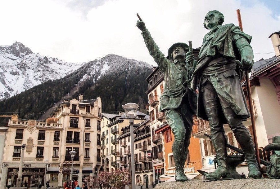
Les Houches, France
A much smaller and quieter village in the Chamonix Valley, and yet Les Houches shares the same stunning views of the Mont Blanc massif. It has good facilities, restaurants, bars, supermarkets and shops.
Les Contamines, France
Les Contamines is a charming little village on the westerly end of Mont Blanc. It has good facilities, restaurants, bars, supermarkets and shops, and offers great views of the Aiguille du Bionnassay and Domes du Miage.
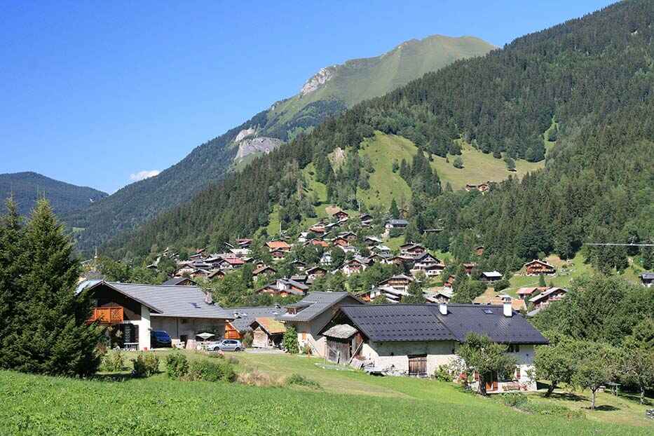
Chapieux & Ville des Glaciers, France
Chapieux & Ville des Glaciers are tiny hamlets on the southwesterly tip of the circuit and probably one of the most remote places on the tour. The valley and its hamlets are totally cut off in winter. Chapieux offers 1 auberge, 1 little shop and a campsite and Ville des Glaciers a refuge and cheese farm which sell fabulous Beaufort cheeses.
Courmayeur, Italy
Charming, Italian-style Alpine town, Courmayeur is definitely on a par with Chamonix with great food, wine and coffee. All facilities are available here.
La Fouly, Switzerland
Small village in the Swiss Val Ferret, La Fouly has great views of Tour Noir and Mont Dolent. The village offers basic facilities, a shop and a few hotels with bars.
Champex-Lac, Switzerland
Champex-Lac is situated at the easterly end of the TMB. This is a typical picture postcard Swiss village with a beautiful lake. A lovely, relaxing enclave with a range of bars, restaurants and shops.
Trient, Switzerland
Trient is a small Swiss village with limited facilities. The village enjoys fabulous views of the Trient Glacier.
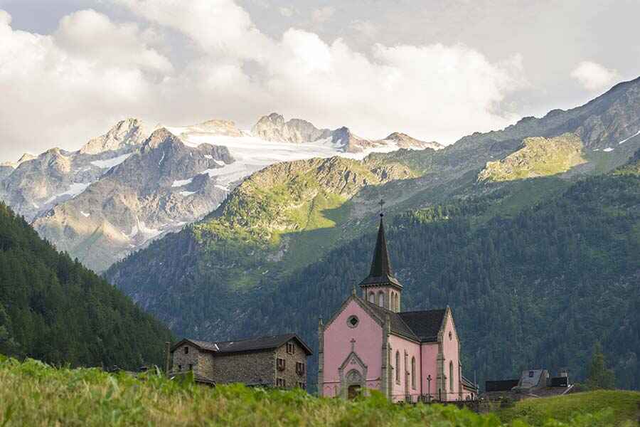
Argentiere, France
Situated at the easterly end of the Chamonix Valley, Argentiere is nested under the famous Grand Montets off-piste and extreme ski area. Argentiere shares the same history as the rest of the Chamonix Valley. It is a lively place in peak season and has a good range of restaurants, bars and shops.
Sign up to Our Newsletter
Marketing permissions.
Mont Blanc Treks will use the information you provide on this form to be in touch with you and to provide updates and marketing. Please let us know if you are happy to receive emails from us by checking the box below.
You can change your mind at any time by clicking the unsubscribe link in the footer of any email you receive from us, or by contacting us at [email protected]. We will treat your information with respect. For more information about our privacy practices please visit our website. By clicking below, you agree that we may process your information in accordance with these terms.
We use Mailchimp as our marketing platform. By clicking below to subscribe, you acknowledge that your information will be transferred to Mailchimp for processing. Learn more about Mailchimp's privacy practices here.
- Where to stay – Chamonix
- Geneva Airport to Chamonix
- Itineraries
- Tour du Mont Blanc Refuges
- Refuges ebook
The Tour du Mont Blanc’s 11 stages
This page will help you get a grip on the route of the Tour du Mont Blanc. There are 11 Tour du Mont Blanc étapes (stages). If you’re planning to trek self guided independently, then you need to get acquainted really well with the trail route and understand it as much as you can before trying to plan your days and where you will stay.
The Tour starts traditionally in Les Houches, a village at the beginning of the Chamonix Valley and it’s actually possible to hike either way around the loop – clockwise or anti-clockwise. Most hikers hike anti-clockwise so that the views of Mont Blanc are always in front of you, but there are actually advantages of hiking clockwise, namely less traffic on the trail in the mornings.
There are several alternative start points to the TMB if you don’t want to start at Les Houches. You could start at any of the main towns along the trail – Les Contamines (France), Courmayeur (Italy) or Champex-Lac (Switzerland).
It’s also possible to start your hike a couple of stages earlier in the Chamonix Valley so instead of starting at Stage 1, you could for example start at Stage 11 and do Stage 1 as your day 2. I often suggest this when I help trekkers plan their itinerary (I offer private consultations via zoom). This is a great option as accommodation is limited between stages 10 and 11 so by starting off on Stage 11 (you can get the Brévent cable car up from Chamonix town centre) you can either do this as a day hike and return to your Chamonix hotel, or you can book somewhere to stay in Les Houches if you want to be moving each day. This means you would finish at the end of Stage 10. Bear in mind that Stage 11 has a long, brutal descent – in fact if you took the Brévent cable car up and then the summit cable car after – you would be whizzed to the top of Brévent (and that spectacular views! ) within minutes – you would ONLY have descent for the remainder of the day (around 5 hours). If you have delicate knees then you might want to re-consider turning this into your first day!
Its also a great idea to do Stages 10 and 11 as day hikes. This allows you to get some ‘training’ hikes in before with just a day pack before you set off into the wilderness!
If you aim to camp along the trail (and are not therefore tied to refuge bookings) and bad weather is predicted for the end of your trek. Instead of missing stage 10 and 11’s outrageously incredible views of Mont Blanc due to closed in weather, you could start at stage 10 and lap up the views before continuing onto ‘Stage 1’.
For now though let’s talk through each stage.

What is a ‘stage’ on the TMB?
The Tour du Mont Blanc hiking route has been divided into 11 sections which can be hiked in a day. Each section is called a ‘stage’.
If you are hiking independently and do not plan to book onto a guided tour, you do not have to follow the recommended 11 stages – you can easily create your own daily hiking plan to fit to your own schedule or level of fitness.
However, all the Tour du Mont Blanc guide books refer to these stages so it’s a good place to start to get to know the trail and is invaluable during your planning phase. If you are planning your trek yourself and going down the self guided route, expect it to take a while to read up, get to know the trail and then plan your days meticulously. There’s plenty of posts here that can help you. Read our Planning – First Steps article.

How long is each stage?
It’s worth noting that each ‘stage’ is LONG averaging between 13-20km per day over challenging terrain, expect between 700m up to 1000m elevation gain each day! Covering the entire Tour du Mont Blanc in 11 days is no walk in the park – expect to be on the trail between 7-9 hours per day.
Some of you may want to walk at a more leisurely pace and cover a shorter distance each day. In this case trekking the entire circuit of the Tour du Mont Blanc could take you nearer 14 days to complete.
Many hikers choose to hike the trek over two summers dividing the Tour du Mont Blanc in half which is a very sensible option. I’ve done this when hiking with my 10 year old. Most hikers split the trek and hike (in which ever order they like):
➳ Les Houches (Chamonix Valley- FRANCE) to Courmayeur (ITALY)
➳ Courmayeur (ITALY) – Les Houches (Chamonix Valley – FRANCE)
Other superhuman hikers fast pack the trail in a week whilst hundreds of hardcore athletes run the trail every August in the ultra endurance race, the UTMB arriving back in Chamonix with 21 -46.5 hours! The choice is yours.

Stage breakdown and overview
Below is a brief breakdown of each stage which will help you get a feel for the route of the Tour du Mont Blanc. The Tour starts traditionally in Les Houches, a village at the end of the Chamonix Valley.
If you want to make a shorter itinerary, for example you only have limited time of say a week, or you want to make shorter days because you don’t want to hike 7-9 hours every day (I hear you), then go on over to our Itineraries page where we have ready made suggested itineraries to shorten sections or to only hike the most stunning stages.
And of course if you have the time and want to hike shorter distances each day (because even the 11 day itinerary has some serious kilometres and elevation each day!) then know that there are refuges every 5km along the Tour du Mont Blanc trail so you can make your own itinerary to suit your needs. Just be sure to book early (Oct-Nov for the following summer) so that you can have your choice of refuges.
Tour du Mont Blanc distances & countries
LES HOUCHES (CHAMONIX) – LES CONTAMINES
- height gain 646m
- height loss 633m
Stage 1 starts from the village of Les Houches at the end of the Chamonix Valley, works its way over to the village of Bionnassay then down into the Montjoie Valley to the town of Les Contamines.
Faced at the beginning of trail with a brutal 600m climb from Les Houches to the Col du Voza (1653m), trekkers can opt out of this and choose to take the Bellevue cable car and be whizzed to more of less the same elevation in less than 5 minutes. Read our post on TMB short cuts .
From the Col du Voza see spectacular views of the Dome du Gouter and Aiguille de Bionnassay. The trail now meanders down through pleasant hamlets and verdant woodland. It’s still a long day but undemanding in terms of exposure and almost completely downhill if you take the cable car up.
It’s a good introduction to the trail to warm up the legs and soak up the French ambiance but nothing in terms of sheer rugged wild beauty which is yet to come.
VARIANT TRAIL – COL DU TRICOT – There is an alternative route for Stage 1 (18km) that passes the Col du Tricot (2120m) which offers much more spectacular views than the traditional route. It’s classed as a more challenging route, which it is compared to the traditional Stage 1, however in my opinion it is not ‘difficult’ and it’s certainly worth the extra effort for the highlights of crossing a Himalayan suspension bridge (crossing the rushing glacial water over this bridge is a highlight of mine), the spectacular views of Glacier Bionassay and the fantastic view of Dômes du Miage. I would say that more trekkers actually take this route than the traditional stage 1 route now and in fact in Kingsley Jones’s guidebook THIS IS simply stage 1. If you take the Bellevue cable car short cut from Les Houches (which I would ALWAYS recommend as it cuts 2 hours of unspectacular up) then it’s only a couple of minutes before you will reach the variant stage 1 trail (see map below). If you want to hike the traditional trail it takes approximately 20 minutes to reach the trail from the top of the Bellevue cable car. It takes me 2 hours to reach the top of the Col du Tricot from the Bellevue cable car. You then have a very steep descent down to Refuge Miage. It takes me 1 hour to descend the steep zig zag trail. DO NOT rush this – an injury here would be terribly disappointing. So in total it takes me 3 hours to get to Refuge Miage which I would highly suggest for lunch – they have a lovely garden overlooking the Dôme du Miage – book ahead in peak season. This variant should NEVER be considered in bad weather. You would not want to be on the top of the Col du Tricot in a lightening storm, plus the descent to Refuge Miage would be hazardous in rain. However look at the weather forecast – if it is predicting thunderstorms in the afternoon (which is common around 4pm in July and August) then this route would be perfectly okay if you were setting off at 8am in the morning – remember it only takes 3 hours to get to Refuge Miage and after this point the route is not a problem in bad weather. Accommodation options are at Refuge de Miage (private refuge – they have one large dorm or lovely private tiny chalets in the garden) or Auberge du Truc (very authentic basic stay available to book on the TMB website) both before Les Contamines. If you’re after a much more adventurous bed for the night consider taking the ‘smuggler’s trail ‘ from the top of Col du Tricot to the tiny 18 bed Refuge Plan Glacier. If you’re looking for more information on the refuges of the TMB I’ve written an ebook on them – click here to find out more .

If you’re looking to shorten your Tour du Mont Blanc trek into less days, then the traditional route through Bionassay is one of the recommended stages to skip. However I would never recommend skipping variant stage 1 – it’s one of my favourites! However if you simply don’t have time and for example want to do the half TMB to Courmayeur but only have 3 days and don’t want to hike longer than the standard stages each day then it would make sense to start in Les Contamines and skip this stage. This can be done by taking the bus from Chamonix to Les Contamines and starting your trail there. Or if you’re coming direct from Geneva Airport you can get an airport transfer direct to Les Contamines (which is easier than catching the bus from Chamonix to Les Contamines because you need to change bus in St Gervais and often the wait time is frustratingly long). Depending on the timetable schedule it can take between 2-4 hours to reach Les Contamines on public transport. Consider a private transfer if there’s a group of you.
If you’re looking how to make stage 2 slightly easier, consider taking the Bellevue cable car to cut 2 hrs off your trail & push on through Les Contamines to stay at the first refuge on the trail after the town. Nant Borrant is a gorgeous chalet refuge 1 hr up the trail (up a very steep hill!) which will give you a head start the following day

Water stops on the TMB

Trekking the Tour du Mont Blanc in June – early season

Money on the TMB
37 comments.

Ashish Shukla
This is Ashish from New York. I stumbled upon your website and I must thank you for a really well written account of all the stages. I have not found such a detailed and succinct explanation for each stage anywhere else and I have done a fair bit of research. Thank you Thank you Thank you!! After reading this blog and your public transportation write up, I feel way more confident to tackle this hike starting on September 01-2021. I am planning to do it in 6 nights/7days.

tourdumontblanchike
Hi Ashish, you’re welcome. Have a great trek!

I totally agree with Ashish’s comments, above. We’ve done the full TMB (in 2015) and yet I still find I’m thoroughly entranced by all of the information, pictures, and tips for good planning that you share. Well done!! This is an excellent resource. I love its down-to-earth, friendly, honest tone. It’s so helpful to get real-life perspectives and details. You present them all in a very reader-friendly manner. The entries about the various refuges, and the descriptions of the traditional TMB stages, are particularly helpful… although, really, *everything* here provides great information. (My only suggestion (humbly offered) would be to proof-read the Casermetta Museum / Col de la Seigne history paragraphs, which seem of very different quality than the rest). Andrew McCluggage has put out a recent and very good book on the TMB, to add to the classic guides by Kev Reynolds and Jim Manthorpe; have you seen it? Your photographs and the attractive arrangement of each page/screen on your site really captures the allure and the magnificence of the TMB. It is an epic experience, from start to finish. Bravo, Mags!!! We will be keeping your work bookmarked for our next trip back!! I wish I could say we were heading out on the trail *today*!
Hi Caroline, thanks for getting in touch and for your kind words. I have re-read the Casermetta post and oh my gosh – why was that not proof read! I think some of it had been translated from Italian and not checked! Apologies! I’ve taken it offline as it needs to be updated anyhow – I hiked over the Col de la Seigne a couple of weeks ago and had the pleasure of interviewing one of the staff at the Casermetta so I have that interview on film which will be uploaded to the post. Hiked the variant stage 9 a couple of days ago which is a real favourite – stunning views of the Trient Glacier! I haven’t yet read Andrew’s book but I shall – will be hiking the tour again fully in September so I’ll aim to take that one with me this time and add it to our post on guidebooks. Thanks again for letting me know about the Casermetta post – glad you did 🙂 Best wishes. Mags
Thanks, Caroline! Hi, Mags – I am starting my hike from Le Brevent. So, the last day of my hike, I am planning to go from Trient to Le Brevent (via Lac Blanc) in one day. I think that’s approximately 19 miles. I was wondering if you have completed that section and your thoughts on whether it can be done in one day? The one constraint I am running into is that the last cable car (descent) from Le Brevent to Chamonix is at 4:30pm. So, I will probably have to start super early from Trient. Not sure if this is do-able in one day. I welcome your thoughts/suggestions.
Hi Ashish this would be an incredibly long day. Do you want to take public transport? One way to cut some time would be to take the chairlift down from Col de Balme then the bubble to the village of Le Tour. Then catch a bus (or walk) down the straight road to Montroc. Cross the train tracks at Montroc and walk behind the station where there is a trail that takes you up to Tré-le-Champ (10-15 mins up). This cuts out the up to Aiguillette des Posettes and the long long descent into Tré-le-Champ. It’s the only way you could cut the trail. Cutting out the Posettes would gain you possibly 2-2.5 hours although it would take at least 45 mins to get to there via public transport but at least saving your legs for the 3 hours up to Lac Blanc from Tré-le-Champ. It would be a long long day and I have to say I would never consider it but if you are a super fast trekker and aim to set off at 6am then its possible. You could always see how you are going when you get to Flégère and if you think you’re running behind take the cable car down into the valley from Flegere instead of continuing to Brevent (2-2.5 hours further). Good luck. Let me know how you get on.

This is a great resource bar none ! If I do stages 10 and 11 in consequtive days and want to stay at a hotel each night, would a stay in the same one both nights ? How do shuttles work at the end of each stage or what other tranportation modes are needed to return the the hotel in the evening ? Thank you
Hi Bob thanks for your kind words. I’m glad our website has helped you! Yes you can stay in the same hotel. It’s a good idea and actually I’ve recommended it before to hikers who want to see a bit of Chamonix first before setting off on the trek as it’s a good way to get a few days training hikes before leaving. Of course it sounds like you’d do this at the end of the trek so you would be arriving down from Col du Balme, to Tre-le-Champ. You will need to stay either in Argentiere, Les Praz or Chamonix. Les Praz would be more convenient as the Flegere cable car arrives here at the end of your next day but there are only a few hotels here (Hotel Eden is nice). Once you arrive in Tre-le-Champ the best way to head down the valley for the night is to walk down to the train station. To get here pass the Easter Island heads in the village (you can’t miss them!) and bear on the lower left hand trail – you will pop out at the train station in around 15 minutes. You will be able to catch the train to Argentiere, Les Praz or Chamonix. You will need to repeat this journey to get to the start of the trail again the following morning. What will be nice is that you won’t need to bring your heavy pack with you!! Stage 10 ends at Flegere – it’s a very short day even with the Lac Blanc detour so you may decide to hike on to Brevent to cut a bit of your trail time the next day. At Brevent you can also take the cable car down to the valley floor (Chamonix) so in this case it would make sense to stay overnight in Chamonix instead of Les Praz. Stage 11 ends in Chamonix Les Houches. There are frequent buses and the train that would bring you back to your hotel.If you followed this plan you could spend the 3 nights in the same hotel.

Merci beaucoup for this information, it is much appreciated. It has helped me so much in planning. The information is succinct and the web design in phenomenal!
I would like to start at Champex, go anti-clockwise, hike the TMB back around to Champex then continue on to hike the Walkers Haute Route to Zermatt. I plan on getting to Champex early to mid September after hiking a long trail in the USA June-Sept, so will have my “trail legs” then hopefully. It looks like the UTMB race will be over at the end of August so this will not be an issue. I also want to camp in a tent for the majority of the trail, sleeping in Refuges only infrequently and when I do I would not need a private room. I have ultra light gear and have experience through hiking in the USA.
Is this an unwise plan, given the start date I have chosen? It looks like the weather will still be reasonable. I do not want to miss too many beautiful views due to bad weather (but do not want to wait another year for TMB and Haute)! In September do I still need reserve Refuge bunk beds far in advance? Could I just see what’s available on the trail as I hike? I was planning on the Refuges just for a little food and a shower mostly. Last thing, what is your opinion on using my Zpacks Duplex tent for this time of year? I’m thinking I might need my NEMO Hornet tent instead but it’s heavy. Thank you!
Hi, the weather is normally still very good in September and indeed has rarely any thunder storms compared to August! I had one day of rain in 8 days last year but of course it can vary. I hiked the trail solo in September last year and didn’t book refuges in advance. I only got caught out on one night but managed to find somewhere in the end. I would suggest starting early September if you are planning on continuing onto the Haute Route after. Some refuges ask you to book a meal the day before but most would allow you to eat if there is enough food by just turning up – a few might not so always have a back up handy in the form of expedition food etc just in case. Take the lightweight tent. Bear in mind that wild camping in Italy and Switzerland is tricky. Italy it is legal after 2500m! and Switzerland is not allowed at all so you need to camp at campsites. Courmayeur has no campsites but there are several in the Val Veny – unfortunately it means that you need to miss out stage 4 or hike it & come back round but that’s quite a mission. Hobo Camping is good https://www.campinghobo.com/en/ . I will be camping the trail in July! Have a great hike. All the best. Mags

Hi We’re planning on doing the TMB clockwise and starting at the Brevent. This gives us two opportunities to see some of the best views if the weather is not good. Telepherique up, then head down and stay at Lac Blanc, then normal days for a 10 day trip. Last day would be Les Houches to the Brevent and ride down. Both times up will be in the morning so it increases the chances of clear viewing. We live in Colorado, so we’ll be acclimatized and relatively fit. Any thoughts, advice? ..
Hi Tom the problem with hiking the tour clockwise, especially in Chamonix is that you will have your back to Mont Blanc all the way. I would suggest if you want to start in the Chamonix Valley and take in the magnificent views of Mont Blanc on the first few days that you start from Tre-le-Champ (get the train to Montroc and then hike up 15 minutes on the trail behind the train station up to Tre-Le-Champ) hike up to Lac Blanc and then you would continue TOWARDS Mont Blanc with the views ahead of you the whole time. You can then walk via La Flégère to Le Brévent and down to Les Houches.

Hi, great site and thank you so much for all the information. Where can I find GPX a route file?
Hi Ori FatMaps has a great map of the TMB and you can download the GPX file
https://fatmap.com/routeid/2721627/tour-du-mont-blanc/@46.0001773,6.9058586,3170.4236129,-82.5128444,0,2243.4477193,satellite

Hi! LOVE your website, thank you so much for all the information! I am planning to do the hike in july but I must ask, is stage 7 the only part with exposure? I love hiking in the alps but would really have a probelm walking next to sheer drops (a bit traumatised from hiking in Madeira hehe)
Hi Caroline stage 7 doesn’t have any exposure and is actually the most gentle section of the trail. Do you mean stage 10 with the ladders?

Thanks a LOT for the great site and all the valuable info here ! Is there a Smartphone (iPhone) navigation application with detailed maps for TMB ?
Hi Mark I use the GAIA GPS app – see my article here https://tourdumontblanchike.com/tour-du-mont-blanc-gps-gaia/
Some trekkers also use Trail Trails.

Christopher Legg
Wow, I have also just stumbled across this, whilst I know some of the area, I shall certainly use this to plan my trip. I haven’t read it all yet but I will. Thankyou. very much. Chris from Cornwall
You’re welcome. I’m glad it’s helped you plan your trip. Happy hiking.

hi, thanks for sharing all details about TMB. Would like to know your location for wild camping, those pictures are awesome.
Hi Ivan wild camping is only permitted in one of the three countries the trek goes through – France. Here you are allowed to bivvy from sunset to sunrise. Therefore this gives plenty of scope on the first and last stages. One of the best places is Lac du Cheserys just under Lac Blanc. Camping at Lac Blanc is not permitted. In Italy wild camping is only permitted above 2500m which doesn’t leave much options and in Switzerland camping is only permitted in campsites. I am due to camp the trail in the next two weeks for my first time so I look forward to being able to share more tips about camping the TMB soon. Happy hiking!

thank you so much for sharing all this info – it seems to have the most comprehensive explanation of each stage I’ve been able to find! I was wondering if you had suggestions on grouping stages together – I find a lot of 8-9-10 day itineraries out there and I was wondering if you had a suggested 9 day or 10 day with no rest days?
Hi Brittney. It all depends how much you want to walk each day. As there are refuges every 5km along the trail you can chop up the route into 9 or 10 days without a rest day. I’m not sure what you mean about grouping together stages if you didn’t want a rest day? Happy to help you plan your itinerary over a zoom call. You can find out more about what’s included and book here https://tourdumontblanchike.com/tmb-zoom-consultation/ . Best wishes. Mags

Bob Bergner
Great website! Thanks for all the work (and pleasure) that went into creating it. I speed hiked the TMB a few decades ago–minimal gear, sleeping under the stars wherever the day ended for a few hours a night. It was mid June (lots of snow), so I had the trail largely to myself. A tremendous experience! Now, I’d like to take my wife on a few days of the trail at a more relaxed pace. From what I remember, the last section from Champex back to Chamonix has the most dramatic scenery. Is that correct? Thanks for a quick answer here. And I look forward to setting up a consultation if (when, really) I need more detailed information. Cheers, Bob
Hi Bob wow what an experience that must have been! Yes the variant stage 8 from Champex (via Col du Fenetre) is the most technically difficult as you have to navigate the boulder field but you also benefit from the truly incredible view of the Trient Glacier. Then Stage 10 is stunning as you are traversing along the Balcon Sud flank with Mont Blanc to your left. For me (variant) stage 1, stage 2, 3 & 4 are my favourites unless I’m taking the variant 8 then the Chamonix legs of 10 and 11. Hope that helps? Feel free to message me direct via email to set up a zoom if you need. Best. Mags

Kathy Meldrum
Hi Mags! What a GREAT website! This info is so helpful! I have an idea for an itinerary and I’m wondering if you can provide me with any input. Is there a hike from Chamonix to Col de Balme and on to Tre le Champ where we can stay the night at Auberge La Boerne for day 1? Then on to either Lac Blanc refuge or Flegere for day 2. Then on to Bellechat for day 3 and then descend to Les Houches on day 4. We will be hiking with kids and are looking for something doable yet challenging, but I can’t quite figure out the mileage or how long it would take us. Any input would be greatly appreciated! Thank you! -Kathy
Hi Kathy apologies for my delay in responding. Yes this itinerary would work – it’s similar to my 2.5/3 day itinerary here https://tourdumontblanchike.com/3-day-itinerary-lac-blanc/
You can get the train or bus to Montroc and then there is a trail from the back of Montroc train station that takes you up to Tre-Le-Champ. Often it’s easier to do this instead of getting the specific bus from Argentiere to Tre-Le-Champ as it doesn’t go very often but buses go regularly past Montroc up to Le Tour and the train stops there once an hour. It takes between 20-30 minutes to hike up the easy trail.
It only takes around 3 hours to hike from La Boerne to Lac Blanc however you will be hiking with kids so lets say 5 hours so you could have a late start enjoying your breakfast (however all refuges will kick you out around 8 or 9am so La Boerne may do this as well. Its definitely worth staying in Lac Blanc if you can get the reservation though over Refuge Flegere. The kids will love the ladders on the way up from La Boerne!
Bellachat doesn’t have a shower just to let you know but it would be a necessary stop for you with kids. It’s a good itinerary. Go for it!

Excellent article, thanks so much for sharing and wishing you many more hiking adventures. Katie
Thanks Katie. Have a great trek!

Hi! I’ve used this resource while planning over the past year and it’s been a huge help! We’re leaving in 2 weeks to begin half of the TMB, Chamonix – Courmayeur. Time is limited as we plan to travel to see the rest of Italy after. However, I’ve been disappointed to not see the great views everyone talks about in the final stages. Is there a way to take the Brévent cable car to Le Brévent, see the views and continue on to Les Contamines without making the descent down into Les Houches? Any public transportation options we could use to try and combine stage 11 and 1? We’re not scared of a long day, just not sure how doable it all is.
Hi Aysia absolutely you can take the Brevent cable car from the centre of Chamonix (you have to walk up the steep hill from the Gendarmerie to get to the cable car station). Take the first cable car up to the mid station (Plan Praz) then you can get the next cable car up to the summit of Brevent, have a look and then come back down. You can then get the no 1 bus from the Chamonix Centre bus stop (which is just around the corner from the Gendarmerie) to Les Houches. There is a bus stop right outside Bellevue cable car (bus stop Bellevue) or if you want to walk through the official arch to start the trek outside the tourist office you would need to get off at ‘Les Houches Mairie’ stop which is two stops before Bellevue. Its just a 10 minute walk to walk down the main road to Bellevue if you wanted to get a photo at the arch. Hope this helps! Have a great trek!

Would you please provide information on the itinerary and refugios you took? Planning the same over ideally 5 or so days! Thanks

Thank you so much for the helpful site, it has been my go-to reference for planning my trip. We are doing the traditional 11 day itinerary beginning is Les Houches, and would like to spend the last night at Lac Blanc. I understand the last day is rough on the knees and having a bad knee already I am curious if staying at Lac Blanc that night will add to the decent on day 11, and if there is a shortcut option to cut down on some of the intense downhill. Thanks!
Hi Rachelle thanks for the kind words. Yes staying in Lac Blanc will add a little onto the next day however what I would do is descend down from Lac Blanc to Refuge Flegere and continue along the TMB balcony trail towards Brevent (epic views along here of Mont Blanc) then when you get to Plan Praz (the mid station at Brevent) I would take the cable car up to the summit and then maybe finish your trek there. There is a cafe there so you can have a celebratory beer overlooking the viewing platform for Mont Blanc and then get the summit cable car down and then the mid station cable car down to Chamonix. This leaves out the long 1300m descent into Chamonix on stage 11. Or the alternative is to add an extra night at the Bellachat refuge so that you split this day in two. Hope this helps.

I, of course, must add that this site is beyond helpful (so many things that I didn’t even know I needed to know)
I thought I was finished planning a shortened version of the TMB. However, after going through your site, I think I need to make an adjustment.
Because we are time limited, we will be skipping certain portions (taking the bus from Courmayeur to Arnuva, then another from Ferret to Champex; and taking the train from Argentiere to Chamonix).
However, Brevent and Balcon Sud seem like they shouldn’t be missed (I love mountain ladders, and scary, narrow paths with great views). We have one day in Chamonix built in before we start (in case the flight from the US has issues). We could use this day to see those areas.
Do you have a suggestion on a one-day version to/from Chamonix to the Brevent / Balcon Sud area (I have no qualms about taking chair lifts/gondolas to make this work)
Thank you so much for making the TMB do-able for all of us.
Hi Anne. Merry Christmas. Apologies for my late reply. Absolutely you can do stage 10 and some of 11 as a day hike. You would need to get the bus or the train from Chamonix to Montroc. I would choose the train if I were you as its a lovely ride and free with the Chamonix guest card that you can get from your hotel. Read my post https://tourdumontblanchike.com/what-is-a-chamonix-guest-card-carte-dhote/ (note there is a bus stop right outside the train station at Montroc too). Disembark from the train then turn right and keep right until you reach a small car park where you’ll see an unsigned trail head – this is the trail up to Tre-Le-Champ. It won’t take you long to reach the village and you’ll be surprised by a number of carved Easter Island heads on the corner when you arrive in the hamlet. With the heads on your right, carry on straight and up to the main Col des Montets busy road. Cross and see the well signposted trail ahead of you. This is the start of stage 10 and is the traditional ladders route. It takes around 1.5 hours to reach the ladders which start at the L’Aiguillette d’Argentière (a rock spire where you’ll find rock climbers climbing) and end at the Tete dux Vents, the cairn which marks the turn off for Lac Blanc. It takes me 3 hours to get to Lac Blanc from Tre-Le-Champ. It’s nice to have lunch here and admire the view before descending down to Refuge Flegere (around an hour). Then you can walk the balcony between Flegere and Brevent. It takes a couple of hours and the views of Mont Blanc are outstanding. You can then choose to take the summit cable car up to Brevent from Plan Praz (the mid station). It’s a great view up there and there is a cafe. This is a good place to end your trek as it takes a further 4-5 hours to descend from the summit of Brevent down to Les Houches to complete stage 11 so I would take the summit cable back down to Plan Praz and then catch the cable car from Plan Praz back down to the centre of Chamonix. A perfect day! Enjoy! Best wishes. Mags
Leave a Reply Cancel Reply
Save my name, email, and website in this browser for the next time I comment.
This site uses Akismet to reduce spam. Learn how your comment data is processed .
What is the 'Tour du Mont Blanc'? 15 quick facts
5 unmissable refuges on the tour du mont blanc, tour du mont blanc hike, privacy overview.

Tour du Mont Blanc in 7 Days: Map, Stages & Accommodations
The Tour du Mont Blanc is an epic hiking experience that takes you through three countries – France, Italy, and Switzerland – in an intense week. This adventure invites you to measure yourself against the majesty of the Alps, crossing mountain passes such as the Col du Brévent, the Col de la Seigne, and the Col des Fours, while admiring the grand landscapes of Mont Blanc.
The route offers exceptional flexibility, allowing hikers to adjust the difficulty of their journey by varying the number of days. A seven-day tour represents a considerable challenge, with some long and strenuous stages, but offers unmatched rewards in terms of satisfaction and breathtaking panoramas. For those who prefer a gentler adventure, a ten-day tour provides a more relaxed alternative.
Accommodation along the route is varied and abundant, with a wide choice ranging from comfortable hotels to quaint gîtes, traditional mountain refuges , and even bivouac sites for the more adventurous. Prepare for total immersion in the wild splendor of the Alps, facing the vastness of Mont Blanc.
Day 1 (Option 1): Les Houches – Refuge de la Balme
Download the GPX track of the stage: https://www.visugpx.com/mSlFmJ4Qro
Elevation gain, altitude, and mileage of the stage

Elevation +

Elevation –

Max. Altitude

Min. Altitude
Stage Summary:
The first stage of the Tour du Mont Blanc is a 25-kilometer adventure that starts at Les Houches and ends at the Refuge de la Balme. After about 2h30 of walking from Les Houches, you will reach the Col de Voza, an initial challenge that will get you into the swing of things with about 660 meters of positive elevation gain over a distance of 6 to 7 kilometers, depending on your starting point. This first part of the route offers an impressive introduction to the beauty of the Alps and a first leg-stretcher for the rest of the tour.
After the Col de Voza, you will descend about 11 kilometers, with a negative elevation change of around 800 meters, to arrive in Les Contamines. This charming town is an ideal place to take a break, refresh with a local beer, and even spend the night if you prefer not to continue to the Refuge de la Balme. For those who choose to continue, there are still about 7 kilometers and 550 meters of positive elevation gain to reach the Refuge de la Balme. There, you can choose to sleep in the comfort of the refuge or experience a more rustic stay at the bivouac area.
Points of Interest for the Stage
Col de Voza
Where to Sleep?
Refuge de la Balme Bivouac area of Refuge de la Balme Possible to stop earlier in Les Contamines (camping or hotel)
Day 1 (option 2): Les Houches – Refuge de la Balme via the Col de Tricot variant
Download the GPX track of the stage: https://www.visugpx.com/rFQWJMXPXN
Summary of the Stage
The first stage of the Tour du Mont Blanc offers an exciting variant that goes through the Col du Tricot, adding an extra dimension to this alpine adventure. The first part of the stage remains the same as the classic route, with a walk of about 2h30 from Les Houches to the Col de Voza. This section of the route includes about 660 meters of positive elevation gain over a distance of 6 to 7 kilometers, depending on your starting point.
Once at the Col de Voza, you will have the choice of staying on the classic route or taking the variant via the Col du Tricot. If you choose the latter, you should prepare for about 600 meters of additional positive elevation gain over a distance of 6 kilometers to reach the Col du Tricot. This variant offers a more demanding hiking experience, but also more rewarding, with spectacular panoramic views of the Alps.
From the Col du Tricot, you have several options for the rest of your day. You can continue to the Refuge de la Balme to spend the night, offering a longer but also more rewarding end to the day. Alternatively, you can turn towards Les Contamines to shorten your day and spend the night there.
Col de Voza Col de tricot at 2120m
Day 2 (option 1): Refuge de la Balme > Chapieux > Les Mottets
Download the GPX track for the stage: https://www.visugpx.com/pubLJ5t1su
The second stage of the Tour du Mont Blanc begins at the Refuge de la Balme and ends at the Refuge des Mottets. It follows the classic route of the tour.
The departure from the Refuge de la Balme leads to a climb of 650 meters of elevation gain over a distance of 4 kilometers to reach the Col du Bonhomme. Once at the pass, you will continue on the classic route of the tour, without taking the variant via the Col des Fours.
After the Col de la Croix du Bonhomme, you will begin a descent of 4 kilometers with a negative elevation change of 800 meters to arrive at Chapieux. From there, you will continue calmly for about 6 kilometers to the Refuge des Mottets. Along the way, you can stop at the Ville des Glaciers, where it’s possible to stop at the alpine pasture to stock up on local cheese, a true delicacy of the region.
Once arrived at the Refuge des Mottets, you will have completed this stage of the tour. This is your last stop before crossing into Italy the next day. It is recommended to book in advance if you plan to sleep in the refuge. It is important to note that it is forbidden to bivouac on the refuge property, which is quite large. However, you can pitch your tents before the refuge at the level of the ruins (about 5/10 minutes before the refuge) or after starting the ascent towards the Col de la Seigne, just behind the first “peak” that is visible from the refuge.
Col du bonhomme Col de la croix du bonhomme
Refuge des Mottets Bivouac before the Refuge des Mottets at the level of the ruins. Set up your tents quickly as it fills up very fast. Bivouac after the Refuge des Mottets (directly after the first ascent towards the Col de la Seigne)
Day 2 (option 2): Refuge de la Balme > Col des Fours > Les Mottets
Download the GPX track for the stage: https://www.visugpx.com/URWmZQHWLG
The beginning of the stage is the same as the classic route, starting from the Refuge de la Balme and ascending 650 meters of elevation gain over 4 kilometers to reach the Col du Bonhomme.
Continuing towards the Col de la Croix du Bonhomme, you will then choose the variant that leads to the Col des Fours. This variant takes you to an altitude of 2665 meters, offering spectacular views of the surrounding mountains. Before embarking on this variant, it is essential to check the weather and the trail conditions in advance. Depending on the season, there can be a lot of snowfields, making some passages dangerous even in summer.
Once at the Col des Fours, you will begin a descent of 5 kilometers with a negative elevation change of 900 meters to arrive at the Ville des Glaciers. You can stop at the alpine pasture to stock up on local cheese, a true delicacy of the region, before continuing to the Refuge des Mottets.
The Refuge des Mottets is your last stop before crossing into Italy the next day. It is recommended to book in advance if you plan to sleep in the refuge. It is important to note that it is forbidden to bivouac on the refuge property, which is quite large. However, you can pitch your tents before the refuge at the level of the ruins (about 5/10 minutes before the refuge) or after starting the ascent towards the Col de la Seigne, just behind the first “peak” that is visible from the refuge.
Day 3: Les Mottets > Courmayeur
Download the GPX track for the stage: https://www.visugpx.com/Twvax7D6iA
The third stage of the Tour du Mont Blanc will take you from France to Italy, crossing spectacular alpine landscapes. The stage begins at the Refuge des Mottets, and after only 4 kilometers and about 600 meters of positive elevation gain, you will reach the Col de la Seigne. This pass, perfect for waking up, marks your entry into Italy and offers breathtaking panoramic views of the surrounding mountains.
After the Col de la Seigne, you will continue for about 9 to 10 kilometers through the beautiful Italian valley. This part of the route takes you through varied landscapes, including the picturesque Lake Combal and several mountain refuges. Each step of this stage offers a new view of the Alps, with constantly changing panoramas and opportunities for memorable photos.
Finally, you will begin a descent of 11 kilometers with a negative elevation change of 1260 meters to arrive in Courmayeur. This Italian town is a welcome resting place after this long stage. Courmayeur is full of hotels, perfect for recharging and preparing for the next stage of your adventure. Whether you choose to relax in a spa, taste local Italian cuisine, or simply rest, Courmayeur offers a perfect end to the day for this third stage of the Tour du Mont Blanc.
Col de la Seigne Lake Combal
Hotels in Courmayeur
Campings outside Courmayeur
Day 4: Courmayeur > Refuge Elena
Download the GPX track for the stage: https://www.visugpx.com/B3MhnslfBa
The fourth stage of the Tour du Mont Blanc is a day that offers a mix of challenges and relaxation. Your day begins with a climb of about 800 meters of positive elevation gain over a distance of 4 to 5 kilometers, depending on your starting point. This initial climb is an excellent way to wake up and prepare for the day ahead.
Once this climb is completed, the rest of the day is relatively “quiet” compared to other stages. You will continue for about 12 kilometers, with 330 meters of positive elevation and 600 meters of negative elevation. This part of the route takes you through the beautiful Italian valley, offering spectacular views and a relaxing hiking experience.
Before arriving at the Refuge Elena, you will have about 2 kilometers and about 300 meters of positive elevation gain left. This last climb is a final challenge before ending the day. The Refuge Elena is a popular place to spend the night, offering spectacular views of the surrounding mountains.
It is important to note that you will need to book in advance to sleep at the Refuge Elena, as it fills up quickly and there are not many sleeping options in the vicinity. In Italy, bivouacking is prohibited below 2500 meters in altitude, so it is essential to plan ahead. This fourth stage of the Tour du Mont Blanc offers a balanced hiking experience, with physical challenges, beautiful landscapes, and moments of relaxation.
Italian Valley
Where to sleep?
Refuge Elena
Day 5: Refuge Elena > Champex
Download the GPX track for the stage: https://www.visugpx.com/v4RKRYwRg3
The fifth stage of the Tour du Mont Blanc, from the Refuge Elena to Champex-Lac, is a hiking day that offers both challenges and moments of relaxation. Although this stage is quite long and some parts may not be the most attractive of the tour, it nevertheless provides a rewarding hiking experience.
The day begins with a beautiful climb of about 500 meters of positive elevation over 2 kilometers to reach the Grand Col Ferret. This ascent marks your crossing into Switzerland, a moment to celebrate, but also to consider for your phone’s internet data, as Switzerland may not be included in your European plan depending on the operator.
From the Grand Col Ferret, a descent of about 20 kilometers and 1600 meters of negative elevation awaits you. This descent brings you closer to Champex-Lac, your destination for the night. It’s worth noting that part of this stage can be done by bus by taking the shuttle at Ferret or La Fouly, which can be an attractive option for those wishing to save some energy.
You then have 6 kilometers and 600 meters of positive elevation remaining to reach the Relais de l’Arpette, where you will spend the night. It is also possible to sleep at the Camping des Rocailles in Champex, which is located about 45 minutes before the Relais de l’Arpette.
Grand Col Ferret (Italy/Switzerland border) Option to take the shuttle at Ferret to Champex and avoid walking for 4 hours Supermarket in La Fouly to restock if needed
Relais de l’Arpette Camping des rocailles (in Champex)
Day 6 (option 1): Champex > Col de Balme (via La Forclaz) > Tré le Champs.
Download the GPX track for the stage: https://www.visugpx.com/f8P8nDc8xt
The sixth stage of the Tour du Mont Blanc, from Champex to Tré le Champ, is a quite hard hiking day even without taking the variant via the Fenêtre d’Arpette. This stage also marks your return to France.
Your day begins with a climb towards the Col de la Forclaz, followed by another ascent to the Col de la Balme. The Col de la Balme is a highlight of this stage, offering spectacular views of the surrounding mountains. The refuge here is a beautiful place to take a break and enjoy the scenery. The passage at the Col de la Balme also marks the border with France, another significant milestone of your journey.
After enjoying the Col de la Balme and a drink at the refuge, you will begin a descent of about 6 kilometers with 700 meters of negative elevation to reach Tré le Champ and the Auberge de la Boerne. This descent offers another opportunity to enjoy the alpine landscapes while approaching your destination for the night.
It’s important to note that you need to book your night at the Auberge de la Boerne in advance, as it fills up quickly. The bivouac area is not the largest, so it’s advised to set up your tents quickly. Once settled, you can enjoy a wonderful meal at the inn and take advantage of the showers if you wish.
Col de la Forclaz Col de la Balme
Auberge de la Boerne (hostel) Auberge de la Boerne (camping)
Day 6 (option 2): Champex > Col de Balme (via Fenêtre d’Arpette) > Tré le Champs
Download the GPX track for the stage: https://www.visugpx.com/iIoAINv20C
The sixth stage of the Tour du Mont Blanc, from Champex to Tré le Champ with the variant via the Fenêtre d’Arpette, is considered one of the hardest of the Tour, but also one of the most beautiful and rewarding.
Starting from Champex, you’ll begin a climb over 6 kilometers with an elevation gain of 1100 meters. This ascent is a challenge in itself, with some complicated passages to reach the Fenêtre d’Arpette, and the trail can be difficult to follow. It’s essential to be cautious on the way, check the weather and trail conditions beforehand carefully. Some passages may still be snow-covered and dangerous if the weather is not favorable.
Once you reach the Fenêtre, take the time to rest and savor your accomplishment. You then have a descent of about 4 kilometers with 1000 meters of negative elevation before arriving at the Chalet des Glaciers. Here, you can reward yourself with a cheese crust and a good beer.
After a well-deserved break, you’ll embark on another ascent to the Col de la Balme, about 2 kilometers with approximately 600 meters of elevation gain. The view and refuge here are magnificent, and it’s recommended to make the most of it.
Finally, you have “only” 6 kilometers and 800 meters of negative elevation to reach Tré le Champ. As always, make sure to book your night in advance, whether in a refuge or bivouac, as these places fill up quickly. The bivouac area is not the largest, so it’s advised to set up your tents quickly. Once settled, you can enjoy a wonderful meal at the inn and take advantage of the showers if you wish. This stage of the Tour du Mont Blanc offers an unforgettable hiking experience, with physical challenges, breathtaking views, and well-deserved moments of relaxation.
Fenêtre d’Arpette Col de la Balme
Day 7: Tré le Champs > Les Houches
Download the GPX track for the stage: https://www.visugpx.com/3kIaPa8PzP
Congratulations! You’ve reached the seventh and final stage of the Tour du Mont Blanc, from Tré le Champ to Les Houches. It’s a flexible day, adaptable to your needs and desires, whether in terms of accommodation, transport, or difficulty level.
If you choose to descend to Les Houches, prepare for a full day. However, many “exits” are available along the way, allowing you to adjust your day according to your physical condition and desires.
You have the option to take the cable car from La Flégère to Chamonix, offering a quick descent and a stunning view of the valley. Another option is to take the cable car from Brévent to Chamonix, another way to enjoy the view without the effort of descending.
If you feel up to it, you can also choose to walk down to Chamonix before the ascent of Brévent. This option allows you to fully enjoy the natural beauty of the route, while offering one last physical challenge.
During this day, you will pass through the Aiguillette d’Argentière and its ladders, as well as the Col du Brévent. Both points offer spectacular views and are highlights of this final stage.
Whichever option you choose, this last stage of the Tour du Mont Blanc is an opportunity to celebrate your achievements, enjoy the last beautiful views, and finish your adventure in style.
Aiguillette d’Argentière Col du Brévent
Les Houches Chamonix Option to take the cable car from La Flégère to Chamonix Option to take the cable car from Brévent to Chamonix Option to walk down to Chamonix before the ascent of Brévent (expect 1h30 to 2h of steep descent)
Submit a Comment
Your email address will not be published. Required fields are marked *
Please enter an answer in digits: 9 + 20 =
Submit Comment
- Follow Follow

This article was written by Hugo, a hiking enthusiast and co-creator of TMB-Guide.com. This site is your gateway to your adventure on the Tour du Mont Blanc. We strive to share as much information as possible about the Tour to help hikers prepare for their trips.

Best Hike: Tour du Mont Blanc in 8 Days: A Phased Planning Guide
Home » Best Hike: Tour du Mont Blanc in 8 Days: A Phased Planning Guide
Are you planning to take on the Tour du Mont Blanc in a week? Then you have come to the right place! This blog post will provide a phased planning guide for you to maximize your experience and make the most of your trip.
Plus, Framey App lets you easily document your journey and share it with your friends. Not only can you post all your vacation photos, but you can also be inspired by your friends’ trips as well.
So make sure you download Framey for the full Mont Blanc experience!
✅ Make sure you’ll see the entire collection in Framey App , including addresses, opening hours, and contact information!
Table of Contents
Step 1: Argentiere -Trient – Tour du Mont Blanc

Argentiere -Trient
The Tour du Mont Blanc is a challenging 8-day trek that takes you around the highest peak in the Alps, Mont Blanc. The first stage of the trek begins in Argentiere, a charming mountain village in the Chamonix Valley, and ends in Trient. This section of the tour is relatively easy and is an ideal way to get acclimatized to the altitude.
The route follows the Valley des Glaciers, a narrow valley that stretches between the Aiguille Rouges to the north and the Aiguille du Midi to the south. Along the way, you’ll be treated to spectacular views of glaciers, wildflowers, and snow-capped mountains. This stage of the tour takes you past traditional Alpine villages and chalets, giving you a taste of the traditional culture of this region.
The route begins with a gentle climb from Argentiere and then descends into Trient. As you pass through Trient, you’ll have spectacular views of the valley and the surrounding peaks. The final stretch of the route passes through meadows and farms before arriving at Trient. From here, you can continue to Orsieres, your next stop on the Tour du Mont Blanc.
Step 2: Trient – Orsieres

Trient – Orsieres
This stage of the Tour du Mont Blanc is one of the most beautiful and challenging legs of the entire journey. Starting in Trient, you’ll follow the TMB trail as it winds through the Alps and up towards the highest peak in the area, Mont Blanc. You’ll ascend nearly 1800m throughout this section, so it’s important to plan your route and make sure you have the proper gear to complete it.
The first stop on this leg of the tour is Col de la Forclaz, a stunning pass between the two valleys that you’ll traverse on your way to Orsieres. Here, you can take a break, admire the views, and fuel up before continuing. The next stretch takes you up the Val d’Entremont, winding past secluded mountain hamlets and through stunning mountain scenery. Once you’ve reached the top of the valley, you’ll head down towards Champex-Lac, where you can take in yet another stunning view before continuing towards Orsieres.
As you descend further down into Orsieres, you’ll have an opportunity to marvel at the breathtaking views of the Arolla Valley and the majestic Mont Blanc. Once you’ve reached Orsieres, you’ll be treated to a well-deserved rest at one of its many cozy chalets and hostels. With its cobblestone streets and traditional Swiss architecture, Orsieres is one of the most charming stops on the TMB tour. Take a few moments to explore the town before setting off for the next leg of your journey.
Step 3: Orsieres – Arnouva – Tour du Mont Blanc

Orsieres – Arnouva
The third leg of your Tour du Mont Blanc in 8 days journey will take you from Orsieres to Arnouva. Starting in Orsieres, you will be following a section of the GR5 Trail towards the beautiful village of St. Jean de Sixt, located on the banks of the river Arve. From here, you will have stunning views of Mont Blanc and its surrounding mountains, as you make your way up toward the Col de Balme.
Once you’ve made it up to the col, you can take a break at the nearby mountain refuge for lunch and take in the incredible views. Afterward, your path will continue onwards toward the villages of Trient and Les Varrilands. Be sure to take some time to explore these quaint alpine towns before heading toward Arnouva.
As you make your way toward Arnouva, you will pass by some spectacular alpine meadows filled with wildflowers and amazing views of the valley below. After passing through a few more small villages, you will eventually arrive in Arnouva where you can rest for the night before starting on the fourth leg of your Tour du Mont Blanc journey.
Step 4: Arnouva – La Palud

Arnouva – La Palud
Day 4 of the Tour du Mont Blanc will take you from Arnouva to La Palud. This section of the tour is one of the most challenging, but it is also one of the most beautiful.
The route begins in Arnouva and follows the valley of Val Ferret. Along the way, you’ll pass through several picturesque villages, including Ferret, Pre de Bar, and La Fouly. You’ll also have a chance to admire some stunning mountain scenery as you make your way up to La Palud.
As you make your way to La Palud, you’ll pass through two high passes: the Col des Montets and the Col de la Croix du Bonhomme. Both of these passes offer stunning views of the mountains surrounding them, so be sure to take your time and savor the scenery!
Once you reach La Palud, you’ll have the chance to explore the town and its surroundings. This small village is known for its breathtaking views of the Aiguille Verte, as well as its abundance of outdoor activities such as hiking, cycling, and skiing. It’s the perfect place to relax after a long day of trekking.
By the end of Day 4, you’ll have completed a significant portion of the Tour du Mont Blanc and will be ready to tackle the remaining sections. With careful planning and careful navigation, you can make it to La Palud in one day.
Step 5: Courmayeur – Les Chapieux – Tour du Mont Blanc

Courmayeur – Les Chapieux
The fifth day of your Tour du Mont Blanc journey will take you from Courmayeur to Les Chapieux, following the Val Veny and Val Ferret. This section of the tour is renowned for its outstanding natural beauty and is a favorite among experienced hikers.
The day begins in the beautiful resort town of Courmayeur, located in the shadow of Mont Blanc. After enjoying a hearty breakfast in town, you’ll begin the trek with a climb up to the Col de la Seigne at 2537m. As you ascend, you’ll be able to take in the sweeping views of the surrounding mountains and valleys.
From the Col de la Seigne, you’ll continue to Les Chapieux, descending through meadows and forests and passing some stunning alpine lakes along the way. You’ll also have an opportunity to admire the impressive waterfalls that pour down the sides of the mountains.
When you reach Les Chapieux, you can relax and enjoy a well-deserved dinner at one of the village’s local restaurants. Make sure to save some energy for tomorrow, as you’ll be setting off early to tackle the final stretch of your Tour du Mont Blanc.
Step 6: The Chapieux – The Contamines

The Chapieux – The Contamines
The sixth day of your Tour du Mont Blanc itinerary takes you from The Chapieux to The Contamines. You’ll leave The Chapieux and make your way up to the Col des Fours, a pass with stunning views of glaciers and mountains. From here, you’ll follow a ridge down to the Refuge de La Balme before continuing to Bonhomme. Then, you’ll descend a steep trail until you reach the small village of The Contamines.
Once in The Contamines, you’ll be rewarded with panoramic views of the valley and the mountains that surround it. You can also take a short side trip to Lac des Cornes and admire the impressive waterfalls. Make sure to take some time to explore the area, take pictures, and enjoy the beauty of nature.
At the end of the day, you’ll have an overnight stay at one of the cozy lodges in The Contamines, where you can relax and recharge for the next stage of your journey.
Step 7: Les Contamines – Chamonix – Tour du Mont Blanc

Les Contamines – Chamonix
The final stage of your Tour du Mont Blanc experience will take you from Les Contamines to Chamonix. It is a beautiful, yet challenging hike with stunning mountain views and lots of adventure.
The first part of the journey takes you up to the Armancette Valley, where you will be able to take in the majestic beauty of the surrounding mountains. As you climb higher and higher, the view of Mont Blanc, Aiguille de Blaitière, and Aiguille des Glaciers will begin to take shape.
Once you reach the Col de Balme, you will have completed the steepest part of the hike. The trail then flattens out and descends into Les Houches, a quaint village nestled in the valley below. This is where you will stop for lunch before continuing to Chamonix.
As you follow the trail along the Arve River, it will eventually lead you to Chamonix. Here you can soak up the views of Mont Blanc and end your tour with a well-deserved celebratory drink!
This final stage of your Tour du Mont Blanc journey is sure to be an unforgettable experience. You will witness breathtaking views, take in the fresh mountain air, and enjoy some peaceful moments as you reflect on your amazing adventure.
Step 8: Chamonix – Argentiere

Chamonix – Argentiere
The final stretch of your Tour du Mont Blanc journey starts with a climb from Chamonix to the Col des Montets. After a brief descent, you will ascend again, to the Pointe de l’Arpette, at an elevation of 2,466 m (8,082 ft). Here you will enjoy breathtaking views of the Valley Blanche and Mont Blanc massif. You will then descend steeply through rugged terrain and continue to the Lac Blanc, where you can take a break and soak in the stunning surroundings.
Your next stop will be at Les Houches, where you can explore the nearby town and the forests. Then, it’s time for the last major ascent of the Tour du Mont Blanc: to La Flegere at 1,850 m (6,070 ft). From here, you will have spectacular views of the Aiguilles Rouges, the Chamonix Valley, and the Mer de Glace.
Finally, you will descend back to Argentiere, completing your 8-day Tour du Mont Blanc journey.
Everything you need to know before you travel to Tour Du Mont Blanc – Tour du Mont Blanc

Everything you need to know before you travel to Tour Du Mont Blanc
Before you begin your 8-day Tour du Mont Blanc journey, it’s important to make sure you’re adequately prepared. This includes having the right equipment, food, clothing, and safety considerations. Here’s what you need to know:
Equipment: For the Tour du Mont Blanc, you will need a good quality backpack, waterproof jacket, trekking poles, comfortable hiking shoes or boots, a sleeping bag, and a map or GPS device. You may also want to bring a light tent, depending on where you plan to stay each night.
Food: Bring along high-energy snacks such as trail mix and dried fruits that are easy to carry in your backpack. Make sure you have enough food to last the entire trip.
Clothing: The weather in the Alps can change quickly, so you need to be prepared for all types of conditions. Bring along plenty of layers and make sure to pack a hat, gloves, and warm socks.
Safety: Be aware of the changing conditions on the trails and take precautions accordingly. Let someone know where you are going and when you expect to return. Bring a first aid kit and know how to use it.
With the proper planning and preparation, your Tour du Mont Blanc experience will be one to remember!
Congratulations on reaching the end of this planning guide for your Tour du Mont Blanc in 8 Days journey! We hope it has been helpful and that you are now ready to take on this amazing challenge. As you prepare for your upcoming trip, remember to take precautions such as packing the proper clothing, supplies, and any necessary medications. Additionally, make sure to keep an eye on weather forecasts and trail conditions as they can change quickly.
Check out Framey!
If you need help planning or navigating your journey, we recommend downloading Framey – a free travel app designed with the needs of passionate travelers in mind. It is available in both the AppStore and Google Play and can be used to find nearby attractions.
With Framey , you can rest assured knowing that you have a reliable companion for all your adventures.
Walks of a Lifetime: Europe’s Most Epic Mountain Hikes in 2023

Roxana Coptu
Previous post top 10 attractions & must-see sights of transylvania, next post romania top music festivals 2023 – with dates, locations & lineups, copyright © 2023.
Framey Technologies Limited
[email protected]
Transform dream photos into memorable trips
+1 206-892-8877
Send Us a Message
France, italy, switzerland, tour of mont blanc 8 days – self guided, basic hotel accommodation & shared refugios, one of the most famous multi-day mountain hike in the alps, adventure in france, italy, and switzerland: explore these alpine cultures & hike to lac blanc.
Embark on an 8-day hut-to-hut adventure along Europe's iconic Tour du Mont Blanc trail. This journey allows you to come within proximity of the legendary Mont Blanc without the need for climbing skills. Each day unveils new wonders as you traverse diverse landscapes and cultures, beginning in France and continuing through Italy and Switzerland. Follow ancient and well-marked trade routes and circuits that have been used since antiquity. This is undeniably one of the world's most celebrated and timeless multi-day mountain hikes.

Trip Itinerary
Day 1 : arrival day in chamonix.
Today, you will start your adventure when you arrive in Chamonix. You will check in to your hotel and get your travel bag with all the information you will need for your trip.
Accommodation: Private double/twin room in hotel (3 star) Meals included : None – dinner on your own in town
Day 2 : Chamonix - Les Contamines-Montjoie
After your transfer in a Bellevue cable car, you will arrive at the trailhead is at the top of the lift. You will be able to take in the amazing scenery as you stand at the foot of Mt. Blanc. From there you will start with a traverse to the Bionnassay Glacier. After a “nepali hanging bridge crossing”, you will hike through the alpine pastures that lead up to Col de Tricot Pass (2120m). You will get a short break to admire the views of Contamines-Montjoie Valley, then hike down a steep trail to the quaint rural chalets in Miage (1559m) your path will continue up to Chalets du Truc (1750m) and finally, contour around Mt. Truc (1811m) and then hike down into the village of Contamines-Montjoie, where you will spend the night.
Please note: it is possible to shorten this hike if you bypass the ascent to Col du Tricot Pass.
Distance : 10 km, 6.5 miles - Ascent : 900 m. Descent : 550 m. (30 min Transfer)
Hiking : 6.5 hrs.
Accommodation: Private double/twin room in Guest house (2 star) Meals included : breakfast and dinner
Day 3 : Les Contamines-Montjoie - Les Chapieux or Ville des Glaciers
In the morning, you will arrive at Notre-Dame-de-la-Gorge (1210m), you will have time to visit the renowned baroque church that marks start of the Roman road (the historic trade route used to travel from one mountain valley to another). After, you will climb to Col du Bonhomme Pass (2329m) which is known for the beautiful section of hiking along the far southern end of the range. This trail marks the boundary between the Mt. Blanc Range and the Beaufortain Mountains. You will continue to Col de la Croix-du-Bonhomme Pass (2433m), which has spectacular views of Mt. Pourri (3779m). During your descent, you will hike through alpine pastures to the small hamlet of Les Chapieux (1549m), typical of the area, where you will spend the night.
Distance : 15 km (9.5 mi.) - Ascent : 1250 m. Descent : 950 m. (15 min Transfer)
Accommodation: shared room (or double/twin room if available) in guest house Meals included : breakfast and dinner
Day 4 : Les Chapieux or Ville des Glaciers - Courmayeur
You will start the day’s hike from Ville des Glaciers (1800m), you will get to stop at the local farm along the way and learn how Beaufort cheese is made. From there you will continue your ascent through the beautiful alpine pastures to Col de la Seigne Pass (2516m) and the Italian border. From here, awe at the beautiful jagged and steep side of the Mt. Blanc Range. These legendary summits such as Mt. Blanc de Courmayeur, Noire de Peuterey Spire, and the Grandes Jorasses appear close enough to be able to reach out and touch them. The descent takes you through Val Veny to the foot of the Miage Glacier with its peaceful lake and unique alpine flora. Short transfer to Courmayeur (1226m), capital of the Italian Alps.
Distance : From 15 to 25 km (10 to 16 mi). - Ascent : From 750 to 1250 m. Descent :850 to 1800 m (30 min Transfer)
Hiking : from 5 to 7 hrs.
Accommodation: Private double/twin room in hotel (2 star) Meals included : breakfast only, dinner on your own in town
Day 5 : Courmayeur – La Fouly or Champex
This short day is the halfway point on your tour and offers the opportunity to take it easy and recharge. After a short morning transfer to Val Ferret which is at the foot of Pré-de-Bar glacier, start the day’s hike with an ascent to Grand Col Ferret Pass (2537m), where you cross from Italy into Switzerland. Take one last look back down the Italian side before descending through Switzerland’s gentle alpine meadows as you hike all the way down to the small hamlet of Ferret (1740m). If you’re staying in Champex, bus transfer to the charming village along a small lake.
Distance : 12.5 km (8 mi.) - Ascent : 500 m. Descent : 900 m. (15 min transfer)
Hiking : 4 hrs.
Day 6: La Fouly or Champex - Bovine (Fenêtre d’Arpette ) – Trient
(After a bus transfer if you’ve stayed in La Fouly) From Champex, start by hiking through the Swiss mountain pastures and alpine meadows be sure to look for the grazing cows that produce some of the Alps’ most famous cheeses! From Bovine, admire incomparable views of the Rhône River Valley.
Please note: We also offer an alternate hike: please be aware that this option presents a much longer and more committing adventure. Fenêtre d’Arpette (2665m) is a spectacular high-mountain notch located near the Grands Glacier.
Finish the day in the village of Trient (1280m), where you will eat dinner and spend the night in a guest house. Via Bovine, 5.5-hour hike, 700m vertical gain. Via Fenêtre d’Arpette, 8-hour hike, 1200m vertical gain, 1400m vertical drop.
Distance : From 14.5 to 15.5 km (9 to 9.5 mi.) - Ascent : From 750 to 1200 m. Descent : 900 to 1350 m. (30 min Transfer)
Hiking : from 5 to 8 hrs.
Day 7 : Trient - col de Balme pass - le Tour or Argentière
From Trient, hike up to Col de Balme Pass (2191m) to cross the French-Swiss border. At the top of the pass enjoy great views into Chamonix and the valley below, as well as the spectacular panorama that includes Mt. Blanc, the Mer de Glace (glacier), and the Argentière Glacier. Hike down (or take the chairlift/gondola) the dirt roads and trails through the meadows and pastures to Le Tour (1453m). From there, you will take a leisurely walk to Montroc (1370m) and Argentière.
Distance : From 12 to 13.5 km (7.5 to 8.5 mi.) - Ascent : From 900 to 1150 m. Descent : 850 to 900 m
Hiking : from 5 to 6 hrs.
Accommodation: double/twin room in Hotel Meals included : breakfast and dinner
Day 8 : Le Tour or Argentière – Col des Montets pass - Lac Blanc – Chamonix
Today, you will enjoy a truly unforgettable hike for your last day of your trip. As you scramble through the Aiguilles Rouges, with the Mont- Blanc Range just across the valley, you will have incredible views of the many glaciers and summits high above Chamonix.
From Col des Montets Pass (1461m), follow the balcony trail to Cheserys Lakes, all known for reflecting in their clear blue waters some of the Alps’ most famous peaks. Continue to Lac Blanc (2352m). Open your eyes, observe your surroundings, and look for one of the area’s many alpine ibex. From here, walk down to La Flégère were a gondola takes you down to the valley floor in Les Praz a Chamonix hamlet.
Distance : 12 km (7.5 mi.) - Ascent : 1050 m. Descent : 600 m.
Accommodation: None Meals included : breakfast only
Additional Trip Info
- Accommodation: 7 nights (2 star hotels & shared refugio accommodation)
- Meals : 7 breakfasts, 5 dinners
- The road book (as well as a maps and reservation vouchers) for a 2 to 4 person group.
- Transporting your bags if you choose this option (+$400usd per person)
- Emergency hotline 24/7
- Guide book » exclusive mobile app including offline Maps & GPS
- Transportation to the meeting point at the start of the trip and from the point where the trip officially ends.
- Local public transportation
- Dinner in Chamonix and Courmayeur
- Pack Lunches (these can be purchased daily form your mountain hut)
- Drinks and personal expenses
- Insurance for trip cancellation/interruption, lost/stolen baggage, or assistance - We recommend World Nomads , or Global Rescue
- Anything that is not specified in the “included in the price” list.

Have Questions?
Related trips, dolomite high route (alta via 1) - 9 days, the legendary dolomites traverse, ladin valleys - 7 days, tour du mont blanc – 7 days – self guided (private hotel rooms), related blog posts, interested in building a custom trip we want to help you travel to places you have dreamt about..

Le Tour du Mont Blanc
Pour recevoir des infos sur le Tour du Mont Blanc , saisissez votre e-mail :
Saisissez votre e-mail*
Tour du Mont Blanc en 8 jours
Exemple de découpage du Tour du Mont blanc en 8 jours en partant des Houches
- Jour 1 : Les Houches > Contamines : (31 km)
- Jour 2 : Contamines > Les Chapieux (20 km)
- Jour 3 : Les Chapieux > Courmayeur (28 km) : vous êtes en Italie !
- Jour 4 : Courmayeur > La Fouly (31 km)
- Jour 5 : La Fouly > Champex (15 km, petite étape)
- Jour 6 : Champex > Vallorcine (25 km)
- Jour 7 : Vallorcine > Bel-Lachat (13 km)
- Jour 8 : Bel-Lachat > Les Houches (12 km)
Le site est en maintenance
En raison de mises à jour majeures, le site sera indisponible durant quelques jours. En raison de cette indisponibilité, la durée de vos abonnements sera prolongée. Nous vous remercions de votre patience et de votre compréhension. Vous pouvez toujours nous contacter à [email protected]


Everything You Need To Know About Hiking The Tour du Mont Blanc
A s an avid hiker, you’ve probably heard of the Tour du Mont Blanc or TMB hiking trail. You might even have plans to conquer this popular hiking destination one day. If so, here’s everything you need to know before you go.
In 1760, a Swiss Geologist and physicist, Horace-Bénédict de Saussure, then living in Geneva, discovered the TMB hiking trail. Saussure wanted to explore the Mont du Blanc Mountains to examine and document plant specimens. Also called the Mont Blanc massif, the mountain range is 60 miles by 20 miles long, with 11 summits over 4,000 meters high. Though he discovered it in 1760, Saussure first walked around the entire TMB hiking path in 1767.
Unfortunately, the Swiss scientist failed to climb one of its peaks on that initial journey around the path. The first to achieve this feat were Michel Paccard and Jacques Balmat. The two found a path to the apex in 1786 through the Grands Mulets route. Sausurre became the third person to reach the summit shortly thereafter.
Trail Overview
Though Pacard and Balmat first reached the peak of the Mont Blanc massif via the Grands Mulets route, the Gouter route is today’s standard path. This trail is 105 miles long and passes through 3 countries: France, Italy, and Switzerland . The Gouter Route (also known as the Voie Des Cristalliers and Voie Royale) is one of the two most commonly utilized routes to reach the summit of Mont Blanc in the Alps. Though the Gouter route reaches an elevation of 15,774 ft, it is considered the most straightforward ascent. The route lies on the north side of the mountain, in France, seeing thousands of mountaineers annually.
The Tour du Mont Blanc difficulty level is somewhat subjective to the hiker. The Gouter route is relatively easy because it takes about two days to reach the ascent and does not require extensive technical skills. Nonetheless, it is physically demanding and mentally challenging if you lack athletic ability. The most difficult aspect of this route includes a narrow passageway of unstable rocks on the mountain’s edge. Seventy-four have died, and 180 were injured in accidents along this dangerous segment between 1990 and 2011.
Once passing this tricky part, the Gouter route is smooth sailing. It steadily increases in steepness while crossing exposed terrain. Hazardous weather conditions are the most dangerous aspects that remain. Cold and wet conditions can cause hypothermia and frostbite. Therefore, visiting the Tour du Mont Blanc for Summer hiking, Mid-June to mid-September, is safest. During the summer, temperatures will range from 40 degrees at night to 80 degrees during the day. Some days require shorts beneath a warm, sunny sky ; others might entail brisk, wet conditions.
Permits And Regulations
No permits are required for the TMB and there are no regulatory restrictions. However, some believe a technical skills test could reduce deaths and injuries along the path. Additionally, residents are disturbed by the amount of trash that hikers inevitably abandon to lighten their loads on the ascent. What’s interesting about the Tour du Mont Blanc is that there are many comforts along the path in the form of hotels and huts. Several companies offer self-guided packages that include accommodations, detailed hiking guides, and set itineraries.
Trail Highlights And Points Of Interest
The Tour du Mont Blanc hike is considered one of the world’s top ten “bucket list” hiking trails. In addition to the soothing sounds of waterfalls , there are glaciers, streams, high alpine meadows, and the natural beauty of the Mont Blanc landscape. Among the most beautiful and visible flora are the rare Slipper Orchid, the Martagon Lily, Aquilegia Alpha, the famous Edelweiss, and rare Campanula thyrsoides. Though heavily impacted by human presence, the animals that remain in the wilderness of the Mont Blanc massif include Marmots, Ravens, Goats, Mountain Hares, Vultures, and Eagles, among others.
Safety Considerations
On the Tour du Mont Blanc hiking trail, the most important considerations will be comfortable shoes and a good quality backpack with appropriate dimensions and weight. What qualifies as an appropriately sized bag will depend on whether you stick to hiking the trail or detour slightly to local huts and hotels. The former will require a 60L bag, and the latter will require a 30L bag. Remember to break in your footwear a few months in advance and buy shoes larger than usual to accommodate swollen, achy feet. Trekking poles will help lessen aches and pains experienced in the knee and leg muscles. Hiking crampons are a “better safe than sorry” item to add to your Tour du Mont Blanc packing list. They will help maintain balance and avoid slipping across waterways and snow patches, which might even save a life!
In case of an emergency, administer first aid, note location and grid reference on a map, call for help (cell phone service is generally available along the TMB). If no phone is available, blow a whistle or flash a flashlight six times. If there is an injured person, carefully consider whether to go for help or stay with the injured. If the injured party stays behind, leave them with food, water, and warm clothes.
Planning and Preparation
Being physically prepared for the TMB hike is a necessary safety precaution. Training should start at least three months in advance and should be in layered clothing, hiking boots, and a fully packed backpack to best simulate trail conditions. Other things that require planning include booking accommodations along the trail and deciding how many days to stay. An itinerary will vary depending on whether two days, two weeks, or even two months are set aside to experience the beauty of TMB.
Most hikers can ascend the Tour du Mont Blanc self-guided if interested. The trail is easy to follow, with well-maintained paths, directional markings, and clearly understood signs. However, map reading skills are essential, and hikers should also carry a guidebook.
People Ask: Hiking the Tour du Mont Blanc
Q: What is the Tour du Mont Blanc hiking trail?
A: The Tour du Mont Blanc is a 170-kilometer hiking trail that circles the Mont Blanc massif in the Alps, passing through France, Italy, and Switzerland.
Q: How long does it take to complete the Tour du Mont Blanc?
A: The entire trail takes about 10 to 12 days to complete.
Q: What is the best time of year to hike the Tour du Mont Blanc?
A: The best time to hike the Tour du Mont Blanc is from mid June to mid September, when the weather is typically mild and the trails are clear of snow.
Q: Are there any accommodations along the trail?
A: Yes, there are many accommodations available along the Tour du Mont Blanc, including hotels, hostels, and mountain huts.
Q: Is it necessary to hire a guide for the hike?
A: No, it is not necessary to hire a guide for the hike. The trail is well-marked and there are many resources available for hikers.
Q: How difficult is the hike?
A: The hike is considered to be moderately difficult, with some steep ascents and descents.
Q: What should I pack for the hike?
A:You should pack appropriate hiking gear, including sturdy boots, warm clothing, and rain gear. You should also bring a map, a compass, and plenty of water and snacks.
Q: Are there any safety concerns I should be aware of?
A: Yes, there are some safety concerns to be aware of, including potential hazards such as steep drops, loose rocks, and unpredictable weather. It is important to stay on the marked trail and to be prepared for changing conditions.
Q: Can I hike the trail in sections?
A: Yes, it is possible to hike the Tour du Mont Blanc in sections, with many hikers choosing to focus on one or two sections at a time.
Q: What are some of the highlights of the hike?
A: Some highlights of the Tour du Mont Blanc include stunning views of the Alps, charming mountain villages, and the opportunity to experience the unique cultures of France, Italy, and Switzerland.
The Tour du Mont Blanc is a renowned hiking trail accommodating hikers from across the globe. It is mentally and physically challenging, but efforts will be rewarded with breathtaking views along the route. The TMB is accessible with or without a guided tour, as there is food, water, emergency services, accommodations, and other modern amenities along the path. With a reasonable amount of advanced preparation, physical training, thoughtful packing, and a conscientious “Leave no trace” mindset, this unforgettable journey is worth experiencing for yourself.

- Start: Les Saisies
- Finish: Les Saisies
- 330 km - 8300 m/d+
- Start 1 : Les Saisies Start 2 : Gd-St-Bernard
- Finish 1 : Gd-St-Bernard Finish 2 : Les Saisies
- Leg 1 : 155 km - 4300 m/d+ Leg 2 : 175 - 4000 m/d+
LE TOUR DU MONT BLANC
You are at the starting line, in the heart of the beautiful ski resort of Les Saisies, it is 4:55 in the morning and you turn on your front light. You listen to the latest safety instructions from the speaker. 4:58 , the departure music starts, a lot of thoughts jump inside your head: “What am I doing here? “Why do I hurt myself like that? “Am I really ready for this huge challenge?” “Why do I do that?”
But you know the answer: To become a Hero! “Hero: person who shows great courage.”
Reference among the ultra events, the Tour du Mont-Blanc Cyclo will require you a flawless preparation, extraordinary courage and push you to exceed your limits to become a hero. Because yes, becoming a hero is the goal of every participant of the Tour du Mont-Blanc. “ The world’s toughest one day bike race ”. This is how the cycling press describes the Tour du Mont-Blanc Cyclo. Indeed, riding 330km and face the 8300m of elevation gain that we offer you, in one day, is not an easy task!
On the program again for the twelfth edition, the crossing of 3 countries, France , Switzerland and Italy . You will once again be confronted with a demanding and ruthless route that will await you with constant strength. A unique experience to be sure.
Epic images


Tour de France 2023: How to watch, schedule, odds and storylines you need to know

The Tour de France returns Saturday for its 110th edition, this time beginning in Spain’s Basque Country, and will end on Sunday, July 23, in Paris. As always, the race — which recently got the “Drive to Survive”-style docuseries treatment on Netflix — will feature 21 stages. There will be eight flat stages, four hilly stages, eight mountain stages with four summit finishes, just one individual time trial (down from the usual two) and two rest days.
Advertisement
Here’s what you need to know to follow along:
How to watch the 2023 Tour de France
Peacock, NBC and USA Network will carry the Tour in the United States (NBC Sports and the Tour recently announced a six-year extension of their exclusive U.S. rights agreement, which now runs through 2029).
Peacock will stream every stage live and have daily pre-race shows. The streamer will also have stage replays, recaps, highlights, rider interviews and more, NBC Sports said.
Phil Liggett, a.k.a. “the voice of cycling,” will be on the call for his 51st tour, joined by analyst Bob Roll. Steve Porino and former professional cyclist Christian Vande Velde will also be reporting from on site, with the latter giving real-time updates while traveling the course on a motorcycle.
For the first time, NBC Sports’ broadcasts will feature clips from team radio, like communication between team directors and riders.
FloSports will stream the event in Canada.
How long is the Tour de France route?
This year’s route runs about 3,406 kilometers (about 2,116 miles). Stage 2, the longest single stage, is 209 km (about 130 miles).
The 22.4-km (about 14-mile) time trial will be held in the Alps in Stage 16.
How much money is on the line?
A total of €2.3 million (about $2.5 million) will be given out to the teams and riders, including €500,000 (about $546,000) to the winner of the overall individual classification.
How many riders are on the Tour?
Each of the 22 teams this year has eight riders, making for 176 total.
Recent Tour de France winners
- 2022 — Jonas Vingegaard (DEN)
- 2021 — Tadej Pogačar (SLO)
- 2020 — Tadej Pogačar (SLO)
- 2019 — Egan Bernal (COL)
- 2018 — Geraint Thomas (GBR)
- 2017 — Chris Froome (GBR)
- 2016 — Chris Froome (GBR)
- 2015 — Chris Froome (GBR)
- 2014 — Vincenzo Nibali (ITA)
- 2013 — Chris Froome (GBR)
Riders to watch
This year is expected to be a two-man battle for the general classification between two-time winner Tadej Pogačar (UAE Team Emirates) and Jonas Vingegaard (Jumbo-Visma), who emerged triumphant last year.
The 24-year-old Pogačar, regarded as the rider of his generation, was poised for a third straight title last year before Vingegaard, backed by a strong Jumbo-Visma squad, spoiled the campaign in the mountains. While the Slovenian Pogačar often has to fend for himself, the Danish Vingegaard, 26, has the backing of a “superteam” that includes do-it-all Belgian Wout van Aert and American Sepp Kuss to deliver him the yellow jersey.
Pogačar will undoubtedly be out for revenge, but questions are swirling about his fitness after he broke his wrist in a race earlier this year and had to miss some time. Whichever way the race goes, it’s always worth a reminder that this pair gave us an iconic moment of sportsmanship last year.
In the “last dance” category, we have British veteran Mark Cavendish (Astana Qazaqstan), French fan favorite Thibaut Pinot (Groupama-FDJ) and Slovakian sprint star Peter Sagan (TotalEnergies). All three plan to retire after the 2023 season (though Sagan said he plans to compete in mountain biking at the Paris Olympics).
Cavendish, 38, has 34 stage wins on the Tour — tied for the most ever with Eddy Merckx (who reached the mark in 1975). Cavendish is seeking one last win in his 14th Tour to retire as the record-holder after sitting out last year.
The 33-year-old Pinot won the young rider classification in 2014 and has since won three stages, most recently in 2019 (when he had to abandon the race with two stages to go after tearing a leg muscle while in fifth place).
Sagan, 33, owns a record seven green jersey wins and has won 12 stages, the last coming in 2019.
Egan Bernal (Ineos Grenadiers), the last man not named Pogačar or Vingegaard to win the Tour, will be in the peloton for the first time since 2020 after returning from a near-fatal crash in January 2022.
If you’ve followed the last few tours, you might also be wondering what’s up with Primož Roglič. The 2020 runner-up had to abandon the 2021 Tour before the ninth stage, and after starting the 2022 race as a Jumbo-Visma co-leader with Vingegaard, dropped out before the final rest day due to injuries. He did win the Giro d’Italia in May, but said he would take a break from racing to celebrate.
Beyond the general classification, you can monitor the additional races within the Tour: for the green jersey (points classification, generally considered a sprint competition) and polka dot jersey (king of the mountains).
Tour de France GC odds, via BetMGM
- Jonas Vingegaard (DEN) — +110
- Tadej Pogačar (SLO) — +115
- Jai Hindley (AUS) — +1400
- Mattias Skjelmose (DEN) — +2500
- Enric Mas (ESP)/Richard Carapaz (ECU)/Ben O’Connor (AUS)/Adam Yates (GBR) — +3300
- Simon Yates (GBR)/David Gaudu (FRA) — +5000
(Photos: Getty Images; iStock / Design: Eamonn Dalton and Rachel Orr)
Get all-access to exclusive stories.
Subscribe to The Athletic for in-depth coverage of your favorite players, teams, leagues and clubs. Try a week on us.

Torrey is a staff editor on The Athletic’s news team. Before joining The Athletic, she worked as a digital editorial producer at NBC Olympics. Prior to that, she was a news editor at Front Office Sports, worked as an editorial production assistant for Pac-12 Networks and wrote for outlets including Yahoo Sports and Sports Illustrated.
Pour soutenir votre journalisme local, abonnez-vous !
Pourquoi voyez-vous ce message ?
Vous avez choisi de refuser le dépôt de cookies, vous pouvez à tout moment modifier votre choix, ici .
Le contenu de ce site est le fruit du travail de journalistes qui vous apportent chaque jour une information locale de qualité, fiable, complète, et des services en ligne innovants. Ce travail s’appuie sur les revenus complémentaires de la publicité et de l’abonnement.
Déjà abonné ?
Connectez-vous ou créez un compte
Pour pouvoir enregistrer un article, un compte est nécessaire.
- Annecy / Rumilly / Les Aravis
- Annonay / Nord Ardèche
- Aubenas / Privas / Vallée du Rhône
- Bourgoin-Jallieu / Nord-Dauphiné
- Chambéry / Aix-les-Bains
- Edition Provençale
- Grand Genève / Chablais / Ain
- Grenoble / Agglomération
- Grésivaudan / Oisans
- Hautes-Alpes / Alpes de Haute-Provence
- La Tour-du-Pin / Nord-Dauphiné
- Mont-Blanc / Arve
- Montélimar / Drôme Provençale
- Romans / Nord Drôme
- Tarentaise / Maurienne
- Valence / Rhône Crussol / Vallée de la Drôme
- Vienne / Roussillon
- Voiron / Saint-Marcellin
- Newsletters
- Libra Memoria

Grenoble et son agglomération
mar. 14/05/2024
- Activer JavaScript dans votre navigateur pour accéder à l'inscription sur notre site
Si vous voyez ce champ, ne le remplissez pas
Le Dauphiné Libéré, en tant que responsable de traitement, recueille dans ce formulaire des informations qui sont enregistrées dans un fichier informatisé par son Service Relations Clients, la finalité étant d’assurer la création et la gestion de votre compte, ainsi que des abonnements et autres services souscrits. Si vous y avez consenti, ces données peuvent également être utilisées pour l’envoi de newsletters et/ou d’offres promotionnelles par Le Dauphiné Libéré, les sociétés qui lui sont affiliées et/ou ses partenaires commerciaux. Vous pouvez exercer en permanence vos droits d’accès, rectification, effacement, limitation, opposition, retirer votre consentement et/ou pour toute question relative au traitement de vos données à caractère personnel en contactant [email protected] ou consulter les liens suivants : Protection des données , CGU du site et Contact . Le Délégué à la Protection des Données personnelles ( [email protected] ) est en copie de toute demande relative à vos informations personnelles.
- Dans un article
- Dans ma ville
- D’Annecy au sommet du mont Blanc : un relais inédit !
- Résultats et classements
- Hockey sur glace
Haute-Savoie D’Annecy au sommet du mont Blanc : un relais inédit !

Pour fêter les 150 ans du Club alpin français (CAF) d’Annecy, l’équipe de direction a organisé un relais de 150 kilomètres en cinq jours de la rue du Mont-Blanc, où se situe le local à Annecy, jusqu’au sommet du mont Blanc.
Jusqu'au 12 mai
Du 8 au 12 mai, les 250 encadrants du CAF se relaient sur l’une des 15 activités que propose le club. « Cet événement concerne les encadrants, ceux qui font que ce club existe. L’idée c’est de les rassembler...
...pour lire la suite, rejoignez notre communauté d'abonnés
et accédez à l'intégralité de nos articles sur le site et l'application mobile
à partir de 1 € le 1er mois, sans engagement de durée
{'skus': ['ldlswgpremium4']}
Google : -50% les 6 premiers mois
- Sports d'hiver
- Chamonix-Mont-Blanc
- Balades et randonnées
- Edition Annecy / Rumilly / Les Aravis
- Edition Mont-Blanc / Arve
- Haute-Savoie

Recevez dans votre boîte mail l'essentiel de l'actualité sportive, des grands clubs de notre région aux événements internationaux.
COMMENTS
Le Tour du Mont Blanc est donc accessible à condition de randonner régulièrement, d'avoir une bonne condition physique et d'être bien sûr à l'aise avec un sac à dos de plusieurs kilos. Préparer le tour du Mont Blanc en 8 jours sans guide : Étapes du TMB en 8 jours : parcours classique. Des Houches à Nant Borrant (France)
Les étapes du Tour du Mont Blanc en 8 jours . De notre côté, nous avons fait le tour du mont blanc en 8 jours (dont une partie en bus et 2 télécabine), avec le découpage suivant : Les Houches > Refuge de Nant Borrant; Refuge de Nant Borrant > Ville des glaciers; Ville des glaciers > Refuge Elisabetta; Refuge Elisabetta > Refuge Bertone
The Tour du Mont Blanc, or TMB Trek as it is also called, is the most famous hut-to-hut hiking tour in the Alps, and for good reason. This 8-day self guided Tour du Mont Blanc hike loops around the highest mountain in the Alps, Mont Blanc, which towers over the surrounding landscape at 4,808 meters above sea level. In addition to traveling ...
Choice 1: 8h walk - 1,300m (4,265 ft) ascent / 1,460m (4,790 ft) descent. Choice 2 : 6h30 walk - 785m (2,575 ft) ascent / 910m (2,985 ft) descent. This is the final stage of our Tour du Mont Blanc, with more beautiful scenery to discover throughout the day. We climb to the Bellevue plateau (1800m), where we can see the famous coloured ...
Jour 8 - Tour du Mont Blanc en 8 jours (GR® TMB) - De la Flégère à Les Houches. Depuis la Flégère, le chemin est relativement plat avec une belle vue dégagée sur le mont Blanc avant d'entamer la dernière montée du TMB : l'ascension du fameux col de Brévent. Nous voilà reparti pour gravir les derniers 700m de D+ de ce Tour du ...
The Tour du Mont-Blanc hikers diary. Focus Nature Reserves : good and banned practices summer 2023. Read more. Get ready to go. ... Bonjour On vient de terminer le tour du mont blanc en famille avec 3 enfants de 10/11 et 13ans. Les conditions étaient excellentes. Juste un névé au Brevent où on a mis les crampons pour assurer la sécurité ...
This is because of one of the most amazing human competitions ever organized on this planet - The Ultra Trail du Mont Blanc - so keep this in mind when planning your hike of the Tour du Mont Blanc. Alpine hiking at its finest, TMB is a 170 km trek through the French, Italian and Swiss Alps. Find here 4 days, 7 days and 9 to 11 days itineraries ...
The Tour du Mont Blanc (TMB) is a captivating multi-day hike that circuits the Mont Blanc massif in usually 10-11 days, passing through France, Italy and Switzerland. The main Tour du Mont Blanc route is 170 km (105 miles) long and involves 10,080 meters (33,071 feet) of elevation gain and loss. The Mont Blanc mountain range takes its name from ...
On vous propose ici un découpage des étapes du Tour du Mont Blanc selon votre souhait : de 4 à 12 jours ! On vous présente pour chaque découpage : le kilométrage. le dénivelé journalier. le point de départ. le point d'arrivée. la liste des hébergements. En 4 jours. Les étapes et refuges sur le TMB en 4 jours, avec des étapes en ...
The Tour Mont Blanc easterly trek starts in Courmayeur and takes in half of the classic route anti-clockwise to Chamonix. It is a 6 day trek that covers approximately 100 kilometers through the Italian, Swiss and French alps. This walking holiday in the alps is ideal for those wanting to experience the Tour du Mont Blanc in a shorter period of ...
The Tour du Mont Blanc (TMB) is a 170-km trek that circles the Mont Blanc massif. The route is traditionally walked in the anti-clockwise direction over 11-stages. The TMB starts and finishes in the French village of Les Houches, which sits adjacent to the popular mountain town of Chamonix.
The Tour du Mont Blanc is the most popular long-distance trek in Europe that covers a total distance of approximately 170km depending on which route is taken (some variants can be sorter or longer than the original section). The daily height gain on the Mont Blanc circuit is substantial, and overall the accumulation over the 10 days is in the ...
Day 2: Chamonix - Les Houches - Les Contamines - Montjoie Ibex in front of Glacier du Bionnassay. From anywhere in Chamonix, take a free local bus to the Bellevue cable car that will take you to the trailhead at the foot of the climb to Mont Blanc. You'll begin with a traverse to the Bionnassay Glacier, followed by a "Nepali hanging bridge crossing."." Make your way through alpine pastures up ...
It's worth noting that each 'stage' is LONG averaging between 13-20km per day over challenging terrain, expect between 700m up to 1000m elevation gain each day! Covering the entire Tour du Mont Blanc in 11 days is no walk in the park - expect to be on the trail between 7-9 hours per day.
Summary of the Stage. The sixth stage of the Tour du Mont Blanc, from Champex to Tré le Champ with the variant via the Fenêtre d'Arpette, is considered one of the hardest of the Tour, but also one of the most beautiful and rewarding. Starting from Champex, you'll begin a climb over 6 kilometers with an elevation gain of 1100 meters.
The third leg of your Tour du Mont Blanc in 8 days journey will take you from Orsieres to Arnouva. Starting in Orsieres, you will be following a section of the GR5 Trail towards the beautiful village of St. Jean de Sixt, located on the banks of the river Arve. From here, you will have stunning views of Mont Blanc and its surrounding mountains ...
Embark on an 8-day hut-to-hut adventure along Europe's iconic Tour du Mont Blanc trail. This journey allows you to come within proximity of the legendary Mont Blanc without the need for climbing skills. Each day unveils new wonders as you traverse diverse landscapes and cultures, beginning in France and continuing through Italy and Switzerland. Follow ancient and well-marked trade routes and ...
Exemple de découpage du Tour du Mont blanc en 8 jours en partant des Houches. Jour 1 : Les Houches > Contamines : (31 km) Jour 2 : Contamines > Les Chapieux (20 km) Jour 3 : Les Chapieux > Courmayeur (28 km) : vous êtes en Italie ! Jour 4 : Courmayeur > La Fouly (31 km) Jour 5 : La Fouly > Champex (15 km, petite étape)
L'itinéraire classique du TMB fait environ 170 km et est généralement parcouru en 7 à 10 jours. Dans ce guide, nous nous concentrerons sur l' itinéraire du Tour du Mont-Blanc en 8 jours, qui couvre une moyenne de 20 km par jour avec un dénivelé positif d'environ 1 400 mètres par jour (idem pour le dénivelé négatif).
Also called the Mont Blanc massif, the mountain range is 60 miles by 20 miles long, with 11 summits over 4,000 meters high. Though he discovered it in 1760, Saussure first walked around the entire ...
Tour du Mont Blanc, France, Italy and Switzerland: ... This six-day trail starts in the town of Bantry and explores the Sheep's Head peninsula, taking in the wild Atlantic en route.
Because yes, becoming a hero is the goal of every participant of the Tour du Mont-Blanc. "The world's toughest one day bike race". This is how the cycling press describes the Tour du Mont-Blanc Cyclo. Indeed, riding 330km and face the 8300m of elevation gain that we offer you, in one day, is not an easy task!
Jun 30, 2023. 40. The Tour de France returns Saturday for its 110th edition, this time beginning in Spain's Basque Country, and will end on Sunday, July 23, in Paris. As always, the race ...
Pour fêter les 150 ans du Club alpin français (CAF) d'Annecy, l'équipe de direction a organisé un relais de 150 kilomètres en cinq jours de la rue du Mont-Blanc, où se situe le local à ...