
16 Things to Know BEFORE Traveling Dempster Highway
Last Updated on June 10, 2020 by Christine Kaaloa

Constructed in 2017, traveling Dempster Highway is a 734 kilometer all-weather road between Dawson City and it further connects Inuvik to Tuktoyaktuk via an all-year road. It is the first road to connect Canada to the Arctic Ocean. Here’s 16 things to know before traveling Dempster Highway.
Alternatively, referred to as the Northwest Territories Highway 8 and Yukon Highway 5 , the highway is also the new lifeline connecting Arctic communities such as Inuvik and Tuktoyaktuk, offering the locals better access to better resources and potentially new employment. The highway still presents a long, remote and challenging 16 hour journey for those who undertake it.
Starting from the Klondike Highway outside of Dawson City, it travels up to the McKenzie Delta and the Northwestern Territories. We were traveling Dempster Highway during a wintery December. Riddled with snow and blizzard conditions, the challenge of traveling the Dempster had slightly different challenges than traveling it during other seasons. We started from Dawson City with our final goal being Tuktoyaktuk.
Table of Contents: 16 Things to Know BEFORE Traveling Dempster Highway
- 1.1 1. Dempster Highway is an all-weather road of gravel and shale.
- 1.2 2. Take a spare tire and know how to change it
- 1.3 3. Do not take your new car
- 1.4 4. Loose Rocks and your windshield
- 1.5 5. Drive slow
- 1.6 6. Consider stretching your road trip over a couple of days
- 1.7 7. Driving conditions on the Dempster Highway during the winter
- 1.8 8. Create distance between you and the car in front of you
- 1.9 9. Bring enough food and water (and snacks)
- 1.10 10. There is no cellphone signal. Get a satellite phone if you want to stay connected
- 1.11 11. Fuel up before you go (and take an extra gas can, just in case!)
- 1.12 12. The Dempster is a home to a lot of wildlife
- 1.13 13. The Arctic Circle (Latitude 66 33 degrees North)
- 1.14 14. Eagle Plains is your half-way mark for gas, car servicing and resources
- 1.15 15. The highway crosses two rivers: McKenzie River and Peel River
- 1.16.1 Watch the full Arctic journey series: Fort St John to Tuktoyaktuk
16 Things to Know before traveling Dempster Highway
Note: I drove this as part of a Mazda road trip to the Arctic Ocean during early December. We were a caravan of ten cars of influencer, car journalists and we had expedition drivers accompanying us to ensure our safety. Extra provisions and communication backup was brought and thought of in the case of any roadside emergencies.
Apologies for any typos, as these are just some rough notes I wanted to share:
1. Dempster Highway is an all-weather road of gravel and shale.
Dempster Highway is a notorious for being problematic for driving, because it is not paved but made of shale. This is because the roads rest on permafrost and that can melt and shift in some spots. Thus, much of the road is unpaved. It is very possible you may encounter problems with your tires. I’ve read many stories about flat tires.
2. Take a spare tire and know how to change it
Given what i’ve shared about the road and its resources, taking a spare tire and knowing how to change it is essential. As the highway is made of loose shale, puncturing a tire is a probability and It can take a while before you get help. Depending upon how far you are from Eagle Plains, you would need to travel a ways to get a new tire, so it is best to just stock a spare in advance. Know how to change it also as you won’t find AAA help out there. If you get a flat, you may be waiting a while before help comes along.
3. Do not take your new car
I have heard of travelers buying a used car to make the journey or renting a car. I would imagine car rentals for this journey to cost more than standard rental prices given the wear and tear a car will experience on this highway. Mazda brought new cars which were already getting thrashed on the first day leaving Fort St. John on paved and partially iced roads- mud sludge and windshield dings from loose flying rocks. Ironically, the night before we hit the Dempster, there was a snow blizzard, so the roads were powdery. This saved our tires and windshields from standard wear and tear, however, alternately we did have two cars skid off the road and get stuck in snow banks. Luckily we had a team to pull those cars out.
4. Loose Rocks and your windshield
To continue where I left off… otherwise, expect loose rocks to hit your windshield.
It’s best to drive slow on the Dempster, especially when you’re coming up on oncoming cars or large trucks. Each of the ten expedition vehicles we took on this trip, got a fair share of dings just from regular roads (some looked like bullet hole-sized dents!) . This created eventual dings which over time would only grow into cracks in the windshields. If you collect enough of them, you could be looking at replacing your windshield at the end of the trip.
5. Drive slow
The speed limit on the Dempster is 90km/hour. I would not drive that fast given the conditions. If not for the gravel, snow (if you’re driving during winter) or loose gravel biting your windshield, I’d say go slow and take your time if you want your car to be in decent condition at the end.
6. Consider stretching your road trip over a couple of days
We had a tight timeline so we pressed on through the driving, but otherwise, the Dempster can be a place to enjoy. During warmer times there’s scenic beauty and you’ll probably want to enjoy the landscape rather than rush through it. The Dempster Highway website recommends stretching your road trip out to a two day trip vs one. Here is a possible itinerary .
7. Driving conditions on the Dempster Highway during the winter
Winter can offer potentially easier or harder conditions for travel, depending upon your resources and number of travelers. We drove the Dempster Highway during winter and were assured that the road conditions and snow probably helped the tires a bit despite creating potentially slippery conditions, open to skidding.
If you asked our expedition drivers, they said the winter conditions made for easier driving, as the roads are covered in snow; thus, not as much loose gravel to potentially harm tires or hit windshields. Cons are that roads may be slippery and tricky due to snow and ice. If you skid, you may land in a deep snow bank and it would take considerable time for someone to find you to pull you out. Also, due to occasional blizzard conditions, the government may close roads close and you can get held up at Dawson City or Eagle Plains ( your more expensive option – there is a hotel but it is an outpost with limited resources).
However, if you ever got stuck on the side of the road with a dead battery or something, winter is the last time of the year I’d want to be waiting for help to come by.

8. Create distance between you and the car in front of you
Although it’s highly unlikely you’ll find many folks out on the Dempster, if you ever did find yourself tailgating another car, pull off and give them space. If in winter, the snow kicks up and creates a dust cloud which impedes visibility- day and night. Even if it’s not wintery conditions, there’s loose gravel kicking up… remember?
9. Bring enough food and water (and snacks)
Driving the Dempster Highway is approximately a 16 hour journey, with the half point mark being Eagle Plains. Bring enough food and water to tide you over. Although, have reserves in the case anything happens to your car and you need to wait for roadside help.
10. There is no cellphone signal. Get a satellite phone if you want to stay connected
You will not have a cellphone signal on the Dempster Highway so if you encounter any car problems, you cannot call for emergency help. Getting a satellite phone as a backup connection to emergency or city numbers is your only solution. Also, if you want to listen to music for your drive, be sure to download your favorite road trip music playlist for the drive. Our cars had satellite reception so we had music from satellite radio stations and we had a GPS (those are handy!)
11. Fuel up before you go (and take an extra gas can, just in case!)
Once you are on the highway, your next and last service station is at Eagle Plains, the half-way mark of the Dempster . Start on a full tank and take an extra gas can for emergencies.
12. The Dempster is a home to a lot of wildlife
Apparently during warmer seasons, some folks will supposedly camp or hike along the Dempster. The Dempster is home to wildlife like caribou, moose, grizzly and black bears, foxes. Research how to handle wildlife encounters in this area in order to keep safe and please be responsible and do not feed or antagonize the roadside wildlife . Read about Bear encounters . Also for tourist information in this area or the Northwestern Territories, check out the tourism board website .
13. The Arctic Circle (Latitude 66 33 degrees North)
Traveling along the Dempster Highway, you will cross the Arctic Circle and if you stop over you can take a photo with the sign. There is almost nothing around it but it’s still a goal.
14. Eagle Plains is your half-way mark for gas, car servicing and resources
Once you are on the highway, the half way mark and last service station is Eagle Plains, at a high elevation of 2,360 ft, it rests between the Ogilvie and Richardson Mountains . There is a service station (road service, truck towing, fuel, etc..), hotel (ph: (867) 993-2453, http://eagleplainshotel.ca/ ), showers, laundry and rest stop there. During winter, they act as a safety guardian to the highway. If a snowstorm is predicted, they will close the gate to the highway and you will be forced to stay until the highway opens again. Map here: https://www.yukoninfo.com/region/eagle-plains/# Keep in mind, this is an outpost and not a city or town, so it has basic necessities to complete your journey.

15. The highway crosses two rivers: McKenzie River and Peel River
The highway crosses to major rivers- the McKenzie and Peel Rivers and this may entail anything from a ferry crossing or ice river crossing. During non-winter months, cars must use a ferry boat crossing. During winter, the rivers freeze over, creating a bridge crossing. The territory puts up signs when the river ice passes safety standards and is thick enough for cars to pass over it.
Technically, a lake has to be at least 8 inches deep to support an automobile. As ice roads are a commonplace road way to this territory, regulations will be according to safety standards.

16. It crosses the Continental Divide and time zones change by an hour
The constant changing back and forth of clocks threw me off. Not having mobile data plan in Canada, I could only update my time/zone clock with the hotel wifi and between my mobile phone, laptop and FitBit, I often had different times. If time is important to you, schedule a hotel wakeup call and make sure your room clock is working.
For example, from Vancouver:
Fort St. John +1 hour
Dawson City -1 hour
Inuvik +1 hour
You need to cross two rivers- the Peel and Mc Kenzie River before getting to Inuvik. Aside from winter, there are free ferries for crossing the rivers. During winter, they freeze over. Check the signs to see if they are safe for crossing. There will be a sign.
Recommend more things to know before traveling Dempster Highway. Leave comments below.
Watch the full arctic journey series: fort st john to tuktoyaktuk.
My Travel Survival Cheat Sheet
- eSim I’m using to stay connected abroad. Activate it before or on your trip!
- Skyroam – Global wifi (take 10% off with referral code GRRRLTRAVELER )
- Trip Insurance Finder Tool for budget travelers looking for trip insurance to fit specific needs.
- I get my adventure trip insurance from World Nomads trip insurance (they cover travel theft)
- Expedia for great weekend trip package deals
- Take your yoga traveling and book a yoga retreat/ training .
- Book hotels without a cancellation fee. Use this Hotel Comparison Tool to find the lowest prices!
- Book chic hostels with Hostelworld
- Ditch and store your luggage at local businesses for under $10/day
- 12goAsia Book trains and buses.
- Discover Cars finds the best car rental price quote.
- GRRRLTRAVELER Group Adventure trip : Travel with me beyond YouTube.

Download my 25 Solo Travel Mistakes to AVOID Checklist
And Get my Travel Survival Blog Updates

Related Posts

6 Best Beaches in Waikiki for First-timers

Incredible things to Do in Memphis

7 Off-beat & Hidden Gems of Memphis (you never knew existed!)
Group adventure trips 2024.

KEEP ME ON THE ROAD

Solo Travel Survival Tools

YouTube Mentoring & Services

My Latest Gear Review
I'm Christine! I film my travels 100% alone, so get confident traveling alone too!
GRRRL Discounts We Love

70% OFF 3-year plan + 1 month FREE: Use code: GRRRLTRAVELER

Copyright & Affiliate Link Disclosure
All content on is this site ©GRRRLTRAVELER. Artwork on this site from contributors have special permissions for our use.

- Work with us
The ULTIMATE guide to driving the Dempster Highway
Last updated on March 24th, 2024
Want to drive to the Arctic Ocean? In this guide we’re sharing everything you need to know before driving the Dempster Highway, based on our experience! Hands down one of the greatest adventures of our lives (and we have had many incredible experiences!) was driving the Dempster Highway in Canada’s Yukon and Northwest Territories. Over the course of a week we experienced epic mountain peaks, complete solitude, wildlife, the northern lights, and small, authentic indigenous towns. And it all ended in Tuktoyaktuk, where we took a dip in the Arctic Ocean, something we NEVER thought we would experience in our lifetime. And what made it even cooler (literally) was that we DROVE ourselves there in our home on wheels.

Watch our experience driving the Dempster Highway , including stopping at different sights and towns, dipping into the Arctic Ocean, and getting stuck at a bridge closure for the night.
While driving the Dempster Highway is a memorable experience, it is also a bit daunting. With almost 900 kilometers (~560 miles) of remote, unpaved road, there are many horror stories. Like how you need to carry TWO spare tires, your windshield will get cracked, and how few and far between services are. It took a bit of convincing to get Adam comfortable with the idea. And this photo below is a pretty accurate representation of how Adam felt going into the drive.

But thankfully the drive went super smoothly. Well, for the most part. And we would both agree that it was easily one of the best things we have ever done! If you’re like us and want to drive the Dempster Highway to the Arctic Ocean, but are a bit uneasy about it, we’re here to help! In this guide we’re covering road conditions, places to stay, what to bring, important things to know, how to stay safe, and so much more for driving the Dempster Highway to Tuktoyaktuk!
Looking for more things to do in Canada and Alaska? Check out our guides and vlogs!
- 17 FUN things to do in Dawson City, Yukon Territory
- How to drive Canada’s EPIC Stewart-Cassiar Highway!
- How to have an EPIC 10 Day Vancouver Island Road Trip!
- 12+ FUN Things to do in Tofino on Vancouver Island (+ 3 day itinerary)
- The BEST things to do in Campbell River on Vancouver Island
- Sea to Sky Highway Road Trip: The Best Stops from Vancouver to Whistler (+Itineraries!)
- 3 Days in Vancouver
- Backpacking at Garibaldi Provincial Park
- Watch our Canada vlogs and Alaska vlogs !
About the Dempster Highway
How to get to the dempster highway, what type of vehicle do you need for the dempster highway, how long does it take to drive the dempster highway, when to drive the dempster highway, important things to know before driving the dempster highway, tips for driving the dempster highway, what to bring to drive dempster highway, a complete breakdown of the dempster highway, the start of the dempster highway (km 0), tombstone territorial park (km 50.5 to 115), north fork pass summit (km 80), two moose lake (km 102.6), blackstone river (km 107.6), sheep lick (km 178.4), engineer creek campground and sapper hill (km 193.8), elephant rock pullout (km 221.2), ogilvie ridge viewpoint (km 259), eagle plains, yukon (km 369), arctic circle sign (km 405.5), rock river campground (km 445.8), yukon territory-northwest territories border (km 465), peel river ferry crossing (nwt km 74), nataiinlaii territorial park and campground (nwt km 76), fort mcpherson (nwt km 86), mackenzie river crossing (nwt km 142), gwich’in territorial park and campground (nwt km 234), jak territorial park (nwt km 266), inuvik (nwt km 272), between inuvik and tuktoyaktuk, tuktoyaktuk, our exact dempster highway itinerary.

The Dempster Highway is Canada’s most northern highway and is the only highway in Canada that crosses the Arctic Circle. It spans 900 kilometers (~560 miles) from the Klondike Highway near Dawson City to Tuktoyaktuk. And minus a small stretch in Inuvik, it’s unpaved, with varying road conditions.
History of the Dempster Highway
Construction on the Dempster Highway began in 1959 and the first 740 km (460 miles) were completed to Inuvik in 1979. It was built to accommodate oil and gas exploration and provide access to the Canadian Arctic. The road has a unique design, as it sits on top of a gravel berm to insulate the permafrost in the soil underneath. The thickness of the berm ranges from 1.2-2.4 meters (~4-8 feet) and without it, the permafrost would melt and the road would sink into the ground. In 2017, they continued the road 152 km (94 miles) up to Tuktoyaktuk (Tuk for short), connecting the rest of Canada to the Arctic Ocean. Before that year there was no way to reach Tuktoyaktuk by car! While this stretch of the road technically is called the Inuvik–Tuktoyaktuk Highway, for the sake of this guide, we’re considering it part of the Dempster Highway.

Dempster Highway vs. the Dalton Highway
While the Dempster Highway is the only way to drive to the Arctic Ocean in Canada, it’s not the only way to drive to the Arctic Ocean! There is another road that can take you there, the Dalton Highway in Alaska. You may be wondering why we chose the Dempster Highway over the Dalton Highway, since we spent the summer in Alaska. While both are scenic, unpaved roads that take you through mountains and wilderness, we decided on the Dempster in Canada for a couple reasons. First, we wanted to visit Tombstone Territorial Park, which is at the start of the drive. And second, the Dalton Highway takes you mostly to oil fields in Prudhoe Bay, which isn’t overly scenic. Once here, you have to pay for a tour to get access to the ocean. The Dempster Highway, however, takes you to a small town, surrounded by pingos and you’re able to visit the ocean on your own. Regardless of which highway you choose, getting to drive to the Arctic Ocean is a bucket list experience. But we highly recommend the Dempster Highway!
The Dempster Highway is located 40 km (~25 miles) east of Dawson City in Canada’s Yukon Territory. This is the closest town to start your adventure, but you could also start from Whitehorse, which is 5.5 hours (493 km/306 miles) south of the Dempster Highway. Flying to the Yukon Territory? Dawson City does have an airport ( YDA ), with flights from Whitehorse (YXY) via Air North, a Yukon airline. This is a tiny airport and there are no nonstop flights from other destinations besides Whitehorse. If you want to see more of the Yukon Territory, we suggest flying into Whitehorse. Air Canada and WestJet offer flights to Whitehorse from May to September. However, keep in mind that if you decide to fly to the Yukon Territory, you will have to rent a car. And not all car rental companies will allow you to drive the Dempster. We’ll share more about that next!

Just about any vehicle (except electric) will work on the Dempster Highway. Having a high clearance vehicle is a plus, but not necessary. We saw all types of vehicles along the way. However, in our opinion, the best vehicle would be a van, truck camper, or small RV. By having a home on wheels, you can be super flexible about where you drive everyday, since you’ll have more sleeping options. And you will also be able to have more comfort along the way! Besides the type of vehicle, here are some other things to consider before driving the Dempster Highway.
Have good tires
The gravel surface can be tough on tires and tires with thick tread is important. We have Falken A/T3W tires and we have been very happy with them! While driving slowly likely helped us avoid any flat tires, we also think the sturdiness of our tires played a role.
Do you need 4×4?
You do not need a 4×4 to drive the Dempster Highway. Our van is RWD and at no point did we feel we needed 4×4.
Make sure your vehicle is in good condition
The most important thing before tackling the Dempster Highway is to ensure your vehicle is ready for the challenge ahead. Make sure to have your fluids topped off, carry at least one extra spare tire, have good tires, and have any required services completed before you set off. We met a guy on the road who bought an old SUV for the drive up and it broke down on him during his drive out, just outside of Tombstone Territorial Park. Despite a couple of us trying to help troubleshoot and get in contact with a tow truck in Dawson City, he had to stay the night in his SUV until help could arrive the next day.
Rental cars may not be allowed
If you do decide to fly to the Yukon Territory and need to rent a car for the Dempster Highway, keep in mind that many rental car companies will not allow you to drive on the Dempster Highway. Some companies that we hear do allow it are Driving Force , Klondike Car Rental , and Overland Yukon . In our opinion, driving a rental would be a bit risky, as you run the risk of damage or issues happening on a car you’re not familiar with. But it isn’t impossible! If you do rent, make sure you pay for windshield coverage, have a spare tire, and have tools to change a spare. You also may be charged additional fees to drive the road, due to how rough it can be on vehicles.

Wash your vehicle afterwards
Your vehicle will be a nice shade of brown by the time you finish the Dempster from all of the mud and dirt that you accumulate along the way. And while it may be obvious, when finishing the Dempster Highway, make sure to wash your vehicle. The road is treated with calcium chloride to keep dust down, so you’ll want to make sure you get that off your vehicle.
According to Google Maps, the drive, without any stops, takes between 13 to 14 hours one way. However, you will want to stop and depending on different factors, like road conditions, construction, and the ferry schedule, it will take longer. We drove the entire Dempster Highway in 7 days. Our drive up to the Arctic Ocean took 5 days, which included a full day at Tombstone Territorial Park. While we did the drive back down in 2 days. So technically it’s doable in about 4 days, but we didn’t stop to do anything on those 2 days back down and drove ALL day. We will share our exact itinerary at the very end of this guide!

The Dempster Highway can technically be driven year round, but with a few caveats.
- Many of the businesses and campgrounds are only open seasonally.
- During certain periods in the spring and fall, the Mackenzie and Peel River crossings are either thawing or still freezing. Because of this, the ferry service won’t be running and the rivers won’t be frozen enough for vehicles to drive over. The road closes for 6-8 weeks in the fall to allow the rivers to freeze and 3-5 weeks in the spring for the rivers to thaw.
- In the winter, you will be driving on ice and snow, which should only be done by experienced winter drivers.

In our opinion, the best time to drive the Dempster Highway is from June to very early September. We drove the Dempster Highway from August 30, 2022-September 5, 2022. While this timeframe was perfect for seeing the amazing fall foliage along the way, we’d suggest going about a week earlier. We ran into a couple issues where places were already closed for the season, including a spot that served fish and chips we were excited about. But had we gone a week earlier, we could’ve gone to that spot and still seen the fall foliage on the way back. This guide is written based on our experience in the late summer. If you plan to make this journey outside of the summer you’ll need to do a lot more planning and preparation to ensure you’ll have enough food, fuel, water, and any other necessities along your route.

Road surface
Except for the first 5 km and the portion in Inuvik, the Dempster Highway is all hard packed gravel. It is a decently maintained gravel road, but you will find washboarded sections, plus potholes. You also need to be mindful of soft shoulders, large rocks, muddy spots, and frost heaves, which are like natural speed bumps in the road. Before driving the road, we were pretty nervous about how rough it would feel. Since we travel in our van, with cabinets and lots of things that can shake on unpaved roads, we were worried that it would be loud and annoying. However, we both agreed that the road was nowhere near as bad as we built it up to be in our heads. During our drive, we found the portion of the road between the Klondike Highway (Highway 2) and Tombstone Territorial Park to be one of the roughest and worst sections. The section before Eagle Plains was also a bit rougher and since the Inuvik-Tuktoyaktuk Highway is still only a few years old, the surface isn’t as compact, so it can feel a bit bumpier. But if like us, you have lots of gravel road experience, you won’t find the road to be too bad.
Ferry crossings
Along the way you will cross two rivers via ferry, the Peel River and Mackenzie River. When traveling northbound, the Peel River will come first. This ferry operates on demand from roughly 9 AM to 1 AM and the Mackenzie River Ferry operates on the hour from roughly 9 AM to 11 PM. You can learn more at the Northwest Territories website to see up to date hours of operation and opening and closing dates. Both ferries are FREE and are a neat experience!
As we have mentioned, flat tires are very common on the Dempster Highway. We met 4+ groups that encountered one and have heard countless stories of others. Make sure you have all of the tools to change a tire and know how to do so!
Windshield damage
It is very common to get a chip on your windshield. That is just a reality of driving hundreds of miles on gravel roads! Thankfully we did not get any chips (we already had a few though!). And our biggest tip for avoiding them is to slow down when passing oncoming vehicles.
Check road conditions
No matter the season you are driving, road conditions and weather can change rapidly. Keep an eye on the road conditions. Be sure to keep the Yukon 511 and Northwest Territories highway conditions websites saved and check them often for updates on road conditions and possible construction. You can also pop into the Dempster Highway Visitor Center in Dawson City to read road reports by recent travelers and speak with someone who has driven it many times. They will be able to answer all of your questions about the road, culture, amenities, history…they know it all about the Dempster Highway!

Cell Service + Internet
Cell service was spotty to non-existent during much of the drive. In towns, you won’t have many options to find Wi-Fi, but you will have cell service. Below is some information on our setup and experience with connectivity on the Dempster Highway.
Our internet set up
When we did the Dempster Highway in 2022, we relied solely on data plans through cell phone providers to have internet on the road. We have Verizon Wireless for our phones and were able to connect to Canadian providers for free with our plan, utilizing the same text and talk allowances (unlimited) we have back in the United States. But for data, Verizon Wireless only gave us 2 GB of high speed data per day, per device (we have two cell phones, plus a Verizon hotspot device), which runs out quickly, as we rely on data for work. We also have an AT&T hotspot device, but unfortunately it was not eligible for any international data, so we couldn’t use it at all. In the past when we had AT&T phones, we were able to use our phones normally in Canada, unlimited data and all.
Have Starlink? You’re in luck! As of 2023, Starlink now has coverage all the way up in the North Country, including the Yukon and Northwest Territories. During our visit in 2022, Starlink only covered about halfway up British Columbia, so it was not worth the investment for us. We do have Starlink now and HIGHLY recommend it if you need to work from the road! If we ever do the Dempster Highway again, this would allow us to spend more time out there in the future. And acts as an additional safety feature if you need to contact someone for help!
Services along the Dempster Highway
The Dempster Highway is a very remote experience. There are limited services and only four towns that offer any amenities: Eagle Plains, Fort McPherson, Inuvik, and Tuktoyaktuk. Inuvik is the largest of them all, but all four towns offer fuel, lodging, and a restaurant or convenience store.

The largest stretch without fuel on the Dempster Highway is from the start of the drive (there is a gas station right here) and Eagle Plains, which is 368 km (228 miles). A general rule of thumb for fuel in this part of Canada is to never let your tank get below half full. It is recommended to fill up at every opportunity. Just in case your vehicle has a small fuel tank, you lose track of your fuel level, or the gas station you were banking on is unexpectedly closed, it might be a good idea to carry extra fuel. We brought 2 two gallon Rotopax fuel canisters for our adventures, but never had to use them. Although, we do have a 24 gallon diesel tank and get about 20 MPG, so we can go for long distances without needing fuel.
Grocery stores
You won’t find any grocery stores along the Dempster Highway except in Inuvik, the largest town on the highway. Plus a very small store in Tuk. We recommend stocking up as best you can in Dawson City. Oddly enough, we found the grocery store in Inuvik to have more selection and inventory than the stores in Dawson City. If you keep your expectations low and be flexible with your meals you’ll find enough to get you by in both towns. We tried to stock up on non-perishable food items, like pasta sauce and noodles, to not risk any food going bad over the drive.
We didn’t personally do any laundry along the Dempster Highway, but Bob’s Gas does have a laundromat in both Inuvik and Tuktoyaktuk.

Where to sleep
Since this is a road trip, your lodging will change every night. It seems that most travelers on the Dempster Highway are RVers or van lifers, so you will stay in your home on wheels, but the location of your home will vary. There are lots of free, boondocking spots along the route! We won’t be sharing all boondocking spots in this guide, as we didn’t stay at too many, but iOverlander is a great resource to find more.
Curious how we find free campsites? Check out our detailed guide to free camping to learn which tools we use, rules to follow, and other tips!
If you prefer a formal, paid accommodation, you can find some lodges, developed campgrounds, and motels. The majority of these will be in Eagle Plains, Fort McPherson, Inuvik, and Tuktoyaktuk. For motels, we suggest booking ahead of time so that you can ensure you have a room. We will list these specific lodging options under our breakdown of the highway below!

If you’re lucky, you’ll see a lot of wildlife along the Dempster Highway! The area is home to caribou, sheep, eagles, and of course, bears (grizzly and black bears). So make sure to stay alert and slow down if you notice any near the road. Unfortunately for us, we only saw one black bear (which was still exciting!) and an eagle. You may be thinking, “wait, don’t polar bears live in the arctic?!” And while they do, it’s pretty rare to see a polar bear along the Dempster Highway. They have been seen in Tuk , but there’s about a 99% chance you will not see one.
One thing you may hear a lot about when heading north are mosquitoes. However, we didn’t find them to be too bad overall. We traveled later in the season so that probably helped. We hear they can be pretty ferocious at times, though! So make sure to be prepared to fight off the little bloodsuckers!

Drive slow!
We experienced so many people driving fast and passing us. And several times we saw some of those same people an hour or two down the road, pulled over and changing a tire. We rarely drove the 90 km (55 mph) speed limit and had zero flat tires. Yes we traveled slowly, but we didn’t have any tire issues and got to enjoy the scenery even more. So we call that a win!
Slow down when passing a vehicle
When getting passed by a car or having a vehicle drive past from the other direction, we suggest slowing down a bit. Other vehicles kick up rocks and debris, which increases your chance of getting a chipped windshield or other damage.
Check on those pulled over
One thing we loved about the Dempster Highway is that people looked out for each other. Whenever someone was pulled over, multiple people would check to make sure they were okay or help them if needed. The sense of community with other travelers, even though we didn’t know each other, put us at ease a bit!
We’ll cover everything you need to bring for this adventure below, but we can’t stress it enough: be prepared! Make sure you have good, quality equipment and enough supplies to keep yourself safe. There isn’t much traffic on the Dempster Highway and if you break down or need help, it might not come for a day or two. We feel like we encountered a wide range of events that could happen on this road including car issues, breakdowns and flat tires (not ours thankfully), bridge closures, unavailable amenities, and more. It is very important to have the gear and knowledge to be self-sufficient.

Tire repair kit and a spare
Make sure you pack a tire repair kit and have at least one spare tire for your trip. While it’s recommended to have two spare tires, this is a bit tough for most vehicles to carry. We felt comfortable with just one and the repair kit.
Roadside emergency kit
We recommend bringing a roadside emergency kit , which will have jumper cables, first aid supplies, a roadside warning sign, emergency blanket, tow strap, and more!
Fluids for your vehicle
Make sure to carry any fluids you might need to keep your vehicle running smoothly, like DEF for the diesel folks out there. Or top off with everything you need beforehand!

More than enough food and water
There are very limited places and communities to eat and get groceries along the way, so you’ll likely be packing your own food and cooking your own meals. Make sure to bring plenty of water and food/snacks for the journey. With a long road trip with challenging road conditions like the Dempster Highway, you never know what may happen. For example, on our journey back down the Dempster a semi truck misjudged the crossbar over a bridge and damaged the bridge. The bridge closed and we had to stay the night with about 20 others at the bridge, waiting for crews to come and assess the damage and open it up. Luckily, the bridge was reopened the day after we arrived and we had plenty of food and water on us. But some people had been stuck there for 24+ hours! With that said, it’s a good idea to carry more food (and water!) than you think you need, especially non perishable items, just in case you break down, you decide to spend more time in one area, or a bridge gets damaged by a semi truck.
Download offline maps & documents
Since you may not have cell service for multiple days of the drive, we highly suggest downloading offline maps (both Google Maps and AllTrails maps), plus any documents you may need before you hit the road. We kept our itinerary on a Google Sheet, so we made sure to have that downloaded, plus the routes for any hikes we wanted to do.
Want to get 30% off an AllTrails+ membership ? Use our code aplusk30 (you must redeem this code on the website, not the app)! We use AllTrails+ on every single hike and it is the most helpful hiking tool out there! Some of the features we love are offline maps (so we can navigate even without cell service), wrong-turn alerts, and its 3D maps feature, so we can get a feel for trails before we hike.
Satellite Device
It’s a good idea to bring a satellite device, like a satellite phone or Garmin inReach Mini , just in case you need help and don’t have any service. If you don’t have your own, you can rent these from Up North Adventures and Yukon Wide Adventures , both in Whitehorse. Our Garmin inReach Mini came in handy many times along the Dempster Highway, both to keep our families updated on our drive and also to troubleshoot issues. When our check engine light came on in the middle of nowhere, we used the Garmin to message my dad to have him help us figure out what was wrong. We also used it to communicate with others we met at the bridge closure, who were also carrying satellite devices, as well as to have my dad help troubleshoot another person’s vehicle issues.
Hiking Gear
If you’re doing any hiking, make sure to bring the appropriate hiking gear with you (see what all we take here !). We also always recommend having the 10 essentials on you, which can come in handy both for hiking or for your road trip!
You may see lots of wildlife along the highway and having binoculars is a must! Adam got these Bushnell H20 Roof Prism binoculars for his birthday in 2021 and we love them!
Bear spray
There is plenty of wildlife to see when driving the Dempster Highway, especially bears. If you plan to hike or camp in a tent, make sure to bring bear spray and more importantly, know how to use it .

Bug repellant
Although we didn’t experience much of a problem with bugs and mosquitos compared to what we expected, they can be notoriously thick in the North Country. For our trip we bought a Thermacell and brought bug spray with DEET .
You might not think to bring your swimsuit to the Arctic Ocean, but if you drive all the way to the Arctic Ocean and don’t take a dip – then what’s the point?!
Podcasts and music to listen to
No road trip is complete without some groovy tunes and fun podcasts. Make sure to download them for offline use!
You will definitely want to bring a camera with you on this adventure! Any camera will work great, but if you’re curious what cameras and gear we use, check out our gear list .
Many of the campgrounds and some businesses along the way only take cash, so make sure to have some Canadian currency on you!
Fishing license
If you plan on fishing along the way, make sure to purchase the appropriate fishing license before you go and read up on the regulations. You can find info at these websites for both Yukon and Northwest Territories .
For the next part of this guide, we’re breaking down the Dempster Highway by major landmark. We’re including details on what to expect, any amenities and services, things to do, and places to stay. We have also created this custom Google Map, which includes the majority of the stops we are listing below. You can download this map to your phone and be able to access it while on the road! To see how we structured the drive, scroll down to the end of this guide for our itinerary! Note: This information below is all based on our visit in 2022. While we have double checked information, we cannot guarantee that things will be the same for future years.

Get ready for the road trip of a lifetime! The Dempster Highway starts right about here , across from a gas station. Make sure to fuel up and take a photo with the Dempster Highway sign before hitting the road. Oh and enjoy the pavement for the first 5 km because it’s the last of it you’ll see until Inuvik!

Tombstone Territorial Park is located along the Dempster Highway between kilometer 50.5 to 115. It is on the traditional territory of the Tr’ondëk Hwëch’in First Nation, who called the mountains “ragged mountain land” in the Han language. And it’s a very accurate description! The park is known for its incredible scenery, including rugged peaks, permafrost landforms, and abundant wildlife. In fact, it’s sometimes referred to as Canada’s Patagonia. In our opinion, this is a MUST visit stop on the Dempster Highway. It’s some of the most stunning scenery of the drive!
Things to do

Hike to Grizzly Lake
The Grizzly Lake Trail is an epic 22 km (13.8 miles) roundtrip hike that is usually done as an overnight trip, but can be done in one day, which is what we did. It is a strenuous hike and will take the whole day, but if you start early it is doable and SO worth it! You are above the treeline basically the entire hike and have nonstop views. But the best part is when you get close to Grizzly Lake and see the insanely jagged peaks that surround it. It’s unreal! And it didn’t hurt that we did this hike at the very end of August, which is the start of fall in the Yukon Territory. The terrain was full of golden, orange, and red hues.
Watch us hike the Grizzly Lake Trail in Tombstone Territorial Park
Goldensides Mountain Trail
If you don’t have the time or ability to hike to Grizzly Lake, Goldensides Mountain is a popular day hike. It’s 3.7 km (2.3 miles) round trip and gains 203 meters (666 feet), making it doable for most visitors!
Backpack to Grizzly Lake, Divide Lake, and Talus Lake
Next time we visit we’d love to hike the Grizzly Lake, Divide Lake, and Talus Lake Trail . This is a multi-night trip that continues beyond Grizzly Lake, to other gorgeous lakes higher up in the mountains. Note: Backcountry camping in Tombstone Territorial Park requires a permit and advance reservation of a campsite. There are limited backcountry campsites and they do go fast. The silver lining to this is that oftentimes campsites come available a couple nights before. So be sure to check often to see if any come available for the dates you’re interested in.
Visit the Tombstone Interpretive Center
To learn more about the area and the local First Nations, visit the Tombstone Interpretive Center. They have different exhibits, plus rangers that can give you suggestions of things to do in the park. It is open mid-May to mid-September.

Tombstone Range viewpoint
The Tombstone Range viewpoint is a great, quick roadside stop to get a view of the mountains.
Where to stay
Campgrounds .
Tombstone Mountain Campground
This is the only campground in the park and is first-come, first-served. Despite us going later in the season, it was extremely busy when we visited. We arrived later in the day and couldn’t get a spot. But if you arrive earlier, you will likely have a good chance at getting one of the 51 spots. However, if you don’t get a campsite they do offer overflow parking, which is what we had to do. The overflow parking does still cost the same as a spot, so we’d suggest boondocking nearby instead.
Dispersed camping
Open Gravel Area KM 88 (we stayed here for one night with a handful of others after hiking Grizzly Lake) Spot by the river Small spot by the Blackstone River

The North Fork Pass Summit is the highest point on the Dempster at 1,400 meters (4,593 feet). This is also a continental divide, where rivers to the north flow to the Beaufort Sea via the Mackenzie River and rivers to the south flow into the Bering Sea to the west via the Yukon River. From here on you are traveling through mostly permafrost! Wherever you see tundra, the soil underneath is likely frozen.
While there aren’t many moose in this area, if you are to see some, it will likely be here around Two Moose Lake . There is lots of shrubbery around the lake and moose are sometimes seen here feeding on it.

The Blackstone River is one of the many rivers you’ll encounter along the Dempster Highway. And around 107 km into the drive you can find a rest area along the river, which has two pit toilets and some trash cans. This is also a great spot to fish! Adam spent a few hours fishing here for Arctic Grayling. He hooked one, but unfortunately it swam away…womp womp!

As you’re passing through this area keep an eye on the hillsides across the water and look for little trails leading to the water. Engineer Creek is rich in calcium and magnesium and the resident Dall Sheep come down to drink the water to add these minerals to their diet. You can see them by the water or sunning on the hill sides!
Here you’ll find a Yukon government campground with about 12 sites. It’s a first-come, first-served campground that costs $20 (in cash) at the campground or $18 if you get your camping pass in advance . The campground sits just below towering dolomite cliffs that you can actually hike up to via the Sapper Hill Trail . This short, but steep, hike will take you among tors, which are towers and spikes of rocks that are the result of frost shattering. It looks like an amazing hike and we intended to hike it, but unfortunately ran out of time…next time for sure!

For a quick stop, check out the Elephant Rock Pullout! If you look southeast across the river, you can see a rock formation on the rock that resembles an elephant. Believe it or not, elephants once roamed the Yukon! Wooly mammoth bones have been found in the territory and the animals are believed to have lived here only 8,000 years ago. We will say that binoculars will help quite a bit with looking at the rock, so make sure to have them handy!

One stop that we loved along the drive was the Ogilvie Ridge Viewpoint. From this viewpoint you have sweeping views of the Ogilvie Mountains and Eagle Plains, which were filled with golden trees.

You have made it to the mighty metropolis of Eagle Plains! When we passed through they boasted a bustling population of 9! Eagle Plains is your first fuel stop, so make sure you stop and fill up! This gas station was a neat experience in itself. It’s much more old school than modern day gas stations. The diesel pump was unlike anything we had seen! Besides the gas station, there is a tire shop here, plus a restaurant. And if you need a place to stay, you can stay at the Eagle Plains Hotel or the Eagle Plains Campground & RV Park .

Welcome to the Arctic Circle! For us, this was the first of many extremely exciting moments along the drive. The ARCTIC CIRCLE! We just drove to the ARCTIC CIRCLE! You’ll find a large pullout off the side of the Dempster Highway, where you can stop and snap a photo with the Arctic Circle sign. And a bonus is that the scenery in this area is gorgeous! We were treated to golden and red rolling mountains, as the sun was beginning to set. But if you happen to visit here on the Summer Solstice, the sun will never set!

If you need a place to stop and sleep, you can find the Rock River Campground shortly after reaching the Arctic Circle. It’s a Yukon government campground with 17 sites. And similar to the Engineer Creek Campground, it costs $20 (in cash) at the campground of $18 if you get your camping pass in advance .

Less than 60 km from the Arctic Circle sign is another big accomplishment…getting to the Northwest Territories! This entire road trip was something we never thought we’d do in our lifetime. But crossing into the Northwest Territories was extra special because growing up in Texas, it’s not a place you ever hear about. Knowing we were getting to experience this remote part of Canada was such a cool feeling. Make sure to stop at the sign for a photo! And don’t forget to move the clock ahead 1 hour because you are now on Mountain Standard Time. You’ll also notice that the kilometer markers will reset to 0.

We arrived in the Northwest Territories very late at night, just after the sun had set. So our goal was to find a spot to sleep right away. We headed to this spot a few minutes down the road from the border. It’s an open space up on a hill, with amazing views and no civilization in sight. And at around 2 AM, we woke up to peek outside and were treated to one of the most magical moments of our lives… we saw the Northern Lights !
We left our boondocking spot around sunrise and got to experience gorgeous glowing light as we made our way to the Peel River Ferry. This part of the drive experiences a variety of scenery. You start with bare mountains and end with more green, forested terrain, plus water around. The Peel River Ferry will be your first of two ferries on the Dempster Highway. This ferry is a cable ferry, which means the ferry is pulled across the river by a cable! It’s pretty neat to ride and it only takes a few minutes! The ferry operates from early June to mid October and is free to ride. Make sure to check the NWT website for current operating times! We got there early for the first ferry of the day and had no issue getting on.

Meaning “water flowing out in all directions,” Nataiinlaii Territorial Park was for many years a hunting and fishing ground and an important transportation route. The park offers a campground with 23 first-come, first-served, non-powered sites with picnic tables, firepit, firewood, and water fillup. We believe the sites are around $23 CAD and since there is no internet, you will need to pay with cash. There is also a visitor center with an interpretive center, showers, and a kitchen shelter. You can enjoy a trail with views of the Peel River too!

Just a quick drive from the river is the hamlet of Fort McPherson! This hamlet is home to the Tetlit Gwich’in First Nation, who call the hamlet “head of the waters-town” in their language of Gwich’in. It was also the principal Hudson’s Bay Company trading post in the Mackenzie Delta for over 50 years. We also stopped to refuel here . Remember to fuel up every chance you get! There is also a small grocery store here if you’re looking for a snack.

There aren’t a ton of things to do in this area, but one thing to check out is the Lost Patrol Gravesite . Between 1904 and 1921 the Royal Northwest Mounted Police would make a trip between Dawson City and Fort McPherson to deliver mail and other dispatches. In December of 1910, a group of four police left Fort McPherson with supplies for 30 days, but never made it to Dawson City. The patrol headed south, dismissed their guide a few days into the trip, and soon got lost. In Dawson City, the patrol was more than a month late so a search party led by Corporal William John Dempster sought out to find them. They found the lost patrol in February of 1911 frozen in the snow. The bodies were recovered and buried in Fort McPherson and a memorial was created in 1938. And in 1963, the highway was named after Dempster, years before it was even completed.
The Peel River Inn is located right by the gas station in town.
After a bit more driving, you’ll make it to your next ferry to get across the Mackenzie River, the longest river in Canada and second longest in North America, after the Mississippi! Like the Peel River crossing, you’ll take a ferry to get across the Mackenzie and this one is free and operated seasonally. Make sure to check the times ! This ferry took longer than the Peel River crossing. It has two total stops, so depending on where people need to go, you may make another stop first.

The Gwich’in Territorial Park and Campground has beautiful scenery and opportunities for recreation like fishing and canoeing/kayaking. At the campground you can find 15 non-powered sites and 4 tent sites with firepits. There is also potable water, kitchen shelter, and toilets. We can’t find any information on pricing, so make sure to have enough cash handy if you decide to stay.

Just a few kilometers south of Inuvik is Jak Territorial Park , a small park with a nice campground. We stayed here one night after exploring Inuvik and would recommend it! The campground includes 11 powered sites and 25 non-powered sites. During our visit, we paid $24 for the campsite, which included showers. But our favorite part of the park was the 10 meter high lookout tower that has impressive views of the Mackenzie Delta and Richardson Mountains!
You’ve made it to the largest town on the Dempster Highway…Inuvik! This is the largest Canadian community north of the Arctic Circle and offers just about anything you’ll need on your Dempster Highway journey. It’s worth spending a few hours here or staying for the night, like we did!

Get a photo at the Inuvik Sign
As you enter town, it’s hard to not notice the beautiful Inuvik sign . It’s designed to resemble the Northern Lights and makes for a great, quick photo opp!
Check out the Igloo Church
One of the most photographed buildings in Inuvik is the Our Lady of Victory Church, also known as the Igloo Church . It is a Catholic Church that was built to imitate the Inuvialuit igloo-style snow houses and it’s very unique on the outside.

Western Arctic Regional Visitor Center
Make sure to visit the Western Arctic Regional Visitor Center to get your “I crossed the Arctic Circle” certificate! They also have a nice exhibit inside that showcases some indigenous history and culture of the area, plus information about wildlife. It’s well worth the visit!
Inuvik Community Greenhouse
The people of Inuvik have transformed an old hockey rink into a community greenhouse , which is a neat way to take advantage of all that sunlight! Tours of the greenhouse are offered in the summer months and you can check out their Facebook page to learn more.

Take a walk around Boot Lake Trail
If you’re looking for somewhere to stretch your legs, the Boot Lake Trail is a good option! You’ll hike around the little lake and also get views of the east channel of the Mackenzie River. It is a well maintained gravel trail that’s easy to access from town. We really enjoyed our walk here!
Great Northern Arts Festival
If you time your visit in July, check out The Great Northern Arts Festival . This is a 10 day fine arts and performing arts festival with workshops, galleries, and evenings of song, dance, and stories. It showcases artists from the Northwest Territories, Yukon, Nunavut, and other areas.
Places to eat
We really wanted to eat at Alestine’s , which we hear has amazing fish and chips, tacos, and a dessert called a piece of tail. Unfortunately they were closed for the season when we rolled through town. So if you go earlier than us, you may be in luck!
Services
Grocery store: NorthMart had a decent selection of the staples. They also sell other items, like clothes and snowmobiles, plus have fast food inside. Fuel: There are a handful of gas stations in Inuvik, like Northwind Gas Station and Bob’s Gas Station . Be sure to fill up! We also got a discount for Bob’s Gas Station from the Inuvik Visitor Center, which I am not sure if they still do, but it’s worth trying to get! Laundry: Bob’s Gas Station has a laundromat. Cell service: We had full bars of service in Inuvik! Water fill up and dump station: Happy Valley Campground . According to iOverlander, you can use their dump station and fill up on water even if not staying here.
Campgrounds
Happy Valley Territorial Park Jak Territorial Park (mentioned above)
Boondocking
There aren’t many boondocking options around Inuvik, which is why we opted to camp at Jak Territorial Park.

The stretch of road between Inuvik and Tuktoyaktuk was completed in 2017 and the road surface is a bit different. The road surface seemed to be a bit chunkier and not as worn down, which made for what seemed like a rougher ride. There isn’t much to stop and do on this stretch so drive safely, take your time, and enjoy the unique scenery. You will be surrounded by tundra, passing ice hills, thousands of lakes, and solitude! If you leave Inuvik early like us, you may be treated to an EPIC sunrise! What a way to start an exciting day!

And now for the BEST part of the drive…you have made it to Tuk and the ARCTIC OCEAN! What an accomplishment! There are no words to describe the feeling we had when we pulled up to the end of town and saw the Arctic Ocean sign. It was unreal! Beyond the Arctic Ocean, Tuk is an interesting place to visit in itself. It’s a very small Inuvialuit community and was inhabited by the Inuvialuit for centuries, before being established in 1936 as a Hudson’s Bay Company trading post and transport depot. It originally was named Port Brabant, but was renamed in 1950 and was the first place in Canada to revert to its traditional Indigenous name. Despite becoming more popular to visit, it has an extremely authentic feel to it. Minus the campers you’ll see parked by the Arctic Ocean, you’ll mostly be surrounded by locals and their homes. You won’t find many shops or restaurants or amenities, but you will get a glimpse into what life by the Arctic Ocean looks like.

Take a photo with the Arctic Ocean sign
You’ve driven all this way…you gotta get a photo with the Arctic Ocean Sign to prove it!
Take a dip in the Arctic Ocean
A must do on our trip was to take a swim in the Arctic Ocean! Even if you don’t go full body, at least dip your feet in! We went to a beach-like area near Grandma’s Kitchen to get into the water. It was definitely cold, but as someone who hates cold water, I was able to dunk my whole body.

Visit the Visitor Center
Make sure to pop into the Visitor Center to get any questions you have answered. They’ll have the scoop on any restaurant hours and other activities. You can also get another certificate for making it to the end of the road! You can see their hours on their Facebook page . Also, if you plan to camp by the ocean, this is where you’ll pay for your site.

Pingo National Landmark
Our favorite thing we did in Tuk, minus getting into the ocean, was visiting Pingo National Landmark . Pingo is the Inuvialuit word for “small hill.” They are a kind of “periglacial” landform, meaning they are created through processes of freezing and thawing. Pingos are covered with tundra on the outside and the core is ice. They are basically ice dome hills and they grow in much the same way that a can of soda expands as it freezes. They have been used by the Inuvialuit for centuries as navigational aids, as well as to spot caribou and whales. The area around Tuk is home to over 1,350 pingos, which is the highest concentration in the world. Pingo National Landmark protects eight of these pingos including the tallest in Canada and second tallest in the world, Ibyuk Pingo. The Ibyuk Pingo is 49 meters (161 feet) tall by 300 meters (984 feet) wide.

The only way to get close to a pingo is to paddle out to the viewing boardwalk. If you have your own kayak, SUP, or canoe you can park and launch from the day use area . If you need to rent you can give Arctic Ocean Canoe & Qayak a call and they can help you! It was an easy paddle out to the viewing boardwalk and we highly recommend it. We had the whole place to ourselves! If you don’t have time to paddle out to them, you can stop by the Pingo National Landmark Lookout to get a good look at them as well.

Check out a Traditional Sod House
Years ago the Inuvialuit built traditional sod houses , which are built out of driftwood and sod is used for insulation. It was designed so that the warm air stayed in and the cooler air would be trapped in the tunnel that leads into the dwelling. We were able to check out the outside of the sod houses on our own. But we believe there are some tours that can take you inside. Finding information on the tours was a bit tough for us though.

Wander around town
While there isn’t a ton to see and do in town, there are a couple cool churches and the Our Lady of Lourdes Ship . Plus it’s just interesting to see a different way of life. As you explore, you may even meet a kind local! We ran into the deputy mayor, who took us out to a random area of town to see some beluga whales from afar. Which was SO cool and a really memorable experience!
There are only two restaurants in Tuk and we highly recommend Grandma’s Kitchen ! This is a stand run by the sweetest local woman, who during our visit was both taking the orders and making the food! One item that you should try here is muktuk, which is the beluga whale blubber and skin that is boiled. As you can imagine, being this far north, getting food can be a bit difficult. And like many indigenous cultures, the population in Tuk has historically relied on hunting and fishing for most of their food. And beluga whales are a big staple in their diet. This is something we never thought we’d try, but we think it’s super important to try local foods when traveling, especially the foods of other cultures. It was a valuable cultural experience and we’re so thankful we got to try it! They also have muskox, burgers, fish and chips, and bake their own bread. We enjoyed a burger as well and it was super solid!

Grocery store: Northern Store and Stanton Tuk Fuel: Bob’s Gas Tuktoyaktuk , Gruben’s Gas Bar Laundry: Bob’s Gas Tuktoyaktuk Cell service: We had cell service while in Tuk. Water fill up and dump station: We couldn’t find any options for water or a dump station. Your best bet is in Inuvik.

Hotels/B&Bs
End of the Road Ltd. Smitty’s Bed and Breakfast Hunter’s B&B Tuktu B&B
Tuktoyaktuk Sandspit Campground This is one of two campgrounds in Tuk and costs $63 CAD. The cost may be hard to swallow, but you get an oceanside spot and you get to help support the community. Before 2017, this tiny hamlet didn’t receive many tourists and this fee goes towards helping the community build more infrastructure for tourism. Please only camp in the designated and allowed areas, as locals like to use this area as well. This camping area does have some outlets (but not to charge your RV) and portapotties. Tuktoyaktuk Souvenir Shop This is a souvenir shop with a few spots for RVs, which costs $25 per night. You can also buy some local art here.

Below is our exact Dempster Highway itinerary, with the kilometers driven each day noted. This itinerary allowed us to enjoy some sights along the way without feeling too rushed and we’d recommend structuring your trip this way! In the future, we’d probably spend another night or two out on the highway, boondocking in an epic nature spot and working via our Starlink. August 30 (58 km): We began the Dempster Highway mid-day from Dawson City and drove to Tombstone Territorial Park for the night. August 31 (0 km): We spent the day hiking to Grizzly Lake at Tombstone Territorial Park and boondocked just outside the park boundary. September 1 (398 km): We left Tombstone Territorial Park in the morning, stopped to fish at the Blackstone River, and ended the day just past the Northwest Territories border. September 2 (265 km): We drove from the NWT border to Inuvik, with two ferry crossings. Originally we planned to make it to Tuk, but after a long first day, we decided to take it easy and just explore Inuvik and go to bed early. September 3 (152 km): We drove the final stretch from Invuik to Tuk and the Arctic Ocean! We spent the day exploring town, getting in the ocean, checking out the pingos, and eating at Grandma’s Kitchen. September 4 (518 km): We made the drive from Tuk to Eagle Plains, where we got stuck at a bridge closure for the night. September 5 (369 km): After the bridge reopened, we drove from Eagle Plains back to the start of the Dempster Highway.
Ready to tackle the Dempster Highway to Tuktoyaktuk?
Pin this guide to driving the Dempster Highway to help you plan!

get the behind the scenes scoop!
© 2023 Adventures of A+K. All Rights Reserved. Website built with love by Dreamworthy Design . – Stock Photos provided by our partner Depositphotos
Privacy Policy
Driving the Dempster Highway Comprehensive Guide
The drive on the Dempster Highway is an odyssey. It is one of Canada’s most epic road trips, leading from Dawson City, Yukon, to Inuvik, Northwest Territories. The route crosses the Arctic Circle and winds through mountains and valleys amidst extraordinary scenery. In Inuvik, it connects to the new Inuvik-Tuktoyaktuk Highway route, which runs all the way to the Arctic Ocean. It is Canada’s only year-round road that crosses the Arctic Circle. But this drive is challenging, stretching 543 miles (874 kilometers) one way on a gravel road. How can you prepare for this adventure? What can you expect on the Dempster Highway? Is driving on the Dempster Highway dangerous? What should you pack, and where can you stop along the way? You’ll find all the answers in our Dempster Highway Comprehensive Guide.

Introduction to Dempster Highway Comprehensive Guide
Driving the Dempster Highway is no ordinary journey. Just like the Dempster Highway, it is no ordinary road. It is one of the most remote roads in Canada . And it is also the northernmost road in Canada. It passes through the Yukon and the Northwest Territories. This beautiful but extremely challenging route crosses the Arctic Circle and is the gateway to the Canadian Arctic. If you decide to end your trip in Tuktoyaktuk, you can dip your foot into the terrifyingly cold Arctic Ocean.
Dempster Highway – Our Experiences
A road trip on the Dempster Highway is an adventure that requires a lot of preparation, caution, and mindfulness on the part of the traveler. We have traveled many difficult roads in America, also the Dalton Highway in Alaska . Our longest trip lasted eight months, and we traveled over 26,000 miles from Alaska to Florida. So we have experience.
The Dempster Highway is one of the most beautiful and incredible journeys through backcountry wilderness. In this article, we share our experiences and tips on preparing to drive the Dempster Highway and reach Tuktoyaktuk and the Arctic Ocean via Inuvik-Tuktoyaktuk Highway. It was an incredible journey for us, and we love the wild scenery and nature which we experienced during the Dempster Highway trip.
We have divided our Dempster Highway Comprehensive Guide into two parts. This article will teach you all the details and tips for preparing for your road trip. Step by step. What are Dempster Highway conditions, the dangers, and how to avoid them? We tell you when to go, where to stay overnight, where to refuel, and what weather to expect. After all, the Dempster Highway likes to surprise travelers. The second part presents the best stopping places along the road and the best highlights on Dempster Highway from Dawson City to Tuktoyaktuk .

What is the Dempster Highway?
The Dempster Highway, also known as Yukon Highway 5 and Northwest Territories Highway 8, is a highway in Canada connecting the Klondike Highway in Yukon with Inuvik, Northwest Territories, on the delta of the Mackenzie River. The route crosses the Peel and Mackenzie Rivers with a combination of seasonal ferry service and ice bridges. The highway was named after Inspector William J.D. Dempster, who served with the Mounted Police from 1897 to 1934. The Dempster Highway—Canada’s first all-weather road to cross the Arctic Circle—was officially opened in August 1979.
However, in November 2017, a year-round road connection from Inuvik to Tuktoyaktuk opened as the Inuvik-Tuktoyaktuk Highway. This created the road link connecting the Canadian road network to the Arctic Ocean. Before 2017, Touktuyoktuk wasn’t accessible by road or by car.
Because we traveled all of Dempster Highway to Inuvik and Inuvik-Tuktoyaktuk Highway, we give you a comprehensive guide to this adventure. For simplicity, we refer to the entire route to the Arctic Ocean as the Dempster Highway because that name is the most widely used.

How long is Dempster Highway?
The Dempster Highway runs northeast for 457 miles (736 km) via Arctic Circle to Inuvik in the Northwest Territories (NWT). But at Inuvik, at the end of the Dempster Highway, begins the Inuvik-Tuktoyaktuk Highway, which leads to Tuktoyaktuk on the Arctic Ocean. The Inuvik-Tuktoyaktuk Highway is 86 miles (138 km) long.
So, if you want to reach the remote and isolated community of Tuktoyaktuk and see the Arctic Ocean, you will have to travel 543 miles (874 kilometers) one way on the gravel road. The highway passes through Tombstone Territorial Park and crosses the Ogilvie and Richardson mountain ranges. The highest pass is North Fork Pass Summit, an elevation of 4,229 feet/1,289m. The Dempster Highway is longer than the famous Dalton Highway in Alaska , leading you to the Arctic Ocean.

Where does the Dempster Highway start?
The Dempster Highway begins 25 miles (40 km) east of Dawson City , Yukon, on the Klondike Highway. There are no highway or significant road intersections along the highway route. It’s remote and pure wilderness.
Kilometers/miles reflect the distance from the beginning of the Dempster Highway in the Yukon, at the junction of Highway 2 (Klondike Highway) and Highway 5 (Dempster Highway). Set your odometer to zero and use the mileage/travelogue markers for navigation. At the mile/km 0 at the Dempster Corner is a public cardlock gas station with diesel. The next gas northbound is at Eagle Plains, 229 miles/369 km from here.
At the beginning of the highway, you will see the Dempster Highway Interpretive Display with information panels and driving tips.

Where does the Dempster Highway end?
As we mentioned above, the highway leads you to Inuvik, Northwest Territories, on the Mackenzie River delta. Inuvik is both a Gwich’in and an Inuvialuit community.
But from Inuvik, you only have 86 miles (138 km) to the Arctic Ocean via Inuvik–Tuktoyaktuk Highway, which was put into service a few years ago in 2017. It will lead you to a wonderful community in Tuktoyaktuk, so far isolated from civilization. This tour is worth the effort.

Distances from various locations to Inuvik and Tuktoyaktuk
To help you visualize how long and far this road trip is, here are some examples of distances from famous cities in Canada to Inuvik and Tuktoyaktuk. Keep in mind that it’s a one-way distance . From Toronto, Ontario – to Inuvik: 4,120 mi (6,611 km) – to Tuktoyaktuk: 4,206 mi (6,748 km) From Vancouver, British Columbia – to Inuvik: 2,422 mi (3,898 km) – to Tuktoyaktuk: 2,508 mi (4,036 km) From Edmonton, Alberta – to Inuvik: 2,010 mi (3,235 km) – to Tuktoyaktuk: 2,096 mi (3,373 km) From Whitehorse, Yukon – to Inuvik: 762 mi (1,227 km) – to Tuktoyaktuk: 848 mi (1,365 km) From Dawson City, Yukon – to Inuvik: 481 mi (774 km) – to Tuktoyaktuk: 567 mi (912 km).
The end of the world? Yes. Do you still want to make this road trip? Then read more tips and information below because driving on the Dempster Highway requires preparation.
We drove from Alaska via Taylor Highway and the odd town of Chicken and Top of the World Highway . We stopped for two days in unique Dawson City to prepare for our adventure drive to the Arctic Ocean and Tuktoyaktuk. As we started our adventure with Dempster Highway in Dawson City, we covered 1134 mi (1824 km) in both directions.

Dempster Highway Map
Getting lost on this route is not difficult because there are no crossings to make a wrong turn. But be sure to pack a detailed map .
Dempster Highway is an extremely isolated highway. You will probably be without cell service and internet for a few days. There aren’t many civilizations on the Dempster Highway (below, we’ll show you all the places where you’ll find them). It’s a wasteland. You will encounter wild animals more often than other travelers. For a trip to northern Canada and Alaska, the best map is MILEPOST . We don’t know a better source. We’ve been using it for years. We used it also during our Dalton Highway adventure in Alaska .
It is more than a map and more than a guidebook. The MILEPOST contains mile-by-mile descriptions of more than 15,000 road miles in Alaska, Yukon, the Northwest Territories, British Columbia, and Alberta. More than 600 pages describe accommodations, campgrounds, fishing, gas stations, attractions, and services along highways and byways in Alaska and western Canada. Now you have a new release for 2023 , which gives you the guarantee of the very latest updated information. Purchase your copy before you hit this route.

- The MILEPOST includes mile-by-mile descriptions of more than 15,000 miles of road in Alaska, Yukon, Northwest Territories, British Columbia and Alberta.
- It also covers newer roads, such as the Dalton Highway and the Dempster Highway, and opened in 2017 road to Tuktoyaktuk and the Arctic Ocea
Dempster Highway Conditions
Is dempster highway paved.
No. This is not a paved road. It is a gravel road through the mountains. Only the first 5 miles (8 km) of the Dempster are seal-coated, and the last 6 miles (10 km) before Inuvik are paved, the rest of the road is gravel. The stretch from Inuvik to Tuktoyaktuk is also a gravel road. This makes the route very strenuous.
How rough is the Dempster Highway?
The Dempster Highway is a bit bumpy, so the ride is strenuous even for an experienced driver. It is the longest gravel and crushed stone road we have traveled so far. It is not technically demanding, but you have to adjust your driving speed to the road conditions and drive slower. On this highway, drivers must be alert to sudden changes in the road surface, such as frost heave, potholes, swampy or slippery sections, and crushed shale (hard on tires).

How fast can you drive on the Dempster Highway?
The speed limit on Dempster is 55 mph (90 km/h) . But drive slowly and take your time if you want your car to be in good condition at the end. Keep that in mind, especially if you have rented a car for this trip. We drove slower than the speed limit because of the roughness and road conditions. Be especially careful and slow down when it is raining or snowing.
The road conditions are then very bad. We also encountered dense fog on the way back. Visibility was nil and driving became really dangerous. Regardless of the weather, you drive through the mountains, so clouds often overlap the road, which can also significantly impede visibility. Keep your lights on all the way while driving the Dempster Highway.

How long does it take to drive Dempster Highway?
The highway can be driven in 10 to 14 hours to Inuvik, and 2-3 hours from Inuvik to Tuktoyaktuk. But what for? Is it a race? Driving the Dempster Highway is an adventure. This route offers hiking, camping, wildlife viewing, and photo opportunities. For the route to Inuvik, you should reserve at least four days for a trip both ways. But if you want to go to Tuktuyaktk to the Arctic Ocean, you should add at least 1-2 more days. So, the route from Dawson City to Tuktoyaktuk is at least 5 to 6 days. Of course, it all depends on the weather on the road, your driving skills, and how much time you want to spend in landscape photography, wildlife viewing, or visiting Inuvik and Tuktoyaktuk. If you’re going to do this route calmly, you should give yourself 6 – 7 days.

Is the Dempster Highway dangerous?
The Dempster Highway is magnificent and wild. It is one of the most incredible highways we have ever traveled. However, it might be dangerous in some ways. But it is enough to familiarize ourselves with the risks and dangers that we may encounter on the Dempster Highway, and then we will avoid trouble. It is enough to prepare well to enjoy an incredible journey. Below you will find a list of things that you should pay special attention to before embarking on this route.
Threats on the Dempster Highway and Tips on how to prevent them
Limited services and assistance on the road.
- You need to be aware that you will not have phone or internet access for most of this route (even if your provider says you will). So if you need medical assistance or roadside assistance, you may not be able to call for it . It’s therefore worth packing a satellite phone if you want service, or at least a personal locator device (but only use it in case of a life-threatening situation).
- Even if you have phone reception (which is unlikely but can happen in the Eagle Plains and Inuvik area) or a satellite phone or SOS Personal Locator , expect help reaching you many hours later or the next day. Depending on where you are on the route, you will be hundreds of miles from civilization. There are no medical services for the entire 456 miles. So pack a well-stocked First-aid-Kit and purchase additional insurance for this trip.
- There is limited access to fuel, water, and food on this route (details below), so it’s essential to take your supplies with you. Be sure to carry an extra Jerry can filled with gas. You must also know that fuel is much more expensive on this route. Water taken from a non-commercial source along the highway should be boiled or treated before drinking. Bring a water filter or Water Purification Tablets .
- Also, pack some cash . You will not be able to pay with the card everywhere. Especially if you would like to support local communities in the remote Tuktoyaktuk or Inuvik by buying souvenirs, dry fish, or handicrafts – cash will be obligatory.

Gravel road surface – tire killer
- If you plan to get to the Arctic Ocean, you have to travel 1134 miles (1824 km) in both directions on a dirty, gravel road. It’s a challenge not only for drivers. Also, it’s a massive challenge for tires. It’s strongly advised that Dempster motorists carry a good jack and at least one full-sized spare tire (on rims, fully inflated). What’s more, learn how to change/fix tires before the trip. There is no road assistance. A roadside emergency kit is a must for this road trip. It should also be in your trunk Air Compressor . It’s a lifesaver when you find that your spare tire is slightly deflated. On this route, it is highly probable.
Broken windshields
- The Dempster Highway is also known for broken windshields. Cracks or dents caused by flung-up small stones from passing trucks are not uncommon. So be sure to pack a windshield repair kit. It is cheap and can be very useful on this route. Windshield spall repair kits can be especially valuable in preventing spalls from developing into full-fledged windshield cracks.

Changing weather
- Rapid weather change is one of the most common threats on Dempster Highway. It can affect speed and safety while driving. Sometimes it even prevents you from continuing to navigate. We were enveloped in a thick fog. Even though we had a two-hour drive ahead, we had to find a safe part of the roadside and wait until morning. It was too dangerous on the road. Visibility was nil. After about a dozen hours, we set out. After driving about 50 miles, we saw crashed RV next to the road. They had fallen out of the curve. They were probably in a hurry and did not wait for conditions to improve. There were no people inside. Luckily, someone helped them.
- Be sure to check the weather forecast before traveling. It’s best to visit Dawson City Visitor Information Centre. Also, recheck the weather when you reach the gas station in Eagle Plains. Ask employees what the latest forecast for the next few days is. Adapt your driving speed to the weather conditions.

Wildlife along the road
- Wildlife is another potential threat on the Dempster Highway. On the one hand, this route is delightful for wild animals and wilderness. This is an excellent route for wildlife watching. We love it. But on the other hand, the encounter with wild animals might pose a threat to them or us. So drive carefully. Watch the roadside because a fox, a bear, a moose, or a caribou may jump on the road.
- You must also be careful when stopping and at the campground. Be sure to pack all your rubbish with you. Do not leave any food scraps, even a banana peel on the route. Keep any food and cosmetics in a smell-proof container . Each scent can attract wildlife. There is a large population of wolves and grizzly bears in the Dempster Highway area. Believe us, you don’t want to have a close encounter with them. Also, remember to pack bear spray . Check out our Alaska Packing List to read more about the necessary protection in the event of a bear encounter. Pack bug spray as well. Mosquitoes and black flies can be very annoying in the summer. Use a product that contains at least 40% DEET . You will also need Mosquito Head Net or Hat with Hidden Net Mesh if you decide to hike or set up camp.

Other drivers
- There is not much traffic on this road, so it is easy to lull the driver’s attention. Drive with your headlights on at all times to be visible to others. If you meet other travelers and want to talk to them, exchange experiences – stop in a safe place on the side of the road. On this route, there are trucks with deliveries to Inuvik and Tuktoyaktuk, so do not stop in the middle of the road. Drivers should pull over for oncoming trucks or allow trucks to pass.

Dempster Highway Gas Stations
Refueling on this route is a massive challenge because the service is limited. It’s strongly recommended to carry extra gas for this trip. Fuel is much more expensive on this route. Check exactly how much your car is burning when preparing for the trip. Assume that you can burn more on this road because it is gravel and leads through the mountains. Make sure to the volume of the tank that is in the car.
Make sure you fill up in Dawson City which is 25 miles (40 km) from the beginning of Dempster Highway. Or, if you are coming from the Whitehorse side just before entering the Dempster Highway on the Klondike Highway, you will have one gas station.
Gasoline, diesel, propane, and repairs are available at Eagle Plains 229 mi (369 km), Fort McPherson 345 mi ( 555 km ) , and in Inuvik. Gasoline and diesel are also available in Tuktoyaktuk (but no propane at Tuktoyaktuk).
Note: Eagle Plains Hotel and RV Campground , is the first gas station on the Dempster Highway where you can fill your tank. It’s at a kilometer 369 (it’s on mile 229). So you have to be prepared for such a long distance without services.

Best time to drive the Dempster Highway
The Dempster Highway is not open all year round for vehicles. It is not passable all year round due to the weather. Winter, spring, and fall conditions are challenging. They may prevent your trip at all. In the winter months, it is available only for snowmobiles. Also, the route from Inuvik to Tuktuyaktuk to the Arctic Ocean is not passable for vehicles in the winter months. The rivers on the way are also frozen, so there is no ferry crossing.
When is Dempster Highway open?
The Dempster Highway is open in summer from about June 10 to October 14 and in winter from December 15 to April 30 . In the fall, when the Peel and Mackenzie Rivers freeze over, the highway is closed for about 6 to 8 weeks, and again for 3 to 5 weeks in the spring when they thaw.
Pro Tip: Before traveling, be sure to check the weather and check the road conditions on the official Yukon website and the Northwest Territories – Department of Infrastructure website .
Dempster Highway Ferries
You have to cross two rivers during your Dempster road trip. It’s a free government ferry, and crossing is on-demand or by ice bridge in winter. Ferry service operates on both the Peel and Mackenzie Rivers. River crossings on the Dempster are the Peel River, on the Milepost 334.9, and at the Mackenzie River, Milepost 377.4
- Peel River Ferry operates from 9:15 a.m. – to 12:45 p.m. It runs on average from June 2 to November 8.
- The Mackenzie River Ferry operates from 8:15 a.m. – to 11:45 p.m. It works on average from May 30 to November 8.
Pro Tip: Before traveling, check the official ferries website to see if the operating hours are the same.

The best vehicle for Dempster Highway
First of all, your car must be roadworthy. Be sure to follow our previous tips. Please check our articles: Road Trip Packing List Essentials and Car Camping Checklist . They should be helpful.
We recommend a car with high suspension and 4 WD. It was helpful when, on the way back, first it was raining, and then there was frost and glazed frost. The Dempster Highway is passable by a normal car as long as it doesn’t rain. But when it rains, the road becomes very slippery and the drive becomes a mud fight.
It is challenging to rent a car for this route. Most rental companies will not authorize you to ride this route. Therefore, carefully read the terms and conditions and ask for details if you can go on this trip.

What is the best time to drive the Dempster Highway?
- Summer (mid-June – mid-August) The best months for travel, and in fact the only months when the entire route to the Arctic Ocean is navigable, are June, July, and August. Summer conditions are best because the midnight sun shines and the days are long. All facilities along the route are open. Grocery stores, gift stores, and visitor centers are also open. Wildlife along the highway: grizzly bears, black bears, foxes, wolves, and ground squirrels are the most common wildlife spotted during the summer season.
- Fall (late August-September) Autumn is short here. September is the beginning of the winter season. September is beautiful because of the fall colors, but the temperatures are cooler. We were traveling in the first half of September, and everything was already closed for the winter except for the gas stations. Wildlife: foxes, caribou, and grizzlies are often spotted along the road.

- Winter (October – March) In winter, the highway is passable except during the weeks listed above. Ice road crossings are accessible from late November to late April. If you are planning a winter trip, however, keep in mind that temperatures can be frigid, with very gusty winds or snowstorms. But it’s also aurora borealis season. Wildlife: foxes, hares, moose, and grouse are often spotted foraging along the roadside.
- Spring (April – early June) . Although spring brings warmer temperatures and more sunlight, roads are still frozen and the ground is covered with snow. Winter driving conditions may still be present. It can also be muddy. Wildlife along the Dempster Highway: foxes, rabbits, and grouse are often spotted foraging along the roadside.
Also, only drive this route during the day. Keep your lights on during the entire drive. Stay in a safe place to spend the night. Stop overnight before sunset. Never drive in the dark. It’s hazardous. If a wild animal jumps onto the road in the darkness, you have no chance with it.

Dempster Highway Weather
The weather can change quickly and drastically. The road winds through two mountain ranges, the Oglivie and the Richardson. It crosses the Continental Divide three times, crosses the Arctic Circle, and largely follows the old dog team routes on its way to Inuvik and the Mackenzie Delta. Therefore, be prepared for weather surprises on this route, no matter what the forecast is .
We experienced all seasons on this highway. It was mid-September. The first few days were sunny and calm, then came the rain and the fog that did not allow visibility. We also experienced the first winter frost and black ice on this route. Yes, September is the beginning of winter on the Dempster Highway.

Inuvik Weather
In Inuvik, the summers are cool; the winters are long, icy, and snowy; and the whole year is overcast. Throughout the year, temperatures range from -29° C (-20,2° F) to 20° C (68° F) and rarely fall below -40° C (-40° F) or exceed 27° C (80.6° F).
- The warmest month in Inuvik is July, with an average maximum temperature of 19°C (66°F).
- The coldest month in Inuvik is January, with an average maximum temperature of -24°C (-11°F).
- The wettest month in Inuvik is August, with 44mm (1.7in) of rainfall.
- The driest month in Inuvik is February, with 11mm (0.4in) of precipitation.

Tuktoyaktuk Weather
According to the Weather Atlas , summers in Tuktoyaktuk are cool, dry, and very cloudy, while winters are long, icy, snowy, windy, and foggy.
- The coldest month in Tuktoyaktuk is January, with an average high temperature of -23°C (-9.4°F) and an average low temperature of -30.4°C (-22.7°F).
- The lowest recorded temperature in Tuktoyaktuk is -43.2°C (-45.8°F), which was recorded in January.
- There is no rain from January to April and in November.
- The warmest month in Tuktuyaktuk is July, with an average high temperature of 15.1°C (59.2°F) and an average low temperature of 6.9°C (44.4°F).
- The snowiest month is October when it snows for 13 days and typically receives up to 201 mm (7.91″) of snow.
- The rainiest month in Tuktoyaktuk is August. Here, rain falls on 12.4 days with a total rainfall of 24.4 mm (0.96″).
- With an average of 24 hours of daylight, June has the longest days. The shortest days are in December.

Dempster Highway Camping
Before crossing into the Northwest Territory, there are three Yukon government campgrounds. And there are two campgrounds in the Northwest Territory. All campsites are simple, without any amenities, but surrounded by beautiful nature. But some were closed during the first half of September. Most campgrounds are open usually from June through September, only a few are year-round open.
Wild camping is allowed, however. Just be sure to park safely, watch for wildlife, and pack your trash. Be careful not to damage vegetation, moss, grass, bushes, and trees. In this harsh climate, each plant is crucial for the ecosystem. Park at a safe distance from the highway. Do not park against mountain walls from which stones may roll-off.
There is also a private campground at Eagle Plains. Showers are included there. However, the showers are closed during the winter season, which begins in early September.
Campgrounds along Dempster Highway
- Kilometer 72 (Mile 45) – Tombstone Mountain Campground with 51 campsites.
- At kilometer 194 (Mile 120) – Engineer Creek Campground with 11 campsites, kitchen shelter, water, and toilets.
- Kilometer 369 (Mile 229) – Eagle Plains Hotel and RV Campground . This is the halfway point to Inuvik. The Highway Lodge is open year-round and offers a restaurant and lounge with a liquor license, a full-service garage, an RV park, and a campground with 15 sites. Be sure to stop here, refuel, rest, and check the weather forecast.
- At kilometer 447 (Mile 277) – Rock River Campground with 17 campsites.
- Kilometer 221 (Mile 137.4) – Gwich’in Territorial Park – Vadzaih Van Tshik Campground – with 10 non-powered sites nestled on the side of Caribou Creek
- Kilometer 240 (Mile 149) – Gwich’in Territorial Park – Gwich’in Territorial Campground with 29 non-powered campsites and 4 tent sites near Campbell Lake.
Lodging along Dempster Highway
This route is through the wilderness. This is not a highway where you will find luxuries and comforts. Accommodation is minimal. In addition to the mentioned above Eagle Plains Hotel, you will find a hotel in Inuvik. This is the Nova Inn Inuvik . It is worth booking your accommodation in advance because you may have a problem with it in the high season. Also, you can buy groceries in Inuvik. In Tuktoyaktuk, you will find Smitty’s Bed and Breakfast and Hunter’s B&B. But there were closed from September for the winter season.
You will find a great source of information about the highway, its history, interesting places along the route, and campsites in a government publication. Download it before your trip: Dempster Highway Travelogue .

Do you like it? Pin it!
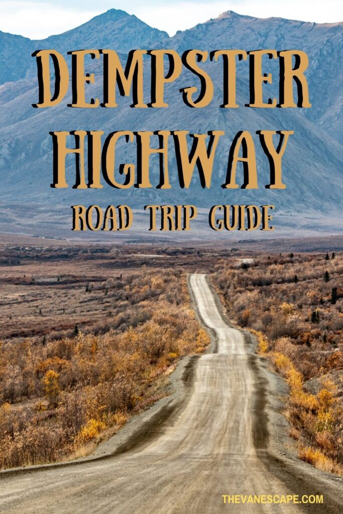
Agnes Stabinska is a writer, photographer, and co-founder of The Van Escape. She loves wildlife, landscape photography, and outdoor adventures, especially hiking, camping, and exploring U.S. national parks. Although she has traveled to many countries for almost 20 years, her favorite places are Alaska, the American Southwest, and the Pacific Northwest, which she often visits and explore with her partner, Chris. Their travel tips, itineraries, and recommendations will help you get away from it all and plan a wonderful vacation.
18 Comments
I’m always amazed to see a strip of road running through in the wilderness like this. That’s a long route on a gravel road – but well worth it to be able to see the wildlife along the way and reach the Arctic Ocean! I appreciate the tip about keeping speeds down to minimize car damage and getting a 4WD with a high suspension. Othewise, that could be an expensive surprise at the rental agency!
This is exactly my type of trip! I would love to drive the Dempster Highway at some point. I would probably struggle with the road not being paved, as I haven’t driven much on gravel. I remember the few times I did, it wasn’t a pleasant experience. It’s very good to know where the petrol stations are, and that you should stock on petrol in order to avoid getting stranded on the road. The advice about packing a windscreen kit is very valuable as well.
I am loving your travels through the north and learning so much for when we finally plan a visit. We would definitely plan to do the Dempster Highway between Yukon and the NWT. But I can certainly understand that it requires careful preparation to do it. Another good route for the Milepost map. Like many remote roads I am sure the speed limit at times is “90kph … if you dare”. A great post to save for when we start planning.
I hung on your every word. Being Canadian this fascinates me. And to learn that from home (Toronto) it’s one-way distance to Inuvik of a mere 6,611 km. It’s definitely an adventure from the conditions of road, weather and no cellular service. I’m not sure I’d be brave enough, but would love this experience.
Great post!
Because it is a desolate road, driving the Dempster Highway appears exciting and adventurous. The reminders and cautions you provided are really useful for first-time passengers and drivers. Despite the difficulty of the route, they can at least relax and envision how long and distant it is. Thank you for providing us with such a thorough guide!
As someone who loves traveling through remote roads, the Dempster Highway sounds like the perfect place I’d love to visit. You got me at “It’s remote and pure wilderness, without any intersections. A gravel road through the mountains”. Totally my kinda place to visit. Thanks for all tips about having a windshield repair kit, packing food in smell-proof packages etc.
The Dempster highway is a magnificent and scenic route crossing the Arctic circle along the Inuvik-Tuktuyaktuk range. Driving across these far and wide destinations and watching wildlife in the way is truly an odeyssy. It looks so similar to Death valley national park. And it’s exciting to know there are camping sites along Dempster highway for visitors interested in trekking. Thanks for sharing all the safety essentials like like carrying a smell proof containers to prevent animal attacks, best time to visit and going on 4 WD due to bumpy road conditions.
Wow! Driving on Dempster Highway is really an adventurous trip! I like adventures but I don’t think I braved enough to do this. Driving on gravel road with a possibility of changing tires? Eek!! Not to mention there’s no fuel station along the way, no cell service, no food services etc. But I enjoyed reading your experience here.
This comprehensive guide is super helpful. This is quite an adventure and we appreciate all the tips that you shared since this will be our first time. Thank you for the heads about no cell service and internet as well as the road condition. Will make sure to pack a satellite phone.
Well that sure sounds like an adventure. I would love to visit the Yukon and North West Territories, but since I travel solo I don’t think that I’ll be taking that highway.
I am glad we did it! And with our 24-ft. Class B RV! Stayed at the Eagle Plains campground. We got to the Arctic Circle and turned back. That new road from Inuvik to Tuktoyaktuk would have motivated us to go all the way!
Thank you for the informative post. Taking my daughter to Tuktoyuktuk in 10 days from southern BC. I will certainly save your post to reference along the way. I have been dreaming of making it to the arctic ocean since I worked in Eagle Plains about 7 years ago.
Driving Dempster Highway must have been an adventure – it looks so wild and empty. But I guess there are more people in summer than your pictures show. Is it a touristic place in summer? Do people cycle along Dempster highway too?
What an absolutely amazing drive. It looks like another world! I would love to make this road trip if we ever get this far north, coming from Florida would be quite a drive. The scenery and landscapes would totally make a road trip on the Dempster Highway worth the trek!
This sounds like such a wonderful adventure. I’m not driving and most of the time that’s no big deal. But I certainly would appreciate a bit of this on-the-road-again vibe. In Europe, you can easily do road trips by bus or train, in the US, however, it’s far more complicated and you don’t get much to see between two spots.
I need to find someone willing to go with me. My wife says “No Way”. I have a 24′ class C, but it rides really low. I also have a GMC 4×4 1/2 ton truck. This is a fantastic guide, hopefully I’ll make it some day.
Most comprehensive information I have ever seen on the internet. Thank you very much. I am driving this highway with my son and brother In the first week of August. Really excited! Thanks for all the safety tips.
Leave a Reply Cancel reply
Your email address will not be published. Required fields are marked *
Privacy Overview
Dempster Highway Driving Guide to the Arctic Ocean in Tuktoyaktuk
Last Updated on March 7, 2024
The Dempster Highway is a truly unique road trip from already remote Dawson City into Canada’s Arctic and the shore of the Arctic Ocean. There is stunning and unique scenery everywhere, crossing four mountain ranges, going back and forth across the Continental Divide, traversing the only never glaciated area in Canada and crossing two epic northern rivers.
This is truly one of the most incredible road trips I have ever done. Many thanks to Go North Rentals in Fairbanks for letting us take one of their Scout Campers on this adventure!
I’ve driven almost every mile of road in Alaska and the Yukon in addition to this remote road trip, so you can trust me to give you straight talk about this drive, how to determine if it’s right for you and how to prepare for your trip.
“Highway” is a generous term for this narrow strip of gravel, which requires your complete focus and preparation. This is a journey for self sufficient adventurers with a good sense of humor. If that sounds like you, I can’t wait to show you the way and help you prepare for your own unforgettable road trip.
The Dempster Highway takes you through the land of the Gwich’in, Tr’ondëk Hwëch’in and Inuvialuit First Nations People.

How long does it take to drive the Dempster Highway?
- What are the road conditions like?
- What is the best time of year to drive the Dempster Highway?
- What is the best vehicle for the Dempster Highway?
How to get to the Dempster Highway
- Gas stations and Fuel availability
Hotel Accommodations along the Dempster Highway
- Camping on the Dempster Highway
Groceries and Restaurants along the Dempster Highway
What wildlife might i see along the dempster highway, what to pack, dempster guide: dawson city to tombstone territorial park, dempster guide: tombstone territorial park to eagle plains.
- Dempster Guide: Eagle Plains to Inuvik – Crossing the Arctic Circle
Dempster Guide: Inuvik to Tuktoyaktuk and the Arctic Ocean
- Dempster Highway vs Dalton Highway
- Final Thoughts and advice
This article contains affiliate links, which means if you make a purchase I receive a small commission at no cost to you.
I recommend spending 5 days on the Dempster Highway, and more if you want to spent time hiking in the Tombstone Mountains or kayaking out to the Pingos in Tuktoyaktuk. It’s about 1000 miles (1600km) of gravel and often mud.
To drive from Dawson City to Tuktoyaktuk at the Arctic Ocean and back took us 33 hours. That included quick bathroom stops but not meal stops, exploring or sleeping. We averaged around 45 mph, occasionally we went a bit faster and when it was raining it was slower.
Driving on the Dempster is a lot more tiring than highway driving and you won’t want to do as many hours in a day as you might otherwise.
The highway is slow, and gets slower in wet weather. There are lots of unexpected potential delays (construction, ferries, hours of fuel stations) so you do not want to be rushing.
It can be done in as little as four days, but five is much more comfortable. That gives you two days to drive the Dempster, two days to drive back and a day to go up to Tuktoyaktuk and back.
What are the road conditions like on the Dempster Highway?

Is the Dempster Highway paved?
No. It’s gravel. There is a short paved section just south of Inuvik.
How rough is the Dempster Highway?
Since the Dempster is in a remote area and subject to extreme weather, the road conditions can vary a lot. When I drove the highway the same stretch of road was different going north and south in the same section depending on if it was raining or not.
Overall I was impressed at the condition of the highway. There were potholes in places and the mud got very slippery when it was raining, but overall it was very well maintained.
This road requires your constant attention as a driver. There may suddenly be heavy equipment in your lane, including graders, without warning. There are potholes in places and other bumps.
The best way to stay safe on the road is to make sure your vehicle is well maintained and do not try to go fast. I always recommend checking Yukon road conditions and Northwest Territories road conditions any time you have cell service.
Timelapse Video of the Dempster Highway and Road to Tuktoyaktuk
Really want to see what every moment is like? Watch it at high speed here:
When is the best time of year to drive the Dempster Highway?
September. The first half of September is absolutely stunning with the fall color but (usually) there isn’t snow yet. We did this drive the first week of September and I can’t imagine a better time.
I’m sure many people would tell you that summer is better, but I am happy to trade colder weather, some rain, fall color and the potential for seeing an Aurora for the midnight sun and bugs.
The highway is open all year, and locals often say it’s smoother in the winter. However, a winter drive here would require an even higher level of preparation, self sufficiency and experience with harsh winter weather.

What is the best vehicle to drive on the Dempster Highway?
We drove an F-150 pick up truck with a Scout Camper and it was absolutely ideal. Any pick up truck and camper combo would be great. A van camper would also work well as long as it had good clearance and tires.

Most of the highway you could drive in any well maintained car with excellent tires, though it would be slower in areas of rough road. There are areas where a high clearance vehicle is very helpful, but without one you could make it as long as you take it slow. Keep in mind if you drive a car that the options for staying in hotels along the way and tent camping can be hard if bugs or rain are intense. You also must have a full size spare tire, tire changing equipment and know how to change a tire.
I would not recommend this drive for trailers or larger RVs. I think in a smaller motorhome you would be ok as long as you didn’t have anything hanging below (like a dump hose) and the tires are in good condition.
We saw quite a few motorcycles along this road and I am not an expert on motorcycles but people are definitely doing it. Understand that you will be absolutely coated in mud or dust depending on the weather. We also saw people on bicycles which I can’t really imagine doing (bugs, dust, mud and vehicles passing slinging the same) but people are out there doing it!
The Dempster Highway starts near Dawson City in Canada’s Yukon Territory.
If you’re driving to the Dempster to start the drive, you’ll take the Klondike Highway north from Whitehorse or the Taylor Highway/Top of the World Highway from Tok, Alaska.
If you’re flying in to rent a vehicle for the drive, plan on flying to Whitehorse, Yukon or Fairbanks, Alaska and renting a vehicle.
I recommend renting from Go North Rentals in Whitehorse or Fairbanks, they rent pick up campers that are perfect for this drive and allow you to drive on these unpaved roads (most rental companies do not).
Gas Stations and Fuel Availability
Gas stations are extremely limited along this highway, it’s important to fill up at every opportunity.
There is a gas station where the Dempster Highway leaves the Klondike Highway, one in Eagle Plains, one in McPherson and a couple in Inuvik. There is also a fuel station in Tuktoyaktuk.
The longest distance between fuel stations is about 250 miles (about 400km). If your vehicle can go 250 miles between fuel stops, there is no reason to carry a gas can. We did not carry a gas can and did just fine.
Most gas stations are not open 24 hours, another reason to not be rushing on this drive.
Hotel options are limited and very basic along the Dempster. There are plenty of hotels in Dawson City. After that, there is a hotel in Eagle Plains and one in Fort McPherson. There are a few options in Inuvik.
It is important to make a plan and reserve hotels in advance if you are relying on them for your trip.
Camping along the Dempster Highway
Camping in a pick up camper is an ideal way to experience the Dempster Highway. You have flexibility in where you stop for the night but the protection from weather and bugs that an RV provides.
You can also tent camp and lots of people do this. Make sure your tent has a full rain fly and no leaks or holes to protect you from weather and bugs. You also need a tent that can stand up to the wind.
There are lots of pullouts where you can disperse camp. The Milepost tells you the location of every pullout as well as campgrounds. We found a great spot with a view our first night, and there were lots of beautiful pullouts. We found that there were more options before the Mackenzie River, and after the Mackenzie River there were not as many pullouts.
There are three Yukon Government campgrounds and five Northwest Territories Campground along the Dempster Highway. There is also the campground in Tuktoyaktuk next to the beach at the Arctic Ocean.
Most campgrounds do not have running water, although the two in Inuvik as well as the Nataiinlaii Campground near the Peel River ferry did have flushing toilets and showers. Some campgrounds have drinking water but not all.
Most campgrounds have big firewood piles that you can help yourself to, at a few you pay extra for firewood.
We were warned by locals that some campgrounds are VERY buggy in summer and some are almost unbearably windy. For example we learned that Rock River Campground is protected from the wind, but bugs can be terrible, meanwhile nearby James Creek Campground is extremely windy, too windy for tent camping (but good for keeping bugs away!).
I loved the Tombstone campground. It’s the busiest one we encountered, it does sometimes fill up in summer. It has several developed trails and is surrounded by the gorgeous Tombstone mountains.
My favorite campground overall that we stayed at was the Jak Territorial Park Campground just outside Inuvik. It had a gorgeous view of the Mackenzie Delta and running water. They also have the only playground we saw along the Dempster Highway. It was full of golden birch trees in early September.

Make sure to bring cash for camping, the only place we could pay with a credit card was at Jak. Everywhere else was $20-$25 Canadian cash for camping.
Your food options are extremely limited along the Dempster Highway. They are open limited and not always published hours.
I strongly urge you to bring all the food and snacks you need for your trip and enjoy a restaurant meal if one becomes available.
Stocking up on food in Whitehorse, Dawson City or Fairbanks are your best options. Keep in mind for Fairbanks you’ll be crossing the border into Canada and cannot bring fresh meat, fruits or vegetables. I bought everything except those items in Fairbanks and got vegetables in Dawson.
We enjoyed having lunch at the restaurant in Eagle Plains and the breakfast sandwich I had at the News Stand (like a convenience store) in Inuvik. Those were the only restaurants that were open at the times I was passing through. Everything else I ate for five days we brought with us.
If you have any restrictions on what you eat, you definitely need to bring your own food.

At times in spring and fall, you might see caribou migrating along the highway. There are also bears along the route (I saw one!).
The big wildlife highlight of this trip is the migratory birds throughout the Mackenzie River Delta. Millions of birds nest here during the summer.
The weather is unpredictable in the Arctic and there are no emergency services. You need to be as self sufficient as possible. Make sure you have some warm clothes and rain gear in addition to long sleeve lighter layers and long sleeve pants.
Bugs can be fierce in summer, make sure you have long pants, boots or shoes, long sleeve shirt, rain gear and a hat and headnet to protect yourself. You’ll also need sun protection.
It’s important to carry plenty of drinking water and cooking water as well as your own food. Water is very difficult to get along the Dempster.
You will want to have a copy of the Milepost , it will tell you where fuel, campgrounds, hotels and food are as well as toilets and trash cans and pullouts. It also has a map. These things are all important without cell service.

As far as your vehicle, make sure it’s in good repair and has excellent tires. You’ll need a full size spare tire and all the changing equipment. If you have a flat, you’ll need to be able to change it and drive over 100 miles before you can get it fixed.
Finally, I recommend bringing an emergency communications device, such as a satellite phone or satellite communicator. Make sure to tell friends and family back how how long you expect to be out of service and how they can contact you if you have an emergency device. Test it before you leave home!
I travel with a Garmin inReach Mini anytime I’m away from cell service. It has an emergency button to contact Search and Rescue and I can send short texts to family using it.

Once you get onto the Dempster Highway, it’s only 44 miles (70km) to the Interpretive Centre at Tombstone Territorial Park.
The Tombstone Mountains are a true gem and I highly encourage you to spend some time here.
There are numerous hiking trails as well as epic views and a wonderful campground.
This is also the busiest stretch of the Dempster, lots of people go to Tombstone who don’t travel further up the highway.
Leaving Tombstone, you quickly come to North Pass, the highest elevation spot along the Dempster Highway at 4600 feet/1400 m. You’ll then be leaving the Tombstone Mountains and driving along the Blackstone River to Chapman Lake.
After cresting Windy Pass, you’ll descend into a canyon among the Northern Ogilvie Mountains to Engineer Creek. This area is one of the very few places in Canada that has never been under ice and glaciers!

You’ll slowly leave this set of mountains behind as you get closer to Eagle Plains.
A mandatory stop, Eagle Plains was built to provide services to travelers on the highway between Dawson City and Inuvik. You’ll need to get gas here and if the restaurant is open, grab a meal. Be ready to encounter many friendly dogs in Eagle Plains!

Dempster Guide: Eagle Plains to the Arctic Circle and Inuvik
Leaving Eagle Plains, you drive through a wide valley with the Richardson Mountains in the distance. This stunning vista provides the backdrop when you arrive at the Arctic Circle. Spend some time here to take in the incredible view. There’s even a picnic table perfect for having some lunch.

After leaving the Arctic Circle you’ll slowly climb to Wright Pass, which marks the border between the Yukon and Northwest Territories. There is a one hour time change here in the summer with Northwest Territories being an hour ahead of the Yukon. The ridgeline makes for a wonderful hike if it’s a nice day.

As you continue into the Northwest Territories, you’ll descend to the Peel River and then the Mackenzie River. Each river requires a ferry crossing so expect to wait a bit for your turn on the ferry.

If the timing works out, the Nataiinlaii Campground just on the north side of the ferry is lovely campground with flushing toilets and a short, flat and beautiful trail to a viewpoint over the Peel River.

Continuing on the highway, the village of Fort McPherson is a short distance off the highway and has gas, a restaurant and a hotel.
The next river you’ll come to is the mighty Mackenzie River, the second longest river in North America. The Nagwichoonjik/Kuukpak/Mackenzie River is an unexpected highlight of this entire trip. You cross it on the ferry and then drive near it the rest of the way to Inuvik and Tuktoyaktuk along and through its delta, which is immense and an important nesting area to millions of birds. It is large enough to moderate the climate in its basin creating a unique and vast ecosystem. The river basin formed about 13000 years ago by glacial lake outburst floods and drains much all of the Northwest Territories and much of the Yukon, British Columbia, Alberta and Saskatchewan.

People have lived along this river and its delta for at least centuries and probably thousands of years in permanent and seasonal homes.
The Gwich’in Community of Tsiigehtchic is also served by the ferry crossing and has been a community in this location for about 1400 years. The Gwich’in name for the river is Nagwichoonjik (river flowing through a big country).
The river is called Kuukpak (Great River) by Inuvialuit. The Inuvialuit have lived near the mouth of the Kuukpak and it’s delta for about 1000 years.
Settling into the Mackenzie Delta, we found the rest of the road to Inuvik the roughest stretch of road with the least pullouts and viewpoints.
Even if you don’t stay at Jak Territorial Park Campground, definitely go into the park to check out the observation tower with its incredible view over the Mackenzie Delta.

When you arrive in Inuvik, be prepared that this is a community that exists to serve as a commercial hub and health care hub for Northwest Territories residents.

There are limited visitor services in Inuvik but you can definitely get gas. I recommend asking at the gas station if any restaurants or stores are open. There are only a couple and they have limited hours, but locals will know where to send you!
We got a great breakfast sandwich from Mac’s News Stand that we never would have found without a local directing us there.

I recommend doing this section of the drive as a day trip from Inuvik so you can enjoy the drive and have some time at the Arctic Ocean. Plan on this 90 mile drive taking 2.5 to 3 hours in each direction.
The road from Inuvik to Tuktoyaktuk was completed in 2018. Before that, you had to fly to Tuk unless it was winter when the ice road was stable. The road is much like the Dempster, though there were a few more potholes and washboard.
It starts in the forest around Inuvik and slowly becomes less trees and more tundra as you approach the Arctic Ocean. There are lots of tiny lakes and you are along the Mackenzie Delta. The tundra is bright red in early September.

When you get close to Tuk, make sure to stop at the Pingo Canadian Landmark to see the impressive ice mounds that stick up from the otherwise pancake flat tundra. If you have time, you can rent kayaks here to get closer to them.
When you get to Tuktoyaktuk, you’ll drive through the village to the end of Beaufort Drive to get to the Arctic Ocean. There’s a sign and some beach area (obey all access signs) along with outhouses and picnic tables. You can camp here and there are several firepits.

Is the Dempster Highway or the Dalton Highway better for crossing the Arctic Circle and going to the Arctic Ocean?
If you’re considering the Dempster Highway drive as a way to drive across the Arctic Circle, you might be wondering if this is the best way to do it compared to the Dalton Highway in Alaska.
I like the Dempster Highway drive better, but it is definitely farther from Fairbanks or Whitehorse, so if your only goal is to just cross the Arctic Circle, it will be shorter on the Dalton. The Dalton Highway also has more truck traffic.
If you choose the Dalton Highway, you can’t drive your personal vehicle to the Arctic Ocean since it’s part of the Prudhoe Bay oil field. You have to take a bus to get there, so if you have your heart set on driving your own vehicle to the Arctic Ocean, the Dempster is where it’s at!

Final thoughts and Advice for driving the Dempster Highway
Driving the Dempster Highway to Canada’s Arctic is a challenging and remote adventure, and travelers should prioritize preparation and planning as well as being as self sufficient as possible. A few other final thoughts:
- A pick up camper was the ideal vehicle for this drive. With high clearance and excellent tires, we were able to navigate random construction and potholes no problem. The camper was great since there aren’t many hotels.
- There was no cell phone service for nearly all of this drive. We had a Garmin inReach for emergencies. I would encourage other drivers to have a satellite phone or a satellite communicator like a Garmin.
- There were limited places to get food, either groceries or restaurants. We were very glad we had plenty of provisions that we had bought in Fairbanks and Dawson.

Privacy Policy

Driving the Denali Highway (WOW, just WOW)
Dempster Highway Blog – My Journey to the Arctic Ocean
Driving the Dempster Highway to Tuktoyaktuk (Arctic Ocean or Bust)
- By [email protected] in Scenery , Undiscovered Gems , Unique Experiences
Driving the Dempster Highway is one of the great North American adventures as you drive all the way to the Arctic Ocean, in the hamlet of Tuktoyaktuk (lovingly referred to as “Tuk”, pronounced “tuck”). I was driving the Dempster Highway from August 10-15, 2019. I had originally planned to visit around July 18 to attend the annual arts festival in Inuvik, but the smoke conditions were very bad, so I detoured to Atlin, BC and Alaska first. Read here about my experience on the Dempster Highway , and below for some tips if you’re planning to do the journey for driving tips and things you can see on the Dempster Highway.
What is the Dempster Highway?
The Dempster is a 736 km (457 mile ) gravel road from the junction of Highway 2 in Yukon (aka the Klondike Highway) to Inuvik, Northwest Territories. It was completed in 1978 and has been known as one of the more extreme road trips in North America. In late 2017, a road was completed the final 144 km (90 miles) to Tuktoyaktuk, which previously was only reachable by plane and in the winter when there was an ice road on the Mackenzie River and the Arctic Ocean. So now, you can drive 547 miles one way to the Arctic Ocean, of course you have to drive back the same way you came!
What to See on the Dempster Highway – Scenery
The highway is famous for its scenery. Some of the top scenic highlights include:
Tombstone Territorial Park – this is one of the most scenic sections of the Dempster Highway. There are several hikes to do in the park. If you’re short on time, the Goldenside Trail is a short (4 km), scenic hike.

Fall Colors – late August to early September is one of the best times to travel the highway, as you might see the northern lights and the fall colors are amazing.

Ogilvie-Peel viewpoint Lookout – this viewpoint is the meeting of two rivers.

Arctic Circle Crossing – stop at the Arctic Circle for great views and pictures at the Arctic Circle Marker.

Yukon/NWT Crossing and Markers – the border is located on a mountain pass, there was snow present in my early August visit. Each territory has its own welcome signs.

Fort McPherson – it’s worth a visit to the local church and cemetery. You can visit the grave of the Lost Patrol. The Lost Patrol were 4 Mounties that set off using sled dogs from Fort McPherson to Dawson City in the winter without a guide. Sadly, it didn’t end well for the Mounties or the dogs.

Inuvik/Mackenzie River – Inuvik is the largest town in this part of NWT, with a population above 3,000. It’s the only pavement you will see on the entire Dempster highway. The Mackenzie River makes the border of the western side of Inuvik

Pingos – Pingos are earth-covered ice blocks caused by permafrost and one of the largest Pingos in the world is located just outside of Tuktoyaktuk, part of Parks Canada. The adventurous can canoe to a boardwalk to get a closer view.

Tuktoyaktuk/Arctic Ocean – Tuktoyaktuk is a small town with mostly First Nations population on the Arctic Ocean. You can park on the spit for photos of the “Arctic Ocean” sign. It’s also possible to camp out there for $63 CAD per night (money to go for developing the site). While you are allowed to dip your toes at the city park, a better place to swim or dip your toes is at the beach at Grandma’s Kitchen. Make sure you stop into Grandma’s Kitchen to try local delicacies. I tried a sampler plate of smoked fish, muktuk (raw beluga meat), and beluga jerky.

What to See on the Dempster Highway – Wildlife
Wildlife is not abundant on the highway. The only wildlife I saw was birds, rabbits, and a couple foxes. That being said, you may be lucky. I met 3 different travelers, one saw a Grizzly Bear, one saw the huge Porcupine Caribou herd, and the other incredibly saw a Musk Ox.

How Many Days to Do the Dempster Highway?
They say the highway is like Vegas – 3 days is too short and 7 days is too long. 3 days would mean you’re literally driving from morning to night with no stops (it is 1100 miles on gravel, after all). I would say do a minimum of 4 days (Day 1 to Dawson City to Eagle Plains, Day 2 to Tuktoyaktuk, Day 3 back to Eagle Plains, Day 4 back to Dawson City). My trip was 5.5 days and I felt that was about perfect. It gave me some time to explore Tuktoyaktuk, Inuvik, and Tombstone Territorial Park.
Dempster Highway Driving Tips
This post contains affiliate links. This website earns a small commission for items purchased through these links with no additional cost to you.
Take the Milepost Guidebook. This book has maps and a mile by mile description of the Top of the World Highway, as well as the other highways and detours to and around Alaska.
The best advice someone gave me – if it is raining and the road is sloppy, avoid driving. You will be stuck in slippery mud. On the day I had planned my departure from Inuvik, it had rained all night and the roads were terrible. So I hung out in Inuvik all day, visiting the museum, watching films, taking an art class (making a small dream catcher), and using the wi-fi at the library. By 5 pm, the roads were drier so I drove for 5 hours on better roads. The next day, I heard both a tour bus and RV had gone in the ditch near Rock River Campground, the worst part of the Dempster Highway.

There is limited cell phone reception and wi-fi only at a few locations, so plan to be disconnected – and ENJOY being disconnected!
Ferry Crossings – the times are fairly random, so expect to wait awhile , up to 30 minutes at the Mackenzie River crossing as that’s a 3-way crossing between the two ends of the Dempster and the village of Tsiigehtchic. The Peel River Ferry just runs back and forth so it’s a shorter wait. These ferries are open from 8-9 am to 11-12 midnight each day. If you do get stuck in between the two ferries, there is a motel in Fort McPherson, a NWT campground at Nitainlaii Territorial Park just north of the Peel River ferry, and several places you can Boondock camp for free.

Dempster Highway Gas Stations – the gas stations from south to north are Dawson City, Dempster Highway Junction (24-hour cardlock only), Eagle Plains, Fort McPherson, Inuvik, and Tuktoyaktuk. At the time of my visit, there was only an 11 cent difference per liter of gas. It seems that Fort McPherson consistently has the cheapest gas, and Eagle Plains has the most expensive (probably because they can – it’s such a long distance without stations from Dawson City to Eagle Plains). In summer 2019, Bob’s Welding which has stations in Inuvik and Tuk was offering a 10% discount. These are full service stations but keep an eye on your gas filler – I suspect one time the machine hadn’t been reset to zero and another time the guy overfilled my tank by topping it up to much, which I didn’t ask for. Also, at Eagle Plains, they will automatically fill your tank rather than ask how much you want – I only wanted enough to get to Fort McPherson but he had already filled it by the time I got out of my car to talk to him.
The Dempster is notorious for flat tires but I think this is a story of the past – I don’t think I met a single person that had a flat tire, and I didn’t see anyone stopped fixing one on the road. That being said, it is worth coming prepared as flats certainly do happen. Bring any automotive essentials you might take on a remote gravel road (spare tire, repair kit, etc)
The Dempster is also notorious for chipped windshields and I am sorry to report I did end up with a small chip. I was pulling over to let semis go by but a big pickup truck sent a small rock flying my way. Of the others that had rock chips, most of them got it on the Alaska Highway rather than the Dempster.
Warning – your car will be VERY dirty and caked with mud after driving the highway. The back of my van was caked with as much as ½ an inch of mud, and I had to kick huge clumps of mud from my wheel wells. There are several car washes in Dawson City. Insider tip: consider having your tires washed of the mud. My van was off balance for some time due to caked mud.

Weather on the Dempster Highway
On the Dempster Highway, I encountered sun, rain, mud, sleet, snow, horizontal mist, rainbows, and that was on Monday morning! Weather on the Dempster Highway is quite erratic. In general, the weather was a little be better than forecast – for example if it was a forecast of clouds, there was a little sun. If there was a forecast of rain, there were clearings in the rain.

Cost to Drive the Dempster Highway
The main cost of the Dempster Highway is the gas! Gas cost from $1.59 to $1.70 CAD per liter. I got surprisingly good mileage on the gravel road, but poor mileage on the sections where I was driving in mushy mud.
The next cost was camping. While there are lots of places to pull over in Yukon and southern NWT to camp for free, once you get near Inuvik and Tuktoyaktuk, there are no places to camp for free (or legally anyways). The public campgrounds in NWT are $23.65 CAD a night, but they usually include flush toilets and hot showers, unlike the public Yukon campgrounds that cost only $12 CAD a night.
Another cost was food. I was on a diet and I had stocked up prior to making the trip north. I did eat out one meal at Grandma’s Kitchen in Tuktoyaktuk. And I stopped into the cafe at Eagle Plains for some great coffee.

Most activities and attractions along the Dempster Highway are free – including Tombstone Territorial Park, Arctic Circle marker, Pingos, and Tuktoyaktuk spit. I also participated in some free cultural activities in Inuvik.
Where to Stay on the Dempster Highway
There’s lots of camping on the Dempster Highway. If you’re not camping, there are only a few places to stay – the single motel at Eagle Plains and one of several motels and hotels in Inuvik ( Check Rates and Availability in Inuvik ). There are also a few B&B’s in Tuktoyaktuk, but they are quite expensive.
Like this post? Click on one of the pictures below to save to pinterest.

Sharing is caring!
- Arctic , Arctic Ocean , Dempster Highway , Mountains , Northwest Territories , NWT , Ocean , Road Trip , Scenic Drives , Scenic Roads , Yukon

- Lisa on October 19, 2019 at 2:18 am
What an amazing trip. We really do need to get back to this part of the world and explore more and this is now high up on our list to do. Thank you for the tips.

- Ann on October 20, 2019 at 7:24 am
Oh what a great post, thank you for sharing!
Comments have been disabled.
Subscribe to blog via email.
Enter your email address to subscribe to this blog and receive notifications of new posts by email.
Email Address
- View tflashpacker’s profile on Facebook
- View tflashpacker’s profile on Twitter
- View tflashpacker’s profile on Instagram
- View thehotflashpacker’s profile on Pinterest
Recent Posts
- Grand Canyon Rafting Gear – Packing for your trip for less
- The Best Time to Visit Joshua Tree National Park + Best Sunset Spots
- My Alaska Road Trip – The Actual Trip!
- My Road Trip to Alaska Cost + How to Save Money in Alaska
- I Visited Yellowstone National Park the Day it Opened Post-COVID-19 Quarantine, This is What Happened
- Antarctica Clothing – Packing for Antarctica on a Budget
Recent Comments
- Mike on Alaska Road Trip Packing List (13 Essentials for Driving to Alaska)
- Dylan on A Day out on the Lu-Lu Belle – The Best Valdez Glacier Cruise
- Street Art and Graffiti in Mostar, Bosnia on Day Trips From Mostar (Herzegovina Tour)
- [email protected] on My Road Trip to Alaska Cost + How to Save Money in Alaska
- [email protected] on My Favorite Alaska Fireweed Photos
- August 2021
- August 2020
- February 2020
- January 2020
- December 2019
- November 2019
- October 2019
- September 2019
- August 2019
- February 2019
- January 2019
- December 2018
- November 2018
- October 2018
- September 2018
- August 2018
- February 2018
- January 2018
- December 2017
- November 2017
- October 2017
- September 2017
- August 2017
- February 2017
- Architecture
- Travel Tips
- Uncategorized
- Undiscovered Gems
- Unique Experiences
- Van Camping
© 2024 TheHotFlashPacker.com.
Made with by Graphene Themes .
- Budget Travel
- Cheap Flights
- Driving Canada
- Paved Roads
- Gravel Roads
- Train Travel
- Hitchhikers Guide
- Tourist Visa
- Working Holiday Visa
- Hospitality Work
- Organic Farms
- Ranch Jobs in Canada
- Canada Topo Maps
- Climate & Weather
- Alaska Highway
- Thompson Okanagan
- Kootenay Rockies
- Cariboo Chilcotin
- Northern BC
- Alberta Rockies
- Southern Alberta
- 19 Best Alberta Towns
- Northwest Territories
- Saskatchewan
- Guided Tours in 2024
- Camper Rental
- Accommodation
- Travel Insurance
- Basic Packing List
- Campfire Cooking
- Campfire Recipes
- Multi Day Hikes
- Horseback Adventures
- National Parks Canada
- Small Town Rodeos
- Heliskiing Canada
- Canada Facts
- Wilderness Dangers
- Black Bears
- Grizzly Bears
- Polar Bears
- Canada With Kids
- Canadian Food
- Canadian Currency
- Outdoor Store
- Travel Resources
- Backcountry Newsletter
Dempster Highway: The Wildest Solo Road Trip To The Arctic
I finally was doing it, my Solo Drive to the Arctic on the Dempster Highway to Inuvik, Northwest Territories.


Table of Contents
The road trip of a lifetime
Have you ever wondered where the “north” begins and what the Arctic is like? I often thought about it and I found the answers driving the Dempster Highway.
The vastness of the land around the Dempster blows your mind. You suddenly realize that the Dempster Highway is the only raggedy little road that cuts through the wilderness, and opens up an incredible part of the world for us to experience.
The Dempster Highway is one of the most spectacular road trips on earth and yet, many people have never heard of it. It’s the only road in Canada that takes you across the Arctic Circle at km 405.5. It takes you into the land of the midnight sun, where you have 24 hours of daylight.

Dempster Highway’s History
The Dempster Highway to Inuvik was completed in 1975 as a transportation route. It connects the Southern Yukon with Inuvik, the Mackenzie Delta and communities in the Northwest Territories . An overland supply route was needed to serve large-scale oil exploration taking place in the Beaufort Sea.
The surface of the Dempster Highway is all gravel; 2.4 m thick in some places to protect the permafrost, on which the road sits on. The road is like a raised bridge with no sides. If the permafrost would melt, the road would sink.
For most of its length, the Dempster Highway crosses land and territories with no sign of human presence; no side roads, no houses and no power lines.
The highway is named after Corporal William Dempster of the RCMP. He searched for the men of the Lost Patrol and found them frozen to death near Fort McPherson in 1911. Read about the tragedy HERE .

What You Need To Know
What you need for this trip is an adventurous spirit, a reliable vehicle, excellent tires, a couple of spares and a jerry can with extra gasoline.
Be prepared for the journey ahead and check out my Wilderness Road Trip Planner . You will be mostly on your own driving through the endless wilderness. Most of the time it’s only an occasional rabbit or arctic ground squirrel you share the road with.
My road trip to the Arctic started in Okanagan, British Columbia , ten days before reaching the Dempster. My Toyota RAV4 was equipped with the best all-season tires I could find and I was prepared for the journey ahead. I realized early during my trip that things would be rough. The front windshield of my vehicle was rock chipped before I reached the Yukon border. Lesson learned; coming to a full stop whenever a semi-truck approaches, will limit the number of rocks hitting the windshield.
Driving The Dempster Highway
I took a break from my journey in the Wild West town of Dawson City, with my small tent squeezed between large RVs at Dawson’s main campground. Being aware of the remoteness and solitude of the road ahead, I didn’t mind the hustle and bustle of Dawson and tried to take in some of its vibes and Klondike history.
Km 0 of the Dempster Highway starts 40 km south of Dawson City , Yukon on the Klondike Highway and ends in Inuvik in the Northwest Territories. The road winds through some of the most amazing mountain and tundra terrain in Canada. At km 460.0 you cross the Yukon border to the Northwest Territories and that is where the kilometre count starts at zero again.
The Dempster Highway is not a good fit for inexperienced city drivers. Make sure you know what you get yourself into. Once you’re on the road drive carefully and obey posted signs.
You’ll come across airstrips on the Dempster which were officially built as resupply points during highway construction. The airstrips may still be used today.
Stop only where other drivers can pass safely. Pull over as far to the right as possible. Do not stop at the top of a hill, on a bridge, or on a curve.
Drive with headlights on and keep your seat belt fastened. Avoid sliding on the loose road surface by eliminating sudden braking or steering.

Weather Conditions
The region is usually dry. Still, the possibility of the road being washed out in the mountains remains. Two days after I arrived back in Dawson City , the road between Tombstone Territorial Park and Eagle Plains was totally washed out and collapsed . Travellers got stuck in between. It is very important to check the weather forecast to time the trip right.
Most people drive the highway in July and August during the short Arctic summer. September is the month to experience the spectacular autumn colours. Be aware that the long winter (October to April) requires additional precautions for travelling.
Weather conditions along the Dempster and on the Beaufort Coast can change quickly at any time of the year. You might come across cold winds and snow in the mountains in the middle of summer. Bring along layered clothes, a warm jacket, good boots, a hat, and gloves.

How long does it take?
The 736 km journey from the North Klondike Highway turnoff south of Dawson City to Inuvik takes at least two days. Count on driving 12 to 16 hours in each direction. The time it takes depends on road conditions and how often you stop along the way. If you want to do some serious hiking at Tombstone Territorial Park , you will need at least an extra day.
I recommend spending a couple of nights in Inuvik . Consider continuing your trip to Tuktoyaktuk or catching a flight to another Northern Community.
Make sure your vehicle is dependable and well-maintained. Travel the Dempster in a 4-wheel drive, even if some travel articles tell you differently. If you have to rent a vehicle , tell the rental company that you’re planning to drive the Dempster.
Car rental companies are located in Whitehorse and Inuvik .
If you break down you may have to wait for a long time to get help. Carry extra fluids, spare belts, some basic tools, a flare gun, tow rope, axe, knife, and matches. Ensure that all of your tires are in good condition, with lots of treads.
Slowing down and pulling over when meeting vehicles, especially large trucks, will minimize rock damage to your windshield. It is a good idea to protect your headlights with plastic or wire mesh covers.

There are only three gasoline stops along the Dempster. Make sure you start off with a full tank and carry some spare fuel, just in case.
There are gas stations at the southern end of the highway at Klondike River Lodge, Eagle Plains, Fort McPherson, and Inuvik.
Ask locals where the best place is to get gasoline. Usually, there is one place in town where you get it cheaper.
The Dempster Highway is unpaved except for the last 10 km before Inuvik. The road is mostly gravel. Some sections of the highway are made of shale which is hard on tires. When it rains, the road can be very slippery, and slowing down is crucial.
Flat tires are common so make sure to carry two spare tires on this trip and know how to change them.
Flats can be repaired at Eagle Plains and Fort McPherson (and Inuvik and Dawson), but expect high prices!

The speed limit on the Dempster is 90 km/h. Whether you are experienced with driving on gravel roads or not, you will be well advised to take it slower. Choose the speed according to road conditions. In some sections, you will need to go very slowly. When I drove the Dempster I hit a bottom speed of 25 km/ in some really rough sections and through stretches of mud. Maybe I went slower than most, but I was happy to complete the drive with no flat tires or other major car problems .
I got three chips in my windshield before I reached the Dempster. All were caused by one single semi-truck and I learned my lesson. After this incident, I slowed right down or came to a stop whenever there was a truck coming my way. Truckers seem to appreciate that.

River Crossings
The ferries over the Peel and Mackenzie/Arctic Red Rivers are free of charge. They operate daily from 9 am to 12:30 am. During the winter months, there are ice bridges and it is not possible to cross the rivers during freeze-up and break-up.
The Mackenzie ferry runs a triangle shape between two points where the Dempster Highway meets the river and the community of Tsiigehtchic , which is located where the two waterways meet.

There is a restaurant at Eagle Plains and a grocery store at Fort McPherson (where you get cheaper gasoline). Tsiigehtchic also has a store if you decide to travel an extra leg of the triangular ferry route to get there.
I suggest you stock up on food before you leave Dawson or Inuvik. There are many hours of driving between these places. Snacking on the way keeps you alert.
Tourist Information Centres
Before you set off I suggest you make a side trip into the historic Yukon gold mining town of Dawson City .
While in Dawson make sure to visit the friendly staff at the Northwest Territories Dempster Delta Western Arctic Visitor Centre. It is located across from the main visitor centre on Front Street. Get the latest Dempster road reports, ferry information, and current events. They also give you a Passport which you can have stamped at certain locations along the Dempster Highway. If you collect all the stamps you take part in a draw to win a gold nugget.
Visitor Information is also available at the Eagle Plains Hotel.
In Inuvik visit the Western Arctic Regional Visitor Centre for information. It is an excellent facility with interpretive displays of local wildlife and history as well as a good selection of brochures and leaflets.
The Dempster Highway by Bike
Some people cycle the Dempster Highway, though moving along is rough at certain sections of the road. Stop in Dawson’s Circle Cycle and talk to the staff there about cycling the Dempster. You also find blogs with information online.
Note that you need a licence to fish in the Yukon and a separate licence to fish in the Northwest Territories. More information is available at yukon.ca/en/yukon-fishing-licence .
The Dempster Highway is a self-guided wildlife tour. The area is home to moose, caribou, mountain sheep, grizzly bears marmots, collared pica, and other animals. The Dempster is a birders paradise. Look out for golden eagles, hawks, falcons, owls, and many other birds. When you come across wildlife, pull off the road and observe from a respectful distance. Learn about wildlife and how to prevent negative encounters.
Drinking Water
Water taken from any non-commercial source along the highway should be boiled or treated before drinking. If you are like me and you don’t like the taste of treated water, stop at the Tombstone Interpretive Centre to fill up your jug with mountain water (at your own risk).
Accommodation and Campground
- Yukon km 72: Tombstone Mountain Campground – The 36-site campground is a good spot to relax for a day or two and to take advantage of the spectacular hiking trails nearby.
- Yukon km 193.8: Engineer Creek Campground – 15 campsites, kitchen shelter, water, and toilets
- km 369: Eagle Plains – Hotel accommodation year-round as well as camping and free showers.
- km 445.8: Rock River Campground – 17 campsites offer sheltered protection within a steep gorge of the Richardson Mountains.
- NWT km 235: Gwich’in Territorial Park – 15 sites and four tent sites, picnic tables barbecue pits, kitchen shelter, and toilets. Located on Campbell Lake.
- NWT km 266: Jak Territorial Park – Six sites with power and 32 non-powered sites, picnic tables, barbecue pits, firewood, water, kitchen shelter, toilets and showers, a 10 m high lookout tower, and walking trails View of the Mackenzie Delta and the Richardson Mountains.
- NWT km 272: Happy Valley Territorial Campground – In the heart of Inuvik , 19 powered and 8 non-powered sites. The park is situated on a bluff overlooking the east branch of the Mackenzie River and offers a view of the Richardson Mountains.
Budget Accommodation options are available in Inuvik .

To experience summer conditions, including the midnight sun, plan your trip for June through September. September is a good month to view the fall colours if you don’t mind cooler temperatures. Between Mid-September to late October, you might see herds of caribou.
Access to Inuvik is possible year-round, except during the spring and fall with the break-up (thaw) and freeze-up of the ice at the Peel and Mackenzie River crossings.
February through April is recommended for winter travel. Winter is the best time to see the northern lights. You will be able to drive the ice roads on the Mackenzie River to Aklavik from mid-December to mid-April, depending on the weather. Be prepared for winter driving and the conditions!

Additional Information
The Dempster is a long road and some areas can be rough. The stretch around Midway Lake is known for road problems and was in bad shape when I went through, just after the rain. I was driving through deep mud for many kilometres and the driving experience was nerve-wracking. On the way south it was at the north end of Tombstone when the going was slow.
It was an amazing feeling to reach the end of the legendary Dempster Highway and arrive in Inuvik a sleepy town that saw its glory days during the gas and oil boom in the 1990s. Today, the town is a vibrant mix of Inuvialuit, Gwich’in, and non-Native residents and is Mile 0 on the brand-new Inuvik to Tuktoyaktuk Highway.
As I stood there, thankful that I made it to the end of the Dempster, I quickly remembered that my journey was just beginning and that it was a long drive back to Dawson City.

A Journey of Awareness
Since I arrived in Canada’s North I have learned about First Nations and their culture. The Dempster took me through the traditional home of the Han, Gwich’in, and Inuvialuit people. Hunting, fishing, and trapping are still part of the life of many people living in the area.
Foraging on the Dempster
2 1/2 hours south of Inuvik I stopped my car. A First Nation couple was picking berries on the side of the road. I walked over to them and inquired about what they were picking. Cloudberries or “yellow” I was told. The couple drove down from Inuvik to this berry patch and has been picking since 2 am. It doesn’t get dark this time of year. They will freeze the berries when they get home and use them for desserts. “Pick some too,” said the woman with a smile.

The Dempster Highway Travelogue
“The Dempster Highway Travelogue” is an excellent 52-page mile-by-mile guide published by the Yukon and Northwest Territories governments. You can download it here .
Communities
- Eagle Plains Hotel at 371 km
- Fort McPherson at NWT km 86
- Tsiigehtchic (Arctic Red River) at NWT km 143
- Inuvik at NWT km 272

And while you’re here at the end of the road…
You want to go Tuktoyaktuk and dip your feet into the Arctic Ocean (Beaufort Sea). This is a great way to highlight your Arctic adventure.
And now, after driving the Dempster, explore other gravel travel highways of the North.
Travel Information
- Yukon Travel Guide
- Northwest Territories Travel Guide
- THE MILEPOST – Alaska Travel Planner is the only Travel Guide you need for your northern road trip.
Related Articles
17 Best Towns in NWT
Yellowknife
Fort Resolution
Tuktoyaktuk
Ingraham Trail
Liard Trail
Waterfalls Route
Heritage Route
Frontier Trail
Wood Buffalo National Park
Wildlife Viewing Sites
Things to do in the north
Wilderness Camping
Wilderness Road Trip Planner
How to keep safe on a solo road trip

The show has never been better
Over the next year, the northern lights will be more vibrant than they’ve been in a decade.

Your favorites
Hit the heart icon to bookmark a page. That way, you can keep exploring without leaving anything behind.
Sign up to save your favorite content!
Let us be your guide to the yukon and help plan the trip of your dreams.
Create an account to access personalized activity recommendations, save your favorites, and receive new and exclusive content by email.
Traveller Quiz
Dempster Highway road trip itinerary

No stoplights. No traffic jams. No road rage.
If your ideal road trip involves getting way off the beaten track then this is the drive for you. Canada’s only all-season public road to cross the Arctic Circle, the Dempster Highway, is 740 km (458 mi.) of unpaved road that traverses some of the most beautiful scenery on the planet. It starts near Dawson City and heads due north to Inuvik in the Northwest Territories. Dramatic tundra landscapes, mountain ranges and abundant wildlife are all part of the Dempster experience. Early summer brings a variety of young animals, mid-summer heralds long days under the midnight sun, while late summer visitors are treated to vivid crimson and gold tundra vegetation.
Communities
Exploring the Klondike

The Klondike Gold Rush has become synonymous with adventure and the spirit of the frontier. A slice of history itself, Dawson City is the real deal. Its inhabitants are an eclectic mix of modern day characters living side by side with a rollicking past. Gold rush lore permeates every corner of this town.
The perfect way to explore downtown Dawson is on foot. At the Visitor Information Centre you can organize a guided walking tour with Parks Canada. Their interpretive guides will bring to life the gold rush stories and characters, from the elegance of the Commissioner’s Residence to the height of society at the Palace Grand Theatre. Dawson was, after all, once known as the “Paris of the North”. Listen to the words of the Yukon’s most famous poet, Robert Service, or wander down the lane to the cabin of our other famous gold rush writer—Jack London.
You can also get to know the cultural history of the area’s original inhabitants, the Tr’ondëk Hwëch’in, at the Dänojà Zho Cultural Centre .
Touring the Goldfields

Now that you’ve explored the town, drive out to where it all began. You can visit the original gold strike site at the Discovery Claim National Historic Site and then see how large scale mechanized mining took place at Dredge No.4. Then it’s time to try your own hand at gold panning at Free Claim #6—anything you find is yours to keep.
One of the best viewpoints of the region is atop the Midnight Dome. On your way back into town from the goldfields you’ll pass the turn-off—it’s well worth the detour. At the top you’ll be rewarded with 360° views and, if you time it right, an amazing Yukon sunset.
Your Dempster adventure requires some planning. As you enjoy your day in Dawson City, keep in mind you’ll need a well-running vehicle, a spare tire, full tank of gas plus an extra jerry can, food and fresh water, as well as a plan for camping or other accommodations while on your trek.
This evening, before heading off into the wilderness, kick up your heels at Diamond Tooth Gerties , where the entertainment comes gold rush style. Can-can girls whoop it up on stage as the roulette wheels spin in Canada’s oldest gambling hall.
And if you’re feeling brave, head for a cocktail at the Downtown Hotel . No frothy pink concoctions here. Instead, you’ll be served your drink with a human toe bobbing in the glass. Suck it back, and you’ll become a member of the illustrious Sourtoe Cocktail club—just remember not to swallow the toe.
Driving the Dempster Highway

The Dempster Highway begins at Dempster Corner about 40 km (25 mi) from Dawson City. Travel north to Tombstone Territorial Park . This unique wilderness of wind-carved mountain peaks and sub-arctic landscape offers outstanding wildlife viewing, hiking and scenic vistas.
At the Tombstone Interpretive Centre you can get the latest information on wildlife sightings and trail conditions. They also offer interpretive programs, guided walks, and art, culture and natural history special events throughout summer. Sip some mountain tea, relax and chat with other adventurers.
At the North Fork Pass viewpoint, the craggy, granite peak of Tombstone Mountain—so named for its striking resemblance to a grave marker—is visible from the roadside.
The highest point on the Dempster, North Fork Pass Summit, is a great spot for a roadside ramble. Keep an eye out for pika, marmots, ptarmigan and eagles. From here you’ll enter the Blackstone Uplands, an area rich with birdlife. At Two Moose Lake a viewing platform provides the perfect location to soak in the silence and watch for an elusive moose or two (twilight is best).
If you’re camping there’s either the Tombstone Territorial Park campground or Engineer Creek Campground.
Driving Time: 2 hours to Tombstone Campground (112km/69mi.); 4 hours to Engineer Creek (234km/147mi.)
Crossing the Arctic Circle

The adventure continues today through the Northern Ogilvie Mountains. Part of ancient Beringia, this area escaped glaciation during the last Ice Age. The road follows the Ogilvie River Valley before climbing to the Eagle Plains plateau, where you can enjoy a panoramic vista at the Ogilvie Ridge/Gwazhal Kak viewpoint.
The halfway point of the Dempster is Eagle Plains. If you’re not camping, the Eagle Plains Hotel is the only accommodation available between Dawson and Inuvik and should be booked in advance. There’s also a restaurant, RV services and gas station. Fuel up both yourself and your vehicle.
A short drive later you’ll find yourself at latitude 66° 33’, otherwise known as the Arctic Circle. It’s time to break out the champagne and pose for the proof-you-did-it photo. On summer solstice (21 June), you can watch the sun circle the sky and never set. Absorb the moment while you savor the sweeping views of the Richardson Mountains.
From here, you can either continue on to Inuvik in the Northwest Territories or return to Dawson City.
Driving Time: 4 - 5 hours Engineer Creek to Arctic Circle (212km/130mi.)
Driving to Inuvik

From the Arctic Circle, the Dempster crosses into the Northwest Territories and through the Richardson Mountains before descending to the Peel River. A free vehicle ferry will carry you across the river during the summer months. Continue north to the Dene settlement of Fort McPherson.
Make sure to visit the Lost Patrol Gravesite, where the men from this ill-fated Northwest Mounted Police patrol of the early 1900s were laid to rest. The search for the men was led by Corporal W.J.D. Dempster, for whom the road is named.
After another ferry crossing—this time over the Mackenzie River—the road continues through the village of Tsiigehtchic and eventually ends in the arctic town of Inuvik. Meaning “Place of Man” in the Inuvialuit language, you’ll find a full range of services here including accommodation. Drop into the Western Arctic Visitor Information Centre to find out more about the Mackenzie Delta region. Other attractions to explore include the unique Igloo Church, the Inuvialuit Cultural Centre and the Aurora Research Institute.
There are several campgrounds between the Arctic Circle and Inuvik.
Driving Time: 6 hours Arctic Circle to Inuvik (329km/204mi.)

Related experiences

A Year on the Road (Part 4): The Dempster Highway
An adventurous week of hiking and camping along northwest territory's unpaved highway.

Brian McCurdy Photography
We use affiliate links and may receive a small commission on purchases. Read more about us .

“Oh what a life! We cannot wait. To be in that arctic land, where we'll be the masters of our fate, and lead a life that's grand!... – Bill Waterson (Calvin & Hobbes)

The Journey

The Dempster Highway
Due to the pandemic, we were able to drive only 515 kilometers, about 50 kilometers into Northwest Territory. Despite not journeying all the way to the Arctic Ocean, the length of the Dempster that we traveled felt complete: it comprised so many landscapes, each unique and other-worldly, with the ribbon of highway serving as the only constant.

After passing through the Ogilvie River Valley and following the ribbon of highway as it climbed 7 miles up the rolling hills of the Eagle Plains plateau, we came across the much-anticipated settlement of Eagle Plains, the only source of supplies along the Dempster Highway (in non-Covid times, there would also be the ability to resupply in Inuvik). With its self-proclaimed population of fewer than 10, Eagle Plains is no metropolis. We stopped for a meal and Otis was immediately enamored with the restaurant dog, likely concluding he was the only dog left on the planet.

After leaving Eagle Plains, we continued north and crossed the Arctic Circle. The land started to become vaster and more open, and peaks shrunk in stature as we left the dark shale of the Richardson Mountains and found ourselves at Northwest Territory's border. We were now in true Arctic tundra. About 50 kilometers into the territory, we stopped just before a Covid checkpoint and turned around, happy to re-witness all that we’d seen—but this time in the opposite direction.

Things to Know
- The varied geology makes each hike entirely unique. In total, we did six day hikes: Infant Peak, Sapper Hill, Angelcomb, Goldensides, Rake Mountain, Charcoal Ridge. On our hikes, we saw sheep, moose, and camouflaged ptarmigans, but no humans. Both Sapper Hill and Goldensides are short and well-established trails, but the others are less so to varying degrees and require some basic navigation skills and decision-making. In fact, we often did not follow exact routes but opted to choose our own adventures.

- YukonHiking.ca is a great resource for hikes. We also have the book connected with the website, and would highly recommend it. Having said that, it is also worth checking the website when you have WiFi or cell service as it includes additional hikes, including Infant Peak.
- We’ve also found the AllTrails app to be very helpful. It’s worth investing in the "Pro" version if you want to download maps and GPS tracks to use offline.

- Wild camping is allowed. There are numerous water sources if you bring a water filter or plan to boil your water.
- The highway is littered with pullouts with rock rings for firepits, making it easy to find a place to set up camp each night. Because it was the off-season—and amid a global pandemic—we had our pick of locations. We stayed by the Blackstone River on our first night and were rewarded by a spectacular sunset that lit up the limestone mountains in the area. On other nights, we parked in large clearings that were perfect for Aurora Borealis displays.

- There are three Yukon Government campsites before crossing into Northwest Territory. The first is at the Tombstone Interpretive Centre, one is at Engineer Creek, and one at Rock River. Each is $12 a night and includes firewood.
- There is also a private campground at Eagle Plains. A stay there includes showers.
- iOverlander is a helpful app for pull-out options and can be used without cell coverage.

- Bring spare tires (do not rely on a donut). A plug kit is also recommended. In total, we had conversations with five different parties during our time on the Dempster, three of whom had suffered at least one flat tire. Incidentally, both couples who did not get a flat tire were driving Sprinters.
- It is a good idea to bring extra fuel, though we were able to fill up in Eagle Plains.
- There is no cell service, with the surprising exception of service at the Covid checkpoint in Northwest Territory.

- Eagle Plains has a population of 8, and together, residents run the gas station, hotel, restaurant, and campground. The grocery store had snacks, but do not count on it for substantial groceries.
- The website www.511yukon.ca is a great resource for information on highway conditions.
- If you plan to travel into Northwest Territory during the era of Covid, it is important to be aware of entry requirements and check regulations ahead of time.
Read More From Switchback Travel

A Year on the Road (Part 1): Northern British Columbia

Hiking Gear Reviews

Best Hiking Boots of 2024

Patagonia Houdini Air Jacket Review

A Year on the Road (Part 3): Tombstone Territorial Park

Camping Checklist for 2023

Best Backpacking Tents of 2024

Best Cheap Down Jacket: REI Co-op 650 2.0

Best Backpacking Stoves of 2024
Mobile Menu
Megamenu - desktop hamburger menu.
- Hiking Gear
- Backpacking Gear
- Biking Gear
- Camping Gear
- Footwear Reviews
- Climbing Gear
- Skiing Gear
- Winter Gear Reviews
- In-Depth Gear Reviews
- Hiking Shoes
- Hiking Boots
- Trail Running Shoes
- Mountain Bike Shoes
- Approach Shoes
- Climbing Shoes
- Beginner Climbing Shoes
- Mountaineering Boots
- Winter Boots
- Rain Jackets
- Down Jackets
- Synthetic Jackets
- Fleece Jackets
- Hardshell Jackets
- Softshell Jackets
- Windbreaker Jackets
- Ski Jackets
- Winter Jackets
- Hiking Pants
- Hiking Socks
- Trekking Poles
- Baby Carriers
- Running Vests
- Backpacking Tents
- Backpacking Packs
- Backpacking Sleeping Bags
- Backpacking Sleeping Pads
- Backpacking Stoves
- Backpacking Food
- Water Filters
- Altimeter Watches
- Handheld GPS
- Mountain Bike Helmets
- Mountain Bikes
- Mountain Bikes Under $1,000
- Mountain Bikes Under $2,000
- Gravel Bikes
- Bike Brands
- Kids' Bikes
- Hitch Bike Racks
- Camping Tents
- Rooftop Tents
- Camping Sleeping Bags
- Camping Mattresses
- Camping Chairs
- Camping Stoves
- Duffel Bags
- Rock Climbing Shoes
- Climbing Helmets
- Climbing Harnesses
- Climbing Quickdraws
- Belay Devices
- Climbing Ropes
- Climbing Backpacks
- Winter Gloves
- 4-Season Tents
- Ski Helmets
- Ski Goggles
- Ski Backpacks
- All-Mountain Skis
- Ski Bindings
- Backcountry Skis
- Backcountry Ski Boots
- Skis for Beginners
- Hardpack Skis
- Mirrorless Cameras
- Full-Frame Cameras
- DSLR Cameras
- Point-and-Shoot Cameras
- Travel Cameras
- DSLR Lenses
- Mirrorless Lenses
- Lofoten Islands
- Lofoten Hiking
- Hardangervidda
- Jotunheimen
- 10 Great Norway Hikes
- Public Huts
- Torres del Paine
- Chalten and Glaciares
- Lake District
- Patagonia National Park
- Milford Sound
- Abel Tasman
- Marlborough
- Great Walks
- Adventure Towns
Add adventure to your inbox
- Privacy Policy
- Terms of Use
© 2024 Switchback Travel. All Rights Reserved. No part of this site may be reproduced without our written permission.
The Dempster Highway: alone with the road
Oct 18, 2019 • 6 min read
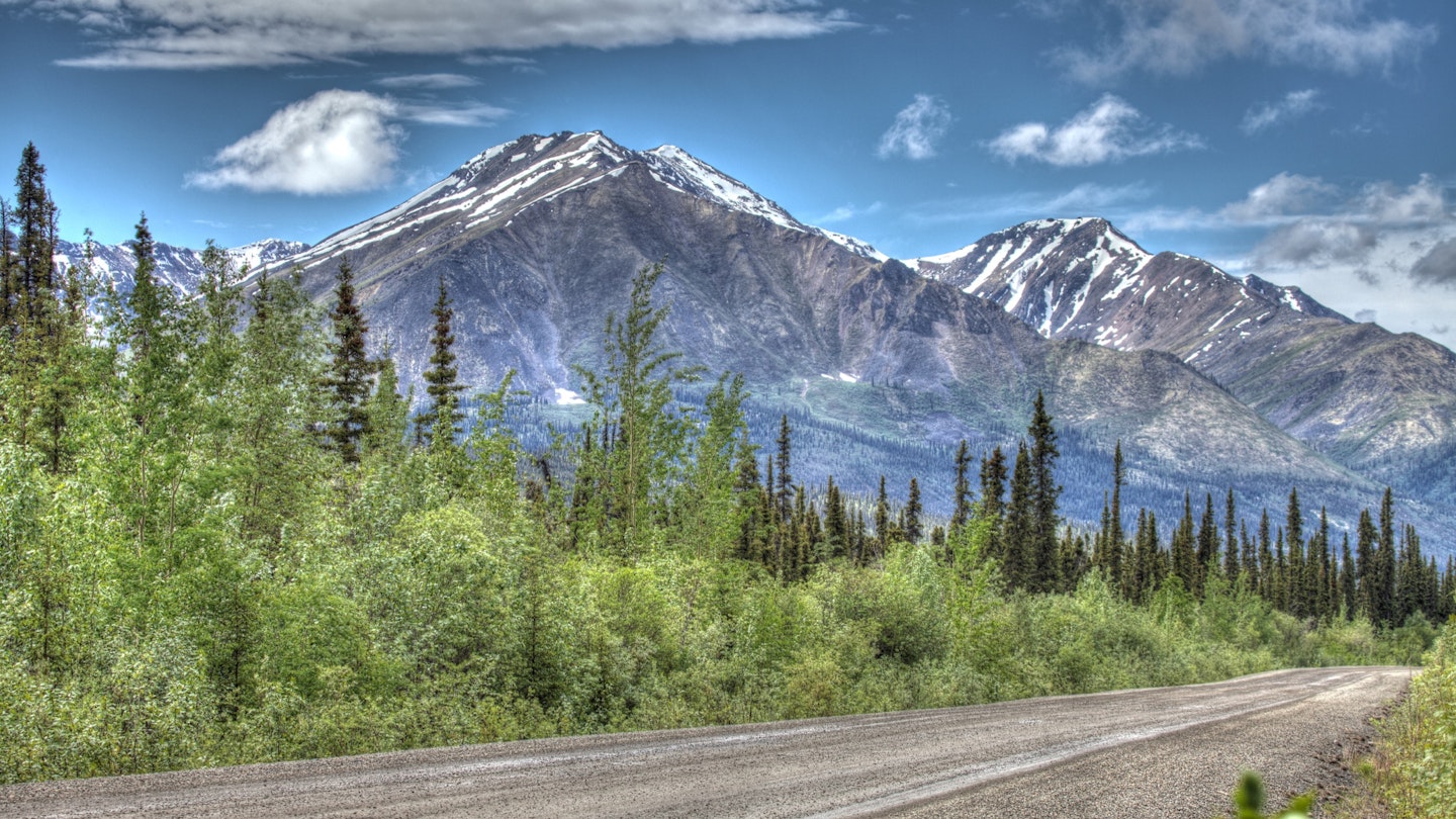
Few people get to see the remarkable, unique features of the harsh northern landscape around the Dempster Highway up close. © Murphy_Shewchuk / Getty Images
I pause at the deserted gas station at the turnoff from the Klondike Highway onto the Dempster and check my gas tank for the umpteenth time. I’ve been up since dawn in preparation for my journey and am in no doubt about the seriousness of my undertaking. It’s a long and lonely ride to the next pit stop and I’m very much on my own.

I’m no stranger to driving challenging roads. I cut my teeth on Chile’s Carretera Austral when the legendary highway was more pothole than road and drove it in an ancient little Skoda – and even so, the Dempster gives me pause. Before I trade the bitumen of the Klondike Highway for the gravel and shale of the Dempster and point my SUV northwards, I can’t help but recall a line from a Mary Chapin Carpenter Song: “Now it’s too late for turning back/I pray for the heart and the nerve...”
Canada ’s legendary highway ribbons its solitary way for some 764km from near the Klondike Gold Rush settlement of Dawson City in the Yukon to Inuvik, the northernmost town in the Northwest Territories . It’s the only highway in Canada to cross the Arctic Circle and, as of 2019, it’s the only road that allows you to drive from mainland Canada, all the way to the shores of the Arctic Ocean. It bisects swathes of virgin spruce forest – and cuts across vast empty spaces of undulating tundra. There are no settlements along the way until you reach the mighty Peel River and the small Gwich’in town of Fort McPherson, some 555 km into the journey, and little signs of human life until you hit Eagle Plains, a motel/gas station combo at Km365, roughly halfway to Inuvik, where I plan to break for lunch.
Related coverage: Never mind the hypothermia – easy winter adventures in the Yukon
Hours fly by in a meditative blur of green spruce that flanks the road on both sides, as I revel in the silence and stillness of the land around me, punctuated only by the gravel flying from beneath my tires. I begin to believe that the challenges of the Dempster have been vastly exaggerated until a sharp beeping from the console shocks me out of my state of complacency. Car rental companies in Whitehorse will only allow 4WD vehicles on the Dempster and my souped-up SUV comes with rudimentary tools in case of (likely) breakdown. Back in the day, the Dempster was covered solely in tire-shredding shale, and drivers brought two spare tires with them. I’ve taken a chance by carrying just one spare tire, and though I theoretically know how to change one, I’d rather not turn my back on the forest due to wildlife concerns. So far I’ve only caught a glimpse of five denizens of the woods – a black mama bear and her three cubs crossing the road some distance away, and a shy wolverine, but this is grizzly bear country as well.

I coast on a near-flat the last 25 kilometers to Eagle Plains, where the mechanic fixes my car and refuels it. There are three RVs parked outside the lonely motel, plus a pair of dusty cyclists adjusting the panniers on their bicycles – the most traffic I’ve seen so far today. One of the most daunting (and exhilarating) aspects of driving the Dempster is the near-isolation; even during the height of summer, you’re unlikely to see more than a dozen motorists during your entire journey and there is no phone signal en route. The hubbub and the exchanged greetings inside the busy diner is a welcome culture shock after hours spent in silence and solitude.
The weather turns as I pull away from Eagle Plains. The Dempster is open pretty much year-round, barring the freezing (Nov-Dec) and the thawing (Mar-Apr) of the Peel and the Mackenzie rivers, and the advantages of travel in winter include a lack of mosquitoes, and often-visible northern lights (but also the chance of freezing if you break down). I’m travelling at the most popular time of year (summer – as opposed to the October to March winter), when there are more fellow motorists to rely on, but the weather is unpredictable at best. Torrential rain turns the unpaved road into a mudslide and it’s all I can do to keep my car steady as it attempts to glide off the side of the road.
It’s wondrous to watch the changes in the landscape beyond the Arctic Circle. Dense spruce forest gives way to dwarf trees and then the land opens up, suddenly and dramatically, with rolling tundra stretching to the horizon and bare, snow-tipped hills soaring to one side. Then fog descends without warning, and for a short while, I can barely see a few meters in front of me and slow down to a crawl. Out here, you’re very much at the mercy of the elements.
A few more hours and two car ferries later, I finally make it to Inuvik, twelve hours after I’d started out and shaking with exertion.
Days later, I’m retracing my steps, having enjoyed the small-town hospitality of this remote northern town and having driven the new highway that connects Inuvik to the tiny Inuit settlement of Tuktoyaktuk, on the banks of the Arctic Ocean. Three years prior, I’d flown over the tundra, the myriad ice-melt lakes and pingos (permafrost hillocks). So few people get to see these remarkable, unique features of this harsh northern landscape up close; I’m truly one of the lucky ones.

In Fort McPherson, I’m turned away from the car ferry landing. “The water levels are too high.” Ferry service may resume the following day, or not. I’m hugely glad that I allowed myself a couple of extra days for the drive back, but it’ll be tight to make my flight out of Whitehorse. I spend the night in Fort McPherson’s only motel, waiting for word about the ferry. Serendipitously, the delay coincides with the July 1 Canada Day celebrations; locals invite me to join their merry cookout outside the community center, while a Gwich’in teenager paints a maple leaf on my cheek.
Luckily, I’m able to leave the following day, and a reverse blur of tundra, snowy hills, glacial rivers and endless spruce forest follows. I stop to stretch my legs at the entrance to Tombstone Territorial Park , some 70km from the southern end of the Dempster and gaze wistfully at the mountain peaks in the distance, making a silent vow to return one day and camp among its harsh peaks and valleys.
As I near the junction with the Klondike Highway, I smell gasoline and my fuel tank dramatically empties within seconds. Somehow I’ve managed to puncture it on the very last stretch. But luck is with me, just as it has been my entire trip; I’m promptly rescued by a kindly local and given a ride onwards to Dawson City – a fitting end to a dramatic journey that exceeded every expectation.
Produced by Lonely Planet for Travel Yukon. All editorial views are those of Lonely Planet alone and reflect our policy of editorial independence and impartiality.
Explore related stories

Jul 22, 2020 • 5 min read
From desert to coast, here are some of the most beautiful drives in the Americas to inspire your next road trip.

Jul 2, 2020 • 9 min read

Mar 30, 2024 • 4 min read

Mar 25, 2024 • 8 min read

Mar 24, 2024 • 7 min read

Mar 20, 2024 • 8 min read

Mar 19, 2024 • 6 min read

Feb 24, 2024 • 6 min read

Feb 7, 2024 • 5 min read
The Dempster Highway Road Trip Guide
By: Author The Drivin' & Vibin' Team
Posted on June 14, 2021
Tucked away in northwest Canada is a remote highway you may have never heard of – the Dempster Highway. But it’s a trip you might want to consider taking.
Traveling the Dempster Highway in Canada will certainly provide you with the perfect mix of history, fun adventures, and stunning views.
Today, we’ll look at the Dempster Highway and find out what you can expect on this unique road trip.
Let’s go!
Where is the Dempster Highway?
The Dempster Highway is in northwest Canada, crossing two territories. In fact, the Dempster Highway connects the Klondike Highway in Yukon to Inuvik, Northwest Territories, on the Mackenzie River delta.
The route will also take you over the gorgeous Peel and Mackenzie Rivers. The start of Dempster Highway begins 25 miles east of Dawson City, Yukon.
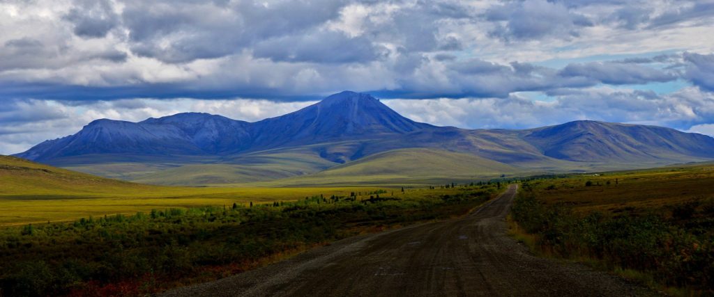
History of the Dempster Highway
The Dempster Highway’s name honors Corporal William Dempster from the North-West Mounted Police. In December 1910, an inspector named Francis Joseph Fitzgerald and three other men went on an annual winter patrol from Fort McPherson to Dawson City. Sadly, the men became lost on the trail, and as a result, died of exposure and starvation.
In March 1911, Corporal William Dempster and two others went on a rescue mission to look for Fitzgerald and the three others. Dempster and the men later found the bodies of the patrol on March 22, 1911.
Completed in 1978, the Dempster Highway was a 19-year project that began in 1959. The discovery of oil in the area led to the construction of the Dempster Highway to allow for further exploration. In 1978 the highway was completed, but it officially opened in August of 1979. The route follows the old dog sled route that takes you from Dawson City to Fort McPherson. The highway helps connect this northern region to southern Canada and also supports the transporting of supplies.
How Long is the Dempster Highway?
The Dempster Highway covers 456 miles taking travelers from Dawson City to Inuvik, NWT. While this route covers less than 500 miles, be ready for a long trip. The road can be slow going at times and has limited services. Those preparing to tackle this journey should expect to spend at least two days driving in each direction.
Is the Dempster Highway Dangerous?
While the Dempster Highway is a remote road, it is in good condition. Drivers should always be alert, watching out for changes in the road, potholes, oncoming traffic, and wildlife. The route can be tight in some locations and might require drivers to pull over when facing oncoming traffic.
Even if your vehicle can cover 500 miles without many fuel stops, you will want to bring along extra fuel as there are only two places to stop for services. Running out of fuel could lead to a long day.
Due to the limited services provided on this highway, drivers should have a full-size spare tire with them at all times. Those with unusually sized tires or RVs may want to consider having multiple spares so you can ensure a smooth experience if you have a blowout or two.
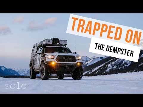
Dempster Highway in Dawson City
Dawson City is the launching point onto the Dempster Highway, but don’t bypass it in your eagerness to begin the drive. This walkable city transports you into the exciting world of the gold rush. There are tours to help you get a complete picture of both the historical components and modern advances of Dawson City.
If you’d like to try your hand at gold panning, you’re in luck! Drive out to Free Claim #6 and spend your day having fun trying to strike it rich. This free location provides no guides or supplies, so you’ll need to come prepared.
Dempster Highway at the Arctic Circle
If crossing into the Arctic Circle is on your bucket list, you’ll be able to check off that box while driving the Dempster Highway. Just past the highway point of your drive, you’ll find yourself at latitude 66° 33’, otherwise known as the Arctic Circle.
Crossing into the Arctic Circle will reward you with great photo opportunities, including a sign to mark the accomplishment. If you plan it right and can be there to experience the summer solstice, you’ll be able to watch the sun circle around you, never setting.
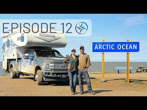
Dempster Highway in the Northwest Territories
Now that you’ve made your way to the northern portion of the Dempster Highway, you’ll get to experience the Northwest Territories. Beautiful views of the Richardson Mountains will give way to the Peel River. Here you’ll cross the river via a free ferry or ice bridge, depending on the time of year.
Between Peel River and Mackenzie River, you’ll find the Lost Patrol Gravesite. This is where the men from the Northwest Mounted Police patrol lay at rest. From there, you can cross the Mackenzie River, again, by either a free ferry or ice bridge.
Hiking on the Dempster Highway
The experience of being on the Dempster Highway doesn’t limit you to staying in your car. Part of the experience is getting out and exploring. Thankfully there are a few great hikes to enjoy along the way.
Tombstone Goldensides
The Tombstone Goldensides hike will take you on an out-and-back journey that’s a bit over two miles in length. There’s an elevation gain of 718 feet, and it’s rated as easy. So, all skill levels should enjoy this hike.
Those who choose to trek Tombstone Goldensides will experience views of the valleys of Tombstone. Wildlife viewing is another excellent opportunity for hikers. At the turnaround point, the more adventurous can scramble up the rocks for a spectacular 360-degree view.
Tombstone Grizzly Ridge
Tombstone Grizzly Ridge is a three-mile hike not far off Dempster Highway. This trail is a moderate hike with an elevation gain of 1387 feet. While you’ll climb a considerable amount, the effort is worth it. This hike will present you with views of Mount Monolith, which is at the end of Grizzly Valley.
The trail is well-defined and easy to follow. It’s certainly one of the most popular hikes in Tombstone Territorial Park, and it’s easy to see why. The views combined with a trail in excellent condition make it the perfect escape for hikers. Those who’d like to extend their hike can continue to follow the ridge towards Grizzly Lake.
Camping on the Dempster Highway
Once you get on the Dempster Highway, you’ll have the urge to slow down and enjoy the experience a bit longer. Camping along the Dempster Highway is a great way to prolong the drive and allow you to take it all in. We’ve gathered a few options for you to stop and enjoy an evening on the Dempster Highway.
Tombstone Mountain Campground
Tombstone Mountain Campground provides a great place to rest while on your Dempster Highway journey. These are basic no-frills sites but are adequate for a simple stay. The views, hiking available, and wildlife viewing make this a great place to spend the night or even a few days.
At the campground, you will find vault toilets for those who would like to make use of them. Water is available, but you should boil or filter it before use as it is straight from the nearby river. Some campers report that firewood is provided for free, setting you up for a great evening around the fire.
Pro Tip: This campground can fill up quickly in the busy season, so be sure to arrive early to snag a spot.
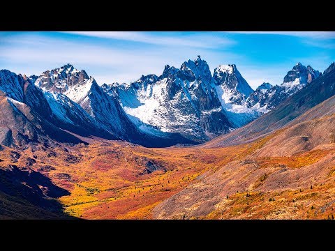
Eagle Plains Hotel and RV Campground
If you’re tired of roughing it and need a place to refuel both yourself and your rig, Eagle Plains Hotel and RV Campground is exactly what you need. Located about halfway through the Dempster Highway, this is the perfect midway pitstop. There’s even a lovely dining room for those tired of cooking and dishes.
Eagle Plains Hotel and RV Campground has electric and nonelectric sites and has potable water available. Other amenities include a laundry room, showers, gas, diesel, and propane fill-ups. They can even help you if you’ve been having tire problems or other minor repairs. While the sites themselves are not large, it does the job of providing much-needed rest and refueling.
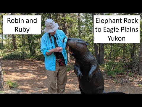
Explore the Dempster Highway
With so many great places in Canada to explore, it can be difficult to know where to go. But, we think a road trip on the Dempster Highway is well worth your time! The wildlife, amazing views, and history are waiting for you! Will you be adding Dempster Highway to your Canada bucket list?
Discover the Best Free Camping Across the USA
To be honest with you, we hate paying for camping . There are so many free campsites in America (with complete privacy).
You should give it a try!
As a matter of fact, these free campsites are yours. Every time you pay federal taxes, you’re contributing to these lands.
Become a FREE CAMPING INSIDER and join the 100,000 campers who love to score the best site!
We’ll send you the 50 Best Free Campsites in the USA (one per state). Access the list by submitting your email below:
Tips for Driving on the Dempster Highway
One of the most beautiful road trips you’ll ever take might not even be on a paved road..
The Dempster highway is a 737 km road that stretches from the Klondike Highway in the Yukon to Inuvik in the Northwest Territories. The Inuvik-Tuktoyaktuk Highway continues this stretch of road from Inuvik to Tuktoyaktuk, reaching the Arctic Ocean.

So what is it like to drive on the Dempster Highway?
It’s unpaved, there’s loose rocks and bumps galore, and no lines dividing the traffic. But the views along the highway are just spectacular.

Make no mistake, this highway is not your regular highway that you may come across in metropolitan cities. Gas stations are sparse along the entire stretch (Eagle Plains 365.7 km, Ft. McPherson 555 km, and at Inuvik), no restaurants other than at the aforementioned gas stations, and no cellular access. Instead, there’s some Territory-run campgrounds (the first one being Tombstone Territorial Park ), the terrific Tombstone Interpretive Center that is a must-visit, some private campgrounds, and plenty of pull-out areas for a quick rest or overnight stay—some of which even have outhouses.

The highway is more suited for SUVs, trucks and the like, but is still drivable with regular vehicles, trailers, and campers. During the more favourable driving conditions (summer and fall), you’ll find that most of the vehicles on the road are large transport trucks, SUVs, and a whole lot of campers and trailers.

During my first visit to Yukon in early September, we rented an RV camper van at Canadream in Whitehorse. We drove it up the Klondike Highway making several stops along the way for pictures, and made our way to Dawson City and Tombstone Territorial Park. We continued on the Dempster Highway until about the 170 km mark, at which point we headed back to our pull-out area where we had decided to stay for the night. Our intention was never to go all the way to the Arctic Ocean this time around since we weren’t properly prepared.

So how do you prepare yourself to drive on the Dempster Highway?
Gas stations are very limited on the Dempster Highway, as mentioned above. While it is completely possible to travel the entire stretch without extra gas canisters for your car or truck, why risk it? If you run out of gas in between gas stations, you’re pretty much stuck there until someone else comes and helps you out.
At the beginning of the Dempster Highway in the Yukon, there is an APD gas station with a public card lock. If you can get the card lock to work, fill your vehicle up here. We could not get the card lock to work despite following the instructions step by step. I even phoned the number listed there for additional help only to get an answering machine. We asked someone else who came by and they said this station was very unreliable. We ended up driving all the way back to Dawson City—about 40km away—to fill up on gas, and bought an extra 20 litre jerry can of gas.
From the start of the Dempster Highway, your next gas station is at Eagle Plains, 365 km away.

Spare tires are also essential when travelling on the Dempster Highway. With so many loose rocks, bumps, and who knows what else on the gravel and unpaved roads, your tire will go through a lot of abuse. If you don’t have a spare tire and your tire ruptures, you’re out of luck unless someone else on the highway happens to have a spare. Don’t take the risk and make sure to carry at least one, maybe even two spares.

It’s possible to drive the entire stretch of the Dempster Highway in one day (approximately 12 hours), but why would you when you have the most beautiful expanse of Mother Nature right there in front of you? There’s so much natural beauty along the way there is no way I would even want to drive it in one day: Enjoy the ride, camp for a night or two, and continue on your journey. This is one time when the journey can be just as exciting as the destination itself.

Driving an RV on a bumpy highway means not going very fast. While I drove to the 170 km mark, the fastest I drove was 80 km/h, and that wasn’t even for very long. With every bump on the road, the camper would make noises, dishes would shift in the cupboard, and your hope for great suspension gets stronger. Don’t expect to go 100 km/hr through the entire highway. Add this to the various stops you will take for bathroom breaks and pictures, and it’s probably best to take your time getting to the end.

Hiking Trails
If you enjoy hiking, there are plenty of trails for beginners and experts alike. Scattered throughout the highway, if you choose to take these hikes, you’ll definitely want to slow your pace and make this a multi-day trip. Tombstone Territorial Park also houses some great interior camping trails that can take as much as six or seven days to complete (round trip). There are, of course, shorter hikes like Goldensides, which can be done in a couple hours round trip.

Aurora Borealis
If none of the above were reason enough for you to slow down and enjoy the ride, seeing Mother Nature’s most incredible light show should tip the scale. Starting from mid-late August is the Aurora Borealis viewing season. With nights getting darker by the day, on a clear night you will have a great chance of seeing the Northern Lights.

With much of the Dempster Highway sitting beneath the Auroral Oval, it is in an ideal location to view the show. During our time on the highway, we saw the lights for three nights in a row, and it couldn’t have been more spectacular. Since the Aurora Borealis occurs at night and well into the wee hours of the morning, you will need to stay the night to see the show.

Cellular Service
I mentioned above that there are no cellular services on the highway, and this should be a good thing. Take the time to appreciate where you are and enjoy the ride.
Some people have mentioned getting very spotty cellular services in Inuvik or even in Tuktoyaktuk (depending on your provider), but I wouldn’t rely on this. You can rent satellite phones in Whitehorse for added safety.
There is also free wifi at the Tombstone Visitor’s Centre, if you really need it.

Our time on the Dempster Highway was relatively short, but that’s because it wasn’t our intention to drive all the way up to the Arctic. We decided to save that trip for another trip to the Yukon, which will hopefully be sooner rather than later!

Have you driven on the Dempster Highway? Let me know what your experience was like in the comments below!

The Dempster Highway Travelogue
This guide that I picked up at the Tombstone Visitor’s Centre offers a great summary of attractions on the Dempster Highway. From Caribou crossing paths etched along the mountainside (which we could not find) to interesting river crossings, we followed this guide all the way to the 170 km mark, or Red River.
Download the PDF from the link above!
For more information on the Dempster Highway, this website offers a great km-by-km summary of attractions on the Dempster Highway: https://www.bellsalaska.com/highway/dempster-highway .
Additional information on the highway can be found here too: https://www.dempsterhighway.com .

6 thoughts on “Tips for Driving on the Dempster Highway”

Hi Taku and Naomi. Loved your commentary. We too took our time along the highway staying overnight at tombstone campsite and also just off the road near the Arctic Circle ! We were there in July so no aurora but the scenery was still spectacular. Stopped at Fort McPherson (the church yard where the rcmp men who lost their way ) and another little native village where you take a ferry to and then take same ferry back across the McKenzie river to drive to inuvik. The road to til was not open when we were there but it is my dream to drive the whole route once again this time in the fall to see the colours as you did. Maybe next fall. Loved the community garden in inuvik snd the aboriginal handicraft store on top floor of the building to the right next to the tourist store. Incredibly beautiful Inuit hand sewn clothing and crafts. Hope all is well with you both. Xoxo

Thank you Marilyn! I’m so glad you were able to explore the Dempster too! I will take note of your experiences and hope that one day I can too go all the way up north to the arctic. The Fall is indeed a wonderful time to go there—not to mention the Aurora Borealis at night, so I would aim for Fall too!

Hi there and thank you for what you wrote, very helpful. Did you drive back to Whitehorse and there is a special insurance needed for the vehicle you rented? Thanks again, your explanation of the trip is very good and clear!
Hi George! Thanks so much for dropping by and reading! Yes, after our trip on the Dempster Highway, we made our way back to Whitehorse while stopping a night at another pullout just outside of Whitehorse to see the Northern Lights. Can you tell I love seeing them? As for insurance, I believe it was included in the rental package from Canadream, and it was mandatory that you get it. Your credit card insurance typically doesn’t insure camper van rentals, as far as I’m concerned. But rest assure the people at Canadream will make sure you have everything you need to enjoy your travels in their RVs. I hope you enjoy your travels wherever it may take you!

I drove the Dempter Highway in early summer 2018. I had to returned at approximately 250 km mark, as the road was too muddy for a tiny Mirage. The scenery was spectacular along the way.
I took two hiking trails at Tombstone. I still plan to drive the entire route someday, maybe in the fall season when the highway may not be as muddy as the spring/summer.
Sounds like a great trip James. I definitely recommend a trip back in autumn—first week of September is usually peak around that area. The roads weren’t too muddy, but definitely bumpy in various areas so an SUV is best suited IMO. Likewise I will have to return one day too to complete the trip.
Leave a Comment Cancel Reply
Your email address will not be published. Required fields are marked *
Save my name, email, and website in this browser for the next time I comment.
Privacy Overview
- Toll Free: 1-800-347-7126
- Intl: 1-403-259-5447
- Online Check-in
- Agent Portal
Rental Vehicles
- Maxi Travel Camper (TCA)
- Deluxe Van Camper (DVC)
- Super Van Camper (SVC)
- Compact Motorhome (MHC)
- Midi Motorhome (MHB)
- Maxi Motorhome (MHA)
- Maxi Plus Motorhome (MHX)
Special Offers
- Relocation Offers
- 2025 Early Booking Deals
- Easter Eggstra Savings
- My CanaDream
- Liability Reduction Options
- How To Videos
- Travel Extras
- Temporary Accommodation
- Book Now Pay Later
- Payment Options
- Free Winter E-Book
- CanaDream Cares
Go Global with THL
- 30 Years of CanaDream
Be Inspired
- Trip Planner
- Destinations
- Itineraries
- Ski Safaris
- Guide Books
Download Our Guides

- Gift Certificates
CanaDream Club
- Hotel & Parking Offers
- Ski Resort Specials
- Premium Partners
- Fuel Savings
- Club App Booking Offers
- Campertunity
- Sustainability
Join the Club
- Be a Campground Partner
- Be an Attraction Partner

- Club Savings
- Discovery Pass
- Explore the Club
- Solis Mobile Hotspot
- View Inventory
- RV Financing
- RV Sales FAQ's
- CanaDream Club for Owners
- Rent Before You Buy
RV Sales Locations
- Truck Camper
- RV Specials
- Certified Winter Ready RVs
Click to Learn More
- Financing your RV
- Certified Adventure Ready
Service & Parts
- Calgary RV Storage
- Halifax RV Storage

- Vehicles Back Vehicles
- Maxi Travel Camper (TCA) Back Maxi Travel Camper (TCA)
- Deluxe Van Camper (DVC) Back Deluxe Van Camper (DVC)
- Super Van Camper (SVC) Back Super Van Camper (SVC)
- Compact Motorhome (MHC) Back Compact Motorhome (MHC)
- Midi Motorhome (MHB) Back Midi Motorhome (MHB)
- Maxi Motorhome (MHA) Back Maxi Motorhome (MHA)
- Maxi Plus Motorhome (MHX) Back Maxi Plus Motorhome (MHX)
- Saver 2 Back Saver 2
- Saver 4 Back Saver 4
- Saver 6 Back Saver 6
- Winter RV Back Winter RV
- Vancouver Back Vancouver
- Calgary Back Calgary
- Toronto Back Toronto
- Montreal Back Montreal
- Halifax Back Halifax
- Edmonton Back Edmonton
- Whitehorse Back Whitehorse
- Hot Deals Back Hot Deals
- Relocation Offers Back Relocation Offers
- Winter Vacation Deals Back Winter Vacation Deals
- Rewards Back Rewards
- 2025 Early Booking Deals Back 2025 Early Booking Deals
- My CanaDream Back My CanaDream
- How To Videos Back How To Videos
- Travel Extras Back Travel Extras
- Temporary Accommodation Back Temporary Accommodation
- Book Now Pay Later Back Book Now Pay Later
- Payment Options Back Payment Options
- Liability Reduction Options Back Liability Reduction Options
- About Back About
- Contact Us Back Contact Us
- Careers Back Careers
- CanaDream Cares Back CanaDream Cares
- CAA Travel Insurance Back CAA Travel Insurance
- FAQs Back FAQs
- Go Global with THL Back Go Global with THL
- 30 Years of CanaDream Back 30 Years of CanaDream
- Blog Back Blog
- Destinations Back Destinations
- Itineraries Back Itineraries
- Camping Back Camping
- Trip Planner Back Trip Planner
- Ski Safaris Back Ski Safaris
- FAQ's Back FAQ's
- Gift Certificates Back Gift Certificates
- CanaDream Guides Back CanaDream Guides
- Explore the Club Back Explore the Club
- CanaDream Club Welcome Video Back CanaDream Club Welcome Video
- Hotel & Parking Offers Back Hotel & Parking Offers
- Premium Partners Back Premium Partners
- Fuel Savings Back Fuel Savings
- Download our App Back Download our App
- Club App Booking Offers Back Club App Booking Offers
- Discovery Pass Back Discovery Pass
- Solis Mobile Hotspot Back Solis Mobile Hotspot
- Campertunity Back Campertunity
- Sustainability Back Sustainability
- Be a Campground Partner Back Be a Campground Partner
- Be an Attraction Partner Back Be an Attraction Partner
- RV Sales Locations Back RV Sales Locations
- RV Financing Back RV Financing
- RV Sales FAQ's Back RV Sales FAQ's
- CanaDream Club for Owners Back CanaDream Club for Owners
- Truck Camper Back Truck Camper
- Class B Back Class B
- Class B+ Back Class B+
- Class C Back Class C
- Trucks Back Trucks
- Certified Winter Ready RVs Back Certified Winter Ready RVs
- Service Back Service
- Parts Back Parts
- Calgary RV Storage Back Calgary RV Storage
- Pricing Back Pricing
- Lot Map Back Lot Map
Get RV Rental Pricing & Availability
- {{pickup.Value}}
- {{dropoff.Value}}
- {{country.CountryNameEnglish}}
Get RV Sales Pricing & Availability
- All RV Types
- {{rvType.Name}}
- All Locations
- {{location.Name}}
- {{sleepCapacity.Name}}
- {{maxPrice.Name}}

Blog RVing the Dempster Highway and Beyond

Where is the Dempster Highway and what is the best way to travel it?
The Dempster Highway (known locally as 'the Dempster") is a 736km long road beginning 40km east of Dawson City, Yukon , continuing north of the Arctic Circle, and ending in the Northwest Territories town of Inuvik . Road conditions vary greatly, but essentially it's an unpaved road built from gravel, shale and clay. To say it can be 'bumpy' is an understatement but more about that soon.

How long does it take to drive the Dempster Highway?
Our advice - take your time. Theoretically, you can travel it in 12-14 hours but why would you? There is so much spectacular scenery on the way, along with opportunities to hike, that the minimum you should spend on this road is 2-3 days. It's probably going to take twice the time you think it will - we averaged just over 50km an hour so we ended up assuming that a 100km distance would take us at least 2 hours to cover. At times, this meant long days driving.
Does the Dempster Highway cross the Arctic Circle?

What sort of road conditions will I encounter on the Dempster Highway and the Inuvik to Tuktoyaktuk Highway?

Regardless of the vehicle you decide to travel in, make sure your tires are in good condition before you set out. Carry at least one (preferably two) good spares with you - we were lucky not to have to use ours but many weren't. If you have the opportunity to take out windshield insurance, do it. You'll be sharing the road with semis and large vehicles, and windshield chips and cracks are common.
Can I travel the Dempster Highway year-round?

When deciding the best time to travel the highway, think about what you want to see and do. Peak times are around the summer solstice when the sun never sets and during the Fall when the arctic tundra changes colour and takes your breath away. June through mid-August bring fairly warm temperatures while late August through September could be considered jacket weather.
Where can I camp along the Dempster Highway?

Can I fill my freshwater tank and empty my holding tanks along this highway?
If you're planning to spend a number of days on the Dempster, you should be aware that we found no opportunities to empty our waste tanks between Dawson City and Inuvik. Before you leave these towns, ensure your tanks are empty and your freshwater tank is full. If you're travelling in a truck camper as we were, our black tank held only 13 US gallons so we used it sparingly and utilized campground toilets wherever possible. Fresh water fill is available at Eagle Plains.
Where can I get gas, diesel or propane along the Dempster Highway?
Fill up in either Dawson City or at the Dempster Corner cardlock station. After Dempster corner there are no gas stations for 370km. Fill up again in Eagle Plains, a roadside service area with a permanent population of 8 people. It's not really a town but you can gas up here, service your vehicle, get propane, buy small essentials and get a good meal. There's a place here to camp with electrical hookups and you can refill your freshwater tank. It's less than an hour from the Arctic Circle sign so a good place to overnight. Wi-Fi is available in the lobby and restaurant areas but there is no cellphone service. Coming back down the Dempster, make sure you have a full tank when you leave Inuvik. Fuel is also available in Fort McPherson.
If you have a CanaDream TCA, you'll leave with two full 9kg propane tanks. When one runs out, you should switch to the other and find a propane filling station. These are available only in Inuvik, Eagle Plains and Dawson City.
Is there cellphone service on the Dempster Highway?
There were small pockets of cellphone service on the highway near the few towns we came to but nothing you could rely on. We found ourselves travelling sometimes for a couple of hours without seeing another vehicle so keep in mind that help could be hard to find. We passed many crumbled vehicles in roadside ditches but acknowledge many had been there for a long time - given the isolation on this road, it's often not worth recovering them. We opted to rent a sat phone for the trip - we didn't need to use it but felt good about having this 'insurance' should anything have happened.
Where is Tuktoyaktuk and is it on the Arctic Ocean?

What are the 'must see' places along the Dempster Highway?
For mile by mile in-depth information on travelling the Dempster Highway (and many other routes in the Yukon, Alaska and Northwest territories), you can beat The Milepost, available for purchase online. If you just want to take in the highlights, here's our pick of stopping places.
Km 0. Everyone needs to stop here - if not to gas up before continuing north, to have your picture taken by the Dempster Highway sign.
Km 71. Tombstone Territorial Park could be considered the 'crown jewel' of the Dempster. It's a place of stunning arctic tundra, abundant wildlife, First Nations culture and opportunities for hiking and back-country camping. Call in at the Interpretive Centre (open May to September) for information. The Tombstone Territorial Park Campground is close by. There are some easy short hikes here.
Km 74. Be sure to stop at the Tombstone Mountain Viewpoint for stunning views of the surrounding area. If you're travelling in the fall, the colours are breathtaking.

KM 180. Red Creek. Here the hills and creeks are a rusty brown due to high levels of iron.
KM 260. Ogilvie Ridge Viewpoint. Great views of the tundra and mountains.

KM 405.6. The Arctic Circle sign.
KM 465. Boundary between the Yukon and the NWT. It also marks a crossing of the Continental Divide. Between March and November the Northwest Territories is one hour ahead of the Yukon.
KM 539. Peel River Crossing. The first of the free ferry crossings on the Dempster. There's a nice NWT campground close by with hot showers and flush toilets but no sani-dump or water fill.
KM 550. Fort McPherson. A small hamlet in the traditional territory of the Teetl'it Gwich'in First Nation. Gas is available here.
KM 608. Mackenzie River Crossing. A slightly longer ferry crossing across the Mackenzie River. This ferry also services Tsiigehtchic as required so you may experience a short wait here.

It is truly a bucket-list trip and one we would do again, given the opportunity. If it's also on your bucket list, start planning now. Give CanaDream a call to enquire about renting a truck and camper for the trip. We'd also recommend taking out third-party supplementary insurance with a company like rentalcover.com to cover items not covered by the rental company insurance. It's fairly cheap and covers undercarriage and roof damage as well as other things excluded in the rental company's plan. If renting a sat phone for the trip is important to you - check out Up North Adventures .
You can online chat with CanaDream on their website, email them at [email protected] or phone them for more information about RV Rentals in Whitehorse . Of course, you can also pick up from a different location (a northern surcharge fee applies) and one-ways are often available into and out of Whitehorse (one-way charge applies). Where we camped: Dawson City - Dawson City RV Park - Full hookups Eagle Plains - Electrical Hookups away from the hotel accommodation. Fresh water available at shower block. Inuvik - Happy Valley Territorial Park. Electrical Hookup. Fresh water and sani dump on site. Laundry and showers on site. Tuktoyuktuk - The Point. No services. Stop at information centre to pay camping fee. Each site has a picnic table. Peel River - Nataiinlaii Territorial Park Campground. No hookups, no water fill and no sani dump. Showers and flush toilets. Dempster Highway - Engineer Creek Campground. No hookups, no water fill and no sani dump. Pit toilets. Tombstone Territorial Park - Tombstone Campground. No hookups, no water fill and no sani dump. Fresh water is available in buckets but not enough pressure to fill fresh water tank. Dawson City - Bonanza Gold Motel & RV Park. All services. Flush toilets and showers, Laundromat. RV Wash.
More Stories

Eggs-tended! Spring RV Savings

The Dempster Highway
TRAVEL PLANNING
The Dempster Highway is a 740 KM (460 miles) hard packed, but well maintained, gravel road that winds its way through two mountain ranges, the Ogilvie and the Richardson; crosses the continental divide three times, traverses the Arctic Circle and loosely follows the old dog team routes on its way to Inuvik and the Mackenzie Delta where access to the Arctic Ocean is available.

- Election 2024
- Entertainment
- Newsletters
- Photography
- Personal Finance
- AP Buyline Personal Finance
- Press Releases
- Israel-Hamas War
- Russia-Ukraine War
- Global elections
- Asia Pacific
- Latin America
- Middle East
- Election Results
- Delegate Tracker
- AP & Elections
- March Madness
- AP Top 25 Poll
- Movie reviews
- Book reviews
- Personal finance
- Financial Markets
- Business Highlights
- Financial wellness
- Artificial Intelligence
- Social Media
What to know about the cargo ship Dali, a mid-sized ocean monster that took down a Baltimore bridge
Crews were set to begin removing the wreckage of a collapsed highway bridge in Baltimore on Friday. Maryland Gov. Wes Moore said a large crane, which can lift up to 1,000 tons, would be one of at least two used to clear the channel of the twisted metal and concrete remains of the Francis Scott Key Bridge, and the cargo ship that collided with it this week.
The container ship Dali, owned by Grace Ocean PTE, rests against wreckage of the Francis Scott Key Bridge in the Patapsco River on Wednesday, March 27, 2024, as seen from Pasadena, Md. Investigators began collecting evidence Wednesday from the cargo ship that plowed into Baltimore’s Francis Scott Key Bridge and caused its collapse, while in the waters below divers searched through twisted metal for several construction workers who plunged into the harbor and were feared dead. (AP Photo/Alex Brandon)
- Copy Link copied
In this image taken from video released by the National Transportation and Safety Board, the cargo ship Dali is stuck under part of the structure of the Francis Scott Key Bridge after the ship hit the bridge, Tuesday, March 26, 2024, in Baltimore. (NTSB via AP)
Here’s what to know about the cargo ship Dali that crashed into Baltimore’s Francis Scott Key Bridge, causing it to collapse and leaving six bridge construction workers presumed dead.
MONSTERS OF THE OCEAN
If stood upright, the Dali would reach almost to the top of the Eiffel Tower in Paris or about two-thirds of the way up the Empire State Building in New York.
It can carry the equivalent of almost 10,000 standard-sized metal shipping containers, and at the time of the accident was carrying nearly 4,700 containers. But while those figures are impressive, the Dali pales in comparison to the world’s largest container ships, which can carry more than 24,000 containers. There are environmental and economic advantages to operating giant container ships , but their sheer size and weight make them difficult to maneuver and stop — especially when something goes wrong.
Dali length: 984 feet (300 meters). Weight: 95,000 tons when empty.
Capacity: 10,000 20-foot (6-meter) containers.
MAYDAY CALL SAVES LIVES
The ship shares a name with one of history’s most celebrated artists, Spanish surrealist painter Salvador Dali.
Built by South Korea’s Hyundai Heavy Industries, one of the world’s largest shipbuilders, the Dali was launched in late 2014. It’s owned by Grace Ocean Private Ltd, flies a Singapore flag and is powered by diesel engines.
Danish shipping giant Maersk had chartered the Dali for a planned trip from Baltimore to Sri Lanka, but the ship didn’t get far, with the crew sending a mayday call early Tuesday saying they had lost power and had no control of the steering system. Minutes later, the ship rammed one of the bridge’s columns, causing the entire structure to collapse within seconds.
The ship was moving at about 8 knots, or 9 mph (15 kph). The mayday gave just enough time for authorities to stop bridge traffic and likely prevent more deaths , but not enough time to clear the construction crew that was filling potholes on the bridge. Divers on Wednesday recovered the bodies of two of the workers.
All of the nearly two dozen crew members from the Dali were accounted for after the accident, with one taken to a hospital with minor injuries.
PASSED PREVIOUS INSPECTIONS
The Dali passed a June 2023 inspection in Chile. A faulty pressure gauge for the fuel heaters was identified but fixed before the vessel left the port, according to authorities. The Dali was then inspected in September by the U.S. Coast Guard in New York, and no problems were found. Before it left Baltimore, the ship underwent routine engine maintenance, according to the Coast Guard.
The container ship Dali, owned by Grace Ocean PTE, rests against wreckage of the Francis Scott Key Bridge in the Patapsco River on Wednesday, March 27, 2024, as seen from Pasadena, Md. (AP Photo/Alex Brandon)
Federal and state officials say the crash appears to be an accident.
The Coast Guard has downloaded the voyage data recorder and sent it to the National Transportation Safety Board, which is building a timeline of what led to the crash, and a preliminary report is expected in the coming weeks. Singapore also plans to carry out its own investigation, which it says will be to identify lessons for the future rather than determine liability.
WHAT’S NEXT
In addition to trying to clear the channel floor of the bridge debris, officials will need to assess the damage to the Dali and make sure it doesn’t leak fuel or sink. Investigators found damage to at least 13 containers on the ship.
The Dali will then likely be towed back to the port and the cargo offloaded.
Transportation Secretary Pete Buttigieg says it’s too early to say how long it will take to reopen the Port of Baltimore or replace the destroyed bridge. He noted it initially took five years to build the bridge .
Find Info For
- Current Students
- Prospective Students
- Research and Partnerships
- Entrepreneurship and Commercialization
Quick Links
- Health and Life Sciences
- Info Security and AI
- Transformative Education
- Purdue Today
- Purdue Global
- Purdue in the News
March 27, 2024
Building the first highway segment in the U.S. that can charge electric vehicles big and small as they drive

Purdue University engineers John Haddock (left), Nadia Gkritza, Dionysios Aliprantis and Steve Pekarek stand in the lab where they are testing technology they designed to enable all electric vehicle classes to receive power from the road. (Purdue University photo/Vincent Walter)
Construction to begin on test bed in Indiana to develop wireless charging for electric vehicles traveling at highway speeds
WEST LAFAYETTE, Ind. — At the “Crossroads of America,” Purdue University engineers and the Indiana Department of Transportation (INDOT) are working to make it possible for electric vehicles ranging from tractor-trailers to passenger cars to wirelessly charge while driving on highways.
Construction begins as soon as April 1 on a quarter-mile test bed on U.S. Highway 231/U.S. Highway 52 in West Lafayette that the team will use for testing how well a patent-pending system designed by Purdue engineers can provide power to a heavy-duty electric truck traveling at highway speeds.
“Thanks once again to some engineers and pioneers from Purdue, we’re developing the world’s first highway test bed for wireless charging,” said Indiana Gov. Eric Holcomb to attendees of COP27 , a United Nations environmental conference that took place in Egypt in 2022. “Please remember that one. Yes, we will be testing whether concrete can charge passing trucks — and don’t bet against a Purdue Boilermaker.”
The electric truck, provided by Indiana-based company Cummins Inc., will drive over the test bed as part of a pilot program tentatively planned to start next year. The hope is to electrify a section of an Indiana interstate in the next four to five years.
A few other states and countries have also begun testing roads that wirelessly charge EVs. But making this possible for highways — and heavy-duty trucks in particular — is a unique challenge. Because vehicles travel so much faster on highways than city roads, they need to be charged at higher power levels.
The Purdue-designed wireless charging system is intended to work at power levels much higher than what has been demonstrated in the U.S. so far. By accommodating the higher power needs for heavy-duty vehicles, the design is also able to support the lower power needs of other vehicle classes.
Why design electrified highways for trucks first?
An electrified highway in Indiana would serve much of the nation’s traffic. Eighty percent of the U.S. can be reached within a day’s drive from the state’s pass-through highways.
Building electrified highways with heavy-duty trucks in mind would maximize greenhouse gas reductions and the economic feasibility of developing infrastructure for EVs.
Heavy-duty trucks are one of the biggest sources of greenhouse gas emissions for the U.S. transportation sector because they make up a large portion of interstate traffic. Compared to passenger cars, these trucks also need a lot more fuel so that they can constantly transport everything from the packages we order to groceries.
“The so-called ‘middle mile’ of the supply chain, which refers to all the travel heavy-duty trucks have to do to carry goods from one major location to another, is the most challenging part of the transportation sector to decarbonize,” said Nadia Gkritza , a Purdue professor of civil engineering and agricultural and biological engineering .
But if electric heavy-duty trucks could charge or maintain their state-of-charge using highways, their batteries could be smaller in size and they could carry more cargo, significantly reducing the costs of using EVs for freight transportation. Since trucking contributes the most to U.S. gross domestic product compared to other modes of freight transportation, lowering costs for heavy-duty electric trucks could help attract more investment into electrifying highways that all vehicle classes would share.
“We’re developing a system that has the power to charge semitractor-trailers as they move 65 miles per hour down the road,” John Haddock , a professor in Purdue’s Lyles School of Civil Engineering, told U.S. News & World Report .

Highways that charge EVs like a smartphone
The technology Purdue is developing would enable highway pavement to provide power to EVs similarly to how newer smartphones use magnetic fields to wirelessly charge when placed on a pad.
“If you have a cellphone and you place it on a charger, there is what’s called magnetic fields that are coming up from the charger into that phone. We’re doing something similar. The only thing that’s different is the power levels are higher and you’re going out across a large distance from the roadway to the vehicle,” said Steve Pekarek , Purdue’s Edmund O. Schweitzer, III Professor of Electrical and Computer Engineering , in an episode of “American Innovators,” a Made in America series by Consensus Digital Media . “This is a simple solution. There are complicated parts of it, and that we leave to the vehicle manufacturers.”
In the wireless charging system that Purdue researchers have designed, transmitter coils would be installed in specially dedicated lanes underneath normal concrete pavement and send power to receiver coils attached to the underside of a vehicle.
Other wireless EV charging efforts are also using transmitter and receiver coils, but they haven’t been designed for the higher power levels that heavy-duty trucks need. The Purdue-designed coils accommodate a wider power range — larger vehicles wouldn’t need multiple low-power receiver coils on the trailer to charge from the road, which has been proposed to meet the high-power demands. Instead, in the Purdue design, a single receiver coil assembly is placed under the tractor, greatly simplifying the overall system.
Purdue researchers have also designed the transmitter coils to work within concrete pavement, which makes up 20% of the U.S. interstate system . Other coil designs have only been developed for use in asphalt pavement.
“The whole idea is if you can charge your car on the road while in motion, then you’re basically riding for free,” Aaron Brovont , a Purdue research assistant professor in Purdue’s Elmore Family School of Electrical and Computer Engineering, explained in a Scripps news segment .

The team has completed testing of how well 20-foot-long sections of concrete and asphalt could handle heavy loads with the transmitter coils embedded. The researchers imitated truck traffic by having a machine repeatedly drive a loaded one-half semi axle over the pavements.
Alongside the pavement mechanical tests, the team has also done lab tests verifying the electromagnetic performance of the bare transmitter coils and the receiver coils.
Laying the groundwork for highways that recharge EVs everywhere
As reported by The New York Times , CNBC , Scripps , Popular Mechanics and other news outlets, the research has the potential to define what EV charging looks like on highways.
The team’s partnerships are not just in Indiana, but also throughout the country. In addition to its funding from INDOT through the Joint Transportation Research Program at Purdue, the project is affiliated with a fourth-generation National Science Foundation Engineering Research Center called Advancing Sustainability through Powered Infrastructure for Roadway Electrification (ASPIRE) , dedicated to progressing the field of electrified transportation in all its forms.
Most real-world deployments of wireless pavement charging in the U.S. are led by members of ASPIRE. Purdue is a founding member of ASPIRE and Gkritza is the campus director of ASPIRE’s Purdue location.
Headquartered at Utah State University, ASPIRE integrates academia, scientific research, and real-world tests and deployments across more than 400 members from 10 partner universities: Purdue, the University of Colorado Boulder, the University of Texas at El Paso, the University of Auckland in New Zealand, Colorado State University, the University of Colorado Colorado Springs, Virginia Tech, Cornell University, and the University of Utah. These universities are joined by more than 60 industry, government and nonprofit members across all sections of the electric transportation ecosystem, as well as community partners and advisors.
ASPIRE’s members at Purdue and Cummins are also leading a project funded by the U.S. Department of Energy to develop an EV charging and hydrogen fueling plan for medium-duty and heavy-duty trucks on the Midwest’s Interstate 80 corridor. The corridor serves Indiana, Illinois and Ohio. The plan will examine the use of the wireless power transfer technology that Gkritza and her team are testing in West Lafayette.
“We don’t envision 100% of the roads being electrified,” Gkritza said in an episode of “Resources Radio,” a podcast by Washington, D.C., research institution Resources for the Future . “But we see the potential for dynamic wireless power pavement technology as complementary to an expanding network of EV charging stations that we will see very soon here in the U.S. We feel it would be useful in areas where charging stations are scarce in underserved communities, even supporting transit routes where initial charging at the depots and terminal stations might not be enough and there might need to be some charging in between the routes.”
The researchers anticipate that it may be 20 to 30 years before EVs can receive the full power they need while driving at highway speeds. It is up to EV manufacturers to decide whether to incorporate receiver coils into their vehicles.
“The technical obstacles that we need to overcome are not insurmountable. Those can be overcome with proper design,” Dionysios Aliprantis , a Purdue electrical and computer engineering professor, told The New York Times .
The team hopes that the results of their experiments could help convince the industry that electrified highways could work.
“We are Purdue University, where the difficult is done today and the impossible takes a bit longer,” Haddock said.
ASPIRE’s Purdue location is part of a new Purdue Engineering Initiative, Leading Energy-Transition Advances and Pathways to Sustainability (LEAPS) . The initiative’s mission is to spark and nurture innovations within Purdue to create scalable technologies for the energy transition, transform the nature of energy-focused learning, and accelerate the translation of these technologies through academic-industry synergies.
The researchers have disclosed their innovation to the Purdue Innovates Office of Technology Commercialization , which has applied for a patent on the intellectual property. Industry partners interested in developing or commercializing the work should contact Matt Halladay, senior business development manager and licensing manager, physical sciences, at [email protected] about track codes 2022-ALIP-69682, 2024-PEKA-70401 and 2024-PEKA-70402.
About Purdue University
Purdue University is a public research institution demonstrating excellence at scale. Ranked among top 10 public universities and with two colleges in the top four in the United States, Purdue discovers and disseminates knowledge with a quality and at a scale second to none. More than 105,000 students study at Purdue across modalities and locations, including nearly 50,000 in person on the West Lafayette campus. Committed to affordability and accessibility, Purdue’s main campus has frozen tuition 13 years in a row. See how Purdue never stops in the persistent pursuit of the next giant leap — including its first comprehensive urban campus in Indianapolis, the new Mitchell E. Daniels, Jr. School of Business, and Purdue Computes — at https://www.purdue.edu/president/strategic-initiatives .
Writer/Media contact: Kayla Albert, 765-494-2432, [email protected]
Nadia Gkritza, [email protected]
John Haddock, [email protected]
Dionysios Aliprantis, [email protected]
Steve Pekarek, [email protected]
Aaron Brovont, [email protected]
Note to journalists: Photos and video of the researchers and their experiments , in addition to b-roll of Purdue University’s campus , are available via Google Drive.
Research News
Communication.
- OneCampus Portal
- Brightspace
- BoilerConnect
- Faculty and Staff
- Human Resources
- Colleges and Schools
Info for Staff
- Purdue Moves
- Board of Trustees
- University Senate
- Center for Healthy Living
- Information Technology
- Ethics & Compliance
- Campus Disruptions
Purdue University, 610 Purdue Mall, West Lafayette, IN 47907, (765) 494-4600
© 2015-24 Purdue University | An equal access/equal opportunity university | Copyright Complaints | Maintained by Office of Strategic Communications
Trouble with this page? Disability-related accessibility issue? Please contact News Service at [email protected] .
IMAGES
VIDEO
COMMENTS
1 16 Things to Know before traveling Dempster Highway. 1.1 1. Dempster Highway is an all-weather road of gravel and shale. 1.2 2. Take a spare tire and know how to change it. 1.3 3. Do not take your new car. 1.4 4. Loose Rocks and your windshield.
We took our 34'' travel trailer up the Dempster highway all the way to Tuktoyaktuk on the Arctic Ocean!Once we left the sign post forest, we made our way nor...
According to Google Maps, the drive, without any stops, takes between 13 to 14 hours one way. However, you will want to stop and depending on different factors, like road conditions, construction, and the ferry schedule, it will take longer. We drove the entire Dempster Highway in 7 days.
The Dempster Highway—Canada's first all-weather road to cross the Arctic Circle—was officially opened in August 1979. However, in November 2017, a year-round road connection from Inuvik to Tuktoyaktuk opened as the Inuvik-Tuktoyaktuk Highway. This created the road link connecting the Canadian road network to the Arctic Ocean.
Check out our free travel itineraries: https://linktr.ee/letsjustgotravelFollow us on Instagram: https://www.instagram.com/letsjustgo.travelIn the final epis...
Last Updated on March 7, 2024. The Dempster Highway is a truly unique road trip from already remote Dawson City into Canada's Arctic and the shore of the Arctic Ocean. There is stunning and unique scenery everywhere, crossing four mountain ranges, going back and forth across the Continental Divide, traversing the only never glaciated area in Canada and crossing two epic northern rivers.
4. Travel With a Good Spare Tire. As mentioned earlier, the Dempster Highway is a gravel road. This type of surface is hard on tires. Plus, you'll drive over potholes and have to pull over to let others pass on this one-lane road. Make sure you have a good spare tire, a good jack, and an emergency roadside kit.
The Dempster is a 736 km (457 mile) gravel road from the junction of Highway 2 in Yukon (aka the Klondike Highway) to Inuvik, Northwest Territories. It was completed in 1978 and has been known as one of the more extreme road trips in North America. In late 2017, a road was completed the final 144 km (90 miles) to Tuktoyaktuk, which previously ...
The Dempster Highway is the northernmost road in Canada and one of the most remote roadways in all of North America. It is the only place where you can drive all the way to the Arctic Ocean (without special authorization) in North America. ... (some of which were towing camper trailers), RVs, large expedition vehicles and many, many semi trucks ...
Km 0 of the Dempster Highway starts 40 km south of Dawson City, Yukon on the Klondike Highway and ends in Inuvik in the Northwest Territories. The road winds through some of the most amazing mountain and tundra terrain in Canada. At km 460.0 you cross the Yukon border to the Northwest Territories and that is where the kilometre count starts at ...
If your ideal road trip involves getting way off the beaten track then this is the drive for you. Canada's only all-season public road to cross the Arctic Circle, the Dempster Highway, is 740 km (458 mi.) of unpaved road that traverses some of the most beautiful scenery on the planet. It starts near Dawson City and heads due north to Inuvik in the Northwest Territories. Dramatic tundra ...
The Dempster Highway. Due to the pandemic, we were able to drive only 515 kilometers, about 50 kilometers into Northwest Territory. Despite not journeying all the way to the Arctic Ocean, the length of the Dempster that we traveled felt complete: it comprised so many landscapes, each unique and other-worldly, with the ribbon of highway serving ...
Canada 's legendary highway ribbons its solitary way for some 764km from near the Klondike Gold Rush settlement of Dawson City in the Yukon to Inuvik, the northernmost town in the Northwest Territories. It's the only highway in Canada to cross the Arctic Circle and, as of 2019, it's the only road that allows you to drive from mainland ...
Completed in 1978, the Dempster Highway was a 19-year project that began in 1959. The discovery of oil in the area led to the construction of the Dempster Highway to allow for further exploration. In 1978 the highway was completed, but it officially opened in August of 1979. The route follows the old dog sled route that takes you from Dawson ...
Please take the time to register and you will gain a lot of great new features including; the ability to participate in discussions, network with other RV owners, see fewer ads, upload photographs, create an RV blog, send private messages and so much, much more! Join iRV2.com For Free - Click Here. 06-23-2022, 06:29 PM.
Info, advice, and our experience, while driving the Dempster Highway to the Arctic Ocean in Tuktoyaktuk, Northwest Territories.Please consider subscribing to...
The Dempster highway is a 737 km road that stretches from the Klondike Highway in the Yukon to Inuvik in the Northwest Territories. ... trailers, and campers. During the more favourable driving conditions (summer and fall), you'll find that most of the vehicles on the road are large transport trucks, SUVs, and a whole lot of campers and trailers.
The Dempster Highway (known locally as 'the Dempster") is a 736km long road beginning 40km east of Dawson City, Yukon, continuing north of the Arctic Circle, and ending in the Northwest Territories town of Inuvik. Road conditions vary greatly, but essentially it's an unpaved road built from gravel, shale and clay. To say it can be 'bumpy' is an ...
Driving The Dempster. August 1, 2017. The Dempster Highway travels through Fort McPherson, a small town along the Peel River in the Northwest Territories. An Arctic travel adventure from Dawson City, Yukon, to Inuvik, Northwest Territories. The trails of the world be countless, And most of the trails be tried; You tread on the heels of the many,
Road to the Arctic Ocean, Driving the Dempster Highway to Tuktoyaktuk | Go North Ep 12This episode chronicles our trip up the Dempster Highway and the new In...
Blanche would need some winterizing to handle the cold, of course: a bigger fuel tank for the diesel heater, a plug-in engine warmer, more insulation, tire chains, and a battery warmer for the lithium ion batteries. We would also have to get lots more in the way of winter clothing - thermal underwear, lots of warm layers, heavy outer coats ...
Travel Planning | dempsterhighway
Check out our free travel itineraries: https://linktr.ee/letsjustgotravelFollow us on Instagram: https://www.instagram.com/letsjustgo.travelWe've finally beg...
What to know about the cargo ship Dali, a mid-sized ocean monster that took down a Baltimore bridge. Crews were set to begin removing the wreckage of a collapsed highway bridge in Baltimore on Friday. Maryland Gov. Wes Moore said a large crane, which can lift up to 1,000 tons, would be one of at least two used to clear the channel of the ...
An electrified highway in Indiana would serve much of the nation's traffic. Eighty percent of the U.S. can be reached within a day's drive from the state's pass-through highways. Building electrified highways with heavy-duty trucks in mind would maximize greenhouse gas reductions and the economic feasibility of developing infrastructure ...