Aiguille du Tour (3542m)
- Mont Blanc / Haute-Savoie / Vallorcine

- Télécharger le GPX
Course d'alpinisme peu difficile dans le Massif du Mont Blanc. Le panorama sur le Bassin glaciaire du Tour ainsi que sur des grands sommets comme le Mont Blanc, l'Aiguille Verte ou le Chardonnet est superbe. – Auteur : David.C
De Chamonix , prendre la direction du col des Montets, puis bifurquer peu avant au village du Tour . Se garer au parking du télécabine (1500m).

Précisions sur la difficulté
- Cotation alpinisme : 2/F
- Parcours glaciaire crevassé (voir très crevassé),
- Escalade sur du bon rocher pour accéder au sommet (passage de 2e/3e degré) mais assez court.
- Rimaye bien ouverte en fonction de la saison.
Les infos essentielles
- Carte : IGN TOP25 3630 OT Chamonix - Massif du Mont Blanc.
- Difficulté : 2F, parcours glaciaire crevassé, rochers faciles, rimaye parfois ouverte.
- Matériel : De sécurité sur glacier, crampons, piolet, casque (évidemment indispensable).
- Hébergement : W 6kqjeS" class="spip_out" rel="external">Refuge Albert 1er (2702m) .
- Dénivelé : 840m depuis le refuge (environ 2000m depuis le village du Tour).
- Période favorable : privilégier le début de l’ été pour que le glacier soit en neige et bouché.
Le milieu que vous traversez durant cette randonnée est fragile. Faites attention à la flore et ne dérangez pas la faune locale. Rapportez vos déchets et ramassez ceux que vous trouverez. Vous soutiendrez ainsi le mouvement KeepTheMountainsClean , une initiative Altituderando !
Chargement de la carte en cours

à partir de 1 € par mois
- Fond de carte IGN Plan et IGN Top25 (France) en ligne
- Fini la pub
- Cartes hors-ligne
- Topos hors-ligne
- Fiche Rando PDF / version imprimable
- et d'autres options ...

- La carte des pentes

Abonnement "Expert Top25"
2 € par mois
- Fond de carte IGN Top25 (France)
- Fond de carte Suisse
- Fond de carte Espagne
Découvrir l'offre
Peut-être plus tard
Sommet du massif du Mont Blanc marquant la frontière avec la Suisse.
I l est évidemment conseillé de faire cette course sur deux jours, sinon la longueur devient très importante. D’autre part, il est évidemment indispensable d’être matinal le deuxième jour afin de profiter de bonnes conditions de regel et météo.
D u Tour gagner soit à pied soit en télésiège le col de Balme puis le refuge (1h30 environ du col).
L e lendemain atteindre le glacier du Tour, puis gagner le col du Midi des Grands (3235m) afin d’accéder au plateau du Trient . Dépasser l’Aiguille Nord du Tour pour rejoindre la voie normale de l’Aiguille Sud, puis franchir la rimaye, et suivre la vire naturelle qui atteint une petite brèche menant au sommet après une courte escalade.
P our la descente rejoindre la rimaye, puis descendre vers le sud pour atteindre le col Supérieur du Tour (3289m). Par le large couloir regagner le glacier du Tour puis la trace de montée.
. Dernière modification : 7 juin 2022 ( Avertissements et Droits d'auteur )

Auteur : David.C

Réagissez !

Superbe !!

Est ce que l aiguille est difficile

L’Aiguille du Tour relève de l’alpinisme. Alpinisme facile mais alpinisme quand même : c’est à dire glacier très crevassé, petite escalade en 2 e degré à la fin. Il faut donc avoir le matériel adéquat.
Bonjour, cette voie est elle facilement accessible et faisable en hiver ? je souhaitais y aller le dernier week end de février. Merci de vos réponses =)

Bonjour En février il faut les skis. D’autre part, l’itinéraire de montée au refuge du Tour n’est à n’emprunter que si la partie avant la moraine est déneigée, donc en fin de saison. Donc il faudrait passer par le Trient. C’est coté PD+ en alpi et D+ à skis. Une hivernale n’est jamais facile.
D’accord, merci pour ces infos, je vais attendre un peu que la saison d’été pointe le bout de son nez. Cordialement, Romain.
Bonjour romain, Vu le faible enneigement,je pense que c’est pas vraiment une bonne idée d’aller se promener sur des glaciers aussi crevassés en ce moment. Le final de l’Aiguille du Tour est en escalade facile, à privilégier effectivement en été.
Vous avez fait cette rando récemment ? Prenez votre plus belle plume pour écrire un petit mot sympathique à l'auteur ! Par exemple, avez-vous apprécié cette rando ? Avez-vous relevé des changements par rapport à l'itinéraire décrit ? Un témoignage récent est toujours intéressant pour nos lecteurs. 😊
Nous posons cette question pour lutter contre le spam.
Pour créer des paragraphes, laissez simplement des lignes vides.
Dernières sorties
Retrouvez les récits et photos de randonneurs ayant déjà parcouru cet itinéraire.

Ces randos pourraient vous intéresser :

Aiguille du Génépi des Grands (3263m), par l’arête ouest
Une petite ascension vers un sommet sauvage et oublié, offrant une totale immersion entre glaciers et aiguilles acérées typiques du massif du Mont Blanc.

Pointe des Grands (3101m), à skis de randonnée
Ascension dans le massif du Mont Blanc. On domine alors le Glacier du Tour et la vue est superbe sur le Mont Blanc ou des sommets comme le Chardonnet ou encore (...)

Refuge Albert 1er en boucle par la tête de Balme (2702m)
Du glacier aux alpages : deux randonnées pour le prix d’une !
Choisissez le type de carte :

OpenStreetMap Monde

OSM Cyclo Monde

Plan IGN France

IGN Classique France

IGN Top25 France
Version imprimable
Création du PDF
Félicitations 😃.
Le fichier PDF est prêt ! Il ne vous reste plus qu'à le récupérer. Ouvrir le PDF Retour au topo
Une erreur s'est produite ! 🤪
A l'étape :
Peut-être y a t-il une indisponibilité temporaire du service. Merci de bien vouloir réessayer un petit peu plus tard. Retour au topo
Pour accéder au départ de la randonnée , utilisez le service de votre choix :
Altituderando, les guides

Montagne, bivouac & génépi
---------- Plus qu'un slogan, un état d'esprit ----------
Altituderando est un support de diffusion indépendant qui veut donner une place aux amoureux de la montagne. Nous nous inscrivons également dans un processus de sensibilisation au respect de la nature et de notre environnement. Il s'agit d'une oeuvre collaborative et VOUS êtes donc les bienvenus si vous souhaitez participer.
- Trip Reports
- Areas & Ranges
- Huts & Campgrounds
- Logistical Centers
- Fact Sheets
- Custom Objects
- Plans & Partners
- Aiguille du Tour

- Additional Parents
- Images (207)
- Climber's Log Entries (63)
- Comments (5)
- Additions & Corrections (4 )
Aiguille du Tour is situated in the northern part of the Mont Banc Massif. It can be climbed rather easely from both France and Switzerland. It was climbed for the first time in 1926 M. Dreyfus, R. Duval, P. Henry, M. Ichac. For all the routes you first have to go over the glacier to the foot of Aiguille du Tour and then a mix climb to the summit. From the cabane du Trient first traverse the Plateau du Trient towards the Col du Tour. Then go to the left to the base of the mountain. Then scramble to the gap between the north and south summit (the north summit is slightly higher). Both summits can be reached by an some easy scrambling.
- Getting There
To get to the summit of Aiguille du Tour, there are two mountain cabines that are almost always used. From the French side it is the refuge Albert premier (2702 m) that is the starting point while from the Suisse side the cabane du Trient (3170 m) is used. It is also possible to start from the Cabane d'Orny (2831 m), but that means that the climb will take one hour longer.
- When To Climb
Best time to climb Aiguille du Tour is Summer, but it can also be done on skies in winter (ski to the foot and then scramble up)
camping and hotels in Chamonix
- Miscellaneous Info
The refuge Albert premier is named after the third king of Belgium who was a mountainclimber. He was killed in a climbing accident at the rocks of March-les-Dames in his homeland where he fell to dead. If you have information about this mountain that doesn't pertain to any of the other sections, please add it here.
- External Links
- Pictures topo clic on the pict to get it
Additions and Corrections Post an Addition or Correction

norbertc - Mar 12, 2002 3:59 am - Voted 8/10
I fell into a deep, completely hidden crevasse crossing the Glacier du Trient to the Cabane du Trient on a warm, late July afternoon. We were corded together, so no problem. Climbing the Aiguille du Tour the next day we found a mixture of rock, ice and snow - plus two dozen other climbers. A helmet is a good idea. We wore our crampons all the way to the eastern summit.
Garfield - Dec 13, 2005 2:50 am - Hasn't voted

georgen - Jul 25, 2010 8:21 am - Voted 6/10
18 August 1864,the date 1926 is for Table de roc spur.

eporr - Sep 1, 2014 3:48 am - Hasn't voted
Take Argenteirre ski lift to top in village of La Tour. French Alpine Club maintains a hostel-like Chalet in La Tour that is 1/2 board and very nice, CHEAP. 2 hour hike along NW side of glacier to Albert 1st Hut. The hut was just completely renovated and reopened in June 2014 and is the nicest hut I've been in. It will definitely open up more traffic to the Aguille du Chardonet and La Tour. The "normal" route is not technical with a long glacier traverse around the mountain with a 200 ft section that can be short roped. This now is the most common way of descent and by far the best climb to summit is via Table de Roc. Table de Roc is a short "AD" climb that has some mixed parts but 90% alpine rock. Only a few sections of rock that is maybe 5.8 but most of the rock would be 5.5-7, and done without crampons. There are 2 nice false peaks with a great exposed ridge line and great views of the Chardonet. Of course the first section ends on the "Table" which makes for a good kodak moment.
View Aiguille du Tour Image Gallery - 207 Images
- Additions & Corrections
- Nearby Mountains & Rocks
- Interactive Map
- Mountains & Rocks in France / Switzerland
Children refers to the set of objects that logically fall under a given object. For example, the Aconcagua mountain page is a child of the 'Aconcagua Group' and the 'Seven Summits.' The Aconcagua mountain itself has many routes, photos, and trip reports as children.
- South-West (Table de Roc) Ridge
- Couloir de la Breche
- Couloir de la table
- East Flank/ North East Ridge
- L'arete du Table
- Alps International Expedition 2012
- Midweek Mountain Moments
- Aiguille du Tour & Aiguilles Dorées – Warming Up for Mont Blanc
- Aiguille du Tour - Traverse
- Refuge Albert Premier
Parents refers to a larger category under which an object falls. For example, theAconcagua mountain page has the 'Aconcagua Group' and the 'Seven Summits' asparents and is a parent itself to many routes, photos, and Trip Reports.
- Monte Bianco di Courmayeur
- Mont Maudit
- Dôme du Goûter
- Mont Blanc du Tacul
- Grandes Jorasses
- Aiguille Verte
- Diable (Aiguilles du)
- Aiguille Blanche de Peuterey
- Grande Rocheuse
- Bionnassay (Aiguille de)
- Dôme de Rochefort
- Dent du Géant/Dente del Gigante
- Aiguille de Rochefort
- Les Droites
- Pointe Durier
- Aiguilles de Trélatéte
- Aiguille d'Argentière
- Aiguille de Triolet
- Aiguille du Goûter
- Les Courtes
- Pilier Tre Punte
- Aiguille du Midi
- Grand Capucin
- Le Tour Noir
- Chardonnet (Aiguille du)
- Mont Dolent
- Aiguille Des Glaciers
- Aiguille Noire de Peuterey
- 56 More
You need to login in order to vote!
Don't have an account.
- Rating available
- Suggested routes for you
- People who climb the same things as you
- Comments Available
- Create Albums
Mountaineering Aiguille du Tour

Level 1: You have never practiced.
Level 2: You have some initial experience.
Level 3: You practice occasionally.
Level 4: You practice regularly.
Level 5: You have a sustained practice.
- General information
- Group booking
- Private booking
- Further information
Of the peaks in the Massif du Mont Blanc the Aiguille du Tour is the most suitable for a first experience of mountaineering. Its ascent is always fun and provides a distillation of everything a trip into the mountains has to offer: a night in a mountain hut, breath-taking glacial landscapes, multi-coloured rock outcrops and magnificent panoramic views. The ascent of the Aiguille du Tour is aimed at people wishing to discover the mountains with a night in a mountain hut. It also provides an opportunity to learn basic mountaineering techniques, such as crampon and ice axe use. No mountaineering experience necessary but this ascent is for people with a good experience in walking in the mountains.
Group session associates several people who don’t know each other. It allows for a planned program to benefit from an attractive price on fixed dates. This formula is ideal for people looking for the friendliness of a group. Dates : See below for the group booking module
Price 2024 : 475€ per person, based on minimum of 3 people
Included in the package : - IFMGA English speaking mountain guiding service - half-board in Albert 1er hut (dinner, breakfast and night) - lift access as per programme Not included in the package : - personal drinks and other personal expenses (we recommend you bring Euros) - take out lunches and daily snacks - cost of getting to meeting point - personal technical equipment including your mountaineering shoes
Private booking is the historical relationship that binds a guide to his/her client. It allows you to be alone, or in a constituted group, with your guide that meets your specific needs. It is undoubtedly the ideal formula to realize your projects because it guarantees you a maximum of comfort. You are free to choose your departure date (depending on the availability of the huts) and the itinerary can be adjusted, according to your specific expectations. Online private booking is not available, please contact our advisors. Prices 2024 : 2 people : 745€ per person 3 people : 545€ per person 4 people : 445€ per person
In this section, find all the information about this activity. To prepare your trip effectively, refer to the guides’ tips . They share their expertise and recommendations, ensuring you have a great experience.
Meeting point : Meet at 1pm at the Tour lift
Fitness level : For people who regularly exercise/take part in sports. Six to seven hours of exercise per day.
Technical Level : No mountaineering experience is necessary. The Aiguille du Tour ascent is suitable for individuals with good experience in mountain walking
Guiding policy : 3 to 4 people.
Accommodation : One half-board in hut (night, dinner & breakfast).
Documentation : Participants must have mountain sports insurance with repatriation cover. We strongly recommend that this also includes cancellation cover. You can take out insurance when you sign up. Participants must also take valid ID with them.
Documents available for download
- Information sheet
- Conditions of Sale
- Client rights
- Insurance contract
- Guides' tips
We recommend you take particular care over you choice of equipment, as it plays a large role in the success of your trip. Weight is critical, and you must always evaluate the weight-to-comfort ratio to find the best compromise.
Equipment - 35-litre backpack - High-altitude mountaineering boots that are not too tight - Gaiters, if needed for your trousers - Telescopic trekking poles - Crampons with anti-balling plates; helmet, harness and straight ice axe
Clothing - Warm hat that can be worn under a helmet - Sun hat or cap - Neck protection such as a ‘Buff’ - ‘Micro-fibre’ style long-sleeve base layer - Fleece - ‘Gore Tex’ style shell jacket with hood - Down jacket - Base layer leggings - Durable summer mountaineering trousers (not ski trousers) - ‘Gore Tex’ style over-trousers - Warm specialist walking socks - Lightweight specialist walking socks - Ski gloves or good quality mitts - Leather or fleece gloves - Change of clothes at your discretion
Accessories - A bed liner - Indoor shoes (depending on hut and COVID restrictions) - Category 4 sunglasses - Ski goggles - Headtorch plus spare batteries - Water bottle (minimum 1.5l) and thermos bottle - Personalised first aid kit with a minimum of: sun cream, lip balm, cotton buds, blister kit, antisickness medication - Watertight bag to contain your ID/passport and Euros
Our Rental Partners : You can rent your equipment with our rental shops partners and benefit from special price Sanglard Sports , Ravanel & Co & Concept Pro Shop Our Equipment Partners : Millet , Dynastar , Julbo , Grivel & Monnet
Walk up to the Albert 1er hut Start in the village of Le Tour (1450m). We use the ski lifts to take us up to near the Col de Balme (2100m). We take a comfortable path that starts with a traverse before following the moraine of the Tour glacier to the Albert 1er hut (2702m). The hut was renovated in 2014 and we hope you will appreciate the level of comfort and the views from the terrace at sunset. Vertical ascent: 600m
Ascent of Aiguille du Tour We head out by the light of our headtorches. We quickly reach the Tour glacier where we put our crampons on. We climb up the glacier to the Col Supérieur du Tour (3289m), which gives access to Switzerland and the Trient glacier. Tracks now lead us to the foot of the Aiguille du Tour and we reach the summit (3542m) via some sections of easy rock climbing. We descend via the same route and return to the village of Le Tour by mid-afternoon. Vertical ascent: 840m / Vertical descent: 1440m
Book your activity
Calculate your carbon footprint.
Discover the carbon emissions of this activity and add your trip to the meeting point.
CO2 emitted per person for the activity: 15 kg . Learn out more about the footprint calculation of this activity
CO2 emitted per person for this activity & journey(s) = 0 kg In order to limit global warming to +2°C by 2100, the COP-21 agreement stipulates that each human should emit no more than 2t of CO2 per year. According to the French Ministry of Ecology , today European citizens emit an average of 11t per year, and American citizens emit an average of 21t annually. , or 1.5€ The price for a ton of CO2 is currently 100€ in the European Union to offset.
Find out more about our zero impact strategy .

- Off piste courses
- Ski Vallée Blanche
- Private off-piste guiding
- Private ski and snowboard lessons
- Ski touring courses
- Summits to ski
- Private ski touring
- Snowboard courses
- Private snowboard & splitboard guiding
- Avalanche safety courses
- Crevasse rescue
- Rock climbing courses
- Rock climbing trips
- Greatest alpine rock climbs
- Private rock climbing
- Via Ferrata
- Mountaineering courses
- Climb Mont-Blanc
- Prestigious peaks
- Greatest alpine climbs
- Private mountain guide
- Expedition training
- Classic climbs
- Winter mountaineering courses
- Ice climbing courses
- Private ice climbing trips and courses
- Haute route
- Glacier treks in Chamonix
- Private treks
- Snowshoe hiking
- Tour du Mont-Blanc
- Multiday hikes
- Mountain Guide Company in Chamonix
- Our mountains guides and organisers
- Terms and conditions
- Legal information
Arête de la Table – Aiguille du Tour
Interesting and varied ridge climb, fun route, breathtaking views.
The Aiguille du Tour is probably one of the most travelled summits in the massif, and rightly so. It offers a sumptuous panorama in a grandiose setting between France and Switzerland. The Table ridge, first climbed in 1926, offers a grandiose journey without being too strenuous.
Depending on the time of year and conditions, you can climb either by the snow couloir or follow the full ridge itinerary. The approach from the Albert 1er hut to the Glacier du Tour takes 30 minutes and you should allow an hour or so to reach the start of the climb – the Couloir de la Table. The ridge is mostly III granite grade with the crux pitch at IV+ (old grading). The descent is by the normal route and the glacier back to the hut and then to Chamonix.
From: 790 €
Intermediate.
- Fitness level 1/5
- Dates on demand
- Guiding ratio 1:2
- Climb over 2 days
- Available May – July
- 1 night in mountain hut

D1: Hike up to the Albert 1er hut
We will meet on the Chamex offices or directly at the Le Tour lift station in the morning. The Charamillon lift will help us to gain some altitude and then we hike up to the Albert 1er hut where we stay for the night.
D2: Climb the Arete de la Table
Early start from the hut, we climb the Arete de Table ridge to the summit of the Aiguille du Tour. We will return to Chamonix the same day.
Level requirements
Technical level.
You need to have good previous mountaineering experience in climbing ridges at PD+ to AD (following) in mountaineering boots. You need be skilled in using crampons and ice axe on rock and mixed terrain and be comfortable and quick climbing snow slopes of up to 45 degrees.
Physical level
You need to have a good level of fitness. The climb is long and you will be exposed to high altitude. Previous acclimatization is advised.
Included or not
- Technical gear
- Other essentials

UIAGM / IFMGA mountain guide – a fully qualified and experienced Chamex guide will accompany you for the duration of your trip.
Mountain hut
1 night in a mountain hut with breakfast and dinner included.
Lift passes
The cost of any lift access that is required during the course for the itinerary described above.
Group Equipment
Ropes, safety equipment, etc will be provided when needed by your guide.
Office Support
Our team is based at the foot of the Aiguillle du Midi cable car and will be happy to help you with any questions you may have before, during or after your trip to Chamonix.
Not included in price
Personal equipment.
Please see the “Equipment” tab to find out what you will need on this trip / course. For private customised guiding, please contact us directly to confirm your personalised kit list.
Food & Drink
The price does not include lunch or snacks. You can bring your own food and we can stop for a picnic, or there may be the option to buy lunch at a mountain hut. Please make sure that you are carrying sufficient water and snacks as we will be in the mountains for a number of hours.
Travel insurance including a mountain search and rescue insurance is mandatory on all our trips (we can organise the mountai search and rescue insurance for you on request). We highly advice to have a policy covering the cost of medical treatment and to protect the value of your holiday in the event of cancellation. When taking out insurance please ensure the policy you choose covers you for the activities and altitude included in your itinerary.
- Je m’abonne
- ... Patrimoine
- Patrimoine naturel
L'aiguille du Tour : une cordée de hautes sensations
Publié le 22 oct. 2014 par Vincent Noyoux
Au fond de la vallée de Chamonix, le hameau du Tour est le point de départ d'une belle excursion sportive de deux jours, mêlant randonnée sur glacier et alpinisme. Crevasses et cimes enneigées, crampons et piolets, tous les ingrédients d'une ascension mémorable sont réunis. En route pour l'aiguille du Tour !

Durant cette longue marche vers le sommet de l'aiguille du Tour (3 544 mètres d'altitude), sur le flanc nord du mont Blanc, vous entendrez parler de « voie », d' « arête », de « pas », de « couloir »... Une initiation aux sommets chamoniards, mais les exploits de Frison-Roche ne sont pas encore à votre portée...

Le vieux refuge Albert-Ier (2 706 mètres), tout droit sorti d'un roman de Roger Frison-Roche, fut inauguré par le roi de Belgique Albert Ier le 30 août 1930. Plus récent, son (grand) petit frère compte 137 lits.

Le vieux refuge Albert-Ier est géré par le Club alpin français (CAF) de Chamonix-Mont-Blanc. Il peut se rejoindre via la télécabine de Charamillon et le télésiège du col de la Balme ou, pour les plus aguerris au crapahut montagnard, par la moraine depuis la Tour.

Avant de profiter de la vue sur le mont Blanc, vous serez passé près du glacier du Trient, sous le regard des Aiguilles Dorées, arête rocheuse helvète du massif du massif du Mont-Blanc, à 3 519 mètres.

À peine sortis du glacier de la vallée du Trient, situé en Suisse et qui communique avec le glacier français du Tour, les randonneurs s'engagent sur les pentes enneigées menant à l'aiguille du Chardonnet. Culminant à 3 824 mètres d'altitude, l'aiguille sépare le bassin du Tour de celui d'Argentière.

Climax de l'ascension de l'aiguille du Tour : l'arrivée au sommet !
RANDO PRATIQUE L'AIGUILLE DU TOUR Dénivelé : 1380 mètres de la télécabine de Charamillon à l'aiguille du Tour. Temps de parcours : le 1er jour (télécabine de Charamillon-refuge Albert-1er), 2 h 30. Nuitée au refuge Albert-1er. Le 2e jour, 3 h pour monter à l'aiguille du Tour, 2 h pour descendre au refuge, puis 1 h 1 5 pour descendre à la télécabine. Difficulté : l'aiguille du Tour est une course d'alpinisme cotée « facile », mais qui nécessite l'usage de crampons et de piolet sur la fin (escalade). Une initiation préalable à la marche sur glace (par exemple à la Mer de Glace) est un plus. À emporter : crampons, piolet, baudrier, corde, casque avec lampe frontale, gants, bonnets, bonne polaire, chaussures d'alpinisme (location de matériel de montagne à Chamonix), carte IGN 3630 OT « Chamonix Massif du Mont-Blanc ». Guide : une telle course requiert un guide de haute montagne. Compter 435 € le guide pour 4 personnes maximum (sur 2 jours). Ouverture : le refuge Albert-1er (137 lits) est ouvert du 1er juillet à fin septembre. Il faut réserver sa place (et celle du guide) une semaine à l'avance. Compter 50 € par personne en demi-pension. 04 50 54 06 20 et 06 60 33 73 62. La télécabine de Charamillon est ouverte du 14 juin au 21 septembre. SE RENSEIGNER Compagnie des guides de Chamonix 04 50 53 00 88 et chamonix-guides.com. La célèbre compagnie chamoniarde pro- pose une vaste gamme d'activités, du raid glaciaire aux grandes courses d'escalade, de la randonnée à ski au canyoning. Compter 435 € la course d'une journée et demie à l'aiguille du Tour avec guide. Généralement, la prestation d'un guide à la Compagnie revient à 310 € la journée (200 € si c'est un accompagnateur).
- Le prodigieux paysage de la mer de glace
- Les aiguilles Rouges : le mont Blanc pour témoin
- Les éditions Guérin : nées à Chamonix
- Peter Steltzner : l'ébéniste des neiges
- La famille Carrier : d'une petite pension au Hameau Albert 1er
- La Haute-Marne en deux étapes
Sujets associés
- Auvergne-Rhône-Alpes
- On part où ?
- Pépites du patrimoine
- Qui sommes-nous ?
- Demande d'info
- FAQ Vallée Blanche
- FAQ vie en refuge
- Matériel pour l'alpinisme
- FAQ Co-voiturage
- Chèques cadeaux
- Grand Paradis
- Métier de guide
- Barre des Ercins
- Tour du Mont Blanc Vélo
- Tour du Mont Blanc
- Corde en 1865
- Conditions de vente
- Notre charte
- Droits essentiels
- Ski hors-piste Formation
- Vallée Blanche en privée
- Vallée Blanche nuit en refuge
- Vallée Blanche 2 jours
- Ski à Chamonix 2 jours
- Ski à Chamonix 3 jours
- Formation Neige et Sécurité
- Val Montjoie 4 jours
- Beaufortain 5 jours
- Dômes de Miage 3 jours
- Dômes de Miage 4 jours
- Dômes de Miage 5 jours
- Mini Haute-Route 4 jours
- Mini Haute-Route 5 jours
- Bonneval-sur-Arc | 5 jours
- Albaron Haute-Maurienne
- Clarée Névache
- Oisans - Romanche
- Val Formazza 5 jours
- Grand Paradis 5 jours
- Val de Rhêmes 3 jours
- Val de Rhêmes 5 jours
- Monterosa-Ski 5 jours
- Chamonix-Zermatt 7 J
- Zermatt-Chamonix 7 J
- Oberland bernois 6 J
- Verbier Zermatt 5 J
- Wildstrubel en Lodge 5 J
- Wildstrubel le Tour 5 J
- Chamonix-Champex 5 J
- Wildstrubel 4 J
- Wildstrubel en Lodge 4 J
- Arolla-Zermatt 4 J
- Oberland bernois 4 J
- Wildstrubel 3 J
- Arolla-Zermatt 3 J
- Silvretta 7 jours
- Silvretta facile 7 jours
- Stubai 7 jours
- Ötztal 6 jours
- Ski en Crète
- Facile au Mont de Vorès
- Aux Contamines
- Facile dans les Aravis
- Facile à Flaine
- En Vallée Blanche
- Classiques à Chamonix
- Traversée Vallée Blanche
- Engagement ski ou raquette
- Val Montjoie facile
- Val Montjoie
- Val de Rhêmes Bénévolo
- Glacier d'Argentière
- Vallée Blanche Hors-traces
- Tête Blanche de Bertol
- Pigne d'Arolla
- Experts Brèche Puiseux
- Val Montjoie facile 3 jours
- Val Montjoie 3 jours
- Avérole 3 jours
- Evettes | 3 jours
- Avérole 4 jours
- Ruitor 3 jours
- 1er 4000 à ski | 3 jours
- Grand Paradis 3 jours
- Mont-Rose 3 jours
- Gd St-Bernard 4 jours
- Gd St-Bernard 5 jours
- Val Maira Confort 6 jours
- Wildstrubel facile 3 jours
- Wildstrubel 3 jours
- Wildstrubel 4 jours
- Glacier d’Argentière et Vallée Blanche 3 jours
- Parc Thermal St-Gervais
- Refuge Monzino 2 jours
- Mont-Emilius 2 jours
- Mont-Mars 2 jours
- Index de la Glière 2595 m
- Préalpes Calcaire
- Pointe Percée 2750 m
- Mont-Mars 2600 m
- Mont-Emilius 3559 m
- Aiguille Croux 3256 m
- Moine 3412 m
- Dent du Géant 4013 m
- Escalade Orny - Trient
- Granit Argentière
- Envers des Aiguilles
- Cascade Cogne journée
- Cascade Cogne 2 jours
- MB de Cheilon 3870 m
- Grand Cornier 3962 m
- Pigne d'Arolla 3790 m
- Alphubel 4206 m
- Bishorn 4153 m
- Breithorn 4164 m
- Nadelhorn 4327 m
- Lagginhorn 4010 m
- Weissmies 4023 m
- Weissmies + Lagginhorn
- 4000 Zermatt Saas-Fee
- Pollux Castor par Zermatt
- Mt-Rose Dufour 4634 m
- Cervin 4478 m
- Mönch Jungfrau 4158 m
- Piz Palü Bernina 4049 m
- Punta Galisia 2 jours
- Grand Paradis 2 jours
- Grand-Paradis 3 jours
- Grand Paradis 4 jours
- 4000 Mont-Rose 2 jours
- 4000 Mont-Rose 3 jours
- 4000 Mont-Rose 4 jours
- 4000 Mont-Rose 5 jours
- Castor 2 jours
- Castor-Mont-Rose 3 jours
- 4000 Ayas 2 jours
- 4000 Ayas 3 jours
- Castor par Zermatt 2 jours
- Pointe Dufour 3 jours
- 4000 Walser 4 jours
- Lyskamm 3 jours
- Lyskamm 4 jours
- Apprentissage 2 jours
- Stage Mont-Blanc
- Bionnassay Mont-Blanc
- Bérangère 3425 m
- Dômes de Miage
- Miage Tré-la-Tête 3 jours
- Miage & Bionnassay
- Tête Blanche - Aiguille du Tour
- Arête des Cosmiques
- Alpinisme aux Cosmiques
- Depuis le Couvercle
- Aiguille Croux
- Aiguille d'Entrèves
- Dent du Géant
- Face Nord de la Tour Ronde
- Vallée des Glaciers
- Dent Parrachée
- Grande Glière
- Bolivie - Illimani Uturuncu
- Alpinisme à Chamonix
- Stage Mont-Rose facile
- Stage Grand Paradis
- Stage altitude Torino
- Stage Mont-Rose Experts
- Trient Orny Saleinaz
- Alpinisme à Arolla
- Des 4000 en Pays Walser
- Les 4000 du Mont-Rose
- Des 4000 à Saas-Fee
- Alpinisme Arolla
- Arolla Zermatt en été
- Chamonix Zermatt en été
- Traversée Silvretta
- Sommets de Bernina
- Glaciers de Chamonix
- Mer de Glace
- Skyway facile
- Glacier du Tour
- Traversée de la Vallée Blanche
- Randonnée au coeur du Mont-Blanc 2 jours
- Randonnée au coeur du Mont-Blanc 3 jours
- Tour des Dorées 3 jours
- Glaciers de l'Oberland
- Refuge Monzino
- Refuge des Conscrits
- Refuge d'Argentière
- Cabane Mischabel
- Les 3000 du val d'Ayas
- Au pied des Géants
- Randos du vertige
- Tour du Mont-Blanc
- Autour du Mont-Blanc
- Raids à skis
- Rando glaciaire
- Toutes les infos
- Alpinisme - escalade
- Vallée Blanche à ski
- Conditions de ski
- Conditions au Mont-Blanc
Tête Blanche - Aiguille du Tour - Petite Fourche
- Sommets Eté
Tête Blanche | Aiguille du Tour | Petite Fourche
Chamonix | haute‑savoie, alpinisme | 3542 m | 2 jours | dès 396 €.
- Encadrement par un guide de haute montagne
- Pension complète comprenant petit-déjeuner, pique-nique et repas du soir, depuis le repas du premier soir jusqu’à la collation de midi du dernier jour
- Hébergement en refuge de haute-montagne
- Frais de remontées mécaniques suivant la saison
- Transport aller-retour au lieu de rendez-vous
- Pique-nique du premier jour
- Boissons et extras
- Tout ce qui ne figure pas dans « Le prix comprend ».
- Location du matériel technique
- dès 396 € €
- Inscription Inscription
- Demande Demande

À découvrir aussi
- Ascensions depuis le Couvercle: le Moine, la Nonne
- Pointe de la Grande Glière arête sud
- Randonnée au glacier du Tour (Chamonix)
- Aiguille de la Bérangère
- Des sommets du Mont Rose en 3 jours
Les plus lus
- Conditions au Grand Paradis
- Haute-Route en été 7 jours
- Traversée 4000 du Mont-Rose
- Conditions à l'Aiguille d'Entrèves
- Ascension du Grand Paradis
- Conditions au Glacier du Tour
- Le Grand Paradis ou Gran Paradiso
- Ski en Crète - Grèce
Les plus récents
- Ski de Rando aux Evettes
- Tour des Aiguilles Dorées
- Bonneval-sur-Arc : Evettes - Carro
- La Haute-Route Zermatt Chamonix
- Mini Haute-Route - Chamonix Champex

contact@alta-via.fr
Standard / répondeur +33 483 43 40 11 Voir les Guides Alta-Via
Association immatriculée au registre des opérateurs de voyages et de séjours ATOUT FRANCE IM074140013 RCP MAIF Avenue Salvador Allende 79000 Niort Garantie financière contrat n° 4000713247/0 Groupama 93199 Noisy-Le-Grand Cedex APE 9499Z SIRET 50314751400015 TVA Intracommunautaire FR43503147514 La Charte Alta-Via | Conditions de vente | Droits essentiels
Your browser does not support JavaScript! Please enable it for maximum experience. Thank you.
- Route Finder
- Route Planner
- Travel Guide
- Places to visit
- Eat & drink
- Accommodation
- Ski resorts
- Current Conditions
- Avalanche Report
- Collections
- Travel Stories
- Publications
Chamonix dayhike Mer de Glace to Aiguille du Midi

The Grand Balcon Nord leads from the Mer de Glace glacier to the mid-station of Aiguille du Midi. Gorgeous views of the Mer de Glace glacier, Chamonix valley and Mont Blanc.
Start with the with a cogwheel train up to Mer de Glace, enjoy this beautiful hike, and return by cable car for a relatively moderate day.
The Mer de Glace is Europe’s second longest glacier, and is certainly one of the most elegant. This gently curving S-shaped river of ice was Chamonix’s original tourist attraction. A rack-and-pinion train takes hundreds of people a day up to the Montenvers station at the top, so be prepared for crowds when you arrive.
There is plenty to do at Montenvers, the upper Mer de Glace station. You can take the gondola down to walk to the ever-receding glacier and pay a small fee to walk into a cave cut into the glacier. If you’ve never been inside a glacier, it’s chilly and fun, but also adds a couple hours to your day, with time for the gondola, 20-30 minutes walk each way, and time in the glacier.
There is also the hotel and restaurant Montenvers and a small glacier museum at the train station.
www.alpinehikers.com

Track types
Tips and hints.
If it rains... This is a fine hike for a cloudy day, although in the rain it might be better just to stick with Montenvers, taking the train both ways and visiting the glacier cave 38€ for train, cable car and glacier entrance, round-trip.
Destination
Turn-by-turn directions.
- To get started, you’ll want to the Montenvers station, across a footbridge behind the main Chamonix train station. You can buy a combo ticket up to Montenvers and down from Plan de l’Aiguille here.
- Optional walk from Chamonix: For a big day, you can hike up, on a pleasantly wooded 3 hr hike from Chamonix. Start from the Planards amusement park, there a signed trail skirts the northern side of the park. In a few minutes turn right at the first opportunity, which take you onto a steeper, zig-zagging trail headed towards Caillet. This trail dives into the woods, becoming an enjoyable uphill walk.
- 2 hours after starting out, you’ll reach the small restaurant Buvette du Caillet, where you can stop for a drink and a break and enjoy the beautiful views down into the valley, which is suddenly far below. Continue uphill from the restaurant to Montenvers.
- From Montenvers: Whether you walk or take the train, you’ll find yourself at Montevers. The view across the Mer de Glace is stunning, snaking down in elegant curves from the rugged Grandes Jorasses. If you look closely down to the glacier, you may see roped-up groups of mountaineers walking across the ice.
- Mer de Glace has been a primary attraction for hundreds of years, since Chamonix’s first tourists, Windham and Pocock, came in 1741. Hard to believe the glacier extended all the way to the valley floor, even to the mid-1800’s, but it did. Montenvers, built in 1909 was placed at the very edge of the ice. It has receded dramatically since then, as have all European glaciers, and a gondola now takes you closer, if you are planning to visit the cave.
- There are two trails, a lower and slightly easier one, or the higher trail via Signal Forbes. Either will work, but we suggest the higher trail for better views.
- The first hour is a steady uphill hike, with ever nicer views down toward Mer de Glacier. After about an hour, at a point called Signal Forbes, the trail starts to drop again, soon meeting up with the lower route.
- Continue along this popular but easy trail, gently rising through the rocky landscape with beautiful views of the Chamonix needles and Mont Blanc.
- As you approach the mid-station of the Aiguille du Midi lift, you have the choice to head directly up to the station, or to take a short detour to the right to the Refuge du Plan de l’Aiguille. If you have time, this small mountain restaurant is a nice detour with a scenic terrace and great homemade pies.
- From the hut, it’s a short 20 minute walk up to the station. There is another small restaurant just outside the station, also with a big terrace and great views.
- Return to Chamonix by cable car.
Coordinates
Book recommendations for this region:, recommended maps for this region:.

Similar routes nearby
- Grand Balcon Nord (Chamonix)
- Grand Balcon Nord
- Montenvers Mer de Glace from Les Praz de Chamonix
- Chamonix Valley walk around Les Praz and Les Tines
Questions and answers
Would you like to ask the author a question?
Help others by being the first to add a review
Photos from others
Weather at the route's trailhead.
- Show images Hide images
Excursions and leisure tips for the region
- SAC-Tourenportal
- Hütte finden
- Kurse und Touren finden
- «Die Alpen» lesen
- Suche & Biete
- Übersicht & Aktuelles
SAC-Tourenportal Abonnement
- Mehrtagestouren
- Kurse und Touren
- Sicher unterwegs
- Tourenplanung
- Inklusion am Berg
- Sportklettern
- Skitourenrennen
- Eisklettern
- Nutzen & Schützen
- Bergsport und Umwelt
- Freier Zugang
- Landschaftsschutz
- Klimaschutz
- Bergsport für Kinder und Jugendliche
- SAC-Expeditionsteam
- Schulen und Partner
Unsere Partner
- Swiss Sport Integrity
- Arbeiten beim SAC
- +41 31 370 18 18
- Kontakt Kontakt
- Die Gesundheitspartnerin des SAC CSS
- Hütten und Touren
- Ausbildung und Sicherheit
- Leistungssport
Die neusten Routen
Zustandswarnungen, schutzbestimmungen, mehrtagestouren von hütte zu hütte.
- Erstbegehungen und Sanierungen
Legende und Erklärungen
- FAQ Tourenportal
Rückmeldung
Aiguilles du tour 3541 m hochtouren.
Die beiden gleich hohen Gipfel liegen 130 m voneinander entfernt. Sie werden durch eine Lücke (ca. 3490 m) voneinander getrennt. Der S-Gipfel wird meist alleine bestiegen. Hier erwähnen wir die Überschreitung beider Gipfel. Bei den Aiguilles du Tour handelt sich um einen wenig schwierigen, aber lohnenden Berg.
- Zustandswarnung melden Zustandswarnung melden
- Änderungsvorschlag für Routenbeschreibung melden Änderungsvorschlag für Routenbeschreibung melden
Weitere Informationen
Sicher unterwegs auf hochtouren, naturverträgliches bergsteigen, faq sac-tourenportal, aus dem routenarchiv, hütten in der region.
CAS DIABLERETS LAUSANNE
Cabane d'Orny CAS
Cabane de l'a neuve cas, cabane du trient cas, refuge albert 1er caf, ähnliche tourenziele, fletschhorn.
CAS CHAUSSY
Cabane de Tracuit CAS
Aiguille de l'amône, chüeplanggenstock / winterberg, unsere empfehlungen.
Alpine Touren
Walliser Alpen
Sac-tourenportal abo, sac-hydro flask, sac-taschenmesser, sac-brändi dog xs, bergsport sommer, ausbildung bergwandern / alpinwandern.
Leadingpartner
Hauptpartner / Nationale Sportförderer
- [object Object]
- SAC-CAS App
- Eine Hütte finden
- Mitglied werden
Abonniere den SAC-Newsletter
- SAC/CAS Facebook
- SAC/CAS Instagram
- SAC/CAS Youtube
- Datenschutz
- Preplanned tours
- Daytrips out of Moscow
- Themed tours
- Customized tours
- St. Petersburg
Moscow Metro
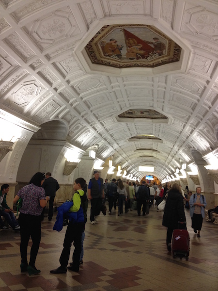
The Moscow Metro Tour is included in most guided tours’ itineraries. Opened in 1935, under Stalin’s regime, the metro was not only meant to solve transport problems, but also was hailed as “a people’s palace”. Every station you will see during your Moscow metro tour looks like a palace room. There are bright paintings, mosaics, stained glass, bronze statues… Our Moscow metro tour includes the most impressive stations best architects and designers worked at - Ploshchad Revolutsii, Mayakovskaya, Komsomolskaya, Kievskaya, Novoslobodskaya and some others.
What is the kremlin in russia?
The guide will not only help you navigate the metro, but will also provide you with fascinating background tales for the images you see and a history of each station.
And there some stories to be told during the Moscow metro tour! The deepest station - Park Pobedy - is 84 metres under the ground with the world longest escalator of 140 meters. Parts of the so-called Metro-2, a secret strategic system of underground tunnels, was used for its construction.
During the Second World War the metro itself became a strategic asset: it was turned into the city's biggest bomb-shelter and one of the stations even became a library. 217 children were born here in 1941-1942! The metro is the most effective means of transport in the capital.
There are almost 200 stations 196 at the moment and trains run every 90 seconds! The guide of your Moscow metro tour can explain to you how to buy tickets and find your way if you plan to get around by yourself.
- accéder au contenu
- accéder au menu principal
- contactez-nous
- direct radio
- Gouvernement de Gabriel Attal
- Assemblée nationale
- Emmanuel Macron
- Réforme des retraites 2023
- Les Républicains
- Renaissance
- Rassemblement national
- Parti socialiste
- La France insoumise
- Les Ecologistes - EELV
- Election présidentielle
- Toutes les élections
- Élections européennes 2024
- Egalité femmes-hommes
- Immigration
- Maltraitance dans les Ehpad
- Droits des femmes
- Violences sexuelles
- Féminicides
- Prostitution
- Calendrier des vacances scolaires
- Résultats Bac
- Résultats Brevet
- Résultats Bts
- Résultats Cap
- Harcèlement scolaire
- Enlèvements
- Justice – Procès
- Incendies de forêt
- Mort de Nahel à Nanterre
- Disparition de Delphine Jubillar
- Attaque au couteau à Annecy
- Procès de l’attentat de Magnanville
- Disparition du petit Emile
- Incendie meurtrier à Wintzenheim
- Vaccin contre le Covid-19
- La crise de l’hôpital public
- Biologie - Génétique
- Alimentation
- Lutte contre le tabagisme
- Politique de santé
- Psycho - Bien-être
- Sport et santé
- Professions médicales
- Le tabou de la santé mentale
- Pouvoir d'achat
- Impôts - Fiscalité
- Entreprises
- Auto-entrepreneurs
- Aéronautique
- Budget de la France
- Soldes d'hiver 2024
- Asie-Pacifique
- Etats Unis d'Amérique
- Proche-orient
- Guerre en Ukraine
- Sommet de l'UE
- Royaume-Uni
- Story Killers
- Conflit dans le Haut-Karabakh
- Guerre entre Israël et le Hamas
- Inondations meurtrières en Libye
- Séisme au Maroc
- Festival de Cannes 2024
- Oscars 2024
- Victoires de la musique 2024
- Festival du livre de Paris 2024
- Les Molières
- Fête de la musique 2024
- Rock en Seine 2024
- Festivals d'été
- Roland-Garros
- Tour de France
- Coupe du monde de foot
- Mondiaux d'athlétisme
- Coupe du monde de rugby
- Crise climatique
- Convention citoyenne sur le climat
- Biodiversité
- Pollution de l'air
- Le tableau de bord du réchauffement climatique
- Nos réponses à vos questions sur le climat
- Empreinte carbone
- Montée des eaux
- Greta Thunberg
- Carte des restrictions d'eau
- Tableau de bord des nappes phréatiques
- Calculez votre empreinte carbone
- Calculez l'impact carbone de vos déplacements
- Trouvez des fruits et légumes de saison
- Triez mieux vos déchets
- Intempéries
- Météo France
- Météo Paris
- Météo Marseille
- Actualités météo
CARTE. Tour de l’Ain 2024. Découvrez le tracé de la nouvelle boucle cycliste avec une arrivée finale inédite
Quel est le tracé de la 36ᵉ édition du Tour de l'Ain ? Du 13 au 15 juillet, les équipes devront parcourir pas moins de 431 kilomètres à travers tout le département. Suivez les trois étapes en direct sur France 3 Rhône-Alpes.
Le Tour de l’Ain fait son grand retour du 13 au 15 juillet 2024. Initialement prévue au début du mois d’août, la course cycliste a été avancée en raison de l’organisation des Jeux olympiques et Paralympiques 2024.
La boucle aindinoise est généralement l’occasion de "de donner leur chance à des coureurs, qui ne sont ni sur le programme Tour de France, ni sur le programme Tour d'Espagne, de s'exprimer et de se remettre en jambes" , expliquait Nicolas Roche, consultant lors de la précédente édition.
Créé en 1989, le Tour de l’Ain est intégré au calendrier de l’Union Cycliste Internationale (Classe 2.1) et compte pour l’UCI Europe Tour. Cette classification et sa position parfaite entre la Grande Boucle et la Vuelta, lui permettent d’accueillir des équipes comptant parmi les meilleures équipes mondiales. Si celles-ci sont présentées en juin, le parcours a quant à lui été exposé au grand public ce jeudi 25 avril. Il promet une arrivée inédite dans le site naturel de l'Ile Chambord.
Étape 1 : Laiz – Bourg-en-Bresse
Quel profil pour la 1ère étape du Tour de l'Ain 2024 ? • © Alpes Vélo
Pour la 36ᵉ édition du Tour de l’Ain, c’est la commune de Laiz au nord du département qui accueillera le départ. L’occasion pour les cyclistes de découvrir sur leur deux-roues les plaines du côté ouest du département, entre Bresse et Dombes.
Une première étape plus courte et moins accidentée que les deux suivantes, ce qui rend la bataille plus serrée. Sur leur route, ils devront tout de même gravir la côte de Chaveyriat, avec une pente de 4 % sur 1 kilomètre, puis celle de Châtillon-sur-Chalaronne du même acabit, pour une arrivée prévue 132.7 kilomètres plus loin, à Bourg-en-Bresse.
Étape 2 : Saint-Vulbas – Lélex Monts-Jura
Quel profil pour la 2ème étape du Tour de l'Ain 2024 ? • © Alpes Vélo
Lors de la deuxième étape, les coureurs traverseront tout le côté Est du département. Saint-Vulbas accueillera une nouvelle fois le départ de cette épreuve. Direction, Lélex Monts-Jura dans le Pays de Gex, qui l’année dernière a vu débarquer les coureurs pour leur dernier effort après trois jours de course.
La deuxième étape organisée le jour de la fête nationale, c’est celle de puncheurs. Ils sauront se démarquer sur les routes sinueuses et escarpées avec quelques cols et cotes déjà plus pentus à gravir : la côte de Corlier (4.1 % sur 12.5 kilomètres), la côte du Giron (5.9 % sur 8 kilomètres) et le mythique col de Menthières (7 % sur 9.1 kilomètres) au terme duquel l’Australien Michael Storer s’était illustré le 2 août 2023, remportant la 35ᵉ édition du Tour de l’Ain.
Étape 3 : Lagnieu – Ile Chambord
Pour cette troisième et dernière étape de la course cycliste, les coureurs s’élanceront de Lagnieu dans la plaine de l’Ain. La commune a accueilli l’arrivée de la deuxième épreuve lors de l’édition précédente. Ils rejoindront le site naturel de l’Ile Chambord, une première dans l'histoire du tour.
Quel profil pour la 3ème étape du Tour de l'Ain 2024 ? • © Alpes Vélo
Et entre les deux, une multitude de cols et de côtes à gravir. D’abord le col de Montratier et ses 3.3 % de pente sur 6.6 kilomètres, ensuite la côte de Mérignat avec 5.8 % de pente sur 2 kilomètres. Il y aura ensuite la cote de Corveissiat (3.3 % sur 3.8 kilomètres), la côte de Matafelon (4 % sur 3.1 kilomètres) et le col de Berthiand (6 % sur 4.8 kilomètres).
Et comme un seul passage ne suffit pas, les cyclistes affronteront une nouvelle fois cette série de deux côtes et un col. 153,1 kilomètres seront à parcourir au total dans une épreuve faite pour les grimpeurs.
Suivez les trois étapes en direct sur France 3 Rhône-Alpes .
Pour aller plus loin :

- copier le lien https://france3-regions.francetvinfo.fr/auvergne-rhone-alpes/ain/carte-tour-de-l-ain-2024-decouvrez-le-trace-de-la-nouvelle-boucle-cycliste-avec-une-arrivee-finale-inedite-2961197.html
- Bourg-en-Bresse
- Clermont-Ferrand
- Le Puy-En-Velay
- Saint-Etienne
- Haute-Loire
- Haute-Savoie
- Puy-de-Dôme
- Toute la région
- Chalon-sur-Saône
- Lons le Saunier
- Luxeuil Les Bains
- Montbéliard
- Côte-d'Or
- Haute-Saône
- Saône-et-Loire
- Territoire de Belfort
- Saint-Brieuc
- Côtes-d'Armor
- Ille-et-Vilaine
- Châteauroux
- Eure-et-Loir
- Indre-et-Loire
- Loir-et-Cher
- Corse-du-Sud
- Haute-Corse
- Châlons-en-Champagne
- Charleville-Mézières
- Saint-Dizier
- Haute-Marne
- Meurthe-et-Moselle
- Boulogne-sur-Mer
- Saint-Quentin
- Valenciennes
- Pas-de-Calais
- Cherbourg-En-Cotentin
- Seine-Maritime
- Châtellerault
- La Rochelle
- Mont-de-Marsan
- Sarlat-la-Canéda
- Charente-Maritime
- Deux-Sèvres
- Haute-Vienne
- Lot-et-Garonne
- Pyrénées-Atlantiques
- Montpellier
- Haute-Garonne
- Hautes-Pyrénées
- Pyrénées-Orientales
- Tarn-et-Garonne
- Grand Paris
- Saint-Denis
- Hauts-de-Seine
- Seine-et-Marne
- Seine-Saint-Denis
- Val-de-Marne
- Val-d'Oise
- La Roche-sur-Yon
- Les Sables-d'Olonne
- Saint-Nazaire
- Loire-Atlantique
- Maine-et-Loire
- Aix-en-Provence
- Digne-les-Bains
- Fréjus Et Saint-Raphaël
- Saint-Tropez
- Alpes-de-Haute-Provence
- Alpes-Maritimes
- Bouches-du-Rhône
- Hautes-Alpes
- Toute la France
Moscow Metro Tour
- Page active

Description
Moscow metro private tours.
- 2-hour tour $87: 10 Must-See Moscow Metro stations with hotel pick-up and drop-off
- 3-hour tour $137: 20 Must-See Moscow Metro stations with Russian lunch in beautifully-decorated Metro Diner + hotel pick-up and drop off.
- Metro pass is included in the price of both tours.
Highlight of Metro Tour
- Visit 10 must-see stations of Moscow metro on 2-hr tour and 20 Metro stations on 3-hr tour, including grand Komsomolskaya station with its distinctive Baroque décor, aristocratic Mayakovskaya station with Soviet mosaics, legendary Revolution Square station with 72 bronze sculptures and more!
- Explore Museum of Moscow Metro and learn a ton of technical and historical facts;
- Listen to the secrets about the Metro-2, a secret line supposedly used by the government and KGB;
- Experience a selection of most striking features of Moscow Metro hidden from most tourists and even locals;
- Discover the underground treasure of Russian Soviet past – from mosaics to bronzes, paintings, marble arches, stained glass and even paleontological elements;
- Learn fun stories and myths about Coffee Ring, Zodiac signs of Moscow Metro and more;
- Admire Soviet-era architecture of pre- and post- World War II perious;
- Enjoy panoramic views of Sparrow Hills from Luzhniki Metro Bridge – MetroMost, the only station of Moscow Metro located over water and the highest station above ground level;
- If lucky, catch a unique «Aquarelle Train» – a wheeled picture gallery, brightly painted with images of peony, chrysanthemums, daisies, sunflowers and each car unit is unique;
- Become an expert at navigating the legendary Moscow Metro system;
- Have fun time with a very friendly local;
- + Atmospheric Metro lunch in Moscow’s the only Metro Diner (included in a 3-hr tour)
Hotel Pick-up
Metro stations:.
Komsomolskaya
Novoslobodskaya
Prospekt Mira
Belorusskaya
Mayakovskaya
Novokuznetskaya
Revolution Square
Sparrow Hills
+ for 3-hour tour
Victory Park
Slavic Boulevard
Vystavochnaya
Dostoevskaya
Elektrozavodskaya
Partizanskaya
Museum of Moscow Metro
- Drop-off at your hotel, Novodevichy Convent, Sparrow Hills or any place you wish
- + Russian lunch in Metro Diner with artistic metro-style interior for 3-hour tour
Fun facts from our Moscow Metro Tours:
From the very first days of its existence, the Moscow Metro was the object of civil defense, used as a bomb shelter, and designed as a defense for a possible attack on the Soviet Union.
At a depth of 50 to 120 meters lies the second, the coded system of Metro-2 of Moscow subway, which is equipped with everything you need, from food storage to the nuclear button.
According to some sources, the total length of Metro-2 reaches over 150 kilometers.
The Museum was opened on Sportivnaya metro station on November 6, 1967. It features the most interesting models of trains and stations.
Coffee Ring
The first scheme of Moscow Metro looked like a bunch of separate lines. Listen to a myth about Joseph Stalin and the main brown line of Moscow Metro.
Zodiac Metro
According to some astrologers, each of the 12 stops of the Moscow Ring Line corresponds to a particular sign of the zodiac and divides the city into astrological sector.
Astrologers believe that being in a particular zadiac sector of Moscow for a long time, you attract certain energy and events into your life.
Paleontological finds
Red marble walls of some of the Metro stations hide in themselves petrified inhabitants of ancient seas. Try and find some!
- Every day each car in Moscow metro passes more than 600 km, which is the distance from Moscow to St. Petersburg.
- Moscow subway system is the 5th in the intensity of use (after the subways of Beijing, Tokyo, Seoul and Shanghai).
- The interval in the movement of trains in rush hour is 90 seconds .
What you get:
- + A friend in Moscow.
- + Private & customized Moscow tour.
- + An exciting pastime, not just boring history lessons.
- + An authentic experience of local life.
- + Flexibility during the walking tour: changes can be made at any time to suit individual preferences.
- + Amazing deals for breakfast, lunch, and dinner in the very best cafes & restaurants. Discounts on weekdays (Mon-Fri).
- + A photo session amongst spectacular Moscow scenery that can be treasured for a lifetime.
- + Good value for souvenirs, taxis, and hotels.
- + Expert advice on what to do, where to go, and how to make the most of your time in Moscow.
Write your review

Tour Details
Moscow metro tour: architectural styles of the subway.

Duration: 2 hours
Categories: Culture & History, Sightseeing
This metro tour of Russia’s capital and most populous city, Moscow, is your chance to get a unique insight into the beautiful and impressive architecture of the city's underground stations. Admire their marble walls and high ceilings representing Stalin's desire for glory after World War 2, and see first-hand how the interiors change with the rise of new political eras. Your guide will lead you through the complex network, which is one of the most heavily used rapid transit systems worldwide, with over two billion travelers in 2011.
Opened in 1935, Moscow’s underground system, now 190 miles (305 km) long with 185 stations, is today one the largest and most heavily used rapid transit systems in the world. On this Moscow metro tour, discover the impressive architecture of Moscow’s underground stations and learn how they reflect the Soviet era.
Getting around by metro, your local guide will take you through parts of Moscow’s infamous history. Stop at stations built during the time of the USSR (Soviet Union) that are praised as one of the most extravagant architectural projects from Stalin’s time. After World War 2, he was keen on establishing Stalinist architecture to represent his rising regime and a recognized empire. Learn how when his successor started the de-Stalinization of the former Soviet Union in 1953, the extravagancy of the architecture was toned down.
Discover how the unique character of each station reflected several different eras. While stations like Kievskaya and Slavyansky Bulvar have pompous halls and high stucco ceilings brimming with extravagant decorations, those built later, like Volzhskaya, are lightly adorned with sparse furnishings. Architect Alexey Dushkin and painter Alexander Deyneka were just two of the many artists who made these magnificent landmarks possible.
Revel in Moscow's glory days, as well as the years of scarcity, on this fascinating Moscow metro experience. Conclude your tour at one of the central stations in Moscow. If you're lucky, you may even find the secret entrance to the unconfirmed Metro-2, a parallel underground system used by the government -- a mystery which has neither been denied nor confirmed today.
Nearby tours

Soviet-Era Walking Tour in Moscow: Lubyanka Square and the Gulag History Museum
If you love history, would like to know more about Russia’s past, or just want to take an interesting walk, book this guided Moscow walking tour of Soviet-era sites. With your expert guide, walk through Lubyanka Squ...

Walking Tour of Moscow's Kolomenskoye Estate
On this walking tour through the Kolomenskoye Estate in Moscow, immerse yourself in Russia’s interesting royal history. Walk around the UNESCO World Heritage-listed Ascension Church, built in 1532, and enter the Hou...

Moscow Cultural Walking Tour: Red Square, Kitay-Gorod and St Basil's Cathedral
Take a guided walking tour of Moscow's cultural highlights, like the beautiful UNESCO World Heritage-listed Red Square, said to be the central square of Russia. Walk through the adjoining district Kitay-Gorod, one of ...

Kremlin Grounds, Cathedrals and Patriarch's Palace Tour from Moscow
A great three hour tour exploring the Kremlin Grounds, Cathedrals and Patriarch's Palaces in Moscow! The small city in the center of Moscow, once the residence of Czars and Patriarchs, contains Russia's main cathedra...

Moscow City Tour
The Moscow City Tour covers all the highlights and most beautiful places in the enchanting Russian capital. The tour begins with a stop at the Red Square and St. Basil's Cathedral, the architectural masterpiece and w...
Culture Shock Rating
We have a wide range of tours designed to give you an insight into the destination you're travelling in and there is something for everybody. The culture shock ratings considers the destination visited, transport used, activities undertaken and that "Wow, I'm really not at home now!" factor. While generalisations are always tricky, a summary of our gradings is as follows…
This is the least confronting of our tour range. Transport used on the trip is either private or a very comfortable public option, the activities included are usually iconic sites and locations that are not all too confronting.
The tour can include a mix of private and public transport providing a level of comfort that is slightly below what you would experience at home. Sites visited are usually iconic sites, tours can also include market visits, visits to communities etc that provide the traveller with a fantastic insight into destination.
Expect to rough it for parts of this tour, whether it's a packed public bus where you are forced to stand, a visit to a local market, a local community, you are sure to have an experience that is very different from what you're used to at home.
The comforts of your home town and the environment you are used to are more of a rarity. Expect some challenging transport options, visits to local sites and areas that don't resemble anything at home.
You're out there in the global community! You are likely to be exposed to the elements, travel in whatever means of transport is available and basically take it as it comes, whatever comes! It can be tough.
Physical Rating
Our physical rating gives you an idea of how much huffing and puffing you can expect on the tour. While generalisations are always tricky, a summary of our gradings is as follows…
These tours have very limited physical activity. Usually climbing in and out of the transport provided, walking through sites, markets etc included in the itinerary.
These tours have a bit of physical activity but nothing that should challenge you too much. This could be climbing on and off public transport through to a walk through the destination you're travelling in, they can include walking only tours or a combination of walking and transport.
These tours involve a bit of physical activity from walking up and down hills in the destination you're travelling in or the surrounding areas. Climbing on and off local transport or riding a bike up to 30 kms along predominantly flat terrain or jumping in a kayak for a gentle paddle on flat water.
These Tours will provide you with some solid physical activity. Whether its bike riding, walking, trekking, kayaking or riding on public transport you will need to have a good level of fitness to enjoy this tour.
Be prepared for some serious physical activity. These tours are our most challenging and involve some serious walking, hiking or bike riding. Can involve step climbs by foot or pedal and some challenging public transport options in the destination you are travelling.
Luxury Rating
Some trips are like a stroll on the beach, while others have you trekking alpine passes. Some of you thrive on camping out on the savannah, while others may prefer a hot shower and a comfortable bed in a lodge. Follow the grading systems below to find the right trip for you.
To help you choose the trip that's right for you, we've broken all of our trips down into four service levels. Measuring the comfort level of the accommodation and transport. So whether you're travelling on a budget and want to save money by using public transport, or prefer upgraded accommodation and are happy to pay a little more, then we have a level for you.
This is grassroots travel at its most interesting
Authentic experiences with some of the comforts of home
For those who like to travel in comfort
All the unique experiences wrapped up with a gold ribbon
Claudia Looi
Touring the Top 10 Moscow Metro Stations
By Claudia Looi 2 Comments

Komsomolskaya metro station looks like a museum. It has vaulted ceilings and baroque decor.
Hidden underground, in the heart of Moscow, are historical and architectural treasures of Russia. These are Soviet-era creations – the metro stations of Moscow.
Our guide Maria introduced these elaborate metro stations as “the palaces for the people.” Built between 1937 and 1955, each station holds its own history and stories. Stalin had the idea of building beautiful underground spaces that the masses could enjoy. They would look like museums, art centers, concert halls, palaces and churches. Each would have a different theme. None would be alike.
The two-hour private tour was with a former Intourist tour guide named Maria. Maria lived in Moscow all her life and through the communist era of 60s to 90s. She has been a tour guide for more than 30 years. Being in her 60s, she moved rather quickly for her age. We traveled and crammed with Maria and other Muscovites on the metro to visit 10 different metro stations.

Arrow showing the direction of metro line 1 and 2

Moscow subways are very clean
To Maria, every street, metro and building told a story. I couldn’t keep up with her stories. I don’t remember most of what she said because I was just thrilled being in Moscow. Added to that, she spilled out so many Russian words and names, which to one who can’t read Cyrillic, sounded so foreign and could be easily forgotten.
The metro tour was the first part of our all day tour of Moscow with Maria. Here are the stations we visited:
1. Komsomolskaya Metro Station is the most beautiful of them all. Painted yellow and decorated with chandeliers, gold leaves and semi precious stones, the station looks like a stately museum. And possibly decorated like a palace. I saw Komsomolskaya first, before the rest of the stations upon arrival in Moscow by train from St. Petersburg.
2. Revolution Square Metro Station (Ploshchad Revolyutsii) has marble arches and 72 bronze sculptures designed by Alexey Dushkin. The marble arches are flanked by the bronze sculptures. If you look closely you will see passersby touching the bronze dog's nose. Legend has it that good luck comes to those who touch the dog's nose.

Touch the dog's nose for good luck. At the Revolution Square station

Revolution Square Metro Station
3. Arbatskaya Metro Station served as a shelter during the Soviet-era. It is one of the largest and the deepest metro stations in Moscow.

Arbatskaya Metro Station
4. Biblioteka Imeni Lenina Metro Station was built in 1935 and named after the Russian State Library. It is located near the library and has a big mosaic portrait of Lenin and yellow ceramic tiles on the track walls.

Lenin's portrait at the Biblioteka Imeni Lenina Metro Station

5. Kievskaya Metro Station was one of the first to be completed in Moscow. Named after the capital city of Ukraine by Kiev-born, Nikita Khruschev, Stalin's successor.

Kievskaya Metro Station
6. Novoslobodskaya Metro Station was built in 1952. It has 32 stained glass murals with brass borders.

Novoslobodskaya metro station
7. Kurskaya Metro Station was one of the first few to be built in Moscow in 1938. It has ceiling panels and artwork showing Soviet leadership, Soviet lifestyle and political power. It has a dome with patriotic slogans decorated with red stars representing the Soviet's World War II Hall of Fame. Kurskaya Metro Station is a must-visit station in Moscow.
Ceiling panel and artworks at Kurskaya Metro Station

8. Mayakovskaya Metro Station built in 1938. It was named after Russian poet Vladmir Mayakovsky. This is one of the most beautiful metro stations in the world with 34 mosaics painted by Alexander Deyneka.

Mayakovskaya station

One of the over 30 ceiling mosaics in Mayakovskaya metro station
9. Belorusskaya Metro Station is named after the people of Belarus. In the picture below, there are statues of 3 members of the Partisan Resistance in Belarus during World War II. The statues were sculpted by Sergei Orlov, S. Rabinovich and I. Slonim.

10. Teatralnaya Metro Station (Theatre Metro Station) is located near the Bolshoi Theatre.

Teatralnaya Metro Station decorated with porcelain figures .

Taking the metro's escalator at the end of the tour with Maria the tour guide.
Have you visited the Moscow Metro? Leave your comment below.

January 15, 2017 at 8:17 am
An excellent read! Thanks for much for sharing the Russian metro system with us. We're heading to Moscow in April and exploring the metro stations were on our list and after reading your post, I'm even more excited to go visit them. Thanks again 🙂

December 6, 2017 at 10:45 pm
Hi, do you remember which tour company you contacted for this tour?
Leave a Reply Cancel reply
You must be logged in to post a comment.
Please go to the Instagram Feed settings page to create a feed.
IMAGES
VIDEO
COMMENTS
Carte : IGN TOP25 3630 OT Chamonix - Massif du Mont Blanc. ... Dépasser l'Aiguille Nord du Tour pour rejoindre la voie normale de l'Aiguille Sud, puis franchir la rimaye, et suivre la vire naturelle qui atteint une petite brèche menant au sommet après une courte escalade.
The Aiguille du Tour (3,540 metres (11,614 ft)) is a mountain in the Mont Blanc massif, located on the border between Switzerland and France. The voie normale on the mountain is graded F (facile) and can be climbed from either the Albert Premier Hut on the French side or the Trient Hut on the Swiss side. The Aiguille du Pissoir (3,440 m) and ...
Aiguille du Tour, versant S - Itinéraire en Noir Montée. Depuis le Refuge Albert 1 er, monter la rive droite du glacier du Tour en direction du Col Supérieur du Tour (3288 m) en contournant par la droite le Signal Reilly. Après avoir passé celui-ci, remonter sous l'Aiguille Purtscheller pour éviter une zone de crevasses et rejoindre un petit replat (3420 m) sous les aiguilles.
L'Aiguille du Tour est le sommet du Massif du Mont Blanc le mieux adapté à une première expérience en alpinisme. Son ascension par sa voie normale depuis le refuge Albert Ier, toujours ludique, est un condensé de ce que peut offrir une sortie en haute montagne : nuit en refuge d'altitude, paysages glaciaires à couper le souffle, rocher coloré et panoramas magnifiques.
Overview. Aiguille du Tour is situated in the northern part of the Mont Banc Massif. It can be climbed rather easely from both France and Switzerland. It was climbed for the first time in 1926 M. Dreyfus, R. Duval, P. Henry, M. Ichac. For all the routes you first have to go over the glacier to the foot of Aiguille du Tour and then a mix climb ...
The ascent of the Aiguille du Tour is aimed at people wishing to discover the mountains with a night in a mountain hut. It also provides an opportunity to learn basic mountaineering techniques, such as crampon and ice axe use. No mountaineering experience necessary but this ascent is for people with a good experience in walking in the mountains.
Aiguilles du Tour. Vue du versant sud de l'aiguille du Tour. L' aiguille du Tour pour le côté français 1 ou les aiguilles du Tour pour le côté suisse 2 est un sommet du massif du Mont-Blanc, au-dessus du village du Tour. Il se situe entre les glaciers du Tour et du Trient, sur la frontière franco-suisse. C'est l'un des sommets les plus ...
The Aiguille du Tour is probably one of the most travelled summits in the massif, and rightly so. It offers a sumptuous panorama in a grandiose setting between France and Switzerland. The Table ridge, first climbed in 1926, offers a grandiose journey without being too strenuous. Depending on the time of year and conditions, you can climb either ...
Aiguilles du Tour 3541 m. Alpinism. The two equally high peaks are 130 m apart. They are separated by a col (about 3493 m). The south summit is usually climbed alone. In this guide you can find a description of the traverse to both peaks. The Aiguilles du Tour gives a not-too-difficult but rewarding mountain tour.
Climax de l'ascension de l'aiguille du Tour : l'arrivée au sommet ! Dénivelé : 1380 mètres de la télécabine de Charamillon à l'aiguille du Tour. Temps de parcours : le 1er jour (télécabine de Charamillon-refuge Albert-1er), 2 h 30. Nuitée au refuge Albert-1er. Le 2e jour, 3 h pour monter à l'aiguille du Tour, 2 h pour descendre au ...
Approche. Depuis le Refuge Albert 1 er 2 options : Par le Col Supérieur du Tour, suivre la voie normale jusqu'à la rimaye, puis tirer à droite jusqu'au pied de l'arête (à vue).; Par le Col du Midi des Grands (moins fréquenté et plus court), passer le col puis traverser à flanc vers la droite (E puis S) pour contourner l'Aiguille du Pissoir et arriver au pied de l'arête.
On y accède par un long parcours glaciaire facile et panoramique, puis une escalade plus aérienne présentant des difficultés abordables. Le sommet de Tête Blanche 3421m, situé entre les l'Aiguille du Tour et la Petite Fourche ne présente pas de passage d'escalade et nous permet de prendre jusqu'à 6 personnes par guide.
The Grand Balcon Nord leads from the Mer de Glace glacier to the mid-station of Aiguille du Midi. Gorgeous views of the Mer de Glace glacier, Chamonix valley and Mont Blanc. Start with the with a cogwheel train up to Mer de Glace, enjoy this beautiful hike, and return by cable car for a relatively moderate day.
Aiguilles du Tour 3541 m Hochtouren. Aiguilles du Tour 3541 m. Hochtouren. Die beiden gleich hohen Gipfel liegen 130 m voneinander entfernt. Sie werden durch eine Lücke (ca. 3490 m) voneinander getrennt. Der S-Gipfel wird meist alleine bestiegen. Hier erwähnen wir die Überschreitung beider Gipfel.
Description. L'Aiguille du Tour est un sommet qui se situe entre les glaciers du Tour et du Trient, sur la frontière franco-suisse. Il comporte un sommet N et un sommet S, culminant tous les deux à 3540 m selon Swisstopo (Office fédéral de topographie suisse) et à 3544 m le sommet N et 3542 m le sommet S selon l'IGN (Institut géographique ...
Itinéraire pour les Aiguilles du Tour. Du bivouac, sortir au mieux du pierrier direction N jusqu'à une sorte d'arête neigeuse qui commence à gauche du pt 3110. La suivre direction NW en visant le col entre le Roc des Plines et le pt 3325. La première partie est en neige/glace puis l'on monte sur du rocher délité (pas comme indiqué sur ...
Moscow Metro. The Moscow Metro Tour is included in most guided tours' itineraries. Opened in 1935, under Stalin's regime, the metro was not only meant to solve transport problems, but also was hailed as "a people's palace". Every station you will see during your Moscow metro tour looks like a palace room. There are bright paintings ...
Quel est le tracé de la 36ᵉ édition du Tour de l'Ain ? Du 13 au 15 juillet, les équipes devront parcourir pas moins de 431 kilomètres à travers tout le département. Suivez les trois ...
Moscow Metro private tours. 2-hour tour $87: 10 Must-See Moscow Metro stations with hotel pick-up and drop-off. 3-hour tour $137: 20 Must-See Moscow Metro stations with Russian lunch in beautifully-decorated Metro Diner + hotel pick-up and drop off. Metro pass is included in the price of both tours.
Itinéraire 5h30 à 7h refuge-refuge. Depuis le refuge Albert 1 er, monter la rive droite du glacier du Tour, puis, au pt. 2883 m (signal Reilly), se séparer de la voie normale et prendre la direction de l'Aiguille du Pissoir pour passer la zone crevassée. Prendre la rive gauche de cette partie du glacier, aller au fond du cirque et trouver le passage le plus évident pour gravir le col du ...
Opened in 1935, Moscow's underground system, now 190 miles (305 km) long with 185 stations, is today one the largest and most heavily used rapid transit systems in the world. On this Moscow metro tour, discover the impressive architecture of Moscow's underground stations and learn how they reflect the Soviet era.
The two-hour private tour was with a former Intourist tour guide named Maria. Maria lived in Moscow all her life and through the communist era of 60s to 90s. She has been a tour guide for more than 30 years. Being in her 60s, she moved rather quickly for her age. We traveled and crammed with Maria and other Muscovites on the metro to visit 10 ...