Please note that creating presentations is not supported in Internet Explorer versions 6, 7. We recommend upgrading to the latest Internet Explorer, Google Chrome, or Firefox. If you are using IE 8 or later, make sure you turn off "Compatibility View".

Visited States Map
This page features an interactive and customizable map builder showing visited states. You can use it to track your US travel history by marking the states you have previously visited! Create a beautiful custom map in a few clicks, and share it with your community. Also, check out our Interactive US Map for Websites with advanced customization options!

Select states you visited
- Connecticut
- District of Columbia
- Massachusetts
- Mississippi
- New Hampshire
- North Carolina
- North Dakota
- Pennsylvania
- Rhode Island
- South Carolina
- South Dakota
- West Virginia

Share the URL anywhere you want - or save it so you can come back and add new achievements to your map.
Embedding the map
If you need a US map with advanced features for your website, we offer several options for you. Alongside the standard HTML and JavaScript package, you can also opt for an easy-to-use WordPress plugin.

Frequently Asked Questions
This very simple tool allows you to easily create a map of states you have visited. Simply click on the states on the map, or toggle a checklist item below the map to mark where you have been. You can also customize the colors, turn off labels, and show stats regarding the number of states you have visited.
You can use this tool to track how many US states you have been to. In the "Set Map Parameters" control, check the "Show stats" box. The number of states where you have been will be displayed below the map. When the "Show stats" control is active, the exact number of states you have been to and the percentage of states you have visited are shown below the map.
This page features buttons that allow you to share this map via Facebook, Twitter, and Pinterest. Once you click the button, it will generate an image for the customized map and opens a new tab directing you to the social network you selected. You can also copy the URL and share it on any social network. If you opened map maker from a mobile device, use the share buttons built into your browser.
In the "Set Map Parameters" section, you will see four color options. Click on the associated color square to open the color picker. Once opened, can choose from millions of colors for the states and borders.
This can be done easily, and without the need for registration. Simply copy the unique URL and add it to your bookmarks.
You can quickly reset the map by clicking the "Clear map and reset colors" button. Note, this will reset all the states you have visited, along with reverting your color options and customized settings back to their default.
Use this tool to create stunning interactive maps of your travels across the United States. Select the states, add animations, configure the way you see fit. Then download as a static image, embeddable code, or even a smooth video or an animated GIF. Once you're done, check out 200+ other maps we have.
States Visited Map
How many states have i been to.
Use this free mapping tool to display the states that you have visited, driven or ridden through. Drivers, motorcycle riders, car touring enthusiasts: Create a color state map to show where you have travelled.
States I Have Visited:
While You Are There

Visited States + DC Map Generator

- Le Français

Plan your next dream trip to the USA in seconds.

How it works


- USA State Map
- USA County Map
- USA Congress
- North America
- United Kingdom
- City/Neighborhood
- More maps...
- Canada Cities
- US Counties
- US Neighborhoods
- World Cities
- Congress GIS
- All Map Products
- All Data Products
HTML5 USA Map
Built with JavaScript and SVG
- Buy License ($99)
- Documentation
- Download Trial
- Customize Online

Satisfaction Guaranteed
We're so confident in the quality of our map that we offer a full 30-day money-back guarantee. If the map doesn't work out for you we'll happily refund your money.

Customer Comments
To say I was impressed would be a tremendous understatement. I will be recommending this product to anyone with similar needs.
Matthew Gagnon, Republican Governors Association
..a great product and terrific customer service.
Jeremy K. Washington, DC
...the [installation] process was absolutely painless.
KC Burke kcautomarine.com
"this product [comes] with the kind of hands-on help you don't see much these days
Ken H. pdhengineer.com
...prompt customer service and web savvy enabled my [map] to be fully integrated in no time at all.
Luke, StylePass
...an attractive and intuitive starting point for our location search. One question I submitted via the web site was answered within hours.
Angus M., Web Developer
Very impressed, and if you're looking for an interactive map for your web site, you can't go wrong with this product.

Simple to Use
Customize maps by editing an online spreadsheet or simple text file. No knowledge of HTML5 or JavaScript is required. Step-by-step documentation makes installation painless.

Mobile Compatible
Our HTML5 maps look gorgeous on iPhones, Android devices and iPads. Our responsive maps automatically detect mobile devices and adjust navigation to be touch friendly.

Awesome Support
Get fast answers from the one of the map's developers. We're happy to troubleshoot any installation or customization issues that arise. Just ask !

Pinpoint Locations
Add location markers to the map using only latitude and longitude. Choose shapes or images. Easily customize the size, color, and description.

Clickable States
States can act as links. Click on a state and go to a specific url. Use the map to simplify your websites user interface.

Fully Customizable
Almost every aspect of the map can be customized. Colors, descriptions, links, labels, locations, regions and much more.
Below are a few screenshots illustrating how you can use the US map. Click through to see a live demo. Or, view all examples .
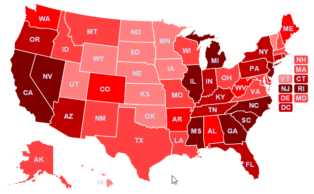
Easily create a heat/intensity map to visualize data.

Zoomable Regions
Create custom regions that are zoomable or clickable.
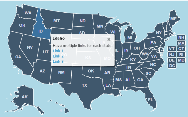
Multiple Links
Show popups upon click to embed multiple links within a description.
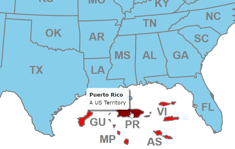
U.S. Territories
Easily display United States Territories on the map.
Included States and Territories
This map includes the following states and territories:
Does the map work on iPhones and iPads?
Yes! It does.
Does the map require jQuery or other dependencies?
No. The map does not use any jQuery and it won't interfere with jQuery or other common libraries you may be using on your page.
Does this map use Adobe Flash?
No, this map replaces the Flash USA map that we used to sell. At this point, Flash is a dying technology and we have deprecated our Flash maps.
What browsers are supported?
Chrome, Firefox, Safari 3.2+, iOS Safari 3.2+, Opera, Opera Mobile, Internet Explorer 7+, Android Browser 3+, Android Chrome and more.
Does the map include U.S. Territories?
Yes! Although hidden by default, the U.S. Territories of Guam, the Virgin Islands, Puerto Rico, American Samoa and the Northern Mariana Islands are included in the map for no additional charge.
Is it possible to split states?
Yes, although this requires a little bit of work. We can do this for you for $15 per state. Or, if you are technically inclined, follow these instructions .
Do you have a hexagon state map?
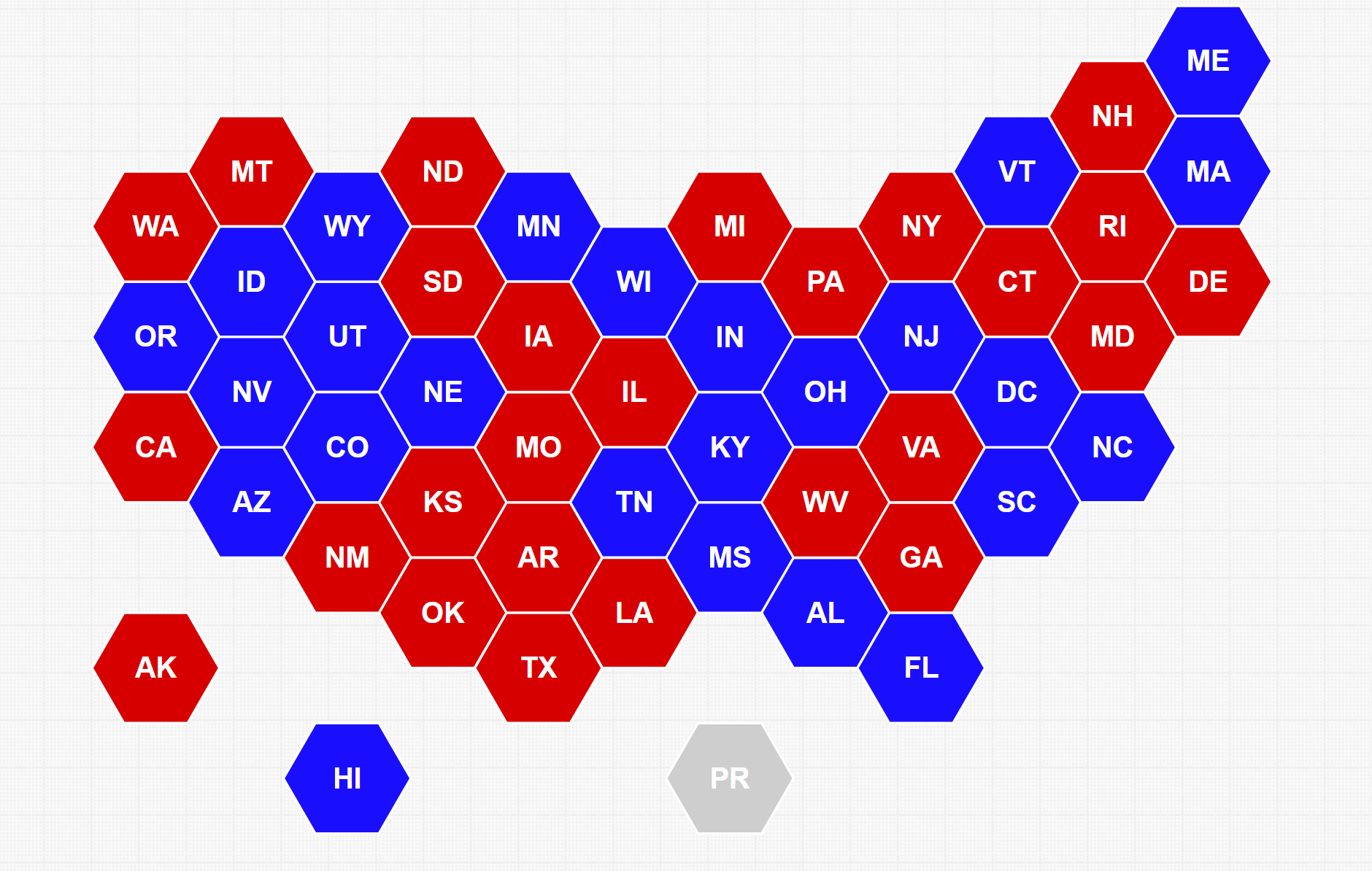
Home | License | Privacy | Releases | Testimonials | Resources | Documentation | Order Lookup | All Maps | FAQs Formerly FlashUSAmap.com and FlashWorldMap.com SimpleMaps.com is a product of Pareto Software, LLC. © 2010-2024.
US State Maps & US State Data
Fast facts as well as detailed information on all 50 states. learn about their history, government, population and much more..
But wait, there's more to our adventure than just maps! Dive into our treasure trove of data to learn fun facts about the people, places, and cultures that make up the United States. Discover how many people live in California compared to Wyoming, or which state boasts the tallest mountains. With our colorful charts and graphs, you'll unlock the secrets of population demographics, economic indicators, and educational achievements across the nation. So grab your compass and join us on this thrilling expedition through the 50 United States, where every map and dataset is a treasure waiting to be explored!
Are you doing a report for school? Need to find some information quickly and easily about one of our 50 states? Just click on the map below by the state you are looking for ! OR check out our updated US Map Explorer with lots of different interactive maps and map types !

- © Roadtrippers
- © Mapbox
- © OpenStreetMap
- Improve this map

Map of Popular 2024 Travel Destinations
On this website our staff reviews some of our favorite road trips and popular travel destinations across North America.
Our travel guides include first-hand experiences, personal recommendations, and original photographs from our trips.
We love traveling around North America, and exploring the many exciting places and destinations that the USA and Canada have to offer. We also enjoy being out on the open roads, like cross-country trips on Route 66 The Mother Road.
From the Beartooth Highway to the Blue Ridge Parkway , from Utah Scenic Byway 12 to the Trans Canada Highway, it is always a fun driving adventure.
Recent trips include driving the Going to the Sun Road in Montana, Trail Ridge Road in Colorado, and the Loneliest Road in America in Nevada .
In 2019 we made a return visit to Victoria BC , one of our favorite destinations in Canada, along with stays in Banff and Lake Louise .
This website also features travel information and reviews on the most popular national parks such as Great Smoky Mountains National Park and other museums and monuments, such as Mount Rushmore . And be sure to check out our newly published Alaska Travel Guide.
Hopefully our travel experiences will be of interest and benefit to website viewers as they plan their travel itineraries for 2024.
The interactive map below highlights many of the more popular travel destinations in America, including national parks, scenic byways, historic sites, museums and favorite travel cities.
Popular Road Trips on Scenic Byways

"The Mother Road " stretched 2,448 miles from Chicago, heading south through Illinois and Missouri. From there Route 66 turned in a more westward direction through Oklahoma and Texas, with the final stretches in New Mexico and Arizona before ending in Los Angeles.

The Blue Ridge Parkway meanders for 469 miles through Virginia and North Carolina, offering endless outdoor recreational opportunities. It provides a slow-paced and relaxing drive revealing stunning long-range vistas and close-up views of the rugged mountains and landscapes of the Appalachian Highlands.
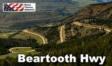
The Beartooth Highway, is one of the most scenic drives in the U.S., with views of the Absaroka and Beartooth Mountains, and open high alpine plateaus. The road features glacial lakes, forests, valleys, waterfalls and a variety of wildlife. It traverses a series of steep switchbacks at the Montana-Wyoming border to the 10,947 ft Beartooth Pass.

US 50 crosses the central portion of Nevada, from the west side of the state near Lake Tahoe to the east side near Great Basin National Park.
The Nevada portion of U.S. 50 was named "The Loneliest Road in America" by Life magazine in July 1986.
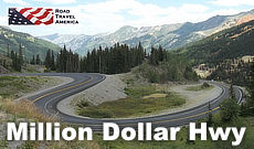
U.S. Highway 550 in Colorado is a two-lane mountainous road. It is one of only two north–south U.S. Highways in Colorado which runs west of the Continental Divide.
The 25-mile section of U.S. 550 from Silverton to Ouray is frequently called the Million Dollar Highway .

Trail Ridge Road is a paved, 48 mile long scenic highway in Rocky Mountain National Park in Colorado. It connects the park entrances in Grand Lake and Estes Park . The road features switchbacks and hairpin curves, and rises to a height of 12,183 feet above sea level. The road is open seasonally in non-winter months.
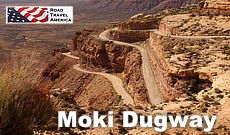
The Moki Dugway is a steep, gravel three mile road located in southeastern Utah, traversing 1,200 feet from the top of Cedar Mesa to the broad valley below. The road is actually part of Utah Highway 261, most of which is paved.
Travel to National Parks
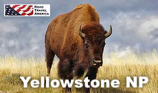
Yellowstone National Park is the world's first national park. It is located mostly in Wyoming, and spans 63 miles north to south, and 54 miles east to west. Geysers, hiking, camping, bison, elk and more!
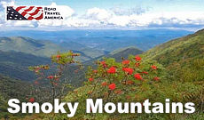
Smoky Mountains Park spans over 800 square miles in Tennessee and North Carolina, and is one of the most pristine natural areas in the Eastern part of the United States. An endless variety of outdoor activities!
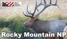
Rocky Mountain National Park is located in Colorado, and consists of 415 square miles of spectacular mountain environments. A highlight of the park is Trail Ridge Road which crests at over 12,000 feet. The park also features over 300 miles of hiking trails, lakes and wildlife.
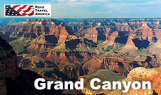
Grand Canyon National Park is located in Arizona, and is centered on a Colorado River canyon that is 277 river miles long, up to 18 miles wide, and a mile deep.
Trending Destinations: February, 2023
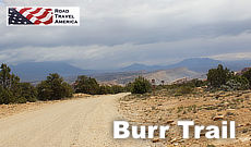
The Burr Trail takes the adventurous traveler into some of Utah's most beautiful and extraordinary country, with views of the Henry Mountains, the colorfully contorted Waterpocket Fold, red Circle Cliffs, and Long Canyon.
The famous Burr Trail switchbacks rise steeply up through the canyon. The trail drops nearly 800 feet in about a mile, while zigging and zagging down the Waterpocket Fold.
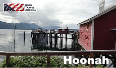
Hoonah is situated on the northwest shore of Chichagof Island across Icy Strait from the entrance to Glacier Bay on Alaska’s scenic Inside Passage.
Known as the Little City with a Big Heart, Hoonah is a family-oriented and closely-knit community of friendly and caring people. Hoonah is about 40 air miles west of the Alaska Capitol in Juneau.

With a perfect growing climate, Victoria is known internationally as the City of Gardens. The Butchart Gardens, just north of Victoria in Brentwood Bay, are internationally known and appreciated, and host over a million visitors annually.
The Butchart Gardens feature a million bedding plants in over 900 varieties.
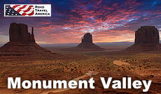
Monument Valley Navajo Tribal Park is located in extreme southeastern Utah, on the northern border of Arizona.
The valley is host to towering sandstone rock formations that have been sculpted over time and soar 400 to 1,000 feet above the valley floor. Combined with the surrounding mesas, buttes, and desert environment, Monument Valley is one of the natural wonders of the world.
SITE MAP | PRIVACY POLICY | TERMS OF USE | CONTACT US
Copyright © 2024 • RoadTravelAmerica.com • All Rights Reserved
My itinerary
This is a free demo version of our mapping software.
Create an account to save your current itinerary and get access to all our features.
Otherwise your data will be automatically deleted after one week.
❌ An error occured!
Something, somewhere went wrong 😞., if you have the time, please send me an email to [email protected] with the following error report:, thanks for helping with the development of mapchart 🙌, 🐞 bug report.
- This may happen when using the browser's page zoom to enlarge the map.
- Although Page Zoom wasn't officially supported, I understand it was a go-to choice for many.
- Please try using the website's own Zoom Mode (at the left side of every map).
- It's designed to keep your map sharp and detailed as you zoom in.
- You can edit maps with the zoom mode on; it also includes a d-pad for navigation.
Something went wrong? Please send a bug report!
This includes details on your browser/OS, and a list of the last edits you made on the map, so that I can reproduce the issue:
To send it, you can:
- Email the report to [email protected] or use the Feedback page.
- Send it anonymously... . Note that, this way, I won't be able to get back to you.
If you send via email, please consider adding a screenshot to your report.
Need more customization options?
Get mapchart plus for a dark website theme and 5 extra map themes..
- Quickly customize your map with extra map themes.
- A dark theme for the whole website.
- My Maps: save all maps you make to your account.
- My Palette: save your favourite colors and patterns to your account and find them quickly.
- and more...
Save / Load Configuration
- Save/Load text file
- Using My Maps My Maps (Plus only)
Click the button below to save your current map settings (colors, borders, legend data) as a mapchartSave.txt file:
To load a previously saved map configuration, upload the mapchartSave.txt file below:
or drag and drop your config file here, or,
Note: Loading a new configuration will replace all current map data.
This configuration was created with an older version of MapChart. The legend position and size may be a bit off. Adjust them as needed and save the map again.
Want more features, like saving maps to your account and an ad-free experience? Get MapChart Plus .
Your work is automatically saved as you make changes to your map. Each page on the website has its own autosave, stored in your browser's cache.
Note: Restoring an autosave will replace all current map data. Use undo to go back to the previous state.
Using My Maps
As a Plus user, you can save your map settings to My Maps and access it any time you want. A quick guide:
- Color and edit your map as you want. To save your progress, hit Save at the left edge of the map.
- Select a name for your save file and hit Save .
- Keep editing your map. Use Save to save your progress again. Use Save as... to save your current map with a different name.
- Use the Load... button to see a list of all maps you have saved for this page. Select Load to resume editing your saved map.
- You can check all your saved maps for all map pages on the My Maps page.
- You can still use the save/upload text files process.
- If you load the wrong map by mistake, use the Undo button to go back.
Get MapChart Plus to create your own account and save your map configurations online.
- Save all the maps you make to your account.
- Load map settings from My Maps whenever you want.
- Log in to your account from any device and continue working on your maps.
- No need to use config text files any more!
Difference between scaling and nonscaling patterns
What is this.
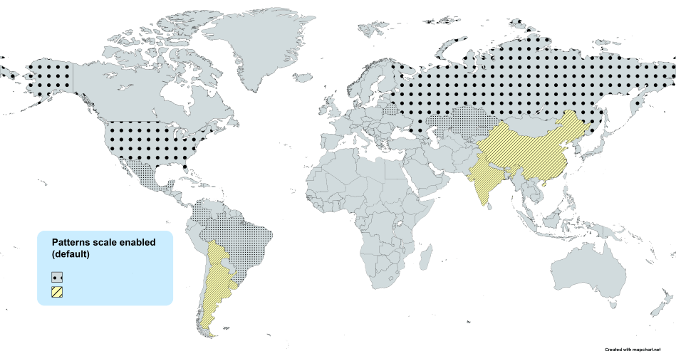
When you color a county with a pattern (dots, stripes, etc.), the pattern by default gets scaled (resized) to fit its size . You can change this to use nonscaling patterns that look the same on all counties. Examples:
Scaling (default)
What to choose?
It can depend on the map or the patterns/colors you select, but generally:
- Scaling patterns (default) are better for maps with small subdivisions, like the detailed maps or the US counties map.
- Scaling patterns (default) are better for zoomed in areas.
- Nonscaling patterns can look better for maps with larger subdivisions, like the simple World map or the US states map.
- Nonscaling patterns can look better when you have a small number of patterns in your map, as they stand out more.
In any case, you can switch this setting on/off as many times as you need to see the difference live on your map. More details on the blog .
Advanced settings
keyboard shortcuts.
∗ Change this behavior in Advanced settings.
Right-click on a county to remove its color or pattern, copy a color/pattern from another county, show, or hide it.
In the legend table, click on a color box to change the color for all counties in the group . Right-click on it to select the color again or use the numpad keys 1 to 9 .
Use to detach and move the color picker around the page.
Map scripts
Run a script from the table below to quickly modify or get data from the map.
Save to My Maps
Save the current map's settings to my maps..
A new config file will be created. While editing your map, hit the Save button again, to save your progress.
Load from My Maps
Find all your saved map configurations below..
Loading a configuration replaces your current map . Use Undo to go back if needed.
* Showing configurations from compatible maps (e.g. from the Europe map, if you are on a world map page).
Share your map settings
Send this link to anyone on the web and they will be able to directly load your map's settings..
* This link will always point to the latest version of this map.
Map settings loaded!
This map configuration was shared with you by a mapchart plus user., get mapchart plus to save your map configurations online and share them with others..
- Share your maps with others, even if they don't have a Plus account.
Create a pattern
Zoom mode settings, for the keyboard shortcuts w a s d and the arrow controls:.
Your preferences will be saved to your browser's cache.

Selection settings
Select all counties that the selection:.
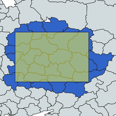
Your preference will be saved to your browser's cache.
Zoom tutorial
Double-click to zoom in.
Use the keyboard shortcuts I O or + - to zoom in/out and W A S D or the keyboard arrows to move the map.
Use the controls at the bottom right of the map for the same functions.
Click on Reset or use R to set the map to its initial zoom.
Click on EXIT ZOOM or use Esc to stop the zoom tool.
While in zoom mode, you can still edit the map, change colors, etc.
🇺🇸 USA Counties Map
Make your own map of us counties and county equivalents..
- Use the switches at the bottom of the page to toggle state names or Interstate Highways on the map. Hover over a highway to check its name.
- When you isolate a state, you can choose to show the county names as labels on the map.
- Great for creating your own statistics or election maps.
- Use it to show places you travelled in the United States. Activate the highways feature to quickly check which counties each highway passes through. Examples of travel maps here .
- Use Excel to speed up the creation process for this map. Full instructions here .
Save the keyboard shortcuts you want to remember
Try Shortcut Keeper — a simple app to get more productive with your Mac.
- Default Label Legend
- Dark Label Legend
- Aqua Label Legend
- Muted Label Legend
- Marine Label Legend
- Royal Label Legend
- Modern Label Legend
- Ancient Label Legend
- Cork Label Legend
- Ocean Label Legend
- Ash Label Legend
- Matrix Label Legend
- The 90s Label Legend
- Default (light)
Your choices will be saved for your next visits to this map page.
Zoom active
Select the color you want and click on a county on the map. Right-click to remove its color, hide, and more.
Color all counties of a state
Select a state and click COLOR STATE to color all its counties with the selected color. Keyboard shortcut: Alt + Shift + click on a county.
Make a map of a single state (with county names shown)
Select the state that you want to isolate and click ISOLATE STATE . The single state map also features the county names on the map . Use SHOW ALL to return to the full map view again.
Isolate multiple states
Select the states you want to isolate and click ISOLATE . All other states will be hidden. Use the zoom tool to adjust the map on the remaining states.
Search for a county and color it
Search for the county you want and click COLOR to paint it with the currently selected color. Use REMOVE to remove the color of the selected county.
Add a title for the map's legend and choose a label for each color group . Change the color for all counties in a group by clicking on it.
Drag the legend on the map to set its position or resize it. Use legend options to change its color, font, and more.
Countries Explored and Counting!
32 countries.

- Get in touch
- Country Flags
- Terms of use
Add more countries to the list
- Skip to main content
- Keyboard shortcuts for audio player
The states to watch on the 2024 electoral map

Domenico Montanaro
To better understand the landscape for the presidential election with a little more than six months to go, here is our initial Electoral Vote map of the cycle.
It focuses on the states that are expected to be most competitive in the effort by the campaigns to get to 270 electoral votes, a majority of the 538 total available.
There are a number of paths each candidate can take to victory. Follow them here.
This analysis, which will appear and be adjusted semi-regularly until Election Day, goes beyond just polling and is based on conversations with campaigns and strategists, NPR reporting from the field, campaign activity, and historical and demographic trends.
It lays out which direction the states are leaning at this point and are organized into seven categories — Toss Up, Lean Republican, Lean Democratic, Likely Republican, Likely Democratic, Safe Republican and Safe Democratic.

Voting booths are seen at Glass Elementary School's polling station in Eagle Pass, Texas, on November 8, 2022. Mark Felix/AFP via Getty Images hide caption
Voting booths are seen at Glass Elementary School's polling station in Eagle Pass, Texas, on November 8, 2022.
State analysis and ad spending
Trump holds slight advantages in most of the swing states right now, according to averages of the polls. Strictly going by the polls, Trump would have a 283-255 lead (if you give Biden Pennsylvania and Wisconsin, which are currently statistical ties).
But the toss up states are expected to be close, within just a few points, in either candidate's direction. Biden currently has a massive war chest and ad-spending advantage. In addition to personnel, ads are the largest expenditure of a presidential campaign.
Third-party scramble
It's also unclear how third-party candidates could affect the map. Robert F. Kennedy Jr. has been pulling double digits in polling, and it's not totally clear which side he pulls most from. Polls have shown him pulling evenly, some have shown him pulling more from Trump, others more from Biden. The Biden campaign would prefer a one-on-one matchup with Trump and super PACs are cropping up on the left to attack Kennedy's record.
He's qualified so far for the ballot in three states — Michigan, Hawaii and Utah. A Quinnipiac poll last month showed Trump's lead expanding from 3 to 5 points when RFK Jr. was included. Kennedy's campaign and a super PAC supporting him say he has enough signatures to potentially also get on ballots in Arizona, Georgia, Idaho, Iowa, Nebraska, New Hampshire, Nevada, North Carolina and South Carolina.
The state of play in the states
In Pennsylvania and Wisconsin, Biden has caught up, pulled even or taken a lead in some recent surveys. And Pennsylvania happens to be where Biden and allies are spending the second-most on ads right now — almost $4 million in the past month and a half since Super Tuesday, the unofficial start to the general election.
That's only slightly behind what they're spending in Michigan. Biden is trying to make up ground there with younger voters and Black voters, groups he's lagging with. Trump and groups supporting him have spent only about $700,000 in Pennsylvania in that same time frame.
Team Biden has also spent $2 million in Wisconsin. Trump and groups supporting him have spent nothing there so far.
Most of the money in this election is going to be poured into seven states, and they fall into two familiar buckets — the so-called "Blue Wall" states of Michigan , Pennsylvania and Wisconsin and the Sun Belt states of Arizona , Georgia, North Carolina and Nevada .
The Blue Wall states are home to significant shares of white, working-class voters, but Biden has retained strong support with unions. Democrats are also putting in significant efforts, especially in Wisconsin , to reach Black voters and be on college campuses. All three states have significant Black populations and multiple colleges and universities.
While North Carolina was also close in 2020 — within 2 points — given its history of voting Republican, it begins the cycle in the Lean Republican category. Democrats feel the gubernatorial race in the state could help them, as Republicans nominated a highly controversial candidate, who could turn off swing voters.
The increasing population of white, college-educated voters in the state's Research Triangle continues to make the state competitive. But Republicans have won it in all but one presidential election since 1976.
Demographics are important but it isn't everything
The industrial Midwest has moved more toward Republicans because of the shift toward the GOP among white voters without college degrees. That's why states like Ohio and Iowa, which were competitive for decades until the Trump era, are no longer Democratic targets.
It's the key group Trump is targeting. But they are declining as a share of the population and of the electorate. That's a big reason Trump lost despite whites without degrees voting at a higher rate in 2020 (64%) compared to 2016 (55%), according to data from Michael McDonald, the preeminent turnout expert in the country and professor at the University of Florida.
It's also because of the continued shift with college-educated white voters toward Democrats. In 2020, Trump won college-educated white men by 3 points in 2020, according to exit polls, but the latest NPR/PBS NewsHour/Marist poll showed Biden winning the group by more than 20 points.
Combined with the increasing Latino and Asian American population and a remigration to the South of young Black voters, particularly in Georgia, that has meant a reshaping of the electoral map.
"In 2024, we'll see an even more diverse electorate than we saw in 2020, which was even more diverse than 2016 and more diverse than 2012," McDonald predicted.
Consider that 20 years ago, Republican George W. Bush won Arizona, Colorado, Georgia, Nevada, New Mexico and North Carolina. That's all changed, as each is either competitive or clearly in the Democratic column.
In addition to the Latino population increase in the Southwest, McDonald pointed to the uptick in Asian Americans, and a remigration of Black voters to Georgia as to why those states continue to trend toward Democrats.
But it's not all demographics. Latinos, Black voters and young voters all view the economy negatively. Majorities overall disapprove of Biden's handling of the economy and more voters say they think the economy was better under Trump.
"Issues matter as well," McDonald noted. "But the sort of issues that can move a sizable chunk of the electorate change with the demographics. And so that's where the two things intersect."
Post-pandemic election realities
This year's election is also going to be different from 2020 in a very big way. Because of the pandemic, mail-in voting was used widely and that contributed heavily to increased turnout. In 2020, 66% of registered voters cast ballots, the highest since 1900 . That's unlikely to be the case again, McDonald noted.
"I would be very surprised if we have a turnout rate like we saw in 2020," McDonald said. "And the people who would most likely then not participate ... are going to be these lower-education voters. And so it's going to pose a real challenge to the Trump campaign, to energize these folks yet again to vote in 2020."
NOTES: President Biden is headed to Tampa, Fla., this week for a campaign event. Campaigns will say that nothing is more precious than a candidate's time, and that stops in a particular state can move numbers. Because of an abortion-related ballot measure in the state, Democrats think they can make Florida competitive. That may be, but it's incredibly expensive because it's such a large state with so many TV markets. In 2020, the Biden team spent more than $150 million in Florida, more than any state, to no avail. To this point, the Biden campaign has spent almost nothing in ads on the state and the polling has, to this point, shown Trump well ahead. For now, it ranks decidedly below the most competitive states. Texas is a majority-minority state, but remains something of a white whale in Democratic politics. In 2020, it was the closest it has been since 1996, decided by 7 points. But with other paths to 270 and how expensive Texas is to advertise and organize in, expect the core seven states to be the focus.

In this combination of file photos, President Joe Biden, left, speaks on Aug. 10, 2023, in Salt Lake City, and former President Donald Trump speaks on June 13, 2023, in Bedminster, N.J. Biden and Trump have set up a political movie the country has seen before — even if the last version was in black and white. Andrew Harnik/AP hide caption
In this combination of file photos, President Joe Biden, left, speaks on Aug. 10, 2023, in Salt Lake City, and former President Donald Trump speaks on June 13, 2023, in Bedminster, N.J. Biden and Trump have set up a political movie the country has seen before — even if the last version was in black and white.
Paths to 270
As the map stands, if Trump and Biden win the states leaning in their direction, Trump would need to win 35 electoral votes from the toss ups to get to 270, and Biden would need 44.
Here are three paths to get over the top for each candidate.
- The Blue Wall Crumble: Trump toppled the Blue Wall in 2016, winning Wisconsin, Michigan and Pennsylvania. If he did so again, the 44 electoral votes there would be more than enough. Any other states would be icing. But importantly: Trump likely needs to win at least one of these states to win election again, because the Sun Belt states of Nevada, Arizona and Georgia only provide 33 Electoral Votes.
- Sun Belt Plus: Trump could sweep the Sun Belt, but would come up short if he were to lose all the Blue Wall states. That would mean a whisker-close, 270-268 loss for Trump. So he would need at least one other state — likely one of the toss-up Blue Wall states, or he could aim to pick off New Hampshire or Minnesota... or win the one electoral vote in Nebraska's 2nd Congressional District, which would lead to a tie race (see below).
- The Eastern Front: Pennsylvania and Georgia provide exactly the 35 Electoral Votes Trump would need to get over the finish line and would put him at 270, even if Biden wins Michigan, Wisconsin, Arizona and Nevada.
- The Repeat: Remember, Biden already won once and with 51% of the vote, so he just has to convince the people who voted for him once to do so again. Biden won in 2020 with 306 electoral votes, meaning he can lose up to 36 and still win. Four years ago, Biden swept all of the states in the toss up column.
- Hold the Wall: If Biden hangs onto Pennsylvania, Wisconsin and Michigan, he'd have a 270-268 win. Of those, the state he most needs to make up some ground is in Michigan, though most polls are currently within the margin of error. That's why Biden is campaigning so hard talking about steel and increasing tariffs on Chinese imports to appeal to the kinds of union and working-class voters – that were so key in 2020 – in those states.
- The Southwest Chip Shot: Latino voters are critical to Biden's efforts to win in Nevada and Arizona. He's lagging with them currently, but is running lots of Spanish-language ads in both places to try and boost his appeal. Plus, the Arizona abortion ruling threatens to make abortion a focus and be a turnout motivator in the state. If Biden were to win both, and Trump were to chip off Michigan (or Wisconsin), but Biden holds Pennsylvania, Biden would win 272-268. (By the way, if Biden were to win Nevada, Arizona, Wisconsin and Michigan, he'd still lose if he lost Pennsylvania, 270-268.)
But, there could also be a tie:
There has only been one Electoral Vote tie in U.S. history — it happened in the election of 1800 .
The country came thisclose in 1876, and 2000 was within 5 electoral votes... and some hanging chads.
If a tie happened, Trump would likely become president, because a tie would go to the House. Each House delegation would cast one collective vote for their states. The voting delegations would be those voted into the House after this year's congressional elections.
Republicans currently hold an advantage and are still likely to do so in 2025 as well.
Here are two potential, not outside the realm of possibility, tie scenarios:
- Sun Belt + Omaha: Trump sweeps the Sun Belt, wins the one electoral vote in the Omaha area congressional district in Nebraska, as he did in 2016, but Biden wins the Blue Wall states.
- Industrial tie: Biden sweeps the Sun Belt toss ups, but loses Michigan and Pennsylvania in the Blue Wall. (NOTE: In this scenario, Georgia and North Carolina could be swapped out because they both have the same number of Electoral Votes.)
Advertisement
Where Third-Party and Independent Candidates Are on the Ballot
By Alyce McFadden , Taylor Robinson , Leanne Abraham and Rebecca Davis O’Brien
Robert F. Kennedy Jr.
In progress
Battleground state
Green Party
Failed to qualify
Cornel West
Note: Attempts at ballot access are designated as “in progress” in states where election officials confirmed they received paperwork from a campaign or party but have not yet approved or denied the bid; and in states where an independent candidate has announced reaching the signature threshold to qualify.
For presidential candidates who are not the Republican or Democratic Party nominee, getting on the ballot for the general election is a state-by-state, make-or-break scramble. The maps above depict the status of two independent candidates — Robert F. Kennedy Jr. and Cornel West — and the Green Party as of Sunday, April 28. “On the ballot” means the state has confirmed the candidate or party will be on the ballot. “In progress” means the campaign or party has secured enough signatures to apply for ballot status. (In many states, campaigns are still in the process of gathering signatures, which is not depicted.)
Each state has unique (and sometimes confusing) election laws, and the process for qualifying as a minor party — like the Green Party — is typically different from the process of getting on the ballot as an independent candidate, like the Mr. West or Mr. Kennedy, neither of whom have a national party affiliation.
Though it depends on the state, the Green Party, like other minor national parties, typically secures ballot access by virtue of its performance in a preceding election. For example, the Green Party recently lost its ballot line in New York State because its candidate did not meet a strict new voter threshold — 2 percent of the total votes cast — in the 2020 presidential election. And so to get on the New York ballot this year, the Green Party must gather 45,000 signatures in a six-week window that closes at the end of May.
This is the same process that Mr. Kennedy and Mr. West must go through to gain ballot access in New York and in dozens of other states. Some states have rules against people coming in from out of state to help a campaign procure signatures; others have rules that restrict a campaign’s ability to hire paid canvassers instead of relying solely on volunteers. Some states allow months for independent candidates to gather signatures, while others have short windows. Some states require a vice presidential nominee on the petition. The work of actually gathering thousands of signatures, and ensuring that all these rules are met, is grueling and often costly.
- Share full article
Our Coverage of the 2024 Election
Presidential Race
College Democrats of America, the student organization of the Democratic Party, endorsed pro-Palestinian campus protests and called on President Biden to support a permanent cease-fire in Gaza.
No major American presidential candidate has talked like Donald Trump now does at his rallies — not Richard Nixon, not George Wallace, not even Trump before.
Robert F. Kennedy Jr.’s independent campaign has deployed a multipart strategy to get him on the ballot in all 50 states: aggressive legal action, shrewd political alliances and surprise filing tactics meant to slow or prevent challenges.
A Match Made in MAGA: Senator J.D. Vance of Ohio and Donald Trump Jr. have bonded politically and personally . It’s a relationship that could factor into the former president’s search for a running mate.
A 2024 Political Hothouse : In Arizona, a battle over abortion bans and criminal charges against allies of Trump continue to raise the state’s election-year profile .
Andy Kim’s Rise: The New Jersey congressman has become the odds-on favorite to win Robert Menendez’s Senate seat. His strategy? Don’t ask anyone for permission .
Inspiring a Senate Bid: Sam Brown, a veteran and former Army captain, was left permanently scarred from a Taliban bomb in 2008. Can his military service drive a successful campaign in Nevada ?
NWS: 12 tornadoes touched down in Texas this weekend. Here's where
All tornadoes rated between ef-0 and ef-2, the three lowest scales in the enhanced fujita ranking system..

It's springtime, which, unfortunately for Texas, means increased tornado potential.
That potential was realized over the weekend when local offices of the National Weather Service identified 10 tornadoes touching down in North Texas and Central Texas on Friday, along with two tornadoes in Madisonville — northeast of Bryan-College Station — on Saturday.
Nine of the Friday tornadoes were EF-0 or EF-1, the two lowest ratings on the Enhanced Fujita scale. An EF-2 tornado touched down in Tours, northeast of Waco.
Here's what we know:
10 tornadoes touched down within a 70-mile stretch around Corsicana, Hillsboro and McGregor
All of the tornadoes that occurred Friday fell within a 70-mile stretch along Interstate 35 and Texas 31 around Corsicana, Hillsboro and McGregor.
These tornadoes touched down in only three counties: two in Hill County, four in Navarro County and four in McLennan County. Their locations were:
- West of Rice: EF-0 with maximum wind speeds of 75 mph.
- Northwest of Tours: EF-0 with maximum wind speeds of 75 mph.
- West of Waco: EF-0 with maximum wind speeds of 80 mph.
- West of Frost: EF-0 with maximum wind speeds of 80 mph.
- Abbott: EF-1 with maximum wind speeds of 95 mph.
- China Spring near Waco: EF-1 with maximum wind speeds of 95 mph.
- Penelope: EF-1 with maximum wind speeds of 105 mph.
- Southwest of Barry: EF-1 with maximum wind speeds of 110 mph.
- Navarro Mills Lake: EF-1 with maximum wind speeds of 110 mph.
- North of Tours: EF-2 with maximum wind speeds of 115 mph.
More: What towns in Oklahoma were hit by tornadoes this weekend?
Two tornadoes hit Madisonville on Saturday
Two tornadoes touched down in Madisonville on Saturday evening, according to the Storm Chasing Video page on Facebook. The National Weather Service has not yet released a preliminary report of the damage.
There were no injuries or deaths reported with the tornadoes
No injuries or deaths have been confirmed from the recent tornadoes throughout Texas, though structural damage occurred.
The EF-1 tornado in Penelope damaged two houses. Winds peeled the metal panels off the roof of one house, shifting it off its cinder blocks by about 8 inches, according to the weather service. The other, which was uninhabited, collapsed after winds entered the garage, lifting the roof off the home before it fell back onto the structure and the walls buckled.
More: What happens if tragedy strikes during an election in Texas?
There were also reports of several damaged trees, downed fences, damaged barns, broken windows and severe roof damage.
What's the difference between a tornado warning and a tornado watch?
- Tornado watch: Tornadoes are possible and residents should be alert.
- Tornado warning: Tornadoes have been spotted or indicated on weather radar, and residents should seek shelter immediately.
More: Farmers' Almanac predicts 'sizzling' summer in Texas. How accurate is it?
Interactive map shows history of tornadoes in Texas since 1950
The National Oceanic and Atmospheric Administration has been tracking tornadoes for decades.
Our interactive map, which contains data from January 1950 to July 31, 2023, pinpoints where a cyclone touched down and traces its path of destruction.
For more recent tornadoes, clicking deeper provides more details, damage estimates and whether someone was injured or killed in the storm.
A history of twisters: Interactive map shows tornadoes in Texas since 1950

Press Releases
- Testimony and Comments

For Immediate Release April 25, 2024
Contacts: Casey Berkovitz, Joe Marvilli – [email protected] (212) 720-3471
City Planning Releases 2023 Housing Production Update, Interactive Map Tools
Without 421-a Tax Program, NYC Permitted Just 16,359 New Homes in 2023, Fewest Since 2016
Uneven Geographic Distribution Continued, with 10 Community Districts Producing as much Housing as Other 49
Report Highlights Urgency of City of Yes for Housing Opportunity Proposal to Spur Housing Growth Across the City
NEW YORK – Department of City Planning (DCP) Director Dan Garodnick today announced the update of the DCP Housing Database through 2023, and the release of two interactive online tools that visualize where new housing is being built and permitted within New York City. 27,980 new homes were constructed in New York City in 2023, which was a slight uptick from 2022. However, only 16,359 new homes were permitted, the lowest figure since 2016, and a clear indication that the lack of the 421-a tax incentive program has depressed new housing development. An interactive tool showing total production over time and by borough is available here , and an interactive tool showing 2023 figures by community district is available here .

The distribution of new housing continued to be extremely uneven in 2023: 10 of New York’s 59 community districts – Bronx 1, 4, 5, 7, Brooklyn 1, 2, 5, 8, and Queens 1 and 2 – saw as much new housing built as the other 49, a pattern that locks New Yorkers out of housing opportunity in large swaths of the city while concentrating new development in select areas. Additionally, 39 of the city’s 195 Neighborhood Tabulation Areas (NTAs) saw fewer than 10 new homes built in 2023, with 10 NTAs, including East Midtown-Turtle Bay, Windsor Terrace-South Slope, Maspeth, and Brighton Beach, actually losing housing last year.
“New York City is producing far less housing than needed, and the housing that is being built is concentrated in just a few neighborhoods. This imbalance is at the root of much of our housing crisis, and is driving up the cost of rent, exacerbating the imbalance of power between landlords and tenants, and forcing working New Yorkers out of our city,” said DCP Director Dan Garodnick . “It’s long past time that we tear down the invisible walls that hold back housing production in some parts of the city and build a little more housing in every neighborhood with City of Yes for Housing Opportunity.”
The City of Yes for Housing Opportunity proposal would alleviate the geographic disparity in housing production by enabling a little more housing in every neighborhood across the city, facilitating new growth in many of the areas that saw little or no new housing in 2023 due to overly restrictive zoning regulations. DCP recently released the draft annotated zoning text of the proposal, which will enter public review later this spring. It is anticipated to come to the City Planning Commission and City Council for hearings and votes before the end of the year.
This update to the DCP Housing Database, which newly includes the second half of 2023, sheds further light on the drop-off in New York City’s housing production following the expiration of the 421-a tax benefit program in June 2022. The last time this few new homes were permitted in New York City, in 2016, a prior version of 421-a had also just expired. A successor tax benefit program, known as 485-x, was created as a part of the state budget approved on April 20, 2024, after successful advocacy by the Adams administration.
The DCP Housing Database is the most reliable aggregated database of housing production in New York City, drawing on NYC Department of Buildings-approved housing construction and demolition jobs. It includes the three primary construction job types that add or remove residential units: new buildings, major alterations, and demolitions, and can be used to determine the change in legal housing units across time and space. Records in the Database are geocoded to the greatest level of precision possible, subject to numerous quality assurance and control checks, recoded for usability, and joined to other housing data sources relevant to city planners and analysts. The Database is updated biannually and tracks both permits, when a building is permitted to begin construction, and completions, when a building receives a certificate of occupancy.
Department of City Planning The Department of City Planning (DCP) plans for the strategic growth and development of the City through ground-up planning with communities, the development of land use policies and zoning regulations applicable citywide, and its contribution to the preparation of the City’s 10-year Capital Strategy. DCP promotes housing production and affordability, fosters economic development and coordinated investments in infrastructure and services, and supports resilient, sustainable communities across the five boroughs for a more equitable New York City.
In addition, DCP supports the City Planning Commission in its annual review of approximately 450 land use applications for a variety of discretionary approvals. The Department also assists both government agencies and the public by advising on strategic and capital planning and providing policy analysis, technical assistance and data relating to housing, transportation, community facilities, demography, zoning, urban design, waterfront areas and public open space.
Watch CBS News
Voters in battleground states say the economy is a top issue
By Megan Cerullo
Edited By Anne Marie Lee
April 29, 2024 / 7:10 PM EDT / CBS News
Voters' impressions of how good each presidential candidate is for the economy could determine the outcome of the 2024 Presidential election.
In Michigan, Pennsylvania and Wisconsin, where President Joe Biden and former President Donald Trump are engaged in close contests , most voters said the economy will be a major factor in deciding whom they will cast their ballot for, results from a CBS News and YouGov poll show.
In Michigan, 80% of voters say the economy is a top issue for them, followed by 77% of voters who say inflation is. Seventy-two percent of voters ranked the state of democracy as one of the issues that matter most to them. Biden currently has a narrow lead over Trump in the state.
In both Pennsylvania and Washington, 80% of voters similarly ranked the economy as one of the topics they care most about this election.
Other lower-ranked topics included candidates' stances on gun policy, crime, the U.S.-Mexico border and abortion.
"It's so evident that the economy remains a central issue, but how people interpret the economy, the issues they want addressed to deal with their own economic situation — that's a complicated questions with complicated answers," said CBS News chief election and campaign correspondent Robert Costa.
About 6 in 10 people polled by CBS News said they rated the economy as "fairly bad" or "very bad," despite economic measures such as low unemployment, growing wages and a resilient stock market, which point to a strong U.S. economy.
That could pose a challenge for Democrats who Costa said are eager to get "that labor voter, the union member" to vote Democratic and pull ahead of Trump.
"They know that those working voters, at times hear the call of the Trump campaign and his message on immigration. And it can be appealing to those voters, and so that's why Democrats are really trying to focus on the economy by focusing on labor," Costa said.
Megan Cerullo is a New York-based reporter for CBS MoneyWatch covering small business, workplace, health care, consumer spending and personal finance topics. She regularly appears on CBS News 24/7 to discuss her reporting.
More from CBS News

Transcript: Rep. Summer Lee on "Face the Nation," April 28, 2024

Trump and DeSantis meet in South Florida to talk about 2024 election
CBS News poll: Democrats start out ahead in 2024 U.S. Senate races

Rep. Elise Stefanik seeks probe of special counsel Jack Smith
Claudia Looi
Touring the Top 10 Moscow Metro Stations
By Claudia Looi 2 Comments
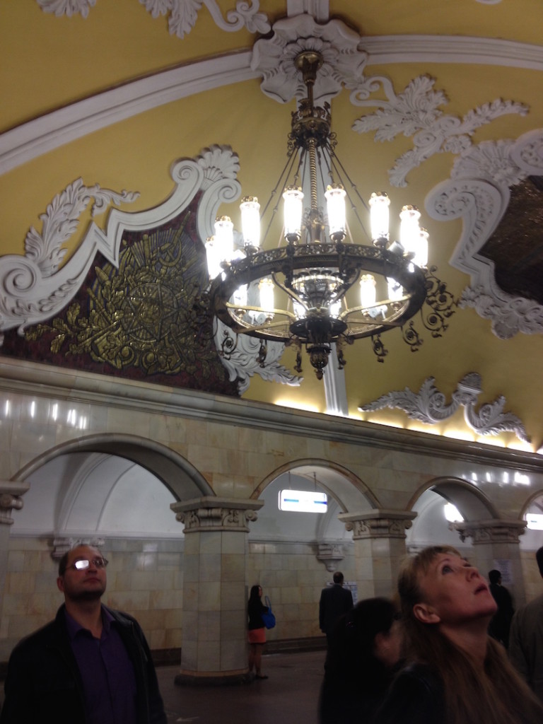
Komsomolskaya metro station looks like a museum. It has vaulted ceilings and baroque decor.
Hidden underground, in the heart of Moscow, are historical and architectural treasures of Russia. These are Soviet-era creations – the metro stations of Moscow.
Our guide Maria introduced these elaborate metro stations as “the palaces for the people.” Built between 1937 and 1955, each station holds its own history and stories. Stalin had the idea of building beautiful underground spaces that the masses could enjoy. They would look like museums, art centers, concert halls, palaces and churches. Each would have a different theme. None would be alike.
The two-hour private tour was with a former Intourist tour guide named Maria. Maria lived in Moscow all her life and through the communist era of 60s to 90s. She has been a tour guide for more than 30 years. Being in her 60s, she moved rather quickly for her age. We traveled and crammed with Maria and other Muscovites on the metro to visit 10 different metro stations.
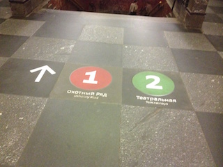
Arrow showing the direction of metro line 1 and 2

Moscow subways are very clean
To Maria, every street, metro and building told a story. I couldn’t keep up with her stories. I don’t remember most of what she said because I was just thrilled being in Moscow. Added to that, she spilled out so many Russian words and names, which to one who can’t read Cyrillic, sounded so foreign and could be easily forgotten.
The metro tour was the first part of our all day tour of Moscow with Maria. Here are the stations we visited:
1. Komsomolskaya Metro Station is the most beautiful of them all. Painted yellow and decorated with chandeliers, gold leaves and semi precious stones, the station looks like a stately museum. And possibly decorated like a palace. I saw Komsomolskaya first, before the rest of the stations upon arrival in Moscow by train from St. Petersburg.
2. Revolution Square Metro Station (Ploshchad Revolyutsii) has marble arches and 72 bronze sculptures designed by Alexey Dushkin. The marble arches are flanked by the bronze sculptures. If you look closely you will see passersby touching the bronze dog's nose. Legend has it that good luck comes to those who touch the dog's nose.
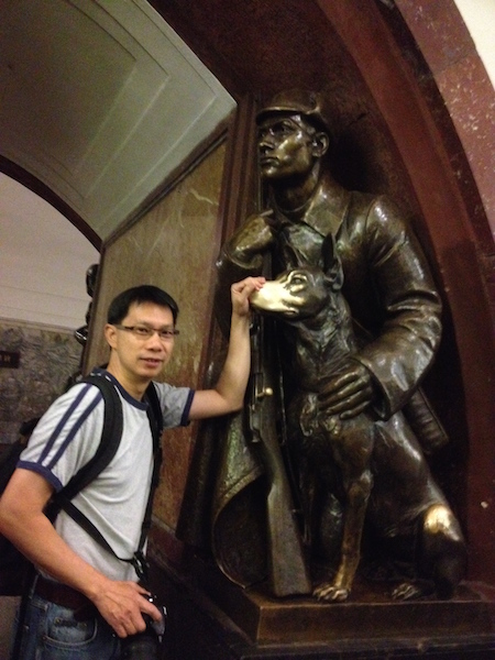
Touch the dog's nose for good luck. At the Revolution Square station

Revolution Square Metro Station
3. Arbatskaya Metro Station served as a shelter during the Soviet-era. It is one of the largest and the deepest metro stations in Moscow.

Arbatskaya Metro Station
4. Biblioteka Imeni Lenina Metro Station was built in 1935 and named after the Russian State Library. It is located near the library and has a big mosaic portrait of Lenin and yellow ceramic tiles on the track walls.
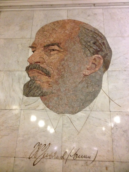
Lenin's portrait at the Biblioteka Imeni Lenina Metro Station

5. Kievskaya Metro Station was one of the first to be completed in Moscow. Named after the capital city of Ukraine by Kiev-born, Nikita Khruschev, Stalin's successor.

Kievskaya Metro Station
6. Novoslobodskaya Metro Station was built in 1952. It has 32 stained glass murals with brass borders.
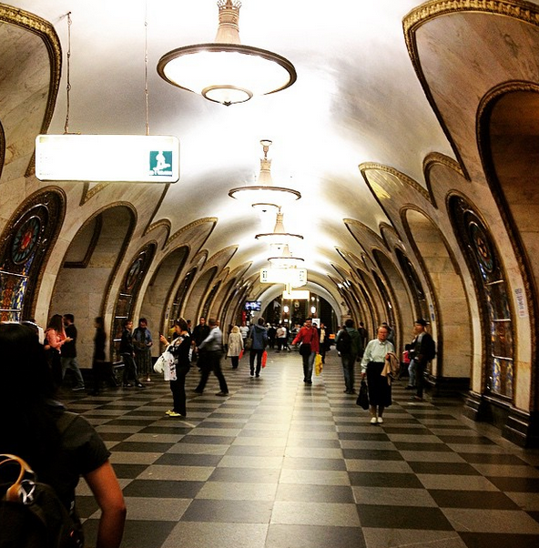
Novoslobodskaya metro station
7. Kurskaya Metro Station was one of the first few to be built in Moscow in 1938. It has ceiling panels and artwork showing Soviet leadership, Soviet lifestyle and political power. It has a dome with patriotic slogans decorated with red stars representing the Soviet's World War II Hall of Fame. Kurskaya Metro Station is a must-visit station in Moscow.

Ceiling panel and artworks at Kurskaya Metro Station

8. Mayakovskaya Metro Station built in 1938. It was named after Russian poet Vladmir Mayakovsky. This is one of the most beautiful metro stations in the world with 34 mosaics painted by Alexander Deyneka.

Mayakovskaya station

One of the over 30 ceiling mosaics in Mayakovskaya metro station
9. Belorusskaya Metro Station is named after the people of Belarus. In the picture below, there are statues of 3 members of the Partisan Resistance in Belarus during World War II. The statues were sculpted by Sergei Orlov, S. Rabinovich and I. Slonim.
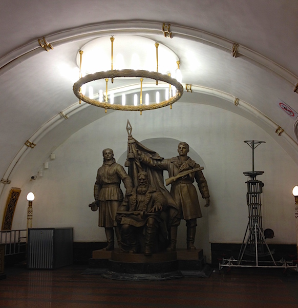
10. Teatralnaya Metro Station (Theatre Metro Station) is located near the Bolshoi Theatre.

Teatralnaya Metro Station decorated with porcelain figures .

Taking the metro's escalator at the end of the tour with Maria the tour guide.
Have you visited the Moscow Metro? Leave your comment below.
January 15, 2017 at 8:17 am
An excellent read! Thanks for much for sharing the Russian metro system with us. We're heading to Moscow in April and exploring the metro stations were on our list and after reading your post, I'm even more excited to go visit them. Thanks again 🙂
December 6, 2017 at 10:45 pm
Hi, do you remember which tour company you contacted for this tour?
Leave a Reply Cancel reply
You must be logged in to post a comment.
Please go to the Instagram Feed settings page to create a feed.
Region by region: How these states could broaden abortion access

The year began with nationwide conservative efforts to shrink abortion access . Advocates for the procedure hope to end 2024 by reversing some of these restrictions, via the ballot box.
And the outcome of their efforts could have major implications for something opponents have long waged war on − interstate abortion travel.
With ballot initiatives underway in nearly a dozen states to let voters weigh in on where to set the limits, the success or failure of these measures will have impacts beyond state lines and on regions broadly, advocates told USA TODAY.
Acting as a sort of sanctuaries for neighboring abortion access deserts, states with more liberal abortion laws have seen an influx of out-of-state patients since the overturning of Roe v. Wade, the landmark 1973 case guaranteeing a constitutional right to the procedure.
And a slew of proposed abortion-related constitutional amendments in 2024 could add to the map.
Prep for the polls: See who is running for president and compare where they stand on key issues in our Voter Guide
How many people got abortions in 2023? New report finds increase despite bans
“Unless there's a national right to abortion care, we're absolutely doing it state by state, community by community as best as possible,” said Adrienne Mansanares, president and CEO of Planned Parenthood of the Rocky Mountains.
Abortion travel escalated post-Roe
After the U.S. Supreme Court overturned Roe v. Wade and decades of federal abortion precedent in June 2022, decisions around the procedure and any limits or exceptions returned to states, creating a nationwide legislative patchwork.
Over a dozen predominantly red states have implemented near total bans on abortions, while a handful of blue states including Oregon and Vermont allow abortions regardless of the gestational period, according to the Guttmacher Institute, a research group that supports abortion rights. Some states restored an abortion limit similar to that of Roe.
The varying laws have led to a rise in patients traveling between states seeking an abortion, Mansanares said.
Planned Parenthood’s health centers in Colorado, a state with wider abortion access, saw a tenfold increase in patients seeking care from nearby Texas, Oklahoma and Arizona between 2020 and last year, according to the organization's records. In October 2020 through September 2021, their Colorado health centers saw 374 of these out-of-state patients; from October 2022 through September 2023, the clinics served approximately 3,800 patients from the same three states. Over 75% of these women scheduled appointments for abortions.
The bulk of women came from the Lone Star State, where the procedure is almost completely banned.
"When state bans go into effect, they impact the entire country,” Mansanares said.
This year, voters in at least three states will decide whether to enshrine abortion access in their constitution. And there are still ongoing initiatives to add such a decision to the ballot in about a dozen more states, including Colorado.
If passed, these referendums could cement some states’ statuses as abortion access points, while opening new points of access in others.
Women travel both to and from Florida for abortions
Sitting in the southeast where some of the country’s tightest abortion laws are concentrated, Florida has been a relative haven for patients in the South in the wake of Roe’s overturning.
But with the state’s current 15-week limit about to drop to six weeks, after a recent state Supreme Court ruling, women in Florida and the surrounding region could face a shortage of care, said Serra Sippel, interim executive director of The Brigid Alliance, a group that provides resources for abortion travel.
Already, Florida is among The Brigid Alliances top states from which they help patients travel, often seeking abortions in D.C. or Maryland, Sippel said.
And she said the group is bracing for this need to grow after May 1, when the six-week limit is set to go into effect.
November ballot measure could change Florida yet again
The Florida Supreme Court at the same time cleared the way for a measure protecting abortion through viability, often around 24 weeks, to appear on November’s ballot.
Tami Fitzgerald, executive director of the “100% pro-life" group North Carolina Values Coalition, said she is worried about the effects of both Florida court decisions in her own southern state.
“All states in the South, once Florida's heartbeat bill goes into effect, will have either a heartbeat bill or a gestational limit at conception,” Fitzgerald said. “And so that means North Carolina's 12-week limit on abortion will cause women to flood across our borders, again, to obtain abortions.”
Along with Virginia, which allows abortion through 26 weeks of pregnancy, North Carolina has some of the lowest restrictions on the procedure compared to the rest of the south. Even after the state legislature last summer lowered the limit from 20 to 12 weeks, with exceptions, North Carolina saw one of the highest number of out-of-state patients in 2023, behind Illinois, according to the Guttmacher Institute.
Fitzgerald said she wants a limit like other southern states for the Tar Heel State and is concerned about referendums like Florida's.
“It should be a concern for everyone who believes in the sanctity of human life,” she said.
Travel for abortion care is 'not ideal'
Still, abortion access advocates say interstate travel is an imperfect solution.
“It is not ideal," said Tara Romano, executive director of Pro-Choice North Carolina, “because not everyone can leave the state to access abortion. And this is really just how chaotic it's been since (Roe was overturned).”
“If you're in a state where you cannot access abortion, being able to get to another state is going to be really critical,” she added. “It's just that it's not going to be able to help everyone,” including patients in emergency situations, Romano said.
For those seeking an abortion, Mansanares said considerations range from travel costs to finding somewhere to stay in a different state, along with taking time off work and, for the many women who are already parents, finding childcare.
“It's a huge financial burden. And then the act of traveling out of your home state for care has a tremendous psychological impact as well,” Mansanares said. “Our patients are very fearful. They experience a deep amount of shame or stigma. Many of them feel terrorized."
And aid from organizations like The Brigid Alliance are “being stretched to the max, Sippel said.
“I want to emphatically say that it's a good thing that this referendum will be on the ballot,” Sippel said of Florida. “If it's passed, that is excellent news for Florida. And then, of course, it won't be enough.”

IMAGES
VIDEO
COMMENTS
Make your own interactive visited states map. Just select the states you visited and share the map with your friends.
Do you want to know the safety and security situation of your travel destination? Check out the color coded map from the U.S. Department of State, which shows the level of risk for each country and region. You can also find detailed information and alerts for specific locations by clicking on the map. Plan your trip wisely and stay informed with the latest travel advisories.
Visited States Map. This page features an interactive and customizable map builder showing visited states. You can use it to track your US travel history by marking the states you have previously visited! Create a beautiful custom map in a few clicks, and share it with your community. Also, check out our Interactive US Map for Websites with ...
Step 2. Add a title for the map's legend and choose a label for each color group. Change the color for all states in a group by clicking on it. Drag the legend on the map to set its position or resize it. Use legend options to change its color, font, and more. Legend options...
Visited states map. Use this tool to create stunning interactive maps of your travels across the United States. Select the states, add animations, configure the way you see fit. Then download as a static image, embeddable code, or even a smooth video or an animated GIF. Once you're done, check out 200+ other maps we have. Make your own ...
Whether you are a first-time visitor or returning to explore more of the USA, using the Visit USA interactive US State map provides a great way of exploring different destinations and understanding how they fit together. The possibilities are endless, from big cities and remote deserts to mountainous national parks, bargain-packed shopping outlets, palm-fringed coastlines and theme parks with ...
Instructions: Check the states checklist for the states you have visited, select a map size, then click Draw Map to create your own customized map of visited states. Right-click on your customized map to copy the map or save it to your hard drive. Then upload your customized visited states map to your own website, Facebook or Instagram.
Visited States + DC Map Generator. Welcome to the Maploco Visited States Generator! This is a fun tool that lets you show your friends all the places you've been. Check the states (and DC) you've been to in the list below. When you're done you can use the buttons to share on Facebook, Pinterest and other sites. Share with your friends!
Make detailed travel plans in seconds. Create a unique, full day by day itinerary based on your preferences. Make it awesome. Explore states, cities and activities. Refine your trip in one click and change/add activities. Share it and navigate on the go. Everything in one place. Everyone on the same page.
Yes, we now have a special version of our US map that uses hexagons to represent the states. It's included for no additional charge with a US map license. An HTML5, JavaScript-powered, interactive United States map. This mobile-compatible, responsive map includes clickable states, region zooming, U.S. territories and location markers.
About Visited States Map Create Your Visited States Map. Click states in the map to cycle through the colors, or use the list beneath. Choose: red for states where you've not spent much time or seen very much.; amber for states where you've at least slept and seen some sights.; blue for states you've spent a lot of time in or seen a fair amount of.; green for states you've spent a ...
US State Maps & US State Data. Fast facts as well as detailed information on all 50 states. Learn about their history, government, population and much more. Welcome, young explorers, to our adventure through the 50 United States using maps and fascinating data! Prepare to embark on an exciting journey where you'll discover the colorful ...
Contact. Help. The ultimate road trip planner to help you discover extraordinary places, book hotels, and share itineraries all from the map.
Make your own interactive visited countries map. Just select the countries you visited and share the map with your friends.
Hopefully our travel experiences will be of interest and benefit to website viewers as they plan their travel itineraries for 2024. The interactive map below highlights many of the more popular travel destinations in America, including national parks, scenic byways, historic sites, museums and favorite travel cities.
Add your travel destinations on a map, select your transport modes, visualize and share your itinerary for free. My itinerary This is a free demo version of our mapping software. Create an account to save your current itinerary and get access to all our features. ...
Make your own map of US counties and county equivalents. Use the switches at the bottom of the page to toggle state names or Interstate Highways on the map. Hover over a highway to check its name. When you isolate a state, you can choose to show the county names as labels on the map. Great for creating your own statistics or election maps.
Track your travel, mark visited countries and create your own world map. Plan your travel adventures, add bucket list destinations to your wishlist and share your travel goals with your friends and family using our interactive map tool. Share this page. Share the Page: Copy and share this unique URL: Copy URL.
Broods XIX and XIII will emerge in a combined 17 states, mostly in the Midwest and Southeast, in a rare, double brood event. These two broods last emerged together 221 years ago, and after this ...
The map provides traffic flow, travel alerts, cameras, weather conditions, mountain pass reports, rest areas and commercial vehicle restrictions.
Democrats expect to have little trouble holding onto this left-leaning Western New York House seat. The race pits Timothy M. Kennedy, a Democratic state senator from Buffalo, against Gary Dickson ...
As the map stands, if Trump and Biden win the states leaning in their direction, Trump would need to win 35 electoral votes from the toss ups to get to 270, and Biden would need 44.
For presidential candidates who are not the Republican or Democratic Party nominee, getting on the ballot for the general election is a state-by-state, make-or-break scramble. The maps above ...
STATE. NWS: 12 tornadoes touched down in Texas this weekend. Here's where ... Our interactive map, which contains data from January 1950 to July 31, 2023, pinpoints where a cyclone touched down ...
Eight officers in total were shot, Jennings said. The Marshals Service said a deputy U.S. marshal was killed. The other two law enforcement officers killed were from the North Carolina Department ...
Last summer, hundreds of millions of people were faced with triple-digit temperatures across the U.S. And now, weeks away from the hottest part of the year for the U.S., officials are warning it ...
NEW YORK - Department of City Planning (DCP) Director Dan Garodnick today announced the update of the DCP Housing Database through 2023, and the release of two interactive online tools that visualize where new housing is being built and permitted within New York City. 27,980 new homes were constructed in New York City in 2023, which was a slight uptick from 2022.
Biden currently has a narrow lead over Trump in the state. In both Pennsylvania and Washington, 80% of voters similarly ranked the economy as one of the topics they care most about this election.
Revolution Square Metro Station. 3. Arbatskaya Metro Station served as a shelter during the Soviet-era. It is one of the largest and the deepest metro stations in Moscow. Arbatskaya Metro Station. 4. Biblioteka Imeni Lenina Metro Station was built in 1935 and named after the Russian State Library.
Abortion travel escalated post-Roe. After the U.S. Supreme Court overturned Roe v. Wade and decades of federal abortion precedent in June 2022, decisions around the procedure and any limits or ...