

Wanderlust Travel & Photos
Seeing the world one trip at a time.
- Work With Me
- Travel Journal
- Privacy Policy
- Browse by Continent
- Australia Travel
- Peru Travel
- Thailand Travel
- Browse by Region
- East North Central
- East South Central
- Mid-Atlantic
- New England
- South Atlantic
- West North Central
- West South Central
- Central America
- North America
- South America
- Travel Vlog
- Instagram Photos
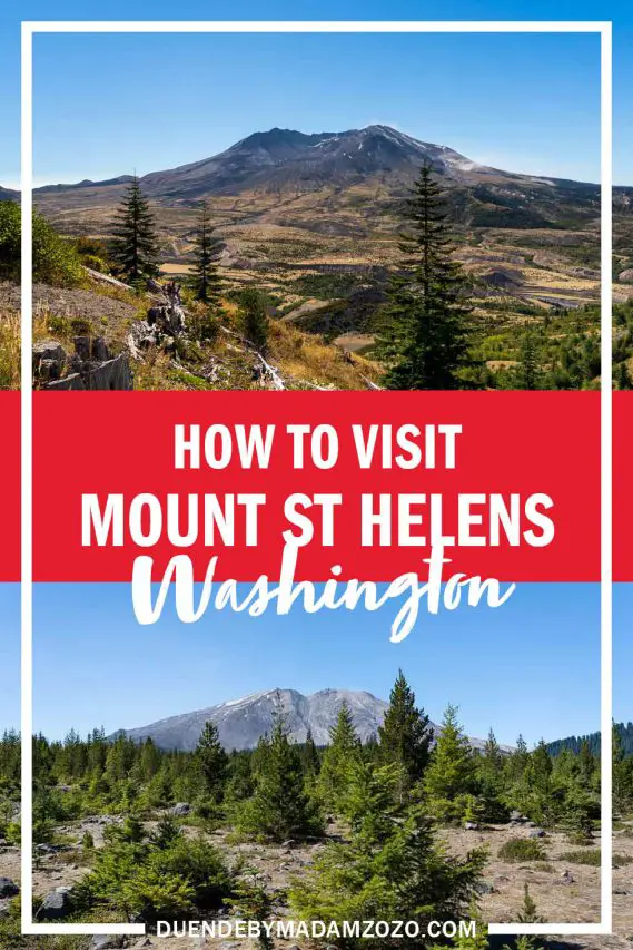
The All You Need Mount St. Helens Visitor Guide
LAST UPDATED: 2/4/24 – Mount St. Helens Visitor Guide
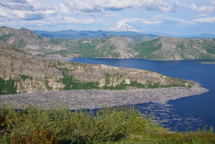
When Mount Saint Helens in Washington erupted on May 18, 1980, the eruption killed 57 people and sent volcanic ash as far as the East Coast of the United States. That eruption left a lasting impression on the mountain as it left a horseshoe-shaped crater when the eruption blasted away part of the mountain. Today, the mountain is one of the most popular tourist attractions in the Northwestern United States, drawing people from all over the world to see the mountain that once shook the United States.
Situated roughly 50 miles Northeast of Portland, Oregon, and roughly 96 miles South of Seattle, Washington as the crow flies, Mount Saint Helens is located in a beautiful part of America’s Pacific Northwest that has an abundance of tourist attractions. Visitors to the Mount Saint Helens National Volcanic Monument can learn about the 1980 eruption that left such a lasting impact on the surrounding landscape, hike in some of the most beautiful and serene landscapes, and marvel at the power of Mother Nature.

An All You Need Mount St. Helens Guide
In this Mount St. Helens visitor guide, I am going to give you all of the information that you need to plan a successful trip to Mount Saint Helens National Volcanic Monument. I am going to let you know the best ways to get there, outline the best times to plan your visit, and then give you some recommendations on where to stay when you visit. I will also give you some recommendations on where to get some of the best pictures of the mountain in the area, provide you with some recommended hiking paths, as well as provide you with some additional sightseeing ideas for your trip.
Mount St. Helens Guide Navigation Menu
How to get to mount st. helens.

Mount Saint Helens is located in the Southern part of the state of Washington in the United States, near the border with the state of Oregon. In fact, Mount Saint Helens is actually closer to the city of Portland in Oregon than it is to Seattle, Washington. To give you a general sense of where it is located, I have provided an area map for you to review in my Mount St. Helens visitor guide below.
Mount St. Helens is Close to Both Seattle and Portland
Situated between the cities of Seattle and Portland in the Pacific Northwest, Mount Saint Helens is close to many other popular tourist attractions in the area. To give you a sense of how far Mount Saint Helens is from other attractions in the area, I have included a table below that outlines some of those distances and drive times.
There are three primary ways that you can approach Mount Saint Helens National Volcanic Monument to view the mountain. From the West, visitors can stop at Johnston Ridge to get some fantastic views of the mountain from the North, as well as make a stop in the interactive visitor center to learn about the mountain’s eruptions.
In the East, visitors can stop at Windy Ridge viewpoint to get a different perspective of the mountain and hike on some of the area’s most scenic trails. Finally, in the South of the mountain viewers can hike through Lava Canyon, visit the Ape Caves, or attempt a summit of the mountain.

View Larger Map
Best Time to Visit Mount St. Helens

To assist you in determining the best time for you to plan your trip, I have included some information on average temperature, average precipitation levels, and the average number of visitors for you to review below.
Temperature (°F)
Because Mount Saint Helens is at a relatively high elevation, the weather near the mountain can be rather unpredictable. In the winter, temperatures near the mountain can be quite chilly and even fall well below freezing. In the summer, the high elevation keeps the temperatures from getting too warm. Even in the summer months, nighttime temperatures can be quite cool.
Precipitation (Inches)
If you would like to avoid freezing rain or snow, then I would recommend avoiding the winter months of November through March. This is the wettest time of year around Mount Saint Helens, with the wettest month being December. During the summer months of June through September, the area sees the lowest amount of precipitation of the year.
Average Visitors
According to Google Trends, the time of year when people are most interested in Mount Saint Helens is during the Spring months. This makes sense as the spring and summer months have the best weather. If you are looking to avoid crowds when you visit, your best bet would probably be early autumn. You should still have decent weather, but the crowds will be much thinner.
NOTE: The chart below is from Google Trends and shows the relative amount of Google searches for Mount Saint Helens by tourists throughout the year. The numbers are calculated relative to the peak month, which is mid-May. For instance, September 16th saw roughly 60% of the searches for “Mount Saint Helens” as May 13th, which was the peak day.

Where to Stay Near Mount St. Helens
Unless you are looking to camp out, there aren’t a lot of options for lodging right by Mount Saint Helens. However, there are quite a few lodging options within an hour’s drive of the monument. To assist you in locating a place to stay during your travels, I have included a list of recommended hotels at different price points in my Mount St. Helens visitor guide below.

Campgrounds Nearby
If you would like to save some extra money, there are also several quality campgrounds and RV parks in the area that you can stay at. To give you an idea of what is available, I have included a list of recommendations below for you to review.
- Cougar RV Park & Campground
- Beaver Bay Campground
- Merrill Lake Campground
- Kalama Horse Camp Campground
- Quartz Creek Big Trees Campground
- Iron Creek Campground
- Tower Rock U-Fish RV Park
- Blue Lake Creek Campground
- Campground: Olallie Lake
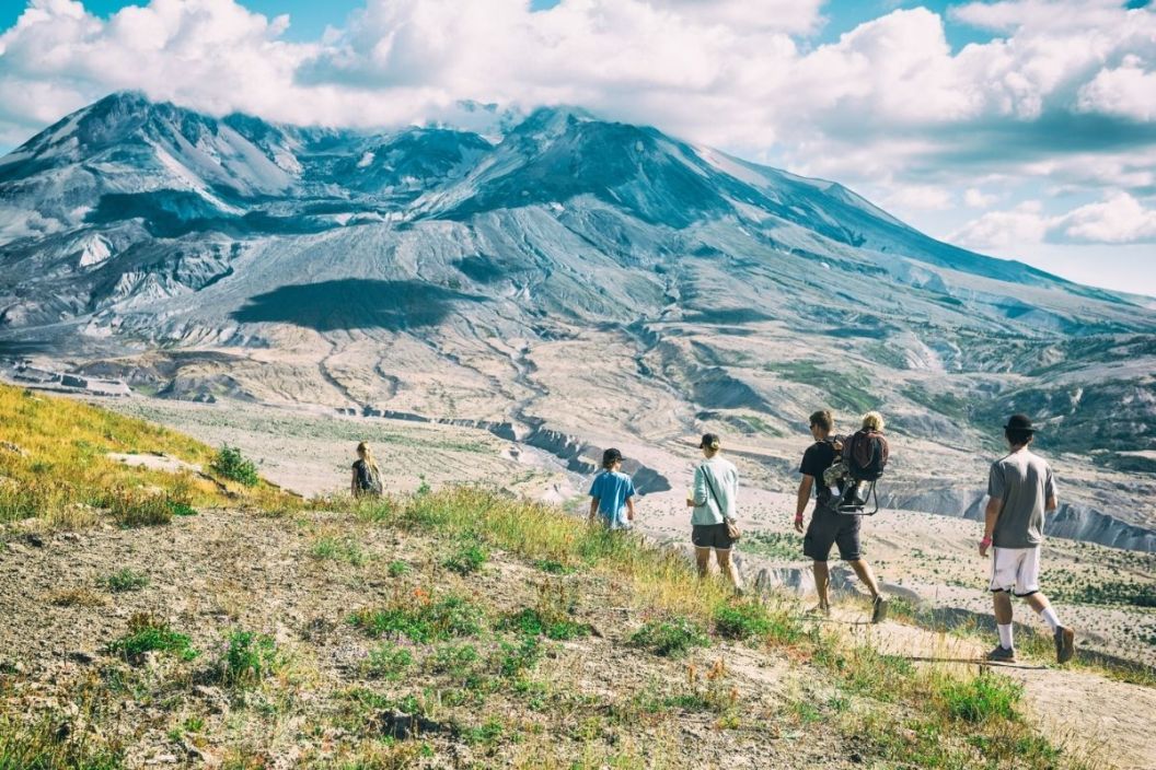
Hiking Near Mount Saint Helens

Another thing that Mount Saint Helens National Volcanic Monument has in abundance is great hiking trails. There are a number of great trails in both the East, West, and South of the national monument. If you are looking for a good hiking trail in the area, I have outlined a half dozen trails that I recommend below.
Popular Mount St. Helens Tours

If you are looking to add some extra adventure to your trip, several really great tours are available in the Mount Saint Helens area. I have included a list of the highest-rated tours and activities below for you to review should you want to book something for your trip.
The Ape Caves

If you are on the south side of the mountain, one of the most unique features that you can tour is the Ape Caves. These lava tunnels are surreal and absolutely worthwhile to tour if you have the time. There is no better way to get a first-hand look at how this volcano works than exploring the mountain’s lava tunnels.
Where to Photograph Mount St. Helens

View Larger Image
There are some absolutely fantastic pictures that you can get on the West side of the mountain. Not only does the Johnston Ridge viewpoint have some good spots to take photos, but you can get some really good shots of the area where the eruption blast devastated as well.

If you are up for doing some hiking then the East side of the mountain is my favorite side for getting shots. The path takes you into the valley right in front of the mountain and you can get some absolutely gorgeous shots of Mount Saint Helens.
PRO TIP : Doing research on a location is one of the best things you can do to increase the quality of your travel photographs. For some tips on how to do some pre-trip scouting for photo opportunities, check out my article on The Art of Travel Photography – Planning Your Shots. In this article, I review the process that I use to do pre-trip photography planning to give you photography location tips like the ones you see above.
Other Things to See in the Area

Because of its location, it is really easy to combine a visit to Mount Saint Helens with stops at some of the other popular tourist spots in the Northwest United States. If you are looking for some additional places to add to your itinerary, I have included a list of the other top tourist spots in the area below.

Mount St. Helens Photo Gallery
Mount Saint Helens is a beautiful mountain in a beautiful landscape. It is almost impossible not to take beautiful pictures when visiting. Below is a gallery of just some of the pictures I was able to take during my visit.
If you would like to see more of my travel photography, I would also encourage you to give me a follow on Instagram . Putting this blog together to pass on my free guides, itineraries, and travel photography tips is a lot of work and your support in the form of a follow-on Instagram would be so very much appreciated!

Don’t Forget to Subscribe to My Adventures!
Type your email…

Let Me Help You Save On Your Next Adventure!
‘start exploring today’ merchandise available now.
Published by Josh Hewitt
Avid traveler and photographer who loves to see new places, meet new people, and experience new things. There is so much this world can teach us, we just need to explore! View all posts by Josh Hewitt
Related Articles
The Ultimate Gibraltar Travel Guide: Everything You Need to Know

Segovia, Spain Travel Guide: Exploring the Historic City
Plan Your Adventure: A Complete Mesa Verde National Park Guide
20 comments ›.
I love all the information you provide! Thanks so much!
Thank you so much for the kind words, and for reading! 😀
Visiting Mount Saint Helens is on my list to do this summer, since we are so close (Seattle area)!
You are close! Seattle is such a beautiful city. I love the Northwest 😀👍
There is no shortage of activities to get into up here, that’s for sure.
Indeed! Olympic NP is my favorite.
Put this on my bucket list!
You will love it!! 😀
There is so much to see and do in the Pacific NW. I have to get back there. Excellent post!
Thank you so much!!! It is one of my favorite areas. So beautiful.
I totally agree with you on researching before visiting tour sites. Asides helping you find good camera angles, you could earn a lot of knowledge regarding the place and not appear so much as a “newbie”
Exactly!!! Thanks so much for reading!! 😀👍
This is fantastic. We did the helicopter tour when I was a teenager, and it was so incredible that I still remember it now, 25 years after the fact.
Thanks Scott!! I really appreciate it! The helicopter ride must have been amazing!!
It was! It was worth whatever my parents paid for it, that’s for certain!
Another great post! I made the mistake of visiting Ape Caves during a snowy November when there weren’t many people around the park. I checked it out by myself with a pretty weak flashlight and felt the darkness surround me. It was very eerie, but an excellent trip nonetheless!
Thank you for the kind words! That would be so spooky to visit during the winter.
What an awesome Mount St. Helens visitor guide! I just blogged today about our trip (last fall) to the East side of the park. I somehow missed this post of yours until today, but it’s so good that I just added a link to it in my post. Also, after reading your guide I know that I must see the south and west sides of the park one day as well!
Awesome!! I am definitely going to check out your post! I appreciate the kind words 😀👍
Leave a Reply Cancel reply
Wonderful, very nice article
[…] Late November or late February are particularly recommended as they offer a balance between good weather and slightly fewer…
I agree!! It is such an incredible place!
Thailand offers a captivating blend of vibrant culture, stunning landscapes, and warm hospitality, making it a top destination for travelers…
Discover more from Wanderlust Travel & Photos
Subscribe now to keep reading and get access to the full archive.
Continue reading
Subscribe To My Adventures!
Perfect Mt St Helens day trip from Seattle or Portland
Last Updated on July 1, 2023
Are you a volcano lover? Nature lover? If so then you absolutely must do a Mt St Helens day trip if you are anywhere near Seattle or Portland. On May 18, 1980, Loowit (Mt St Helens) erupted with incredible force, enough to incinerate miles of forest, unleash an epic mudslide that took out part of Interstate 5 and send an ash cloud miles into the sky that blocked out the sun for much of the west and sent ash traveling around the entire globe multiple times.
June 2023 Note : State Route 504, the Spirit Lake Highway, experienced a landslide in the Spring 2023 and the road is closed to Johnston Ridge Observatory. I will update this once they announce when the road and Johnston Ridge will reopen.
Loowit (Mt St Helens) is a fascinating place to learn about the destruction of the 1980 volcanic eruption and how life returns. You can hike trails, explore epic views, and learn about the science of volcanoes and how ecosystems change and recover after such a disruptive event. It’s an incredible experience that you won’t find anywhere else in the world!
Loowit means “smoking mountain” and is the homeland of the Cowlitz People and the Klickitat People.
Passes Needed : Monument Pass (purchase at the Johnston Ridge Observatory) – $8 per adult (free if you have an annual federal lands pass)
Cell Service : None along the Spirit Lake Highway or in Mt St Helens National Monument.
Dog Friendly : Dogs are not allowed on trails in Mt St Helens National Monument. In addition there is no shade at the Johnston Ridge Observatory so it is not safe to leave your dog in the car either. I recommend NOT bringing your dog to Mt St Helens.
Accessibility : Johnston Ridge has a ADA accessible parking and an ADA accessible restroom as well as a short accessible hiking trail through the destruction of the blast zone. Seaquest State Park also has accessible restrooms, parking an an ADA accessible trail.
Services : Make sure you have a full take of gas and bring plenty of food and water with you. Once you leave I-5, there are no services.
When is the best time to visit Mt St Helens?
- How do you get to Mt St Helens from Seattle?
- How do you get to Mt St Helens from Portland?
Johnston Ridge Observatory
Coldwater lake, forest learning center.
- Buried A-frame and Bigfoot statue
Silver Lake Visitor Center and Seaquest State Park
- Hikes at Mt St Helens
Windy Ridge
- Climbing Mt St Helens

Summer is the best time to visit Mt St Helens, since it really isn’t accessible in the winter. The Spirit Lake Highway which takes you from I-5 to Johnston Ridge is only open in the summer, generally mid-May through October.
I recommend going in July because that gives you the best chance of clear weather, no lingering snow and not too much haze yet. June, August and September are also excellent times to go. If you are not a fan of hot weather, I recommend September because it is a bit cooler than July.
July has stunning wildflowers at Johnston Ridge.
Much of Mt St Helens National Monument has no trees and no shade so it can be VERY hot. Make sure to bring plenty of water and sun protection!
How to get to Mt St Helens from Seattle
Mt St Helens is a long drive from Seattle and if you’re a camper, you might want to consider spending the weekend at Seaquest State Park. You can still do a Mt St Helens day trip from Seattle, no problem!
Head south on I-5 past Chehalis. South of Chehalis, take Exit 68 for US Highway 12. I recommend a short but worthwhile detour and leg stretch to Lewis and Clark State Park. This small state park has an impressive stand of old growth trees like the many that were leveled in the Mt St Helens 1980 eruption. When I did day trip tours to Mt St Helens from Seattle, we always stopped here so people could see the kinds of ancient forest that once existed in the volcanic landscape before the eruption.

There’s a short nature trail that gives you a chance to stretch your legs and use the restroom a couple hours into your trip which is a good time for a break. A Washington Discover Pass is needed to park here.
Once you exit I-5 on to Highway 12, look for Jackson Highway on the right in 4.5 miles. This will take you straight to Lewis and Clark State Park in just a couple miles.
When you leave Lewis and Clark State Park, continue south on Jackson Highway for five miles and then turn left onto State Highway 505. In 14 miles, turn left on State Highway 504, the Spirit Lake Highway. If you want to check out Silver Lake or Seaquest State Park, take a right here to back track about 12 miles. You can also return this way back to the freeway, although it’s slightly longer.
The Spirit Lake Highway takes you straight to the Johnston Ridge Observatory
Driving time from Seattle to Johnston Ridge Observatory (without stops) takes about 3 hours .
How to get to Mt St Helens from Portland
Mt St Helens is a shorter drive from Portland. To get there, take I-5 north into Washington and take exit 49 in Castle Rock. Turn right on State Highway 504, the Spirit Lake Highway. The Spirit Lake Highway dead ends at the Johnston Ridge Observatory.
Driving time from Portland to Johnston Ridge Observatory (without stops) takes about 2 hours .
Things to do on a Mt St Helens day trip

Johnston Ridge Observatory is named for the late volcanologist David Johnston, who’s famous radio broadcast told alerted the scientific community that the expected eruption was happening, just moments before he died in the eruption. Once you arrive, it’s easy to see why this was the perfect place to observe the volcano as it became more active in early 1980.
Today, the observatory has exhibits as well as an excellent movie about the eruption and the way the ecosystem is recovering from the eruption. Make sure to stay all the way through the credits because at the end the curtain pulls up to show a dramatic view straight into the crater of Mt St Helens that you don’t want to miss!
There are also restrooms here, a couple of short nature trails as well as longer trails if you wish to head out deeper into the blast zone.

Stop at the Coldwater Lake recreation area and boat launch to see a gorgeous and huge lake that has only existed since 1980! Massive mud flows and landslides dammed up Coldwater Creek creating a new lake right before our eyes.
You can do a lovely hike along the lake here, or you can just head out to the boardwalk on the short Birth of a Lake trail to learn all about how the eruption created the lake.
It’s easy to overlook this stop, but don’t do that! This is a great opportunity to learn about forestry, see a great view and possibly even some elk from the Elk Viewpoint.
The Forest Learning Center is operated by Weyerhauser, Washington’s big logging company. Keep that in mind as you explore the exhibits, but don’t dismiss it for that reason either. This is a really great place to learn all about forestry! There’s also a short paved trail here with some amazing views and a definitely chance to see elk in the valley below.
Buried A-frame and Bigfoot Statue
This is an absolute must stop for anyone who likes weird roadside attractions! This is one of the best ones in Washington.
An A-frame is a type of cabin that is common in the Pacific Northwest, usually made of roof with a very steep roof. Several hours after the 1980 eruption of Mt St Helens, a massive mud flow came down the Toutle River, destroying plenty of roads, bridges, cars and buildings. The A-frame here is a great place to see some of that destruction! You can see how the mud filled the cabin up to the second floor and you can peak inside this cabin that is frozen in time.
There is also a Bigfoot statue (28 feet high!) and a Bigfoot giftshop here.

If you’re coming from Portland, I highly recommend stopping here! If you’re coming from Seattle this is slightly out of your way, but still worth a stop. This is also the best camping situation near Mt St Helens and a great place to spend a weekend.
The visitor center has a seismograph showing the current volcanic activity on Mt St Helens as well as a step in volcano model which is pretty cool! Outside there is a boardwalk through a wetland with many birds and a view of Mt St Helens.
Seaquest State Park also offers swimming and hiking trails. They also have yurts you can reserve for a camping experience with no tent required!
Hiking at Mt St Helens
While the summit climb is awesome, it is also super hard and an all day adventure that takes plenty of preparation. There are many other wonderful hikes you can do on a Mt St Helens day trip that are much shorter and easier and give you plenty of opportunity to soak up big views, epic volcanic landscapes and scenes of nature recovering from the destruction of the 1980 eruption.
There is no cell service and no shade, so make sure to be prepared, especially with food, water and sun protection.
These are a few of my favorite hikes in Mt St Helens National Monument.
Lakes Trail

- Location : Coldwater Lake
- Distance : up to 9 miles round trip
- Elevation Gain: up to 600 feet round trip
- Special Features : Walk along the shore of a naturally created lake from the 1980 eruption! Epic views and cool breezes too.
Hummocks Trail
- Distance : 2.5 mile loop
- Elevation Gain : 300 feet
- Special Features : a unique and weird landscape of piles of avalanche debris from the 1980 eruption, some of which are several hundred feet high.
Harry’s Ridge
- Location : Johnston Ridge
- Distance : Up to 8 miles round trip
- Elevation Gain : Up to 1000 feet
- Special Features : This hike is harder than it looks on paper, because there is no shade whatsoever and it can be extremely dusty. It is still an incredible hike with astounding views the entire time. You’ll be in the heart of the blast zone with views of Mt St Helens and Spirit Lake. You do not need to go all the way to Harry’s Ridge to experience this awesome trail, you can turn around at any point.
Pumice Plain

- Location: Johnston Ridge
- Distance : Up to 10.4 miles
- Elevation Gain : Up to 1100 feet
- Special Features : This is the best trail for those who really want to get as far as possible into the blast zone! You’ll start the same way as Harry’s Ridge and then divert down into the pumice plain and towards the crater. Like Harry’s Ridge, you don’t need to be destination oriented here, you can follow the trail even a short distance to get a feel for this spectacular volcanic landscape.
Other interesting things to do at Mt St Helens
The list of things to do on a Mt St Helens day trip above are all along the Spirit Lake Highway between I-5 and the Johnston Ridge Observatory. This is the best place for visitors to go on a day trip, but there are some other really cool things to see and do in Mt St Helens National Monument. I think they are worth including here in case you have more time.

Located on the other side of Mt St Helens from the blast zone of the 1980 eruption, Ape Cave was created by Mt St Helens about 2000 years ago!
It is what’s known as a lava tube, where hardening lava creates a tube that provides some protection from colder air outside, allowing the lava to continue to flow liquid a longer distance. After everything cools, it creates a long, narrow cave.
You can go inside (make sure you have fresh headlamp batteries and a back up light!) and go up to a couple of miles inside the lava tube.
Ape Cave is on the south side of Mt St Helens near the town of Cougar. It’s a two and a half hour drive from Johnston Ridge, a three and a half hour drive from Seattle and an hour and a half drive from Portland.

Windy Ridge is on the northeast side of Mt St Helens National Monument and is harder and longer to get to. This is the best place for visitors who don’t like crowds!
It’s only open during the summer months and involves a lot of driving on forest service roads. There are quite a few forest service campgrounds near by.
Windy Ridge provides the same epic views of Mt St Helens and many wonderful hiking trails.
Climb Mt St Helens
Climbing to the summit of Mt St Helens and looking into the crater is one of the top three experiences of my life! I’ve done it several times and it’s absolutely incredible. It is a challenging, long, steep and exposed all day adventure that requires preparation.
Read all about how to plan your own summit climb here .

Privacy Policy
")
How to Visit Mt St Helens in One Day or Two

Mount St Helens is a volcano in southern Washington State. The mountain is an awe-inspiring spectacle—a volcanic temple to the power of mother nature. Even 40 years on from its headline-making eruption, the evidence of its explosive is clear. This is a day trip or weekender not to be missed. Visit Mount St Helens National Volcanic Monument with this itinerary and guide.
Table of contents
Mount st helens fast facts, is mount st helens worth visiting, what is the best time to visit mount st helens, getting to mt st helens national volcanic monument, how long do you need to visit mount st helens, how much does it cost to visit mt st helens, general mount st helens visitor tips.
- Mount St Helens is not a National Park, it is a National Monument established by US Congress in 1982.
- The volcano is known by the Native American names Loowit or Louwala-Clough , which translate to “smoking mountain”.
- Captain George Vancouver of the British Royal Navy dubbed the volcano Mt St Helens in 1792. It’s namesake is Alleyne Fitzherbert, the Baron St Helens who served as the British Ambassador to Spain.
- Mount St Helens’ last major eruption was on Sunday May 18, 1980. It began with an earthquake measuring 5.1 on the Richter scale, followed by the collapse of the north face of the mountain. The collapse released pressurized gases in the volcano triggering a lateral explosion which decimated nearly 38,850 hectares (150 square miles) of the surrounding landscape.
- The area around Mt St Helens had been mostly evacuated prior to the eruption, however 57 people were killed. Three of these people were within the “red zone”: a scientist, a photojournalist and a stubborn resident who wouldn’t leave.
- Mt St Helens lost about 2.6 cubic kilometres (0.63 cubic mile) of its volume in the eruption and which reduced its height about 396m (1300ft).
Volcanic activity continued until 1986 until the mountain settled down again.
In a word, yes! If seeing an active volcano in person excites you, then you will get a kick out of visiting Mt St Helens. It is incredible (and a little scary) to see the destruction wreaked by the 1980 eruption and that even after 40 years it is still so evident on the landscape. Plus, I think of it as a chance to preview what nearby Mt Rainier might look like in the future.
The main road accessing Mount St Helens is State Route 504 (aka Spirit Lake Memorial Highway). The upper part of this road is generally open May to October, making summer and early autumn the best times to visit Mt St Helens. Check with the Forest Service for specific conditions. Summer brings beautiful wildflower blooms, however, note that Mt St Helens National Volcanic Monument has no shade. Early autumn is a little cooler for those who don’t like to be out in the intense summer heat.
The two closest airports to Mount St Helens are Seattle-Tacoma International (SEA) and Portland International (PDX).
From there, the best way to get to the volcano is by car. Here are some rough distances and drive times from the major metro areas to Johnston Observatory:
From Seattle, WA – Approximately 260km (160mi)/ 3.5 hours drive
From Tacoma, WA – Approximately 210km (130mi)/ 2.5 hours drive
From Olympia, WA – Approximately 155km (95mi)/ 1.75 hours drive
From Portland, OR – Approximately 180km (110mi)/ 2.25 hours drive

To visit Mt St Helens in a day trip, you really don’t want to be starting out further away than Olympia, WA or Portland, OR.
It is possible to day trip from Tacoma or Seattle, WA but it would be an awfully long day with a huge proportion spent in the car. If you plan to day trip from Seattle, it would be best to invite some friends that you trust to share the driving duties.
With two days, Mt St Helens is a more comfortable trip from Seattle and you can see both the north/west and south/east side of the mountain.
If you can afford three days or a long weekend, you can see Mt St Helens from all sides and tie in a day trip to Mount Rainier National Park as well!
Entry fees and passes for Mt St Helens National Volcanic Monument are stupidly complicated, so I’ll try to break it down for you the best I can.
The U.S. Forest Service manages the Monument. They charge per-person entry fees to access the Coldwater or Johnson Ridge areas on the west side of the volcano. The cost is $8 per person for adults (kids under 16 are free).
If you also intend to visit the eastern and southern sides of Mt St Helens, you will need to pay $5 per vehicle, per day for a National Forest Day Pass (or $30 for an annual pass) . Passes are available for purchase at Forest Service offices and self-serve kiosks around the Monument. The Volcanic Monument also honours the America the Beautiful pass and Senior passes for the named pass owner and 3 additional adults. If you have a Northwest Forest Pass (Oregon and Washington), this will allow one person to enter.

Mount St Helens one and two day itinerary
Start early, especially if you are driving 2-3 hours to get to the Park rather than overnighting nearby. We drove to Castle Rock on a Friday night after work, to get a head start on the following day. Castle Rock is the closest town with descent amenities including hotels, restaurants and supermarket where you can pick up supplies.
Take State Route 504 off the I-5. Your first stop will be about 10 mins away from the exit, at the Mt St Helens Visitor Center. Though the Visitor Center has been closed during the pandemic, it is still worth a brief stop to stretch your legs on the short interpretative trail which includes a boardwalk along Silver Lake.
About 15-20 minutes further along State Route 504, look for the Bigfoot statue that marks the North Fork Survivors Gift Shop. There you will find an A-frame home that was partially buried by the mudslides resulting from the eruption.
Back on the road, your next stop is Bridge View Point. This spot overlooks Hoffstadt Bridge, the longest and tallest of the fourteen bridges along the Spirit Lake Memorial Highway (SR-504). Here, you’ll also begin to comprehend the extent of the area affected by the 1980 eruption of Mt St Helens, as you stand on the edge of the Blast Zone.
Next stop on our itinerary is the Mount St Helens Forest Learning Center. Even if you don’t intend to visit the Center, make a quick stop here for some photos. The Learning Center overlooks the valley through which the deadly mud and debris slide tore moments after the eruption.
A smidgen further up the road at the Mile 37 marker, you will find Elk Rock Viewpoint. This marks the western entrance to Mount St. Helens National Volcanic Monument with views to the crater, the Toutle River Valley and on clear days, the snowy peak of Mount Adams.
Finally, we arrive at Johnston Ridge Observatory. The Ridge and Observatory are named for USGS volcanologist David A. Johnston , who was monitoring Mt St Helens at a nearby observation post on the morning of the eruption and who died in the blast. Here you’ll have direct views into the horseshoe-shaped crater of the volcano which is partially filled by a lava dome and glacier. While you are here, take a short hike on the paved Eruption Trail (approx. 800m/0.5mi) for more astounding views and gorgeous, summer, wildflower blooms.
Return to your place of origin or go drive to your accommodation for the night and continue with day two. Again, Castle Rock is a good place to spend the evening.

Make your way to the east side of the volcano via WA-503 and stop the Trial of Two Forests trailhead. Wander along the boardwalks of this easy and accessible 0.4km (0.25mi) loop trail. Here, two forests meet. The old-growth forest is composed of Douglas firs and western red cedars. The younger forest, which was destroyed by lava flows from Mt St Helens 2000 years ago, is made up of fir and hemlock. There are imprints of trees in lava beds and a lava cast you can climb into (again, have your flashlight at the ready).
Next stop: Ape Cave. The cave is a lava tube formed over 2000 years ago! You’ll need a flashlight to explore either of the two routes departing from the visitors’ center near the main entrance. The lower trail is about 2.5km/1.5mi return on this easy, out-and-back hike.
The upper trail is about double the distance with half the hike taking you through the cave and a return trail above ground. Among other obstacles, the upper trail requires you to scale a slippery 8ft lava wall with limited footholds. This is one for the adult adventurers!
After Ape Cave, get a contrasting view of Mt St Helens, by making your way to Lahar Viewpoint. Here you’ll see how different the recovery of the landscape has been compared to the crater side.
At this point, it’s time to turn homeward.
- Start early, especially if you are driving 1-2 hours to get to the Monument.
- Always check Park conditions and closures before setting out.
- Make sure you have plenty of sun protection.
- Pack lots of food and water. There are extremely few food outlets once you leave the I-5, so pack lunch, snacks and lots of water.
Remember to take only photos and leave only footprints as you enjoy your visit to Mount St Helens.
Peace, love & inspiring travel,
Simple and Scenic Mount Rainier Day Trip Guide
Weird & wonderful things to do in portland, or, leave a comment cancel reply.
Save my name, email, and website in this browser for the next time I comment.
Don't subscribe All new comments Replies to my comments Notify me of followup comments via e-mail. You can also subscribe without commenting.
This site uses Akismet to reduce spam. Learn how your comment data is processed .
This website uses cookies to improve your experience. We'll assume you're ok with this, but you can opt-out if you wish. Accept Read More
- About Trudy

Live & Travel Well for a Healing Journey...
Mt. st. helens scenic daytrip itinerary in washington state.

The volcanic eruption of Mt St Helens in 1980 became the most devastating in U.S. history. A Mt St Helens daytrip inspires, with the power and renewal of nature. Getting the most out of a daytrip requires planning, as Mt St Helens Volcanic National Monument is massive with 3 main sections: West, South and East. For most visitors the west section is the best for first timers. Here, I explain why and what to do if you only have one day at Mt St Helens National Monument.
Mt St Helens is located in southwest Washington and part of the Cascade Volcanic Arc, a section of the Pacific Ring of Fire. It lies just 50 miles south of Mount Rainier and 33 miles west of Mount Adams. Its eruption on May 18, 1980 is one of the largest volcanic explosions in the history of North America. The active stratovolcano stands at 8,366 feet high, with its crater blown out of the north face.
Mount St Helens Daytrip at West Side

Directions: Take State Route 504 eastward 52 miles from Castle Rock on Interstate 5. The main highlights of the west side are along Highway 504. The Johnston Ridge Observatory is at the end of the 504 about an hour’s drive from Castle Rock.
Overall, the west side is the heart of the blast zone with these main sites: Mt St Helens Visitors Center, Johnston Ridge Observatory, Eruption Trail, Harry’s Ridge Trail, Coldwater Lake and Trail and Hummocks Trail.
Mt St Helens Visitors Center
Mt St Helens Visitors Center is about 30 miles from the volcano and an introduction to its history and significance. Located on the Spirit Lake Highway it offers learning opportunities, such as, theatre showing the eruption, chronological timeline on events leading up to the eruption, displays and current seismographs of the mountain. Also, the visitors center is located near Silver Lake with a .6-mile walking trail to learn about the flora and fauna of this ecosystem.
Johnston Ridge Observatory, Eruption Trail and Harry’s Ridge Trail

If you haven’t seen Mount St. Helen’s before, the Johnston Ridge Observatory is the ideal place to start exploring. Perched on the Johnston Ridge in the heart of the blast zone, it looks southward at the crater, lava dome, pumice plain and landslide across the valley. Named after the volcanologist, David A. Johnston, who lost his life in the eruption, the Observatory offers ways to experience and learn about this amazing volcano with stunning views. Also, there’s an outdoor theatre for presentations facing the volcano.
Near the Observatory is the .8 mile Eruption Trail on a hill, overlooking the volcano. It offers explicit displays and placard explaining the timeline and events leading up to the eruption. This is a great opportunity to let it all sink in and learn all while looking at the smoldering volcano.

Eruption Trail leads to the longer Harry’s Ridge Trail as the best way to observe the volcano. It’s named after the curmudgeon, Harry Truman, who wouldn’t leave his home and died in the eruption. Harry’s Ridge is a 9-mile up and back moderate trail that continuously views Mt St Helens’ crater. Additionally, this trail displays the colorful wildflowers of the area in summer months. It goes to the beautiful spot overlooking Spirit Lake with breathtaking views of this cobalt blue body of water below the ridge. This trail is reasonably wide and well-maintained, however, there are times it gets very close to the steep edge. So, if you have a fear of heights this trail may be a challenge.
Coldwater Lake

This pristine blue-green lake is a wonderful place to swim and cool off on a hot day. The eruption created this lake from its landslide damning the Coldwater Creek. Furthermore, its Birth of a Lake Trail has interpretive signs, that describe how the lake became created. There are also picnic tables and restrooms. Visitors enjoy this lake by swimming, fishing, hiking and paddle boarding.
Hummocks Trail
Across the road from the Coldwater Lake is the Hummocks Trail. This 2.3-mile loop takes you through hummocks (small hills) that were pieces of the mountain carried down by the landslide during the eruption. Walking through the labyrinth of these small hills overgrown with shrubs and small trees is another opportunity to experience parts of the mountain. Additionally, this welcomes some shade on a hot day.
Overall, Mt St Helens Daytrip
There is nothing like a day here to observe the powers of Mother Nature. The renewal of the region is awe-inspiring, reminding us that everything in life has its cycles and seasons for birth, death and renewal.
Read More! Ultimate Guide to Mt Rainier National Park: All You to Need to Know 20 Amazing Must-Do Hiking Trails in Washington State

Leave a Comment Cancel Reply
Save my name, email, and website in this browser for the next time I comment.

Adventures in Destinations Unknown

Day Trip to Mount St Helens National Monument
Last modified on October 1st, 2020 at 10:05
Four decades ago, Mount St Helens unleashed the most destructive eruption in modern US history. The volcano’s explosion expelled 520 million tons of ash that darkened the skies above Washington State. The plumes of smoke traveled eastward nearly 2,000 miles across the country—leaving a blanket of ash in their wake.
The eruption of Mount St Helens created the largest debris avalanche in recorded history. It killed 57 people in its path, and wiped away much of the mountain’s northern face.
Today—forty years after the explosion forever changed the appearance of one of Washington State’s most iconic peaks—the national monument is a beloved Pacific Northwest attraction. It makes for a fantastic weekend getaway, and is a popular day trip destination for travelers from Portland and Seattle.
Table of Contents
MOUNT ST HELENS DAY TRIP FROM SEATTLE OR PORTLAND
Mount St Helens National Monument lies approximately three hours southeast of Seattle and an hour and a half northeast of Portland. Its central location between the Pacific Northwest’s two largest cities, makes it a popular day trip from both Portland and Seattle.
Though Mount St Helens is certainly an ambitious place to visit in one day (especially if coming from Seattle) it is still worth exploring for those with limited time. The area offers a plethora of hiking trails, viewpoints, and educational resources for kids.

When Dan and I chose to take a day trip from Seattle to Mount St Helens, we knew we would have to prioritize certain aspects of our visit. We researched the best hiking trails in Mount St Helens and mapped out the monument’s most scenic viewpoints.
In the end, our day trip to Mount St Helens consisted of a stop by the Johnston Ridge Observatory, and a breathtaking hike along Harry’s Ridge Trail.
JOHNSTON RIDGE OBSERVATORY
The Johnston Ridge Observatory was named for a volcanologist who lost his life during the Mount St Helens eruption. He was one of the 57 people who perished that day.
The observatory lies at the terminus of State Highway 504, in the heart of the volcano’s blast zone. Its viewing platform provides up-close access to the park’s geology. The viewpoint is wheelchair accessible and offers a direct look into the crater.
Access to the area requires an $8 per person Monument Pass.

The visitor’s center at the Johnston Ridge Observatory hosts interpretive displays that tell the story of Mount St. Helens and its eruption. The center’s interactive exhibits allow visitors to learn more about the area’s unique geology and history.
HARRY’S RIDGE TRAIL
Like the Johnston Ridge Observatory, Harry’s Ridge Trail was named after a victim of the volcano’s eruption. Even prior to his death, the victim—Harry R Truman—was a bit of a local legend. A prohibition bootlegger, petty criminal and collector of cats, he was a man who lived by his own rules. In the weeks leading up to the explosion, scientists and researcher were unsuccessful in convincing Truman to evacuate the area. Despite dire signs of an imminent eruption, Truman refused to leave his home at the edge of Spirit Lake. “If the mountain goes. I’m going with it,” he’d stated.
And on that fateful day in 1980, Harry became true to his word. He and his sixteen cats perished in the onslaught.

Harry’s Ridge Trail is one of the most popular hikes in Mount St Helens. It begins at the Johnston Ridge Observatory and extends just over four miles in each direction. For travelers visiting the mountain as a day trip, it is a comprehensive hike that features many of the national monument’s most scenic views. Revealing birds-eye panoramas of the park’s altered landscape, Harry’s Ridge Trail showcases the splendor—and legacy— of the mountain that Harry Truman so dearly loved.
The 8.5 mile out and back trail follows a ridge line and rises at a gradual incline. It is well-maintained and doesn’t require any technical hiking skills.
Throughout the duration of the hike, the trail gives way to intimate views of the Mount St Helens crater and mudflow, before turning inward and climbing gradually up the back side of Harry’s Ridge.

The end of Harry’s Ridge Trail rewards hikers with commanding views of Spirit Lake.
Beyond, its spectacular panoramic vista highlights Mount Adams to the east, Mount St Helens to the south, and Coldwater Peak to the north.
Spirit Lake is the main body of water visible from the end of Harry’s Ridge Trail. The lake has an interesting history, as it has been shaped and altered by volcanic activity for its entire existence.
The lake originally formed when rock fragments dammed two creeks in the area. But then, in 1980, a debris avalanche from the Mount St Helens eruption temporarily displaced much of the lake from its bed. Spirit Lake’s surface area increased in size after the displacement, spreading out its waters to cover an additional 2,000 acres.
The blast deposited thousands of pyrolized trees into Spirit Lake. These shattered trees formed a floating log raft on the lake’s surface. Four decades after the event, the log raft still floats around the northern reaches of the lake.
HIKING MOUNT ST HELENS
Mount St. Helens is a popular climbing destination for both beginning and experienced mountaineers. All routes to the top of Mount St Helens include sections of steep, rugged terrain.

Though climbing Mount St Helens does not require technical skills, hikers must obtain a permit from Recreation.gov. Permits are mandatory year-round for anyone who desires to climb above an altitude of 4,800 ft.
I did not include a hike up Mount St Helens in my day trip itinerary due to limited time and lack of advanced planning, but I hope to summit its cratered peak at some point in the future.
Ape Cave is the longest lava tube in the United States and a popular Mount St Helens attraction. Similar to the Lava River Cave in Central Oregon’s Newberry Crater , Washington’s Ape Cave is a subterranean passageway formed by molten lava.
Ape Cave lies at the opposite edge of the national monument from the Johnston Ridge Observatory. Since roads do not connect the two destinations, it can be difficult to include Ape Cave into a Mount St Helens day trip itinerary.
Travelers interested in visiting the Ape Cave Lava Tube are better off touring the attraction as part of a separate trip, or as part of a multi-day Mount St Helens visit.
Mount Saint Helens National Volcanic Monument is one of the most geologically fascinating destinations in the Pacific Northwest. The mountain is a living laboratory and an enduring reminder of nature’s power.
Mount St Helens lies in the Cascade Mountain Range, between Mount Rainier and Oregon’s Mount Hood. It is one of three national monuments in Washington State —along with Hanford Reach and the San Juan Islands,
Visiting the national monument as a day trip or weekend trip is a fantastic escape into one of Washington State’s premier attractions. It is an educational outing that provides insight into the geological forces at play in this active and ever-changing corner of the Pacific Northwest.
__________________________________
Did You Enjoy this Mount St Helens Day Trip Itinerary? Pin It!

The First-Timer's Guide to Exploring Mount St. Helens
Situated in the Gifford Pinchot National Forest, Mount St. Helens National Volcanic Monument occupies a strange space for official classifications. Unlike Mount Rainier to the north, the U.S. Forest Service oversees what would be considered as the Mt St Helens National Park. But it isn't actually a state or national park, even though it's treated like one.
Although Washington state hosts the Mount St. Helens Visitor Center at Silver Lake, some famous attractions like the Johnston Ridge Observatory are run by the feds. In contrast, others associated bodies like the monument's Science and Learning Center and the Mount St. Helens Institute are extensions of nonprofit institutions.
But you're not here to read about tedious outdoor bureaucracy! You're here because you want to get better acquainted with backcountry pumice plains and lava canyons. We're here to help you with just that. Whether you're planning a day trip from big cities like Portland and Seattle or plotting a round trip from some other corner of North America, we hope the following guide gets you to the lava flows faster!
Mt. St. Helens Entrance Fee
All U.S. Forest Service areas require a $ 5-day pass for entrance and parking. Those that grant access to Mt. St. Helens also work in all other Oregon and Washington national forests for 24 hours. If you plan on dipping into national forests often, you might consider purchasing an annual recreation pass for $30.
Things to Do at Mount St. Helens

thinair28 via Getty Images
There are many things to do at Mt. St. Helens, from the usual suspects like hiking and boating to more niche activities such as paragliding and metal detecting. The best way to explore the region is in sections. There are several independent routes in and out of the monument, leading visitors to one of its distinct ecosystems. The Forest Service divides the memorial up in the following way, and their website is the best place to get more information :
This is the most accessible area to reach if you take the Spirit Lake Highway (504) from Castle Rock, WA, and the I-5. Here you'll find the Johnston Ridge Observatory and the Science and Learning Center, making it a great destination if you're interested in first-time interpretive experiences. The west side of the park has quite a few hiking trails and mountain biking routes, and Coldwater Lake is a great place for picnicking and aquatic recreation.
The monument's east side grants visitors access to Spirit Lake, the largest body of water on the mountain. This side of St. Helens also offers horseback riding and camping opportunities; the west side doesn't.

fishysam via Getty Images
Here, hikers will find some of the monument's most popular trailheads like the Ape Cave lava tube and the Climber's Bivouac trail. If you're coming up from Oregon, this side of the mountain is the easiest to reach.
Related Content
Experience "larch madness" by taking on these gorgeous washington hikes, map your adventure of mt. rainier national park, 5 family-friendly day trips to escape seattle.
If you're headed to the Norway Pass Trailhead, this side of the mountain is where you want to be. It also has some of the most amazing views the monument has to offer. Similarly, the mountain's northern slope has seen less volcanic damage and is lush with flora and fauna.
Eruption of Mount St. Helens

kwiktor via Getty Images
The good news is that Mt. St. Helens has only erupted a couple times in the last half-century. According to the USGS , the bad news is those future eruptions are both expected and predicted to be more devastating than the previous two.
But never fear! Folks brave the blast zone daily, and the mountain sends out plenty of signals before blowing its top. Just so, you don't have to worry about it exploding under your feet once you get there.
What's your favorite thing to do on Mt. St. Helens? Give first-timers a lead on our Wide Open Roads Facebook !
READ MORE: Experience "Larch Madness" by Taking on These Gorgeous Washington Hikes
You might also like.

Summit the Highest Point East of the Mississippi at Mount Mitchell State Park

Trip Planning
Explore grand teton national park, from jenny lake to jackson hole.

Rocky Mountain National Park: A Traveler's Guide to Taking Your Kids

Exploration
Lassen volcanic national park is california's best kept secret.
madalyne loree
- Aug 31, 2023
A Complete Guide to Climbing Mount Saint Helens
46.1914° N, 122.1956° W

LEARN EVERYTHING YOU NEED TO KNOW ABOUT CLIMBING MOUNT ST. HELENS IN WASHINGTON - INCLUDING THE BEST TIME TO GO, WHAT THE BRING WITH YOU, AND WHAT TO EXPECT ALONG THE TRAIL.
While Mount Saint Helens was once thought of as the Mount Fuji of the USA due to its perfect conical shape, thanks to its famous eruption in 1980 the Cascade peak now has an almost equally well-known flat top that can viewed from dozens of miles away (on a clear day at least).
Today, Mount Saint Helens and the surrounding national volcanic monument is a popular destination for hiking, climbing, biking and backpacking. But maybe the most famous adventure is climbing up to the crater rim of the ubiquitous mountain itself.
Mount Saint Helens (or Loowit - the indigenous name given by the Klickitat tribe) is considered to be a non-technical mountain. And in truth, as long as you have the physical fitness, the ability to do a bit of rock scrambling and the gumption, you can make it to the top. There are two trails available depending on the time of year you plan to visit: the Ptarmigan Trail is more commonly used in the summer (this is the route I took), while the Worm Flows Trail is more commonly taken in the winter (though you can obviously take it in the summer too).
This adventure guide mostly covers the Ptarmigan and Monitor Ridge route - though most of the information, especially on what time of year to hike, what to bring with you on the trail and what to expect along the way - can easily be followed for either hike.
If you are thinking of climbing Mount St Helens but have a few lingering questions, then this in-depth guide is for you!

\\ How to Get to the Mount Saint Helens Trailhead
When planning to summit Mount Saint Helens you will want to drive and park (and likely camp) at the Climbers Bivouac Trailhead , located on the boundary of Mount Saint Helens National Volcanic Monument and near the town of Cougar, Washington.
For the most part the drive to the trailhead will be on a well-maintained paved road. Only the last couple of miles are dirt and gravel. but even this section isn't too bad and easily doable for nearly all types of vehicles.
Below are basic driving directions from the nearby major cities of Portland, Oregon and Seattle, Washington:
FROM PORTLAND, OR
If starting from Portland or the surrounding area, the drive to the trailhead should take roughly 1.5 hours. To start, head up Interstate 5 and into Washington. Then turn onto Highway 503 in the town of Woodland (there is a couple of gas stations, restaurants and a large grocery store here if you need some last minute supplies). Then drive for a little over 30 miles, past the town of Cougar until you see a sign and the turn for NF 81. Drive up this paved road until you enter the national monument (there is a sign and information board). Along the way you will see the turn for Ape Cave, a popular destination in the area.
Soon you will see a sign for 830 Road and Climbers Bivouac Trailhead. Turn right here and follow it until the end. The trailhead parking lot is quite large and includes multiple pit toilets, an information station, picnic tables and campsites.
Total Distance: 74 miles // 1 hour and 35 minutes
FROM SEATTLE, WA
If you are coming from Seattle, you will follow a similar route as above but instead of heading north on Interstate 5 you will be coming from the south. The drive from Seattle to the Mount Saint Helens trailhead takes just under 3.5 hours (on average). You will take the same exit in Woodland and drive up through Cougar before reaching the national monument boundary and the turn for the Climbers Bivouac Trailhead.
Total Distance: 186 miles // 3 hours and 20 minutes
CAMPING AT THE MOUNT SAINT HELENS TRAILHEAD
It is perfectly acceptable to camp at the Mount Saint Helens Trailhead, which is especially nice if you are planning an early summit climb. The parking lot is quiet, dark and has the standard amenities like pit toilet bathrooms, an information station, picnic tables, trash bins, fire pits (check for fire regulations beforehand) and plenty of flat and clear spots for tents. Though I do not remember if there was potable water available 😶
I camped the night before in my car and had zero issues. However, I would recommend getting to the trailhead relatively early (I arrived around 6:30 PM on a weeknight) since it does fill up rather quickly - especially in the summer. Also, note that there really is no phone service available at the trailhead, so make sure to download your offline map and let your family and friends know where you are at before heading up.
EXPLORE MORE | MY ULTIMATE GUIDE TO CRATERS OF THE MOON NATIONAL MONUMENT AND PRESERVE
\\ the best time to hike mount saint helens.
The best time of year to climb Mount Saint Helens depends solely on how you want to actually travel: in the winter skis or snowmobiles are necessary, while in the summer hiking boots (and even trail runners) will do the trick. Likewise, you will also want to decide what kind of weather you want to experience. In the winter you can expect snow and icy, cold wind and a lower chance of visibility. While in the summer the temperatures can be quite hot and the sun can be strong when hiking outside of the forest (nearly half of the hike).
I summited Mount Saint Helens in the middle of summer (early August) and found the weather to be quite nice. While it was windy and somewhat chilly at the top, it was nice to have an early sunrise, blue skies (for the most part), balmy temperatures, and a clear trail. But, with that being said, the scree section at the end can be really tough (aka slick) in the summer.
❔GOOD TO KNOW: Mount Saint Helens is a popular place for backcountry skiing in the winter due to its short approach and open mountainside. If you are fine dealing with the cold, skiing up and down could be a fantastic way to explore the mountain.

\\ What to Bring With You to Hike Mount Saint Helens
What gear you bring with you to climb Mount Saint Helens totally depends on the time of year you are planning to go. I did the hike in early August and found the trail to be almost completely clear of snow. Because of this, I chose to wear trail running shoes instead of hiking and mountaineering boots. Likewise, I didn't feel the need to bring as many layers as I would of if I was doing it in the winter and/or during the chillier shoulder seasons.
But, with that being said, because of the warmer temperatures and the overall lack of shade for a good part of the hike, I did make sure to pack plenty of water and sun protection. Below is a brief outline of what I brought with me to climb Mount Saint Helens:
| Shoes: I wore trail running shoes but really the main thing to keep in mind is wearing footwear that has good grip (there is a lot of loose sand and scree as well as boulder hopping along the route) and that are comfortable for both uphill and downhill travel. These are the trail runners that I wore.
| Backpack: make sure to wear a comfortable backpack that can carry all of your necessities like water (see more on this below), snacks, an extra layer or two, a first aid kit and a headlamp. I wore my trusty 30L bag but only filled it about halfway with gear.
| Sun Protection: there isn't too much shade along the trail so be prepared for plenty of sun, especially if you are hiking during the middle of the day. I made sure to bring a sun hat, sun shirt (with a hood), sunscreen, sunglasses and lip balm with SPF.
| Wind Protection: the wind can be fierce once you get within a mile or so of the summit. And I mean howling, push-you-back-down-the-mountain fierce. Because of this, it would be smart to pack a buff to help protect your face and neck from the blowing sand, glasses (or even goggles) to help shield your eyes, and a windbreaker for extra warmth.
Other pieces of gear that would be helpful on Mount Saint Helens are gloves with good grip (great for rock scrambling) and some warmer layers for up at the summit - especially a beanie or headband.
💬INSIDER TIP: because of the lack of shade along the route you will want to bring enough water up with you. I brought a full 3L CamelBak bladder and had plenty for the whole ~9 mile hike. But, with that being said, if you are someone who tends to drink lots of water while out hiking or is planning to start during the heat of the day, then I would highly suggest packing a full water bladder and an extra water bottle too. Unfortunately, there really isn't a place to filter water along the trail so you will have to carry all water with you from the start.
EXPLORE MORE | WHAT'S IN MY BACKPACK: EVERYTHING I BRING MOUNTAINEERING AS A SOLO FEMALE
\\ mount saint helens hiking permits.
A climbing permit is REQUIRED for hiking up Mount Saint Helens year-round. But there are more regulations in place between April 1 and October 31st (the more popular time to climb). During that season there is a quota system in place to help reduce overcrowding and protect the area's natural resources.
During the quota season (April 1 and October 31st) you will need to secure a permit ahead of time. Permits are released in one month increments on the first day of the preceding month. So for example, if you want to climb Mount Saint Helens in August, you will need to get online and reserve your permit on July 1st. To reserve your permit, head to recreation.gov and search for Mount St. Helens climbing permit ( check it out now ).
❔GOOD TO KNOW: permits can go quickly, especially during the busy summer months (June, July and August) so make sure to get online early to reserve the day you want. All permits become available at 7AM PST on the 1st.
Other important things to know about permits for Mount Saint Helens are that you will need to print your permit before hiking (you can do this up to 14 days in advance), once the permit is printed no changes can be made to your reservation, and the max group size is 12 people.
The permit costs $15 per person (per day) . There is also a $6 transaction fee added to each reservation made. So for example, if you are purchasing a permit for 3 people it will cost $51 ($15 x 3 people + $6). If you are climbing with others, you will need to add all members information when making the reservation (mainly their names). Finally, whoever purchases the permit becomes the permit holder and MUST be on the climb.
➳ Learn more about permits for Mount Saint Helens here .

READ MORE | 7 IMPORTANT TRAIL ETIQUETTE TIPS ALL ADVENTURERS NEED TO KNOW
\\ extra tips to know about hiking mount saint helens.
While summiting Mount Saint Helens isn't considered to be very technical, there are a few things to keep in mind in order to have a more enjoyable climbing experience.
1 | It is super easy to find your way along the trail, even when the trail somewhat disappears on the boulder fields. When in the trees (the first ~2 miles of trail) you will want to follow the blue markers (some can be quite high up on tree trunks). Then once you are out of the forest and heading up the rocks, make sure to follow the tall wooden poles. The weather can change quickly on the mountain and fog/clouds are somewhat common, but as long as you always can see the wooden poles you should be fine.
But with that all being said, it is also not a bad idea to download an offline map beforehand. I have been using Gaia GPS for years and love it.
2 | It can be suuuuuper windy during the last mile or so of the summit push (really once you pass the obvious weather station). This is also when the trail gets quite sandy (wind + sand = uncomfortable eyes). Make sure to pack a buff that can be used to shield your mouth and neck from the blowing wind and sand, as well as some eye protection like sunglasses and/or goggles.
3 | In the rocky section (mainly the large boulder field) you will need to be prepared for some scrambling. This can include having to use both hands to pull yourself up and over some large boulders. Always take your time and make sure all rocks are stable before putting all of your weight on it. Likewise, when climbing up or down, always keep an eye on your surroundings in case someone else is in the vicinity who may either knock a rock down on you or who you may knock a rock down on.
💬INSIDER TIP: while I do love rock scrambling, I also found the sandy trails that run along the lower sides of the ridge to be quite nice too. If the upper trail (the one with the wooden poles) is crowded with people going up or down, then I highly recommend heading for one of the other established routes. These should be quite obvious once you are out of the forest.
4 | Let's talk a little bit about the difficulty of this mountain. I personally didn't find it to be too challenging. BUT I am also a very fit 20-something who finds joy in running 20+ miles. So definitely take my view with a grain of salt. With that being said though, this hike is not very long (between 8.5 and 9.5 miles round-trip) and while it does climb a decent amount (4,655 feet), it isn't technical and really just requires the ability to keep putting one foot in front of the other.
Some tips to help make it a more enjoyable hike would be to start early (like around 4AM) in order to beat the heat of the day if you are planning to do it in the summer, hydrating regularly - including the night before you hike, bringing electrolytes (I love electrolyte gummies) as well as plenty of snacks with you, wearing shoes that have good grip (I saw a group that were wearing standard looking boat shoes and they were really struggling on the rocky section), and finally, if this is your first bigger mountain, try to do some training beforehand, including going for long hikes or walks that include some longer hills.
HIKING MOUNT SAINT HELENS | THE ADVENTURE BREAKDOWN
TOTAL DISTANCE: 8.5 miles
ELEVATION PROFILE: 4,655 feet // 1,418 meters; the highest point is the summit at 8,363 feet or 2,549 meters
TIME NEEDED: 5 - 10 hours depending on your fitness level
TRAIL CONDITIONS: first two miles are in the forest on a very easy to follow trail, then it is mostly in the open on a boulder field and/or loose sandy scree; there is a somewhat false summit so be aware of that
CHECK OUT THE ALLTRAILS GUIDE
START | You will begin the climb up Mount Saint Helens from the Climber's Bivouac Trailhead. Before starting, make sure to add your name to the registration book and either pay for parking ($5) or display your Northwest Forest Pass.
1 | The first two miles or so are in the forest. The trail is easy to follow, especially once all of the snow has melted. If the trail is somewhat covered (likely by lingering snow) then simply follow the blue arrows that are posted regularly on the trees.
❔GOOD TO KNOW: you actually enter Mount Saint Helens National Volcanic Monument after 0.3 miles of hiking, before that you are in the Gifford Pinchot National Forest.
2 | After nearly 2 miles, you will come to a junction with the Loowit Trail . This route actually circumnavigates the entire mountain and is open to bikers. Next to this junction is a restroom (though it was closed when I did the hike in August of 2023). This is your last chance to use the bathroom (with some privacy) before the trail leaves the forest and heads out into the wide open boulder fields.
❔GOOD TO KNOW: after the trail junction, the trail name actually changes from being the Ptarmigan Trail to the Monitor Ridge Trail.
3 | Soon after you leave the forest you will see a sign stating that you cannot go any further without a climbing permit (see above for more information). If you do not have a permit, please follow the rules and turn around here. If you do, keep heading up through the rocky landscape. Above you you will be able to see the prominent Green Knoll. Look for the white wooden posts to help guide your way.
4 | From the start of the boulder field the grade gets a lot steeper. Be prepared for some loose rock and rocks that you will very likely need to start climbing up and over. While the trail isn't nearly as obvious as it was in the forest, it is still easy to find your way by always looking for the posts (and/or using an offline map if you have one - I recommend it no matter the hike - and also just heading straight up the hill).

5 | At nearly the 3 mile mark, the rocks get a bit bigger and you will have to do some scrambling. If you are not used to climbing over rocks this section can be quite slow. But always take your time (the mountain isn't going anywhere so why rush it?), check that a rock is secure before putting all of your weight on it, and keep an eye out for other climbers heading up or down.
6 | Once you see the weather tower (a sizeable metal device with a small information sign), know that the boulder field is nearly over. This is a good spot to take a quick snack break and look around at the surrounding area (plus you can read more about how scientists monitor the volcanoes in the area).
7 | After the weather tower the rocks give way to ash, sand and scree. From here you can clearly see the crater rim hovering above you. Just keep heading up, though be prepared for slightly slicker conditions. This part can feel quite long, especially if the wind is really raging.

8 | Once you make it to the rim, you will be rewarded with amazing views of the area and the volcanic crater itself. While it might not look very big, the crater can actually hold 300 football fields. It also has the only growing glacier in North America (both facts are from the wonderful Mount St Helen's volunteer I met on my hike back down).
9 | While you might think you've done all the climbing you need to do, if you are someone who needs to finish something 100% then you will need to head to the left and climb around the crater to reach the actual peak/highest point.
View of the actual highest point along the crater rim and the trail leading up to it.
10 | From where the trail meets the crater rim to the highest point it is roughly 0.4 miles. There is a clear trail along the rim, but make sure to stay vigilant for any falling rock (quite common) on your hike around. Similarly, this part of the trail is all loose sand and scree so it can be a bit slippery. Take your time, especially on some of the downclimbs.
11 | Make it to the actual summit! Woo you did it. From the highest point - which sits at 8,363 feet (2,549 meters) - you will be able to see Mount Adams to the east, Mount Rainier to the north and Mount Hood to the south (on a clear day of course).

12 | Once you get your fill of the summit, simply retrace your steps and head back down the exact way you came up. Do note that the section between the crater rim and the boulder field is quite slippery so take your time and watch your footing.
13 | It is likely that if you started your hike nice and early (I started at 5:30AM) you will see a lot more people coming up on your way down. Etiquette states that uphill travelers get the right of way and this is very true in this case (especially on the boulder field). Obviously, some people will likely move aside while you head down but don't expect this from everyone.
💬INSIDER TIP: on the way down, it might be faster and safer to instead stick to one of the sandy trails instead of along the rocky ridge. When going down rocky sections always stay vigilant with who might be below you in case a rock does fall.
14 | Once you make it back to the trees you have just two miles to go. The whole way back down is downhill (I don't think there is a single uphill section once you leave the crater rim) so you should be able to catch your breath and move a bit quicker.
Congratulations - you just climbed Mount Saint Helens!
Climbing Mount Saint Helens is a fantastic adventure. While the mountain isn't technical, it is a lot of fun nonetheless and definitely worth seeking out. The views from the top and the ability to look into a still quite active volcano are tough to beat.
Hopefully, this adventure guide helps you plan your own epic climb up Mount Saint Helens. But if you have any further questions or comments, please feel free to leave them below or reach out to me directly .
► Follow me on Strava for more Mount Saint Helens climbing information.
WANT TO SAVE THIS HIKING ADVENTURE GUIDE FOR LATER? CONSIDER PINNING IT !

EXPLORE MORE HIKING ADVENTURE GUIDES
CLIMBING MOUNT HOOD IN OREGON | My Ultimate Planning Guide with Insightful Tips
HIKING ACATENANGO VOLCANO IN GUATEMALA | The Complete Adventure Guide
HOW TO BE A RESPONSIBLE ADVENTURER | The 7 Leave No Trace Principles Everyone Should Follow
MORE ESSENTIALS FOR ADVENTURING
| Reusable water bottle: I love my LARQ water bottle . I have brought it on so many adventures and really find it to be extremely useful, especially in the backcountry. If you don't know what a LARQ water bottle is, it's a self-cleaning water bottle with a rechargeable UV filter inside that kills almost all contaminants.
| Eco-friendly sunscreen: I love MadHippie sunscreen because it’s cruelty-free, vegan, broad spectrum, and reef safe. And even better, they donate $1 for every purchase to conservation efforts.
| Allbirds shoes: comfortable shoes can make or break an adventure or travel day, these eco-conscious and cozy shoes from Allbirds have been my favorite for years.
► Find my full sustainable travel packing list here .
Related Posts
The Ultimate Planning Guide to Climbing Mount Hood in Oregon
What to Know About Summiting Mount Hood: My Experience
What's in the Backpack: My Mountaineering Gear Guide
Mount St Helens Visitor Center
3029 Spirit Lake Hwy, Castle Rock, WA 98611
Summer: 9 a.m. - 4 p.m.
Winter: 9 a.m. - 4 p.m. Closed Mondays and Tuesdays.
Email: [email protected]
Phone: (360) 274-0962
Map & visitor guide
46.294580628223, -122.82193932619, additional information, group tours.
Group tours should contact the Interpretive Center early with proposed tour dates for the year. * All groups, both Educational and Non-education requesting a tour should register their visit with park staff by emailing [email protected] or calling Mount St. Helens Visitor Center at (360) 274-0962. This allows park staff to update our activity calendar and ensure all groups are provided a meaningful visit and accommodations/requests are met.
Educational group tours
Educational groups are encouraged to register in advance. To request a visit, please contact the park directly at (360) 274-0962 or complete the registration form and email to [email protected] .
Click here for the registration form (PDF, 124KB) .
Upon approval, a confirmation email will be sent. Preregistered educational groups are not subject to admission and Discover Pass fees. In order to receive the fee waiver, we request students complete an assignment during their visit. Site-specific assignments are available below, otherwise teachers are encouraged to bring their own activity. The Junior Ranger and Junior Geologist program is not intended for students, this is for paying patrons only.
Landscapes of Change Field Trip
We have partnered with the Mount St. Helens Institute to design a new opportunity for school groups, a self-guided excursion on our 0.6-mile accessible Wetland Haven Trail. Follow this link to learn more: Landscapes of Change: Free curriculum for the Washington State Parks Mount St. Helens Visitor Center .
Teachers are welcome to download the pre-trip activities, student journal pages, the facilitator activity guide and the post-trip activity. Please contact us directly if you have any questions or would like to check out supplies to support your field trip.
Educational materials
Pre-visit lesson, grades K-2 (PDF, 96KB)
Activity sheet, grades K-2 (PDF, 346KB)
Pre-visit lesson, grades 3-5 (PDF, 310KB)
Activity sheet, grades 3-5 (PDF, 223KB)
Pre-visit lesson, middle and high school (PDF, 82KB)
Activity sheet, middle school (PDF, 247KB)
Activity sheet, high school (PDF, 314KB)
Non-educational group tours
*All groups are asked to contact park staff to register their group for a visit. *All non-educational tour groups must have a valid Commercial Use Permit to visit the center. The cost is $200 per bus load, not the number of people per bus. *A Commercial Use permit waives the per person and Discover Pass fees at this location.
For additional information and to apply, visit the Commercial Use Permit webpage . Please allow up to 30 days to process your permit.
Hours of Operation
Winter season.
Nov. 1 - Mar. 24, hours of operation 9 a.m. – 4 p.m. Wednesday through Sunday. Closed Monday and Tuesday.
Spring season
Mar. 25 - May 31, hours of operation 9 a.m. - 4 p.m. Open seven days a week.
Summer season
June 1 - Oct. 31, hours of operation 9 a.m. - 5 p.m. Open seven days a week.
Observed holidays:
The center is closed for the following holidays:
- New Year's Day
- Martin Luther King Jr. Day
- Presidents' Day
- Veterans Day
- Thanksgiving Day and Friday after
- Christmas Day
Additional Area (non- Washington State Park entity) Visitor Centers
The Forest Learning Center , operated by Weyerhaeuser is located at milepost 37. For additional information, visit Weyerhaeuser’s Mount St. Helens webpage .
The Science and Learning Center , operated by the Mount St. Helens Institute, is at milepost 43. For additional information, visit The Science and Learning Center’s webpage .
The Johnston Ridge Observatory , operated by the U.S. Forest Service, is at milepost 52. For more information about their facility please visit the Mount St. Helens National Volcanic Monument site . For field trip planning, visit their Teacher's Corner page .
**Due to a landslide in May 2023, the Johnston Ridge Observatory is CLOSED until further notice.
Overnight accommodations
Connected by a short pedestrian tunnel is Seaquest State Park . Reserve a campsite, group camp or yurt to enjoy more of the area.
The park offers Wi-Fi service, in limited coverage areas. For more information, visit our Wi-Fi in the Parks page .
- Find Sno-Parks
- Find Activities
- Get Involved
- Passes & Permits
Visitor Centers You Can Explore at Mount St. Helens
ElTico68/Flickr/CC BY 2.0
There are several Mount St. Helens visitor centers located along State Highway 504, which is the main route into the National Volcanic Monument. Each offers different educational exhibits and viewing opportunities, along with shops, refreshments, and restrooms. Most offer access to trails.
The best way to experience the mountain is to spend at least an entire day driving east on Highway 504, stopping at visitor centers, trails, and viewpoints along the way. The extent of the devastation—obvious even decades after the 1980 eruption —unfolds with each mile. Yet you will also see nature's amazing recovery, plants, and animals of all kinds.
If you only have a short time to spend on your Mount St. Helens visit, the visitor center at Silver Lake is located just off Interstate 5 and offers excellent exhibits and a moving film. If you have time to drive all the way in, but can only stop at a single visitor center, choose the Johnston Ridge Observatory.
Note: Volcano viewing is highly dependent upon the weather . However, if visibility does not allow a view of Mount St. Helens itself, spending time in the blast zone, visiting the centers, and hiking along interpretive trails is still an experience of a lifetime.
Mount St. Helens Visitor Center at Silver Lake
The Mount St. Helens Visitor Center at Silver Lake , located five miles from the I-5 exit at Castle Rock, shows a powerful and moving 16-minute film detailing the events around the May 18, 1980, eruption. Exhibits provide information about volcanoes, comparing the Mount St. Helens eruption to others of historic significance. Adjacent to the center is the half-mile Silver Lake Wetlands Trail, where you can learn about the formation of Silver Lake and the plants and animals that live there. On clear days, Mount St. Helens can be seen in the distance. This center also offers a book and map shop, and the staff is available to answer your questions.
Charles W. Bingham Forest Learning Center
The Charles W. Bingham Forest Learning Center at Mount St. Helens is sponsored jointly by Weyerhaeuser, the Washington Department of Transportation, and the Rocky Mountain Elk Foundation. Visitors will learn about forests and forestry management. A significant amount of the forested land in the blast zone was owned by Weyerhaeuser; exhibits at the center address the timber salvage and forest recovery activity that Weyerhaeuser has conducted since the eruption. Other attractions include multimedia presentations, an elk viewpoint, a volcano-themed playground, a forest trail, and a gift shop.
The Charles W. Bingham Forest Learning Center is closed during the winter.
Science Learning Center
The Coldwater Ridge Visitor Center was permanently closed on November 5, 2007. In 2012, the facility reopened as the Mount St. Helens Science Learning Center and now offers field trips and educational programs and is available for meetings and conferences. Programs for kids, adults, and entire families are presented by the Mount St. Helens Institute , which operates the Science and Learning Center in cooperation with the USDA Forest Service. These programs include guided hiking and climbing trips as well as hands-on, outdoor geology or biology learning experiences.
Johnston Ridge Observatory
Geology and biology are the focus at Johnston Ridge Observatory inside Mount St. Helens National Volcanic Monument. Operated by the U.S. Forestry Service, the Johnston Ridge Observatory is the visitor center closest to the volcano and offers stunning views into the crater as well as the surrounding eruption-altered landscape. A wide-screen theater presentation concludes with the drapes being opened to reveal the view through a windowed-wall. Exhibits take you through Mount St. Helens' geologic events, and you can read the eyewitness accounts of the eruption and its aftermath.
The Johnston Ridge Observatory is closed during the winter.
The 28 Best Day Trips From Seattle
Amazing National Parks Near Seattle
The Best Campsites and Lodges Near Mount St. Helens
Plan Your Trip to Washington State
10 Top Things to Do Between Seattle/Tacoma and Portland
Must-See Destinations in Northern Arizona
Top 12 Washington State Attractions
Mount Hood Attractions and Activities
20 Best Things to Do in Washington, D.C.
14 Free Things to Do on Hawaii's Big Island
Mount Bromo
The Best Day Trips to Take From Portland, Oregon
Family Vacation Destinations in Washington State
How to Travel From Seattle to Portland by Train, Bus, Car, and Plane
7 Best Hikes in Oregon
Visit National Parks Near Los Angeles
Fun things to do in Mt St Helens in a Day
- Post last modified: August 13, 2023
- Post category: Day trips / Itineraries / North America / Washington
In 1980, Mount St Helen erupted exploring ash into the sky and killing 57 people. The debris avalanche that followed covered acres. After the explosion, the volcano and surrounding area were designated as the Mount St Helens National Volcanic Monument . Today, this is one of the best attractions in Washington state and it makes an excellent day trip from Seattle or Portland. If you’ve decided to visit Mt St Helens, continue reading to see the one day itinerary that we followed and our favorite things to do in Mt St Helens National Monument along with some advice for booking accommodations and budgeting for your day trip.
There are so many things to do in Mt St Helens that will fill your day! The area is great for all ages and offers so many educational and interactive resources, hiking trails and amazing views.
Top Things To Do

Getting There and Around
Mt St Helens National Volcanic Monument is located 3 hours south of Seattle and an hour and a half north of Portland. This makes it a great day trip from Seattle or Portland. We visited Mt St Helens and Mt Rainier from Seattle in a long weekend. For a day or weekend trip to Mt St Helens, you will need to have a car. You could also consider taking a guided tour originating in Seattle or Portland as these are offered frequently and include transportation.
Check out other Washington day trips from Seattle in our post here.
When to visit.
Normally we say something like “it’s great year round” and then we recommend a particular season for best viewing. However, this park is definitely best to visit in the summer. Part of what is amazing about this park is seeing the way the landscape has recovered from the Mt St Helens eruption. To see this in full effect, you need to visit in the summer when the landscape is in full bloom. As hiking is one of the most popular things to do in Mt St Helens, visiting in the summer will also give you predictable weather for your hike. June through September is best.
This park isn’t a very busy park if you compare it to it’s neighbor, Mt Rainier. So really visit anytime in the summer. However, visiting on a weekday will mean fewer crowds.
Mount St Helens Itinerary
Start your morning at the Science and Learning Center as you being to enter Gifford Pinchot National Forest and the home of Mt St Helens. From here you’ll learn about the history of the volcano, the eruption and the following land preservation efforts.

Also, we were awed by the trees here. Seriously! Look at them! They are uniform. They make your eyes go wonky because trees never grow uniformly – unless they were all planted at the same time after a giant volcano leveled everything previously growing there. Staring at these trees was one of our favorite things to do in Mt St Helens.

Next, drive all the way to the Johnston Ridge Observatory . At the Observatory learn about the science of volcanoes and enjoy the interactive experiences. Take time to watch the regularly screened film as well. The Johnston Ridge Observatory is one of the best things to do in Mt St Helens and should not be missed. Additionally, from the Observatory you’ll get some of the best views of the volcano.
Johnston Ridge Observatory is closed until at least spring of 2024 due to a washed out road that needs to be repaired.

You may occasionally see the cone of the volcano letting off steam. We’re still in disagreement as to whether we were seeing clouds or steam when we visited.

Next, spend some time hiking the amazing trails. Hiking is one of the most popular things to do in Mt St Helens. Some of the most popular hikes are the Boundary Trail, Harry’s Ridge Trail and the trails along Coldwater lake. We hiked a bit of them all. Spend as much or as little time hiking here as you like.
Additionally, you can also hike to the top of Mt St Helens. However, this requires more skill than we can speak to and it requires a permit. Explore the park’s information on climbing here .

At the end of your day, make sure to stop at Coldwater Lake and take in the sights, even if you don’t hike the lake trails.
Leave the park and head home.
Want to Adjust the Itinerary
If you have less time in the park, stick to the Learning Center and the Observatory. We recommend doing a short hike along the Boundary Trail as it gives you great views of the volcano.
If you have more time, consider visiting Ape Caves. These caves are the empty lava tubes of the volcano. You can hike 2 miles total in the two different caves. However, these caves take about half of a day to visit as you have to access them from the south side of the park. If you visit the caves during the summer months, you’ll be able to join along with a ranger led tour of the caves.
Where to Stay
Staying close to Mt St Helens will allow you to get to the park early and start your day ahead of other visitors. We recommend staying along I-5 somewhere near highway 504. There are very few accommodations closer to the park. We found some really great and really inexpensive AirBnBs in the area. Additionally, hotels are also an option but they aren’t as conveniently located.

What to Budget
Access to Mount St Helens National Volcanic Monument requires an $5/vehicle/day admission fee. The American the Beautiful National Parks pass will get you in as well. If you visit Johnston Ridge Observatory, you’ll need to pay the $8/adult admission. Within the park, you shouldn’t need to spend additional money. However, if you plan to visit Ape Cave, you’ll have to pay the $2/person fee to reserve your ticket.
If you visit the Mt St Helens Visitor Center at Seaquest (and we don’t think you should), you’ll pay an additional $5/person. This park/area is one of those strange places that is operated by a ton of different entities so there are multiple visitor centers and gift shops. We think the Johnston Ridge Observatory and the Science and Learning Center are the best.
Accommodations near the park are relatively cheap. Hotels and vacation rentals average around $80/night.
We think that your best bet for food is to pack a lunch. Once you’re in the park, it’s a bit of a drive back to town. So if you pack a lunch, you’ll save money and get to spend more time in the park. If you do choose to eat in Castle Rock, food is pretty inexpensive averaging around $12/meal for a sit down lunch.
This volcano is one of the most interesting destinations in Washington and is definitely worth a visit. With so many things to do in Mt St Helens we think it is one of the best day trips in the state. We hope this post has helped you to plan your Mt St Helens trip and if you have any questions or comments, please leave them below.
This Post Has 4 Comments

Access to the Johnston Ridge Observatory is closed until 2024 due to bridge/road damage. It’s my first time visiting the volcano so perhaps not the best year for a visit?

Thanks for the update. I’ve put that into the post for future readers 🙂 I think if you’ve never been and you aren’t interested in hiking, that you should save a visit for later. Johnston Ridge Observatory was the most easily accessible and most educational spot to learn/view Mt Saint Helens. However, if you’re interested in hiking, there are lots of hiking trails that can easily bring you to similar viewpoints.

Very useful information. Thank you!
Thanks! I hope you have a good visit 🙂
Leave a Reply Cancel reply
You might also like.

Michigan’s Perfect Upper Peninsula Road Trip for 5-Days

A Great Gooseberry Falls Guide

Top 12 Things to do in Des Moines, Iowa
- About That One Adventure Couple
- Privacy Policy
- Relationship
- Our World Trip
- National Parks
- Philippines
- Travel & Outdoor Gear
- Adventure Photography
Everything You Need to Know About Climbing Mount Saint Helens

Preparing To Climb Mount Saint Helens
We have lived in Washington for most of our lives and in school we learned about the explosion of Mount Saint Helens in 1980. As you can imagine, we both wanted to climb the mountain to see the crater and experience the mountain. Friends of ours did it and told us about how amazing it was, so we made it our goal to climb it this past summer.
How to Get a Permit For Mt St Helens
It was a very spontaneous decision and by the time we decided on it the permit lottery had already happened. I ( Katie) started doing research and checking the recreation.gov website every morning. During that time I was waking up very early at 5 am to teach English classes so luckily one of those mornings I found two available permits for July 12th (the day before my birthday) and without hesitation I booked them right away.
During the quota season, which runs from April 1-October 31, the fee for a Mount St. Helens climbing permit is $15.00/climber per day. Permits are required year round but from November 1st to March 31st they are free and can be self-issued at the trailhead. On March 18th the permits go on sale for the quota season (April-October) at 7a.m. Pacific Time.
Planning ahead is important if you want to secure yourself a permit. If you missed the day they go on sale and there are no availabilities, don’t stress because more than likely there will be people who cancel their permits because of one reason or another. Just check every morning and you’re likely to find some! Permits can be cancelled at least 14 days prior to the permit date for a full refund.
The Best Time to Climb Mt St Helens
Mt Saint Helens can be climbed anytime of the year but the most popular and best time to climb it is late spring through early fall. We happened to get it for mid-July so it worked out perfectly. During that time of year there were no snow patches, most of it having melted by that time. In and around the crater there was still some snow and it made the views just that more incredible!
During the summer, the trailhead starts at Climber’s Bivouac. The Monitor Ridge trail is 10 miles, round trip and 4,598 ft of elevation gain.
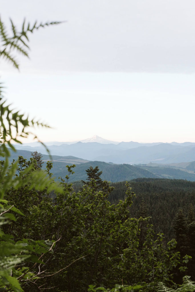
How Long It Takes to Climb Mt St Helens
During the summer it can take anywhere from 6-12 hours roundtrip to climb the mountain. Starting from Climber’s Bivouac most people start early in the morning and finish around noon time. We also saw other people starting later in the day as we were just returning to our car.
We woke up around 4:30am, partly from excitement, and started our hike around 5am in the morning. It was still dark out and the morning light was just beginning. As we made our way higher up the trail the views and the sunrise were amazing! We were able to see Mt. Hood clearly lit up by the early morning sunrise. There were several times where we would stop to just take in the colors and sights.
Another benefit to starting early is that the sun is lower and it’s not as hot. The ground was solid in the morning and there was no mud, so it was easier to hike. Also, there’s a lot less people on the trail early in the morning vs the afternoon. It took us around 7.5 hours roundtrip. We took a nice long 1 hour break at the top of the crater for lunch, pictures and just to take it all in! We were back at our car at around 12:30ish-1:00pm.
A good start time can be established based on an estimated pace and what hour you would like to summit. Descending down the mountain to the parking lot took half the time it took to summit but it’s still challenging because the trail has rocks and skree.
Where to Stay Night Before Climbing Mt. St. Helens
Some climbers that live locally may choose to climb Mt. St. Helens in a day but others can choose to camp. The best place to camp to be near the trailhead is at Climber’s Bivouac . Camping spots are limited and it’s all on a first come, first served basis. There are no reservations. To our surprise, even though we came pretty late the evening before our climb we easily found a spot to camp at that night. Driving there we were already making back up plans just in case everything was taken.
Another great camping area is the Marble Mountain snow-park . If that is full, Gifford Pinchot National Forest has many camping spots that are a 10-15 minute drive from the trailhead.

Packing List For Climbing Mt St Helens
Being prepared physically for hiking up the mountain and having the right gear and things with you is super important. One of the first things that you should pack and fill up on is WATER! We learned our lesson during our climb when we thought we could find a stream to fill up with water during the climb. To our disappointment, the stream dried up at that time of the year and there was no water! We had one 40 ounce water bottle with us to share between each other. We had enough going up but going down we were completely out. Thankfully there were very kind people descending down the trail with us and they gave us their extra water. Also, there was melting snow stream that we managed to hear and see and we were able to filter and fill up our water bottles! Lesson learned- Bring enough water for your trip!
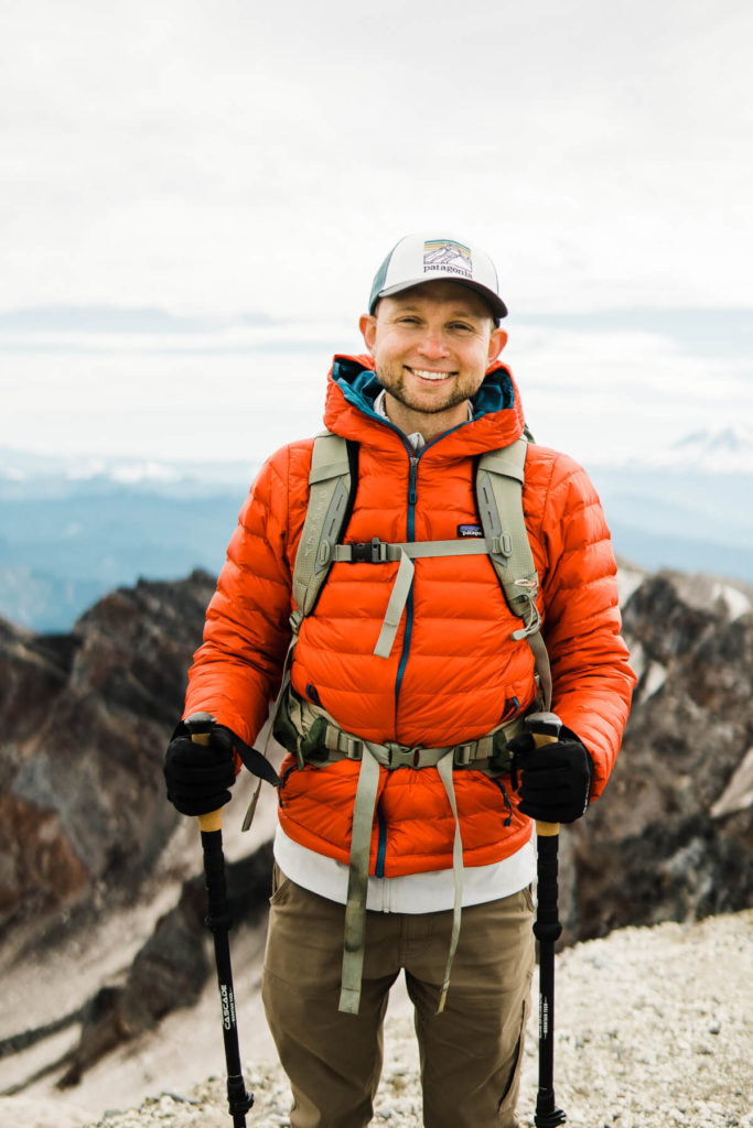
Suggested Packing List
This packing list is for the summer months when there’s little to no snow.

Hiking Pants ( his / hers )

Rain jacket ( his / hers )

Fleece ( his / hers )

Puffy Jacket ( his / hers )
Snacks- Granola Bars, Dried fruit and nut mix, beef jerky, sandwiches, mints or ginger chews (we love ginger chews or mints during harder parts of the climb)
Climbing Permit
Chapstick and Sunscreen

BUFF Headwear – for sun or wind protection

Camera & Phone
Emergency kit
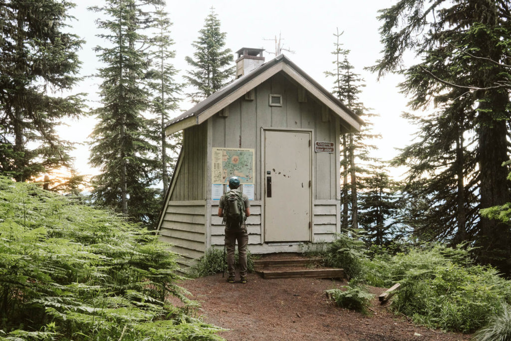
Part One of the Hike: Forest
The first part of the hike starts out in a forest. We started our hike around 5 am in the morning by checking in at the trailhead and then turning on our head lamp to make our way up the trail. The first 2 miles on the Ptarmigan Trail are fairly easy and climb 1000 ft through the forest.
We made stops along the way to take pictures of Mt Hood during sunrise and the beautiful cotton candy colors in the sky. The trail also has a turn off to an outhouse and its a great stopping point for a quick bathroom and water break.
The trail is easy the first two miles and once we reached the timberline was when we realized that in the next 2.7 miles we had 3700 ft more to gain.
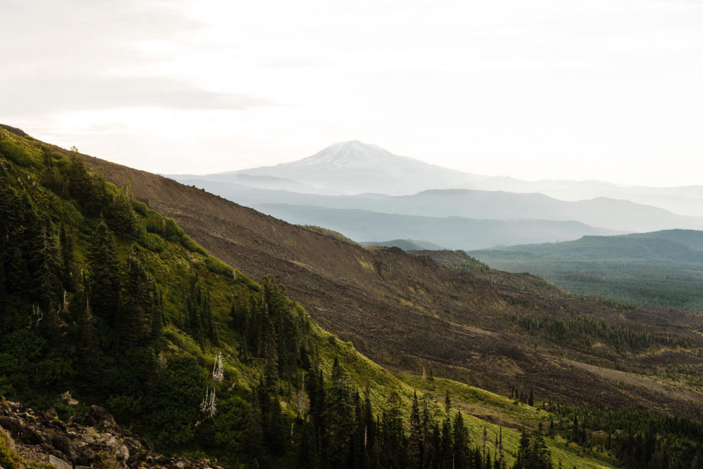
Part Two of the Hike: Rocks
The trail got a lot more difficult once we were out of the forest. We made our way for the next 2500 ft through the boulder fields. At first they were fun and it felt like we were rock climbing but then it quickly got tiring. The rocks are sharp and are dusted with pumice that can cut you if you fall. If you brought gloves this is where you would want to put them on. Thankfully we had our hiking poles that helped out with balance and getting over the boulders. We followed the gully on the left side of the wooden posts sticking out of the ground, making our way up.
Once we reached around 5000 ft in elevation we took a break for a quick snack and water break. Looking down we had an amazing view of where we just came up. From that spot we were able to see Mt Hood, Mt Adams, Mt Jefferson and other small mountains. It was incredible to see the beautiful views. All along it felt like we were in the Lord of the Rings trying to climb Mordor.
From here it was simply a matter of climbing up over the rock piles, with no real path to follow. There are flat spots in-between, but mostly its a matter of scrambling over rocks. Towards the end we reached a volcano monitoring station, and not much further past it was the scree area.
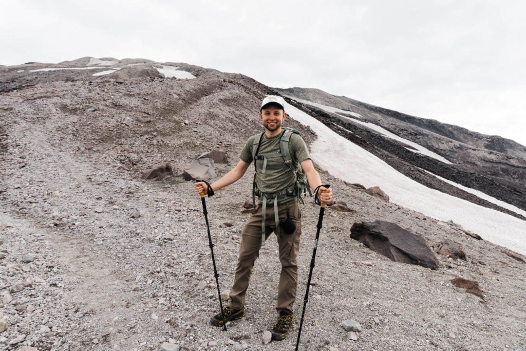
Part Three of the Hike: Ash
Almost done! The last section was one of the hardest parts from the climb. Maybe because the next 1000 vertical feet was just ash and small rocks all the way to the crater rim. It felt so long and exhausting. Our shoes were filling with the small rocks making it difficult to keep going. I think gators would have been a great idea for this part of the trail. We made it our goal to just power through this section and get to the rim.
The trick to getting through this part is to set a good and steady pace and just keep going up because with every step you’re closer to the top.
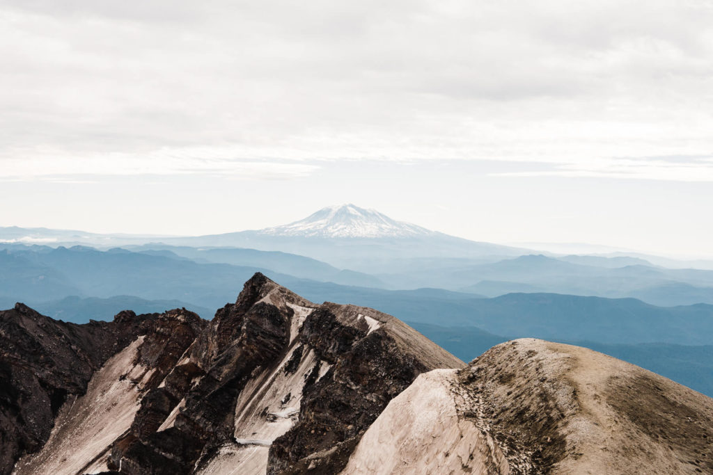
Reaching the Rim of Mt St Helens
Alex got the the rim of the crater a couple of minutes before me and once I heard him gasp with excitement I quickly reached the top to take in the views of the crater. The weather couldn’t have been more perfect that day. The sky was clear and you could see out to Mt Adams and we even saw a hint of Mt Rainier!
The crater was so beautifully with so many textures and colors. There were a few spots with gas and it made it all so real that we were up on Mt St Helens!
We walked around the rim and found a spot to sit down and eat our lunch sandwiches which we were dying to eat because I packed them with the most delicious ingredients the night before!
We spent a good hour at the top taking pictures, snacking on food and just enjoying the crazy beautiful views.
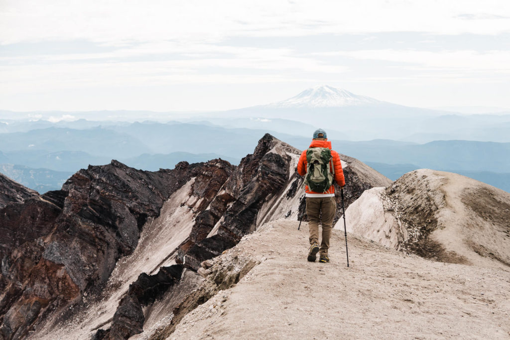
Descending Down Mt St Helens
Descending down the mountain took half the time! The hardest part of descending the mountain was trying to go over the boulders. It was a lot harder on the knees going down. Also, on our way down we ran out of water and since it was pretty warm outside we weren’t sure how we were going to make it the rest of the way down. Thankfully the group of guys hiking in front of us gave us some of their extra water and we also found a small stream that was forming from the melting snow on the side of the trail.
We finally made it to our campsite and car at around 1.30pm. We were pretty tired and since our tent was still up we took a much needed nap before leaving.
Plan Your Own Climb Up Mt St Helens
Climbing Mt St Helens was one of our highlights this summer. It’s honestly possible to reach the top for most people and even if you have kids. It might take some training and getting into shape but the reward of reaching the top and looking into the crater and the surrounding mountain tops is totally worth it.
Best Tips For Climbing Mt St Helens
- Go hiking and get into shape a few months before. It helps to do a variety of different hiking trails and difficulty.
- Make sure you have a permit and have it with you for the climb
- Watch the weather
- Bring lots of water
- Bring snacks
- Pack ahead of time and make sure you have the proper gear for the weather that day
We hope this has been a helpful guide to planning your climb up Mt St Helens this year! It’s a rewarding climb and you won’t regret it.
If you need more inspiration or ideas, follow us on our Instagram @thatoneadventurecouple!
Also, don’t forget to subscribe to our Adventure Newsletter where we feature all our favorite travel spots and tips!
Have you climbed Mt St Helens and want to share, let us know in the comments below!
If you climb it, let us know by tagging us in your pictures on Instagram #thatoneadventurecouple #idratherplayoutside!
Are you on Pinterest?
Follow us & pin this article.
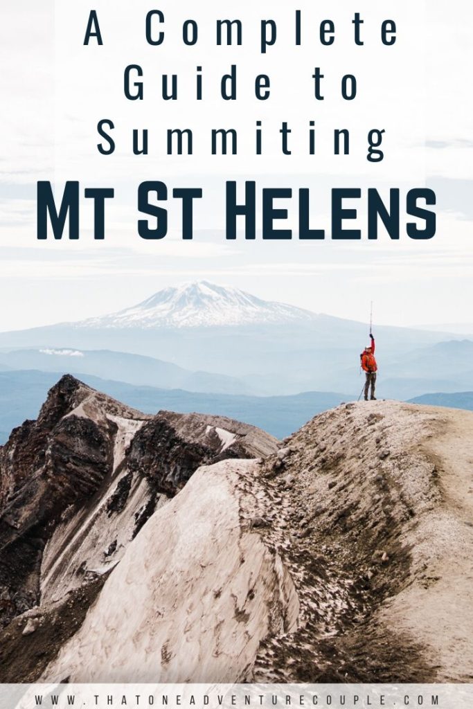
Related Posts

Exploring Mindo From Otavalo we took a bus back to Quito and then onwards to…

The Beautiful Laguna 69 Laguna 69 is one of those lakes that pops up on…

The Amazing Quilotoa Loop We really enjoyed Mindo, it was a lot of fun. Our…

You Might Also Like

Off The Beaten Path Badi Lake in Udaipur India
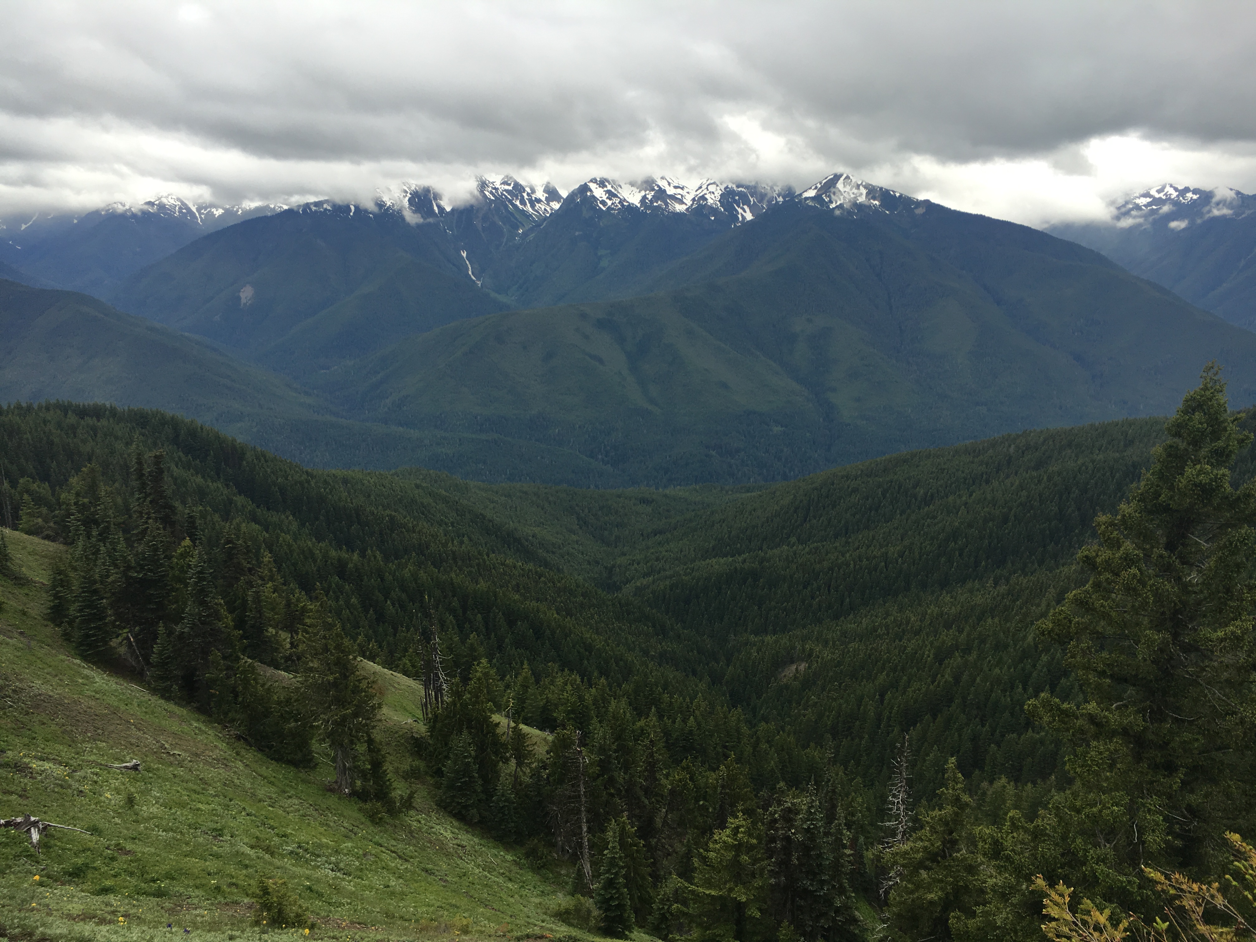
Olympic National Park

Ultimate Oregon Road Trip Through Willamette Valley
No comments, leave a reply cancel reply.
Save my name, email, and website in this browser for the next time I comment.
This site uses Akismet to reduce spam. Learn how your comment data is processed .
Our Current Adventures
Follow the Adventure
Where Nature Erupts
(360) 577-3137.

The Mountain
Mount st. helen's is a peak that should be on every life list. and because it is an active volcano, it is best not to put it off for too long..

Hike Mt St Helens
Mt St Helens Map
www.fs.usda.gov/main/giffordpinchot/maps-pubs
Check the PERMIT SYSTEM for permitted climb dates.
All climbers must register and obtain a climbing permit.
Weather and Avalanche, Climbers should be prepared for extreme weather and rapidly changing climbing and weather conditions. Please update yourself with the latest avalanche and weather forecasts. Check Here for Weather and Avalanche conditions
Mt St Helen's Hike
The hike is hard, but requires no technical climbing skills. The trailhead is known as the Climbers’ Bivouac. The first 2.1 miles climbs 1000 feet through forests and open meadows to the Loowit Trail, which circuits the mountain. This section of trail is described in detail in WTA’s Hiking Guide as Ptarmigan Trail.
Continuing much past the Loowit Trail requires a climber’s permit (details below). This is where the trail ascends to Monitor Ridge, and the way gets more difficult from here. The next 2500 vertical feet is through boulder fields – and not any ordinary boulder fields. These rocks are dusted with an ash pumice than tends to shred the skin. You’d be wise to bring garden gloves for this section! It can also be windy, so bring layers and a jacket as well.
The last section of trail climbs about 1000 vertical feet through ash and small rocks to the crater rim. It’s described by many as “two steps forward and one step back.” Gaiters and long pants are a good choice here. And to get your mind off of the slow slog, be sure to take in the views! You are going upward and before you know it you will be standing on the summit.
The scene at the top is almost surreal – the huge crater with a dome growing rapidly in size each year and the state’s newest glacier forming a horseshoe around it. And the incredible views to Mount Adams, Mount Hood, Mount Rainier floating above the blue-green undulating hills surrounding them. Be sure to stay well-back from the rim while taking photos; this is a cornice and could easily break under your feet.
After enjoying the top, it is time to head down. Trekking poles are a big help for the knees. Depending upon the time of year, it is also possible to glissade down part of the mountain (but be cautious).
Climbing Mount St. Helens - Important information is available from the Mount St. Helens Institute
Mount St. Helens is a popular climb for both beginning and experienced mountaineers. Although people are able to climb Mount St. Helens year-round, late spring through early fall is the most popular season.
Climbers must have a permit. It is recommended that reservations be made well in advance. Reservations can be made online through the Mount St. Helens Institute
From April 1 through May 14, a permit is required.
From May 15 through October 31, a permit is required. Only 100 permits are issued per day.
From November 1 through March 31, a permit is required but there is no charge.
Climbers Bivouac can be accessed by taking State Route 503 from Interstate 5 at Woodland.
Most climbers use the Monitor Ridge route from Climbers Bivouac. This route gains 4,500 feet in five miles to the crater rim at 8,365 feet elevation. Although strenuous, this non-technical climb is suitable for people in good physical condition who are comfortable scrambling over steep, rugged terrain. Most climbers complete the round trip in seven to twelve hours.
All climbers are recommended to carry:
- Climbing Helmet or Hard Hat - Protect your head in the event of volcanic ballistics or rock fall.
- Dust Mask (N95 type) - Cover your mouth and nose in the event of ash fall or blowing dust. Dust Masks (N95 type) should be available from any large hardware store.
- Goggles or Sunglasses with Side Shields, Sunscreen - The Sun reflecting off of snow and ash is intense. Avoid contact lenses, as blowing ash and dust can be a problem. And don't forget a hat.
- Climbing Boots - Sturdy, comfortable hiking boots (lug soled, waterproof, with angle protection ¾ shank) and gaiters (waterproof to keep rain, snow, ice, ash and pumice out of boots).
- First Aid Kit - You may need to come to your own rescue, or help someone else. Be prepared!
- Knife - Handy for all kinds of purposes, especially the type with extra tools.
- Extra Food and Water - Bring at least two quarts of water per person. No water is available at Climbers Bivouac or on the climbing route. Carry plenty of food (high energy food recommended) to snack on all day. Reduce packaging to eliminate trash.
- Extra Clothing - A beautiful sunny morning can turn into a cold rainy afternoon. Plan ahead! Layered clothing including full rain gear, gloves and hat.
- Layering allows you to adjust your clothing to different exertion levels and weather.
- Emergency signal device · Emergency Shelter - Yes, you planned to be out on one very long day. Be prepared just in case that longer day turns into something much longer.
- Head lamp or Flashlight, extra batteries, and bulb - A necessity when the day is short and the trail is long.
- Be sure to tell a friend or relative where you are going and check in with them you return. Having someone that will notify authorities if you don't return can help get you the assistance you need when you need it most.
- Trekking poles (recommended), Waterproof matches, lighter or candles
Enjoy Endless Adventure on Day Hiking Trails
Mount St. Helens Ape Cave Lava Tube is a popular attraction in the Mount St. Helens National Monument and the longest lava tube in the continental United States at over two miles in length.

The Ape Caves are located on the south side of Mount St. Helens and accessed through Woodland - go up highway 503 past Cougar. Driving time from I-5 and highway 504 where all the Mount St. Helens Visitor Centers are to the Ape Cave is just over an hour. The Ape Caves are open year-round though the parking lot gets snowed in during the winter.
Ape Caves Map
www.fs.usda.gov/recarea/giffordpinchot/recarea/?recid=40393
Driving Directions
From I-5 exit 21, travel north and east on State Route 503 (Lewis River Road). At 23 miles from the freeway, continue straight on Spur 503. At 31 miles, Spur 503 becomes Forest Road 90. Cross a bridge over a canal, then 2.6 miles later, turn left on FR 83. Travel 1.7 miles then turn left on FR 8303. Travel the final mile to the parking lot and Ape Headquarters Center. The parking lot has room for 50-60 vehicles, including bus and RV spots. There are vault toilets and garbage cans, but no drinking water. When it’s open, Ape Headquarters Center offers rental lanterns.
If the road is gated at the Trail of Two Forests junction (e.g. early in the season), you will have an additional half mile or so to walk, depending on how close you can park. A Sno-Park permit is required from December 1 through March 31, a Northwest Forest Parking Pass for the rest of the year.
An easy and popular hike perfect for family picnicking, the lake isn’t much, but the setting is peaceful and geologically intriguing. Formed by an old mudflow, June Lake is fed by a 70-foot waterfall tumbling off basalt cliffs from an old lava flow.

The other forest, known formerly as the Lava Cast Forest, encompasses three-dimensional imprints of trees in the old lava beds called lava casts. The boardwalk trail loops through the two forests, and is kid- and wheelchair-friendly.
During eruptive activity some 1900 years ago, fluid lava flowed through a stand of trees, burning them but leaving impressions where they stood or lay. This lava was quite different from the sticky type of lava that forms the dome in the crater of St. Helens today.
When you visit the Trail of Two Forests, please stay on the trail -- the mosses and surrounding features of the forest are fragile.
WTA Pro Tip: One attraction along the boardwalk is a ladder descending eight feet into a lava-cast tree mold. Hikers can crawl through the tree mold, an activity especially popular with youngsters. Flashlights and old, warm clothes are good preparation for the fun.
June Lake Map
www.fs.usda.gov/recarea/giffordpinchot/recreation/recarea/?recid=40377&actid=50
Drive east from I-5 on Highway 503 as it changes to Forest Road 90. Pass the town of Cougar, and just 1 mile beyond the Swift Dam (about 35 miles from your turn off I-5), make a left onto FR 83. Proceed two miles and turn left onto FR 8303. The trailhead is on the left, a half mile away.
Enjoy Endless List Day Hiking Trails
Lava canyon.
This trail begins with an amazing, ADA accessible, interpretive trail before proceeding down a steep rugged canyon to a one-of-a-kind swinging bridge.

There are three sections of the Lava Canyon Trail, each distinguished by increasing difficulty. From the parking lot the trail quickly descends into the canyon on a paved path with a gentle grade. The first section is perfect for everyone from youngsters new to hiking to those with stubborn knees. This section comes to an end at the waterfall viewpoint.
Below, the trail becomes more difficult as the route narrows and skirts along high cliffs. This segment forms a loop, which crosses over a 125-foot suspension bridge torn from the pages of a Hollywood movie script. On the bridge you will be treated to an amazing view of the canyon below and gushing water right under your feet. The sight can be unnerving, so watch your footing.
The trail eventually returns on the south side of the canyon, crossing a steel bridge upstream of the waterfalls and rejoins the paved trail. But before you get there you will need to drop farther into the canyon. If you are fearful of heights, this segment is not for you. After the bridge, the trail crosses an exposed face, followed by a water crossing, where a cable is present to assist hikers make the ford. A metal ladder then descends a vertical cliff providing access to the canyon’s thunderous waterfalls.
The trail soon intersects Ship Trail (the return route), which climbs to a viewpoint atop a lava formation that overlooks a long series of waterfalls in the lower canyon. A bit further, the canyon begins to broaden and flatten as it approaches a large alluvial fan spreading into the Smith Creek valley.
WTA Pro Tip: For more volcanic geology, check out the nearby Trail of Two Forests, the location where a series of lava tubes formed when a lava flow crawled through an old growth forest and cooled. When trees decayed, vertical columns were formed where the old-growth trees once stood.
Lava Canyon Map
www.fs.usda.gov/recarea/giffordpinchot/recarea/?recid=41610
From I-5, take exit 21 and drive east on SR- 503 for 28 miles to Cougar. Continue east on FR-90 past the Swift Dam. Turn onto FR-83 and proceed 12 miles to the trailhead at the end of the road.
Trail of Two Forests
This trail loops through two forests that stand side by side, but are separated in age by 2000 years. One forest is old-growth Douglas-fir and western red-cedar and the other is a young forest that was originally engulfed by lava flows from an eruption of Mount St. Helens over two millennia ago.

Trail of Two Forests Map
www.fs.usda.gov/recarea/giffordpinchot/recarea/?recid=41631
Visit Mt. St. Helens
1900 7th Avenue Longview, WA 98632
- Travel in the Pacific Northwest and beyond
- Work With Me
- Pacific Northwest
- National Parks
- Seattle Travel Guide
- Recommended Gear
- Published Work
Hiking , Outdoor Activities , United States , Washington
How to climb mt. st. helens – everything you need to know (2024 guide).
 1")
There are tons of amazing hikes in Washington, but only one has remained my favorite even after I continue to do more hikes year after year. Once I learned I could climb Mt. St. Helens all the way to the top and see the crater, I couldn’t let the idea go. I watched video after video of other people accomplishing my new dream.
And because I know you’ll ask, yes, this is the same mountain that exploded in 1980, which means you’ll be climbing an active volcano. While it’s five miles to the top, the 4,000-foot elevation gain is no joke.
When my friend asked me in the spring of 2019 if I wanted to join her for an August climb with her permit, I immediately said yes. We spent the summer training together by doing various hikes and getting ready for one of the most exciting hikes of our lives: the Mt. St. Helens summit hike. This is by far one of the top things to do in the Pacific Northwest .
I had a lot of questions when I researched this climb and spent hours looking them up, so I created this guide to hiking Mount St. Helens to help you prepare and feel more comfortable for when you go. By the end, you should feel fully set and ready to go on one of the most exciting hikes of your life!
The information in this post has been updated and is accurate as of July 2023.
Table of Contents
Common Questions About How to Climb Mt. St. Helens
 2")
If you’re not from Washington, you may be unaware that this once-peaceful mountain had a major eruption in 1980 . An earthquake triggered the eruption, which caused a massive debris avalanche that destroyed everything in its path.
This eruption was the deadliest in the United States to date, and 57 people perished. Ash erupted for over nine hours, and it even reached as far as Alberta. While there’s occasionally small activity from inside the mountain, things have been pretty calm since 1980.
There is now a visitor’s center facing the slope of the mountain that collapsed in the eruption. However, those who are adventurous can climb on the backside of Mount St. Helens all the way up to the crater’s rim. Here are the most common questions I’ve gotten since I completed my Mt. St. Helens hike.
How Hard is it to Climb Mt. St. Helens?
While it’s a day hike, summiting Mt. St. Helens isn’t exactly easy. I go into a very detailed explanation in this post, but the short of it is you’re hiking 10 miles roundtrip with six of those miles being completely exposed. The terrain also varies, so you need to know how to navigate through a large boulder field as well as go up a very steep last mile where you’re constantly sliding back.
How Do You Get a Mt. St. Helens Climbing Permit?
You can climb Mount St. Helens throughout the year, but the rules vary. To get Mt. St. Helens permits in 2021, you must apply for a permit before you can hike from April 1 to October 31. You can do this online , and permits usually open up around February 1st.
Permits cost $15 per person (although this will be changing to $20 in 2024), and you can have up to 12 people in your group. From April 1 – May 14 , 300 climbers are allowed per day. The most popular period is the warm months from May 15 – October 31 , when only 110 climbers are allowed each day for the Mount Saint Helens hike.
If you want to hike in the winter from November 1-March 31, there’s an unlimited number of people that can go, and you can register yourself at the trailhead.
My recommendations for getting a permit are to apply as soon as the applications open and pick a weekday when you want to do the Mt. St. Helens summit hike, as weekend permits go quickly. You’ll also need each person’s name on the permit, and everyone should carry their permit and ID on the trail in case a ranger stops them.
If you plan on climbing Mt. St. Helens without a permit, you’ll only be able to go the first two miles on the trail (the wooded section). Once you come out of the trail, you’ll see a sign saying you need a permit so you won’t be able to go on any part of the exposed mountain. There are rangers that are stationed here daily who will be checking for your Mt. St. Helens climbing permit.
That said, you’ll need to make sure each person in your group has their permit and ID on them so you can show the ranger. They may turn you back if you can’t prove it, which would be a huge bummer.
What’s the Best Time to Climb Mt. St. Helens?
This is one of the more common questions I’ve gotten, and it depends on what you’re looking for in a hike. Some people thrive on winter hikes , and if that’s you, you’ll love being able to hike for free during the winter at Mount St. Helens.
You should consider that inclement weather might make you turn around due to safety reasons when you climb Mount Saint Helens. I know it’s heartbreaking to have to turn around on a hike you’ve trained for and driven this far for, but you should never compromise your safety for a hike.
You also might not have a view at the top if it’s snowing or cloudy, depending on the Mt. St. Helens summit weather. These aren’t meant to discourage you but just to make you aware of winter hiking conditions. Being able to see Mount Rainier during my trip in the summer was one of the highlights (and it’s worth it to spend one day at Mt. Rainier if you have the time before or after this).
However, I would say the majority of people prefer hiking in drier conditions. For me personally, I think the best time to hike Mt. St. Helens is during the summer .
Summer hikes are preferable when climbing Mount St. Helens because the early mornings will be cooler when you start, the weather should be pleasant and dry for the most part, and your chances of a stunning view are higher. These are just additional reasons I think the warmer part of the year is the best time to climb Mt. St. Helens.
I love using AllTrails to download maps and stay on the trail during all my hikes.
How Long Does Hiking Mt. St. Helens Take?
 3")
The top question I’ve gotten about this hike is how long it takes to hike Mt. St. Helens. I’ve heard of people completing this anywhere from 7 to 14 hours , so there’s no “set” number you need to aim for.
It took my group, who I would consider moderately fit, about 10 hours to hike to the Mt. St. Helens summit and back.
We started a little before 5 am, summitted at 10 am, enjoyed the view for an hour, and then got back to camp around 3 pm. That means getting to the top took about 5 hours, and it took 4 hours to come back down .
We took plenty of extended breaks and could have completed it in less time if we had shortened them, but we also weren’t in a rush and wanted to pace ourselves. You’ll also find when you’re with a group that each person has certain strengths and weaknesses during the hike.
Some people in my group struggled with the Mt. St. Helens boulder field and needed more time. My biggest struggle was my hip flexor decided to give out halfway down the mountain on the way back, and I had to go much slower than I wanted due to the pain.
How Do You Train to Climb Mt. St. Helens?
 4")
One of the top questions I get is how hard is it to climb Mt. St. Helens. To start, this is a 10-mile roundtrip hike with a 4,500-foot elevation gain . You hike through a variety of terrain (which I’ll cover in more detail below).
While you could try to “wing it,” I recommend being smart about it and training for the hike first. You should also note that you’ll be at 8,365 feet at the top of the mountain, so you’ll have to account for altitude as well.
Based on this, I recommend a few different types of training.
Going on several hikes around Seattle that are between 8-10 miles with a 3,000-4,000 foot elevation will help you get in shape. I also did Mt. Ellinor during my training, which is one of the best Olympic National Park hikes to help you train for this.
A few good hikes to train for this include:
- Granite Mountain (8.6 miles roundtrip, 3,800-foot elevation gain)
- Mt. Si (8.0 miles roundtrip, 3,150-foot elevation gain)
- Mt. Dickerman (8.2 miles roundtrip, 3,950-foot elevation gain)
Stairmaster
I added the Stairmaster to my routine a few times a week over the last few months. You can put it on interval or fat-burning mode, both of which have periods of increased resistance mixed with periods of rest.
This type of training will prepare you better for the steep parts of the climb where you want to give up. I would tell myself, “Just one more minute,” and push on a little longer since I knew I had done it in my training. You’ll also train your glutes and hamstrings to activate and get stronger when preparing. forhow to summit Mt. St. Helens.
Weight Lifting
Speaking of weight lifting, don’t forget to add that to your routine. You’ll want to do exercises that strengthen your core, legs, and glutes in particular.
Rock Climbing
While this might seem like a strange activity to add to a hike training plan, I recommend taking going to an indoor climbing gym a few times before your hike.
The middle section of the Mt. St. Helens climb has very large boulders, and I actually felt this was the easier part because I had previous knowledge of how to alternate using my arms and legs from rock climbing in the past.
What to Pack for Your Mt. St. Helens Climb
While I tend to pack lighter in terms of traveling or hiking, this hike isn’t the time to do that. You don’t want to be stuck halfway up the mountain in the sun with no food or water, so take my Mt. St. Helens packing list seriously.
As far as hydration goes, the most important thing to note is there are no water sources anywhere on the hike, including the trailhead. That means you need to bring all the water you plan on having.
I recommend bringing five liters of water for climbing Mt. St. Helens. You can hide some of it behind trees in the tree line to save for yourself when you’re coming back down.
There is no shade or cover past the tree line, which means you’ll be in the sun for hours going to the summit and back. You’ll also want to bring more snacks than you think you need, as it can take more energy than you think to climb it.
 5")
Some ideas for snacks when you climb Mt. St. Helens are dried fruit, trail mix, chocolate-covered coffee beans, peanut butter and jelly sandwiches, or jerky . They are all pretty easy to digest and give you the boost of energy you need. Another trick I used was taking an energy chew or two when I wanted energy without taking a break.
Since you’ll have zero shade after you get out of the forest, you’ll want to wear a hat and sunglasses . In addition, reapply sunscreen often, as you’ll end up sweating it off several times.
The most random item I’ll recommend for your Mount Saint Helens climb, but also one of the most crucial, is gardening gloves . The second portion of the hike has you going over huge boulders with rough surfaces, so trust me when I say you don’t want to forget these.
Mt. St. Helens Hiking Packing List
Here’s a condensed packing list for hiking Mt. St. Helens:
- hiking backpack
- hiking shoes
- jacket (the summit gets chilly)
- polarized sunglasses
- gardening gloves
- hiking poles
- energy chews
- plenty of water
- optional – a celebration beer
I should note that I hiked this in August, so my list is primarily for hiking during the summer months. Should you decide to do a winter climb, you’ll need winter hiking gear and clothes , as well as microspikes or snowshoes, depending on the weather.
You should also keep in mind that while other spring hikes around Washington may be free of snow, you’ll likely encounter snow here until late summer (there were still patches in August when I did it!).
What the Mt. St. Helens Summit Hike is Like
 6")
There are two different Mt. St. Helens climbing routes to take, depending on what month you climb Mt. St. Helens. From spring through fall, you’ll start at Climber’s Bivouac Trailhead . This is where I recommend camping for the night so you can start early in the morning. The fee is $5 per vehicle, which you can pay at a self-service fee station on-site.
Since I hiked in August, I hiked from Climber’s Bivouac and followed the Monitor Ridge route, so that’s what the following will cover.
If you hike Mt. St. Helens in the winter, you’ll have to do the Worm Flows Route . This starts at Marble Mountain Sno-Park and is longer, increasing your mileage on your Mount St. Helens climb to 12 miles roundtrip. You can read more about the route on the official website .
 7")
The top question I’ve gotten about this hike is how long it takes to hike Mt. St. Helens . It took my group, who I would consider moderately fit, about 10 hours to hike to the summit and back.
Hiking Through the Forest
 8")
My group camped overnight to be able to start first thing in the morning. We left at about 4:45 am and had an easy, quiet hike through the forest with our headlamps. While others were in the campground with us, I was surprised we were the only ones on the trail.
The forest hike is about two miles with a 1,000′ elevation gain . We went at a steady pace and decided to only take a break once we got past the tree line.
A great tip my friend Gabby had was to take extra water bottles and leave them by a tree. We put our water behind a tree just before the “permit required” sign was visible so we would have them when we returned. That way, you don’t have to carry extra weight up the hill while climbing Mount Saint Helens (because every pound counts on this hike, believe me).
Navigating the Boulder Field
 10")
The next two miles have you going through a boulder field. When you first enter it, I recommend taking a break to fuel up and rest. This is also where we got out our hiking poles.
The mountain starts to get steeper, so these can be helpful going uphill when climbing Mt. St. Helens. The trail may also get a bit confusing at this point, but look for the white posts along the mountain and stick close to those.
In the second part of this section, you’ll encounter giant boulders (as in possibly bigger than you). This is where you will need your gardening gloves so you don’t cut up your hands.
I also recommended some rock climbing practice earlier in this post due to this section. You can give your legs a break by pulling up with your arms on the larger boulders. For the smaller boulders, think of pushing through your heel so you use your hamstrings and glutes to help you uphill.
 11")
Something unexpected that we ran across was this weather station sticking out of the boulders. We couldn’t figure out what it was when we first saw it. This solar-powered device sends information back to volcanologists about the current state of the mountain.
The Final Mile
 12")
From all the research I did, most people said this was the hardest part for them. Many said that you take two steps forward only to go back one step. To be honest, I didn’t feel that was true for the conditions we had.
The last section is tough for sure, as it’s very steep and covered with loose rocks and ash . You will need to go slower than you think, and your body has already been hiking Mt. St. Helens for hours, so you’re likely to be exhausted.
I feel like this is where my Stairmaster training came in to help me prepare for climbing Mt. St. Helens, as I set “intervals” in my mind during the last mile. I would tell myself to push with my legs while using my poles for at least a minute or two before I could stop and take a break.
You’ll also start to see people at the top when you summit Mt. St. Helens, which is incredibly motivating. I wanted nothing more than to join them at the top and take a break, so that pushed me as well.
Reaching the Summit of Mt. St. Helens
 13")
As tired as I was when I finally got to the top, all I wanted to do was stand and marvel at how amazing the sight was. We were literally standing on the rim of the crater, looking into the dome of Mt. St. Helens.
Any fatigue I had vanished, but it did get cold as my body started to cool down. That’s why you’ll want a jacket to put on at the top.
When you’re on the rim, do not get too close to the edge . People have fallen in, and it honestly wouldn’t be that hard to do. There is barely room for two people to walk on it at the same time. We always made sure the other person was aware we were trying to pass them.
If you go in the winter, it’s even more important to stand away from the edge, as you can’t see the true edge when it’s covered in snow.
 14")
Be aware of your position when taking pictures, and carefully walk around people on the ridge. I think it’s safest to have someone else take your photos so you’re fully focused on where you’re standing. The only pictures I took myself were further away from the edge, where I felt secure in the ground I was standing on.
I don’t say all this to scare you, but I do think it’s important to remember you’re standing on the edge of a volcano. It’s so easy to get excited about what you just accomplished and let your senses down.
 15")
It’s fun to sit at the top and shout encouragement down to people who are almost there but look discouraged. We also said congratulations to everyone who joined us on the rim, which was fun to talk to different people climbing Mt. St. Helens. Most people agreed that this was one of the best hikes in Washington State they’d ever done.
We stayed at the top for an hour and all pulled out our celebration beer and lunch. I didn’t realize how hungry I was until we stopped moving, and I’m pretty sure I had 2 sandwiches and multiple snacks.
 16")
Take as long as you want at the top, as there isn’t a “limit” for how long you can stay. I would take into account that you’re sitting in direct sun at roughly 8,366′, and you have a long way down until you’re in the shade of trees again. Resting at the Mt. St. Helens summit is also an ideal time to reapply sunscreen .
Heading Back
 18")
When you start to head down from the top, I recommend trying to slide a bit with your shoes. I did what was similar to a skiing motion with my body and zoomed down the steep part in no time going downhill.
One tricky part when you get to the boulders is you aren’t able to see a clear path down. There isn’t necessarily a wrong way down as long as you’re generally going straight, but it’s much easier to see the best path when you’re going uphill hiking Mt. St. Helens.
This slowed us down more than I expected, as we had to backtrack multiple times when we realized certain boulders would be too big to go over. Just be prepared for a little trial and error, and try to remember that you’re that much closer to finishing.
Walking through the forest on the last two miles felt like a dream due to how easy it was. I grabbed the water I had stashed, poured one over me because I was so hot, and downed the other. When we got back to the campsite just before 3 pm, I stretched before getting in the car for a long ride home.
I hope this guide helps you plan your trip to climb Mt. St. Helens, and please leave a comment or email me if you have any additional questions I can help with!

Marissa Pedersen
Marissa is a Seattle local who's obsessed with exploring all things Pacific Northwest, especially hiking, road trips, and national parks. She's been to hundreds of places all over the region and started this website to help others discover the beauty of the area and create their own trips.
15 thoughts on “ How to Climb Mt. St. Helens – Everything You Need to Know (2024 Guide) ”

Did you bring 5 gallons of water per person? That’s about 40 lbs of weight right there (for each individual).I have never brought more than 3 liters to summit and it has been adequate every time. It’s good to be prepared, but save yourself some energy and don’t weigh yourself down.

Thanks for pointing that out – I meant liters! Clearly I was tired from the hike. 🙂 I brought 3 liters to the summit and kept an extra liter in the treeline to have when I got back.

Excellent report! Two years my oldest boy and myself tried the monitor ridge route and failed to reach the summit. My son suggested we really think twice about finishing due to how dark it would be going back down. (we started too late in the a.m. about 10:00am) We reached 1000 feet short of the summit. I like your idea of camping near the Climbers Bivouac and getting an early start. I’m 73 next month, but am quite sure it’s within my ability as I hike often with significant EG. Member of a hiking club and also Washington Trails Assoc. Thank you very much for your in-depth report. I think it was spot-on and useful! Especially liked your idea of stashing extra water trailside on the way up. Good idea!
Hi Charles, thanks for the comment! While I know it’s disappointing to not reach the summit, I’m glad you chose to be safe and not try to get back in the dark. If you hike often then I am sure you can summit next time as well. I would just make sure to either camp or stay in a hotel nearby. While my team woke up very early to get started, I’m glad we did so we could take our time during the hike.

May be a random odd question: What about if you need to use a restroom (urinary/defecate)? Do you just go behind a tree, boulder?
Yes, unfortunately, nowhere to go really! Now that I think about it, no one in our group had to go until we got back to the camp. I think it’s partly because we sweat so much during the hike.

Thank you for the great information! I will be doing the hike in August and was wondering about pants/shirts. I bought hiking pants and was thinking of wearing a long-sleeved white shirt for sun protection or would short sleeves be better? And how about gaiters? Thanks so much!
Hi Lisa, I’ve become a big fan of long sleeve shirts even for summer hikes. It protects you from not only the sun (the last 3 miles are completely exposed), but also bugs (although not a big issue here in August). For this hike specifically, you will definitely need pants so you don’t scratch up your legs on the boulders and I highly recommend a lightweight, long sleeve shirt as well. We did bring gaiters on the recommendation of others, as some said it was necessary the last mile, but we didn’t need ours at all.

To the question on a bathroom, other than the solar restrooms at climbers bivouac, the only outhouse I’m aware of used to be just below the treeline on the Ptarmigan trail up, on the right hand side going up. I’ll be hiking up to at least the treeline this month, if the park service has cleared the road to the bivouac, and will be interested to see if it is still there. ( I first climbed St Helens in 1987, on the first climbable day that it was open again, following the eruption. Some definitely interesting characters up there that day. My party was the second legal climbers to the summit, following the eruption.)
Hi Pete, wow, how amazing to have climbed way back in 1987! I am not aware of an outhouse anywhere besides the campground/trailhead for Ptarmigan Trail (unless I completely missed it, but I don’t believe I did). I did this climb 3 years ago so unless it’s been recently added, I would prepare to last go to the bathroom at the trailhead. I would love for you to follow up and send me a message to let me know what the status is when you go through!

What’s your opinion of how easy it would be to navigate the boulder field in the dark (for example, if we do Monitor Ridge as a sunrise hike)?
I would recommend trying to do a sunrise hike over a sunset, only because it might be hard to gauge how big some of the boulders are when you’re trying to step down (many were as big as me), and also we had trouble ensuring we were still on the path back to the trail in the forest when we were doing it in broad daylight. There are little white sticks indicating where the trail is, but they’re not as obvious as they should be.

Hello friends. Does anyone know of any groups of people who want to go to Mount St Helen in Sep 5?

Hi! Thank you so much for this information. I have been fascinated with Mount St Helen since I was little. She is my #1 bucket list item. I just registered for the guided summit climb 9/16/23 and can’t wait. It’s 2 days before I turn 50 and I promised myself! Living in MO and now NC, I will really have to work at finding hikes to prepare. Would you recommend more stair master with interval if I can’t actually hit proper elevation outside? Thanks!
Hi Dorothy, I’m so glad to hear that! That summit was one of my favorite experiences I’ve ever had in the state. Yes, I did the Stairmaster a few times a week when I couldn’t get out for hikes while I was training, and feel that it helped me.
Leave a Reply
Your email address will not be published. Required fields are marked *
This site uses Akismet to reduce spam. Learn how your comment data is processed .


An Outdoors Girl Trying to Escape Urban Life
Must-have camping gear essentials for twin toddlers.
Loom Footwear Review: An Active Rainproof Shoe for the PNW

How to Choose a Ski Pass – Is a Season Pass Worth the Money?

What to Pack: A Technical Mountaineering Gear Guide

What to Pack: Overnight Mountaineering Camp Gear

What to Wear Mountaineering: A Woman’s Layering Guide

How to Create and Organize Outdoor Gear Storage

How to Entertain Yourself at Home during a Pandemic

A Spring Guide to Backcountry Skiing Mount St. Helens
Washington volcanoes are an objective many mountaineers and skiers seek early spring and into the summer months. Mount St. Helens ranks in as the fifth highest Washington volcano. Mount St. Helens isn’t a technical route, but that doesn’t mean it shouldn’t be taken seriously‒5,000+ feet is a long day especially if traveling over snow and/or rock.

The first time I climbed Helens, I never used crampons, not to mention it was one of the first times I used snowshoes. I had a panic attack during my winter climb in January when the conditions were icy and didn’t know I could trust my gear for traction on the way down. I didn’t summit the mountain but learned a bunch and even practiced using my ice axe after I calmed down.
Read about my first climb up Mount St. Helens here .
Below is a guide to climbing or skiing Mount St. Helens when snow is still present on the mountain. In the summer months, the climb can still be challenging but the Monitor Ridge trail is open.
Note: This post contains affiliate links. Meaning if you click and buy some of the products linked in this post, I may earn a small percentage at no extra cost to you.
Know before you go
Permits are required from April 1 – October 31 . If you’re climbing before April 1, permits are available at the trailhead. Advanced purchase is necessary meaning no day-of walk-ins. If you didn’t plan ahead and still want to climb Mount St. Helens, check out the website Purmit. It allows people to sell or trade permits that aren’t being used.
From April 1 to May 15, 500 climbing permits are granted per day. After May 15 through October 31, climbing permits are limited to 100 climbers as the snow is melting and conserving the natural ecosystem will allow future recreation in the area.
Marble Mountain trailhead – Depending on the time of year you visit, you may need a Sno-Park permit to park your car at the trailhead. The Sno-Park permits are to cover the winter plowing costs. Two pit toilets are available for use and sleeping in cars or in tents is an option.
Climbers Bivouac trailhead – The trailhead opens in June and is 1,000 feet higher than the Marble Mountain trailhead making the climb shorter. The camping platforms are on a first-come-first-serve basis.
When to climb Mount St. Helens
Best time of year to ski Mount St. Helens is March to May. However, if you don’t plan on skiing, March to October work.

Avalanche risk
Be aware of snow conditions before you go and check NWAC.us to understand the risk of climbing. Carrying beacons, shovels, and probes and knowing how to use them can make the difference if a slope slides.
Weather in the alpine can change fast. Study the weather forecast days before the climb and know what’s coming after the climb as weather can shift. Don’t forget to look at the wind. Also, since most of the climb is in the alpine, you may not want to go when the cloud cover is low as it makes route finding hard and can also mess up your internal equilibrium.
When should I start climbing Helens
Depending on the outside temperatures, estimate how long it will take to climb up the mountain and descend the mountain. My scale used was 1 mph for the steep parts of the climb. I estimated it taking roughly 5 to 6 hours to go up with snack breaks and an hour (realistically 45 minutes) to descend on skis. If you don’t have skis, give yourself 3 to 4 hours to descend.
Know the snow. Skiers and snowshoers want firm morning snow. However, as the temperatures warm throughout the day, snow starts to melt making the climbing harder (think walking in sand). You want firm conditions that will soften throughout the day so the descent is more enjoyable. I left at 7:30 am and the snow remained firm for most of the climb. The snow was softening just enough at the top where I wasn’t skiing ice. Remember, the snow will be softer as you decrease elevation, so you won’t have perfect snow conditions the entire 5,000 feet down.
Climbing Mount St. Helens as a day trip from Seattle, Washington.
Leave no trace
Pack it in and pack it out. This means toilet paper, energy bar wrappers, and human waste (#2 only). Let’s leave nature plastic and garbage free.
PIN this image to a Pinterest board for future reference.
Trail stats
Distance: 4.96 miles Elevation: 5228 ft Estimated time: 8 to 9 hours Actual time: 7 hours Starting and ending point: Marble Mountain trailhead
Mount St. Helens Worm Flows route description
The Worm Flows is the most direct winter route up to Mount St. Helens crater. The route provides practice for basic mountaineering skills without crevasses to navigate.
Knowing how to travel on snow is a plus for climbing the mountain unless it is late in the season when the snow has melted. Every time I climb Helens, I notice climbers not knowing how to use their gear properly‒most specifically ice axes and crampons. Ice axes can be used as a crutch as you’re climbing up the mountain and used as a brake when glissading down.
With the increase of permits, finding the route isn’t too daunting. From the Marble Mountain trailhead, enter the trees to the start of the trail. Markers are on the trees where the trail starts. Continue through the trees for 1.25 hours, roughly 2.3 miles and 1,000 feet vertical along a gradual incline.
Cross Swift Creek above Chocolate Falls (a good place to break or camp) into the alpine following ridges and slopes up to the crater rim. The last 2.5 miles of the ascent is a constant uphill climb.

Most stop at the rim, but the true summit is a long walk around the rim and climbs another 200 feet. On a clear day views of Spirit Lake and Rainier appear on the northern horizon. To the south and east Mount Adams and Mount Hood can be seen throughout the climb.

Tempted at the rim to get a good look over, beware the snow cornices, or windblown snow lips, which can fall and break away with weight or warm weather.

For the ski descent, avoid crossing over the uphill skin tracks and bootpack when possible‒it will also mean less choppy skiing. Steer clear of the uphill travelers as they have the right-of-way. Only use the uphill track when visibility is low.

Aim for Chocolate Falls and avoid the valleys that will put you lower than the entrance to the narrow trail through the trees back to the parking lot. Make sure to communicate to the foot traffic as you approach to avoid slowing down your momentum on the gradual decline.
Trip date: April 21, 2018
Get 20% off on a Gaia GPS Membership
Ski descent
Suggested gear list.
With the exposure to snow, consider applying sunscreen often as you sweat and sunglasses to protect from the bright reflection of the sun on the snow. Bring enough water for a long day. Don’t forget the 10 essentials. I packed my 34L pack and was able to wear and store the gear listed below.
- Top base layer
- Bottom base layer
- Top mid layer
- Insulation layer like a down jacket
- Ski pants (or hiking pants)
- Hard shell jacket
- Ski socks (or wool socks)
- Sun hat or beanie
- Backcountry skis with touring bindings
- Climbing skins
- Ski packs and bags
- Ski crampons
- Beacon (avalanche transceiver)
- Snow shovel
- Ski goggles
- Boot crampons (optional depending on comfort on skins)
If you like this post, please share it. F ollow me on Facebook , Instagram , Pinterest , or Twitter (pick your poison).
Share this:
- Click to share on Facebook (Opens in new window)
- Click to share on Twitter (Opens in new window)
- Click to share on Pinterest (Opens in new window)
- Click to share on Reddit (Opens in new window)
Next post 6 Things to Know Before Camping on Olympic Peninsula Beaches
Previous article 18 photos to inspire a skiing trip to kyrgyzstan and kazakhstan.
Best Time to Hike Mt St Helens
When planning a hike to Mt St Helens, there are several factors to consider to ensure a safe and rewarding experience. These factors include weather conditions, trail availability, physical fitness and experience level, and permit requirements. Taking these into account will help you choose the best time to hike this iconic mountain in Washington state.
The weather conditions play a crucial role in hiking Mt St Helens. It is important to check the forecast before embarking on your journey. Unpredictable weather patterns can make hiking hazardous, so it is advisable to choose a time when the weather is most favorable and stable.
Another factor to consider is the trail availability. Mt St Helens has different trail routes, and their accessibility can vary depending on the season. Some trails may be closed or have limited access during certain times of the year, so it is essential to research and plan accordingly.
Your physical fitness and experience level should also be taken into account. Hiking Mt St Helens requires a certain level of endurance and stamina due to its steep and challenging terrain. It is recommended to be in good physical condition and have prior hiking experience before attempting this hike.
Permit requirements are an important consideration. Mt St Helens is a heavily regulated area, and permits are required for most hikers. These permit requirements have limited availability and need to be obtained in advance. It is crucial to check the permit requirements and secure one before your planned hiking date.
Considering these factors, the best time of year to hike Mt St Helens can vary depending on your preferences and circumstances.
In the spring months of April to June, the snow begins to melt, and wildflowers start to bloom, creating a picturesque setting. Summer, from July to September, offers warmer temperatures and longer daylight hours, providing optimal hiking conditions. Fall, during October and November, showcases vibrant autumn colors, but weather conditions can be more unpredictable. Winter, from December to March, is a challenging time to hike due to heavy snowfall and dangerous conditions, and it is not recommended for inexperienced hikers.
Choosing the best day of the week to hike can also be a crucial factor. Weekdays generally offer less crowded trails and a more peaceful hiking experience, while weekends tend to be busier with more hikers on the mountain.
To ensure a successful hike, it is important to be well-prepared. This includes wearing appropriate clothing and footwear, bringing enough water and snacks, carrying a map and compass, and informing others about your hiking plans. Following these tips will help you have a safe and enjoyable experience on Mt St Helens.
Key takeaway:
- Best Time to Hike Mt St Helens maximizes safety: Considering weather conditions, trail availability, physical fitness, experience level, and permit requirements are crucial for a successful hike.
- Seasonal Considerations: Spring offers blooming wildflowers, while summer provides clear views and longer daylight hours. Fall showcases vibrant foliage, and winter offers a unique and challenging experience.
- Choosing the best day of the week can enhance the hiking experience: Weekdays are less crowded, offering tranquility and solitude, whereas weekends may provide more social interaction and a livelier atmosphere.
Factors to Consider for Hiking Mt St Helens

Photo Credits: Jasonexplorer.Com by Charles Taylor
When planning a hike up Mt St Helens, there are several crucial factors to consider. From weather conditions and trail availability to your physical fitness and permit requirements, each aspect plays a crucial role in ensuring a successful and enjoyable expedition. Join me as we explore these essential elements, providing you with the insights you need to make informed decisions and embark on an unforgettable hiking adventure up this majestic mountain. Remember, preparation is key!
Weather Conditions
When planning a hike up Mt St Helens, it is important to consider the weather conditions. Weather conditions can greatly impact your experience and safety during the hike. Here are some factors to take into account:
1. Temperature: The temperature on Mt St Helens can vary depending on the season and time of day. It is crucial to check the weather forecast and dress accordingly. Layering your clothing is recommended to adapt to rapid temperature changes.
2. Precipitation: Rain , snow , and fog are common on Mt St Helens. These weather conditions can make the trail slippery and reduce visibility. It is essential to have the appropriate gear such as waterproof boots and rain gear to stay comfortable and safe.
3. Wind: Mt St Helens is known for having strong winds, especially near the summit. These winds can make balancing difficult and can be quite cold. It is important to be prepared with windproof clothing and take the wind chill factor into consideration when planning your hike.
4. Thunderstorms: Thunderstorms are known to occur, especially during the summer months. These storms bring heavy rain, lightning, and strong winds. It is crucial to closely monitor the weather forecast and avoid hiking during Inca Trail hike time to minimize the risk of lightning strikes.
5. Overall conditions: Weather conditions on Mt St Helens can change rapidly. It is essential to be prepared for unexpected changes and have a plan in case of severe weather. Always check the forecast before your hike and be ready to turn back or reschedule if the conditions are unfavorable.
By carefully considering the weather conditions and being prepared, you can have a safe and enjoyable hike up Mt St Helens. Remember to prioritize safety and use your judgment when it comes to weather-related decisions.
Trail Availability
The availability of trails on Mt St Helens is crucial to consider when planning a hike. It is essential to have accurate information on trail availability in order to ensure a safe and enjoyable experience. The following table provides details on the availability of different trails throughout the year.
The Monitor Ridge and Worm Flows trails are consistently accessible from late spring to early fall. These popular routes lead to the summit of Mt St Helens . It is important to note that temporary closures or restrictions may occur due to weather conditions or volcanic activity.
The Loowit Trail and Ape Canyon trail remain open throughout the year, but caution is advised during the winter months when certain sections may be blocked by snow. If hiking during the winter, it is recommended to check trail conditions and have the appropriate gear for snowy or icy conditions.
For the best time to hike Manoa Falls , it is suggested to visit during the dry season when the weather is stable and the trail is less likely to be affected by rain or mudslides.
To ensure the most up-to-date information on trail availability, it is always advisable to check with relevant authorities or park services when planning a hike on Mt St Helens . This will help guarantee a safe and enjoyable hiking experience.
Physical Fitness and Experience Level
When hiking Mt St Helens , it is important to assess your physical fitness and experience level to ensure a safe and enjoyable trip. Consider the following factors:
1. Physical Fitness Level: Evaluate your cardiovascular endurance and strength. Hiking requires stamina and the ability to navigate different terrains.
2. Hiking Experience: Take into account your past experience on challenging trails. Having familiarity and knowledge of hiking techniques will be beneficial.
3. Elevation Gain: Mt St Helens has an elevation gain over 8,000 feet. It is crucial to ensure that your body can handle hiking uphill in Nepal for extended periods.
4. Endurance: Hiking Patagonia involves covering a considerable distance. Assess your ability to sustain physical activity for several hours or a full day.
5. Terrain Steepness: Be prepared for steep sections that may require climbing. It is important to condition your body to avoid injuries.
6. Altitude Considerations: Consulting a healthcare professional and properly acclimating to high altitudes is recommended if you are not accustomed to them.
7. Training and Preparation: Regularly engaging in exercises like hiking, walking, running, and strength training can improve your physical fitness and endurance.
Remember to prioritize safety, know your limits, and respect trail conditions for a successful and enjoyable Mt St Helens experience.
Permit Requirements
To hike Mt St Helens , you need a permit. There are several types of permits available: day use permits, climbing permits, and group permits. Day use permits and climbing permits have limited availability, so plan ahead and secure your permit in advance.
Day use permits cost $15 per person, while climbing permits cost $30 per person. Group permits are available for up to 12 people and cost $150 per group. Note that these permit fees may change, so check the current rates before applying.
Obtaining a permit ensures the safety and enjoyment of hikers on Mt St Helens . The permits manage visitor numbers and protect the natural resources of the area.
Before applying for a permit, check availability, requirements, and restrictions. Also, familiarize yourself with the rules and regulations set by the Mount St Helens National Volcanic Monument for a successful and enjoyable hike.
Best Time of Year to Hike Mt St Helens
When it comes to hiking Mt St Helens, timing is everything. In this section, we’ll uncover the best time of year to conquer this majestic peak. From the vibrant blooms of spring to the sunny days of summer, the colorful foliage of fall, and even the rugged beauty of winter, each season offers a unique experience. So, whether you’re craving wildflower displays, mild temperatures, or a snowy adventure, we’ve got you covered with the perfect time to hit the trails of Mt St Helens .
When hiking Mount St. Helens in spring, consider the following factors to ensure a successful experience: – Check the forecast for unpredictable spring weather, including temperature fluctuations, rain, or snowfall. – Verify trail conditions and closures due to snow or ice before starting your hike. – Be physically fit and experienced, as slippery terrain and creek crossings may add challenges. – Obtain a permit in advance through the online reservation system, as they are required for all visitors. Hiking Mount St. Helens in spring offers advantages such as fewer crowds and stunning scenery with spring blooms. Careful planning and consideration of these factors are crucial for a safe and enjoyable hike.
When hiking Mt St Helens in the summer, it is important to consider weather conditions, trail availability, physical fitness and experience level, and permit requirements.
The weather conditions during the summer on Mt St Helens are usually favorable for hiking, with temperatures ranging from 60 F to 80 F (15 C to 27 C) . It is essential to monitor the weather forecast and pack appropriate gear for sudden changes.
During the summer season, all trails on Mt St Helens are usually open and accessible, allowing hikers to explore different routes and enjoy the scenic beauty of the mountain.
Hiking Mt St Helens in the summer requires a moderate level of physical fitness . It is important to assess your capabilities and choose a trail that matches your experience and endurance level . The longer daylight hours in the summer provide more time to complete the hike.
Permits are required to hike Mt St Helens regardless of the season, and during the summer, the demand for permits is usually higher. Therefore, it is advisable to book your permit well in advance to secure your spot.
To make the most of your summer hike on Mt St Helens, it is recommended to start early in the day to avoid the midday heat and potential crowds. Remember to carry plenty of water, sunscreen, and insect repellent to stay hydrated and protected during your adventure.
When hiking Mt St Helens in the fall, it is important to consider several factors for a safe and enjoyable experience.
Firstly , be sure to check the forecast for weather conditions such as rain, wind, and potential snowfall. It is also advisable to dress in layers, bring rain gear, and wear sturdy hiking boots. Checking the official website or contacting park rangers will provide information on trail availability, closures, or restrictions.
It is essential to be physically fit and experienced enough to handle moderate trails with slippery conditions and colder temperatures. Prior to your hike, obtain a permit well in advance, as the fall season typically offers fewer crowds and more availability.
For a successful fall hike, it is recommended to start early in order to allow enough time and avoid any unexpected weather changes that may occur later in the day. Be sure to bring plenty of water and snacks to stay hydrated and energized. It is also important to wear appropriate layers, including a hat and gloves, to combat the cooler temperatures. Plan your hike according to the shorter daylight hours that come with the fall season. Always practice Leave No Trace principles and leave the trails as you found them.
Winter hiking on Mt St Helens can be challenging yet rewarding. Here are some factors to consider:
1. Weather Conditions: Winter weather on Mt St Helens can be severe, with freezing temperatures, snowfall, and strong winds. Check the forecast and be prepared. Dress in layers, wear waterproof gear, and carry essential winter hiking equipment such as traction devices and an ice axe.
2. Trail Availability: Some trails may be covered in deep snow during winter, making them inaccessible without proper equipment and experience. Choose suitable winter hiking trails like Mont Blanc or Monitor Ridge routes.
3. Physical Fitness and Experience Level: Winter hiking requires higher physical fitness and experience due to snow and cold temperatures. Ensure strength, endurance, and knowledge of winter hiking techniques before attempting a winter ascent.
4. Permit Requirements: A permit is required to hike Mt St Helens in winter. Check availability and apply in advance.
Despite the challenges, winter hiking on Mt St Helens offers breathtaking views and solitude. Prioritize safety and turn back if conditions become dangerous. Enjoy the unique experience but always be prepared and make informed decisions for a successful and safe adventure.
Choosing the Best Day of the Week to Hike
Choosing the Best Day of the Week to Hike Mt St Helens requires careful consideration of a few factors for a safe and enjoyable experience. Here are some steps to help you decide:
– Check the weather forecast: Before planning your hike, check the weather conditions for each day. Aim for clear skies , minimal chance of rain , and comfortable temperatures to enhance visibility and the overall experience.
– Consider crowd levels: Mt St Helens is a popular hiking destination, especially on weekends. To avoid excessive crowds, choose a less busy weekday .
– Look for trail availability: Check the official website or contact park authorities to ensure the trail you want to hike is open and accessible on your chosen day.
– Evaluate your own schedule: Take into account your personal commitments and choose a day when you have sufficient time, energy , and are not rushed to fully enjoy the experience.
Fact: Mt St Helens is one of the most active stratovolcanoes in the United States, offering breathtaking views of the surrounding landscape from its summit.
Tips for a Successful Hike
When preparing for a hike, keep these tips for a successful hike in mind:
- Plan your route: Familiarize yourself with the trail’s length, difficulty level, and potential hazards.
- Check the weather: Dress appropriately and bring necessary gear based on the forecast.
- Bring essential supplies: Pack a map, compass, first aid kit, extra food, and at least 2 liters of water per person for a day hike.
- Wear proper footwear: Invest in hiking boots or shoes that provide ankle support and have a sturdy grip.
- Inform someone of your plans: Share your intended route and estimated time of return with someone.
- Stay on the trail: Avoid taking shortcuts or venturing into unknown areas to protect the environment and ensure safety.
- Take breaks and stay hydrated: Rest, refuel, and drink water frequently during your hike.
- Leave no trace: Pack out all trash, avoid damaging vegetation, and minimize your impact on the environment.
- Know your limits: Choose trails that match your skills and gradually progress to more challenging hikes.
Frequently Asked Questions
1. when is the best time to hike mt st helens.
The best time to hike Mt St Helens is late summer or early fall when the trail is snow-free.
2. What is the recommended route for climbing Mt St Helens?
The recommended route for climbing Mt St Helens is the Monitor Ridge route from Climbers Bivouac.
3. What is the length and difficulty of the climb?
The climb is approximately 5 miles round trip with an elevation gain of 4,500 feet. It is considered a hard hike that requires good physical condition.
4. What should I pack for the hike?
It is important to pack navigation tools, sun protection, layers of clothing for all weather, a headlamp, first aid kit, knife and duct tape, emergency shelter, plenty of food and water, a camera, gloves, headphones and music, trekking poles, long pants, gaiters, and a car kit.
5. Can I climb Mt St Helens year-round?
Yes, climbing permits are required year-round. Free permits are available between November and March, while permits must be purchased ahead of time between April and October.
6. What are the risks associated with climbing Mt St Helens?
Climbing an active volcano carries risks such as volcanic activity, weather hazards, avalanches, terrain traps, equipment failure, and human error. It is important to take necessary precautions and be prepared for potential hazards.

Jason is a seasoned explorer and avid hiker, having traversed hundreds of trails worldwide. His blog is a testament to his passion, offering readers detailed guides, tips, and personal tales from his hiking experiences. His aim is to inspire and equip all hikers, beginners to experienced, for their adventures. So, lace up your boots and join him in exploring the beauty of the great outdoors!
Similar Posts

How Long Does It Take to Hike Clingmans Dome

Best Fall Hikes in Colorado

Winter Hikes Near Boston

How Long Does It Take to Hike the Colorado Trail

When is National Trails Day

Best Fall Hikes in Vermont
IMAGES
COMMENTS
Over the decades since Mount St. Helens erupted on May 18, 1980, the southwestern Washington wilderness obliterated by the Cascades explosion has slowly been trying to heal. The human toll of the ...
By Josh Hewitt April 12, 2019 ( 20 ) LAST UPDATED: 2/4/24 - Mount St. Helens Visitor Guide. When Mount Saint Helens in Washington erupted on May 18, 1980, the eruption killed 57 people and sent volcanic ash as far as the East Coast of the United States. That eruption left a lasting impression on the mountain as it left a horseshoe-shaped ...
Mt St Helens and Coldwater lake from the Lakes Trail. Location: Coldwater Lake. Distance: up to 9 miles round trip. Elevation Gain: up to 600 feet round trip. Special Features: Walk along the shore of a naturally created lake from the 1980 eruption! Epic views and cool breezes too.
2.5 hours south of Seattle and 1.5 hours north of Portland. It is visited by more than 500,000. visitors a year. The majority of the visitors enter the Mount St. Helens National Park from. Highway 504 on the west side which holds the two main visitor centers: Johnston Ridge. Observatory ($8/adult) at milepost 52, and the Forest Learning Center ...
From there, the best way to get to the volcano is by car. Here are some rough distances and drive times from the major metro areas to Johnston Observatory: From Seattle, WA - Approximately 260km (160mi)/ 3.5 hours drive. From Tacoma, WA - Approximately 210km (130mi)/ 2.5 hours drive.
In comparison, Mount St. Helens probably has something like 8,000-9,000ft of elevation gain over those 30-something miles. So, you're hiking on flat terrain more than going in and out of ravines. The highest point on Loowit Trail is around 4,800ft. View of Toutle River from Loowit Trail.
The Mount. St. Helens Forest Learning Center is located on Hwy 504 at milepost 33. The Learning Center is a partnership between Weyerhaeuser Company, Washington State Department of Transportation and the Rocky Mountain Elk Foundation. The Center is open to the public from May to October and is free of charge. While there, take a walk through a ...
Mt St Helens is located in southwest Washington and part of the Cascade Volcanic Arc, a section of the Pacific Ring of Fire. It lies just 50 miles south of Mount Rainier and 33 miles west of Mount Adams. Its eruption on May 18, 1980 is one of the largest volcanic explosions in the history of North America. The active stratovolcano stands at ...
Mount St Helens National Monument lies approximately three hours southeast of Seattle and an hour and a half northeast of Portland. Its central location between the Pacific Northwest's two largest cities, makes it a popular day trip from both Portland and Seattle. Though Mount St Helens is certainly an ambitious place to visit in one day ...
03:08. There are many things to do at Mt. St. Helens, from the usual suspects like hiking and boating to more niche activities such as paragliding and metal detecting. The best way to explore the region is in sections. There are several independent routes in and out of the monument, leading visitors to one of its distinct ecosystems.
The drive from Seattle to the Mount Saint Helens trailhead takes just under 3.5 hours (on average). You will take the same exit in Woodland and drive up through Cougar before reaching the national monument boundary and the turn for the Climbers Bivouac Trailhead. Total Distance: 186 miles // 3 hours and 20 minutes.
Group tours. Group tours should contact the Interpretive Center early with proposed tour dates for the year. * All groups, both Educational and Non-education requesting a tour should register their visit with park staff by emailing [email protected] or calling Mount St. Helens Visitor Center at (360) 274-0962. This allows park staff to update our activity calendar and ensure all groups ...
The best way to experience the mountain is to spend at least an entire day driving east on Highway 504, stopping at visitor centers, trails, and viewpoints along the way. ... If you only have a short time to spend on your Mount St. Helens visit, the visitor center at Silver Lake is located just off Interstate 5 and offers excellent exhibits and ...
In 1980, Mount St Helen erupted exploring ash into the sky and killing 57 people. The debris avalanche that followed covered acres. After the explosion, the volcano and surrounding area were designated as the Mount St Helens National Volcanic Monument.Today, this is one of the best attractions in Washington state and it makes an excellent day trip from Seattle or Portland.
Portland to Mount St. Helens. Portland is actually much closer to Mt. St. Helens verses Seattle — in fact the forest service office in Vancouver was the "Houston Control" during the 1980 eruption. Portland to Mt. St. Helens Visitor Center, near Castle Rock Exit #49: 70 miles / 1 hour each direction.
During the quota season, which runs from April 1-October 31, the fee for a Mount St. Helens climbing permit is $15.00/climber per day. Permits are required year round but from November 1st to March 31st they are free and can be self-issued at the trailhead. On March 18th the permits go on sale for the quota season (April-October) at 7a.m.
The Ape Caves are located on the south side of Mount St. Helens and accessed through Woodland - go up highway 503 past Cougar. Driving time from I-5 and highway 504 where all the Mount St. Helens Visitor Centers are to the Ape Cave is just over an hour. The Ape Caves are open year-round though the parking lot gets snowed in during the winter.
You can climb Mount St. Helens throughout the year, but the rules vary. To get Mt. St. Helens permits in 2021, you must apply for a permit before you can hike from April 1 to October 31. You can do this online, and permits usually open up around February 1st. Permits cost $15 per person (although this will be changing to $20 in 2024), and you ...
Welcome to , the Information Resource. Center and Visitor Guide for Mount St. Helens. Johnston Ridge Observatory and the - elk. viewing, gift store and rest area are ALL OPEN for the 2019 Season (May 18) ! For Visitor Services call 360-274-7750. The 30+ year-old Mt. St. Helens Visitor Center at.
angelatravels — May 1, 2018. Washington volcanoes are an objective many mountaineers and skiers seek early spring and into the summer months. Mount St. Helens ranks in as the fifth highest Washington volcano. Mount St. Helens isn't a technical route, but that doesn't mean it shouldn't be taken seriously‒5,000+ feet is a long day ...
Despite these setbacks, more than a million people a year visit the monument's various interpretive sites. ... On the 25th anniversary, a gathering of scientists and other creative thinkers spent time at Mount St. Helens. Their reflections appeared in a book, In the Blast Zone. One of the scientists who had studied the aftermath from the ...
For the best time to hike Manoa Falls, it is suggested to visit during the dry season when the weather is stable and the trail is less likely to be affected by rain or mudslides. ... Best Time of Year to Hike Mt St Helens. When it comes to hiking Mt St Helens, timing is everything. In this section, we'll uncover the best time of year to ...